Central Pacific: There are no active tropical cyclone
Tropical cyclone formation is not expected during the next 7 days



By PDC’s Senior Weather
Specialist Glenn James

The Pacific Disaster Center’s (PDC Global) Friday, July 17, 2026, Tropical Cyclone Activity Report…for the Pacific Ocean, the Indian Ocean, and adjacent Seas
Current Tropical Cyclones:
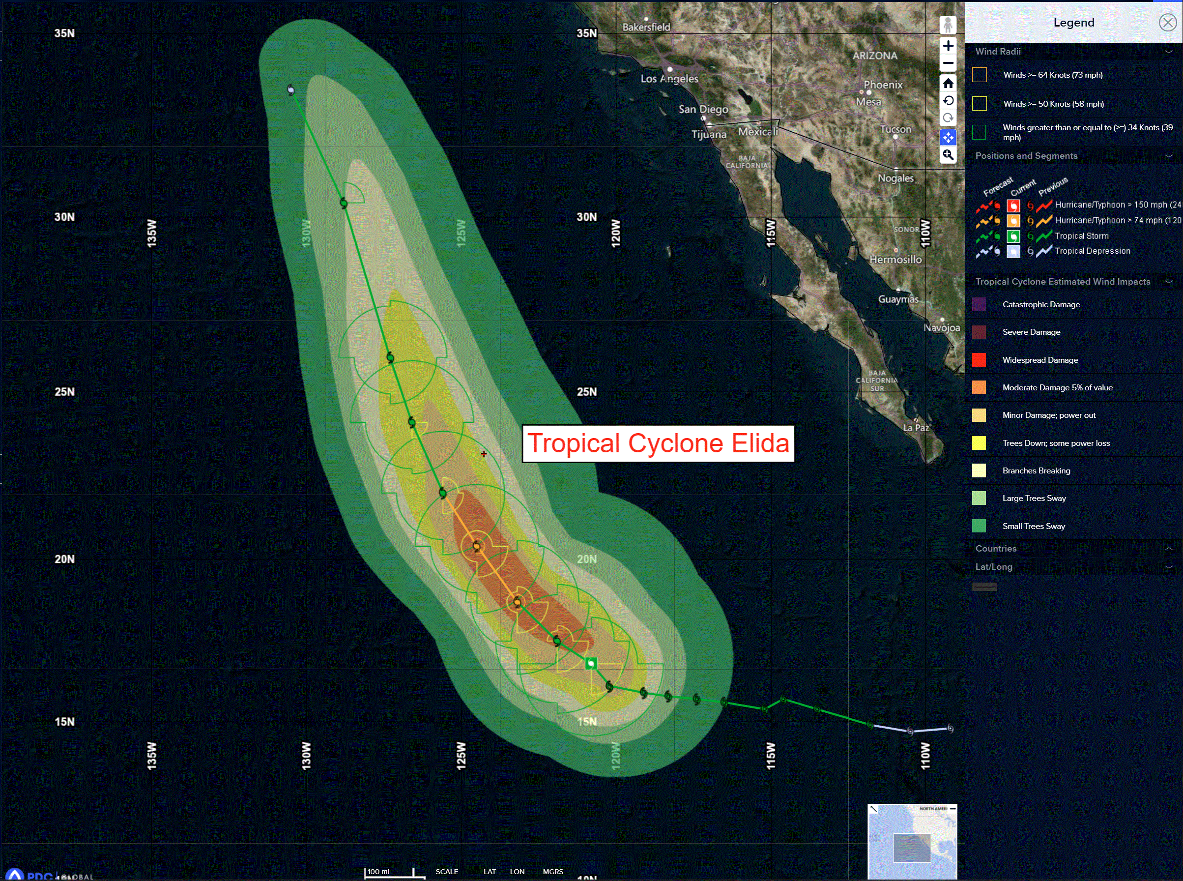
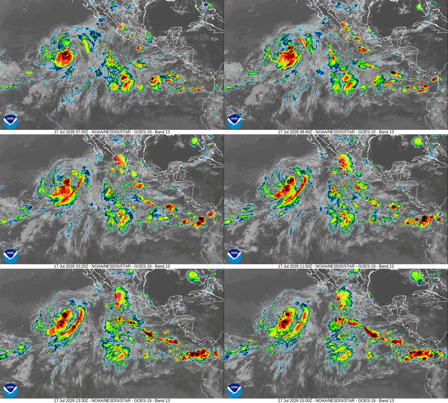
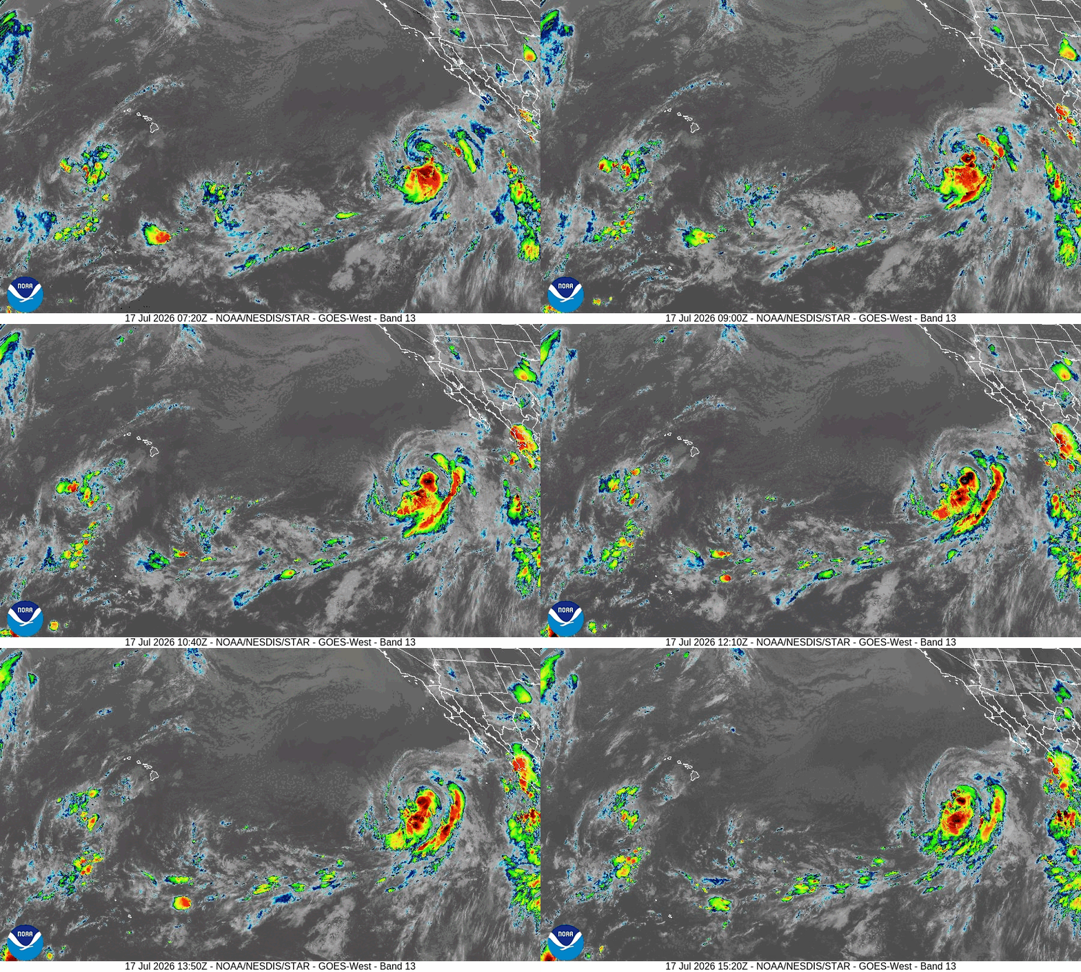
Tropical cyclone 05E (Elida)…is located about 875 miles west-southwest of the southern tip of Baja California
Northeast Pacific:
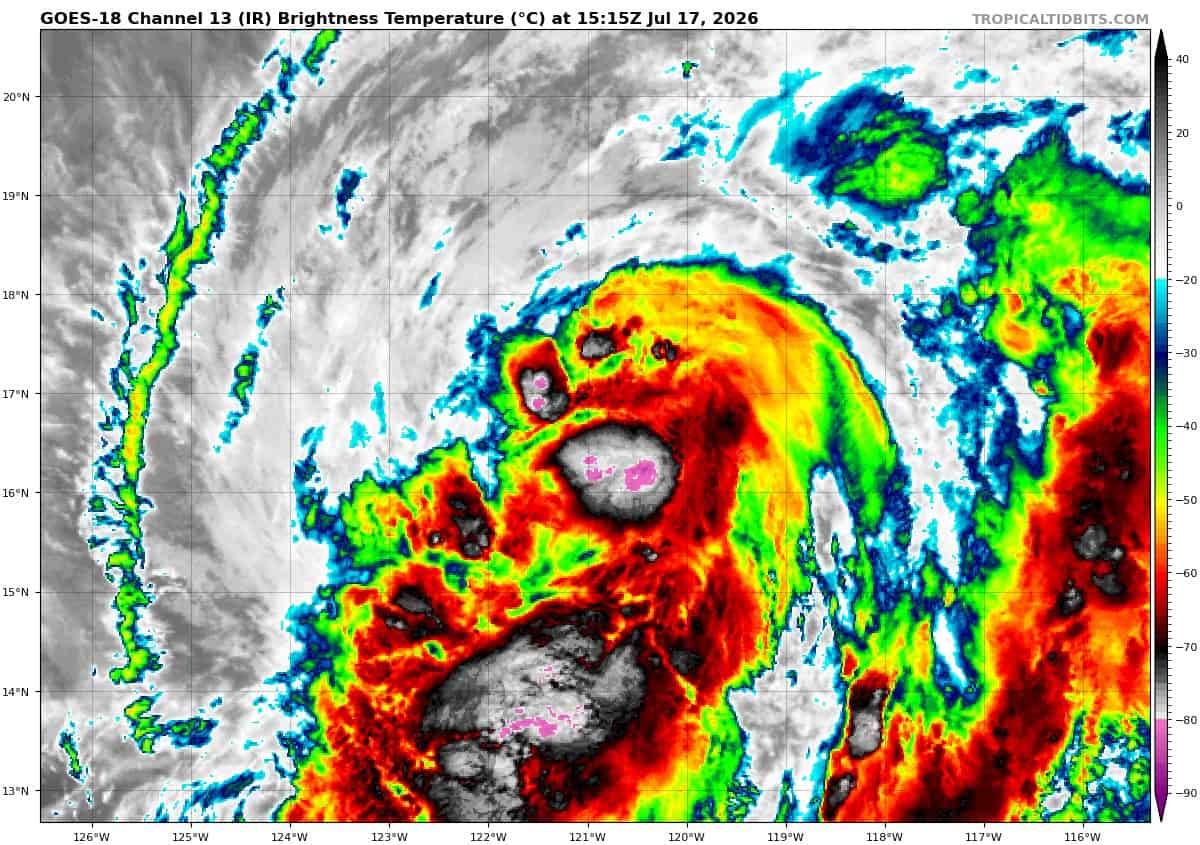
Tropical cyclone 05E (Elida)
ELIDA’S INTENSITY REMAINS STEADY
According to the NHC Advisory number 14
Elida is moving toward the west-northwest near 12 mph (19 km/h). A turn toward the northwest is expected later this evening, followed by a north-northwestward motion at a slightly faster forward speed by Sunday. Maximum sustained winds are near 65 mph (100 km/h) with higher gusts. A very limited window for strengthening remains possible, and Elida could become a strong tropical storm. Weakening is expected to start over the weekend and continue into early next week. Tropical-storm-force winds extend outward up to 195 miles (315 km) from the center.
HAZARDS AFFECTING LAND
SURF: Swells generated by Elida will affect portions of the west coast of Baja California through this weekend. These swells are likely to cause life-threatening surf and rip current conditions.
>>> Central and Western East Pacific:
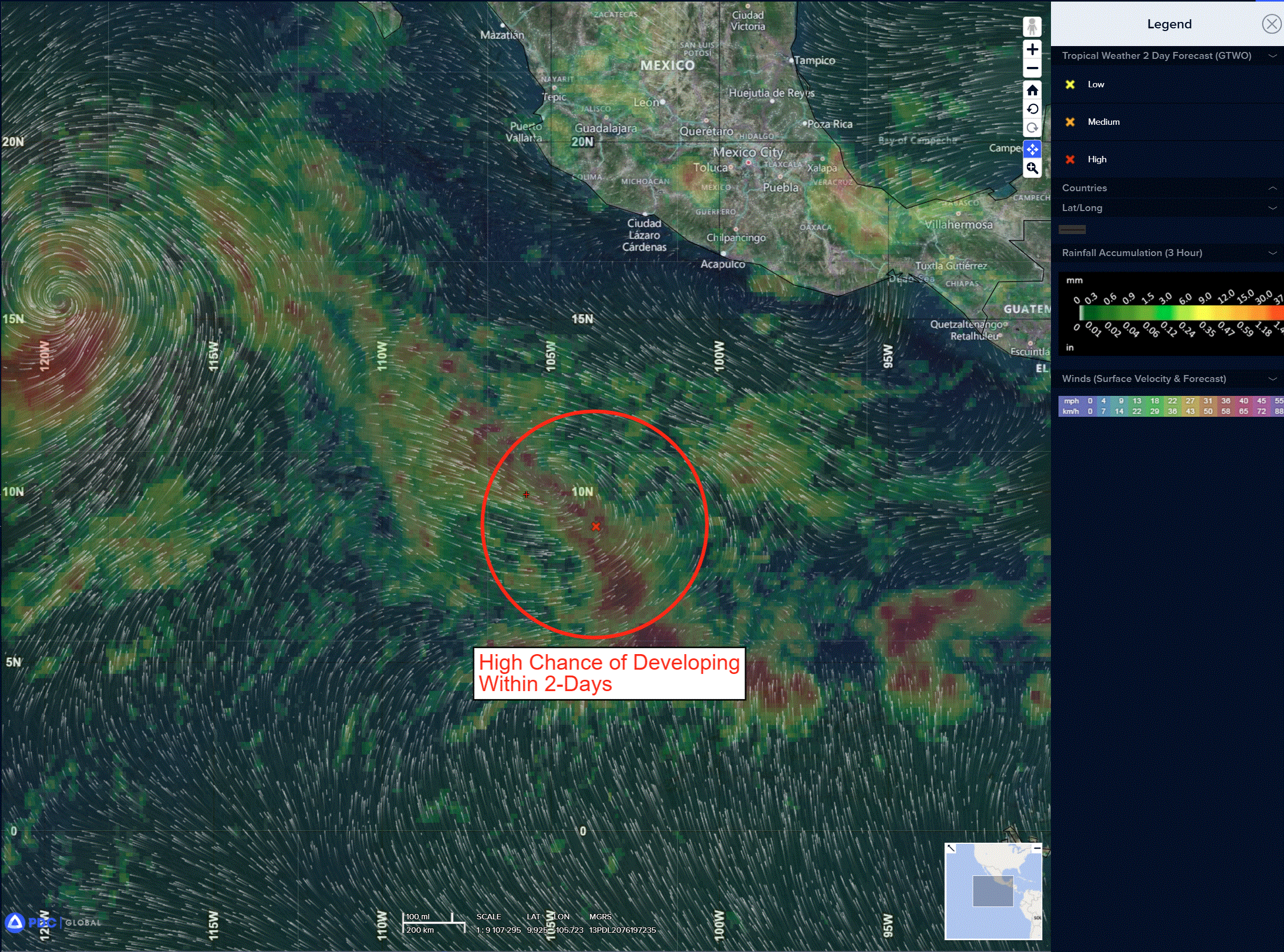
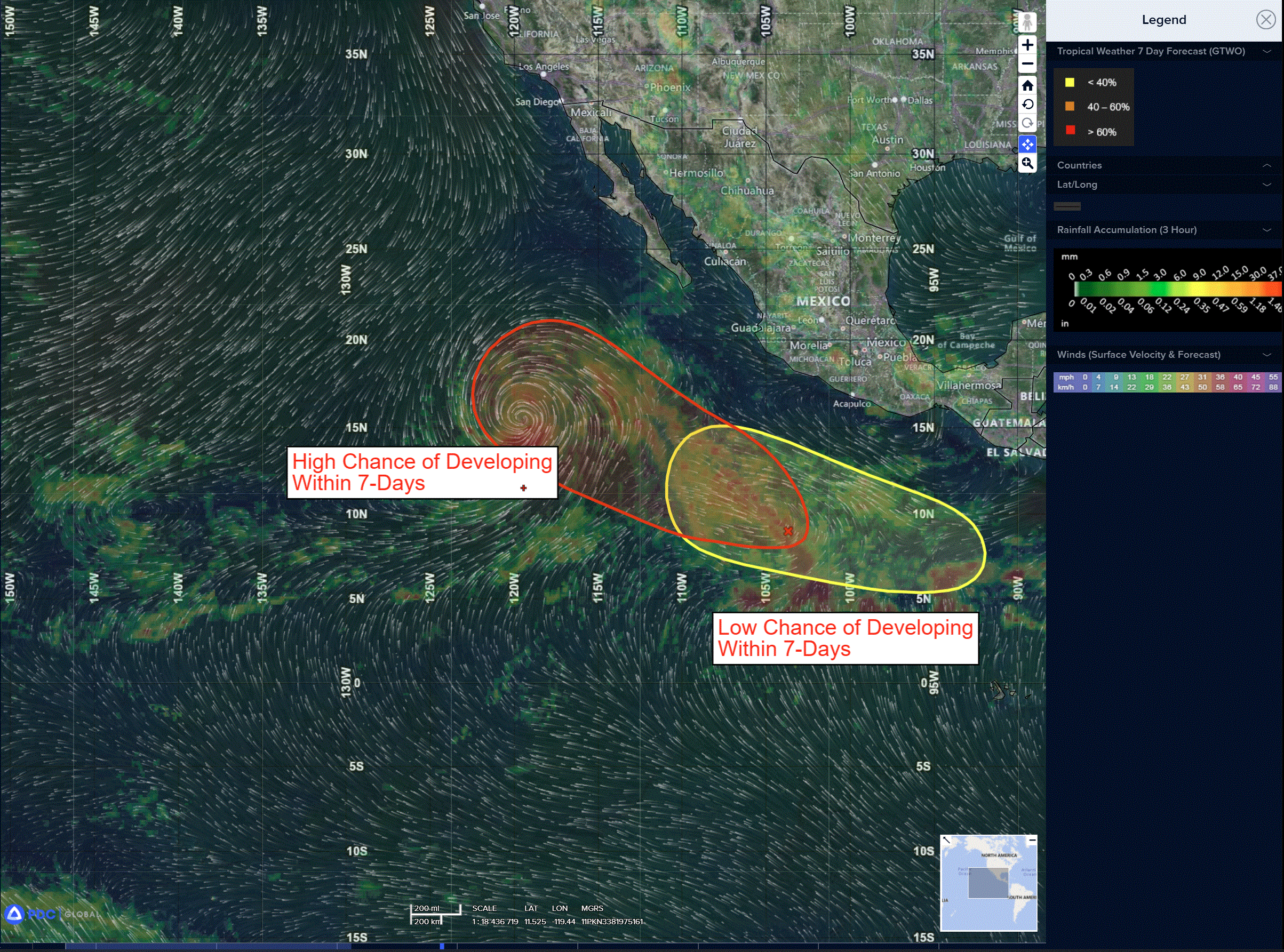
Invest 97E
A tropical wave located several hundred miles south-southwest of the coast of southwestern Mexico is producing a large area of disorganized showers and thunderstorms. Environmental conditions appear conducive for development of this system, and a tropical depression is expected to form over the weekend while it moves west-northwestward to northwestward at 10 to 15 mph over the central portion of the eastern Pacific.
* Formation chance through 48 hours…high…90 percent
* Formation chance through 7 days…high…90 percent
>>> Eastern and Central East Pacific:
A broad area of low pressure is forecast to develop well to the south of Mexico during the middle to the end of next week. Environmental conditions could support some gradual development of this system thereafter while it moves westward to west-northwestward across the eastern and central portions of the eastern Pacific.
* Formation chance through 48 hours…low…near 0 percent
* Formation chance through 7 days…low…30 percent
Here’s the link to the National Hurricane Center (NHC)
Central Pacific: There are no active tropical cyclone
Tropical cyclone formation is not expected during the next 7 days
Western Pacific, Indian Ocean, and adjacent Seas: There are no Tropical Cyclones
Western Pacific
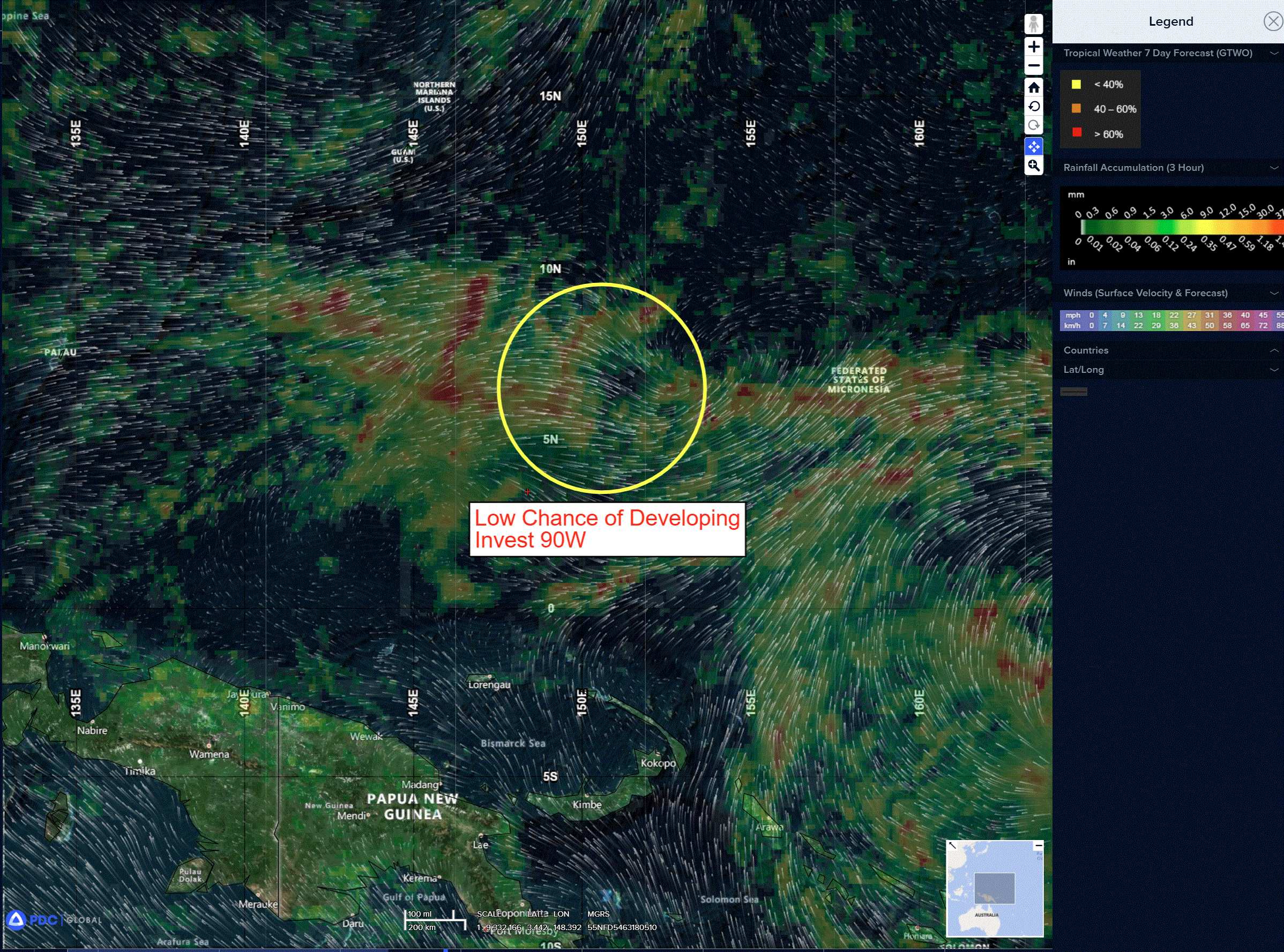
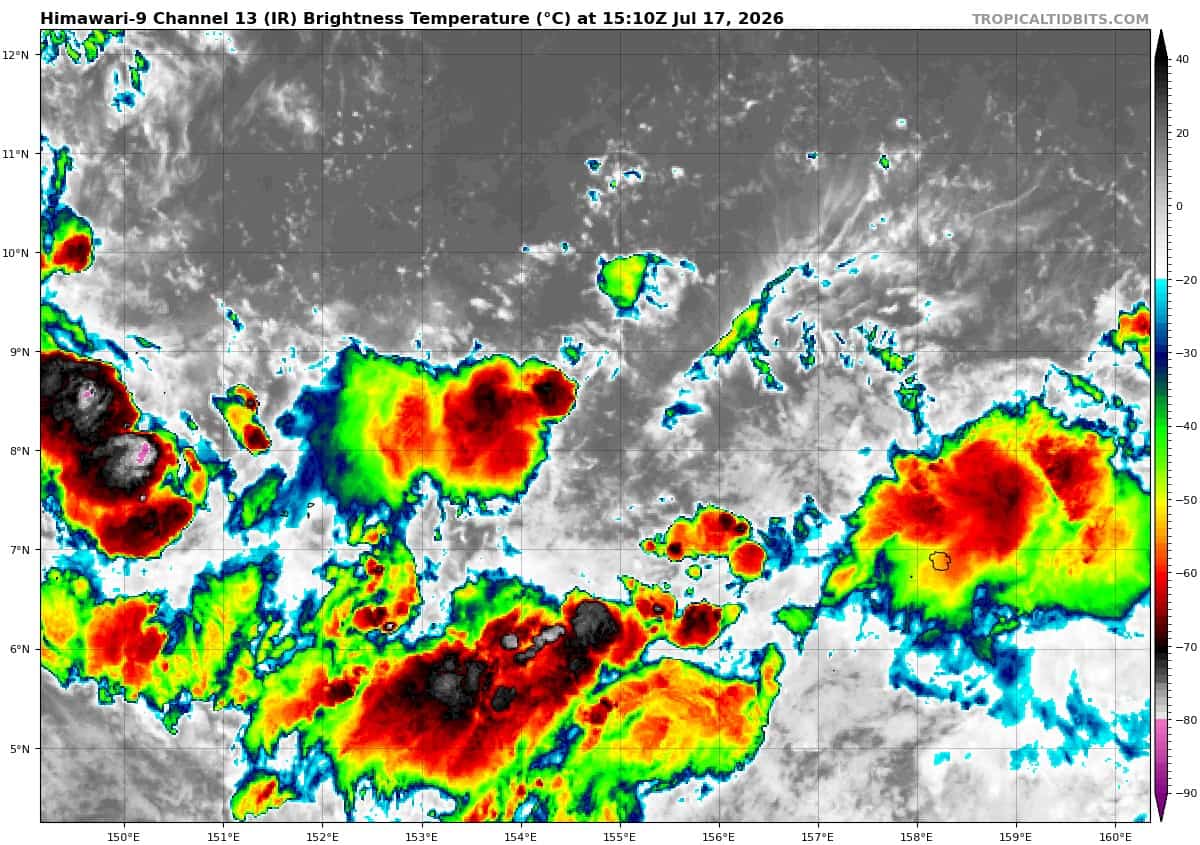
>>> There’s an area of disturbed weather being referred to as Invest 90W, which is located approximately 166 NM west-northwest of Pohnpei
Animated enhanced multi-spectral imagery (msi) depicts a broad area of cyclonic turning with flaring convection displaced to the east of the assessed circulation.
Upper-level analysis indicates that 90W is in a favorable environment for development, with low (5-10 knot) vws, good divergence aloft, and warm (29-30c) sea surface temperatures.
Global models are in good agreement that 90W will continue generally north over the next 24-48 hours before shifting to a northwestward track as it consolidates over the next 72-96 hours. While
the conditions are overall favorable, the lack of a distinct and defined llcc will serve to limit further development at this time, though westerly surface winds equatorward of the system are elevated.
Maximum sustained surface winds are estimated at 23 to 28 knots.
The potential for the development of a significant tropical cyclone within the next 24 hours remains low.