
")
Current Snapshot
For all the latest updates visit: DisasterAWARE
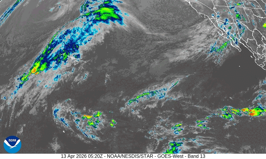
GOES18-TPW-13-900×540
sinlaku
close
04W_130600sair

04W_tracks_latest
By PDC’s Senior Weather
Specialist Glenn James

The Pacific Disaster Center’s (PDC Global) Monday, April 13, 2026, Tropical Cyclone Activity Report…for the Pacific Ocean, the Indian Ocean, and adjacent Seas
Current Tropical Cyclones:
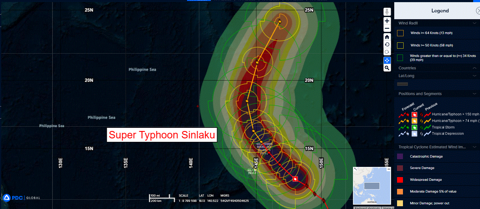
Tropical Cyclone 04W (Sinlaku)…is located approximately 141 NM east of Navsta, Guam
Northeast Pacific Ocean: There are no Tropical Cyclones
The last regularly scheduled Tropical Cyclone Activity Report of the 2025 eastern North Pacific Hurricane Season has been issued. Routine issuance of this section of the PDC product will resume on May 15, 2026. During the off-season, Special Tropical Weather Outlooks will be issued as conditions warrant by the NHC.
Central Pacific Ocean: There are no Tropical Cyclones
The 2025 central North Pacific hurricane season has ended. As such, the final routine Tropical Cyclone Activity Report for the 2025 season has been issued. Routine issuance of this section of the PDC product will resume on June 1, 2026. During the off-season, Special Tropical Weather Outlooks will be issued as conditions warrant by the CPHC.
Western Pacific, Indian Ocean, and adjacent Seas:
Northwest Pacific Ocean
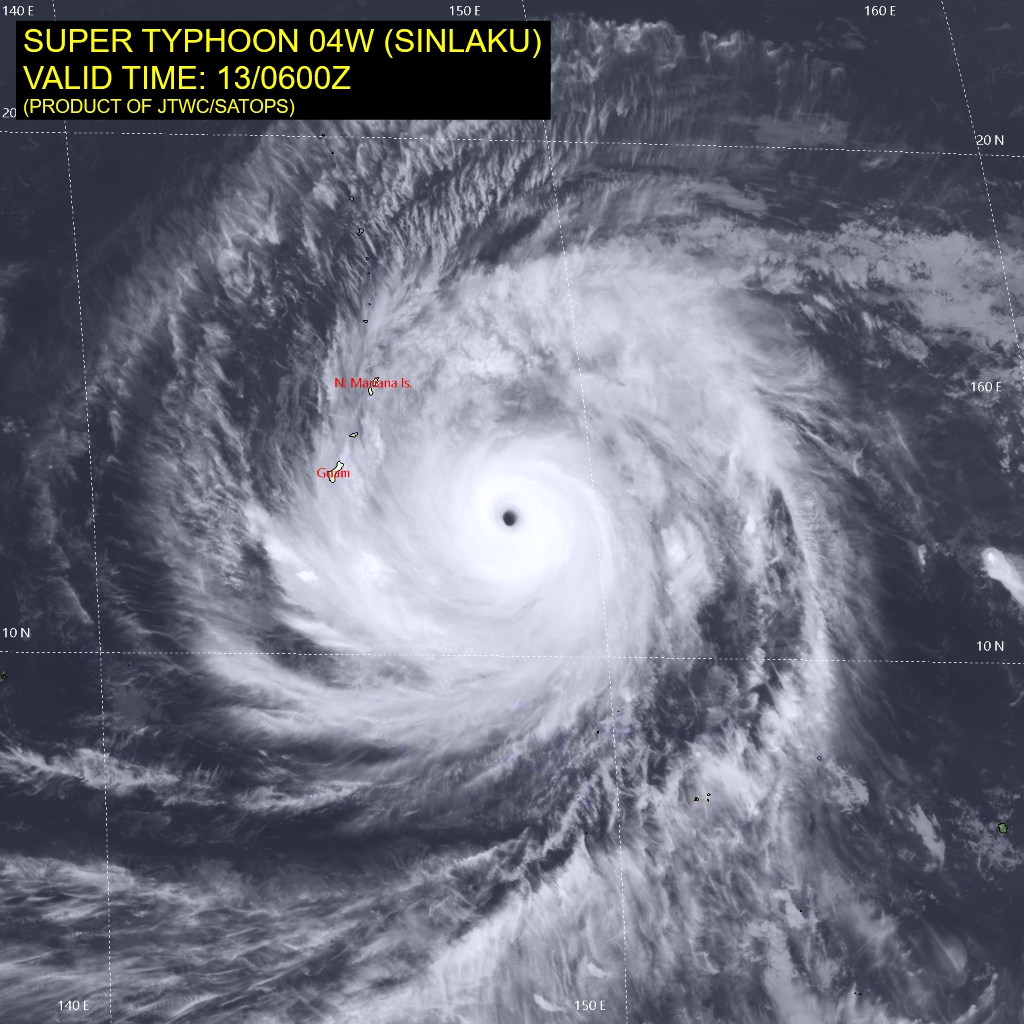
Tropical Cyclone 04W (Sinlaku)
According to the JTWC warning number 20, sustained winds are 145 knots with gusts to 175 knots
Animated multi-spectral satellite imagery depicts a highly organized super typhoon (STY) 04S (Sinlaku) exhibiting an near-perfectly axisymmetric structure. A well-defined, warm (18 c)b 15 NM diameter eye is encased within a cohesive central dense overcast (cdo). The size of the cdo has slightly decreased over the
last 6 hours, which combined with a 3-5 degree cooling of the eye, indicates a very slight overall weakening, resulting from an ongoing eyewall replacement cycle (erc) and dry air entrainment.
On the other hand, the ambient environment remains largely favorable and is characterized by warm (28-29 c) sea surface temperatures (sst), low (5-10 kts) vertical wind shear (vws) and a robust radial outflow.
The near-term intensity forecast suggests that STY 04W has already attained its maximum intensity and is beginning to very slowly weaken as it approaches the northern Mariana Islands. Increasing influence of mid-level dry air entrainment, ongoing erc and reduced northeastward outflow channel will all contribute toward this trend. Some temporary increase in intensity is possible, however, only if the system successfully completes the erc.
STY 04W is expected to maintain an intensity of around 135 kts at its closest point of approach to the northern Marianas. afterwards, a continuous and gradual weakening is forecast throughout the remainder of the current period.
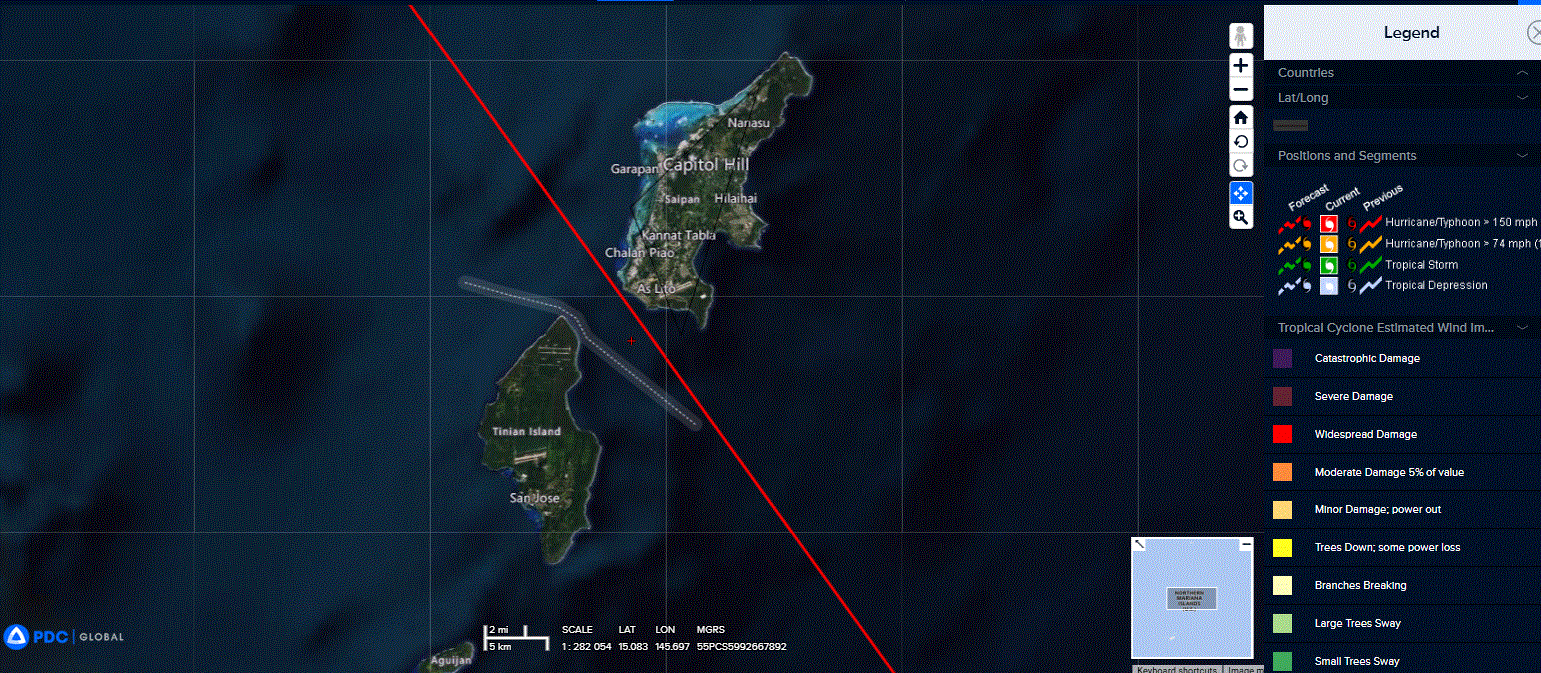
In regard to the track prediction, the system is still positioned within a competing steering environment, with an extension of a ner centered to the east and a deep-layer str centered to the northwest, with the former assuming the primary steering role. A the cpa to the Mariana Islands is expected to occur within the next 24 hours, with the track positioned between the islands of Tinian and Saipan.
After that, STY 04W will begin its recurvature along the axis of the ridge between 48 and 72 hours. Beyond 72 hours, the system will continue to be steered northeastward by the northward-building near-equatorial ridge, which will coincide with a more pronounced weakening trend due to increasingly hostile shear, cooling sea surface temperatures, and dry air entrainment.