
")
Current Snapshot
For all the latest updates visit: DisasterAWARE
GOES18-TPW-13-900×540
sinlaku
04W_190600sair
himawari9_ir_04W_202604191330_lat28.3-lon153.7
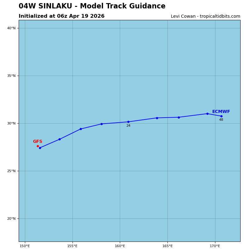
04W_tracks_latest
By PDC’s Senior Weather
Specialist Glenn James

The Pacific Disaster Center’s (PDC Global) Sunday, April 19, 2026, Tropical Cyclone Activity Report…for the Pacific Ocean, the Indian Ocean, and adjacent Seas
Current Tropical Cyclones:
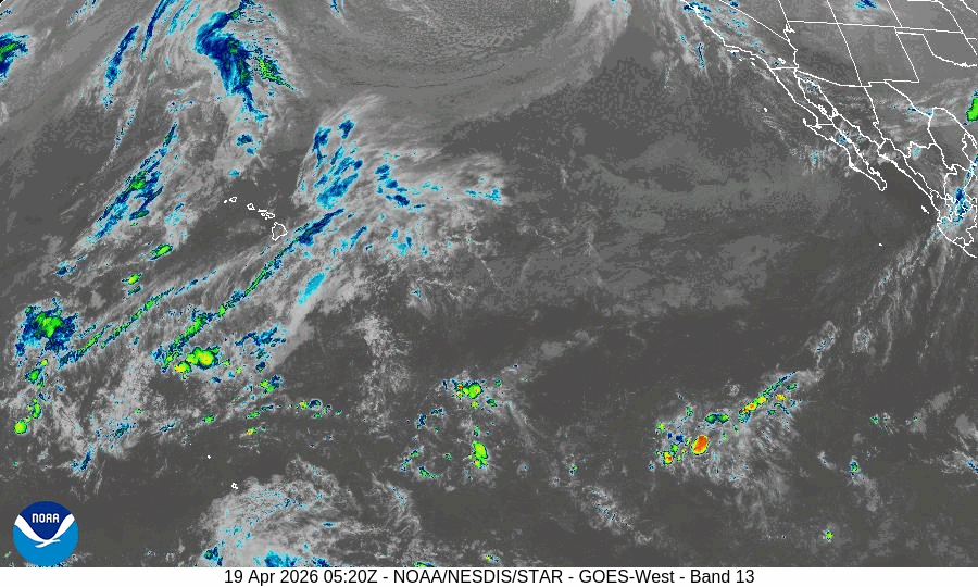
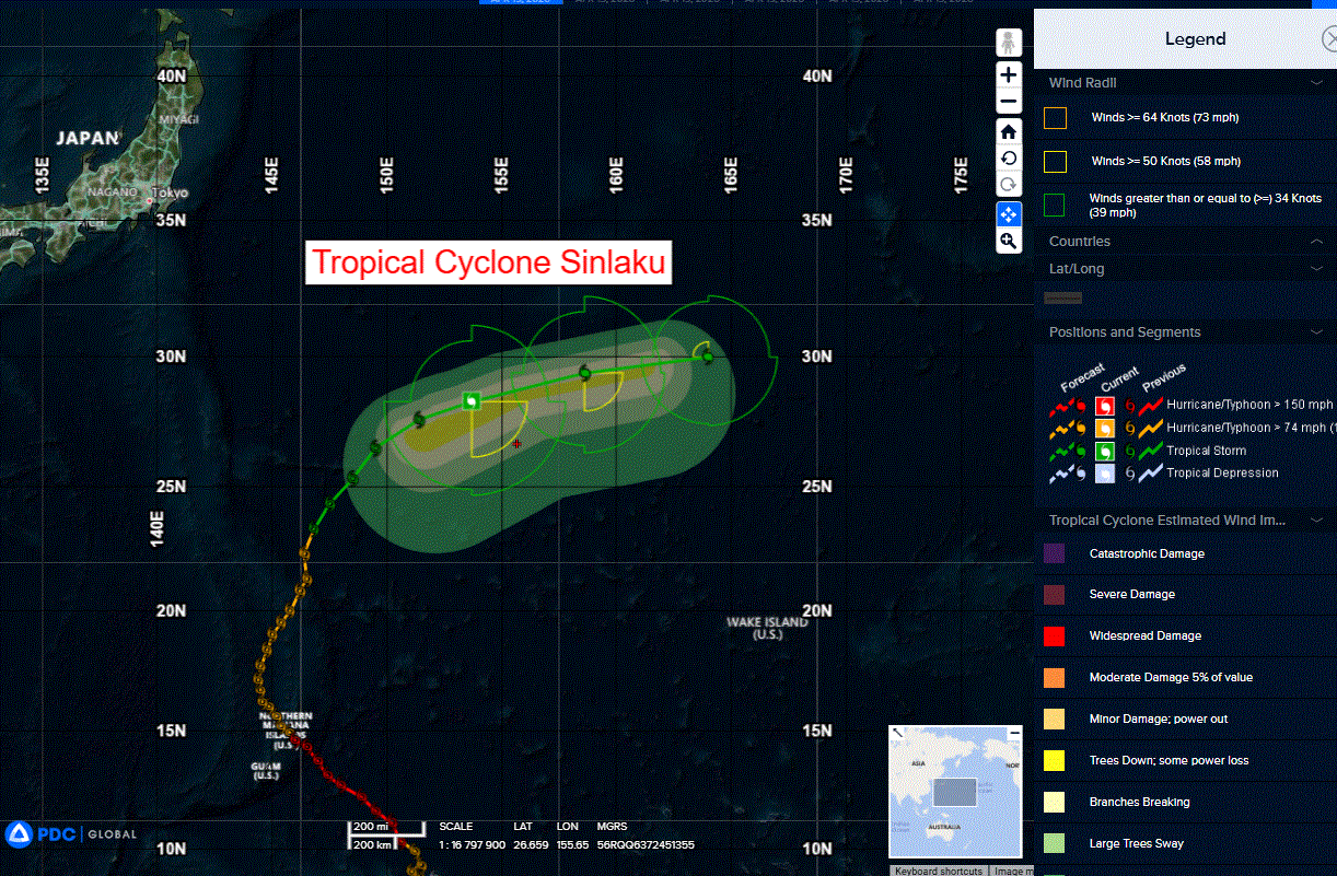
Tropical Cyclone 04W (Sinlaku)…is located approximately 247 NM north of Minami Tori Shima
Northeast Pacific Ocean: There are no Tropical Cyclones
The last regularly scheduled Tropical Cyclone Activity Report of the 2025 eastern North Pacific Hurricane Season has been issued. Routine issuance of this section of the PDC product will resume on May 15, 2026. During the off-season, Special Tropical Weather Outlooks will be issued as conditions warrant by the NHC.
Central Pacific Ocean: There are no Tropical Cyclones
The 2025 central North Pacific hurricane season has ended. As such, the final routine Tropical Cyclone Activity Report for the 2025 season has been issued. Routine issuance of this section of the PDC product will resume on June 1, 2026. During the off-season, Special Tropical Weather Outlooks will be issued as conditions warrant by the CPHC.
Western Pacific, Indian Ocean, and adjacent Seas:
Northwest Pacific Ocean
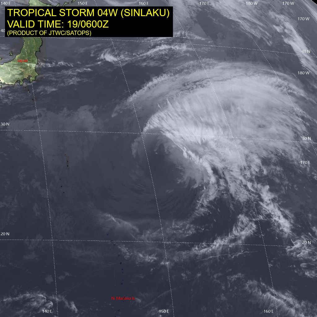
Tropical Cyclone 04W (Sinlaku)
According to the JTWC warning number 43, sustained winds are 55 knots with gusts to 70 knots
Tropical storm 04W (Sinlaku) continues too steadily but slowly weaken as it traverses poleward and begins to lose tropical
characteristics. Animated multi-spectral satellite imagery (msi)
depicts a partially exposed, and broad low level circulation center
(llcc). A large region of moderate convection, and upper-level
clouds forms a developing delta rain region in the northeastern
quadrant of the circulation, indicative of the early phases of extra-
tropical transition. Along the western flank, stable stratiform clouds are being advected around the southern flank and into the core
vortex.
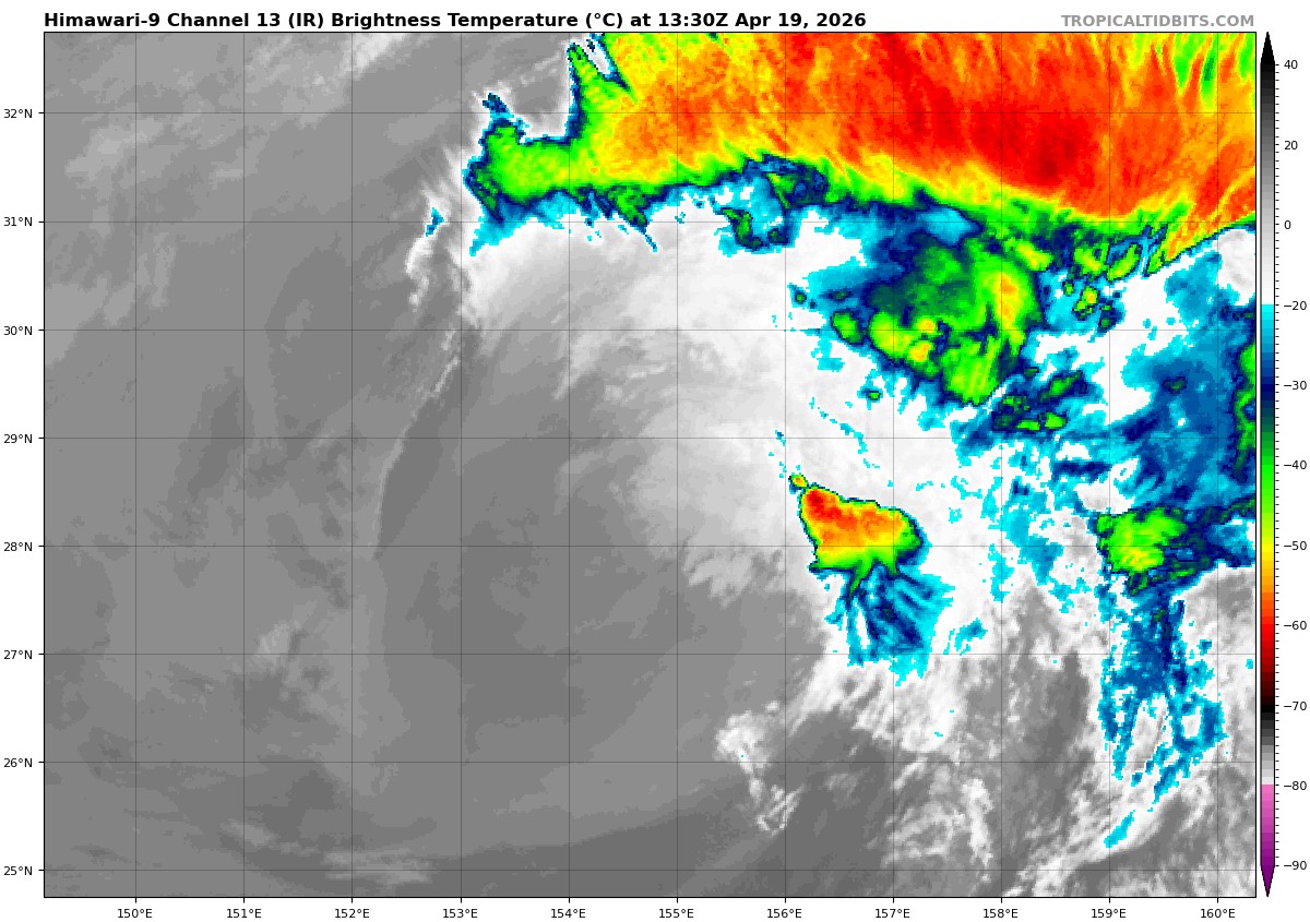
The latest cimss shear analysis indicates a subtle shift in the shear direction from westerly to southwesterly, which aligns the shear vector along the track. This congruence likely delays full llcc exposure, sustaining weak to moderate convection in the northeastern quadrant.
The system is now over very cool waters, experiencing significant shear and engulfed in dry air. poleward outflow, while robust, is insufficient to offset the otherwise unfavorable environment.
Analysis of 1000-500mb thickness, 500mb heights, 850mb winds, sst data, as well as manual and automated phase classification worksheets indicate TS 04W is likely a subtropical cyclone at this point in time; at best a hybrid type system, characterized by a hybrid thermal structure with a strong mid-level warm core and shallow vortex, moving over very cool waters and formative thermal advection. This phase of the systems life cycle will be short-lived however and extra-tropical transition (ett) will begin imminently.
The system is accelerating northeastward along the northwestern flank of a southwest-northeast oriented ridge which extends from near Guam to south of the Aleutian islands. The western end of a old frontal boundary is situated just northeast of the llcc and extends far to the east. The northeastern periphery of the circulation is already interacting with the baroclinic zone, with isentropic upglide forming the delta rain region along the developing warm front.
Over the next 24 hours, the ridge will slowly flatten out to a more east-west orientation, while the frontal boundary will begin to exert more influence, driving TS 04W eastward along the boundary. TS 04W will rapidly complete et within the next 24 to 30 hours as it couples with the baroclinic zone, increases thermal advection, and interacts with the right entrance region of the polar front jet (pfj). Synoptic-scale divergence associated with the pfj jet streak may provide for temporary baroclinic re-intensification during the et process.