
")
Current Snapshot
For all the latest updates visit: DisasterAWARE
hhhh
sinlaku
04W_180600sair
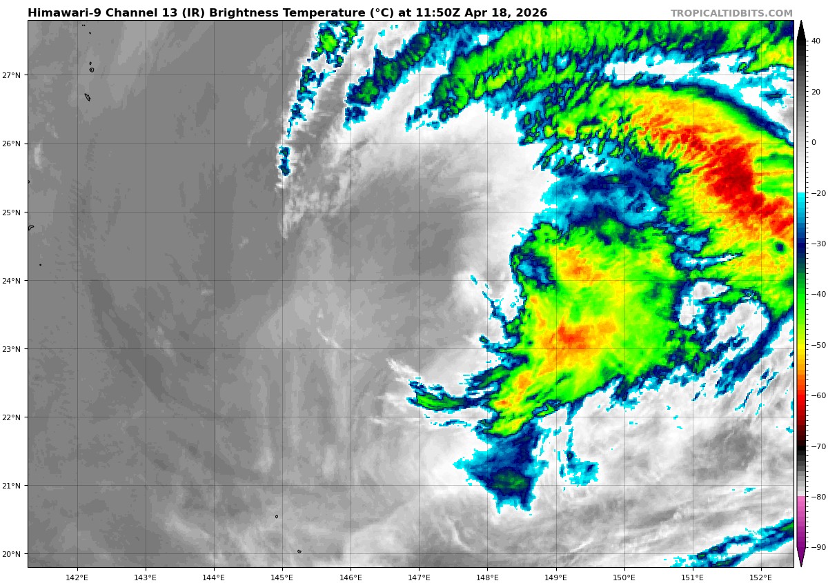
himawari9_ir_04W_202604181150_lat23.3-lon146.8
04W_tracks_latest
By PDC’s Senior Weather
Specialist Glenn James

The Pacific Disaster Center’s (PDC Global) Saturday, April 18, 2026, Tropical Cyclone Activity Report…for the Pacific Ocean, the Indian Ocean, and adjacent Seas
Current Tropical Cyclones:
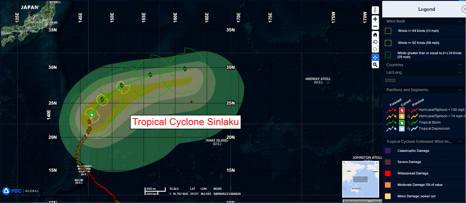
Tropical Cyclone 04W (Sinlaku)…is located approximately 340 NM east of Iwo To
Northeast Pacific Ocean: There are no Tropical Cyclones
The last regularly scheduled Tropical Cyclone Activity Report of the 2025 eastern North Pacific Hurricane Season has been issued. Routine issuance of this section of the PDC product will resume on May 15, 2026. During the off-season, Special Tropical Weather Outlooks will be issued as conditions warrant by the NHC.
Central Pacific Ocean: There are no Tropical Cyclones
The 2025 central North Pacific hurricane season has ended. As such, the final routine Tropical Cyclone Activity Report for the 2025 season has been issued. Routine issuance of this section of the PDC product will resume on June 1, 2026. During the off-season, Special Tropical Weather Outlooks will be issued as conditions warrant by the CPHC.
Western Pacific, Indian Ocean, and adjacent Seas:
Northwest Pacific Ocean
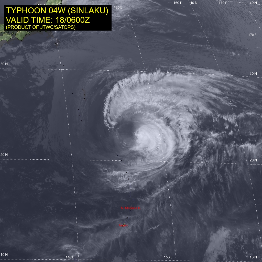
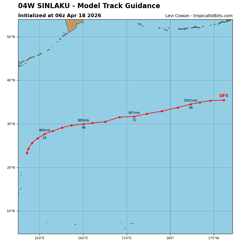
Tropical Cyclone 04W (Sinlaku)
According to the JTWC warning number 39, sustained winds are 60 knots with gusts to 75 knots
Animated multi-spectral satellite imagery (msi) depicts an exposed low level circulation center (llcc), with a small pocket of remnant convection in the southeastern quadrant of the circulation. To the northeast, a low-level rope cloud indicates the western extent of a cold frontal boundary, positioned over Minamai Tori Shima.
Along the western flank of the circulation, a field of low-level stratiform
clouds delineates an area of subsidence and dry, stable air, while gravity waves propagating westward from the convective core are evident moving over the low-level cloud fields. Pronounced dry mid-level air entrainment, accompanied by moderate westerly shear, has displaced convection to the east, fully exposing the llcc.
Environmental conditions are continuing to deteriorate, with moderate and increasing westerly shear, cool ssts (now below 26c), and dry mid-level air entrainment. while poleward outflow remains robust, it is insufficient to compensate for the strong westerly shear.
Tropical storm 04W (Sinlaku) has tracked north-northeastward over the past 12 hours, along the western flank of a large str to the east. Forward speed moderated slightly as a transient mid-latitude anticyclone transited east of Japan and passed north of the system. as the anticyclone moves to the northeast, the str is expected to resume dominance as the primary steering influence.
Over the next 48 hours, the str will regenerate southwestward toward Guam. Simultaneously, the remnant frontal boundary to the northeast will lift northward while maintaining a zonal orientation. These features will collectively induce a rapid
recurvature, transitioning TS 04W to a due eastward trajectory along the frontal interface by 48 hours.
Steady decay is anticipated over the next 24 to 36 hours due to the cumulative effects of moderate to strong vws, dry air entrainment, and thermodynamic limitations from marginal ssts. During the later hours, as TS 04W completes extra-
tropical transition (ett), baroclinic forcing will sustain winds of 45-50 knots.