
")
Current Snapshot
For all the latest updates visit: DisasterAWARE
GOES18-TPW-13-900×540
sinlaku
04W_170600sair
himawari9_ir_04W_202604171330_lat20.0-lon145.8
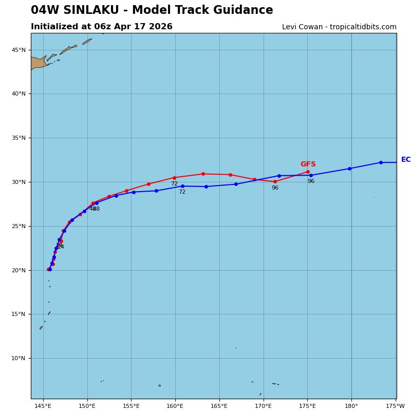
04W_tracks_latest
By PDC’s Senior Weather
Specialist Glenn James

The Pacific Disaster Center’s (PDC Global) Friday, April 17, 2026, Tropical Cyclone Activity Report…for the Pacific Ocean, the Indian Ocean, and adjacent Seas
Current Tropical Cyclones:
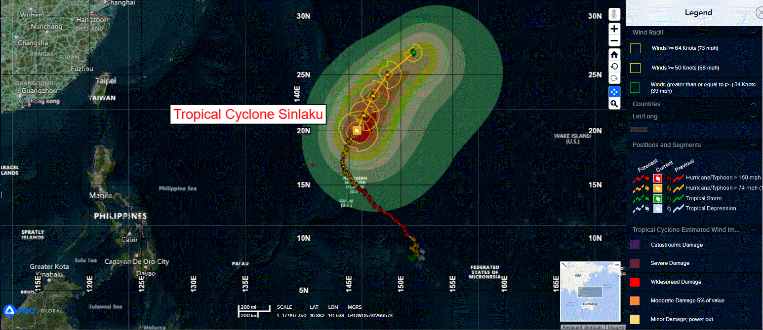
Tropical Cyclone 04W (Sinlaku)…is located approximately 318 NM east-southeast of Iwo To
Northeast Pacific Ocean: There are no Tropical Cyclones
The last regularly scheduled Tropical Cyclone Activity Report of the 2025 eastern North Pacific Hurricane Season has been issued. Routine issuance of this section of the PDC product will resume on May 15, 2026. During the off-season, Special Tropical Weather Outlooks will be issued as conditions warrant by the NHC.
Central Pacific Ocean: There are no Tropical Cyclones
The 2025 central North Pacific hurricane season has ended. As such, the final routine Tropical Cyclone Activity Report for the 2025 season has been issued. Routine issuance of this section of the PDC product will resume on June 1, 2026. During the off-season, Special Tropical Weather Outlooks will be issued as conditions warrant by the CPHC.
Western Pacific, Indian Ocean, and adjacent Seas:
Northwest Pacific Ocean
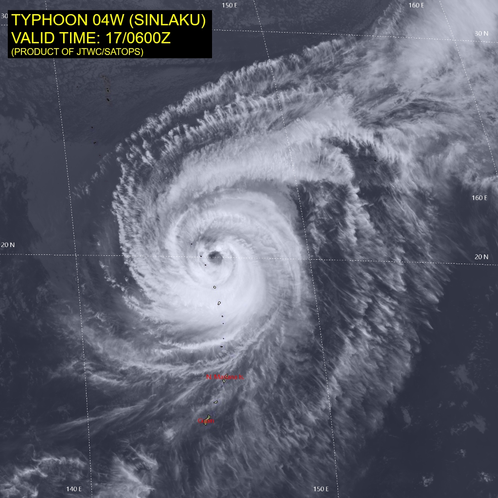
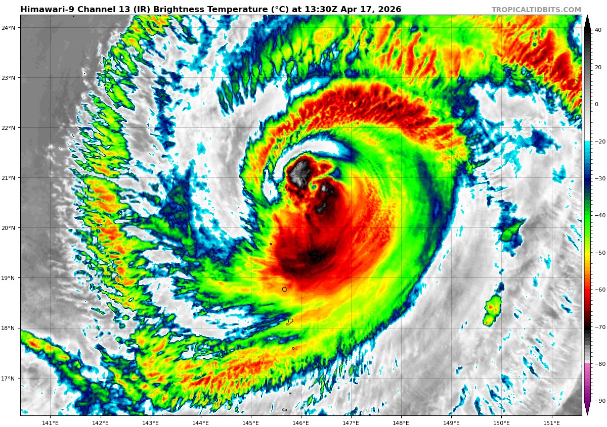
Tropical Cyclone 04W (Sinlaku)
According to the JTWC warning number 37, sustained winds are 65 knots with gusts to 80 knots
Animated multi-spectral satellite imagery (msi) depicts the eye of typhoon 04W (Sinlaku) continuing to fill and elongate slightly, showing a possible tilt of the system by solely analyzing visible imagery indicates the center slightly east to that of the
low level circulation center (llcc) located on ir imagery.
Environmental conditions continue to deteriorate as TY 04W is actively crossing the 26 c sea surface temperature (sst) isotherm as well as encountering low to moderate (15-20 kts) vertical wind shear (vws) and dry air entrainment.
TY 04W is forecast to continue a northeastward track as it continues to be steered by the strong ridging centered to the southeast. By 36 hours, it is forecast to be under the influence of a high (30+ kts) vws, and located fully poleward of the 26 c isotherm, and continuing to entrain dry air.
As such, extratropical transition (ett) will begin at this time, and is expected to complete by 48 hours. Translational speed of TY Sinlaku is forecast to increase, while intensity is forecast to steadily decrease, with a sharper drop between 36 and 48 hours as ett takes hold, completing the transition with an intensity of 55 kts.