
")
Current Snapshot
For all the latest updates visit: DisasterAWARE
GOES18-TPW-13-900×540
sinlaku
04W_160600sair
himawari9_ir_04W_202604161210_lat17.7-lon144.5
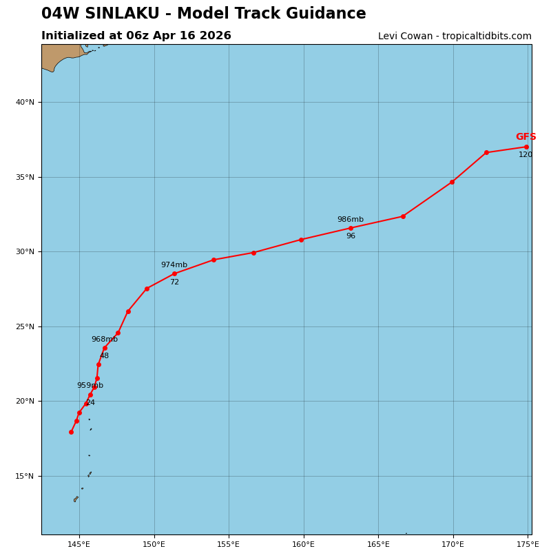
04W_tracks_latest
By PDC’s Senior Weather
Specialist Glenn James

The Pacific Disaster Center’s (PDC Global) Thursday, April 16, 2026, Tropical Cyclone Activity Report…for the Pacific Ocean, the Indian Ocean, and adjacent Seas
Current Tropical Cyclones:
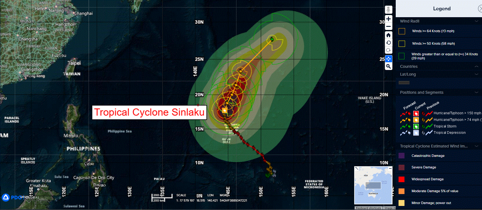
Tropical Cyclone 04W (Sinlaku)…is located approximately 92 NM northwest of Saipan
Northeast Pacific Ocean: There are no Tropical Cyclones
The last regularly scheduled Tropical Cyclone Activity Report of the 2025 eastern North Pacific Hurricane Season has been issued. Routine issuance of this section of the PDC product will resume on May 15, 2026. During the off-season, Special Tropical Weather Outlooks will be issued as conditions warrant by the NHC.
Central Pacific Ocean: There are no Tropical Cyclones
The 2025 central North Pacific hurricane season has ended. As such, the final routine Tropical Cyclone Activity Report for the 2025 season has been issued. Routine issuance of this section of the PDC product will resume on June 1, 2026. During the off-season, Special Tropical Weather Outlooks will be issued as conditions warrant by the CPHC.
Western Pacific, Indian Ocean, and adjacent Seas:
Northwest Pacific Ocean
Tropical Cyclone 04W (Sinlaku)
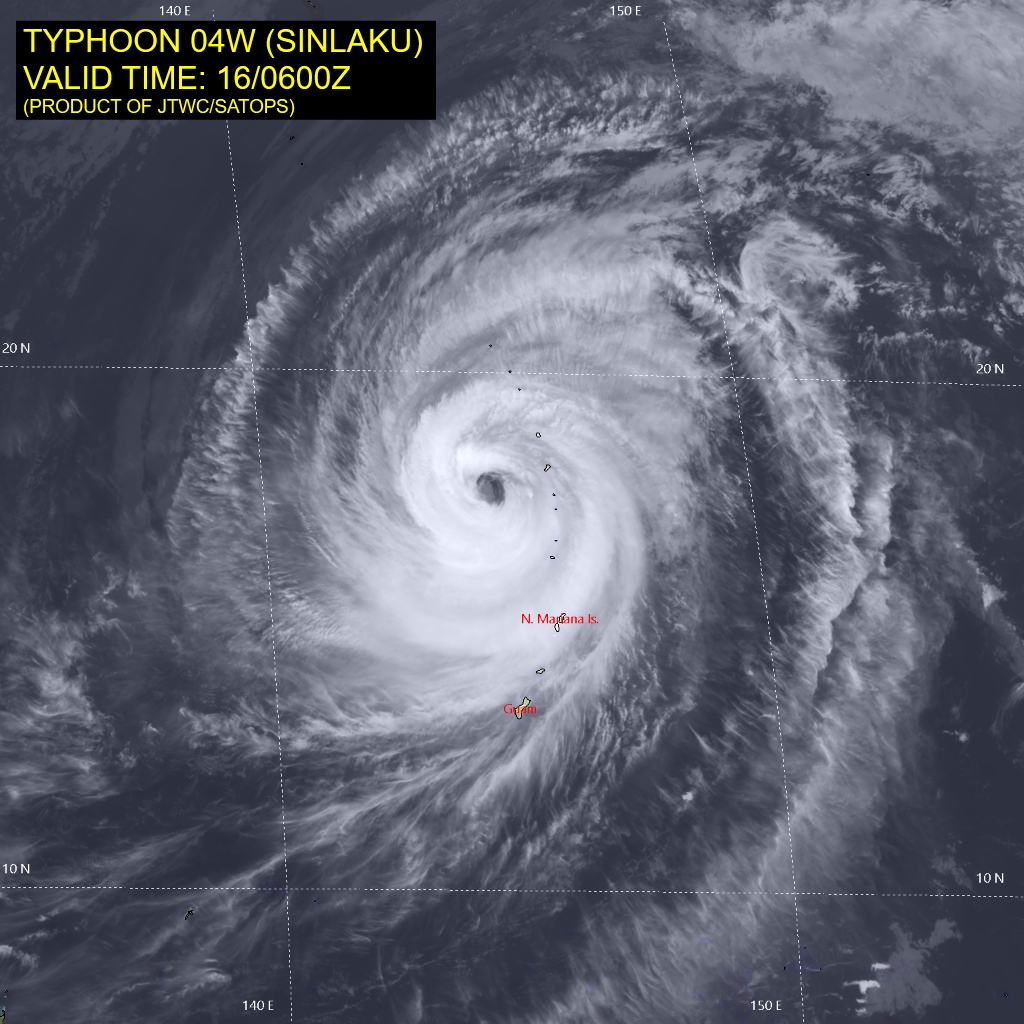
According to the JTWC warning number 30, sustained winds are 100 knots with gusts to 125 knots
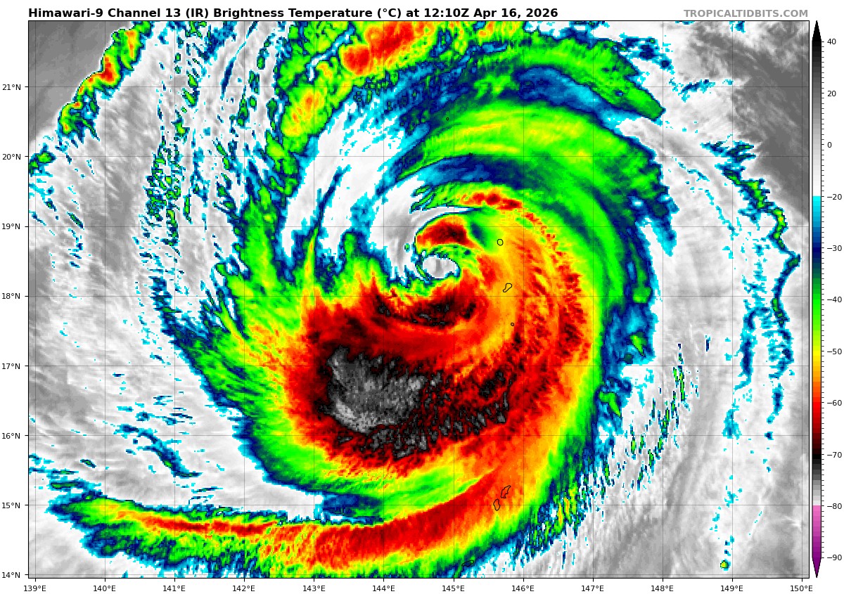
Animated multi-spectral satellite imagery (msi) depicts the slightly cloud filled eye of typhoon 04W (Sinlaku) as it continues to slowly move north-northeastward along the northern Mariana Islands. The northwestern extension of the near equatorial ridge (ner) centered southeast of TY 04W is the primary steering mechanism. The ner is currently not well defined and slightly elongated, which is why we have seen a slower and wobblier path of TY Sinlaku over the past few warnings as compared to what most of the model track guidance has forecast.
Environmental analysis shows warm (27-28 c) sea surface temperatures, robust radial outflow, and low (5-10 kts) vertical wind shear (vws). those favorable characteristics are currently offset by dry air entrainment from a surrounding air mass ultimately resulting in an intensity stagnation. Additionally, the eye temperature has cooled from 14c to 10c over the past six hours. The previously assessed eyewall replacement cycle (erc) has concluded, as witnessed by a 160338z gw1 amsr2 89 ghz image showing a fully developed outer eyewall with the former eyewall largely dissipated. as such,
TY 04W maintained 100 kts over the last 6 hours with the completed erc giving it a brief period of slight intensification despite the marginal environmental conditions. Due to the juxtaposition of current and near-future expected environmental conditions.
TY Sinlaku is forecast to continue transiting northeastward, under the influence of a near equatorial ridge centered to the southeast. The ner is forecast to strengthen and become more well-defined by 36 hours, increasing its steering influence on TY 04W and accounting for a faster north-northeastward recurvature throughout the current forecast period.
TY 04W is expected to cross into 26c waters as early as 24 hours, and encounter
high (30+ kts) vws by 48 hours, coinciding with the forecast beginning of extratropical transition (ett). By 72 hours, TY Sinlaku will be positioned directly underneath upper-level westerly flow, marking the completion of the ett.
In regard to intensity, TY 04W is forecast to begin weakening, as the environmental conditions, particularly vws and sst, are expected to become more hostile as
soon as TY 04W approaches the 26c sst isotherm and strong upper-level westerlies. The system is expected to retain 55-60 kts intensity by the time it transitions into a cold-core low.