

Current Snapshot
For all the latest updates visit: DisasterAWARE
xavier
04P_180600sair
goes18_ir_04P_202611181715_lat-10.3-lon-163.9
04P_tracks_latest
A
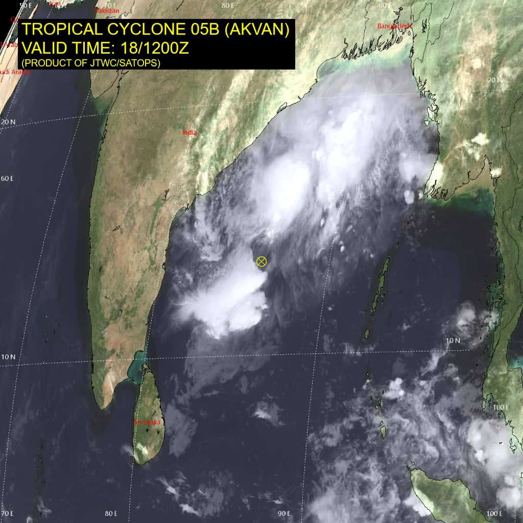
05B_181200sair
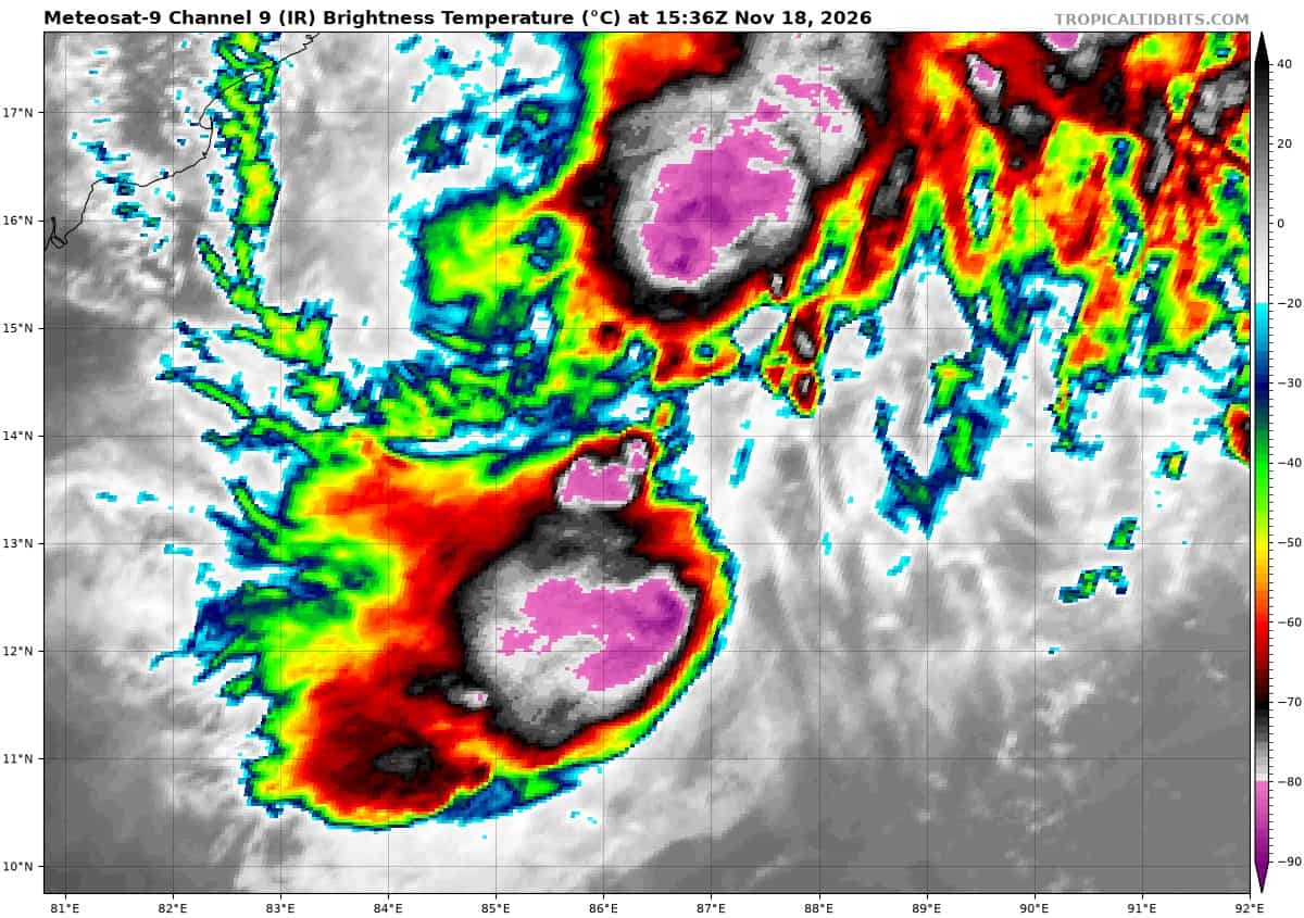
meteosat9_ir_05B_202611181536_lat13.6-lon86.5
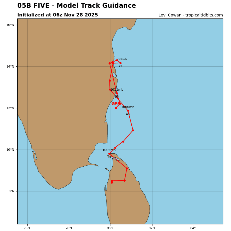
05B_tracks_latest
96s
meteosat9_ir_96S_202611181536_lat-7.3-lon88.6
96S_tracks_latest
By PDC’s Senior Weather
Specialist Glenn James

The Pacific Disaster Center’s (PDC Global) Wednesday, November 18, 2026, Tropical Cyclone Activity Report…for the Pacific Ocean, the Indian Ocean, and adjacent Seas.
Tropical Cyclones
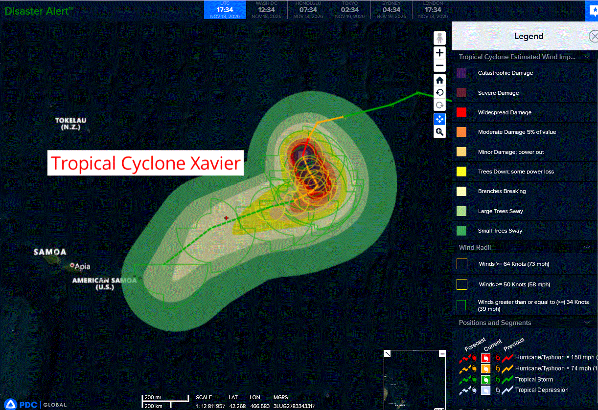
Tropical Cyclone 04P (Xavier)…is located approximately 463 NM east-northeast of Pago Pago
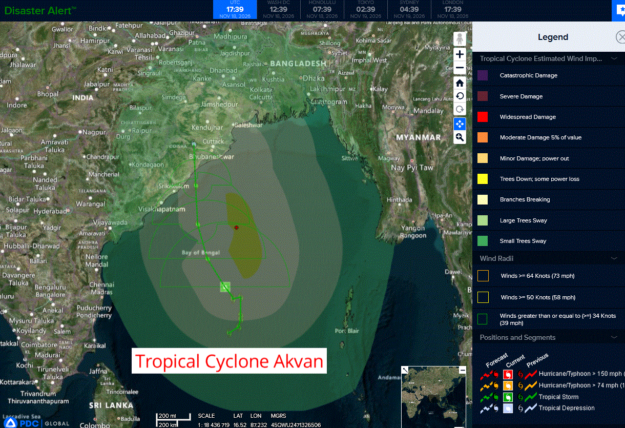
Tropical Cyclone 05B (Akvan)…is located approximately 551 NM south-southwest of Kolkata, India
Northeast Pacific: There are no Tropical Cyclones
Central North Pacific: There are no Tropical Cyclones
Western Pacific, Indian Ocean, and adjacent Seas:
Southwestern Pacific
Tropical Cyclone 04P (Xavier)
According to the JTWC warning number 7, sustained winds were 115 knots with gusts to near 140 knots
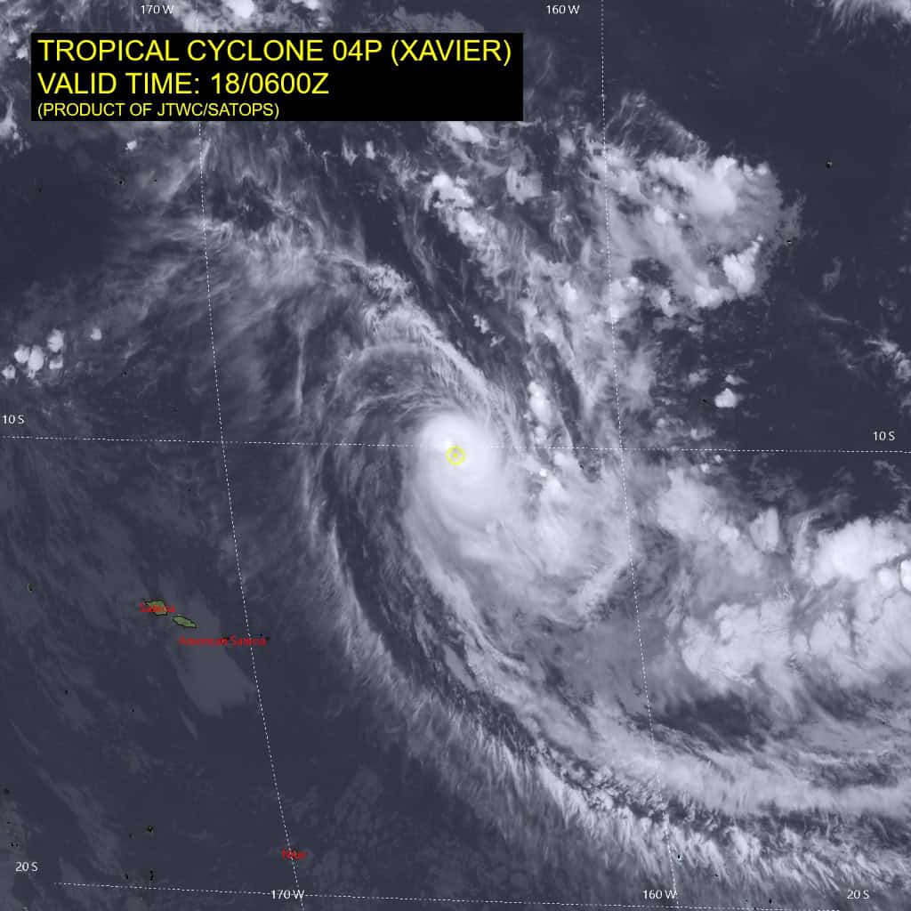
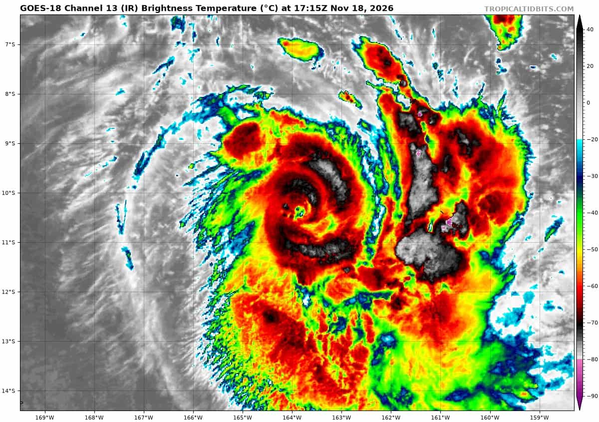
Animated enhanced infrared (eir) satellite imagery depicts tropical cyclone (tc) 04B (Xavier) with a highly compact core and a cloud-filled eye as it continues on its weakening trend, which started soon after 180000z. An 180339z f18 ssmis 91 ghz microwave image revealed a weakness in the northeastern quadrant of the small microwave eye feature and exposed low-level cloud lines within the northern semicircle tightly wrapping into the center.
The environment is now analyzed to be marginally favorable with the main hindrance being the moderate northwesterly shear and dry air entrainment from the west. Outflow aloft is moderate in the poleward direction and sea surface temperatures remain warm (28-29 c).
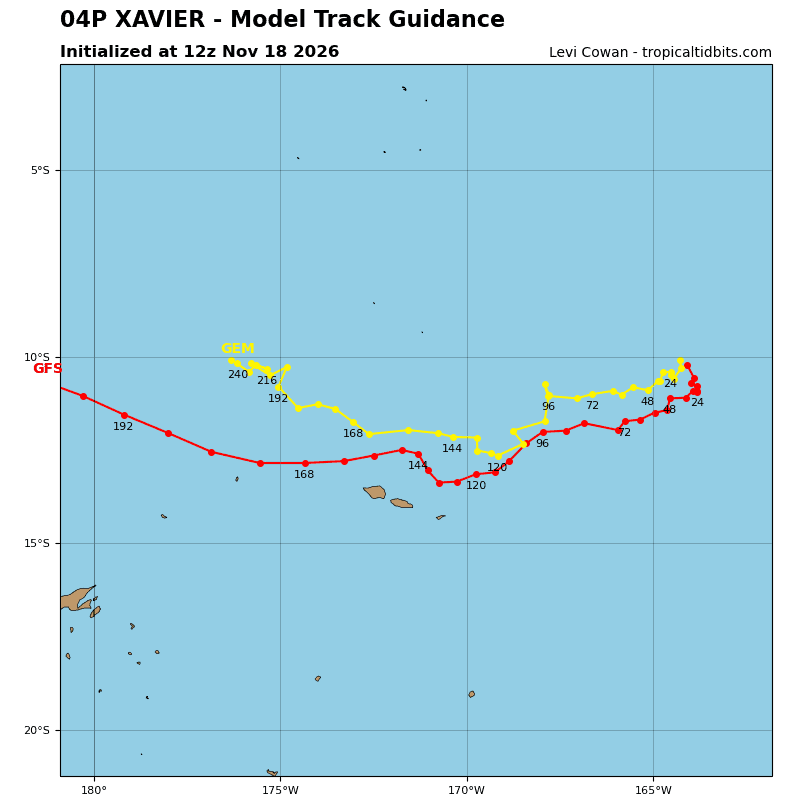
TC 04P is forecast to track slowly south-southeastward as it attempts to round the str axis over the next 24 hours. However, a shortwave trough will break down the ridge, leaving 04P placed within a weak steering environment with no defined steering mechanism from 24 through 48 hours.
Around 60 hours, the vortex is expected to become considerably more shallow, allowing for the steering pattern to be dominated by a low to mid-level str situated to the southeast. This will cause 04P to pick up speed in the west-southwestward direction through 96 hours as the system traverses the northern periphery of the ridge. Following 96 hours, 04P is forecast to dip more southward as the ridge propagates eastward and the system rounds the western extent of it.
In terms of intensity, 04P is forecast to continue weakening through 24 hours due to persistent dry air and moderate shear acting on the vortex. A more rapid rate of weakening is forecast to occur from 24 to 48 hours due to the extremely slow motion of the storm causing the upwelling of cooler waters. 04P will then further weaken as it tracks westward due to significant dry air entrainment and continued westerly shear.
North Indian Ocean
Tropical Cyclone 05B (Akvan)
According to the JTWC warning number 8, sustained winds were 40 knots with gusts to near 50 knots
Animated enhanced infrared (eir) satellite imagery depicts tropical cyclone (tc) 05B (Akvan) attempting to become more vertically stacked with the recent development of convection closer to the center. In particular, the southwestern quadrant now has building convection where previously it was entirely confined far to the north.
A timely 181200z gmi 89 ghz microwave image revealed low-level cloud lines wrapping into the broad center, supporting the initial position with medium confidence. the initial intensity of 40 kts is assessed with medium confidence based on the agency dvorak fixes and cimss intensity estimates listed below.
The environment is analyzed to be marginally favorable, characterized by strong poleward outflow aloft, low (10-15 kts) southeasterly vertical wind shear, and warm (29-30 c) sea surface temperatures.
TC 05B has increased track speeds in the northwestward direction over the last 12 hours as the strong ridging to the east asserts dominance as the primary steering mechanism for the system. The northwestward track is expected to persist for another 12 hours before the trajectory becomes more northward as 05B traverses the western extent of the ridge axis.The landfall timing and location is similar to the previous forecast, and is expected to occur between 36 and 48 hours.
In terms of intensity, 05B is forecast to marginally intensify over the next 12 hours as the wind field consolidates and shear eases.The broad nature of the system will likely hinder any chances for significant development. Near 36 hours, westerly shear will quickly increase, causing the system to begin weakening just before landfall.
The strongest winds are anticipated to remain located along the northern semicircle of the circulation throughout the forecast period. Soon after landfall, 05B is forecast to dissipate over land as strong shear and terrain interaction erode the shallow vortex.
South Indian Ocean
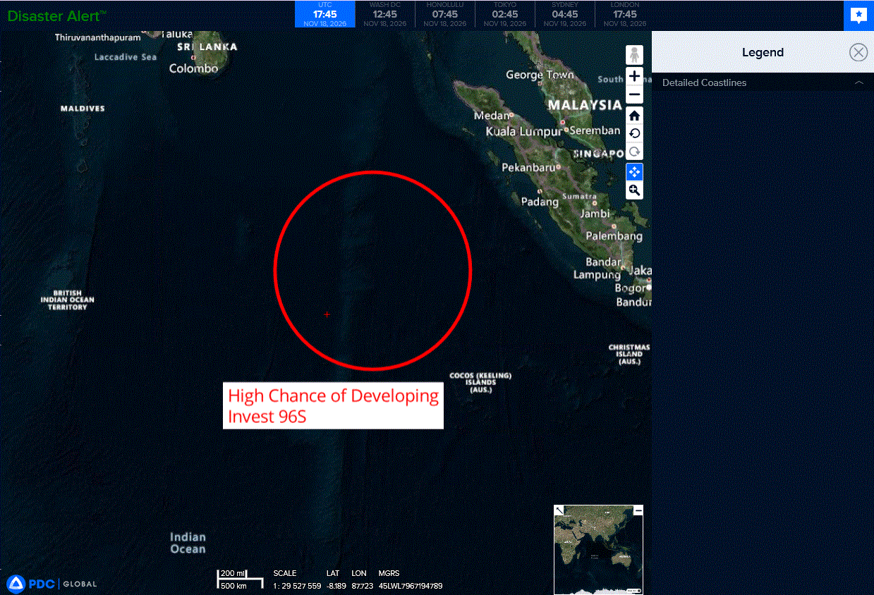
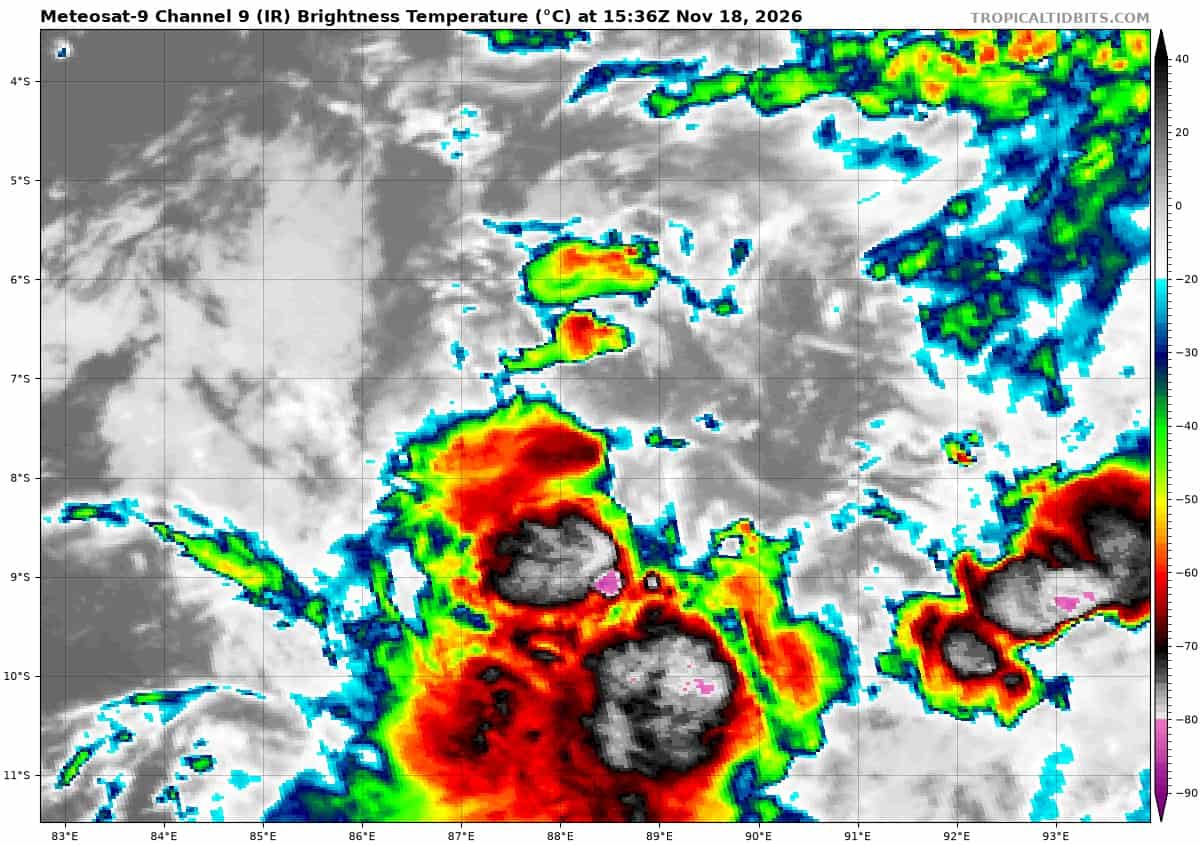
>>> There’s an area of disturbed weather that is being referred to as Invest 96S, which is located approximately 566 NM northwest of Coco Islands
Animated enhanced infrared(eir) satellite depicts persistent deep convection building over the center. A 171521z ascat-b pass shows near gale-force winds along the southern periphery of the low-level circulation center (llcc).
Environmental analysis reveals a marginal environment for development with moderate to high vertical wind shear (vws) of (20 to 25 knots), good poleward upper-level outflow, and warm sea surface temperatures (ssts) of (28 to 29 c).
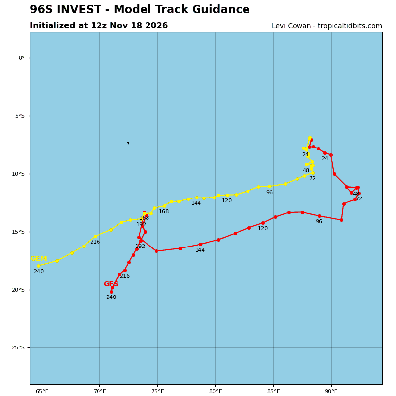
While global deterministic and ensemble models depict a steady-state intensity trend over the next 24-36 hours, only a slight increase in organization is needed for 96S to become a significant tropical cyclone as it tracks south-southwestward.
Maximum sustained surface winds are estimated at 28 to 33 knots.
Minimum sea level pressure is estimated to be near 1006 mb.
The potential for the development of a significant tropical cyclone within the next 24 hours is upgraded to high.