

Current Snapshot
For all the latest updates visit: DisasterAWARE
xavier
04P_201200sair
goes18_ir_04P_202611201505_lat-11.4-lon-163.5
04P_tracks_latest
96s
himawari9_ir_96S_202611201500_lat-10.4-lon90.2
96S_tracks_latest
By PDC’s Senior Weather
Specialist Glenn James

The Pacific Disaster Center’s (PDC Global) Friday, November 20, 2026, Tropical Cyclone Activity Report…for the Pacific Ocean, the Indian Ocean, and adjacent Seas.
Tropical Cyclones
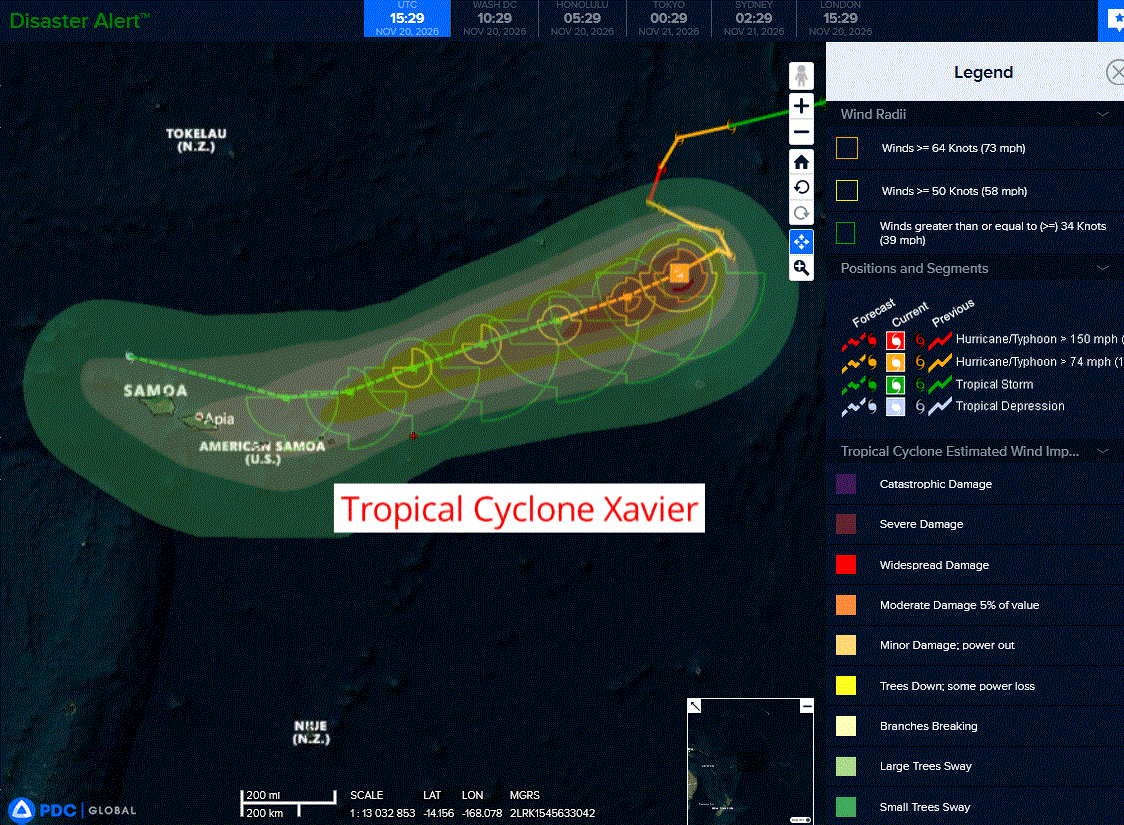
Tropical Cyclone 04P (Xavier)…is located approximately 437 NM east-northeast of Pago Pago
Northeast Pacific: There are no Tropical Cyclones
Central North Pacific: There are no Tropical Cyclones
Western Pacific, Indian Ocean, and adjacent Seas:
Southwestern Pacific
Tropical Cyclone 04P (Xavier)
According to the JTWC warning number 14, sustained winds were 55 knots with gusts to near 70 knots
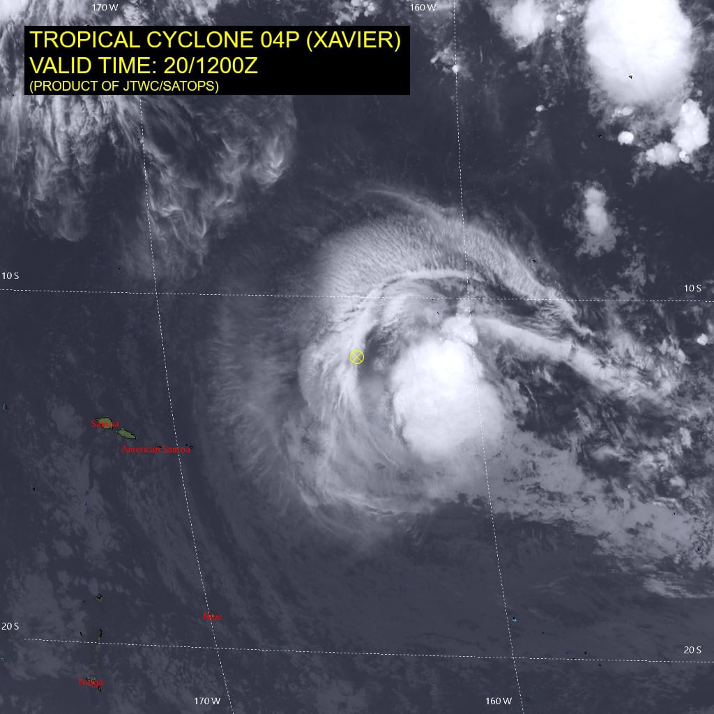
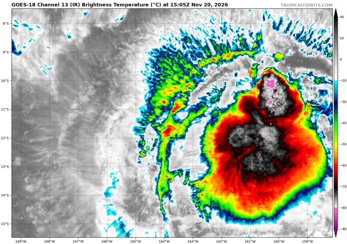
Animated enhanced infrared (eir) satellite imagery depicts the low level circulation (llcc) of tropical cyclone (tc) 04P (Xavier) having rapidly decoupled from the upper level circulation over the last six hours. The central dense overcast (cdo) has become greatlysheared to the southeast from the llcc, while a 201128z amsr-3 37 ghz microwave image confirms the continued west-southwestward motion of the llcc.
Environmental conditions are assessed as unfavorable, with high (25-30 kts) vertical wind shear (vws) that is enhanced in the mid-levels (above 30 kts), moderate poleward outflow, and low (less than 100 kj per cm squared) ocean heat content (ohc).
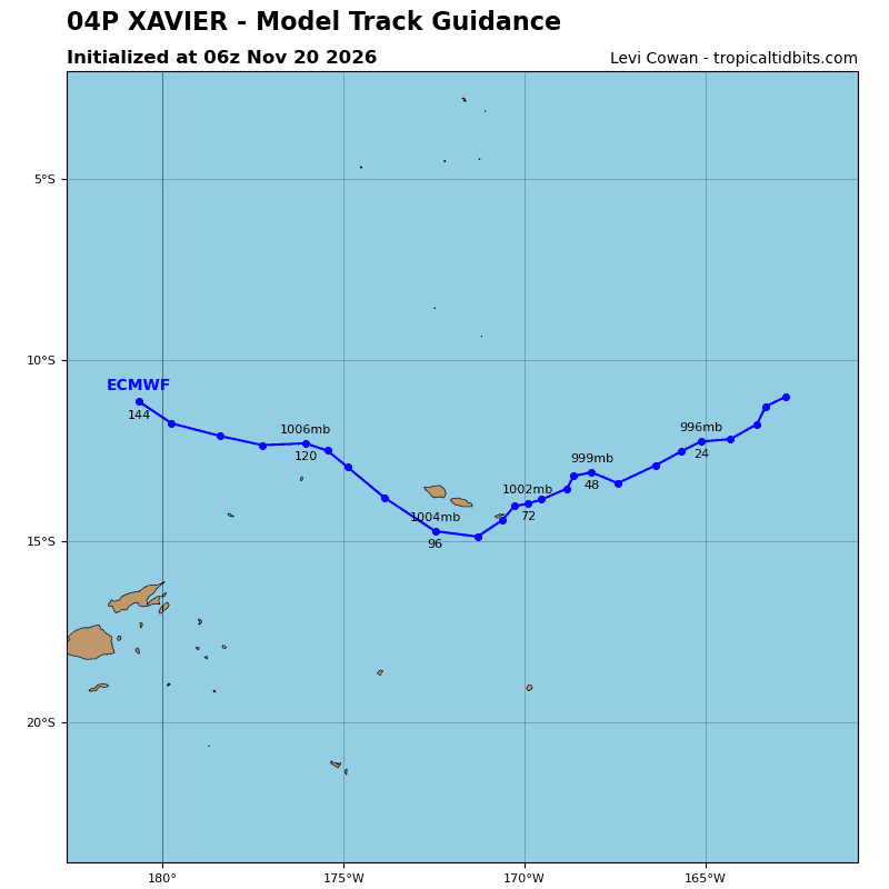
TC 04pP is forecast to continue southwestward out to 60 hours, steered initially by a deep-layer subtropical ridge (str) centered to the southeast, with steering influence transitioning to a mid to low level str centered to the southeast as the intensity of Xavier continues to decrease.
By 60 hours, an incoming mid-latitude trough is expected to weaken the southeastern str and shift it eastward, allowing the low-level southeasterly trade wind flow to dominate steering thereafter, causing an equatorward turn between 60 and 72 hours. The track and intensity forecasts remain closely coupled, with the possibility that a faster weakening system than forecast will turn equatorward sooner as the low-level flow takes over the steering of the vortex.
Regarding intensity, a relatively steady weakening trend is expected for the remainder of the forecast period, with an initially sharper decrease forecast out to 12 hours as the vortex continues to decouple and transits into an area of lower ohc.
VWS is also expected to remain above 30 kts by 24 hours, causing further dry air entrainment into the shallow circulation. The circulation is expected to begin dissipating at 72 hours and dissipate no later than 96 hours as it passes north of American Samoa, with an asymmetrical wind field comprised of highest winds on the southern flank.
South Indian Ocean
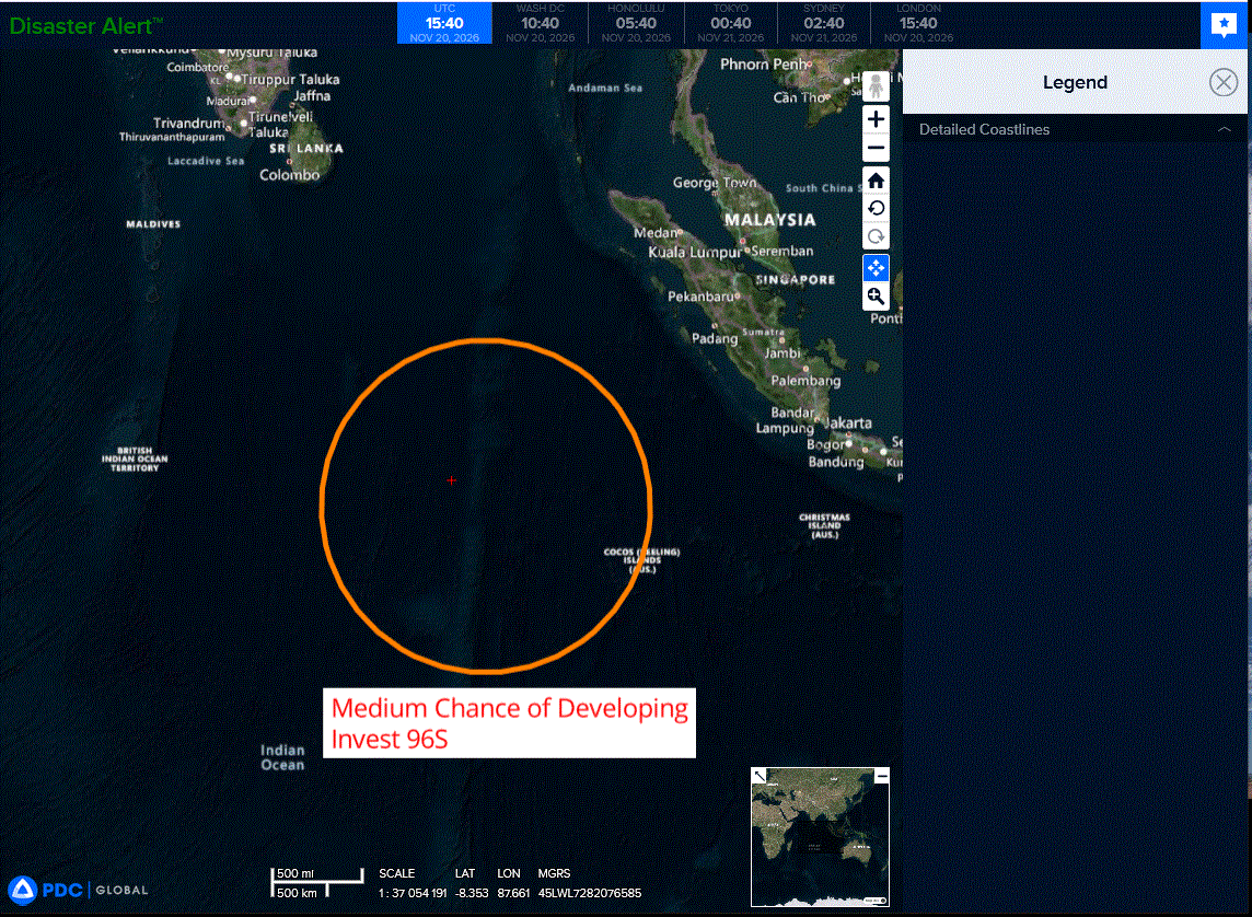
>>> There’s an area of disturbed weather that is being referred to as Invest 96S, which is located approximately 394 NM west of Coco Islands
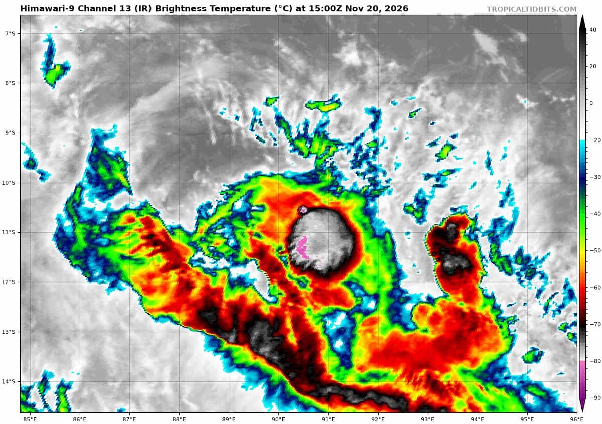
Animated enhanced infrared (eir) satellite depicts a fully exposed low level circulation center (llcc), positioned to the north of an area of persistent deep convection, sheared to the south due to persistent, moderate northeasterly vertical wind shear.
Environmental analysis reveals a marginal environment for development with a high vertical wind shear (vws) of (25 to 30 knots), moderate to strong poleward upper-level outflow, and warm sea surface temperatures (ssts) of (28 to 29 c).
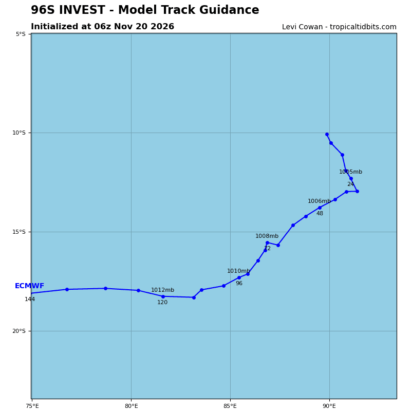
Global deterministic models depict a clearly defined circulation however, the system struggles to meet wind speed criteria as it traverses southward. ensemble models depict a steady state intensity trend over the next 24-36 hours.
Maximum sustained surface winds are estimated at 27 to 32 knots.
Minimum sea level pressure is estimated to be near 1006 mb.
The potential for the development of a significant tropical cyclone within the next 24 hours remains medium.
>>> There’s an area of disturbed weather that is being referred to as Invest 97S, which is located approximately 371 NM west of Diego Garcia
>>> There’s an area of disturbed weather that is being referred to as Invest 98S, which is located approximately 167 NM east of Diego Garcia