

Current Snapshot
For all the latest updates visit: DisasterAWARE
x
04P_221200sair
04P_tracks_latest
2
meteosat9_ir_97S_202611221506_lat-6.9-lon67.2
97S_tracks_latest
meteosat9_ir_98S_202611221506_lat-6.9-lon76.7

98S_tracks_latest
By PDC’s Senior Weather
Specialist Glenn James

The Pacific Disaster Center’s (PDC Global) Sunday, November 22, 2026, Tropical Cyclone Activity Report…for the Pacific Ocean, the Indian Ocean, and adjacent Seas.
Tropical Cyclones
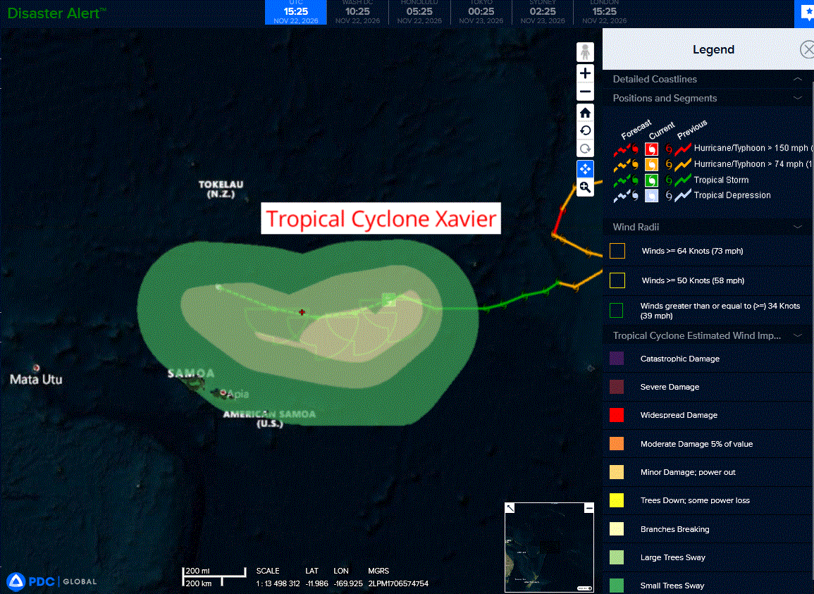
Tropical Cyclone 04P (Xavier)…is located approximately 226 NM northeast of Pago Pago
Northeast Pacific: There are no Tropical Cyclones
Central North Pacific: There are no Tropical Cyclones
Western Pacific, Indian Ocean, and adjacent Seas:
Southwestern Pacific
Tropical Cyclone 04P (Xavier)
According to the JTWC warning number 21, sustained winds were 40 knots with gusts to near 50 knots
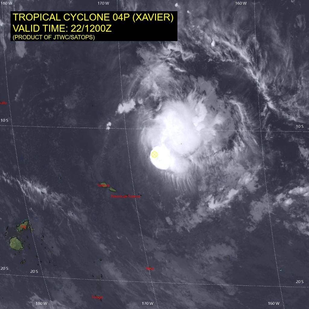
Animated enhanced infrared (eir) satellite imagery depicts tropical
cyclone 04P (Xavier) with cycling deep convection over the eastern portion of the low-level circulation center (llcc). A 120830z
metop-b ascat pass revealed winds of 30-35 kts confined to the
southern semicircle and the strongest winds located in the
southeastern quadrant. The ascat pass also showed a patch of rain contaminated (flagged) winds of 40 kts located far to the northeast of the center, directly underneath a burst of convection at the time.
Environmental analysis indicates that 04P remains placed within an unfavorable environment characterized by weak outflow aloft, high (25-30 kts) southwesterly vertical wind shear, and dry air intrusion.
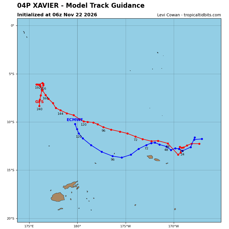
TC 04P appears to be starting on the anticipated west-southwestward track along the northwestern periphery of the str. The west-southwestward trajectory is forecast to persist through 24 hours. Near 24 hours, the str will propagate east due to an incoming shortwave trough and a separate str will build north of New Zealand, redirecting 04P northwestward through the remainder of the forecast period.
Regarding intensity, 04P is forecast to gradually weaken throughout the forecast period in response to persistent vertical wind shear and dry air entrainment. However, the periodic development of convection could allow for a more sinusoidal intensity trend over the next 12-24 hours.
Following 24 hours dry air intrusion will worsen, causing the vortex of 04P to become completely decoupled and shallow. The system is then forecast to dissipate over water near 48 hours, north of Samoa.
South Indian Ocean
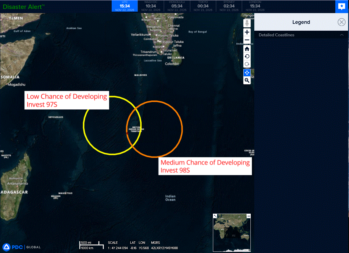
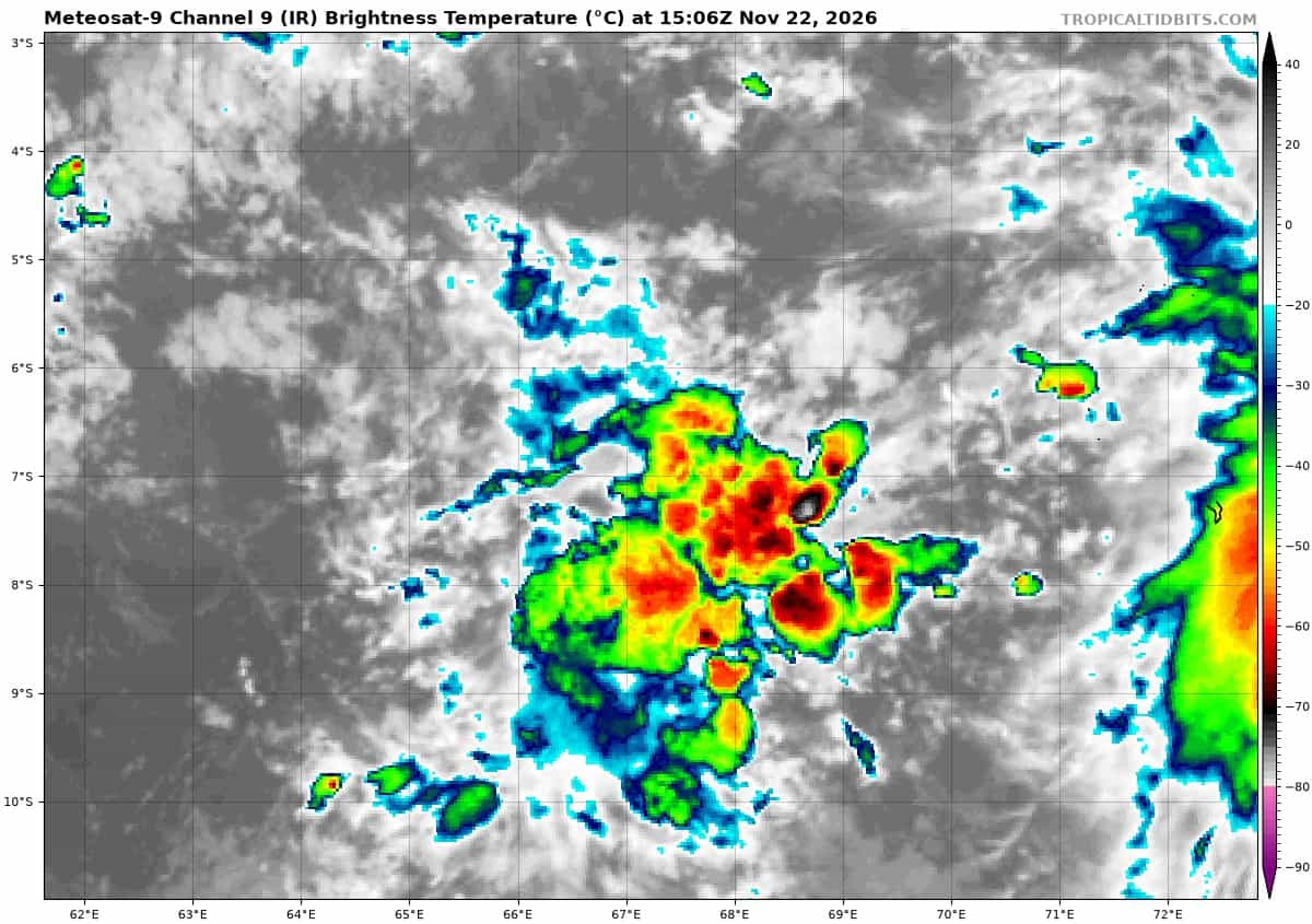
>>> There’s an area of disturbed weather that is being referred to as Invest 97S, which is located approximately 322 NM west of Diego Garcia
Animated multi-spectral satellite imagery shows disorganized deep convection over the monsoon trough.
This disturbance lies in a marginally favorable environment with moderate vertical wind shear (20 kts), moderate poleward upper-
level outflow, and warm sea surface temperatures (28-29c).
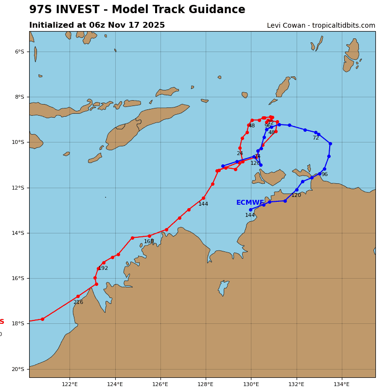
Deterministic and ensemble models indicate weak development as it meanders eastward over the next several days.
Maximum sustained surface winds are estimated at 18 to 23 knots.
Minimum sea level pressure is estimated to be near 1009 mb.
The potential for the development of a significant tropical cyclone within the next 24 hours remains low.
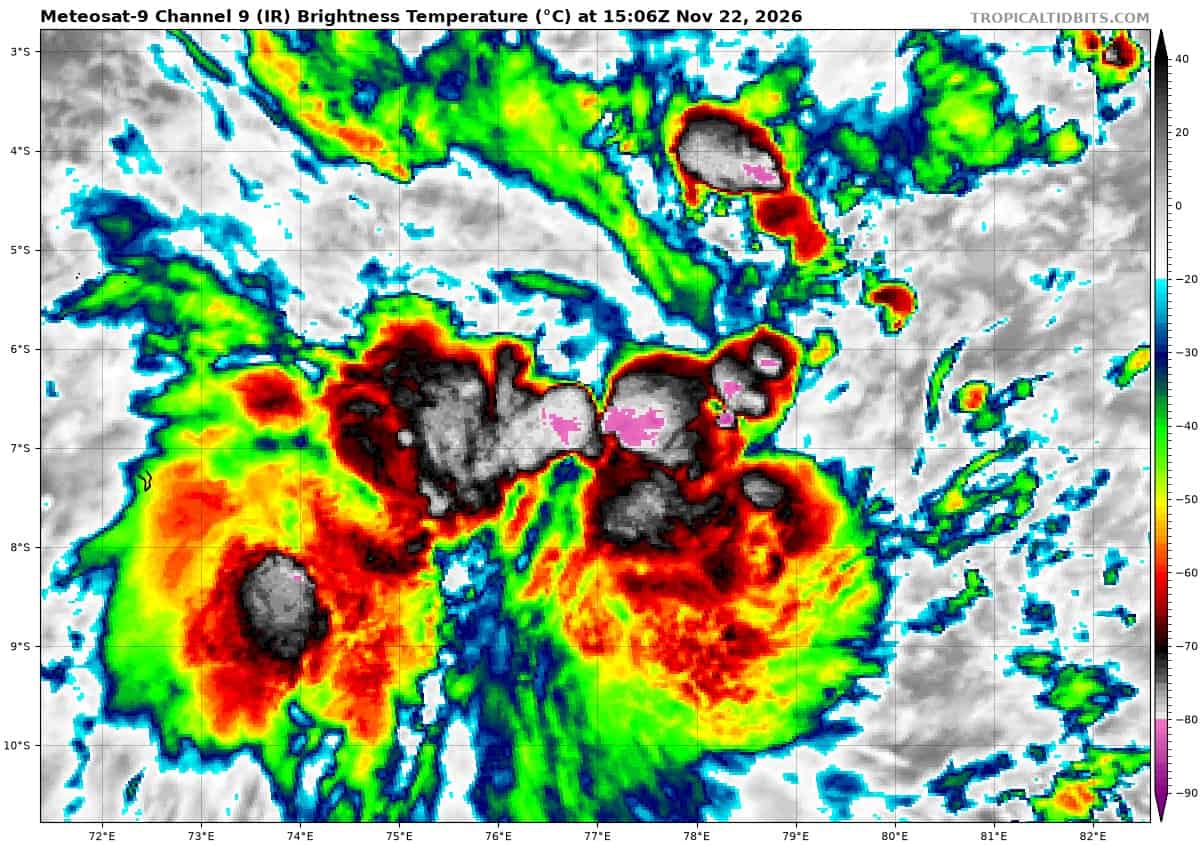
>>> There’s an area of disturbed weather that is being referred to as Invest 98S, which is located approximately 209 NM east of Diego Garcia
Animated multi-spectral satellite imagery depicts an elongated, yet steadily consolidating, low-level circulation center embedded within persistent convection.
Environmental analysis reveals a favorable environment with a warm sea surface temperature (sst) of 29-30 c, low to moderate vertical wind shear of 15-20 kts and good equatorward outflow.
Global models are in agreement with 98S tracking southward with steady development over the next 24-48 hours.
Maximum sustained surface winds are estimated at 18 to 23 knots.
Minimum sea level pressure is estimated to be near 1009 mb.
The potential for the development of a significant tropical cyclone within the next 24 hours is upgraded to medium.