

Current Snapshot
For all the latest updates visit: DisasterAWARE
x
04P_211200sair
04P_tracks_latest
96s
himawari9_ir_96S_202611211500_lat-11.9-lon91.1
96S_tracks_latest
7777
meteosat9_ir_97S_202611211506_lat-6.5-lon64.8
97S_tracks_latest
meteosat9_ir_98S_202611211506_lat-6.8-lon74.9
98S_tracks_latest
By PDC’s Senior Weather
Specialist Glenn James

The Pacific Disaster Center’s (PDC Global) Saturday, November 21, 2026, Tropical Cyclone Activity Report…for the Pacific Ocean, the Indian Ocean, and adjacent Seas.
Tropical Cyclones
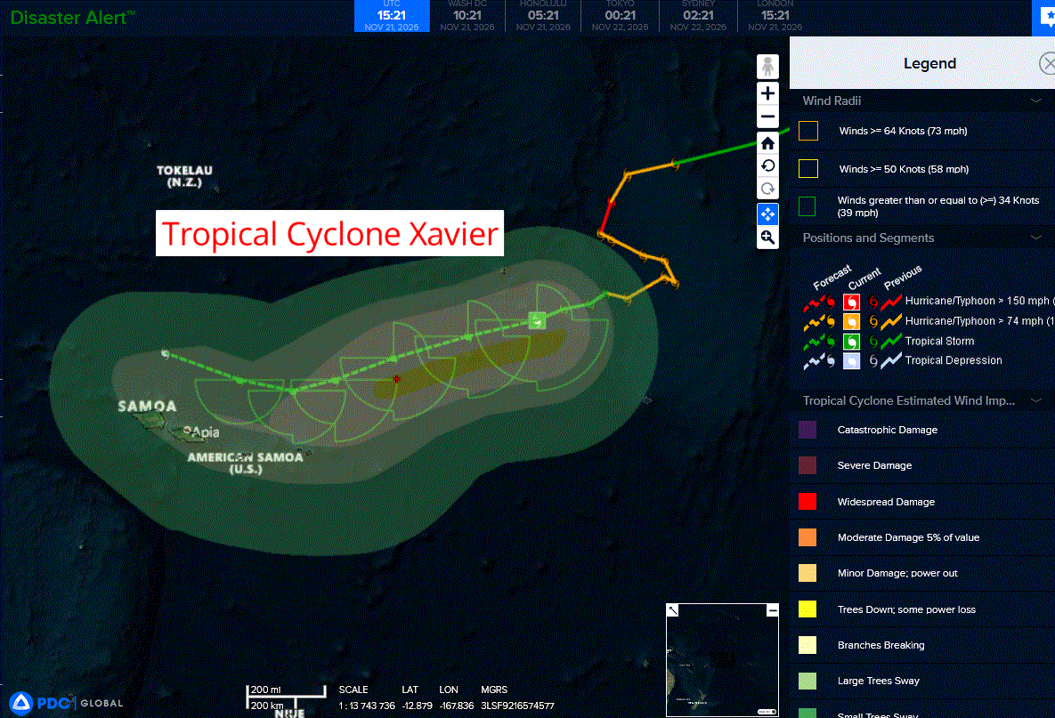
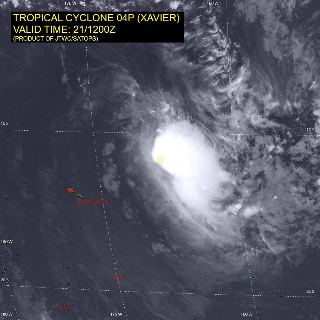
Tropical Cyclone 04P (Xavier)…is located approximately 355 NM east-northeast of Pago Pago
Northeast Pacific: There are no Tropical Cyclones
Central North Pacific: There are no Tropical Cyclones
Western Pacific, Indian Ocean, and adjacent Seas:
Southwestern Pacific
Tropical Cyclone 04P (Xavier)
According to the JTWC warning number 17, sustained winds were 45 knots with gusts to near 55 knots
Animated enhanced infrared (eir) satellite imagery depicts tropical cyclone (tc) 04P (Xavier) with a mostly exposed low-level circulation center (llcc) up until 210300z, but then became obscured by deep convection developing along the southern semicircle. A 210508z f17 ssmis 91 ghz microwave image revealed fragmented convective banding isolated to the southeastern quadrant and low-level cloud lines wrapping into the center.
Environmental analysis indicates that 04P remainsplaced within an unfavorable environment characterized by moderate poleward outflow aloft, moderate (15-20 kts) westerly vertical wind shear, and dry air entrainment.
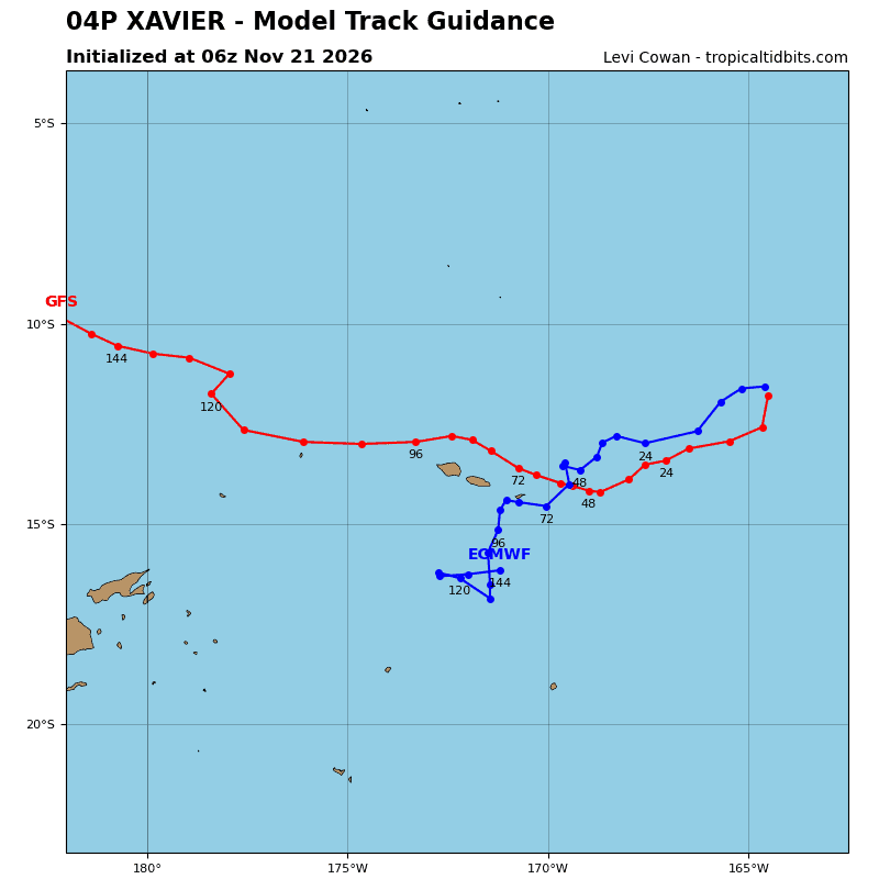
TC 04P is forecast to track west-southwestward, along the northwestern periphery of the subtropical ridge to the southeast through 48 hours. The system is expected to remain north of American Samoa, though there still remains some uncertainty in how close it will ultimately get to the island.
Around 48 hours, a shortwave trough will break down the current steering ridge and a separate ridge will build in behind it, north of New Zealand. The formation of this new ridge is expected to deflect 04P northwestward. The northwestward trajectory will then persist through the remainder of the forecast period.
In terms of intensity, 04P is forecast to maintain its current intensity through 36 hours due primarily to intermittent convective development depicted in mesoscale models and warm sea surface temperatures. If the convection fails to form in the face of persistent shear and dry air, a quicker weakening trend would ensue than is currently depicted in the JTWC forecast.
After 36 hours, dry air entrainment into the core will become significant, further weakening the vortex. As a result, 04P is forecast to dissipate over water no later than 72 hours.
South Indian Ocean
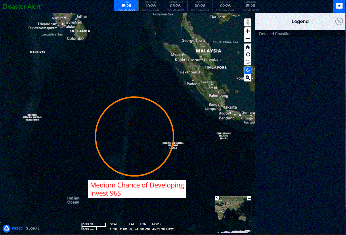
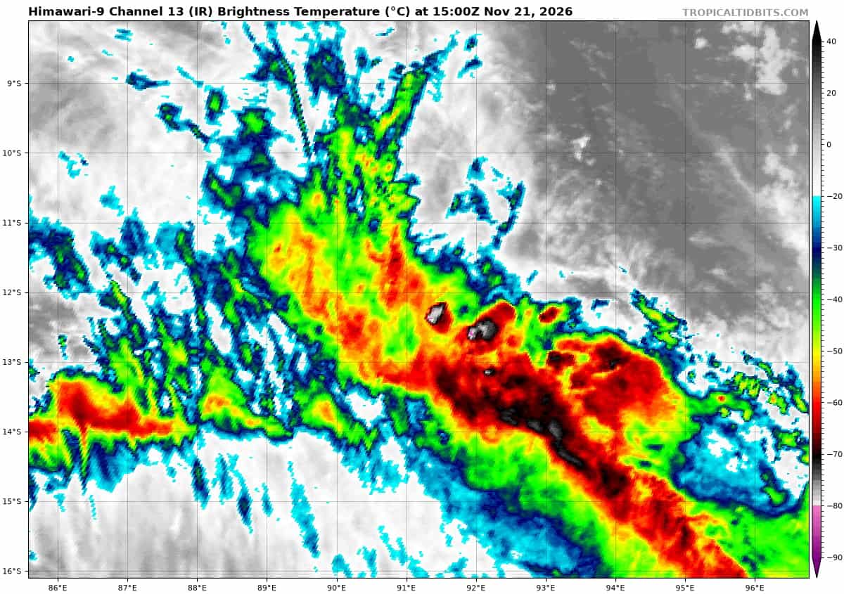
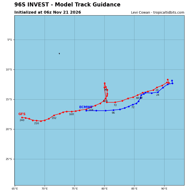
>>> There’s an area of disturbed weather that is being referred to as Invest 96S, which is located approximately 394 NM west of Coco Islands
Animated enhanced infrared (eir) satellite depicts a fully exposed low level circulation center (llcc), positioned to the north of an area of persistent deep convection, sheared to the south due to persistent, moderate northeasterly vertical wind shear.
Environmental analysis reveals a marginal environment for development with a high vertical wind shear (vws) of (25 to 30 knots), moderate to strong poleward upper-level outflow, and warm sea surface temperatures (ssts) of (28 to 29 c).
Global deterministic models depict a clearly defined circulation however, the system struggles to meet wind speed criteria as it traverses southward. Ensemble models depict a steady state intensity trend over the next 24-36 hours.
Maximum sustained surface winds are estimated at 27 to 32 knots.
Minimum sea level pressure is estimated to be near 1006 mb.
The potential for the development of a significant tropical cyclone within the next 24 hours remains medium.
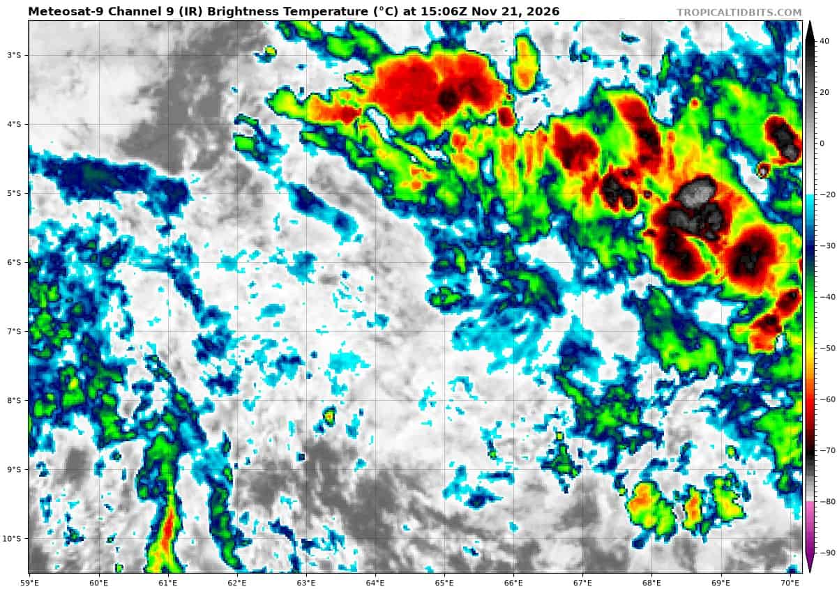
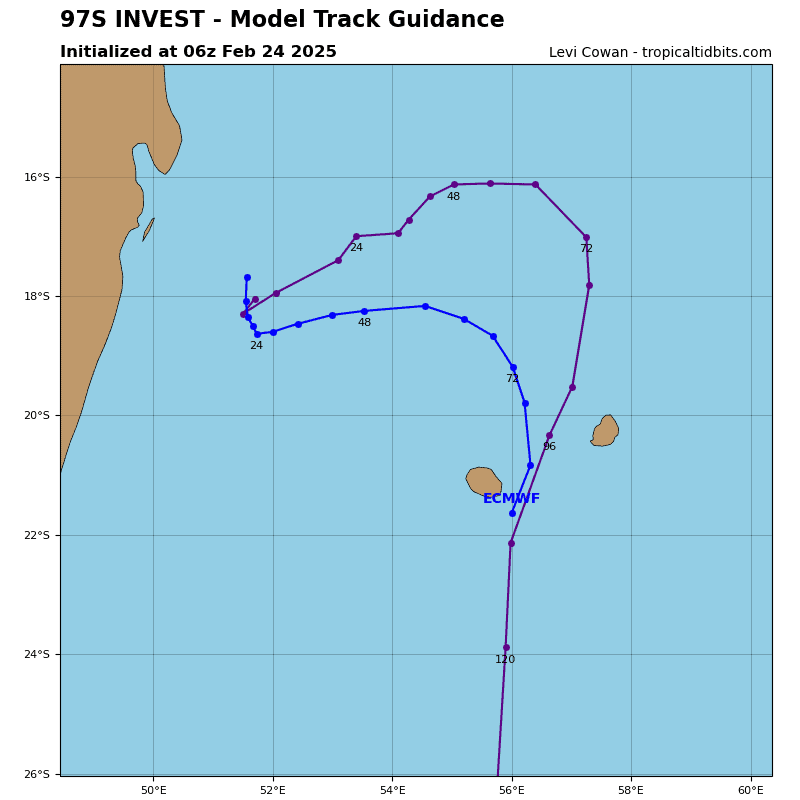
>>> There’s an area of disturbed weather that is being referred to as Invest 97S, which is located approximately 371 NM west of Diego Garcia
Recent animated enhanced infrared satellite imagery shows deep convection developing over a broad area of low-level cyclonic turning evident in a 201448z ssmis pass.
This disturbance lies in a generally favorable environment with low vertical wind shear (5-10 kts), moderate poleward upper-level outflow, and warm sea surface temperatures (29-30c).
Deterministic and ensemble models indicate slow but steady consolidation of this system as it meanders eastward over the next several days.
Maximum sustained surface winds are estimated at 18 to 23 knots.
Minimum sea level pressure is estimated to be near 1009 mb.
The potential for the development of a significant tropical cyclone within the next 24 hours is low.
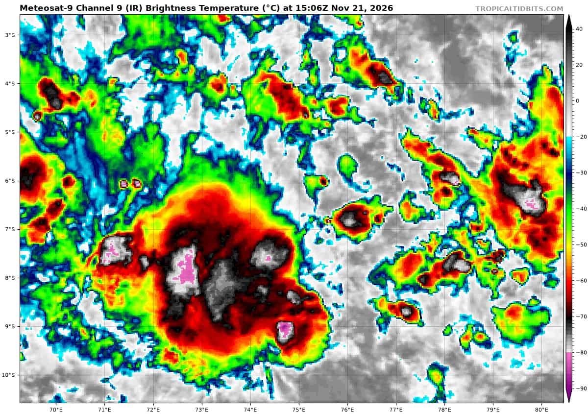
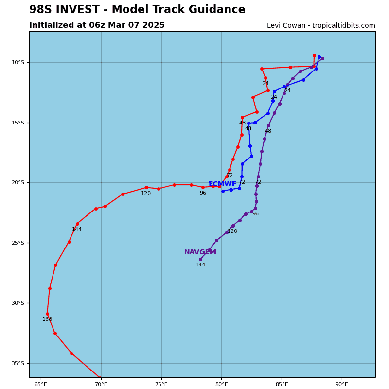
>>> There’s an area of disturbed weather that is being referred to as Invest 98S, which is located approximately 167 NM east of Diego Garcia
Recent animated enhanced infrared satellite imagery indicates patchy deep convection developing over a developing, elongated low-level circulation evident in a 201620z partial metop-c ascat pass.
This disturbance lies in an area of low vertical wind shear (5-10 kts), favorable upper-level outflow, and warm sea surface temperatures (29-30c).
However, the developing circulation is still quite weak and disorganized, and deterministic models and ensembles both indicate slow development over the next few days as the system tracks generally poleward.
Maximum sustained surface winds are estimated at 13 to 18 knots.
Minimum sea level pressure is estimated to be near 1009 mb.
The potential for the development of a significant tropical cyclone within the next 24 hours remains low.