

Current Snapshot
For all the latest updates visit: DisasterAWARE
xavier
04P_160600sair
04P_tracks_latest
92b
meteosat9_ir_92B_202611161621_lat11.6-lon85.9
92B_tracks_latest
96s
himawari9_ir_96S_202611161610_lat-1.2-lon91.4
96S_tracks_latest
By PDC’s Senior Weather
Specialist Glenn James

The Pacific Disaster Center’s (PDC Global) Monday, November 16, 2026, Tropical Cyclone Activity Report…for the Pacific Ocean, the Indian Ocean, and adjacent Seas.
Tropical Cyclones
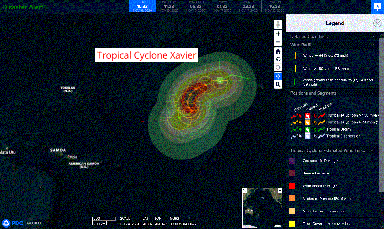
Tropical Cyclone 04P (Xavier)…is located approximately 614 NM northeast of Manua Islands
Northeast Pacific: There are no Tropical Cyclones
Central North Pacific: There are no Tropical Cyclones
Western Pacific, Indian Ocean, and adjacent Seas:
Southwestern Pacific
Tropical Cyclone 04P (Xavier)
According to the JTWC warning number 3, sustained winds were 55 knots with gusts to near 70 knots
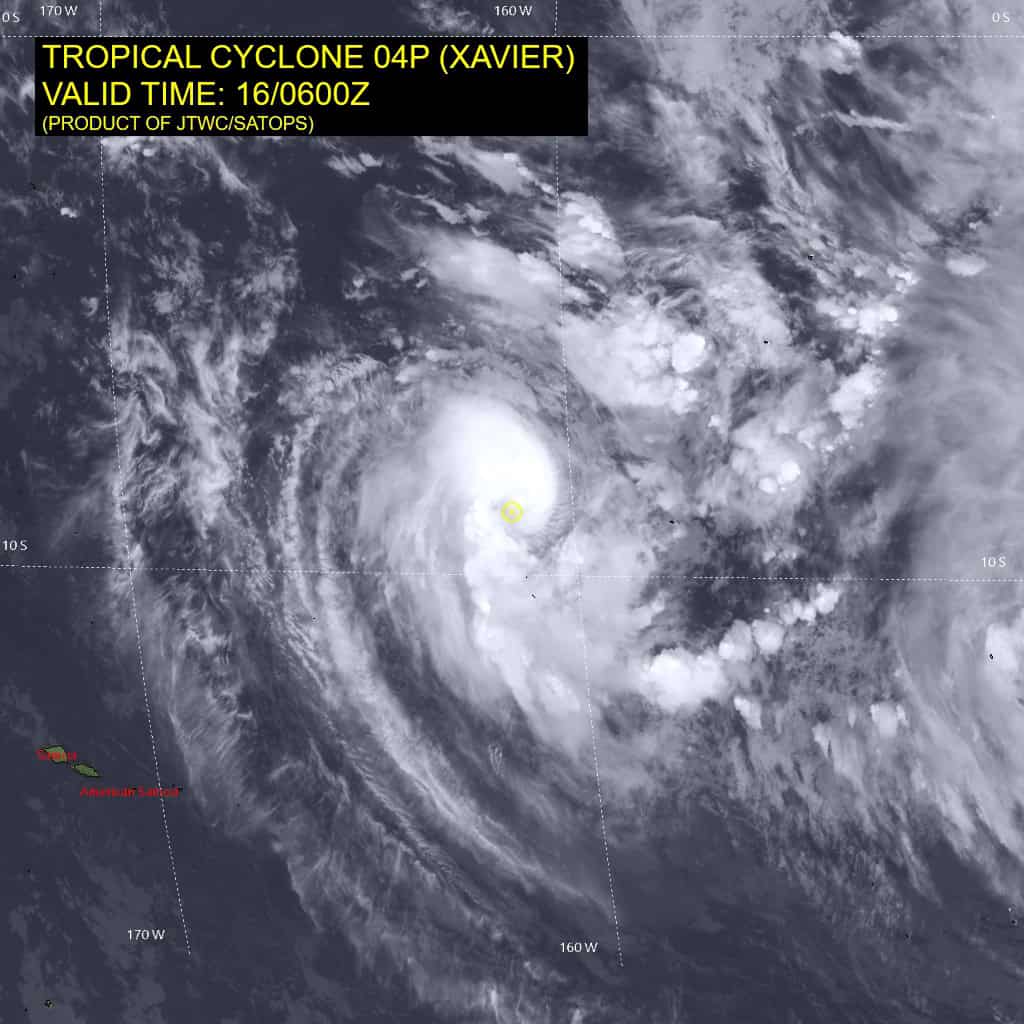
Animated enhanced infrared (eir) satellite imagery depicts tropical cyclone (tc) 04P (Xavier) with an increasingly symmetrical compact core, with convection now fully wrapped around, obscuring the low level circulation center (llcc). a 160544z gpm microwave suite revealed a further developed microwave eye feature in both the 37 ghz and the 89 ghz images, with the deepest convective banding positioned across the western and northern flanks, while the stronger rain bands beyond the discrete eye feature remain incomplete and broken.
The eye feature in the 89 ghz image is situated northwest of the llcc,
indicative of vortex precession as the upper level circulation orbits the llcc cyclonically as it attempts to improve vertical alignment.
Environmental conditions are assessed as favorable, with low (10-15 kts) vertical wind shear (vws), warm (29-30 c) sea surface temperatures (ssts), and strong westward and poleward outflow aloft due to a point source positioned to the east of the system.
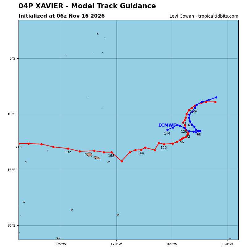
Xavier is forecast to track west-southwestward for the next 24 hours under the combined steering influence of the low to mid level subtropical ridge (str) centered to the south and the western extension of a deep-layer str centered to the southeast.
As the system intensifies and deepens in vertical extent, steering influence is expected to become dominated by the deep-layer str, causing a poleward turn by 36 hours as 04P nears the axis of the western extension. this will be accompanied by a further decrease in the already slow track speed, as Xavier enters a col region between the eastern str and a second, distant str centered far to the west.
04P is expected to become quasi-stationary within this col region until around 96 hours, at which point its decrease in intensity will cause Xavier to be steered primarily west-northwestward by the low-level easterly trades.
Regarding intensity, the compact nature and improved structure of the core as well as continued favorable environmental conditions are indicative of further rapid intensification (ri) out to 24 hours, with an ultimate peak intensity of 95 kts expected to occur between 36 and 48 hours as the approach to the col region between strs optimizes outflow aloft.
After this peak, steady weakening is expected for the remainder of the forecast period as vws becomes increasingly hostile, entraining dry air into the core. Additionally, ocean heat content (ohc) is expected to decrease, coinciding with the stall in track speed, inducing the upwelling of cooler ssts.
North Indian Ocean
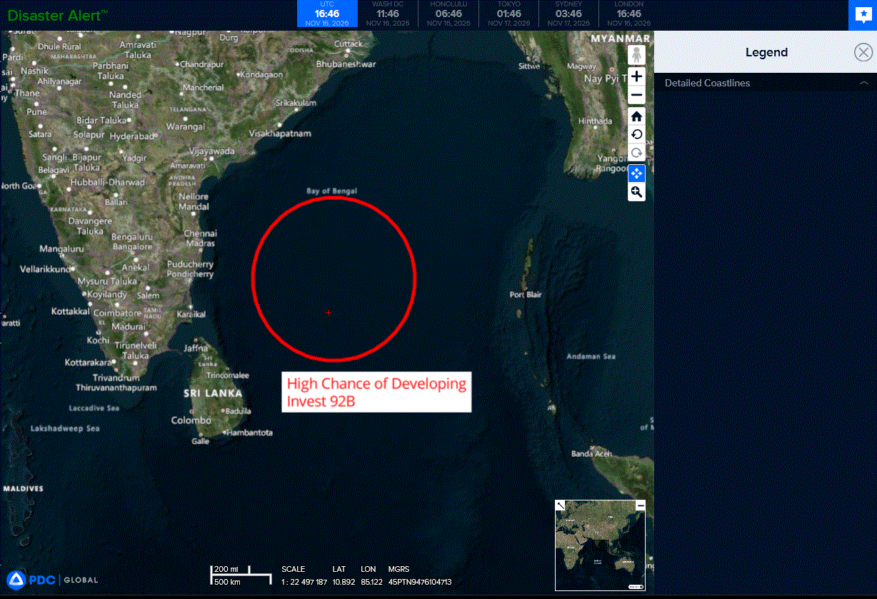
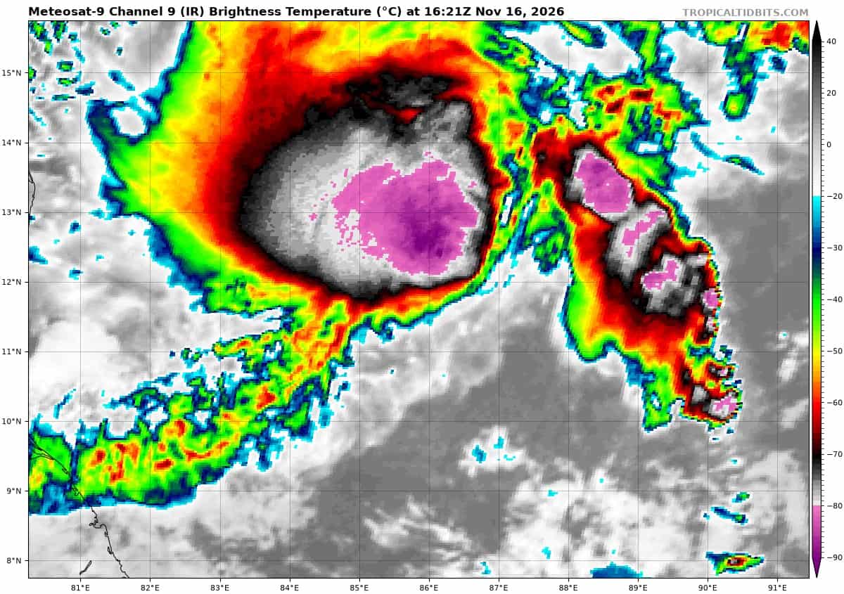
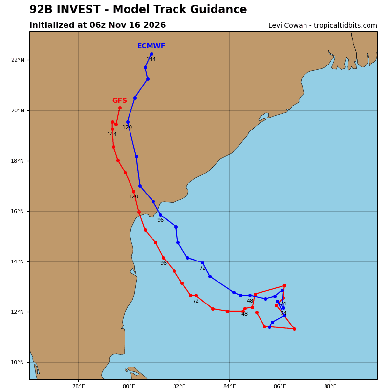
>>> There’s an area of disturbed weather that is being referred to as Invest 92B, which is located approximately 338 NM east-southeast of Chennai, India
Animated multi-spectral satellite imagery depicts a partially-exposed, elongated low level circulation center (llcc) with deep, persistent convective banding sheared to the northwest of the llcc and a flaring puff of convection over the llcc.
A bullseye 160301z ascat-b pass shows 25-30 knots along the southern
and western flanks of the elongated llcc. while still consolidating, the ascat reveals the radius of maximum winds is constricting and the llcc is consolidating.
Environmental analysis reveals a relatively favorable environment for development with moderate to high vertical wind shear (vws) of 20-25 knots, strong upper-level outflow, and warm sea surface temperatures (ssts) of 29-30c.
Global deterministic and ensemble models are in good agreement that invest 92B will continue to consolidate as it tracks north-northwestward over the next 24 hours. GFS remains the most aggressive solution, forecasting 92B to reach criteria within the first 24 hours while the consensus maintains steady development.
Maximum sustained surface winds are estimated at 28 to 33 knots.
Minimum sea level pressure is estimated to be near 1004 mb.
The potential for the development of a significant tropical cyclone within the next 24 hours is upgraded to high.
South Indian Ocean
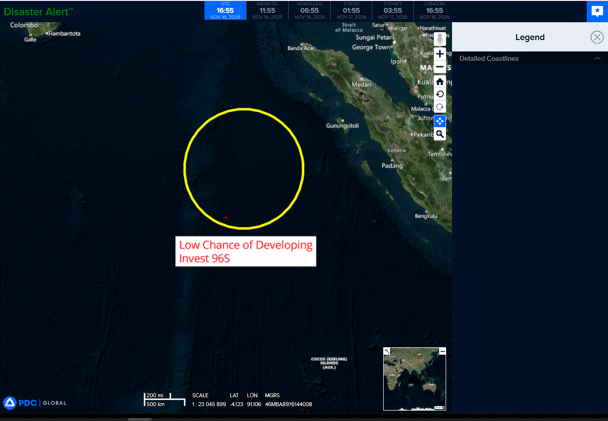
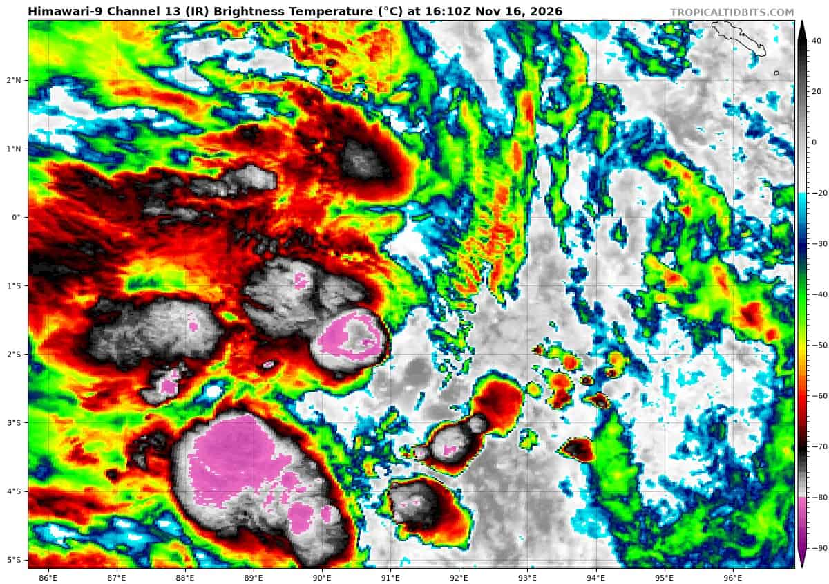
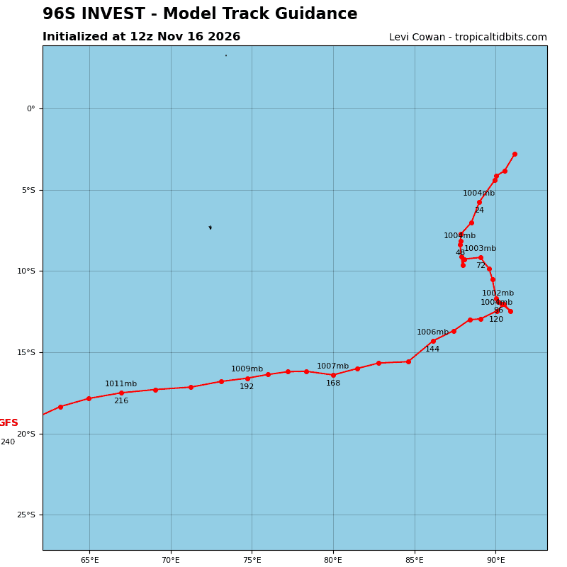
>>> There’s an area of disturbed weather that is being referred to as Invest 96S, which is located approximately 700 NM east-southeast of Cocos Islands
Animated multi-spectral satellite imagery and a 152215z ssmis f18 91ghz microwave image depict fragmented and disorganized convection obscuring the assessed low level circulation center (llcc). A 160304z ascat metop-b pass shows an improved llcc with winds of 25-30 knots on the southern and eastern sides of the llcc, associated with a westerly wind burst along the equator.
Environmental analysis reveals a marginal environment for development
with moderate to high vertical wind shear (vws) of 20-25 knots, good upper-level outflow, and warm sea surface temperatures (ssts) of 29-
30c.
Global ensemble models are in good agreement as 96S slowly
consolidates as it tracks south-southwest over the next 48 hours, while gfs remains the only global deterministic model to develop 96S into a tropical cyclone.
Maximum sustained surface winds are estimated at 28 to 33 knots.
Minimum sea level pressure is estimated to be near 1007 mb.
The potential for the development of a significant tropical cyclone within the next 24 hours is upgraded to medium.