

Current Snapshot
For all the latest updates visit: DisasterAWARE
04p
04P_150600sair
goes18_ir_04P_202611151515_lat-8.3-lon-159.5
04P_tracks_latest
92b
meteosat9_ir_92B_202611151521_lat11.1-lon87.2
92B_tracks_latest
96s
himawari9_ir_96S_202611151510_lat-0.9-lon92.9
96S_tracks_latest
By PDC’s Senior Weather
Specialist Glenn James

The Pacific Disaster Center’s (PDC Global) Sunday, November 15, 2026, Tropical Cyclone Activity Report…for the Pacific Ocean, the Indian Ocean, and adjacent Seas.
Tropical Cyclones
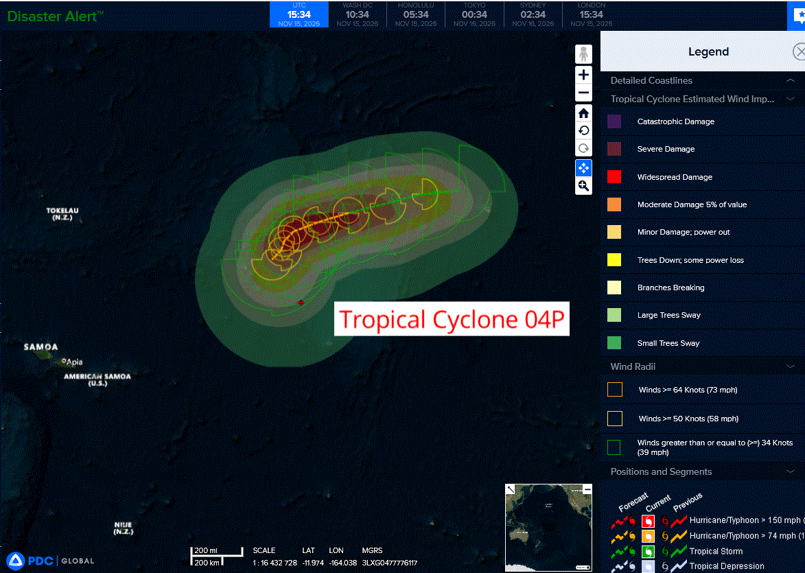
Tropical Cyclone 04P…is located approximately 779 NM east-northeast of Pago Pago
Northeast Pacific: There are no Tropical Cyclones
Central North Pacific: There are no Tropical Cyclones
Western Pacific, Indian Ocean, and adjacent Seas:
Southwestern Pacific
Tropical Cyclone 04P
According to the JTWC warning number 1, sustained winds were 35 knots with gusts to near 45 knots
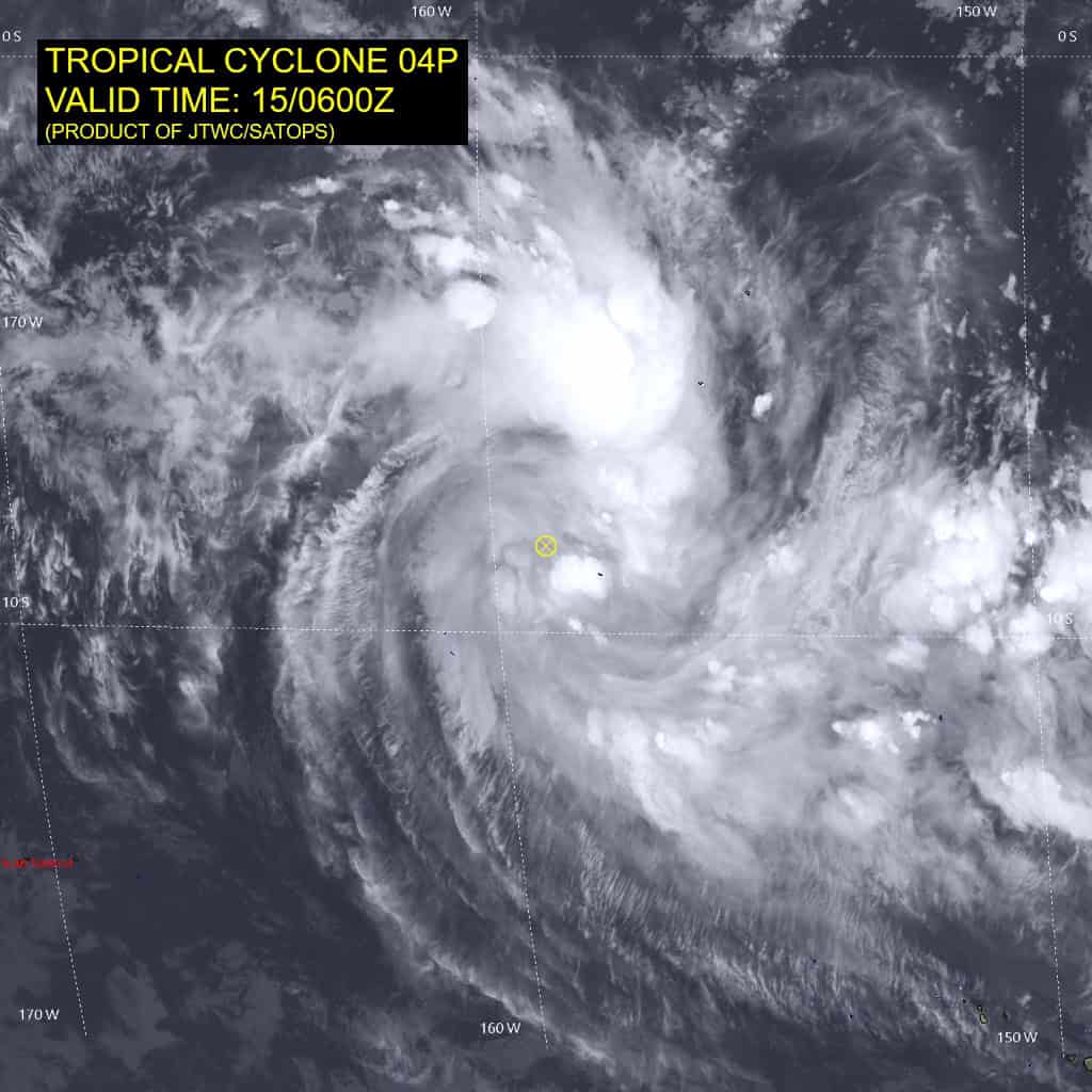
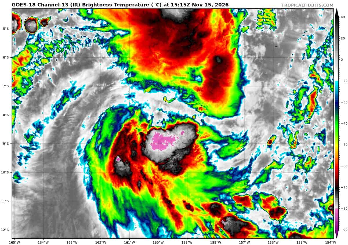
Animated enhanced infrared (eir) satellite imagery depicts tropical
cyclone (tc) 04P as a slightly elongated circulation comprised of deep convective banding expanding off of the northern and southern
flanks. A 150548z f-16 pass revealed a developing low level
circulation center (llcc) vertically aligned between the 37 ghz and 91 ghz images with the most robust convection located within the eastern band.
Environmental conditions are assessed as highly favorable with high (29-30 c) sea surface temperatures, low (5-10 kts) vertical wind shear (vws), and robust radial outflow aloft due to a point source positioned just to the northwest of the system.
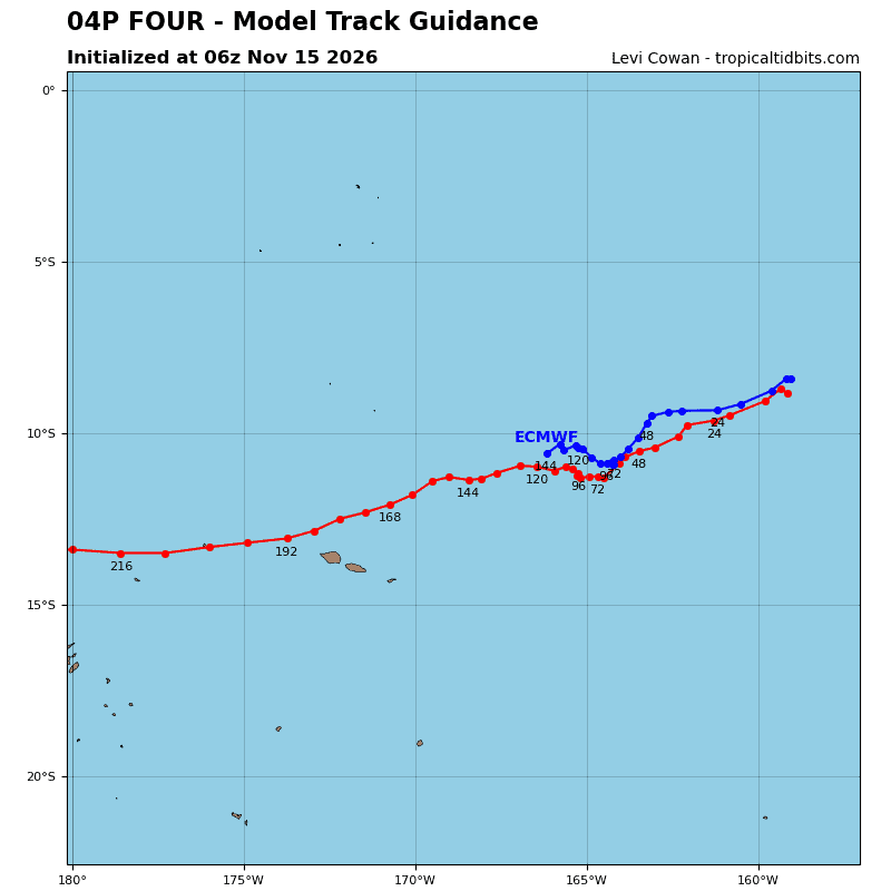
TC 04P is forecast to track generally west to west-southwestward out to 60 hours as the developing system is steered primarily by the low to mid-level subtropical ridge (str) centered to the south. After 60 hours, a slow in track speed and poleward turn is forecast as the deep-layer str centered to the east-southeast builds a westward extension and 04P enters a col region between this str and another, weaker str centered to the west.
Near the end of the forecast period, an incoming mid-latitude trough is expected to reorient and weaken the eastern str, causing a slight
westward turn by 96 hours. The overall steering environment
throughout the forecast period is expected to remain relatively weak and highly dependent on the intensity of 04P at that time.
Regarding intensity, 04P is expected to intensify just below the rate of explicit rapid intensification (ri) out to 36 hours as outflow aloft remains highly conducive and all other environmental conditions remain favorable. A peak of 80 kts is forecast between 48 and 60 hours, followed by general weakening thereafter as mid-layer vws
increases and begins to entrain dry air into the core.
The peak intensity and associated timing of 04P will highly impact its track, as the system gains intensity, it is expected to be steered primarily by the aforementioned deep-layer features, whereas if it peaks lower it will remain steered by the low-to-mid level flow.
North Indian Ocean
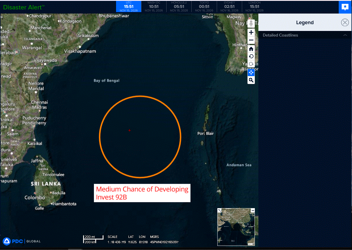
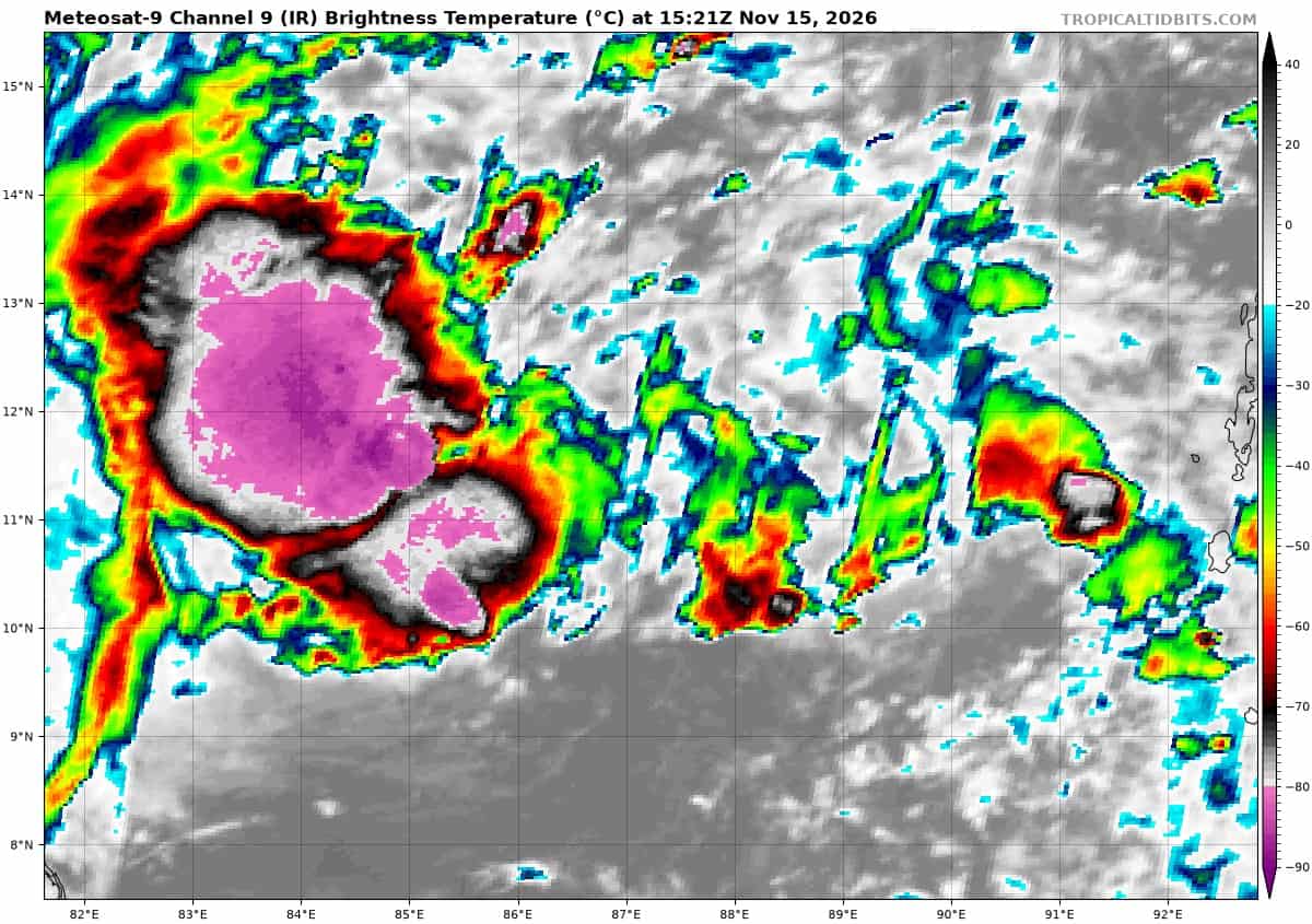
>>> There’s an area of disturbed weather that is being referred to as Invest 92B, which is located approximately 423 NM east-southeast of Chennai, India
Animated enhanced infrared satellite imagery depicts a partially-exposed low level circulation center (llcc) with flaring convection on the southern flank of the llcc. A 151155z wsfm pass supports the broad nature of the llcc as it continues to consolidate, still elongated along the east-west axis.
Environmental analysis reveals a moderately favorable environment for development with strong westward upper-level outflow and warm sea surface temperatures (sst) of 29-30c offset by moderate to high vertical wind shear (vws) of 20-25 knots.
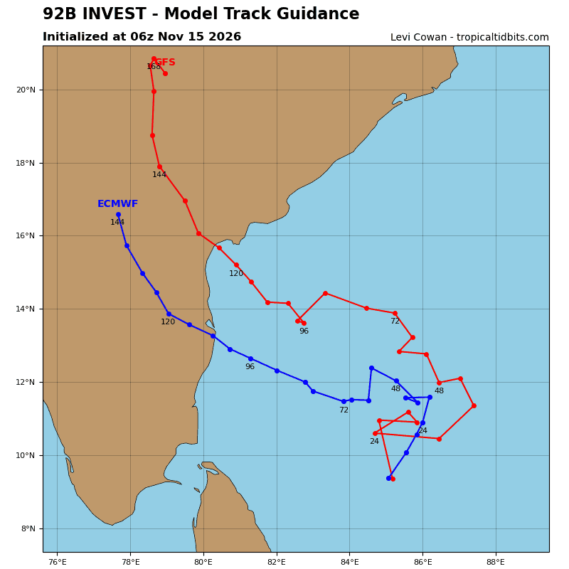
Global deterministic models remain split on structural development, with gfs depicting the circulation to remain broad and is slower to intensify, While the ecmwf is more aggressive, forecasting a tighter circulation and developing 92B into a tropical cyclone within the next 48 hours.
Global models agree on a slow north track over the next 48 hours as
92B consolidates, followed by a northwestward track thereafter.
Maximum sustained surface winds are estimated at 28 to 33 knots.
Minimum sea level pressure is estimated to be near 1006 mb.
The potential for the development of a significant tropical cyclone within the next 24 hours is upgraded to medium.
South Indian Ocean
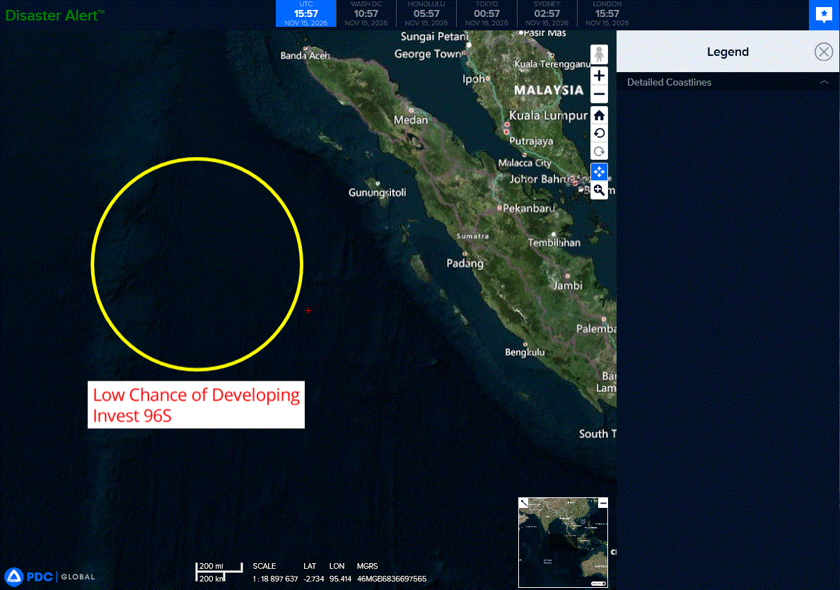
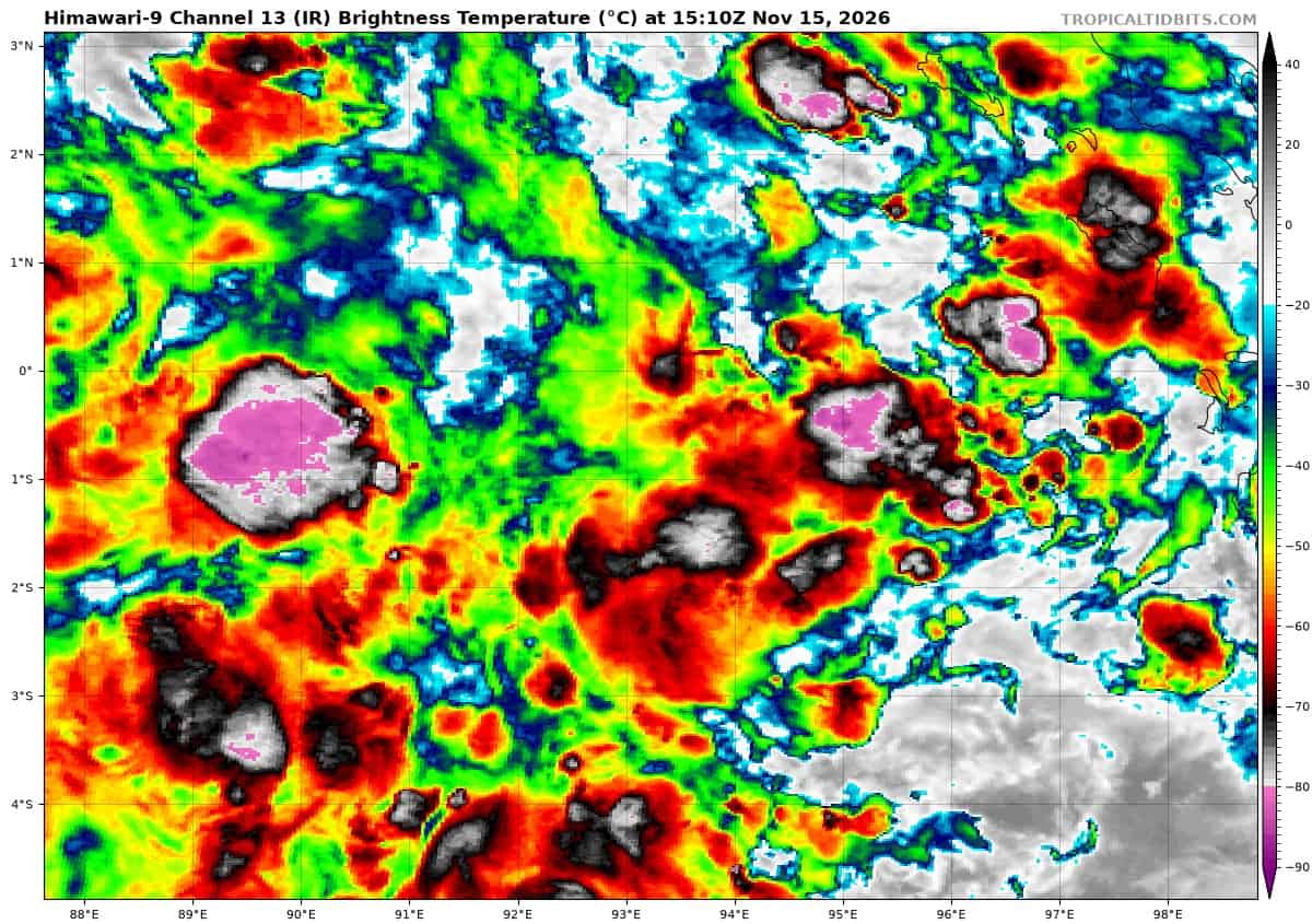
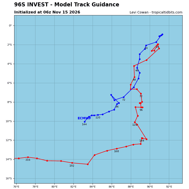
>>> There’s an area of disturbed weather that is being referred to as Invest 96S, which is located approximately 777 NM south-southwest of Port Blair
Animated enhanced infrared satellite imagery depicts invest 96S embedded within a sharp troughing region with a strong westerly wind burst along the equator just to the north. A 131232z wsfm 89 ghz microwave image showed signs of southerly winds beginning to wrap into the system in the western periphery.
Environmental analysis indicates that 96S is in a marginally favorable environment characterized by moderate poleward
outflow aloft, moderate to high (20-25 kts) northeasterly shear, and
warm (29-30 c) sea surface temperatures.
Global models agree on 96S tracking generally eastward, however, they disagree on the amount of development. The ecmwf deterministic model has started showing quick consolidation over the next 24 hours, while gfs takes much longer. Additionally, various ensemble models show only a handful of members that reach tropical cyclone strength.
Maximum sustained surface winds are estimated at 23 to 28 knots.
Minimum sea level pressure is estimated to be near 1009 mb.
The potential for the development of a significant tropical cyclone within the next 24 hours remains low.