

Current Snapshot
For all the latest updates visit: DisasterAWARE
04e
GOES19-EEP-13-900×540
goes18_ir_04E_202607011515_lat14.4-lon-126.7

04E_tracks_latest
ccc
09w
09W_011200sair
himawari9_ir_09W_202607011510_lat9.8-lon162.3

09W_tracks_latest
96w
himawari9_ir_96W_202607011510_lat16.7-lon116.4

96W_tracks_latest
By PDC’s Senior Weather
Specialist Glenn James

The Pacific Disaster Center’s (PDC Global) Wednesday, July 1, 2026, Tropical Cyclone Activity Report…for the Pacific Ocean, the Indian Ocean, and adjacent Seas
Current Tropical Cyclones:
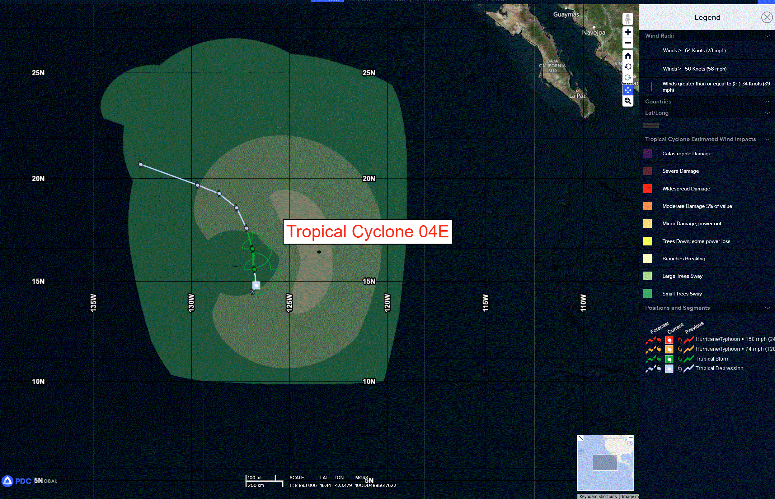
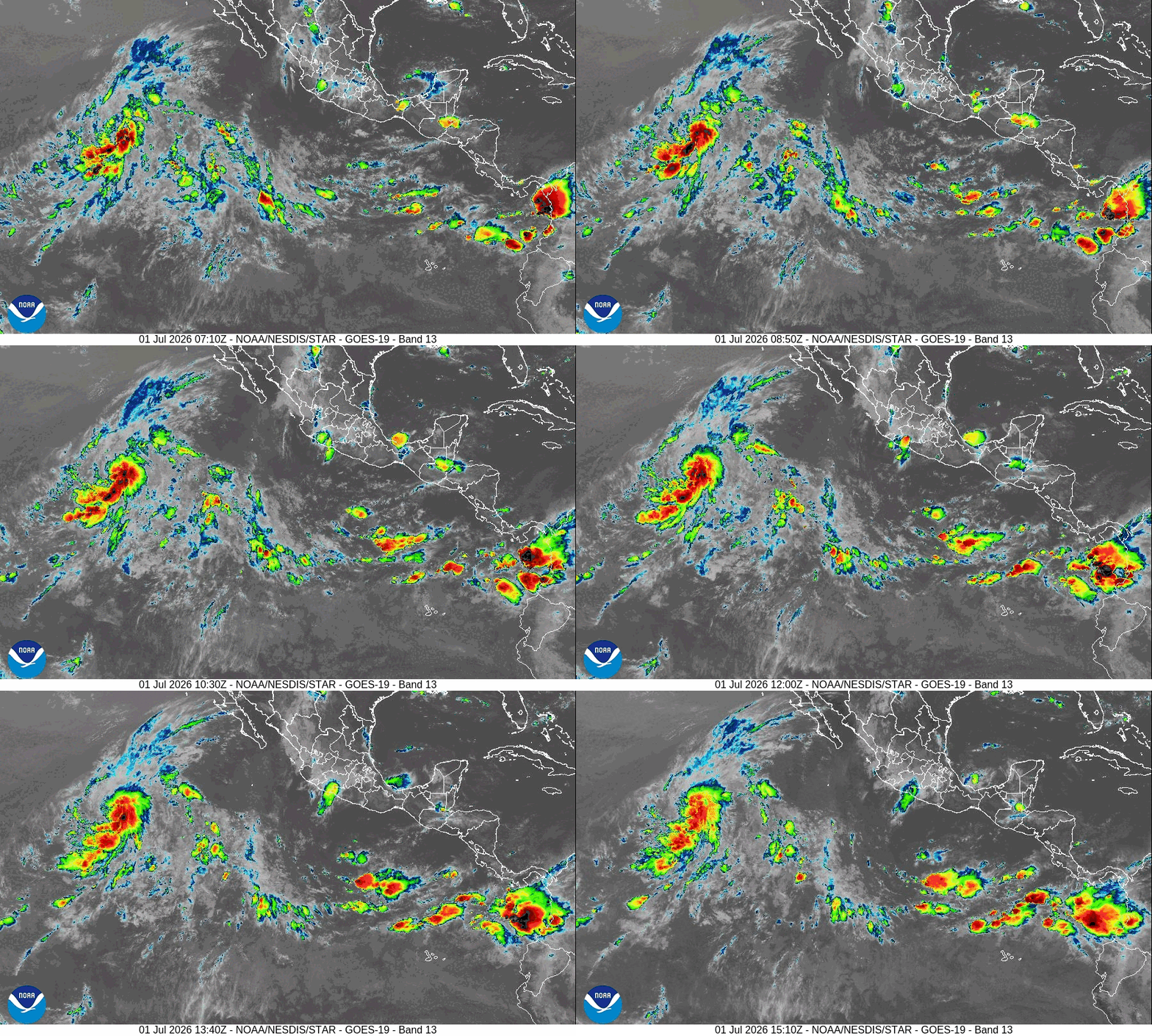
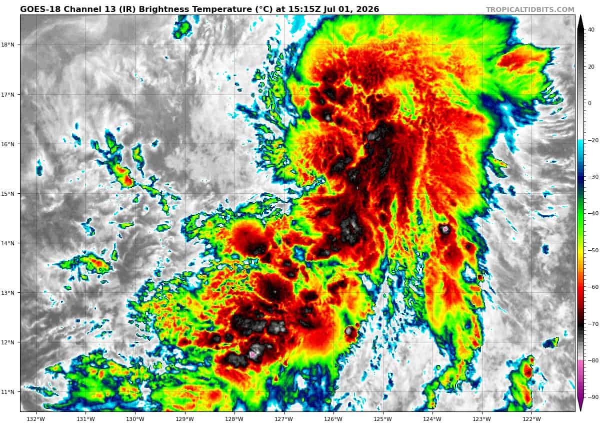
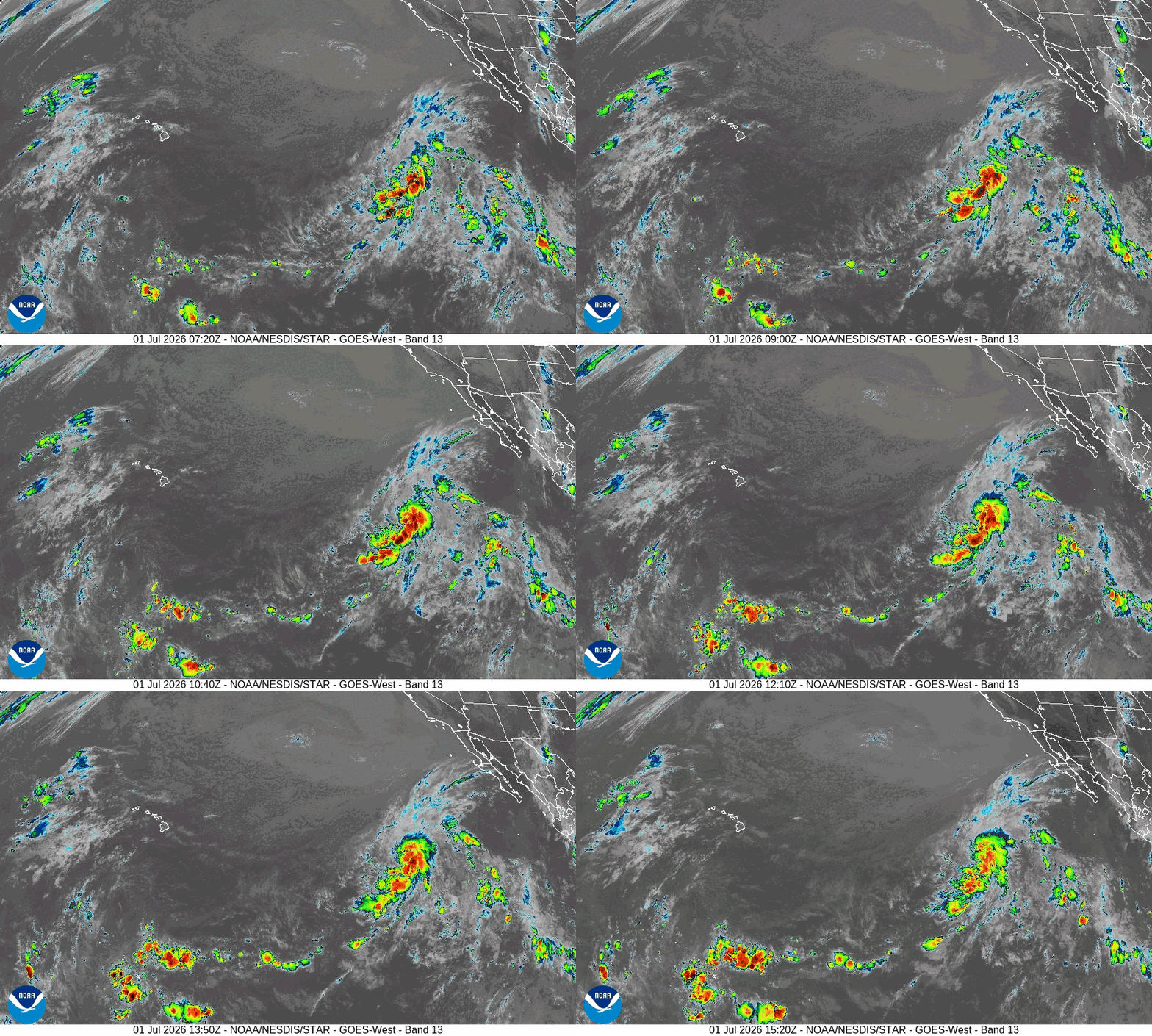
Tropical Cyclone 04E is located about 1230 miles west-southwest of the southern tip of Baja California
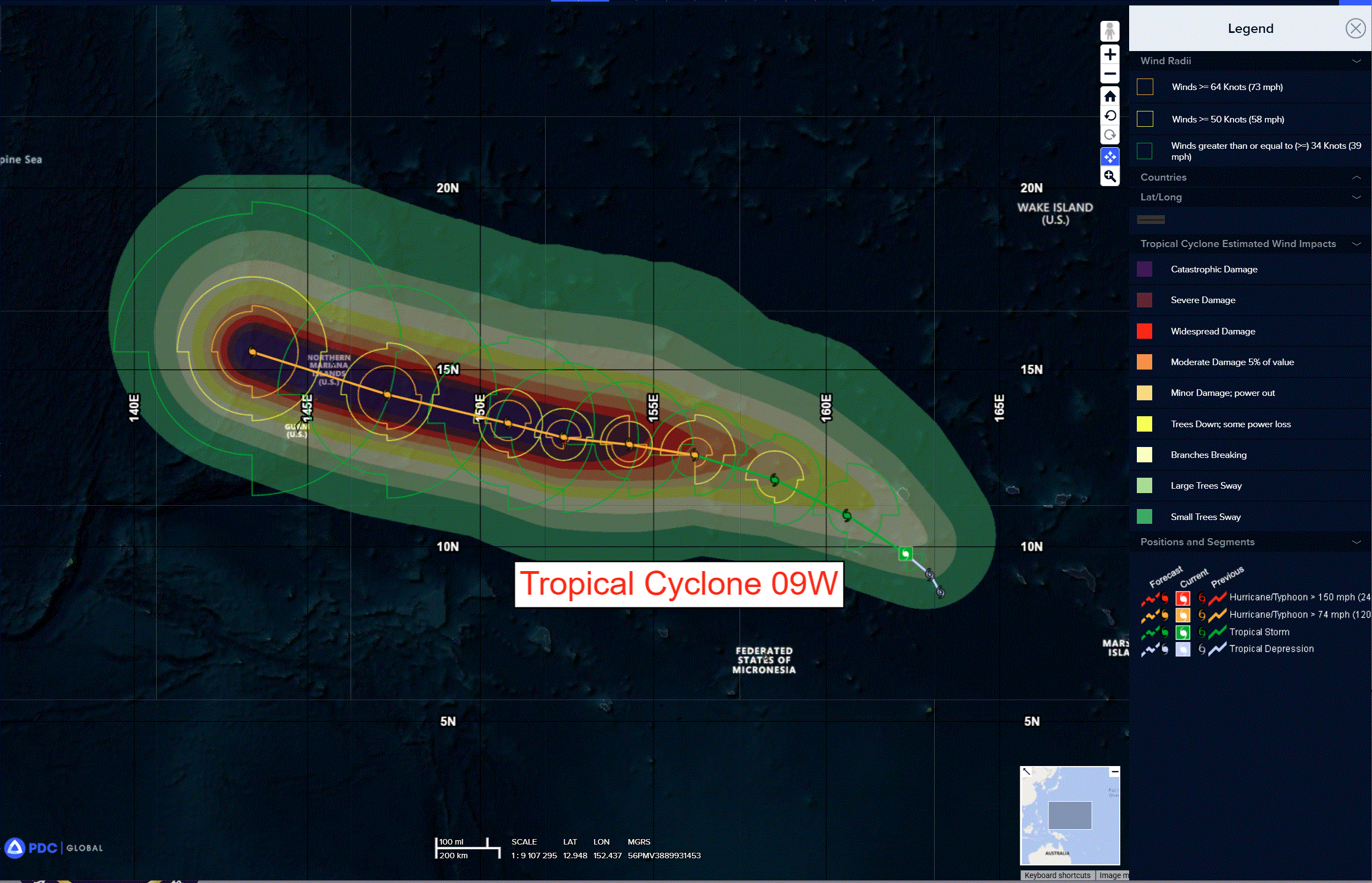
Tropical Cyclone 09W is located approximately 1027 NM east-southeast of Tinian
Northeast Pacific Ocean:
Tropical Cyclone 04E
TROPICAL DEPRESSION FOUR-E MOVING SLOWLY NORTHWARD
According to the NHC advisory number 2…The depression is moving toward the north near 6 mph (9 km/h), and this general motion is expected to continue into Thursday. A gradual turn to the northwest is forecast late this week.
Maximum sustained winds are near 35 mph (55 km/h) with higher gusts. Some strengthening is forecast during the next day or so, and the system is forecast to become a tropical storm later today or tonight.
Central Pacific Ocean: There are no Tropical Cyclones
Western Pacific, Indian Ocean, and adjacent Seas: There are no Tropical Cyclones
Western Pacific
Tropical Cyclone 09W
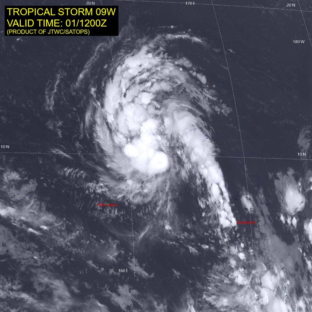
According to the JTWC Warning Number 3, sustained winds are 35 knots with gusts to 45 knots
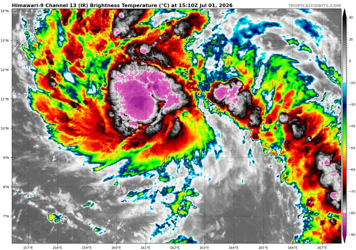
Animated enhanced infrared (eir) satellite imagery depicts tropical storm 09W quickly consolidating under expanding deep convection. The 011019z metop-b ascat pass revealed that the surface winds are still slightly disorganized, with the small patch of gale force winds confined to the southeast quadrant.
Environmental analysis indicates a highly favorable environment, characterized by low (10-15 kts) vertical wind shear (vws), warm (28-29 c) sea surface temperatures, and robust poleward outflow.
TS 09W will continue tracking generally northwestward for the next 12-24 hours as it remains steered by the str centered to its northeast. Around 24 hours, a separate str centered to the northwest will build and extend eastward, gaining steering influence over 09W in the process. After 09W transitions steering ridges, it will track generally west-northwestward through the remainder of the forecast period. Between 48-60 hours, the eastward extension of the steering ridge is expected to weaken, causing a slight slowdown in 09W’s translational speed and a slight
dip in 09w’s track. The ridge is expected to reorient shortly thereafter and keep 09Ww on its west-northwestward trajectory through 120 hours.
Regarding intensity, 09W is currently forecast to steadily intensify until 24 hours while it continues to consolidate. The system is expected to rapidly intensity from 24 until 60 hours. Following 60 hours, 09W is forecast to continue intensifying at a slightly slower rate until remaining steady between 96-120 hours.
In the late-term forecast, 09W is expected to encounter a dry air mass to the west and north of the system; however, by this time, 09W is
expected to be a mature typhoon and should be able to cocoon itself off from the surrounding dry air, as indicated by forecast models.
Additionally, forecast models indicate 09W will have an expansive wind field, and is expected to introduce destructive winds across
CNMI and Guam as it passes south of Tinian.
Western Pacific
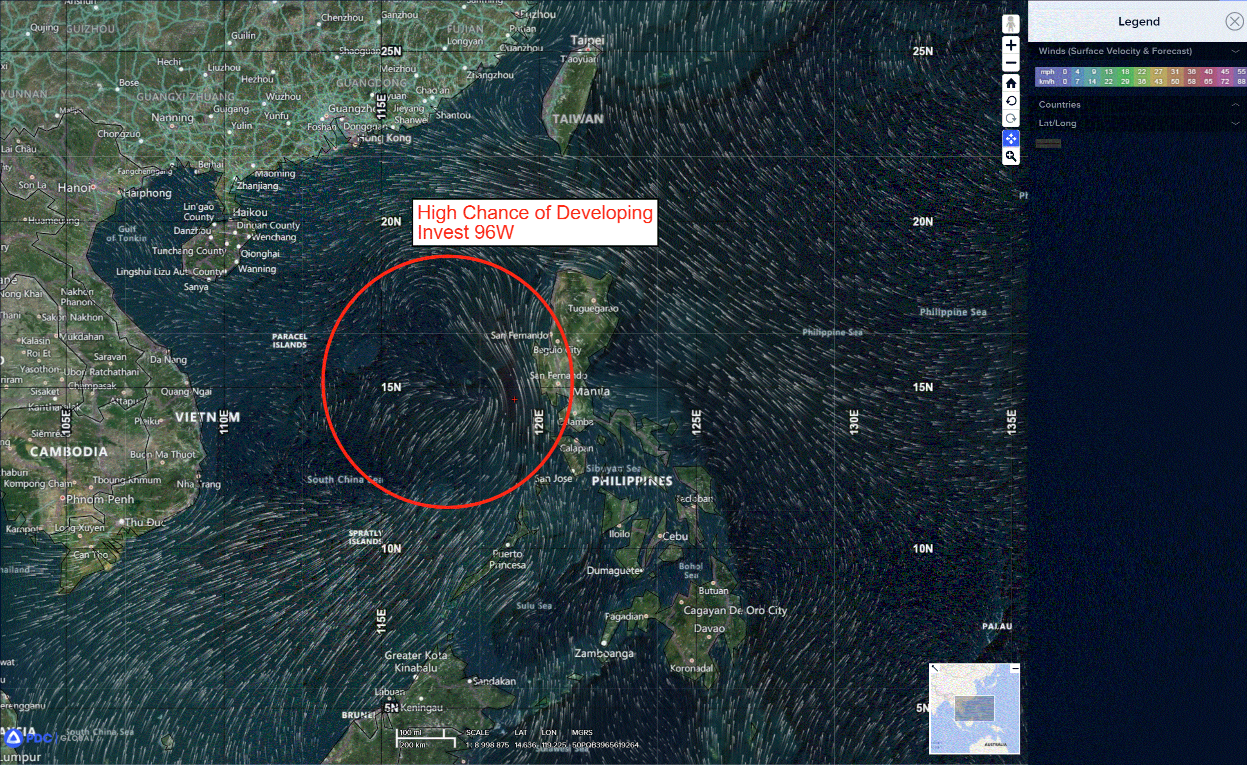
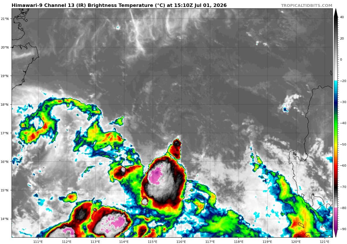
>>> There’s an area of disturbed weather being referred to as Invest 96W, which is located approximately 70 NM southwest of Manila
Animated enhanced infrared satellite imagery (eir) depicts deep convection consolidating over the low-level circulation center (llcc) with curved deep convective banding in the southern periphery.
Environmental analysis for the area indicates a favorable environment for development once it moves over the South China Sea with warm sea surface temperatures (30-31c), low vertical wind shear (10-15kts), and good equatorward outflow aloft.
Global models are in good agreement that 95W will rapidly intensify over the next 24 hours.
Maximum sustained surface winds are estimated at 18 to 23 knots.
The potential for the development of a significant tropical cyclone within the next 24 hours remains high.