
")
Current Snapshot
For all the latest updates visit: DisasterAWARE

amanda
GOES18-TPW-13-900×540
goes18_ir_01E_202606071515_lat11.6-lon-135.2
01E_tracks_latest
02e
dddd
goes19_ir_02E_202606071515_lat15.4-lon-100.0
02E_gefs_latest
2
7
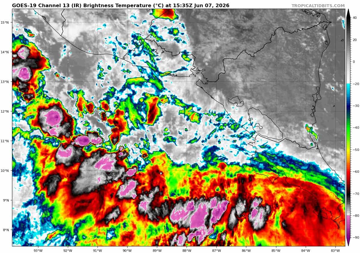
goes19_ir_92E_202606071535_lat11.3-lon-88.4

92E_tracks_latest
By PDC’s Senior Weather
Specialist Glenn James

The Pacific Disaster Center’s (PDC Global) Sunday, June 7, 2026, Tropical Cyclone Activity Report…for the Pacific Ocean, the Indian Ocean, and adjacent Seas
Current Tropical Cyclones:
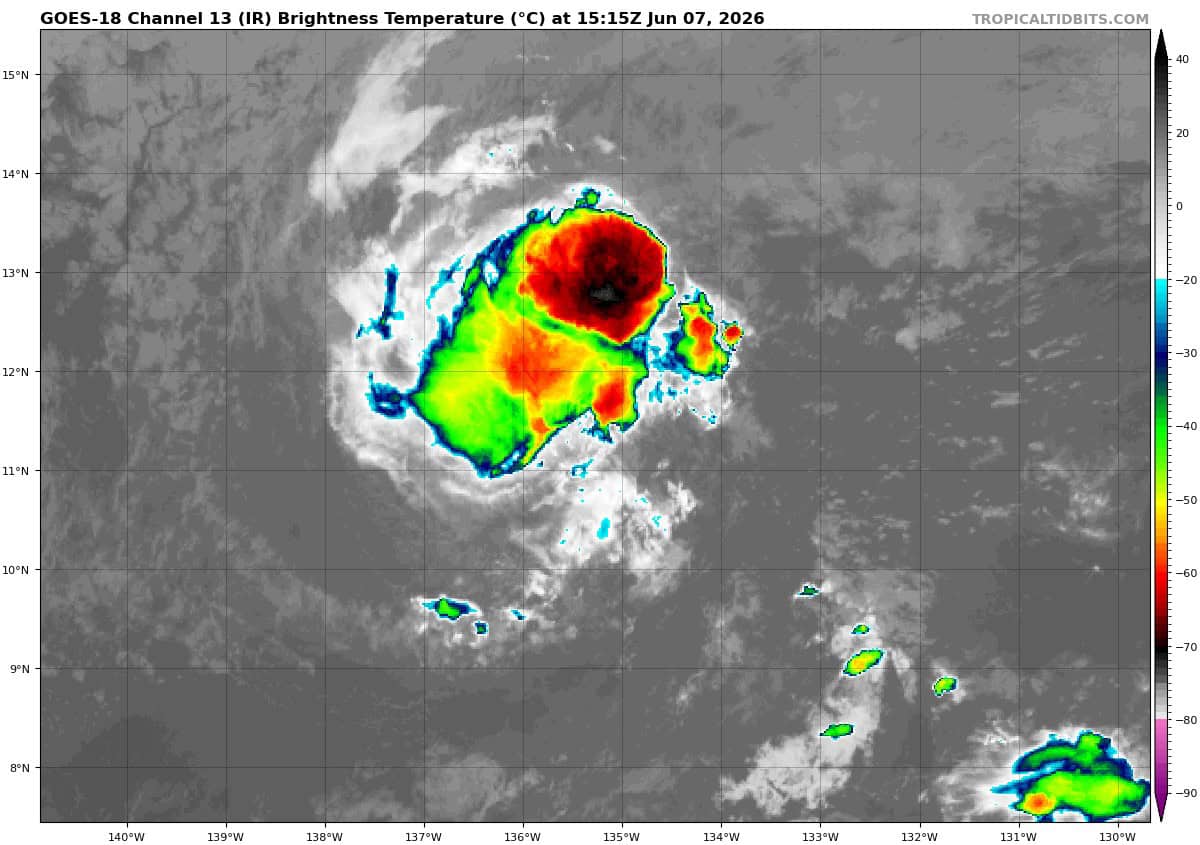
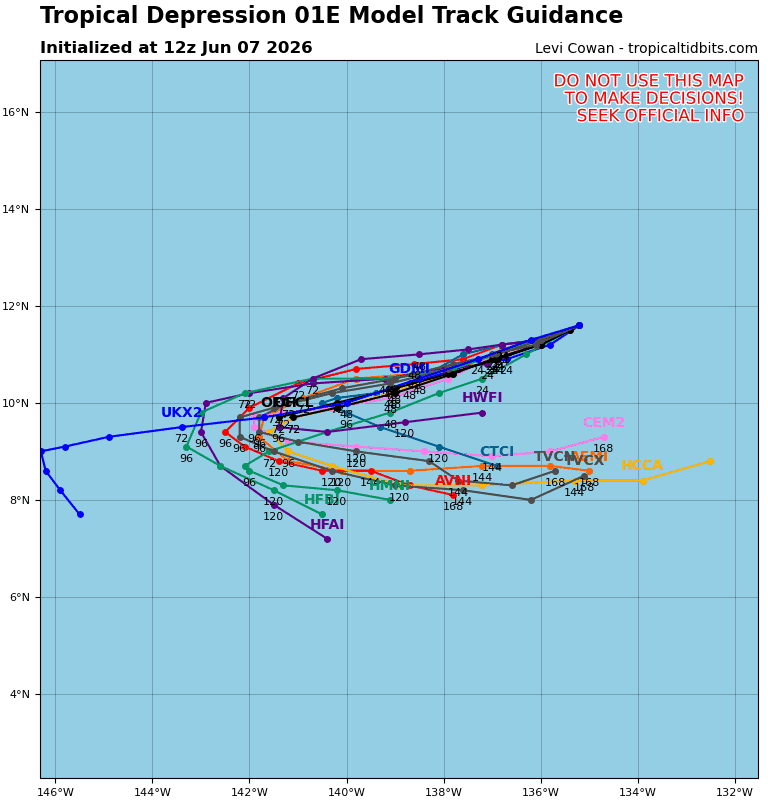
Post-Tropical Cyclone 01E Amanda…is located approximately 1375 miles east-southeast of Hilo, Hawaii – Last Advisory
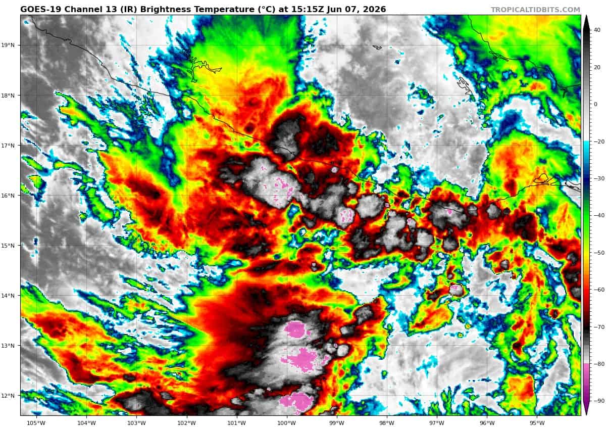
Tropical Cyclone 02E…is located approximately 1150 miles south-southeast of Acapulco, Mexico
Northeast Pacific Ocean:
Post-Tropical Cyclone 01E (Amanda) – Last Advisory
AMANDA DEGENERATES TO A POST-TROPICAL REMNANT LOW
According to the NHC advisory number 22
The post-tropical cyclone is moving toward the west near 6 mph (9 km/h) and this motion is generally expected to continue over the next several days. Maximum sustained winds have decreased to near 30 mph (45 km/h) with higher gusts. The post-tropical remnant low of Amanda is forecast to dissipate by mid-week.
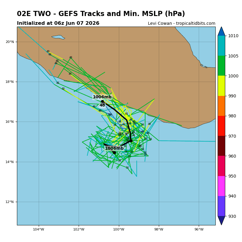
Tropical Cyclone 02E
LARGE DEPRESSION EXPECTED TO BECOME A TROPICAL STORM BEFORE LANDFALL TOMORROW …FLOODING RAINFALL EXPECTED OVER PORTIONS OF SOUTHERN MEXICO THROUGH MONDAY NIGHT
According to the NHC advisory number 3
The depression is moving slowly toward the east-northeast near 2 mph (4 km/h). A turn towards the north is still expected later tonight into tomorrow. On the forecast track, the center will be nearing the coast of Mexico within the warning area on Monday. Maximum sustained winds are near 35 mph (55 km/h) with higher gusts. Some strengthening is forecast, and the depression is expected to become a tropical storm before reaching the coast.
HAZARDS AFFECTING LAND
RAINFALL: Tropical Depression 02E is expected to produce rainfall totals of 4 to 10 inches, with maximum totals of 12 inches possible across coastal portions of the Mexican states of Guerrero and Oaxaca through Monday night. This rainfall may produce life-threatening flooding and mudslides, especially in areas of steep terrain.
WIND: Tropical storm conditions are expected to begin within the warning area along the coast Monday.
>>> Offshore of Central America:
Invest 92E
Showers and thunderstorms associated with a broad area of low pressure continue offshore of Central America. Environmental conditions are conducive for further development of this system, and a tropical depression is likely to form during the next day or two while the system moves slowly northward toward the coast of Central America. Interests along the Pacific coasts of northwestern Costa Rica, Nicaragua, Honduras, and El Salvador should monitor the progress of this system. Regardless of development, heavy rainfall and life-threatening flash flooding are possible across portions of Costa Rica, Nicaragua, El Salvador, and Guatemala through early this week.
* Formation chance through 48 hours…high…90 percent
* Formation chance through 7 days…high…90 percent
Central Pacific Ocean: There are no Tropical Cyclones
Tropical cyclone formation is not expected during the next 7 days.
Western Pacific, Indian Ocean, and adjacent Seas: There are no Tropical Cyclones