

Current Snapshot
For all the latest updates visit: DisasterAWARE
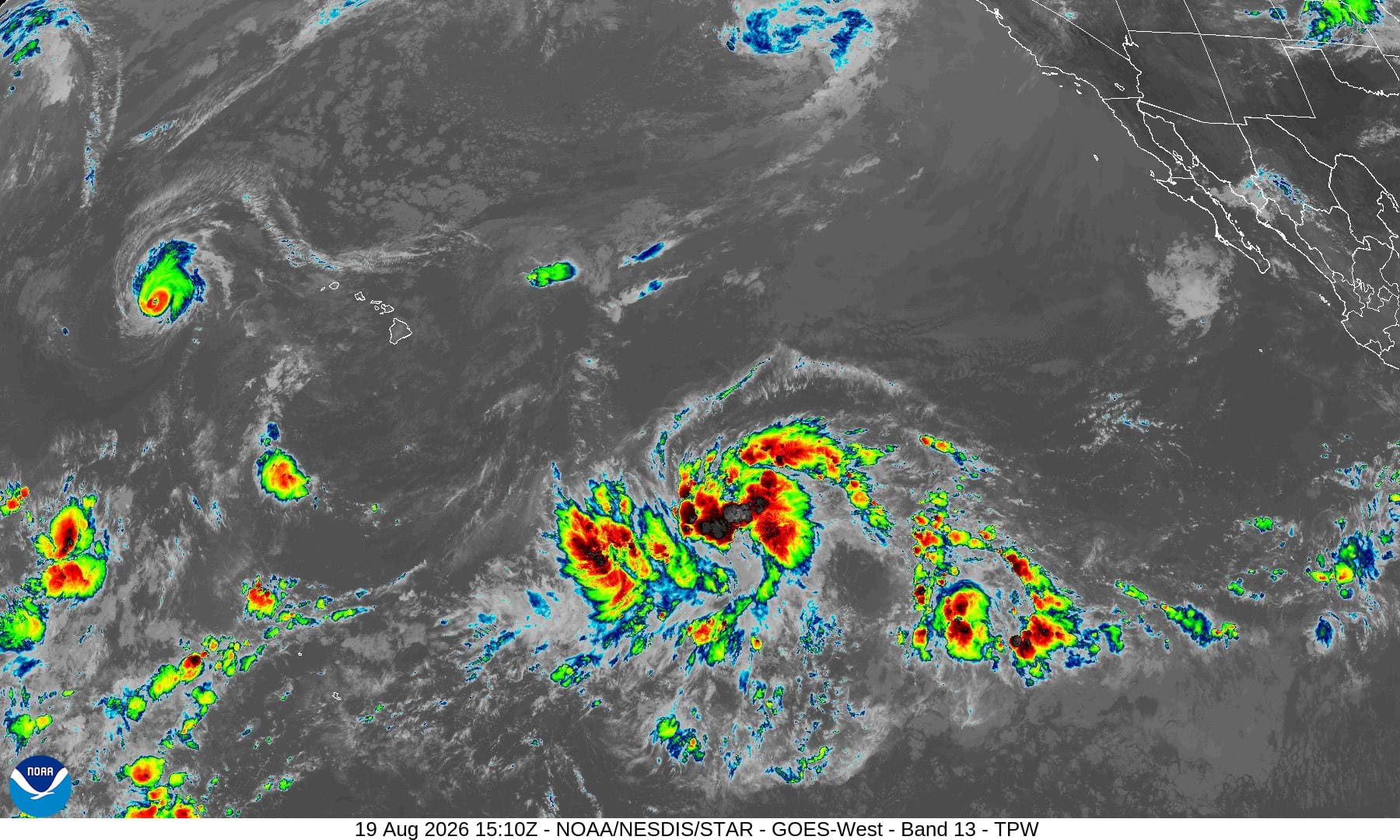
1800x1080ec
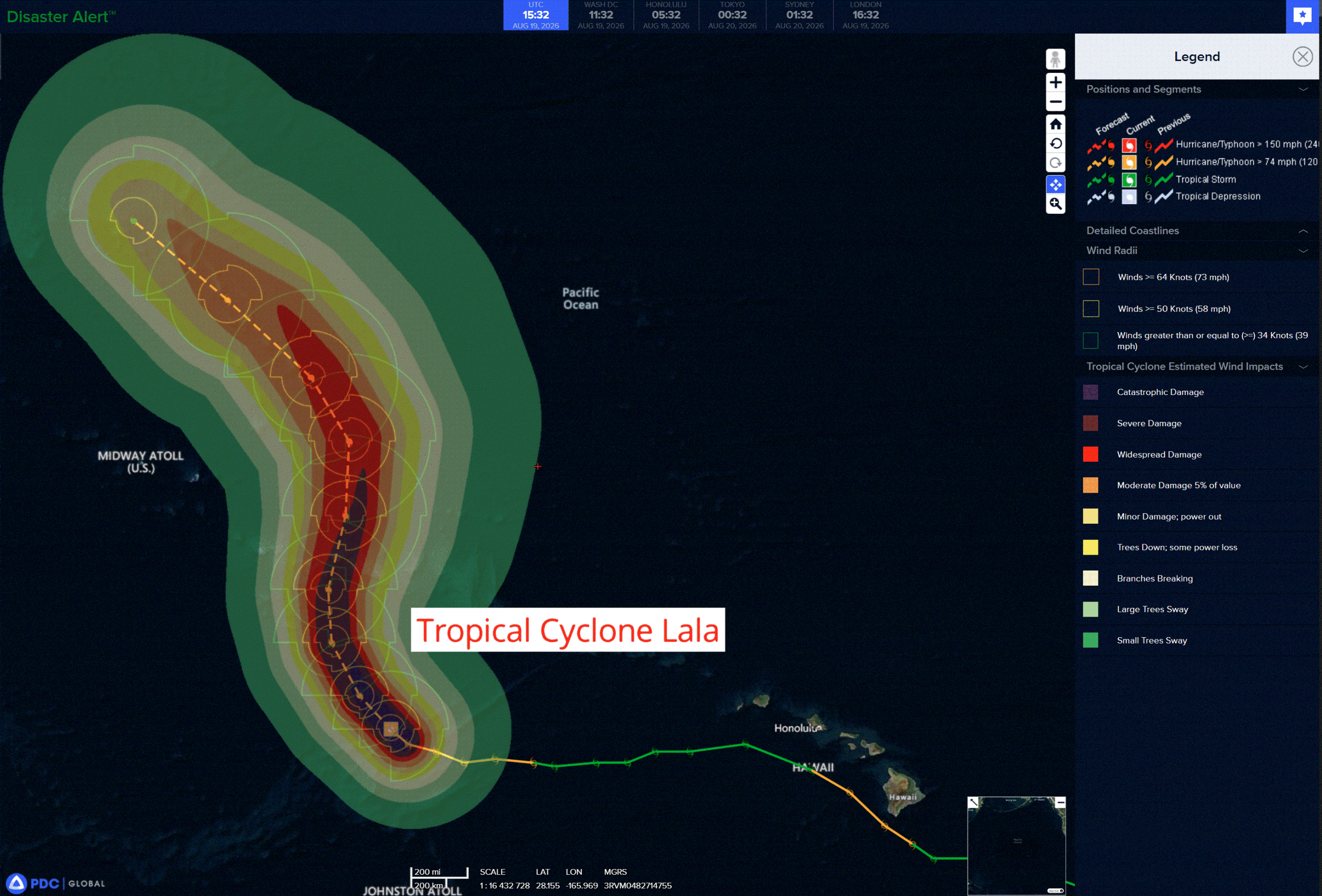
lala
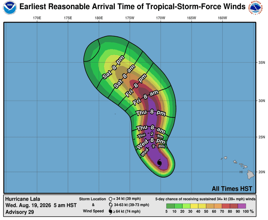
191448_earliest_reasonable_toa_34
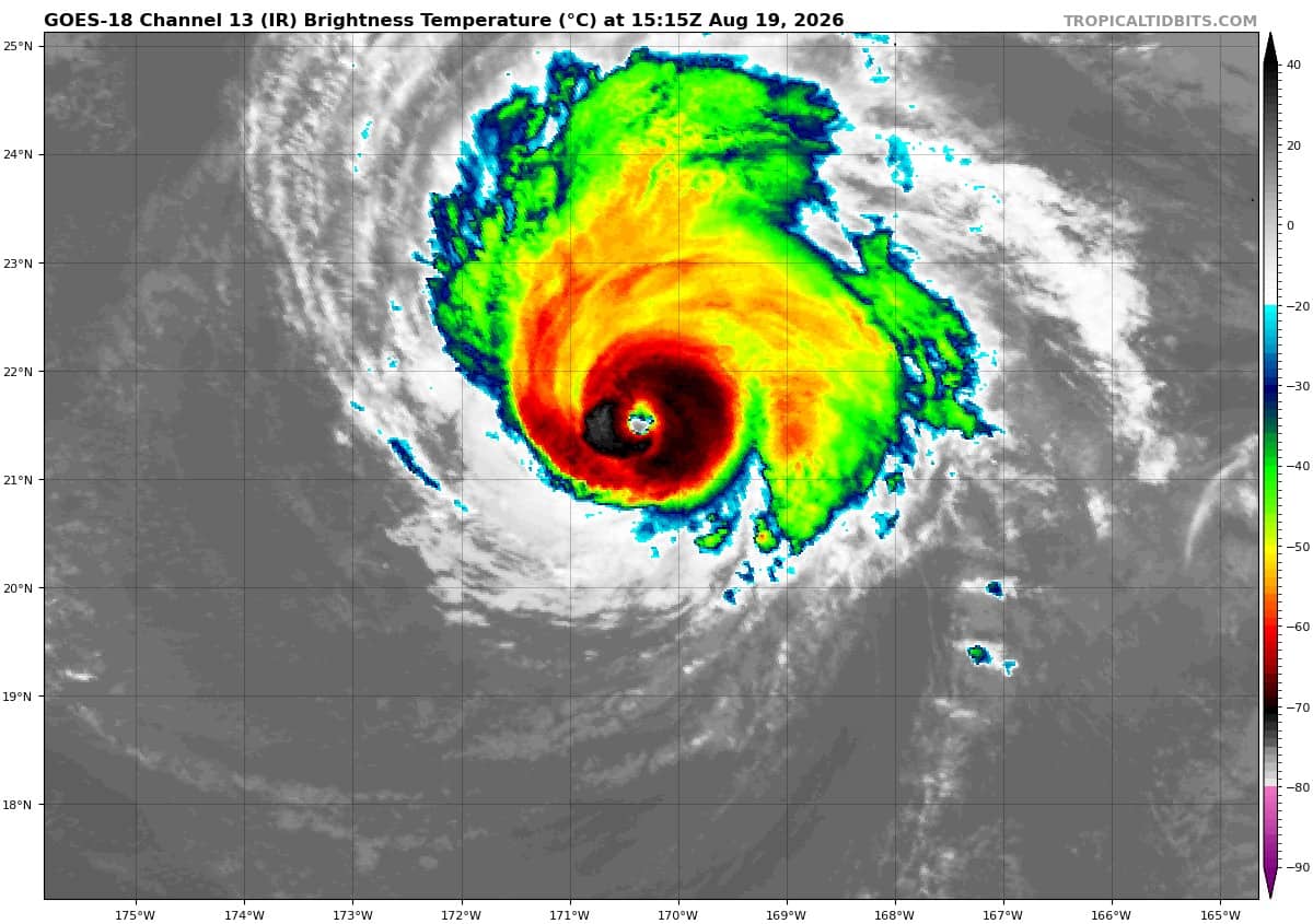
goes18_ir_01C_202608191515_lat21.0-lon-169.9
01C_tracks_latest
high
90c
7
90E_tracks_latestggggg
saudel
17W_191200sair
himawari9_ir_17W_202608191510_lat9.4-lon153.7

17W_tracks_latest
2w
himawari9_ir_94W_202608191510_lat23.1-lon125.4
94W_tracks_latest
himawari9_ir_95W_202608191510_lat19.7-lon111.4
95W_tracks_latest
96w
himawari9_ir_96W_202608191510_lat34.0-lon162.9
96W_tracks_latest
By PDC’s Senior Weather
Specialist Glenn James

The Pacific Disaster Center’s (PDC Global) Wednesday, August 19, 2026, Tropical Cyclone Activity Report…for the Pacific Ocean, the Indian Ocean, and adjacent Seas.
Tropical Cyclones
Tropical Cyclone 01C (Lala) is located about 275 miles south of Maro Reef
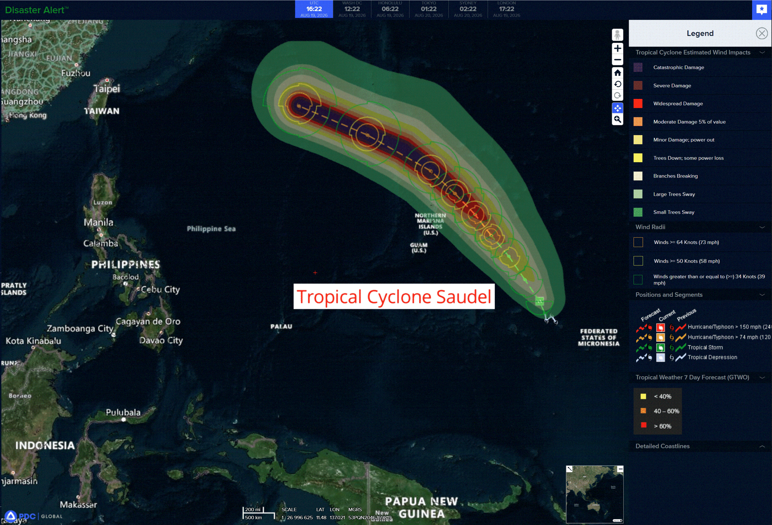
Tropical Cyclone 17W (Saudel)…is located approximately 156 NM northeast of Chuuk
Northeast Pacific: There are no Tropical Cyclones
>>> South-southwest of Mexico:
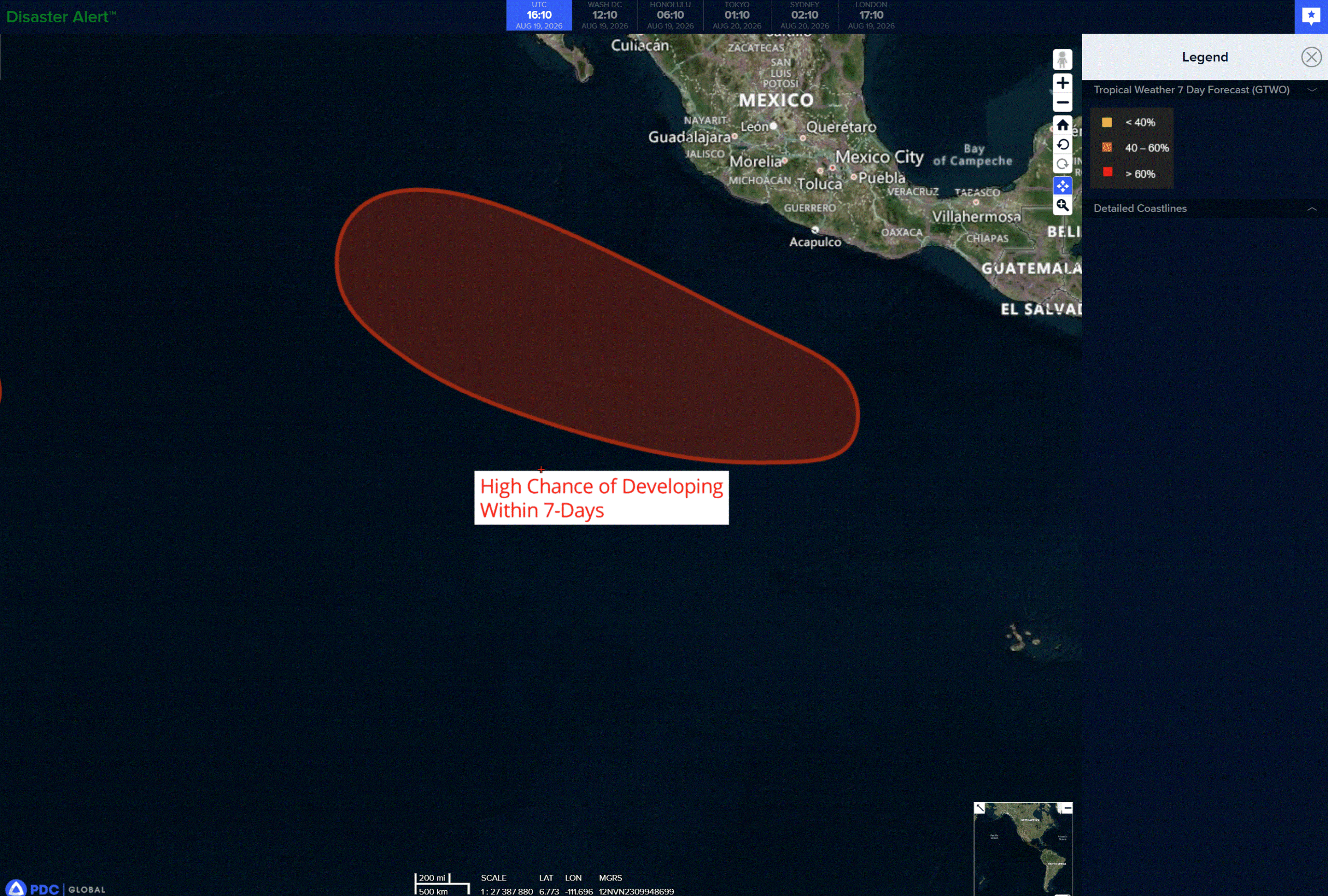
An area of low pressure is forecast to form several hundred miles south-southwest of the coast of southern Mexico around the end of the week. Gradual development of this system is likely thereafter, and a tropical depression is expected to form this weekend while the system moves generally west-northwestward, remaining well offshore of Mexico.
* Formation chance through 48 hours…low…near 0 percent
* Formation chance through 7 days…high…80 percent
Central north Pacific:
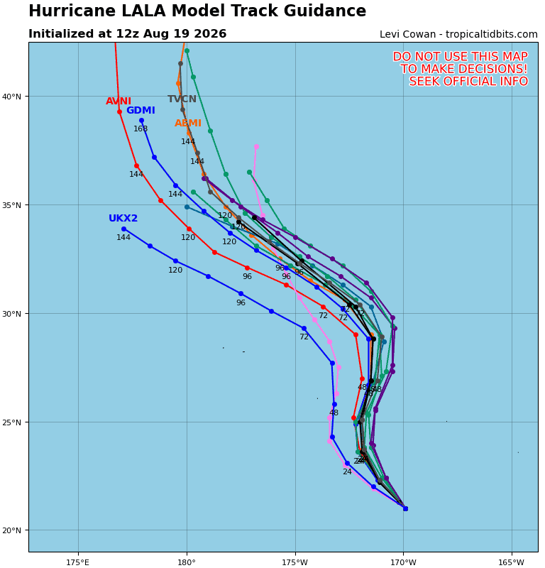
Tropical Cyclone 01C (Lala)
LALA FORECAST TO BE A STRONG HURRICANE NEAR PAPAHANAUMOKUAKEA MARINE NATIONAL MONUMENT
According to the NHC advisory number 29…
Lala is moving toward the northwest near 9 mph (15 km/h). This general motion is expected to continue today, followed by a turn towards the north early tomorrow. On the forecast track, the center of Lala will be near portions of the Papahanaumokuakea Marine National Monument tomorrow. Maximum sustained winds are near 125 mph (205 km/h) with higher gusts. Lala is a category 3 hurricane on the Saffir-Simpson Hurricane Wind Scale. Some gradual weakening is anticipated during the next few days, but Lala is expected to remain a hurricane through the weekend. Hurricane-force winds extend outward up to 30 miles (45 km) from the center and tropical-storm-force winds extend outward up to 115 miles (185 km). The estimated minimum central pressure is 953 mb (28.15 inches).
HAZARDS AFFECTING LAND
WIND: Hurricane conditions are expected in the Hurricane Warning area by Thursday, with tropical storm conditions expected by tonight. Tropical storm conditions are expected in the Tropical Storm Warning area by early Thursday.
SURF: Large surf associated with Lala will affect the Papahanaumokuakea Marine National Monument beginning today. These large waves will likely inundate some of the low-lying atolls, especially from French Frigate Shoals to Maro Reef.
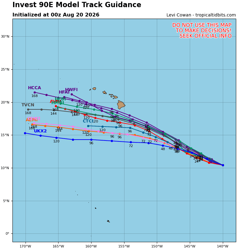
>>> Invest 90C
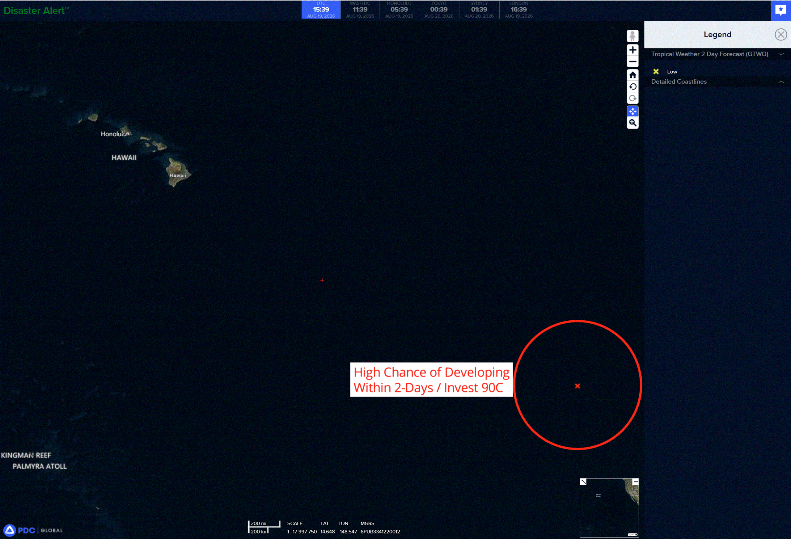
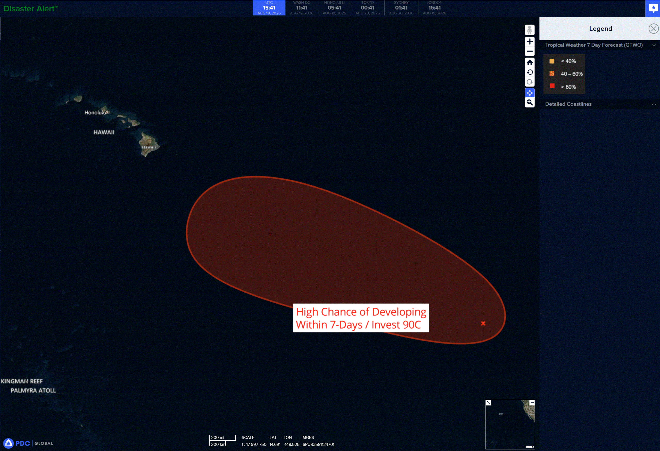
A tropical wave located well to the east-southeast of the Hawaiian Islands is producing a large area of showers and thunderstorms with some signs of organization. Environmental conditions appear conducive for further development of this system, and a tropical depression is likely to form during the next couple of days while the system moves westward to west-northwestward at 10 to 15 mph and crosses into the Central Pacific.
* Formation chance through 48 hours…high…70 percent
* Formation chance through 7 days…high…80 percent
Western Pacific, Indian Ocean, and adjacent Seas:
Western Pacific
Tropical Cyclone 17W (Saudel)
According to the JTWC warning number 25…
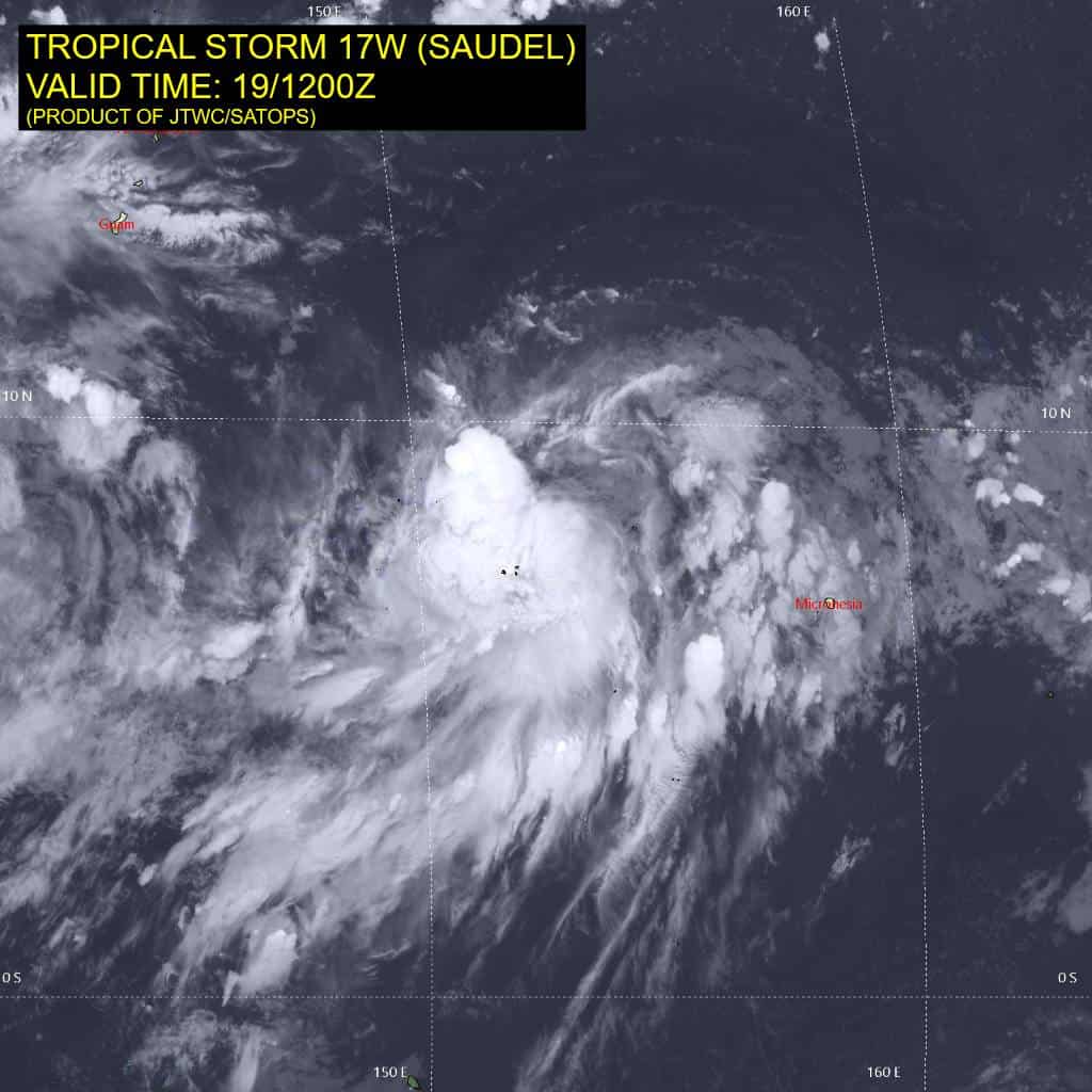
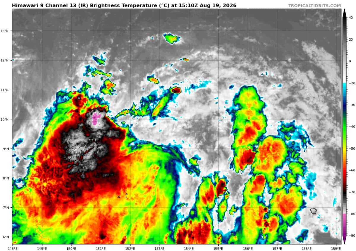
Animated enhanced infrared (eir) satellite imagery depicts tropical storm 17W (Saudel) with a much more disorganized appearance compared to 6 hours ago. The deep convection that was previously near the center has dissipated and now convective activity is confined to the far southwestern periphery. The low-level circulation center (llcc) also appears to be highly elongated now, with potentially multiple areas of enhanced vorticity within the larger-scale circulation. A 190757z rcm-2 sar pass revealed a rather compact core with winds as high as 50 kts within a small pocket in the southern semicircle. However, that compact surface circulation must have quickly washed out afterward, because the exposed low-level clouds in animated eir at around 191200 look quite loose with no clearly identifiable center.
Despite the stall in development, the current environment is analyzed to be favorable for further development due to strong equatorward outflow aloft, low (10-15 kts) vertical wind shear, and warm (29-30 c) sea surface temperatures.
TS 17W (Saudel) is forecast to track north-northwestward as the subtropical ridge (str) positioned south of Honshu weakens and retreats northward, letting 17W continue gaining latitude. The str that is currently to the northeast of 17W is expected to build and propagate westward, becoming the primary steering mechanism throughout the remainder of the forecast period. The cpa to Saipan has slightly increased compared to the previous forecast and the time of cpa is about 6 hours sooner (now 212200z). However, the uncertainty in the initial position may cause there to be a shift in the trajectory relative to the northern Mariana islands. the track is forecast to become more west-northwestward after 72 hours as ridging extends to the north of 17W.
The environment is forecast to improve over the next 12 hours as the dry air entrainment from the north lessens, allowing for the core of the vortex to moisten. The timing of the axisymmetrization of the wind field is currently the largest limiting factor for intensification in the near term. Once the symmetrization completes, 17W is forecast to steadily intensify through 36 hours to around 65 kts. After 36 hours, 17W is forecast to rapidly intensify through 72 hours as the system takes advantage of strong dual channel outflow, very warm (over 30 c) sea surface temperatures, and high ocean heat content (ohc) values east of the marianas.
17W is then forecast to further intensify to a peak of around 125 kts at 96 hours before slightly weakening through 120 hours as the system begins to enter an area of increased northerly shear and lower ohc.
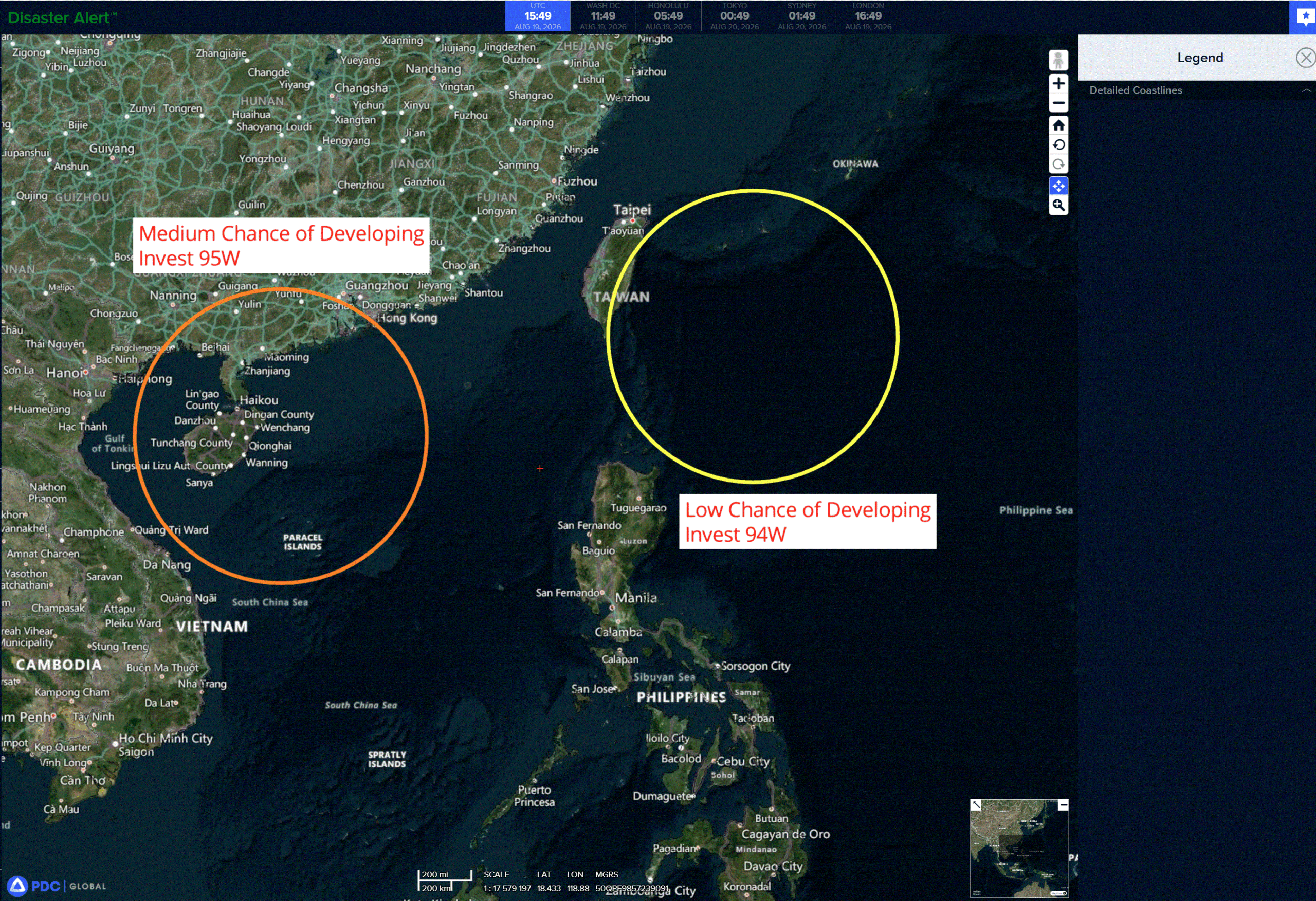
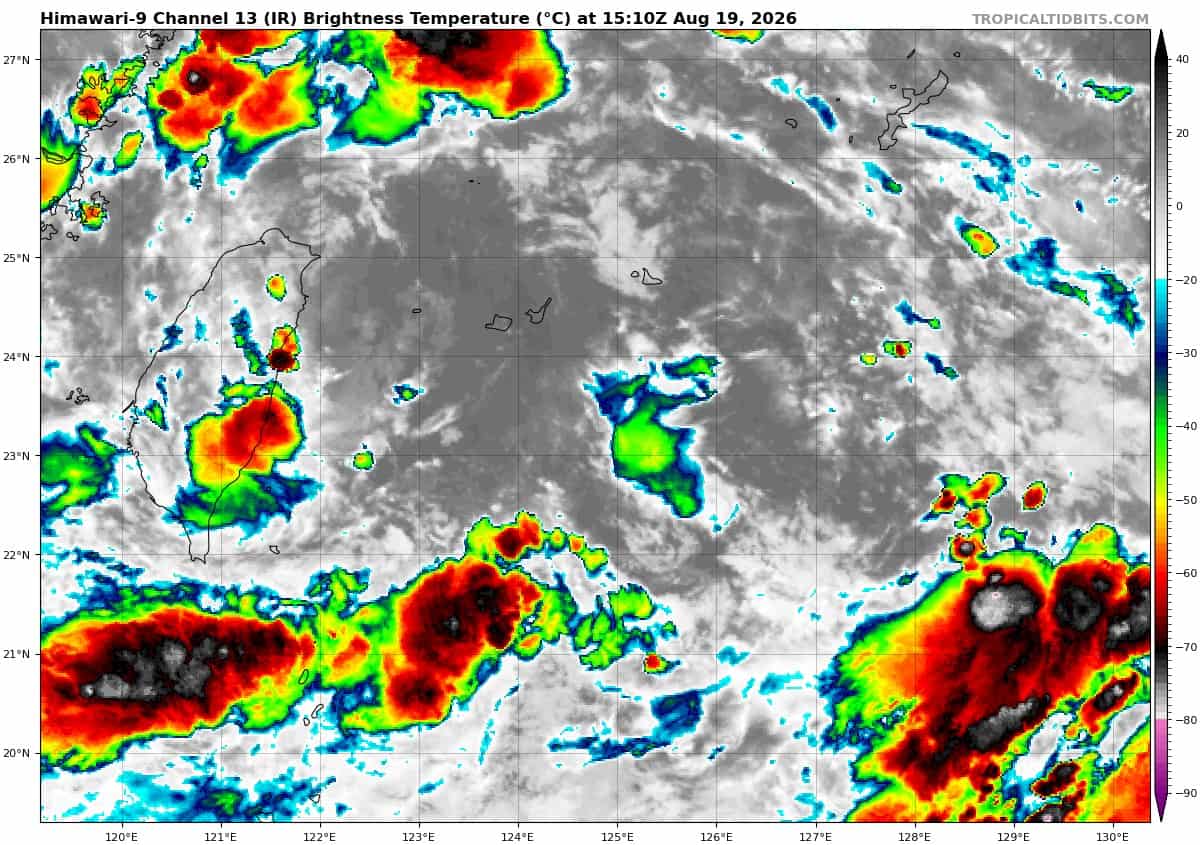
>>> There’s an area of disturbed weather being referred to as Invest 94W, which is located approximately 132 NM southeast of Miyakojima
The system is currently classified as a monsoon depression, generally characterized as a large cyclonic circulation, greater than 600 nm diameter, with enhanced winds over the southeastern periphery and a weak core of light winds.
Animated multi-spectral satellite imagery (msi) depicts a broad circulation center, with multiple areas of turning embedded within the llcc.
Environmental analysis reveals favorable conditions for development with low (10 to 15kts) vertical wind shear, moderate upper-level equatorward outflow, and warm (29 to 30 c) sea surface temperatures.
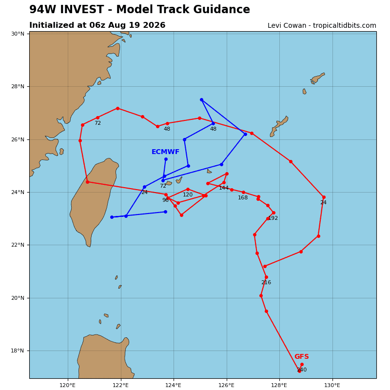
Global models depict an area of broad troughing that is unlikely to transition into a consolidated tropical cyclone.
Maximum sustained surface winds are estimated at 23 to 27 knots.
Minimum sea level pressure is estimated to be near 1002 mb.
The potential for the development of a significant tropical cyclone within the next 24 hours remains low.
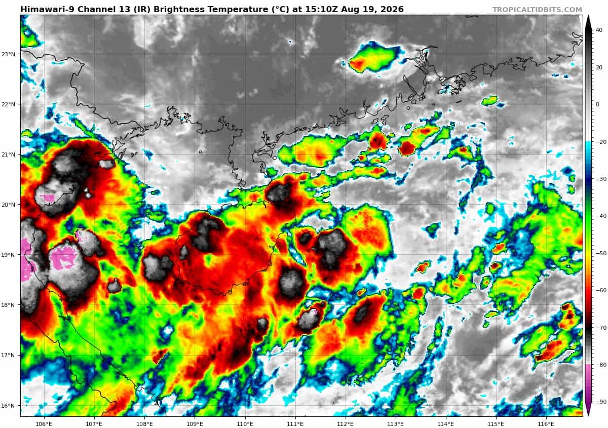
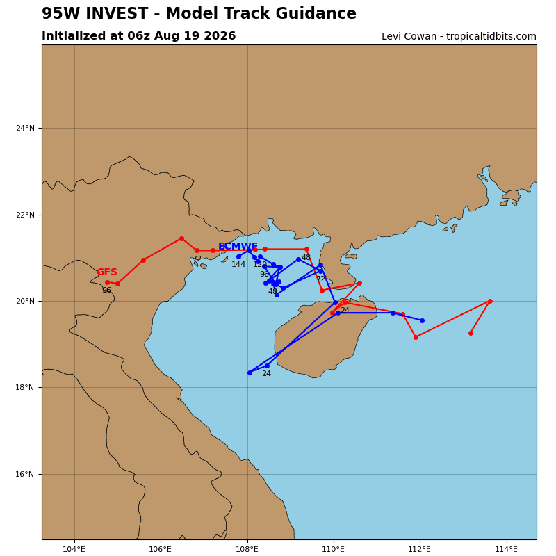
>>> There’s a second area of disturbed weather being referred to as Invest 95W, which is located approximately 90 NM east-southeast of Haikou
Animated multi-spectral satellite imagery (msi) depicts a broad and elongated low -level circulation (llc) that has been consolidating over the last 6-12 hours. a 190155z metop-b ascat pass reveals a broad circulation embedded within a trough east of Hainan.
Environmental analysis reveals marginal to favorable conditions for development with moderate vertical wind shear (15 to 20kts) and moderate equatorward outflow, however, it is offset by warm (29 to 30 c) sea surface temperatures which are conducive for stronger development.
Global models indicate that 95W will gradually intensify and consolidate in the South China Sea. Ensemble models also show further development and a general westward track towards Hainan over the next 36-48 hours.
Maximum sustained surface winds are estimated at 18 to 23 knots.
Minimum sea level pressure is estimated to be near 998 mb.
The potential for the development of a significant tropical cyclone within the next 24 hours remains medium.
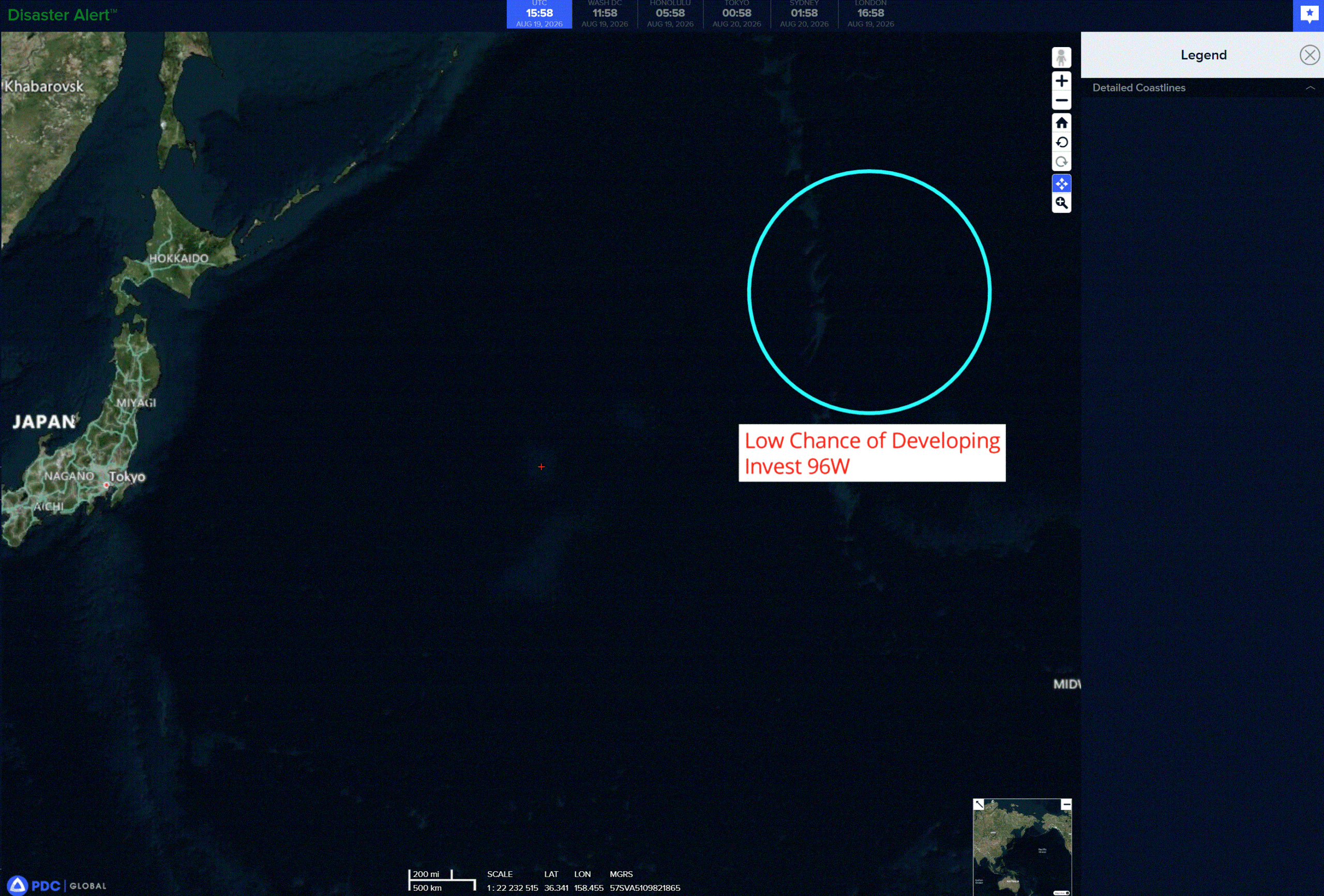
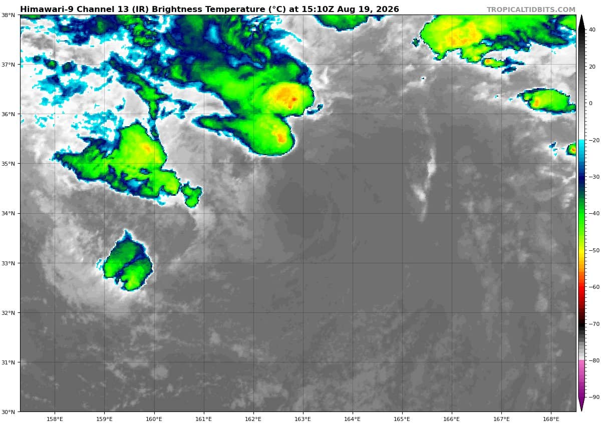
>>> There’s a third area of disturbed weather being referred to as Invest 96W, which is located approximately 842 NM north of Wake Island
The system is currently classified as a subtropical cyclone, generally characterized as having both tropical and mid-latitude cyclone features. Animated enhanced infrared satellite imagery (eir) depicts invest 96W with a fully exposed low-level circulation center (llcc) and sparse convection within the northern periphery that is heavily sheared from the south. The high southerly shear is caused by a strong upper-level cyclone directly to the west of 96W.
Earlier scatterometer data revealed winds of 35 kts within the northern semicircle, thus, 96W is currently assessed as a subtropical storm.
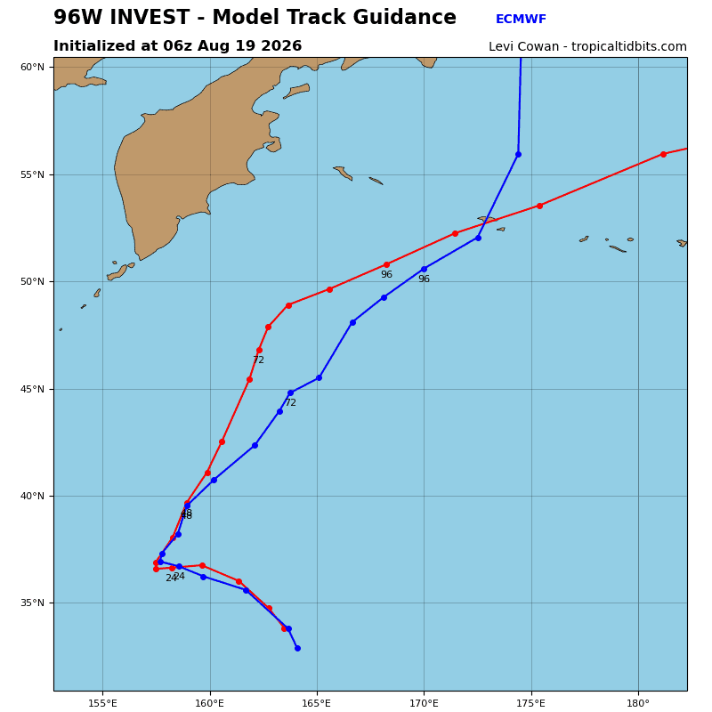
Deterministic models show 96W tracking northwestward over the next 24 hours with a weakening wind field due to extreme dry air entrainment and high vertical wind shear. Transition into a tropical cyclone is analyzed to be highly unlikely due to the previously mentioned environmental characteristics along with cool (24-25 c) sea surface temperatures.
Maximum sustained surface winds are estimated at 33 to 38 knots.
Minimum sea level pressure is estimated to be near 1002 mb.
The potential for the development of a significant tropical cyclone within the next 24 hours is low.