The Pacific Disaster Center’s (PDC Global) Friday, August 14, 2026, Tropical Cyclone Activity Report…for the Pacific Ocean, the Indian Ocean, and adjacent Seas
Current Tropical Cyclones:
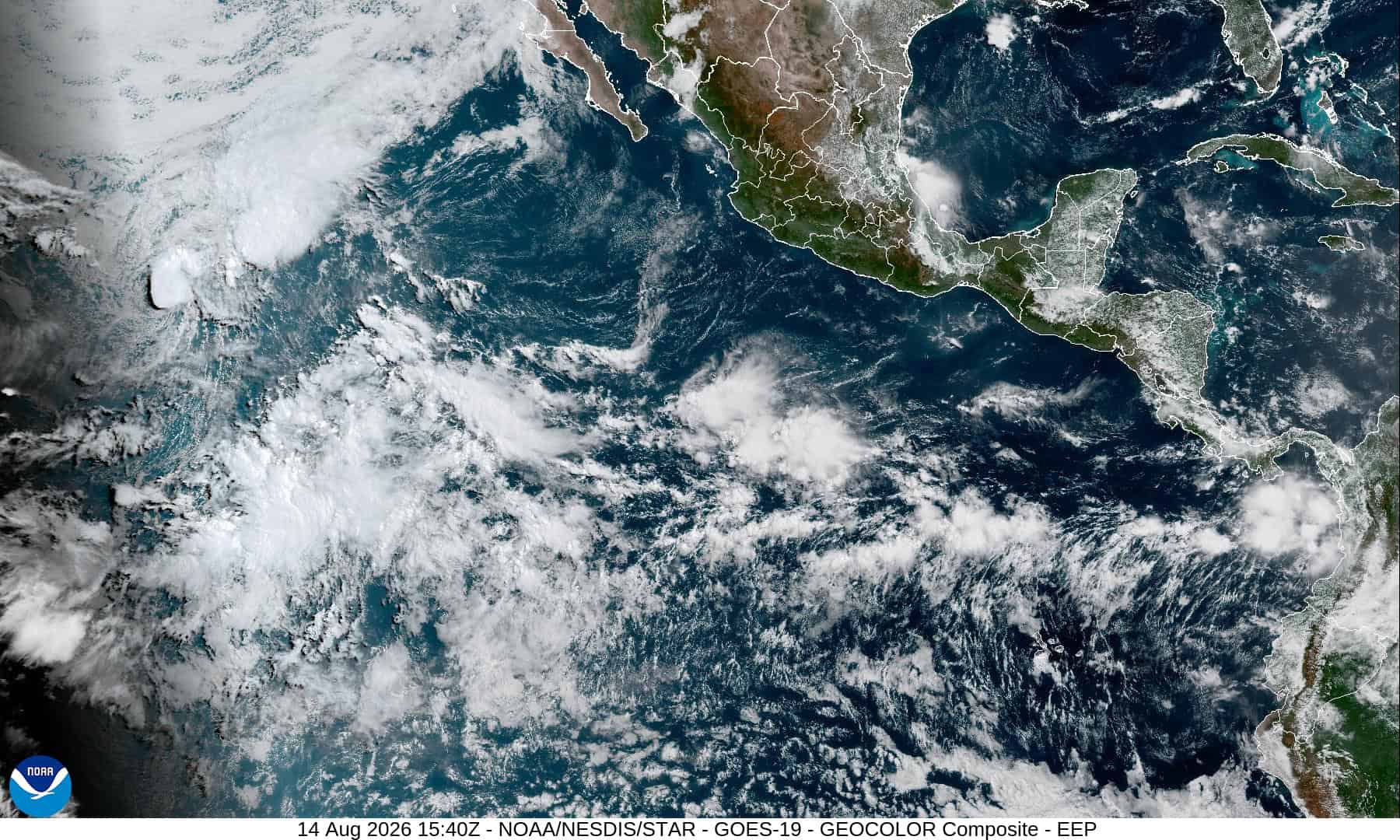
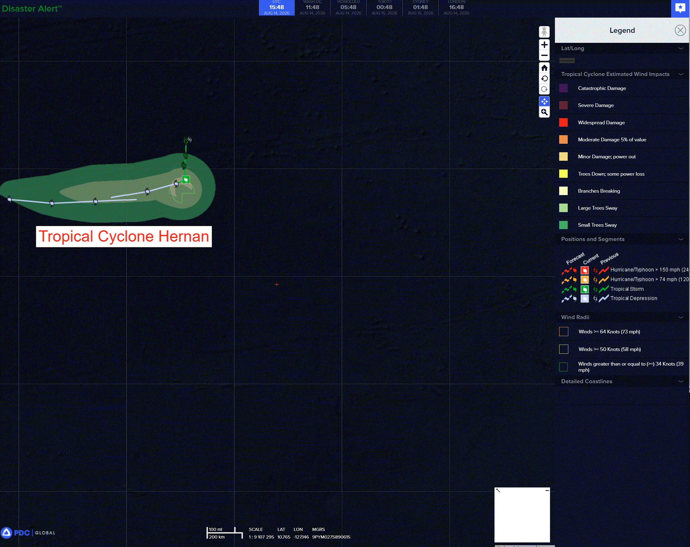
Tropical cyclone 08E (Hernan)…is located approximately 1535 NM west-southwest of the southern tip of Baja California
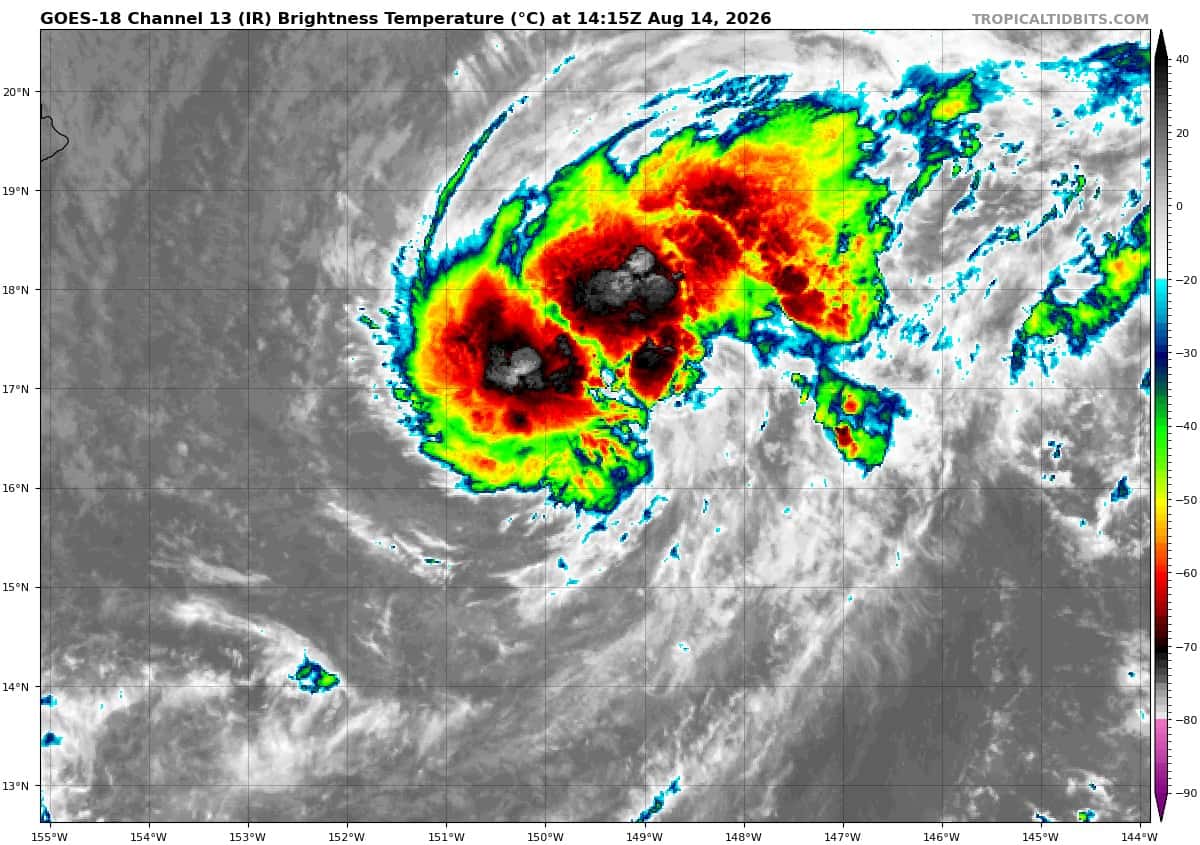
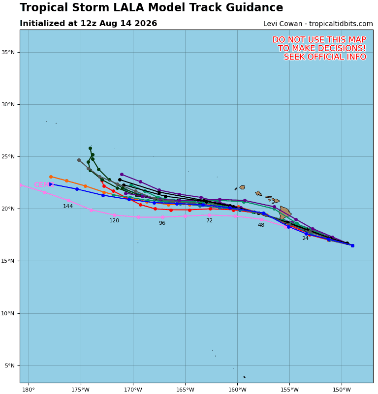
Tropical cyclone 01C (Lala)…is located approximately 420 NM east-southeast of Hilo, Hawaii
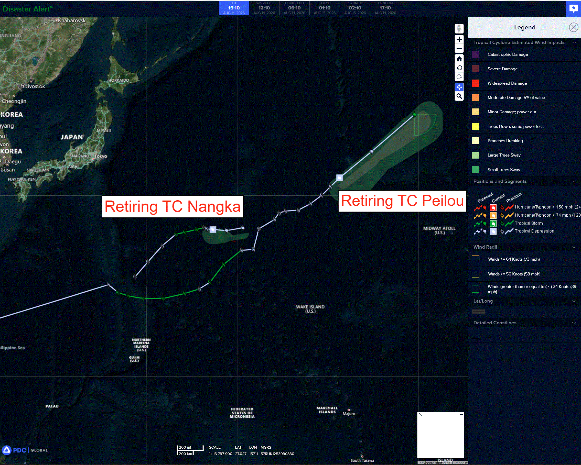
Tropical cyclone 13W (Peilou)…is located approximately 891 NM north-northeast of Wake Island – Final Warning
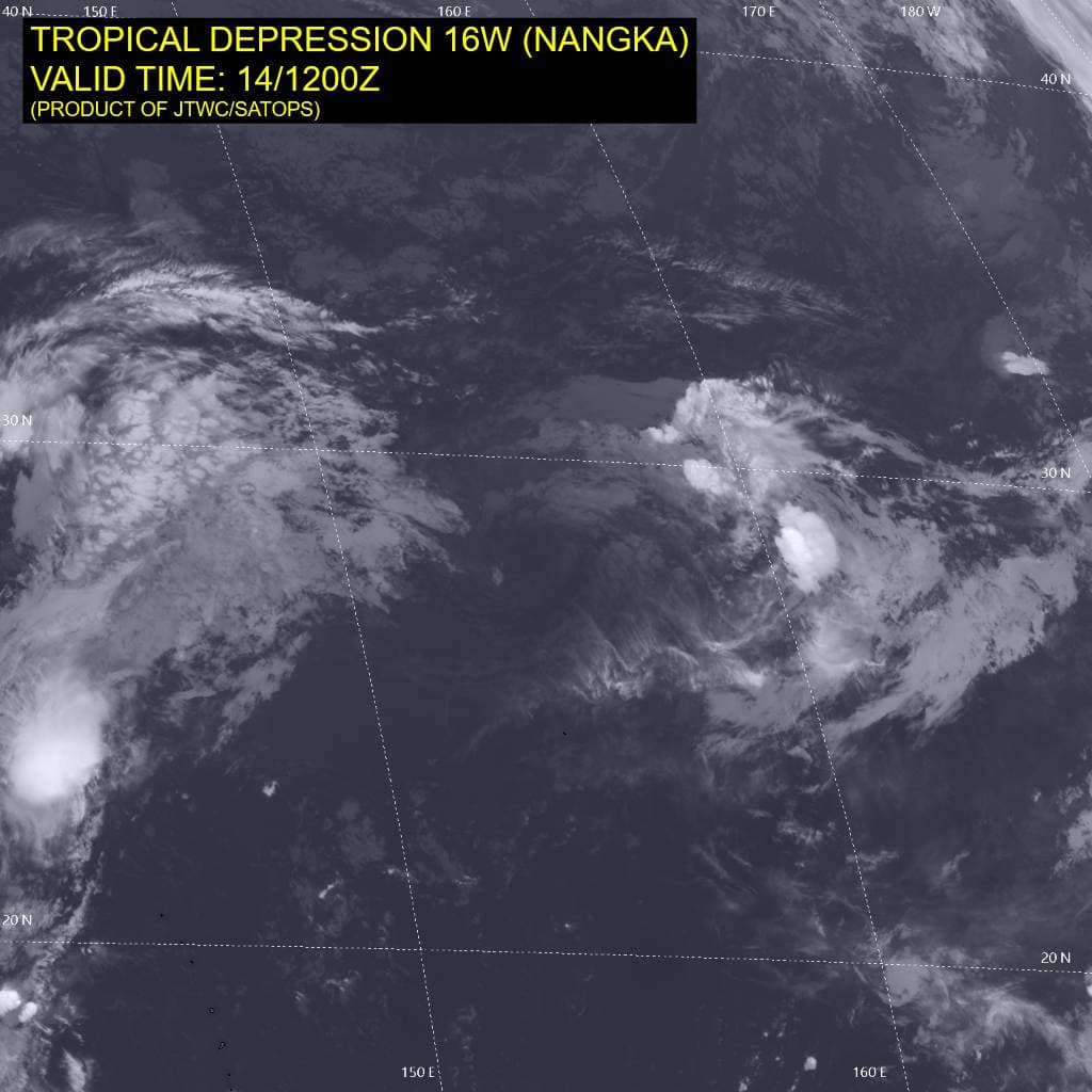
Tropical cyclone 16W (Nangka)…is located approximately 247 NM north of Minami Tori Shima – Final Warning
Northeast Pacific:
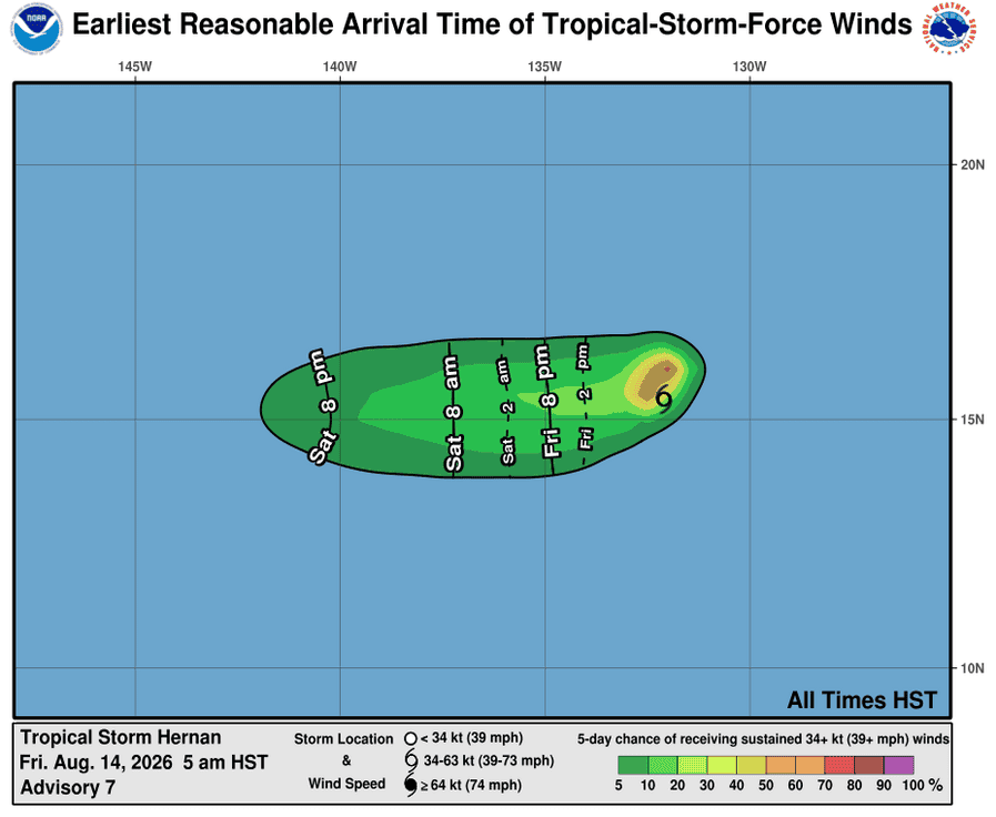
Tropical Cyclone 08E (Hernan)
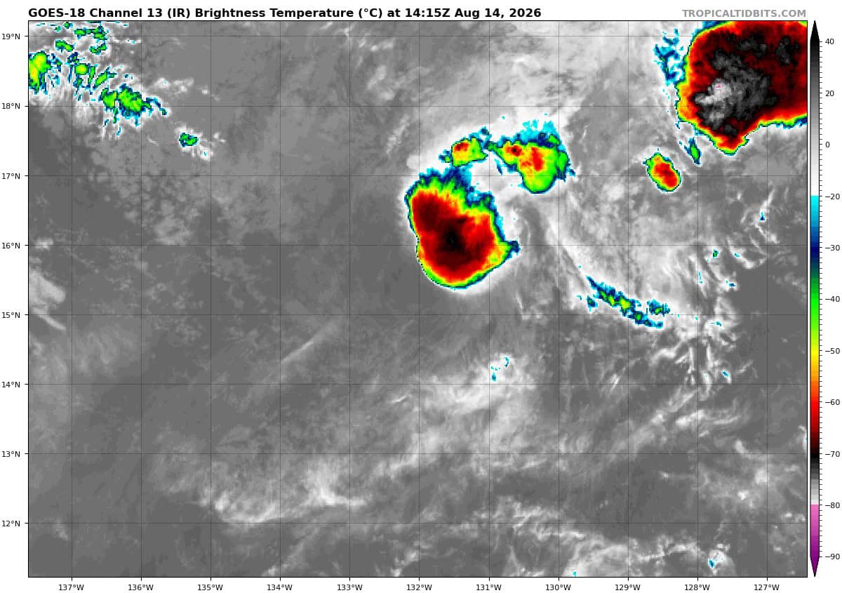
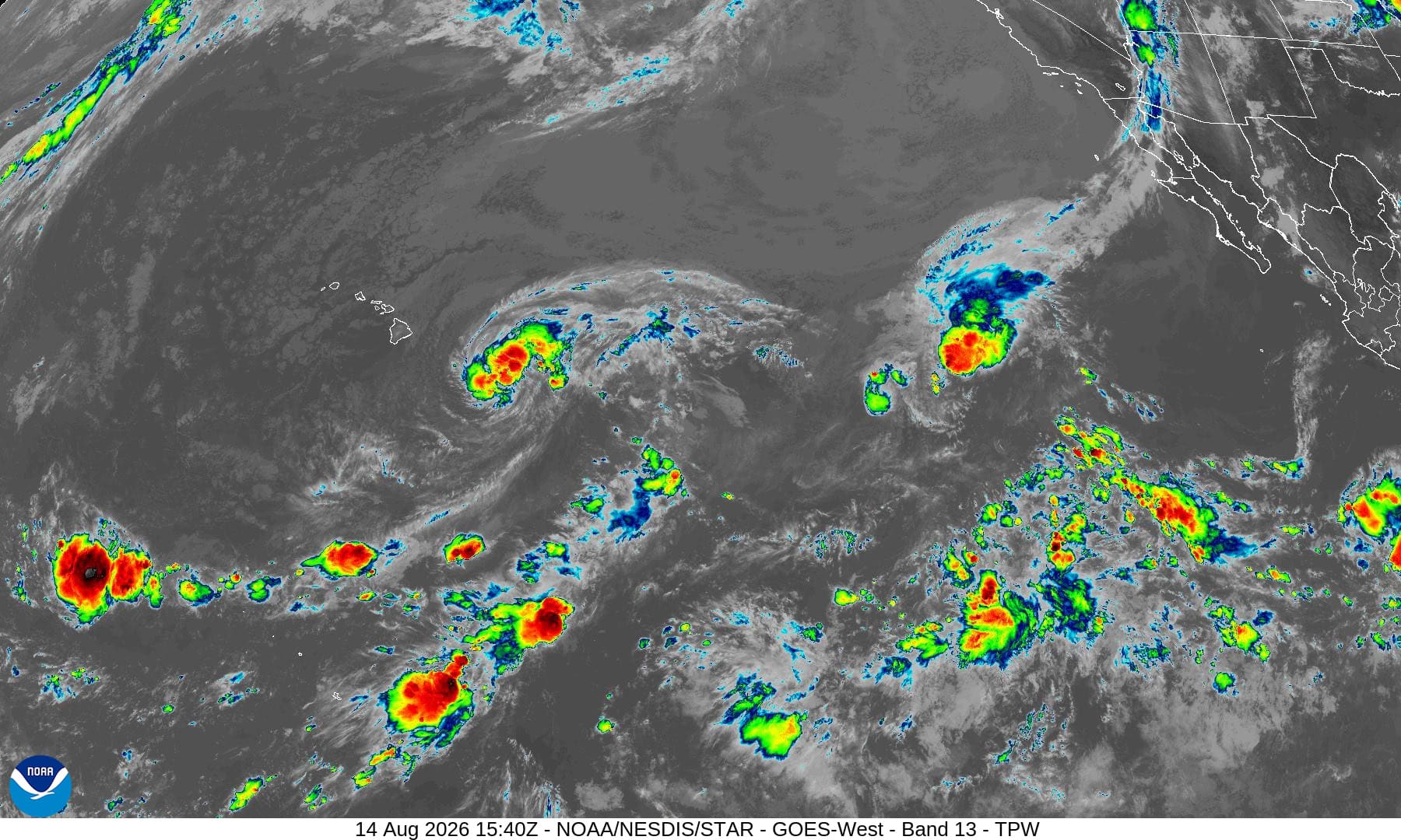
HERNAN SEES A SLIGHT UPTICK IN CONVECTION
According to the NHC advisory number 7
Hernan is moving toward the south near 9 mph (15 km/h). A turn toward the southwest then west-southwest is expected today, with a turn toward the west expected on Saturday. Maximum sustained winds are near 40 mph (65 km/h) with higher gusts. Hernan is forecast to weaken to a tropical depression today and a post-tropical cyclone early Saturday. Tropical-storm-force winds extend outward up to 45 miles (75 km) from the center. The estimated minimum central pressure is 1004 mb (29.65 inches).
>>> South of Mexico:
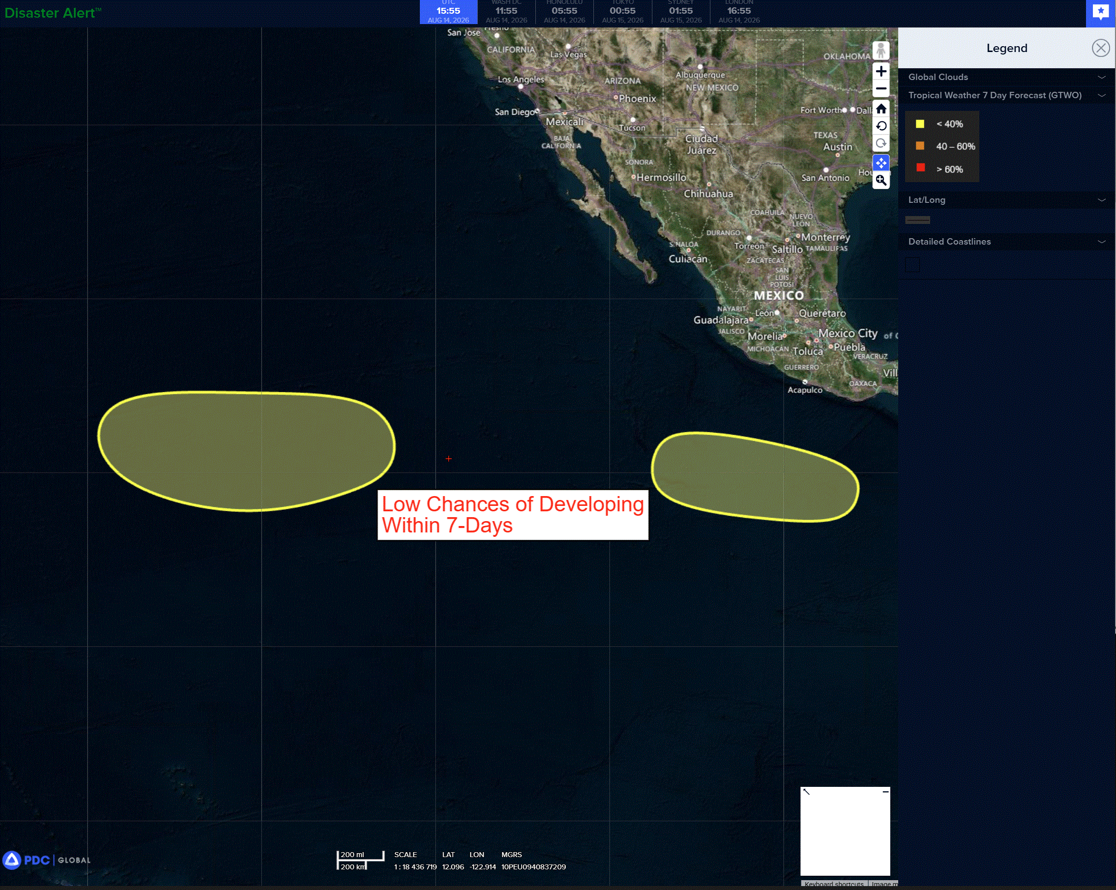
An area of low pressure could form several hundred miles south of the coast of southern Mexico early next week. Some gradual development of this system is possible thereafter while the system moves westward or west-northwestward well south of Mexico.
* Formation chance through 48 hours…low…near 0 percent
* Formation chance through 7 days…low…20 percent
>>> Western part of the eastern Pacific:
An area of low pressure could form well to the west-southwest of the southern tip of the Baja California Peninsula early next week. Gradual additional development of this system is possible thereafter while it moves generally westward.
* Formation chance through 48 hours…low…near 0 percent.
* Formation chance through 7 days…low…20 percent
Central Pacific:
Tropical Cyclone 01C (Lala)
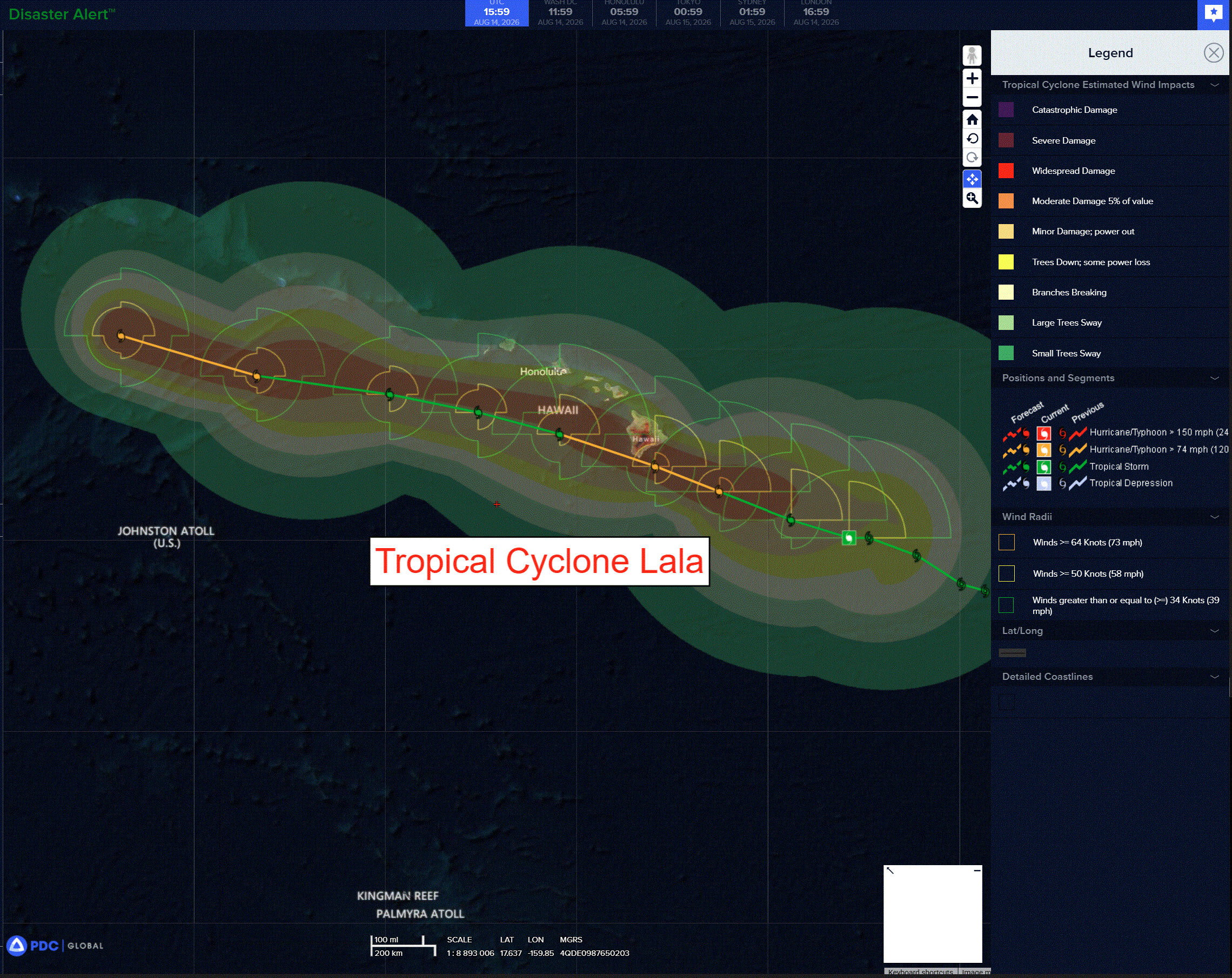
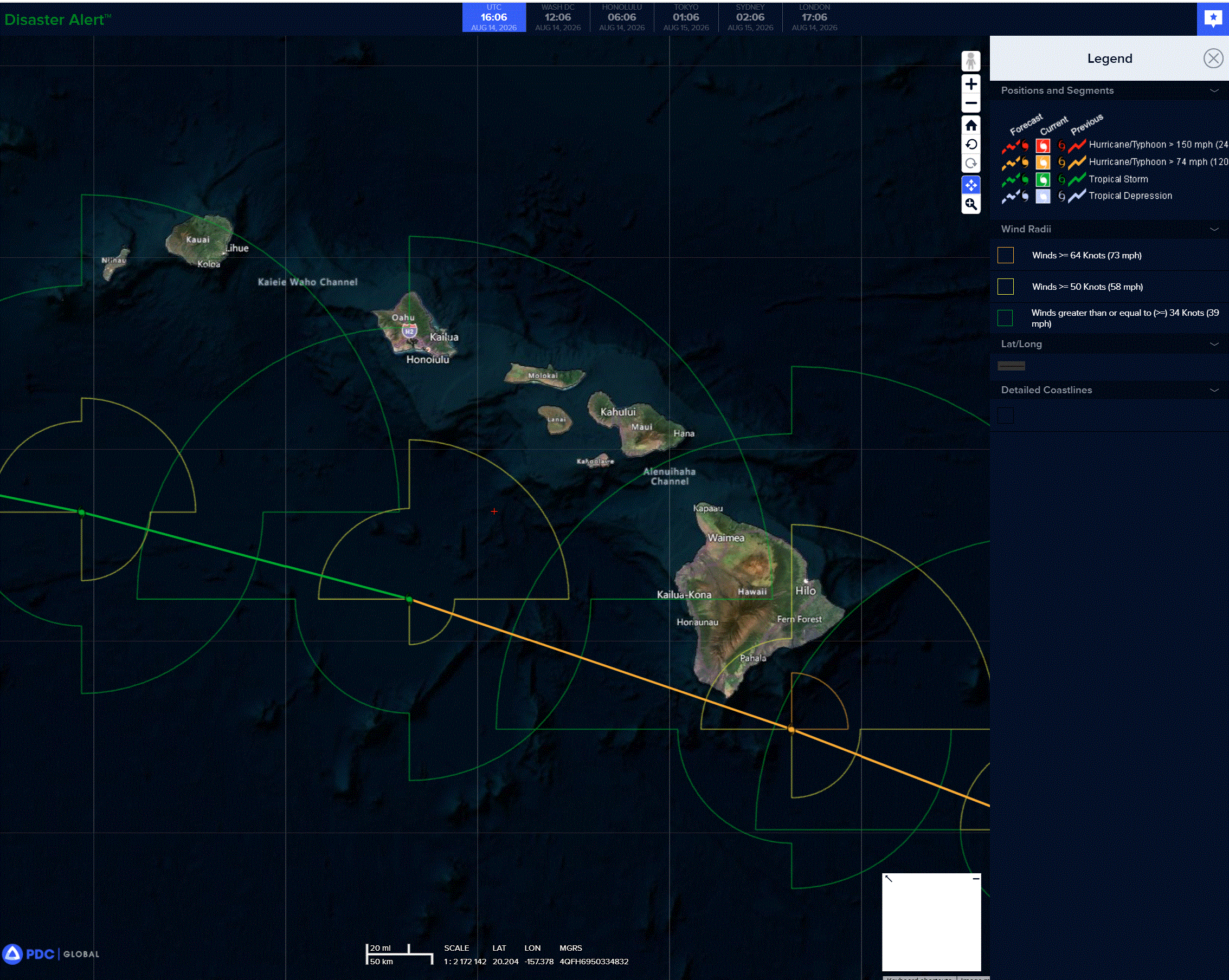
LALA FORECAST TO BRING HURRICANE CONDITIONS TO THE BIG ISLAND OF HAWAII ON SATURDAY …HEAVY RAINFALL EXPECTED ACROSS THE HAWAIIAN ISLAND CHAIN THIS WEEKEND
According to the NHC advisory number 10
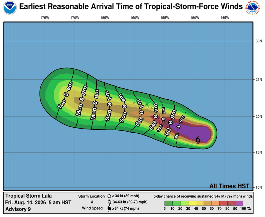
Lala is moving toward the west-northwest near 14 mph (22 km/h). This general motion is expected to continue for the next couple of days, taking the core of Lala near the Big Island of Hawaii on Saturday and then south of the smaller islands on Sunday. Maximum sustained winds are near 60 mph (95 km/h) with higher gusts. Steady strengthening is forecast, and Lala is expected to become a hurricane as it approaches the Big Island. Tropical-storm-force winds extend outward up to 195 miles (315 km) from the center. The estimated minimum central pressure is 997 mb (29.44 inches).
HAZARDS AFFECTING LAND
WIND: Hurricane conditions are expected on the Big Island of Hawaii on Saturday, with tropical storm conditions expected in Maui County Saturday night. Tropical storm conditions are possible in Oahu and Kauai Counties on Sunday. Wind speeds atop and on the windward sides of slopes and mountains are often up to 30 percent stronger than the near-surface winds indicated in this advisory, and in some elevated locations could be even greater.
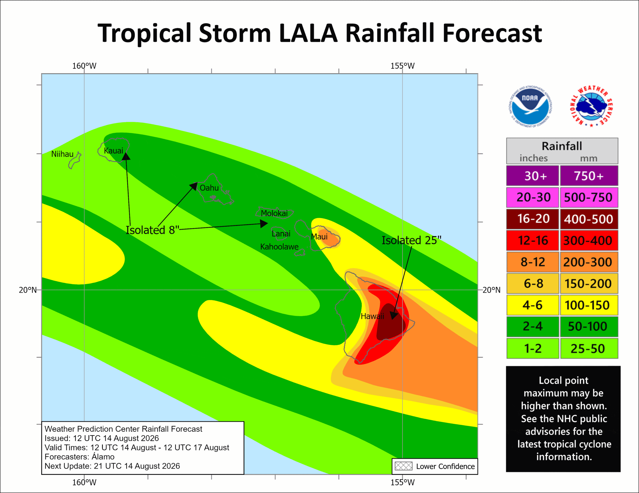
RAINFALL: Tropical Storm Lala is expected to produce rainfall totals of 8 to 12 inches across Maui and the Big Island, with maximum totals of 25 inches possible across the Big Island. Rainfall totals of 2 to 4 inches with maximum amounts of 8 inches is expected across the remainder of the island chain. This rainfall may produce life-threatening flooding and mudslides, especially in areas of steep terrain.
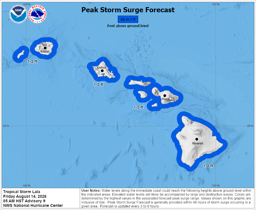
STORM SURGE: The combination of a dangerous storm surge and the tide will cause normally dry areas near the coast to be flooded by rising waters moving inland from the shoreline. The water could reach the following heights above ground somewhere in the indicated areas if the peak surge occurs at the time of high tide…
Hawaii…1 to 3 ft
The deepest water will occur along the immediate coast, where the surge will be accompanied by large and dangerous waves. Surge-related flooding depends on the relative timing of the surge and the tidal cycle, and can vary greatly over short distances.
SURF: Swells generated by Lala are expected to reach the east-facing shores of the state today, spreading westward and building through the weekend. These swells are likely to cause life-threatening surf and rip current conditions.
Western Pacific, Indian Ocean, and adjacent Seas:
Western Pacific
Tropical Cyclone 13W (Peilou) – Final Warning
According to the JTWC warning number 28, sustained winds were 30 knots…with gusts to 40 knots
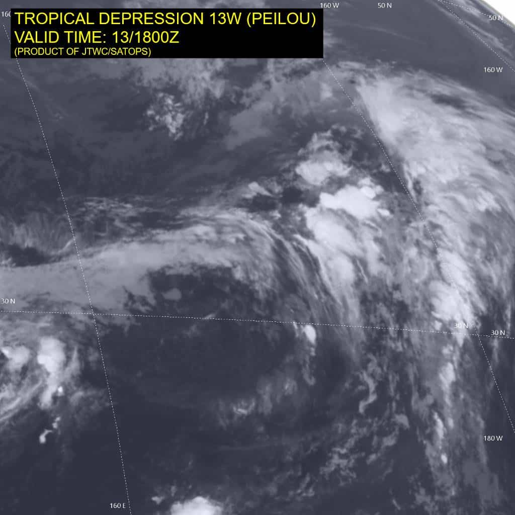
Animated enhanced infrared (eir) imagery depicts tropical depression 13W with an elongated low level circulation center (llcc) embedded underneath the upper-level jet. The system is in cool (25-26 c) sea surface temperatures and experiencing high (over 35 kts) vertical wind shear as it undergoes extratropical transition (ett).
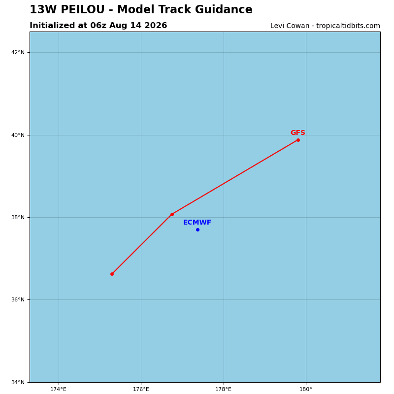
The system is forecast to continue tracking northeastward for the remainder of the forecast period and undergo a slight intensification as it completes ett. Model guidance is in good agreement on td 13W tracking northeastward and completing ett by 12 hours.
Tropical Cyclone 16W (Nangka) – Final Warning
According to the JTWC warning number 9, sustained winds were 25 knots…with gusts to 35 knots
Animated shortwave infrared (swir) satellite imagery shows a fully exposed, increasingly elongated, low level circulation center (llcc). earlier convective activity in the northeastern quadrant has fully dissipated, and the structure of the vortex is now constricted to low- to mid-level clouds only.
The system is tracking eastward along the northwestern flank of a belt of ridging
extending from a near equatorial ridge (ner) to the southwest and an extension of a subtropical ridge (str) to the east.
Persistent strong westerly shear and increasing dry air entrainment will hasten the
weakening trend, leading to the dissipation of the system within the next 12 hours.