Tropical Cyclone 02C…is located about 815 miles southeast of Hilo, Hawaii
TROPICAL DEPRESSION COULD BRING HEAVY RAINFALL TO PORTIONS OF THE HAWAIIAN ISLANDS THIS WEEKEND AND EARLY NEXT WEEK
According to the NHC advisory number 3…



By PDC’s Senior Weather
Specialist Glenn James

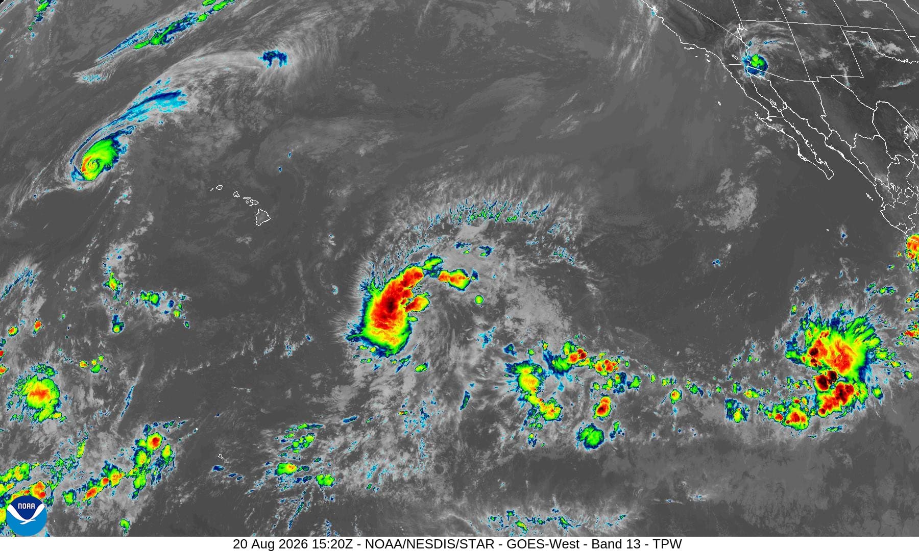
The Pacific Disaster Center’s (PDC Global) Thursday, August 20, 2026, Tropical Cyclone Activity Report…for the Pacific Ocean, the Indian Ocean, and adjacent Seas.
Tropical Cyclones
Tropical Cyclone 01C (Lala) is located about 110 miles west-northwest of Maro Reef
Tropical Cyclone 02C is located about 815 miles southeast of Hilo, Hawaii
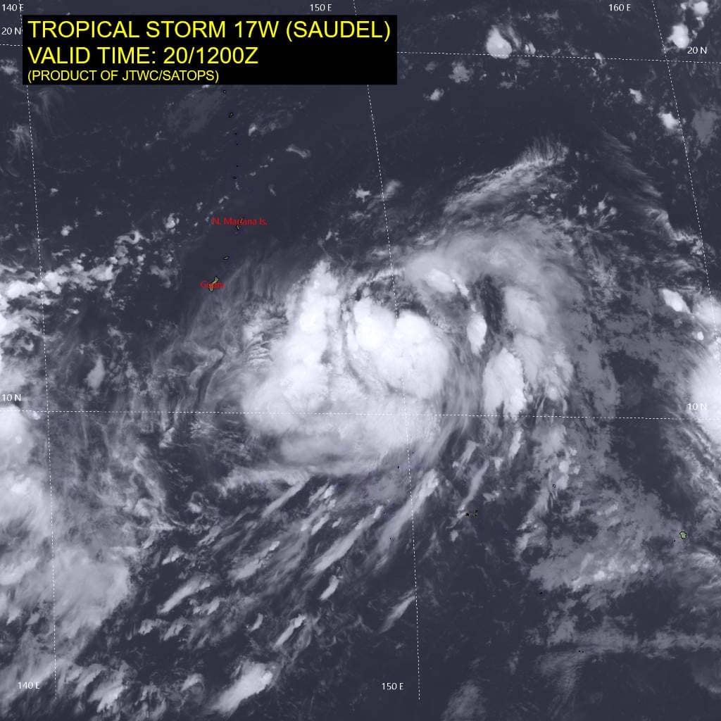
Tropical Cyclone 17W (Saudel)…is located approximately 118 NM east of Saipan
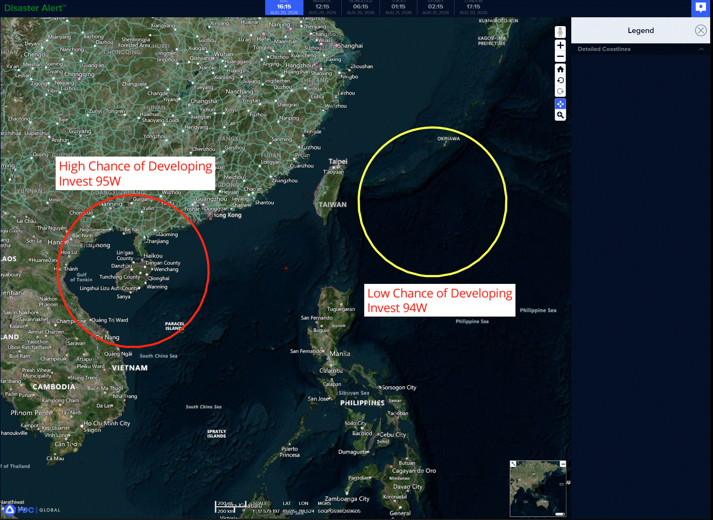
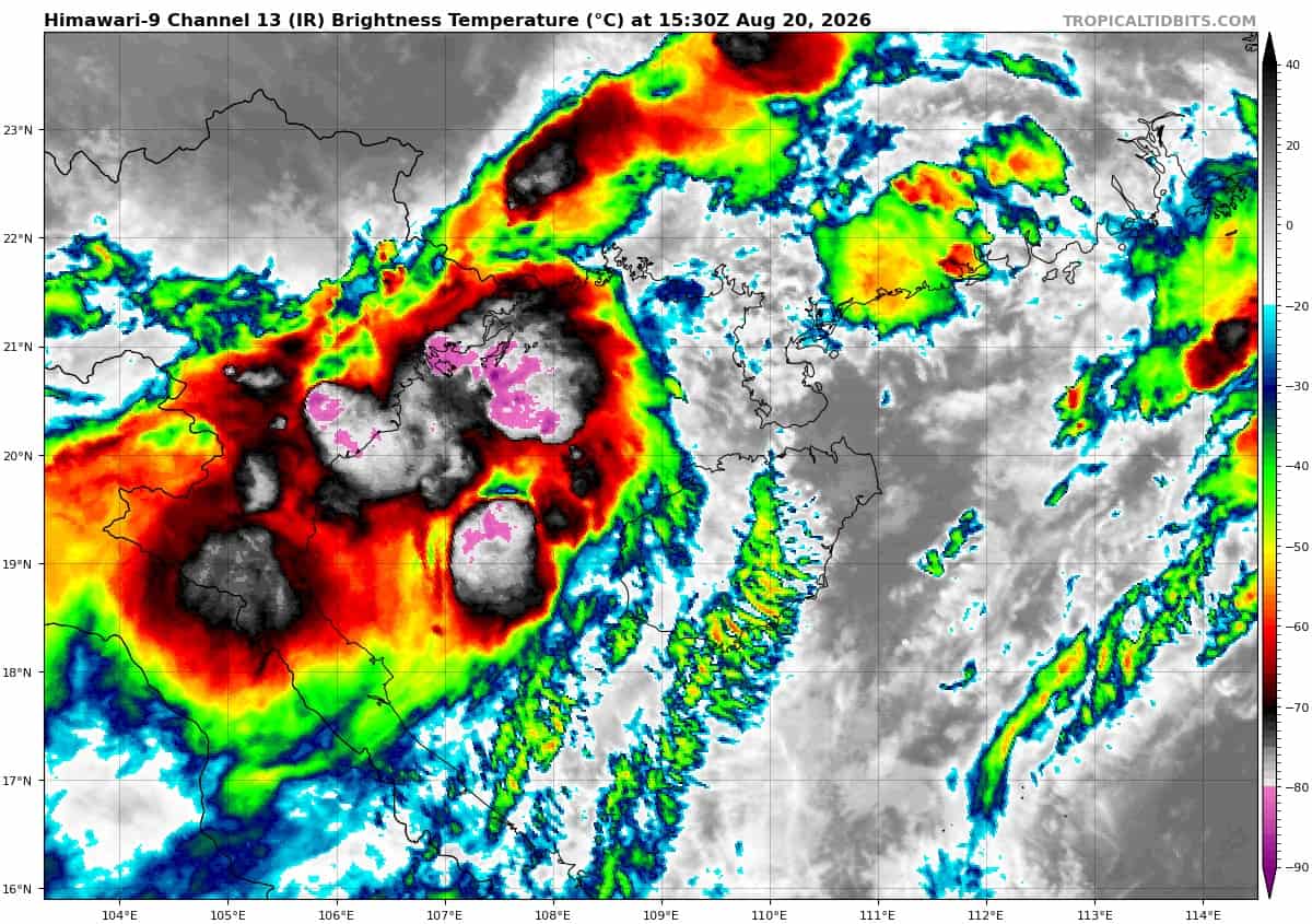
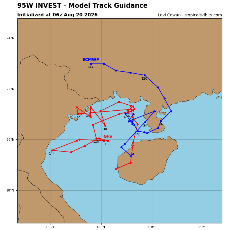
Tropical Cyclone 18W…is located approximately 159 NM east-southeast of Hanoi, Vietnam
Northeast Pacific: There are no Tropical Cyclones
>>> South-southwest of Mexico:
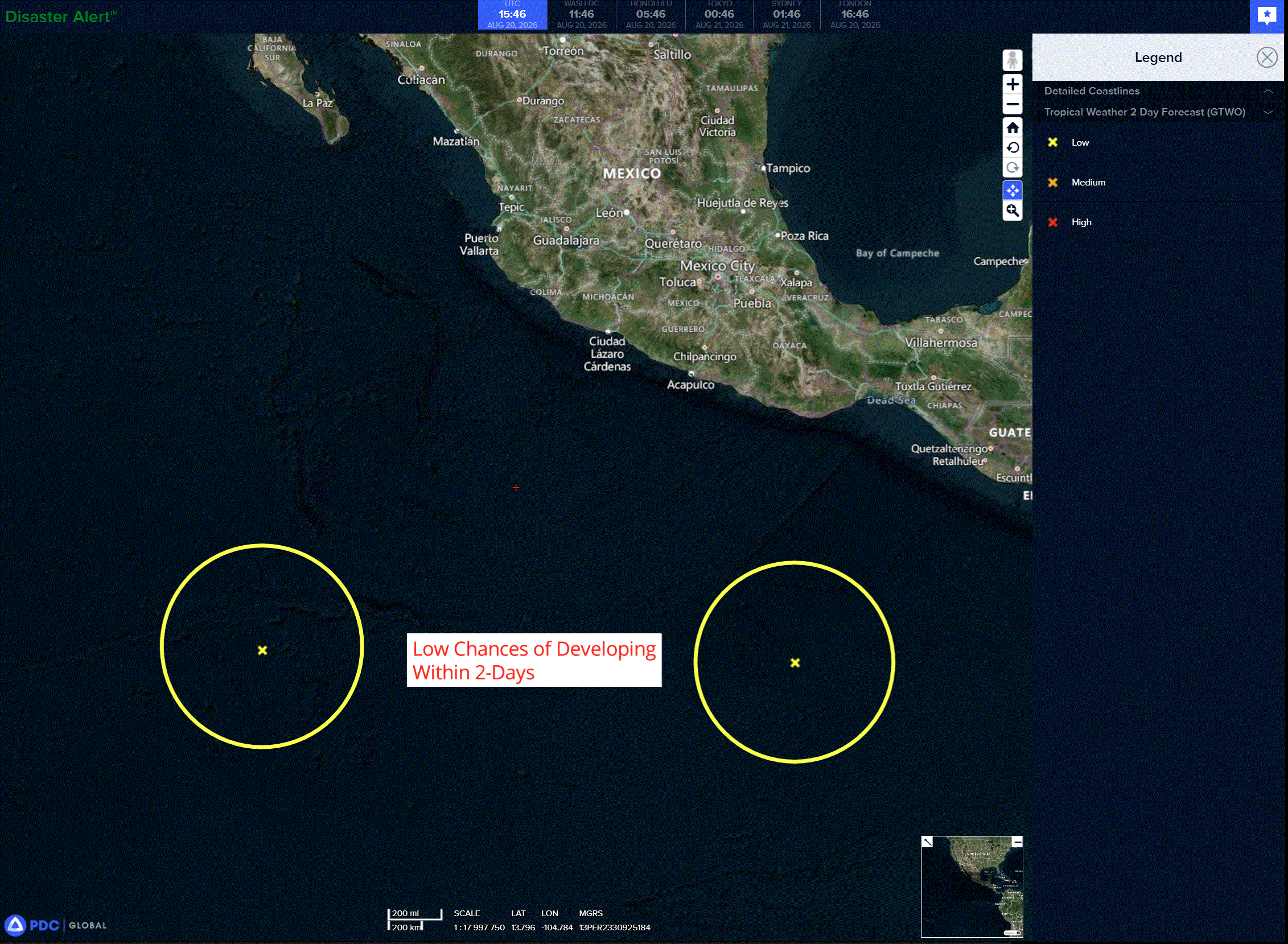
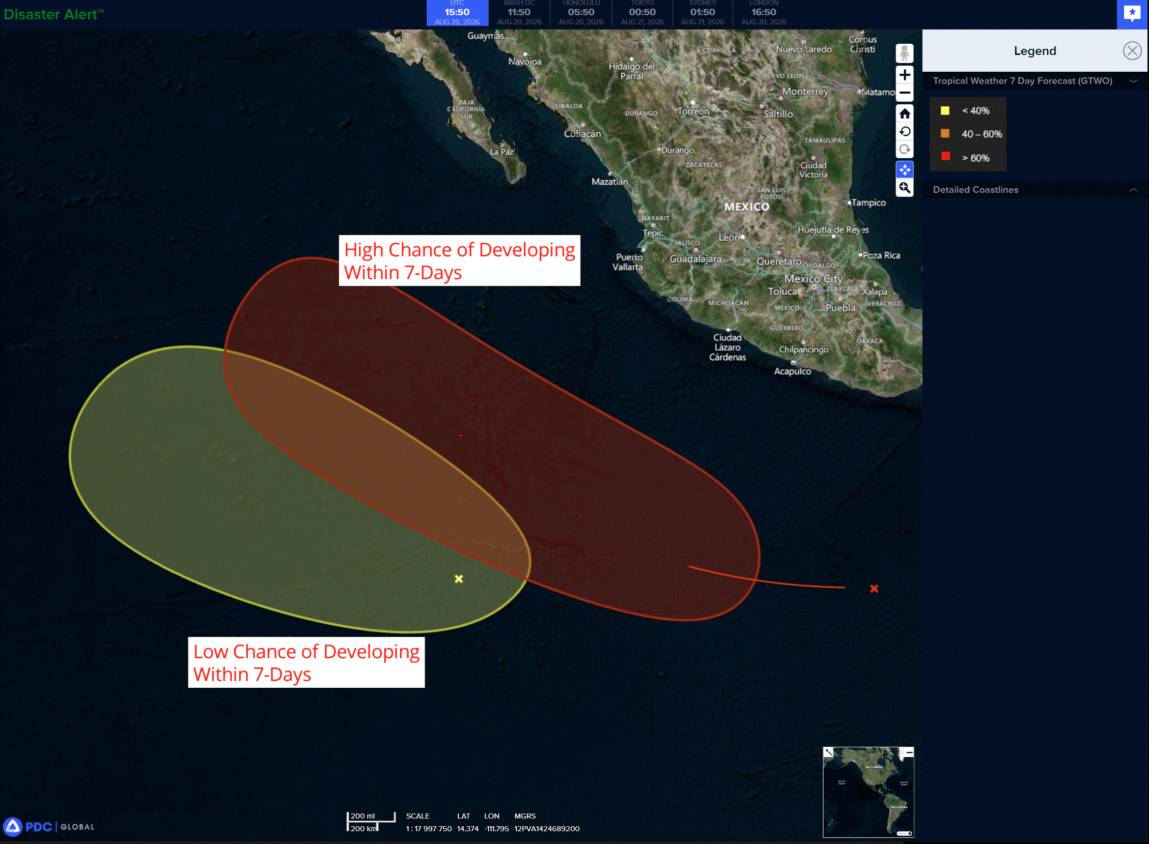
A tropical wave located a few hundred miles south of the coast of southern Mexico is producing disorganized showers and thunderstorms. Environmental conditions appear favorable for gradual development, and a tropical depression is likely to form this weekend while the system moves generally west-northwestward, remaining well offshore of Mexico.
* Formation chance through 48 hours…low…20 percent
* Formation chance through 7 days…medium…60 percent
>>> Central East Pacific:
Invest 91E
A broad area of low pressure associated with a tropical wave is producing disorganized showers and thunderstorms several hundred miles south of the southern tip of the Baja California Peninsula. Environmental conditions are forecast to be marginally favorable for development over the weekend as the system moves westward or west-northwestward at 5 to 10 mph.
* Formation chance through 48 hours…medium…60 percent
* Formation chance through 7 days…high…80 percent
Central north Pacific:
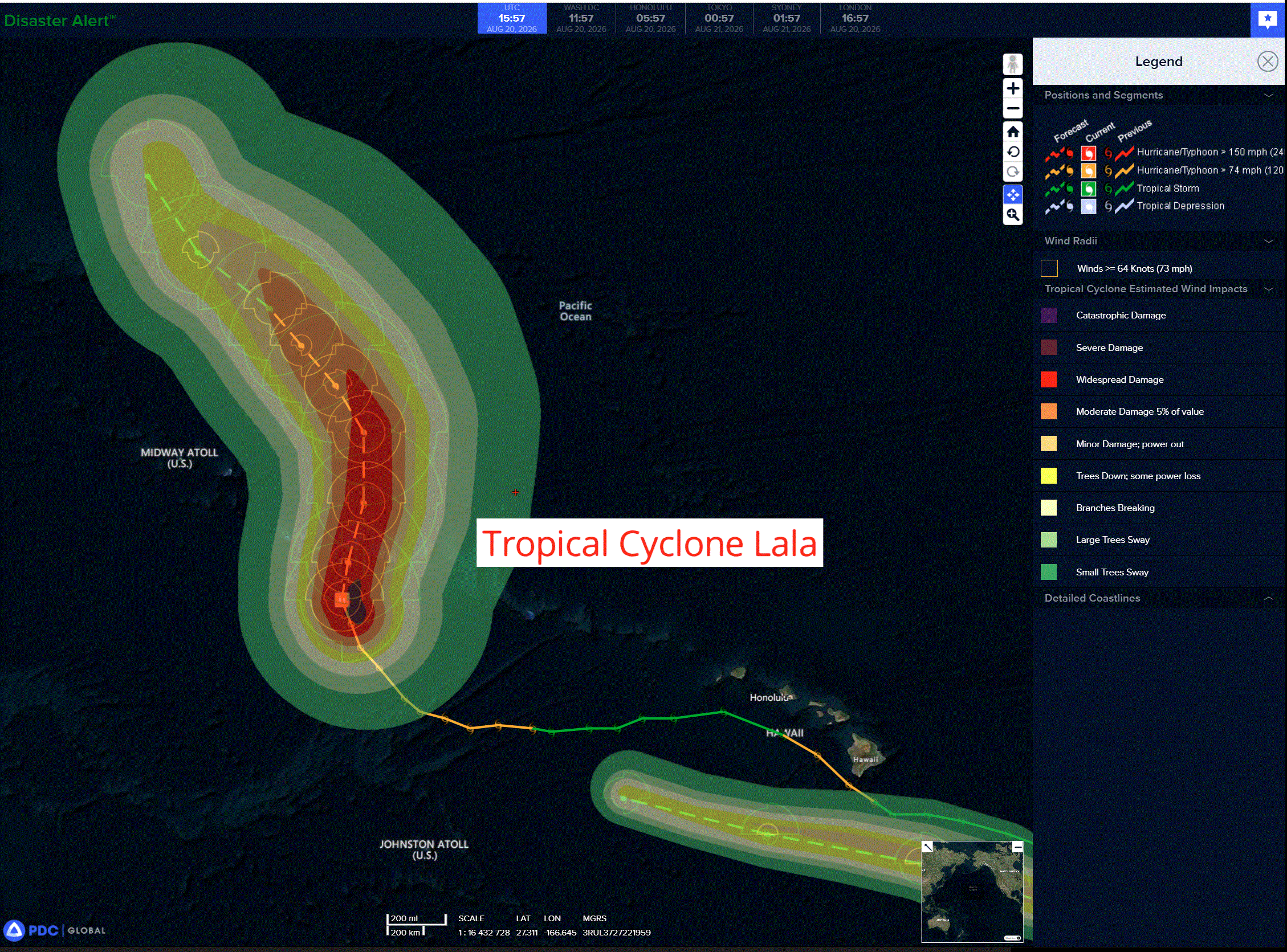
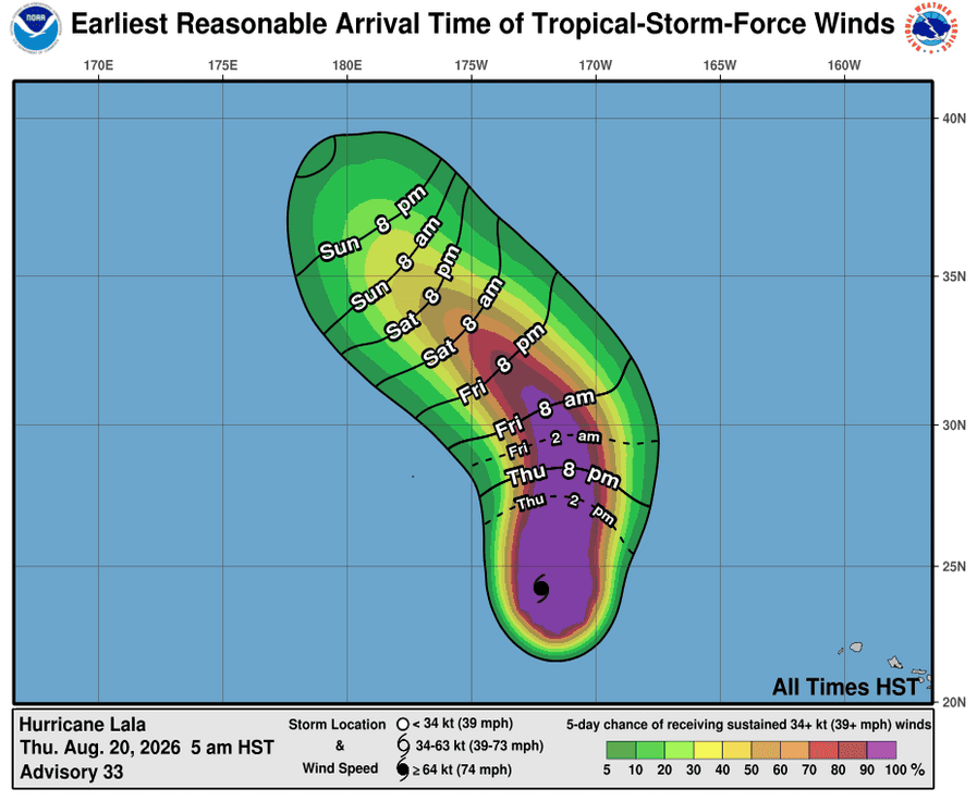
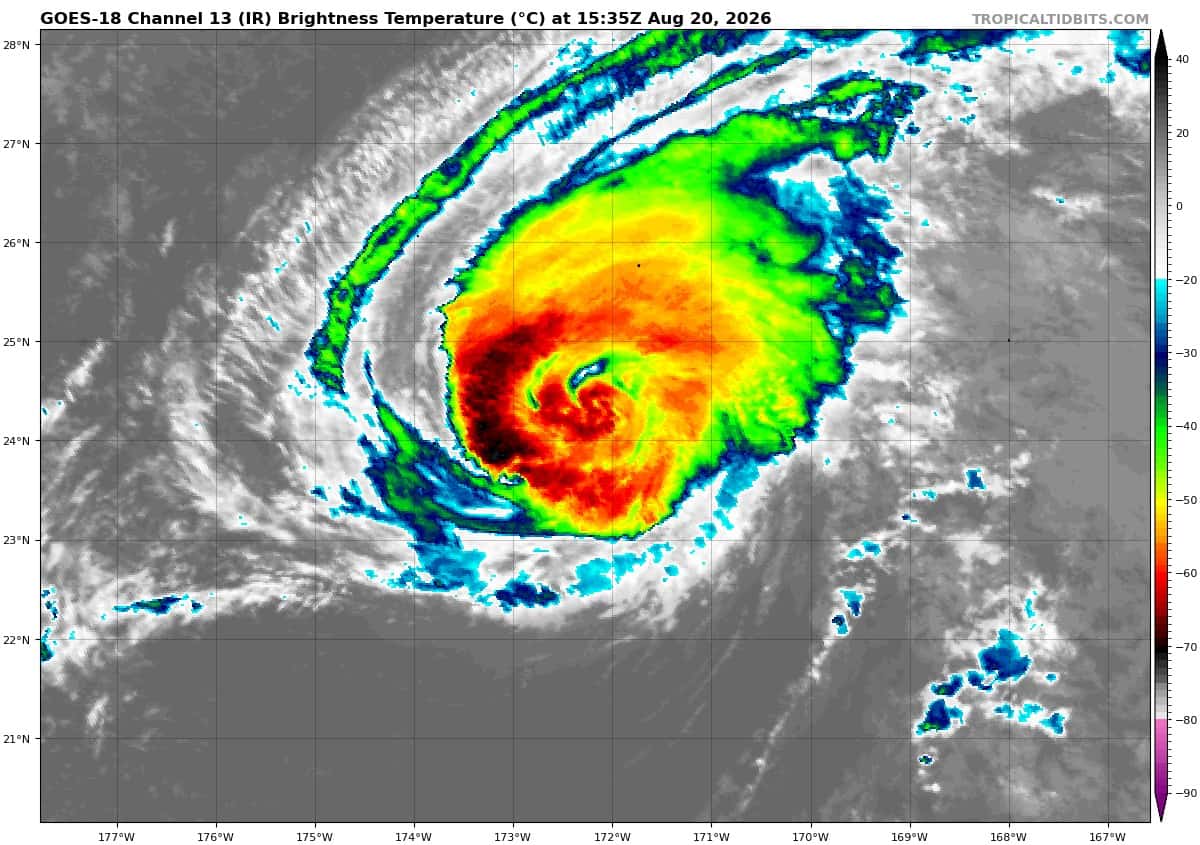
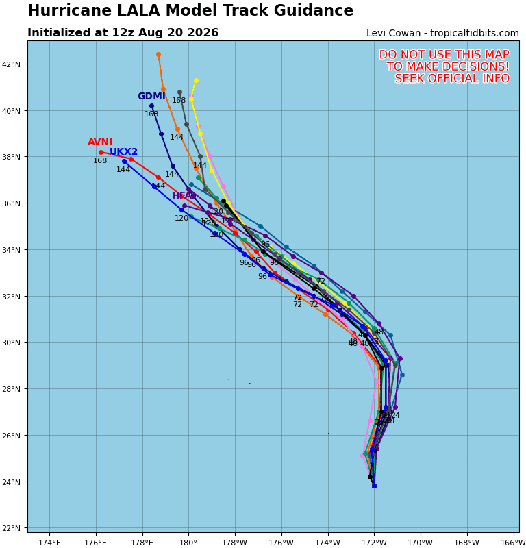
Tropical Cyclone 01C (Lala)
LALA TURNS TOWARD THE NORTH-NORTHEAST …HURRICANE CONDITIONS CONTINUE WITHIN PORTIONS OF THE PAPAHANAUMOKUAKEA MARINE NATIONAL MONUMENT
According to the NHC advisory number 35A…
Lala is moving toward the north-northwest near 9 mph (15 km/h). A turn toward the north is forecast today, with a northwestward motion expected by this weekend. On the forecast track, the center of Lala will be near portions of the Papahanaumokuakea Marine National Monument later today. Maximum sustained winds are near 100 mph (155 km/h) with higher gusts. Some gradual weakening is expected during the next couple of days, but Lala is forecast to remain a hurricane through this weekend. Hurricane-force winds extend outward up to 45 miles (75 km) from the center and tropical-storm-force winds extend outward up to 175 miles (280 km). The estimated minimum central pressure is 969 mb (28.62 inches).
HAZARDS AFFECTING LAND
WIND: Hurricane conditions are expected in the Hurricane Warning area later today, with tropical storm conditions ongoing. Tropical storm conditions are expected in the Tropical Storm Warning area today.
SURF: Large surf associated with Lala will affect the Papahanaumokuakea Marine National Monument for the next couple of days. These large waves will likely inundate some of the low-lying atolls, especially from French Frigate Shoals to Maro Reef.
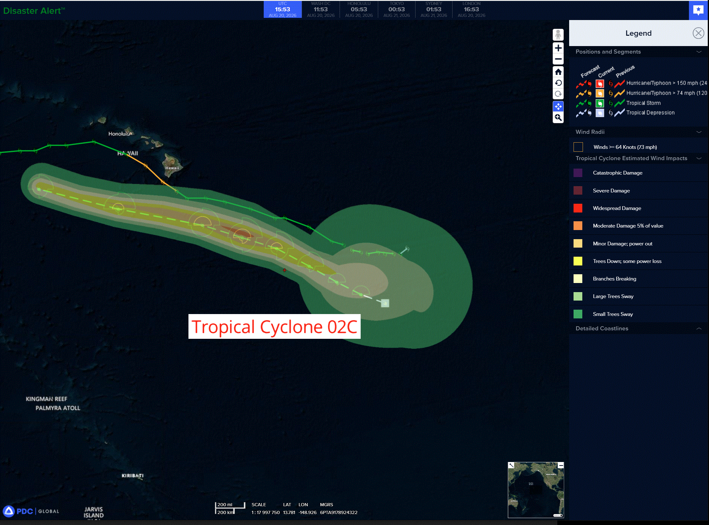
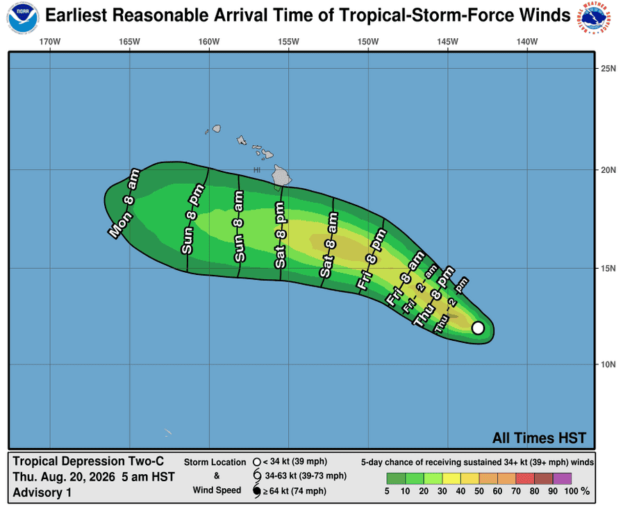
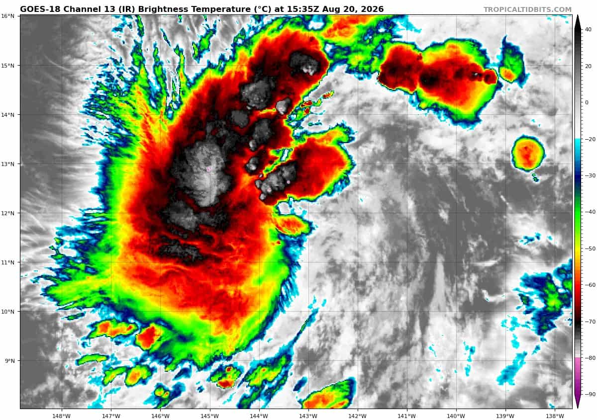
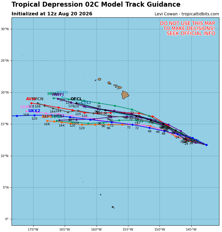
Tropical Cyclone 02C…is located about 815 miles southeast of Hilo, Hawaii
TROPICAL DEPRESSION COULD BRING HEAVY RAINFALL TO PORTIONS OF THE HAWAIIAN ISLANDS THIS WEEKEND AND EARLY NEXT WEEK
According to the NHC advisory number 3…
The depression is moving toward the west-northwest near 16 mph, and this general motion is expected during the next few days. On the forecast track, the center of the system is expected to pass near or south of the Big Island of Hawaii this weekend. Maximum sustained winds are near 35 mph with higher gusts. Gradual strengthening is forecast, and the depression could become a tropical storm later today. The estimated minimum central pressure is 1006 mb (29.71 inches).
HAZARDS AFFECTING LAND
RAINFALL: The tropical depression is expected to produce rainfall totals of 5 to 10 inches with maximum amounts of 15 inches across the Big Island. Rainfall totals of 1 to 3 inches with maximum amounts of 5 inches are expected across the remainder of the Hawaiian Islands this weekend and early next week. This rainfall may produce life-threatening flooding and mudslides, especially in steep terrain and over areas that were affected recently by Lala.
SURF: Swells generated by the depression are expected to affect portions of the Hawaiian Islands ths weekend, and could cause life-threatening surf and rip current conditions.
Western Pacific, Indian Ocean, and adjacent Seas:
Western Pacific
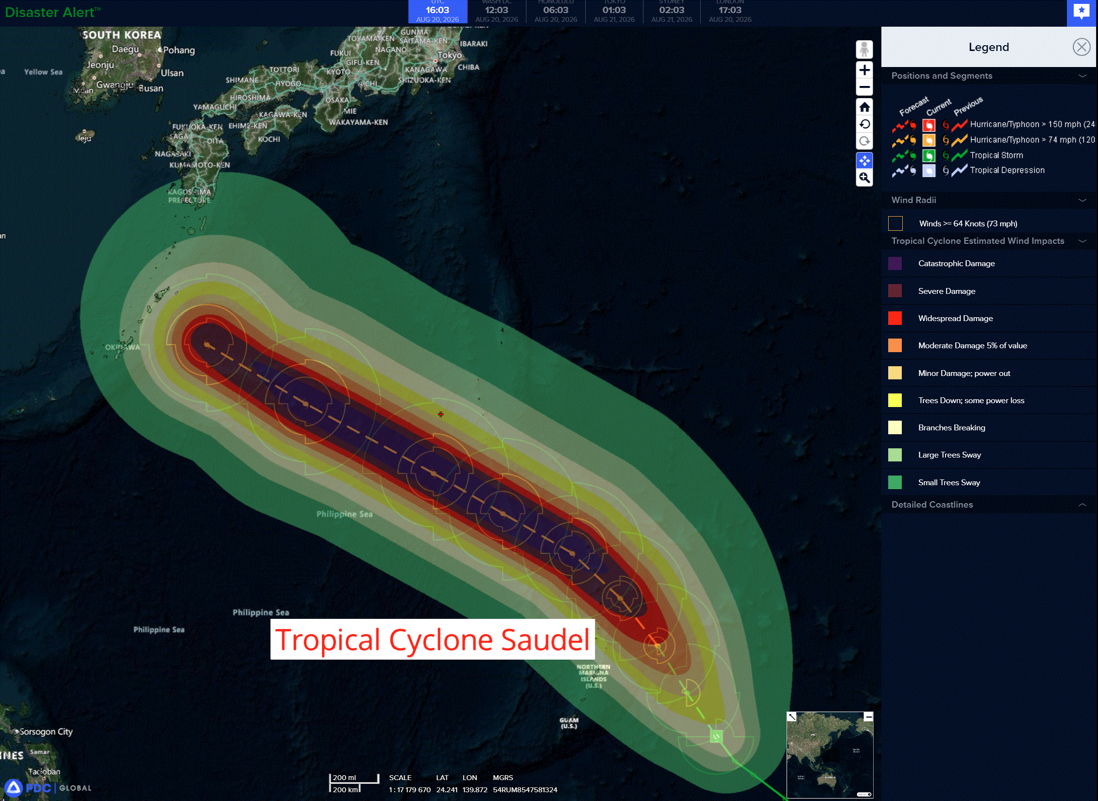
Tropical Cyclone 17W (Saudel)
According to the JTWC warning number 11…
Sustained winds were 45 knots with gusts to 55 knots
Animated enhanced infrared (eir) satellite imagery depicts explosive central convection, with cloud top temperatures as cold as -86 degrees celsius, wrapping into the low-level circulation center. Surrounding this core convection, outer feeder bands are showing increasing curvature and extent. Despite the presence of moderate northeasterly shear in the 850-400 mb layer, the upper-level outflow is expanding radially, indicating that the system is successfully overcoming the shear. aA fortuitous 201101z ascat-b pass revealed unflagged 35-40 kt winds in the southeast quadrant and confirmed a wind field that is gradually becoming more symmetric.
The surrounding environment is favorable for further development, characterized by very warm sea surface temperatures (sst) of 30-31 degrees celsius and rich, deep-layer moisture.
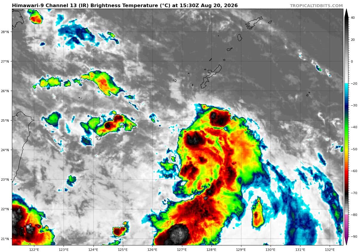
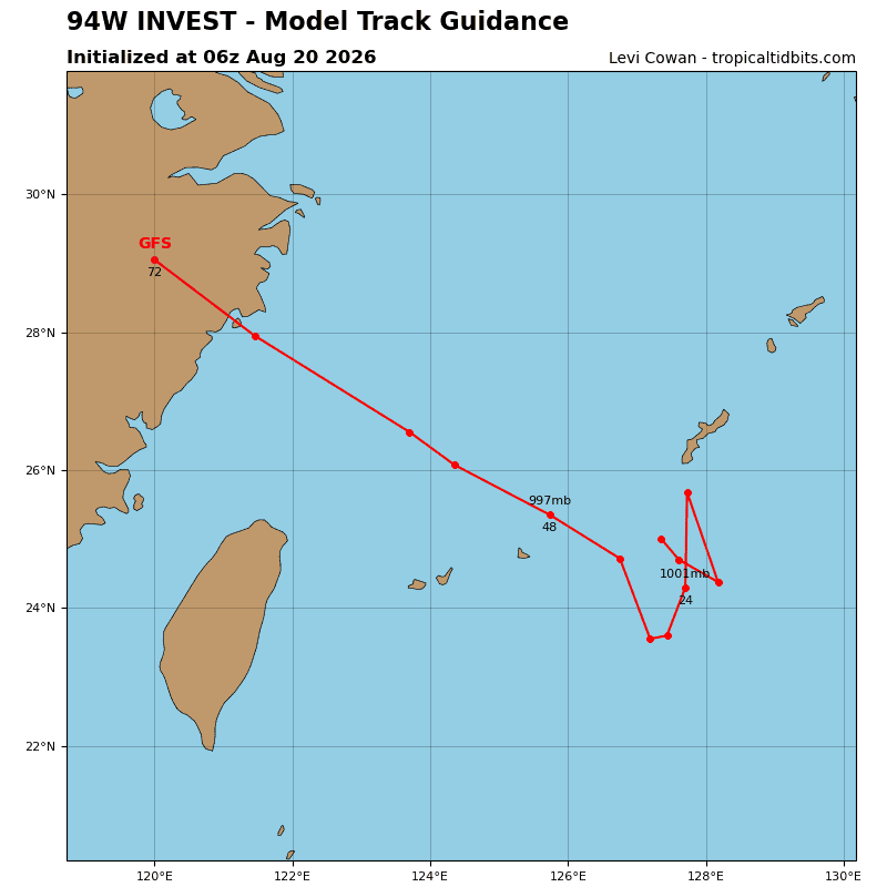
TS 17W is now moving northwestward at 11 kts, a motion that will persist for the next 36 hours under the steering influence of a ridge positioned to its northeast. After 36 hours, a deep-layer ridge over the central north pacific will migrate westward, inducing a more westward track. Complications arising from the interaction of a monsoon depression, designated as 94W, with the subtropical ridge (str) over Honshu result in significant forecast track uncertainty at 96 hours and 120 hours.
A spectrum of possible tracks exist that depend on the strength of the str. On one end of the spectrum, the monsoon depression remains weak, allowing for a stronger str. This would lead to a zonal trajectory toward the southern Ryukyu Islands. The other end presents a stronger 94W, which creates a weakness in the str that would allow TS 17S to turn poleward into Shikoku. The JTWC forecast track favors the former solution and depicts a more zonal track.
The convection associated with TS 17W is expanding rapidly, and the system is on the precipice of a prolonged period of very rapid intensification (ri). The environmental conditions only get better from this point forward, with ocean heat content (ohc) increasing to 125-150 kj per cm2 and vertical wind shear (vws) decreasing to 5-10 kts. Additionally, after 12 hours, the system will tap into a poleward outflow channel created by an upper-level trough.
As the system becomes more symmetric and the inner core consolidates, these factors will fuel very rapid intensification to a peak near super typhoon (sty) status. The ships ri index gives a 60 percent probability of a 65 kt increase in wind speed over the next 24 hours alone. Achieving sty intensity is well within the realm of
possibility, given the highly favorable conditions and a maximum potential intensity of 135 kts.
After peaking around 60-72 hours, the system will enter a less favorable environment of higher shear and
lower ohc, leading to subsequent weakening. Eyewall replacement cycles may also begin near peak intensity, which would introduce less predictable fluctuations in intensity and an expanded wind field.
Tropical Cyclone 18W
According to the JTWC warning number 2…
Sustained winds were 30 knots with gusts to 40 knots
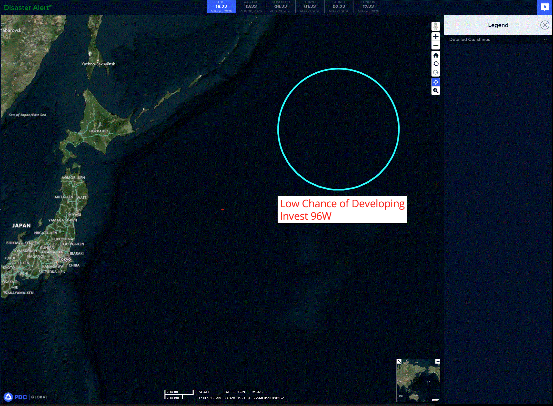
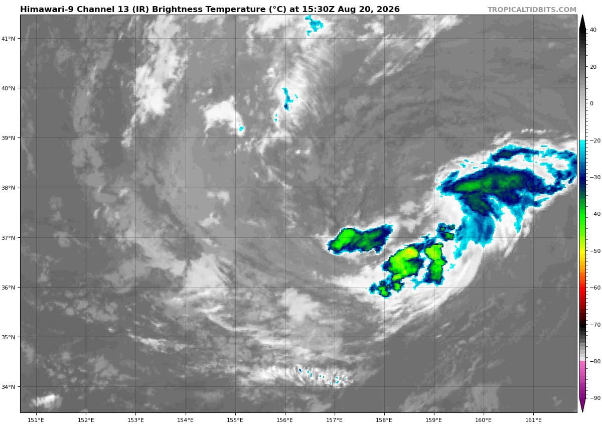
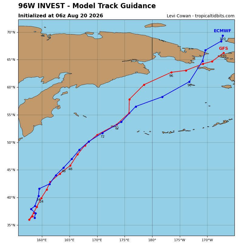
>>> There’s an area of disturbed weather being referred to as Invest 96W, which is located approximately 809 NM east of Misawa, Japan
The system is currently classified as a subtropical cyclone, generally characterized as having both tropical and mid-latitude cyclone features.
Animated enhanced multi-spectral satellite imagery (msi) depicts invest 96W with a fully exposed low-level circulation center (llcc) and deep associated convection over the west-northwestern periphery.
A potent upper-level low presently inhibits convective activity over the center, and plenty of dry air is
wrapping into the circulation.
Deterministic models show 96W transiting northwestward and diminishing as the upper-level low
weakens and the environmental conditions become more hostile, with transition into a tropical cyclone being unlikely.
Maximum sustained surface winds are estimated at 33 to 38 knots.
Minimum sea level pressure is estimated to be near 1003 mb.
The potential for the development of a significant tropical cyclone within the next 24 hours remains low.