Tropical Cyclone 02C (Moke)
HEAVY RAINFALL AND GUSTY WINDS LIKELY OVER THE BIG ISLAND OF HAWAII TODAY AND TOMORROW
According to the NHC advisory number 14…



By PDC’s Senior Weather
Specialist Glenn James

The Pacific Disaster Center’s (PDC Global) Sunday, August 23, 2026, Tropical Cyclone Activity Report…for the Pacific Ocean, the Indian Ocean, and adjacent Seas.
Tropical Cyclones
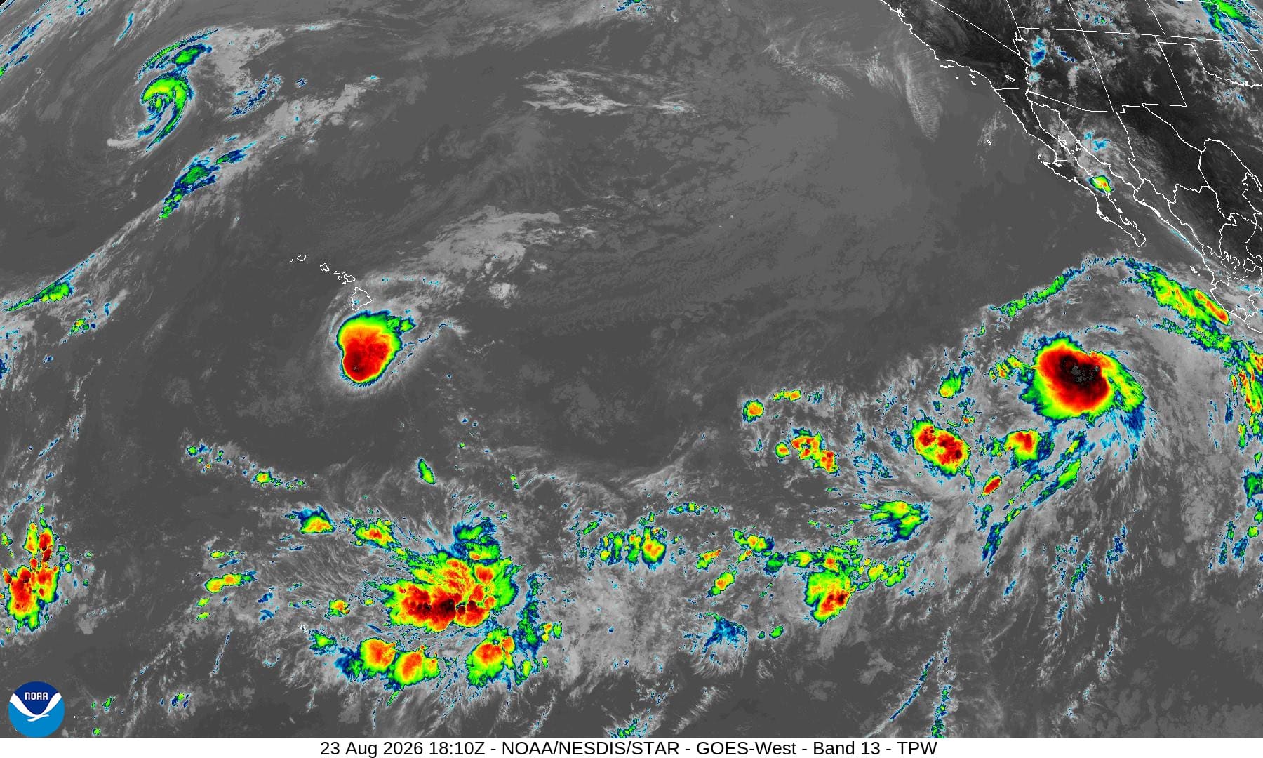
Tropical Cyclone 09E (Iselle) is located about 535 miles southwest of the southern tip of Baja California
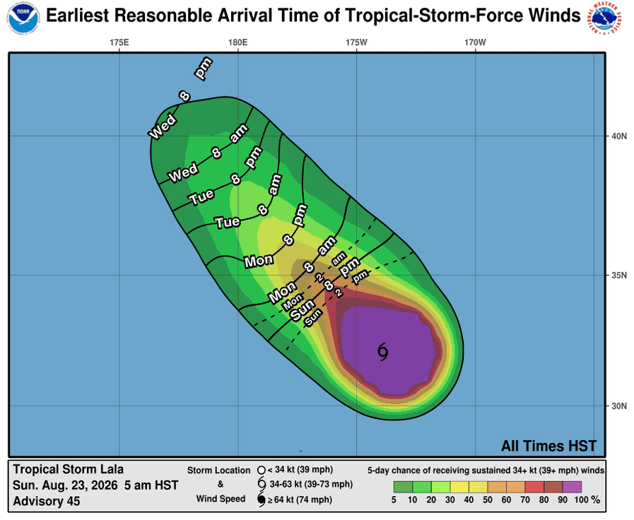
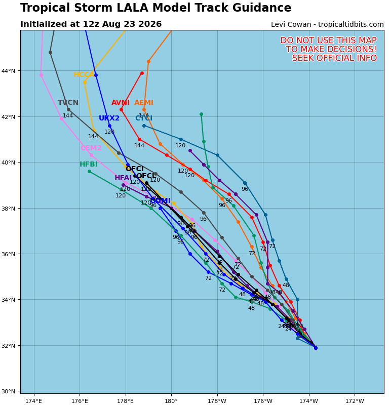
Tropical Cyclone 01C (Lala) is located about 370 miles northeast of Kure Atoll
Tropical Cyclone 02C (Moke) is located about 320 miles south-southwest of Hilo, Hawaii
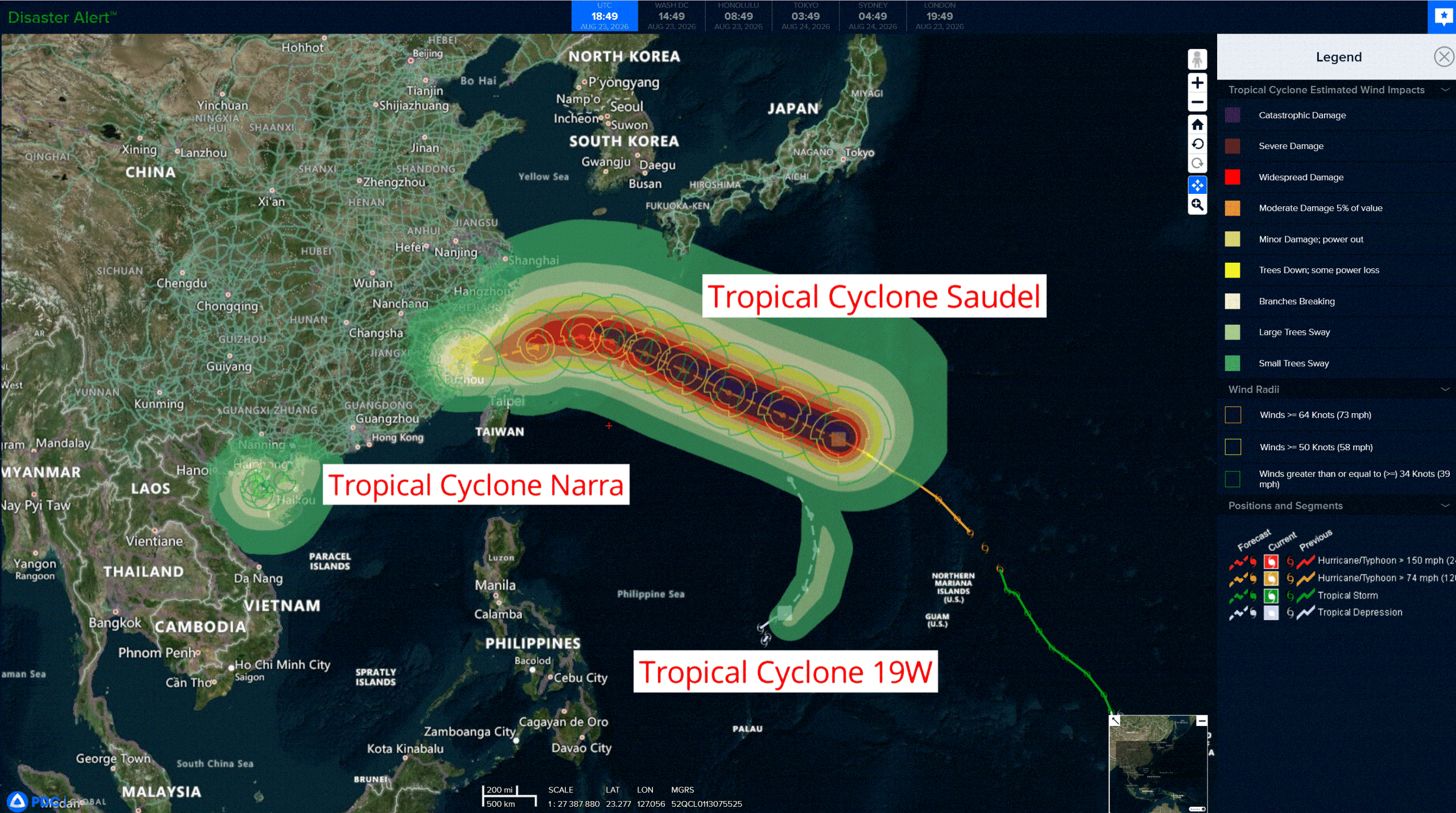
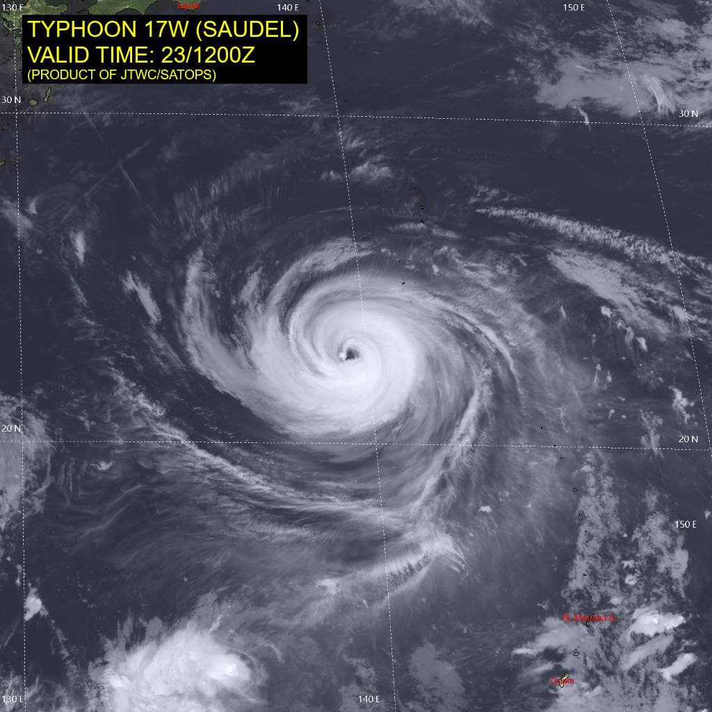
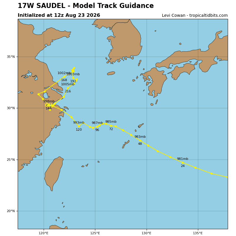
Tropical Cyclone 17W (Saudel)…is located approximately 675 NM east-southeast of Kadena AB
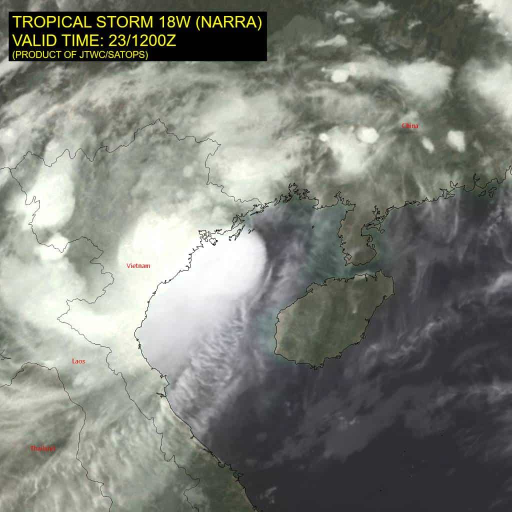
Tropical Cyclone 18W (Narra)…is located approximately 127 NM east-southeast of Hanoi, Vietnam
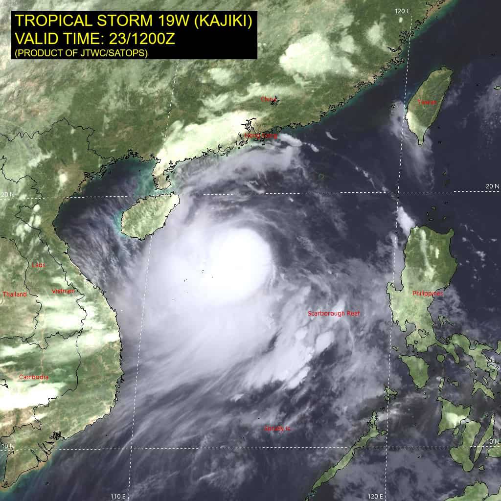
Tropical Cyclone 19W (Ansani)…is located approximately 473 NM west of Navsta Guam
Northeast Pacific:
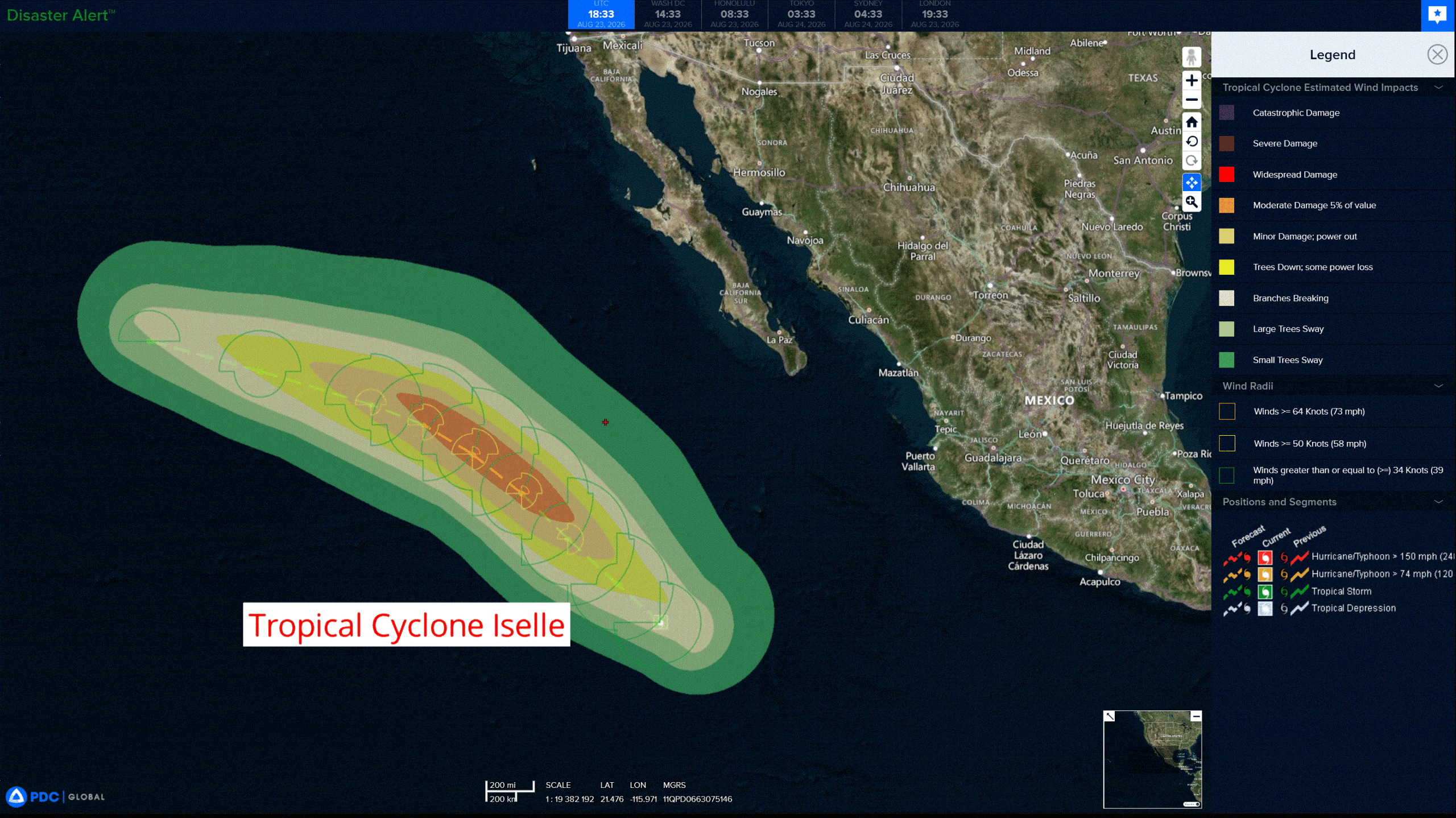
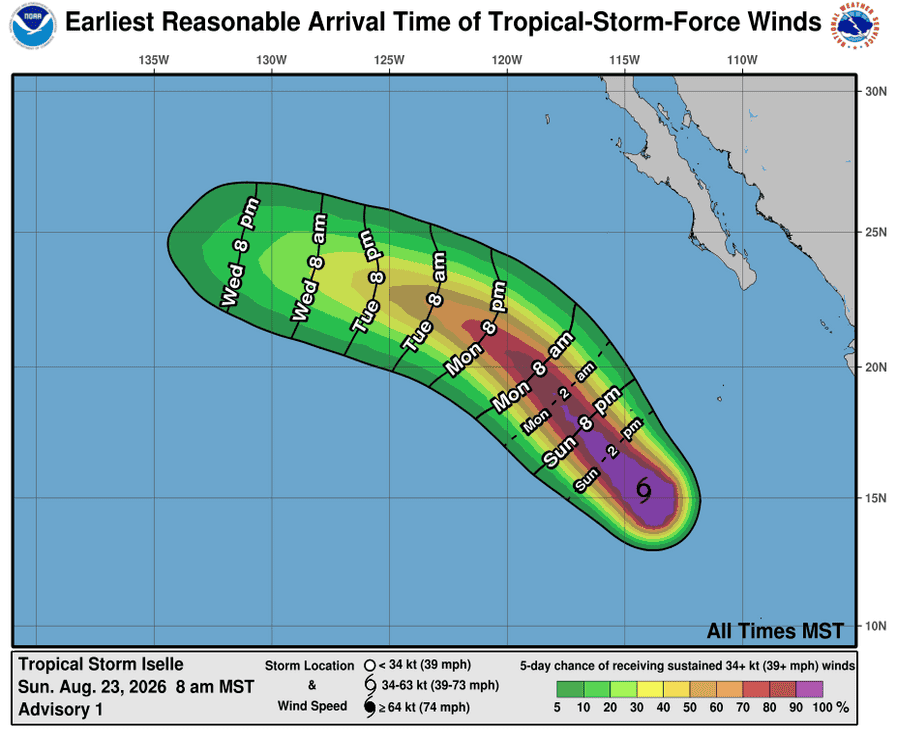
Tropical Cyclone 09E (Iselle)
ISELLE STRENGTHENS AS IT MOVES NORTHWESTWARD WELL OFFSHORE OF MEXICO
According to the NHC advisory number 2…
Iselle is moving toward the northwest near 16 mph (26 km/h) and this motion is expected to continue through Monday, followed by a gradual turn toward the west-northwest on Tuesday. Maximum sustained winds have increased to near 50 mph (85 km/h) with higher gusts. Some strengthening is forecast during the next day or two, and Iselle could become a hurricane Monday night or early Tuesday. Tropical-storm-force winds extend outward up to 125 miles (205 km) from the center. The estimated minimum central pressure is 1001 mb (29.56 inches).
HAZARDS AFFECTING LAND
SURF: Swells generated by Iselle will affect the west coast of the Baja California Peninsula beginning Monday. These swells are likely to cause life-threatening surf and rip current conditions.
>>> Central East Pacific:
Invest 91E
Disorganized showers and thunderstorms are persisting with a broad area of low pressure located well to the south-southwest of the southern tip of the Baja California Peninsula. Environmental conditions could support the development of a short-lived tropical depression during the next couple of days before it becomes absorbed by Tropical Storm Iselle.
* Formation chance through 48 hours…medium…40 percent
* Formation chance through 7 days…medium…40 percent
>>> Well Southwest of Southwestern Mexico:
An area of low pressure is expected to develop well south of the southern tip of the Baja California Peninsula during the middle portion of this week. Some slow development is expected thereafter, and a tropical depression is likely to form later this week or over the weekend while the system moves generally west-northwestward.
* Formation chance through 48 hours…low…near 0 percent
* Formation chance through 7 days…high…70 percent
>>> Well offshore of southern Mexico:
An area of low pressure is expected to develop well south of the southern tip of the Baja California Peninsula during the middle portion of this week. Some slow development is expected thereafter, and a tropical depression is likely to form later this week or over the weekend while the system moves generally west-northwestward.
* Formation chance through 48 hours…low…near 0 percent
* Formation chance through 7 days…low…20 percent
Central north Pacific:
Tropical Cyclone 01C (Lala)
LALA REMAINS A STRONG TROPICAL STORM OVER OPEN WATERS
According to the NHC advisory number 46…
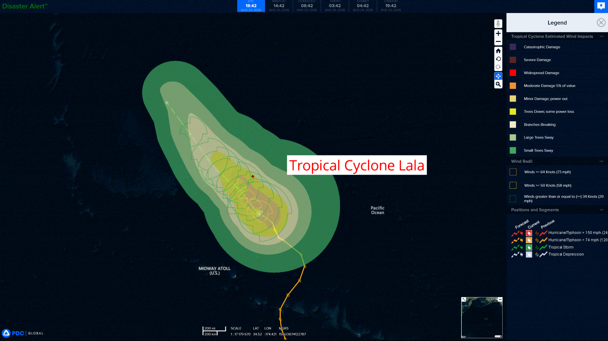
Lala is moving toward the northwest near 5 mph (7 km/h) and this general motion is expected to continue for the next several days. Maximum sustained winds are near 65 mph (100 km/h) with higher gusts. Gradual weakening is forecast during the next several days. Tropical-storm-force winds extend outward up to 175 miles (280 km) from the center. The estimated minimum central pressure is 988 mb (29.18 inches).
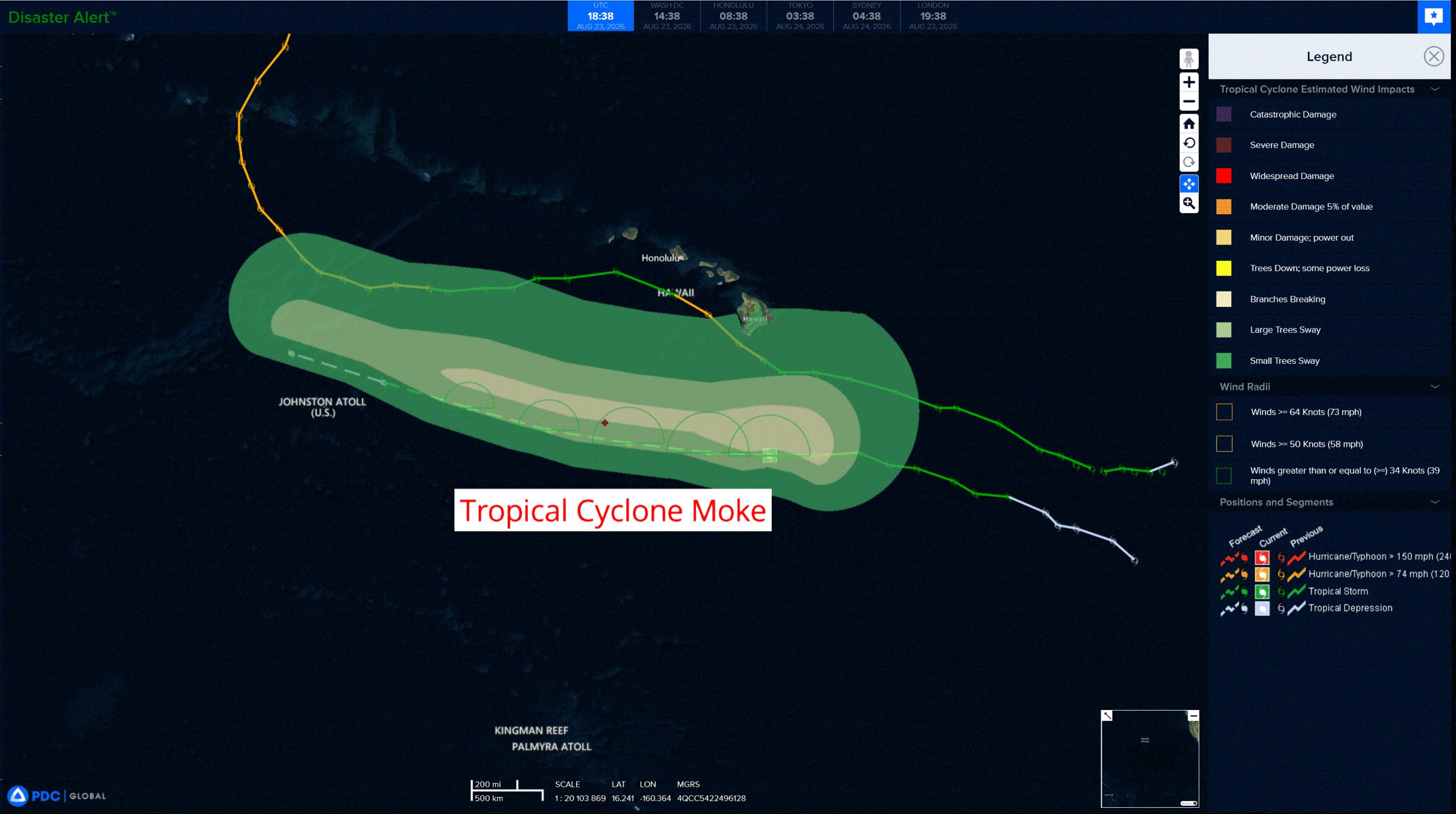
Tropical Cyclone 02C (Moke)
HEAVY RAINFALL AND GUSTY WINDS LIKELY OVER THE BIG ISLAND OF HAWAII TODAY AND TOMORROW
According to the NHC advisory number 14…
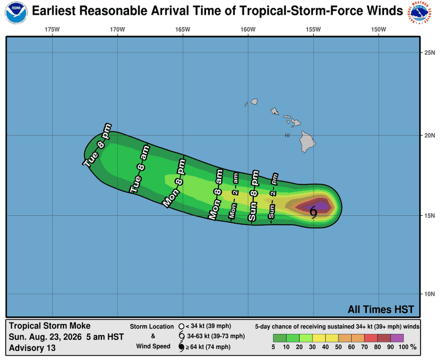
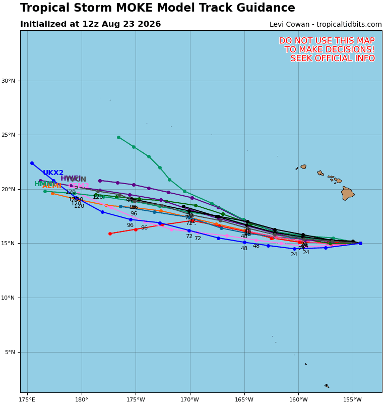
Moke is moving toward the west near 15 mph (24 km/h), and this general motion is expected to continue during the next several days. On the forecast track, the center of the storm is expected to pass south of the Big Island of Hawaii today, then well south of the smaller main Hawaiian Islands early next week. Maximum sustained winds are near 40 mph (65 km/h) with higher gusts. Moke is forecast to slowly lose strength and could become a post-tropical cyclone on Tuesday. Tropical-storm-force winds extend outward up to 45 miles (75 km) from the center. The estimated minimum central pressure is 1003 mb (29.62 inches).
HAZARDS AFFECTING LAND
Wind: Gusty winds are expected across the Hawaiian Islands during the next couple of days, especially in areas of high terrain.
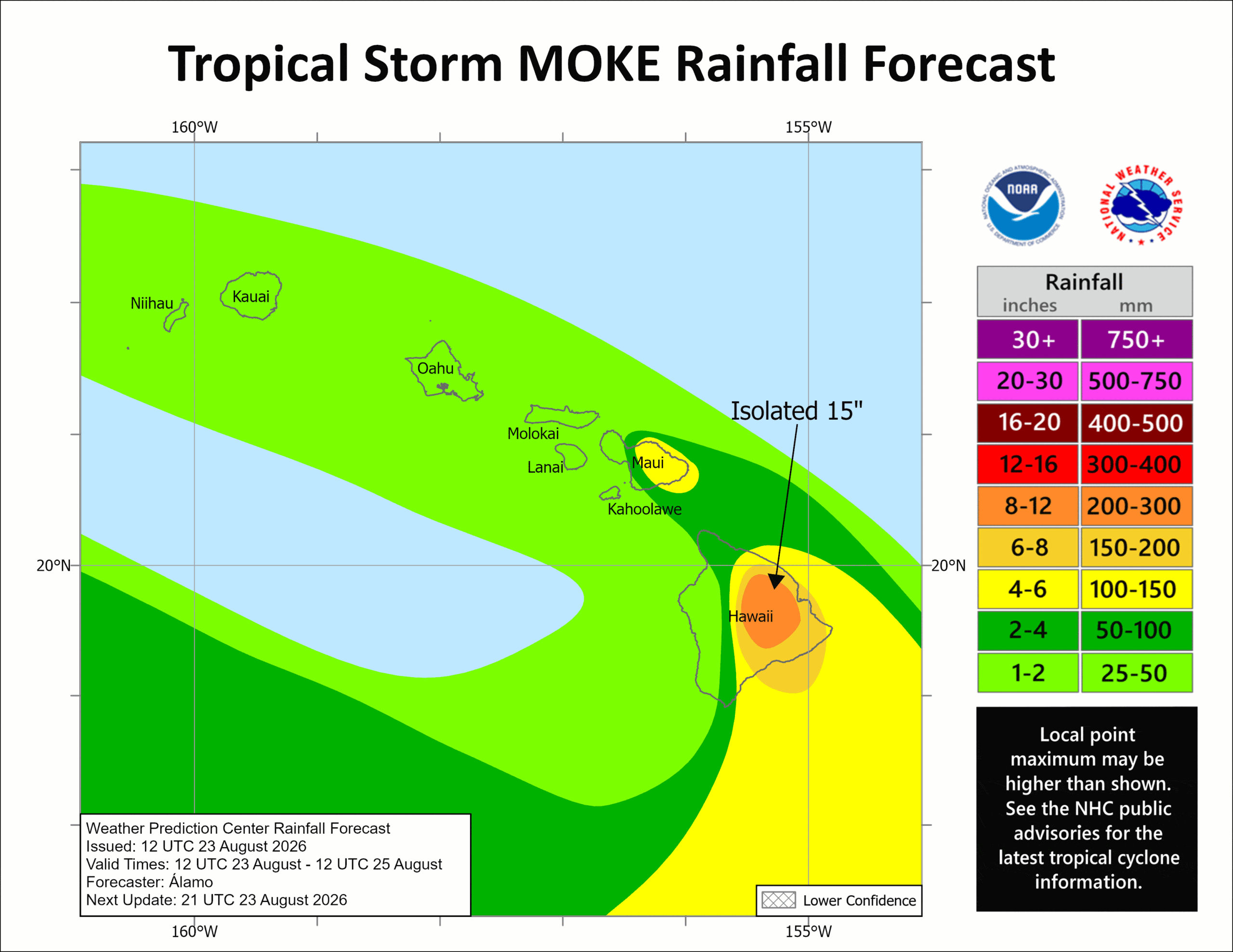
RAINFALL: The tropical storm is expected to produce rainfall totals of 5 to 10 inches with maximum amounts of 15 inches across the Big Island. Rainfall totals of 3 to 6 inches are expected on eastern Maui. These rainfall amounts may produce life-threatening flooding and mudslides for the windward and southeast Big Island, especially in steep terrain and over areas that were affected recently by Lala.
Across western Maui and the remainder of the islands, moisture drawn northward from Moke may bring up to 1 or 2 inches of rain.
Western Pacific, Indian Ocean, and adjacent Seas:
Western Pacific
Tropical Cyclone 17W (Saudel)
According to the JTWC warning number 21…Sustained winds were 110 knots with gusts to 135 knots
Animated enhanced infrared (eir) satellite imagery depicts the core of typhoon 17w (saudel) continuing to reorient as the system continues to undergo an eyewall replacement cycle (erc). The most recent high resolution microwave imagery over the system was a 230811z wsfm 37 ghz image, which showed the inner eyewall continuing to erode and being surrounded by the more dominant outer eyewall. The lack of more recent microwave imagery causes there to be some uncertainty in the progression of the erc. The eir does show a distinct weakness in the northwestern quadrant of the eyewall, indicating that the inner eyewall is likely being choked off and eroding in the later stages of the erc timeline.
Environmental analysis indicates that 17w remains placed within a favorable environment characterized by strong radial outflow aloft, low (5-10 kts) vertical wind shear, and warm (29-30 c) sea surface temperatures.
TY 17w is forecast to continue tracking west-northwestward, along the southwestern periphery of the str to the northeast through 12 hours. Near 12 hours, the str is expected to merge with a separate str centered over southern Japan, which will keep 17w on a west-northwestward trajectory through 60 hours. The system is
forecast to skirt the northern coast of Okinawa between 48 and 60 hours. After 60 hours, track speeds are expected to slow through 96 hours as the system enters a weakness in the steering pattern as the primary steering influence transitions to a str centered over eastern China. 17w is then forecast to track west-southwestward, along the southeastern extent of that str through the remainder of the forecast period. A final landfall is currently forecast to occur just before 120 hours, northwest of Taiwan, though there is some uncertainty in the timing and location of the landfall.
In terms of intensity, 17w is forecast to maintain its current intensity of 110 kts through 24 hours as the system attempts to recover from the ongoing erc. 17w is also entering waters containing a lower ocean heat content (ohc), which will also hinder the chances for redevelopment after the erc completes. Around 24 hours, the upper-level trough to the west of 17w will fill, causing the poleward outflow channel to weaken. Additionally, northerly shear will increase, causing 17w to gradually weaken as it approaches Okinawa. Once the system enters the east China Sea, northeasterly shear induced by the strong ridge over china will cause further weakening through the remainder of the forecast period.
Tropical Cyclone 18W (Narra)
According to the JTWC warning number 12…Sustained winds were 40 knots with gusts to 50 knots
Animated enhanced infrared (eir) satellite imagery depicts tropical storm 18w (Narra) nearly stationary over the past 6 hours with a partially exposed low-level circulation center (llcc) and deep convection confined to the western periphery. Northeasterly shear is evident, indicated by a sharp edge in the northeastern portion of the convection. Additionally, surface observations from Bach Long Vi reported 37 kts from the west-northwest at 231200z, further supporting the
initial intensity estimate.
Environmental analysis indicates that 18w is in a marginally favorable environment characterized by moderate equatorward outflow aloft, low to moderate (15-20 kts) northeasterly vertical wind shear, and very warm (30-31 c) sea surface temperatures.
TS 18w is forecast to drift slowly southward over the next 24 hours as it remains placed within a competing steering environment. The actual track of 18w is likely to be erratic during this time, which is not captured by the JTWC forecast. Around 36 hours, the ner to the south is expected to build to the southeast of 18w, causing it to make an eastward and then northward turn toward the southern coast of China.
In terms of intensity, 18w is forecast to maintain its current intensity of 40 kts through 36 hours as the shear remains relatively low. After 36 hours, easterly shear and dry air will increase, causing the system to start on a weakening trend as it approaches the coast of China. 18w is then forecast to quickly dissipate after making landfall around 72 hours.
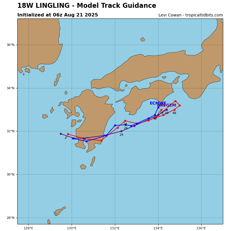
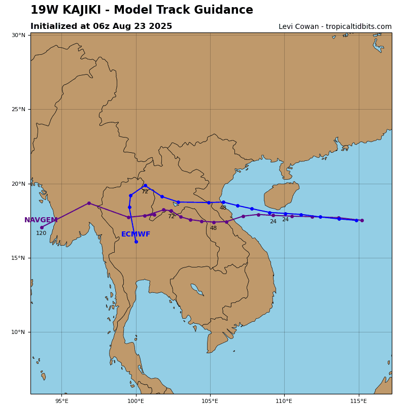
Tropical Cyclone 19W (Atsani)
According to the JTWC warning number 5…Sustained winds were 30 knots with gusts to 40 knots
Animated enhanced infrared (eir) satellite imagery depicts a nearly fully exposed low-level circulation center (llcc) associated with tropical depression (td) 19w (nineteen). The convective structure is highly asymmetric, with most of the deep convection confined to the western semicircle, as also reflected in the wind field observed in a partial 231204z metop-c ascat pass. The low-level vortex is embedded within a strong steering environment and is subject to 10-15 kts of
northeasterly vertical wind shear (vws).
Environmental conditions remain marginal, with warm (29-30 c) sea surface temperatures (sst) and a moderate equatorward outflow channel. Although tropospheric moisture remains relatively high along the western periphery, meteorological analysis indicates the system is being constrained by dry air to the east and northeast.
TD 19w is moving northeastward under the combined influence of a near-equatorial ridge (ner) positioned to the east-southeast and low-level southwesterly flow. By 24 hours, the system is forecast to transition to a new steering pattern dominated by a subtropical ridge (str) to the northeast, which will turn td 19w
northward and then northwestward in the wake of typhoon 17w (Saudel).
Numerical model guidance indicates that the vws will increase to 25-30 kts by around tau 12. This increase in shear, combined with dry-air entrainment, will support a steady weakening trend, with winds decreasing to 20-25 kts by 36 hours. By 48 hours, td 19w will likely struggle to maintain vertical coherence as it encounters the highly sheared peripheral flow associated with typhoon 17w. Consequently, dissipation over water is forecast by 48 hours, though a faster rate of
weakening is possible should vertical wind shear and dry mid-level advection be stronger than currently forecast.
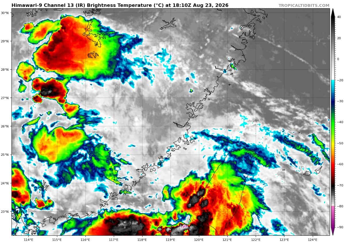
>>> There’s an area of disturbed weather being referred to as Invest 98W, which is located approximately 142 NM west of Taiwan
Animated multi-spectral satellite imagery (msi) depicts an exposed low-level circulation center (llcc) now partially over land with flaring convection along the east-southeast periphery of the circulation. Animated radar data shows a well-defined circulation with moderate convective bands wrapping into the llcc and more concentrated convection to the southeast near the west coast of Taiwan.
Recent observations from across the region depict generally southern winds of 15-20kts with gusts as high as 35kts, particularly from the Penghu Islands.
Environmental analysis reveals unfavorable conditions for development with low vertical wind shear (10 to 15kts), warm sea surface temperatures (28 to 30 c), and good upper-level outflow.
Global deterministic and ensemble models are in poor agreement on development of invest 98w. GFS stalls the system over water for about 6 hours, allowing for a brief period of development as it slowly approaches land, while the ecmwf moves the circulation over land more quickly, denying time for the system to develop further.
Maximum sustained surface winds are estimated at 18 to 23 knots.
Minimum sea level pressure is estimated to be near 995 mb.
The potential for the development of a significant tropical cyclone within the next 24 hours remains High.