

Current Snapshot
For all the latest updates visit: DisasterAWARE
1800x1080a
2a
7a
1000x1000c

04L_tracks_latest
311523_earliest_reasonable_toa_3405
1000x1000g
goes19_ir_05L_202608311652_lat27.6-lon-90.8
311523WPCQPF_sm

05L_tracks_latest
By PDC’s Senior Weather
Specialist Glenn James

The Pacific Disaster Center’s (PDC Global) Monday, August 31, 2026, Tropical Cyclone Activity Report…for the Atlantic Ocean, the Caribbean Sea, and the Gulf of America
Current Tropical Cyclones:
There are no Tropical Cyclones
Atlantic Ocean: There are no active tropical cyclones
Caribbean Sea: There are no active tropical cyclones
>>> Near Hispaniola:
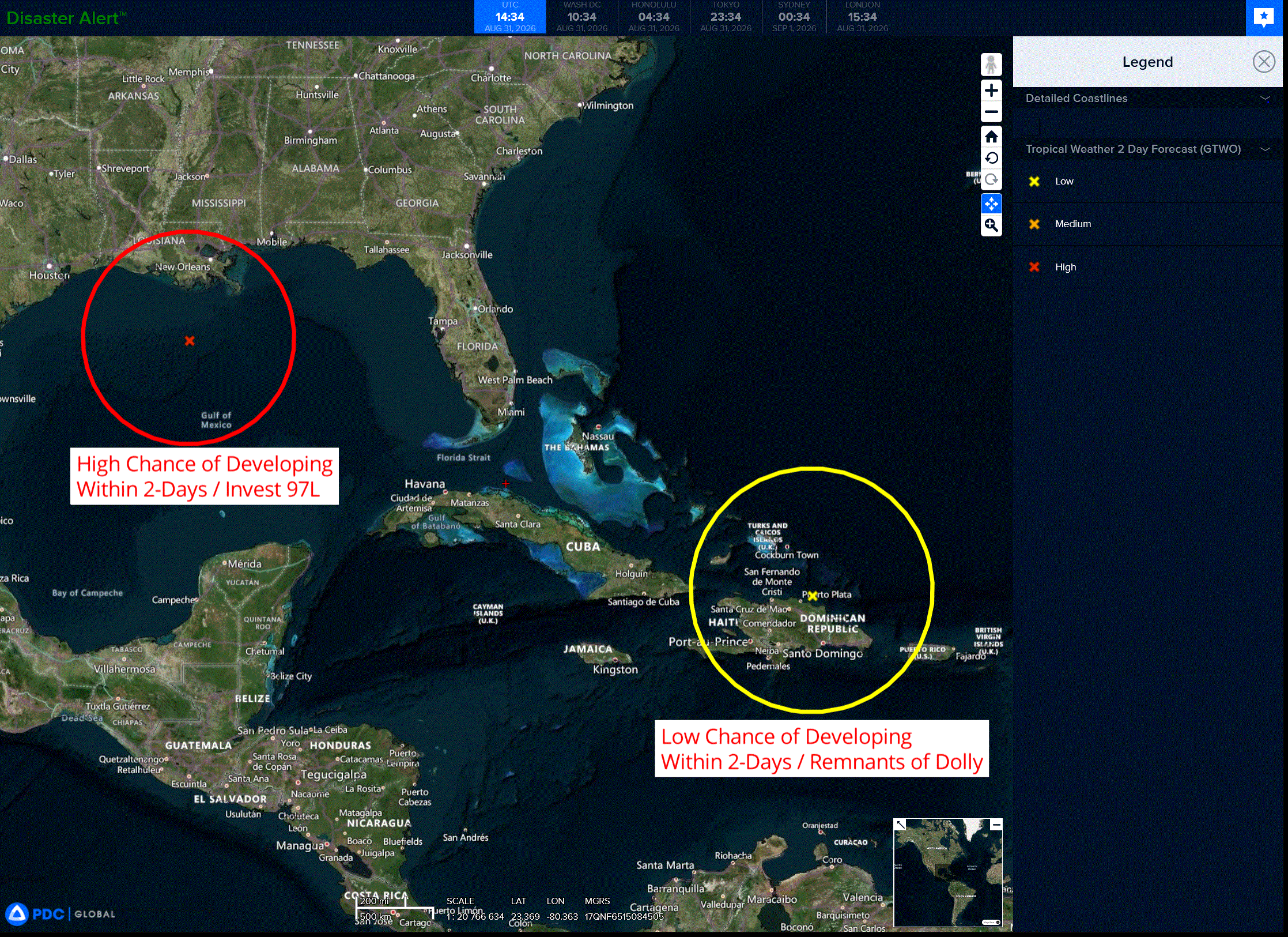
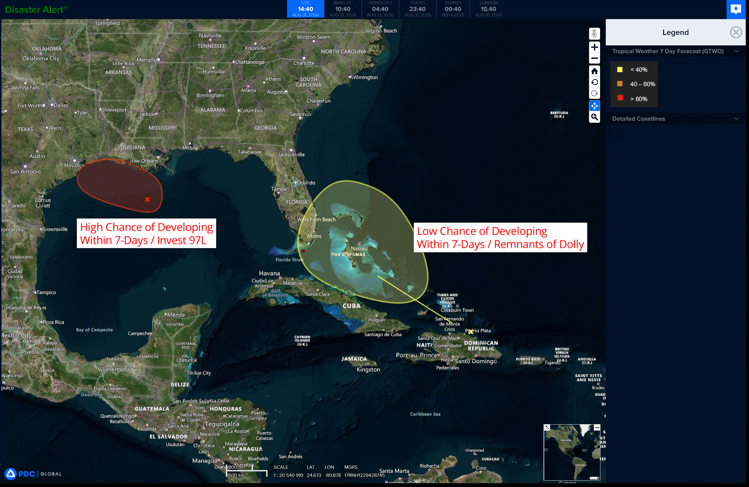
Remnants of Dolly
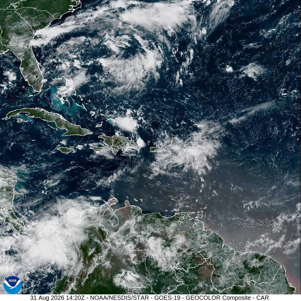
A surface trough of low pressure (the remnants of Tropical Storm Dolly) is producing a disorganized area of showers and thunderstorms that extends from near Hispaniola eastward to the northern Leeward Islands.
Redevelopment, if any, would be slow to occur during the next few days as the system encounters generally unfavorable upper-level winds while moving quickly west-northwestward at 20 to 25 mph.
Regardless, the system could bring locally heavy rains and gusty winds to portions of the Leeward Islands, the Virgin Islands, Puerto Rico, Hispaniola, and the Bahamas during the next couple of days.
* Formation chance through 48 hours…low…near 0 percent
* Formation chance through 7 days…low…10 percent
Gulf of America:
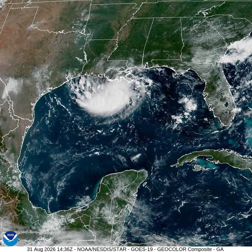
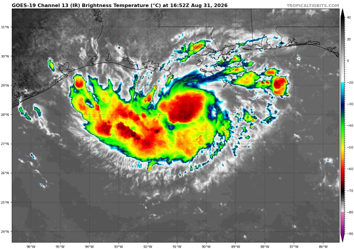
Potential Tropical Cyclone 05L…is located about 230 miles southeast of Port Arthur, Texas
TROPICAL STORM WARNING ISSUED FOR PORTIONS OF THE UPPER TEXAS AND SOUTHWESTERN LOUISIANA COAST
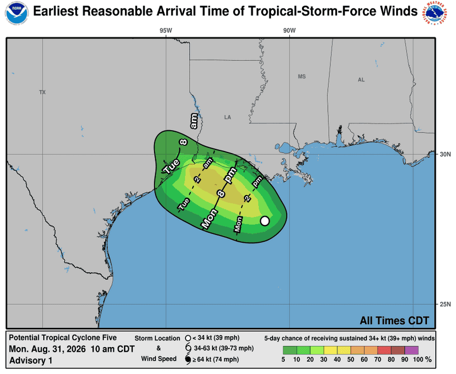
The system is moving toward the west-northwest near 5 mph, and this general motion is expected to continue for the next day or two. On the forecast track, the center of the system is predicted reach the northwestern Gulf Coast within the warning area on Tuesday. Maximum sustained winds are near 35 mph with higher gusts. Some strengthening is expected during the next day or so, and the system is forecast to become a tropical storm by tonight.
* Formation chance through 48 hours…high…80 percent
* Formation chance through 7 days…high…80 percent
HAZARDS AFFECTING LAND
WIND: Tropical storm conditions are expected to reach the coast within the warning area on Tuesday, making outside preparations difficult or dangerous.
STORM SURGE: The combination of storm surge and tide will cause normally dry areas near the coast to be flooded by rising waters moving inland from the shoreline. The water could reach the following heights above ground somewhere in the indicated areas if the peak surge occurs at the time of high tide…
High Island, TX to Vermilion/Iberia Parish Line, LA…1-3 ft
The deepest water will occur along the immediate coast near and to the east of the center. Surge-related flooding depends on the relative timing of the surge and the tidal cycle, and can vary greatly over short distances.
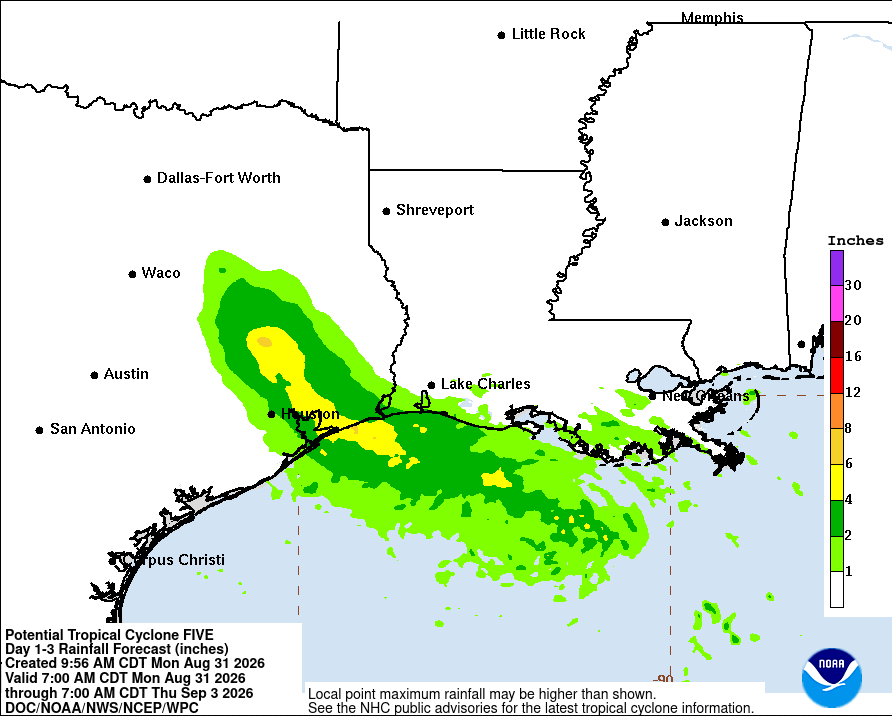
RAINFALL: PTC Five is expected to produce rainfall totals of 3 to 6 inches with maximum totals of 9 inches for parts of the Upper Texas Coast inland through east-central Texas, with 2 to 3 inches for Southwest Louisiana. This rainfall could produce flash flooding, especially in low-lying and urban areas.