
")
Current Snapshot
For all the latest updates visit: DisasterAWARE
zzzzz
jjjjj
By PDC’s Senior Weather
Specialist Glenn James

The Pacific Disaster Center’s (PDC Global) Tuesday, May 12, 2026, Tropical Cyclone Activity Report…for the Pacific Ocean, the Indian Ocean, and adjacent Seas
Current Tropical Cyclones:
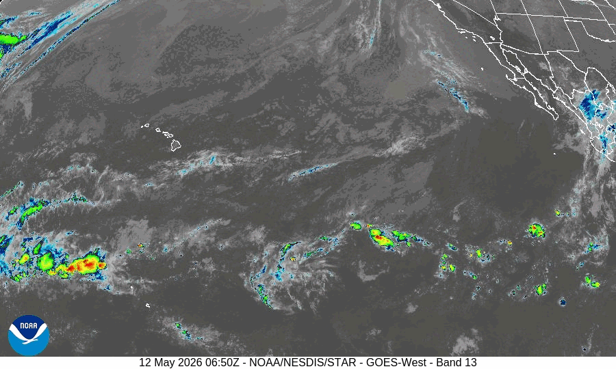
There are no Tropical Cyclones
Northeast Pacific Ocean: There are no Tropical Cyclones
The last regularly scheduled Tropical Cyclone Activity Report of the 2025 eastern North Pacific Hurricane Season has been issued. Routine issuance of this section of the PDC product will resume on May 15, 2026. During the off-season, Special Tropical Weather Outlooks will be issued as conditions warrant by the NHC.
Central Pacific Ocean: There are no Tropical Cyclones
The 2025 central North Pacific hurricane season has ended. As such, the final routine Tropical Cyclone Activity Report for the 2025 season has been issued. Routine issuance of this section of the PDC product will resume on June 1, 2026. During the off-season, Special Tropical Weather Outlooks will be issued as conditions warrant by the CPHC.
Western Pacific, Indian Ocean, and adjacent Seas: There are no Tropical Cyclones
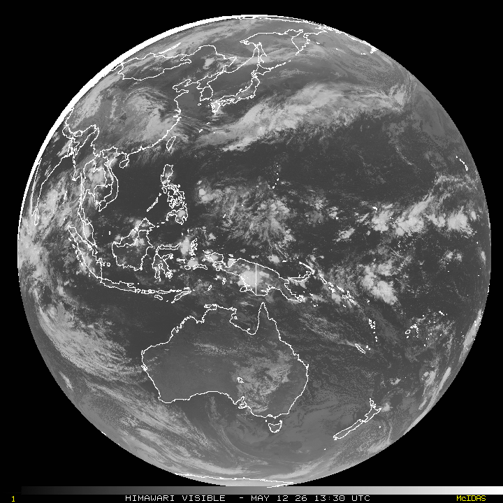
>>> There’s an area of disturbed weather being referred to as Invest 94S, which is located approximately 547 NM east-southeast of Diego Garcia.
Animated multi-spectral enhanced imagery depicts a consolidating low-level circulation, with formative banding along its northeastern periphery. A 121523z ascat (metop-b) pass reveals a broad surface circulation with a patch of 20 knots winds near the spiral band.
Environmental analysis reveals moderately favorable conditions for development with moderate northeasterly vertical wind shear (20-25 kts), warm sea surface temperatures (29-30 c), and moderate poleward outflow.
Global deterministic models depict some short-term development due to increasing poleward outflow as the system approaches a jet max towards the south. The gfs model is the most aggressive and brings the system to near tropical-storm intensity. Most members of gefs and ecens keep the system below criteria and agree on a general southeastward track over the next 24 to 48 hours.
Maximum sustained surface winds are estimated at 23 to 28 knots.
The potential for the development of a significant tropical cyclone within the next 24 hours is low.