
")
Current Snapshot
For all the latest updates visit: DisasterAWARE
cccc
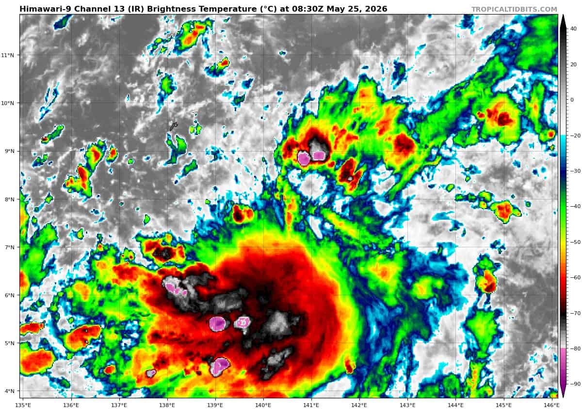
himawari9_ir_99W_202605250830_lat7.8-lon140.8

99W_tracks_latest
By PDC’s Senior Weather
Specialist Glenn James

The Pacific Disaster Center’s (PDC Global) Monday, May 25, 2026, Tropical Cyclone Activity Report…for the Pacific Ocean, the Indian Ocean, and adjacent Seas
Current Tropical Cyclones:
There are no Tropical Cyclones
Northeast Pacific Ocean: There are no Tropical Cyclones
Tropical cyclone formation is not expected during the next 7 days.
Central Pacific Ocean: There are no Tropical Cyclones
Western Pacific, Indian Ocean, and adjacent Seas: There are no Tropical Cyclones
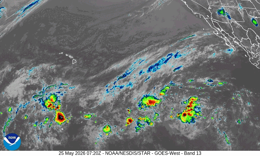
Western Pacific
>>> There’s an area of disturbed weather being referred to as Invest 99W, which is located approximately 76.4 NM south-southeast of Yap
Animated multi-spectral satellite imagery and a 262140z ssmis 91 ghz microwave image depict a broad, developing low-level circulation (llc) with flaring convection throughout the
southern periphery.
Environmental analysis reveals favorable conditions for development characterized by low vertical winds shear (10-15 kts), warm (29-30 c) sea surface temperatures, and weak poleward upper-level outflow.
Global models agree on the continued development of 99W over the next 24-48 hours with a north-northwestward track.
Maximum sustained surface winds are estimated at 18 to 23 knots.
The potential for the development of a significant tropical cyclone within the next 24 hours is upgraded to medium.