
")
Current Snapshot
For all the latest updates visit: DisasterAWARE
GOES18-TPW-13-900×540
99w
99W_261500sair
ffff
By PDC’s Senior Weather
Specialist Glenn James

The Pacific Disaster Center’s (PDC Global) Tuesday, May 26, 2026, Tropical Cyclone Activity Report…for the Pacific Ocean, the Indian Ocean, and adjacent Seas
Current Tropical Cyclones:
There are no Tropical Cyclones
Northeast Pacific Ocean: There are no Tropical Cyclones
Tropical cyclone formation is not expected during the next 7 days.
Central Pacific Ocean: There are no Tropical Cyclones
Western Pacific, Indian Ocean, and adjacent Seas: There are no Tropical Cyclones
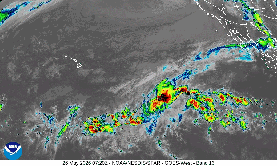
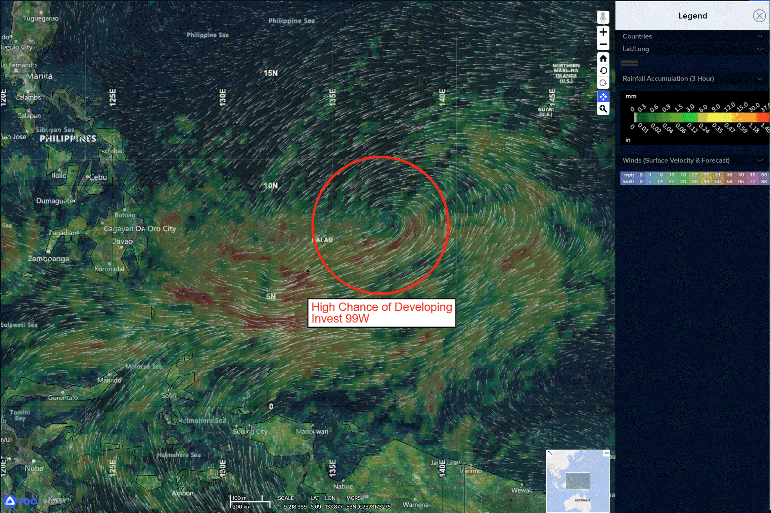
Western Pacific
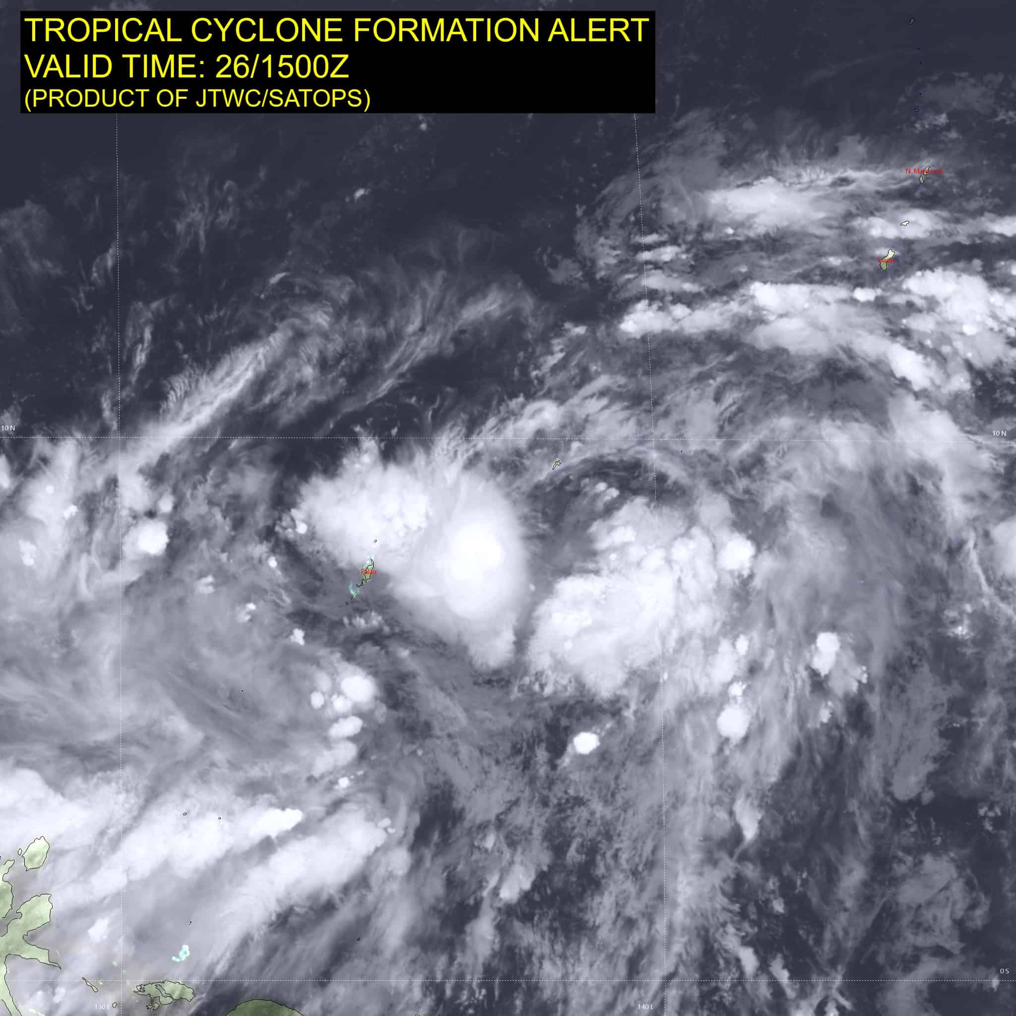
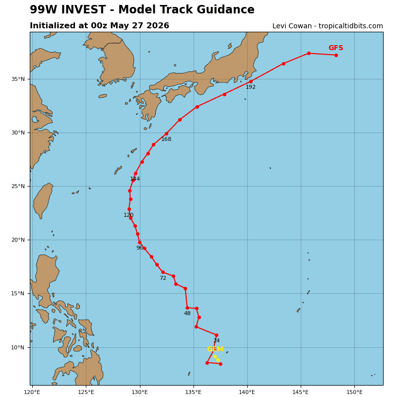
>>> There’s an area of disturbed weather being referred to as Invest 99W, which is located approximately 40 NM southwest of Yap
Animated multi-spectral (msi) and enhanced infrared (eir) satellite imagery depict a broad low level circulation center (llcc) with persistent convective banding along the southwestern periphery. The llcc remains ill-defined, and earlier microwave imagery and high-resolution model data suggests a misaligned vortex, which is inhibiting more rapid development.
The current intensity is assessed as 25 kts, however the wind field is highly asymmetric, and the 25 kt winds are currently limited to a more linear flow along the southern periphery of the circulation.
Environmental analysis reveals a favorable environment for development with moderate equatorward and poleward upper-level outflow, low deep-layer wind shear (10-15 kts), and warm sea
surface temperatures (29-30 c).
Global ensemble and deterministic models show 99W tracking generally northwestward as it continues to undergo consolidation and intensification over the next 24 hours.
Maximum sustained surface winds are estimated at 23 to 26 knots.
The potential for the development of a significant tropical cyclone within the next 24 hours remains high.