

Current Snapshot
For all the latest updates visit: DisasterAWARE
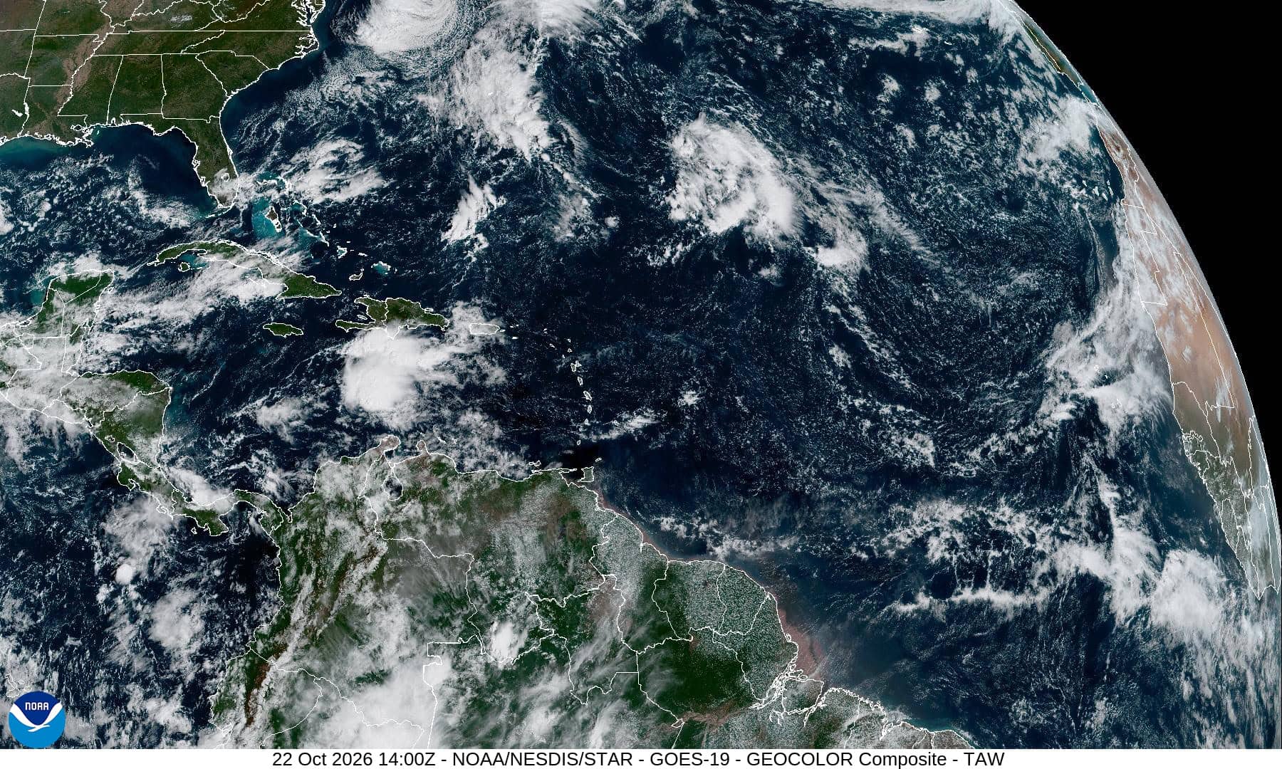
a
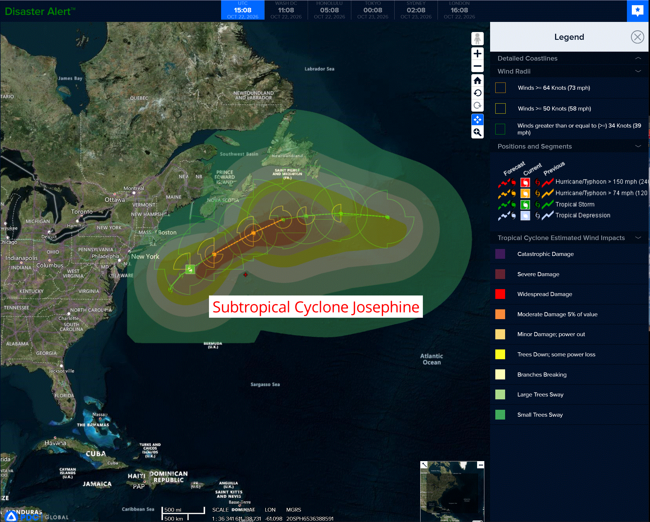
jos
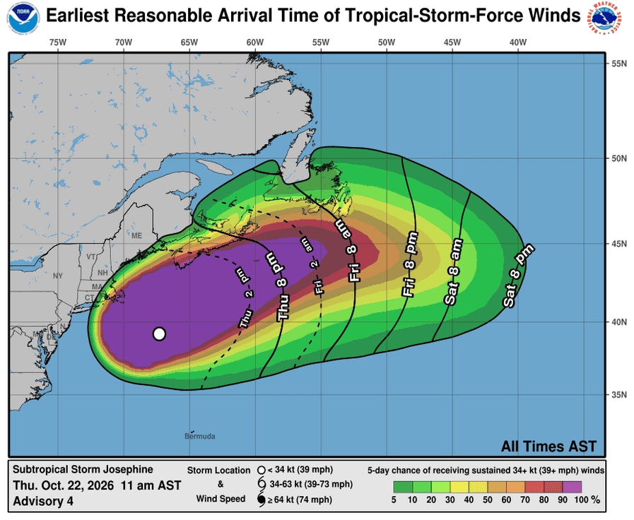
221435_earliest_reasonable_toa_34

1000×1000
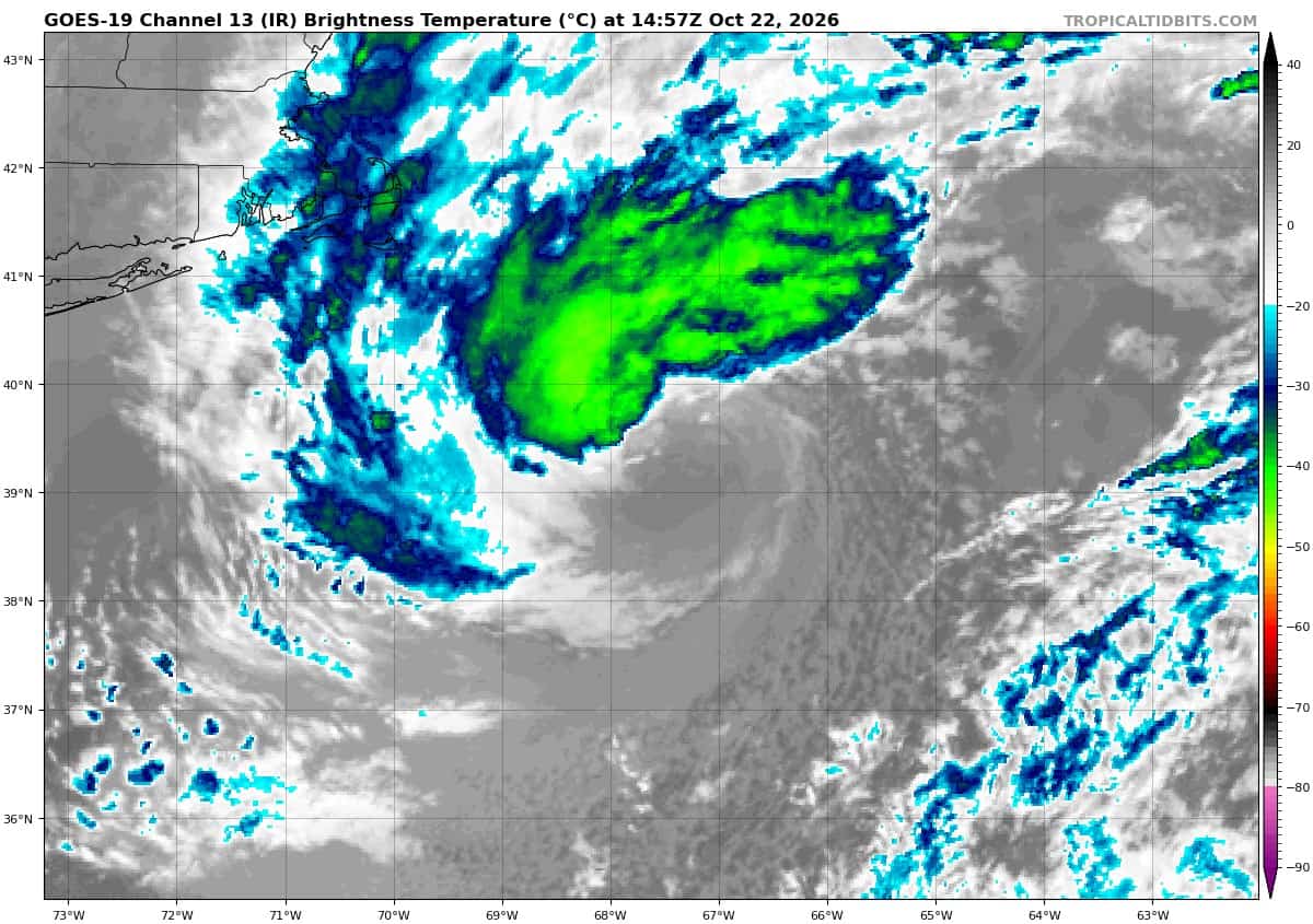
goes19_ir_10L_202610221457_lat38.9-lon-68.0
2a
7a
By PDC’s Senior Weather
Specialist Glenn James

The Pacific Disaster Center’s (PDC Global) Thursday, October 22, 2026, Tropical Cyclone Activity Report…for the Atlantic Ocean, the Caribbean Sea, and the Gulf of America
Current Tropical Cyclones:
Subtropical Cyclone Josephine is located about 420 miles south-southwest of Halifax, Nova Scotia
Atlantic Ocean:
Subtropical Cyclone Josephine
JOSEPHINE MOVING NORTHEASTWARD ACROSS THE NORTHWESTERN ATLANTIC …EXPECTED TO BECOME A POWERFUL EXTRATROPICAL CYCLONE THIS AFTERNOON OR TONIGHT
According to the NHC advisory number 4
The storm is moving toward the northeast near 12 mph (19 km/h), and this motion, along with an increase in forward speed, is expected to continue into tonight. A gradual turn toward the east is forecast on Friday and into the weekend.
On the forecast track, Josephine should move away from the United States and remain south of Nova Scotia and Newfoundland during the next couple of days.
Maximum sustained winds are near 65 mph (100 km/h) with higher gusts. Some additional strengthening is forecast through the day today while Josephine begins to transition to an extratropical cyclone. Josephine is expected to become a powerful extratropical cyclone with hurricane-force winds tonight or early Friday.
Winds of 40 mph extend outward up to 415 miles (665 km) from the center. The estimated minimum central pressure is 988 mb (29.18 inches).
HAZARDS AFFECTING LAND
WIND: Gale-force winds are possible in gusts along portions of the northeastern United States coast through today.
COASTAL FLOODING: Minor to locally moderate coastal flooding is ongoing along portions of the U.S. Mid-Atlantic coast and will continue through the rest of the week around times of high tide.
SURF: Large swells generated by Josephine are affecting much of the eastern seaboard of the United States and portions of Atlantic Canada. These swells are likely to cause life-threatening surf and rip current conditions.
>>> Subtropical Central Atlantic:
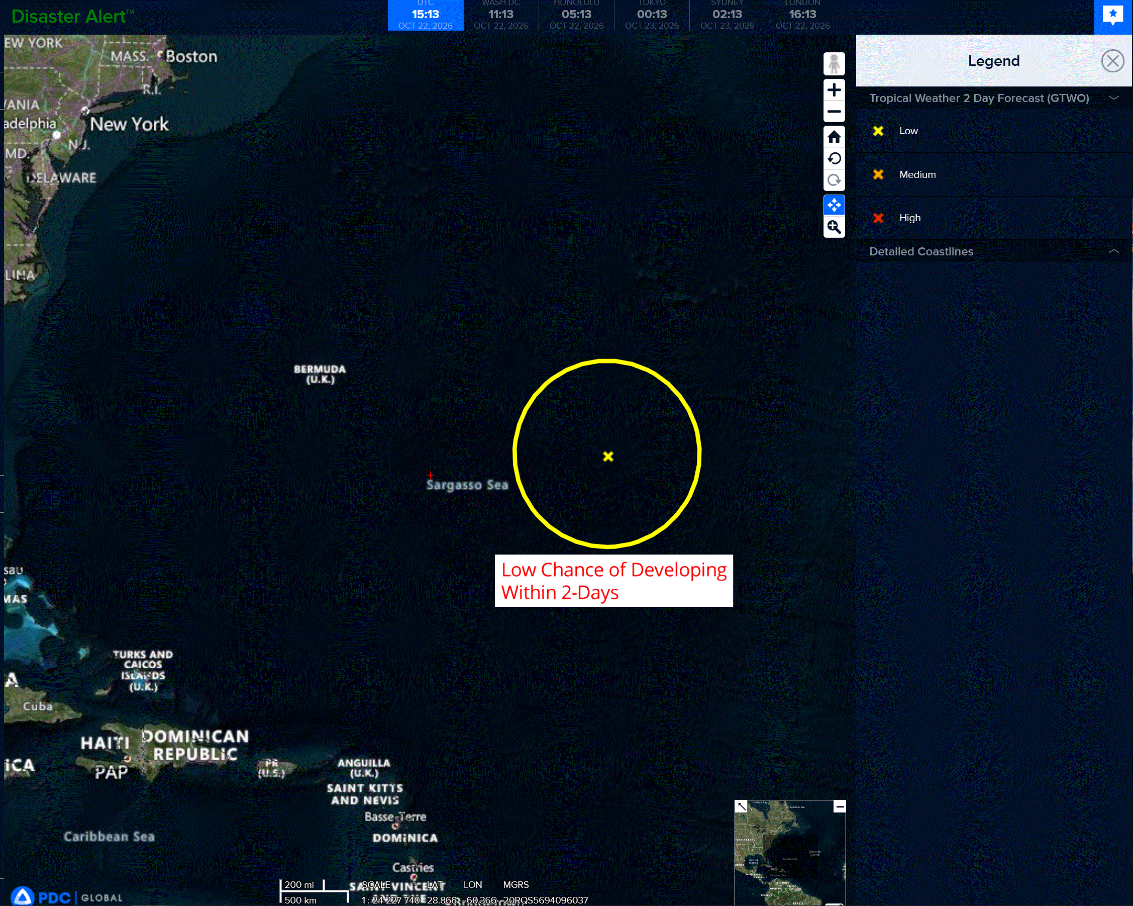
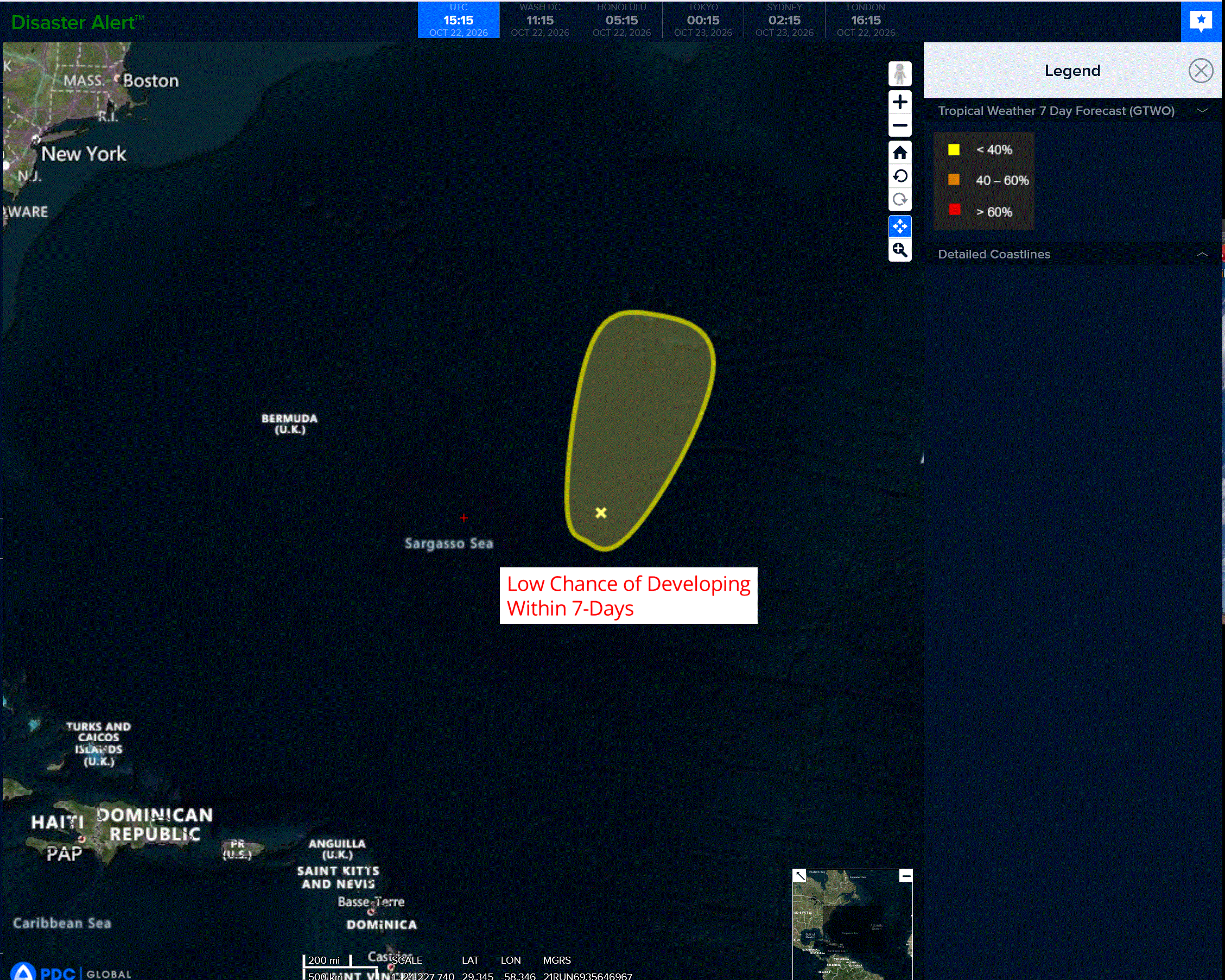
A trough of low pressure located several hundred miles to the east-southeast of Bermuda is producing a large area of disorganized showers and thunderstorms.
Some development of this system is possible during the next day or two while it moves slowly north-northeastward.
Upper-level winds are forecast to become too strong for further development by the weekend.
* Formation chance through 48 hours…low…10 percent
* Formation chance through 7 days…low…10 percent
Caribbean Sea: There are no active tropical cyclones
Tropical cyclone formation is not expected during the next 7 days.
Gulf of America: There are no active tropical cyclones
Tropical cyclone formation is not expected during the next 7 days.