

Current Snapshot
For all the latest updates visit: DisasterAWARE
1800x1080ec
marie
goes18_ir_13E_202609081445_lat25.5-lon-127.1
13E_tracks_latest
2
7
lowell
close
081447_earliest_reasonable_toa_34
goes18_ir_12E_202609081445_lat23.0-lon-160.7
081447WPCQPF_sm
12E_tracks_latest
k
22W_081200sair
himawari9_ir_22W_202609081430_lat31.9-lon133.1
22W_tracks_latest
By PDC’s Senior Weather
Specialist Glenn James

The Pacific Disaster Center’s (PDC Global) Tuesday, September 8, 2026, Tropical Cyclone Activity Report…for the Pacific Ocean, the Indian Ocean, and adjacent Seas.
Tropical Cyclones
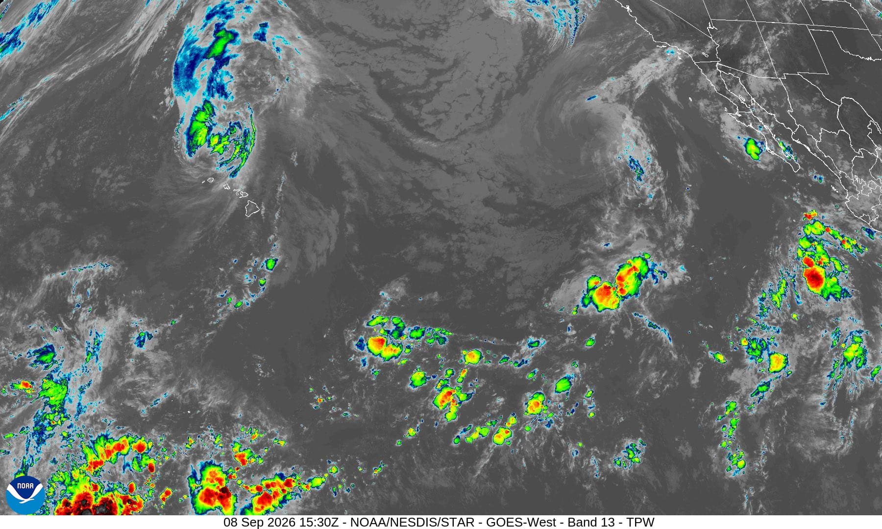
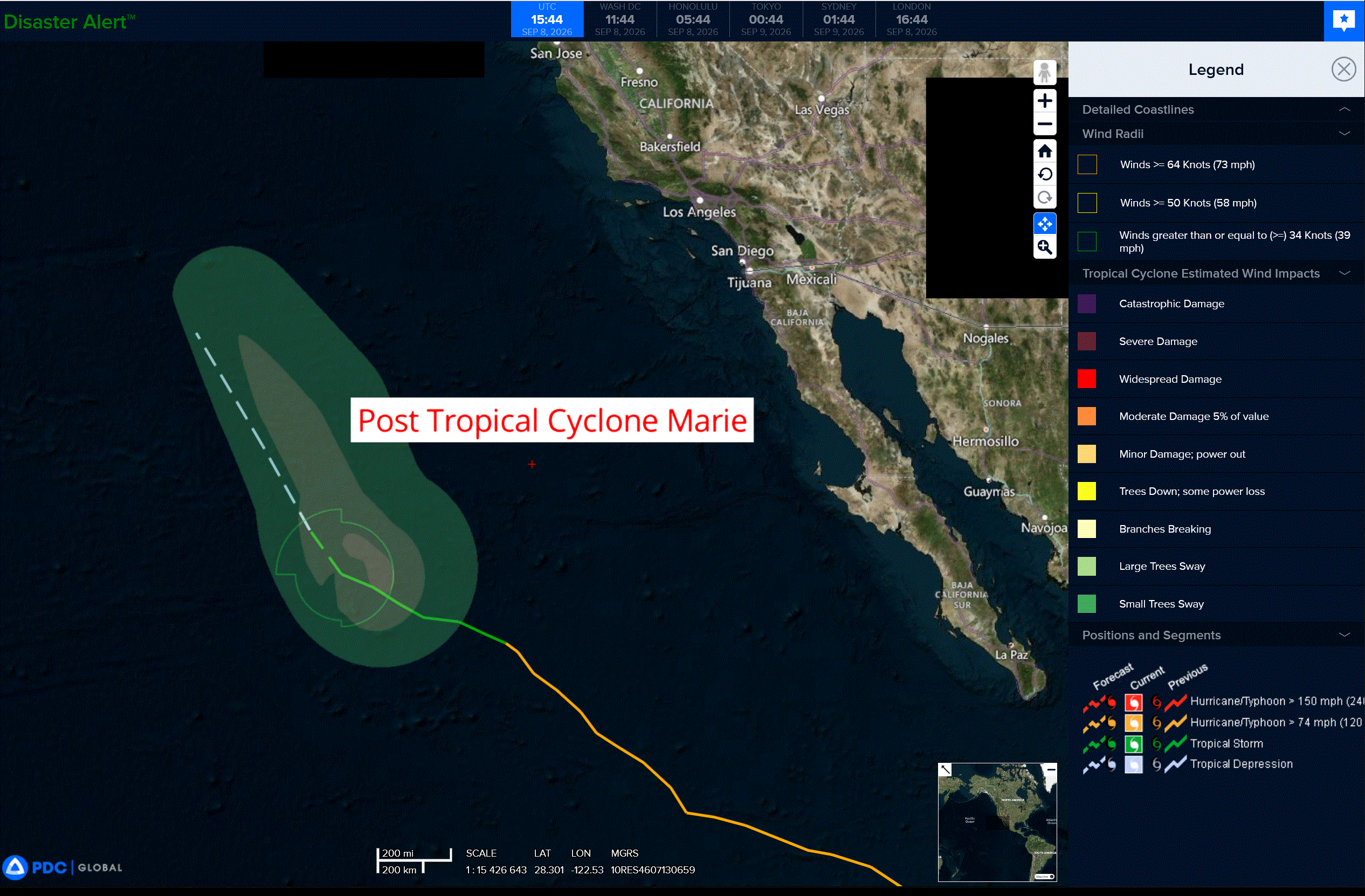
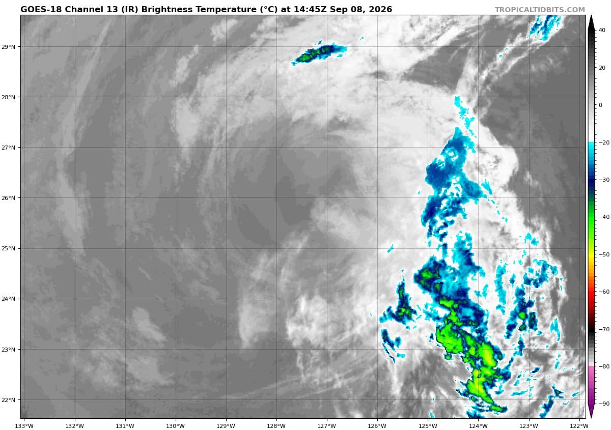
Post-Tropical Cyclone 13E (Marie) is located about 780 miles southwest of San Diego, California – Last Advisory
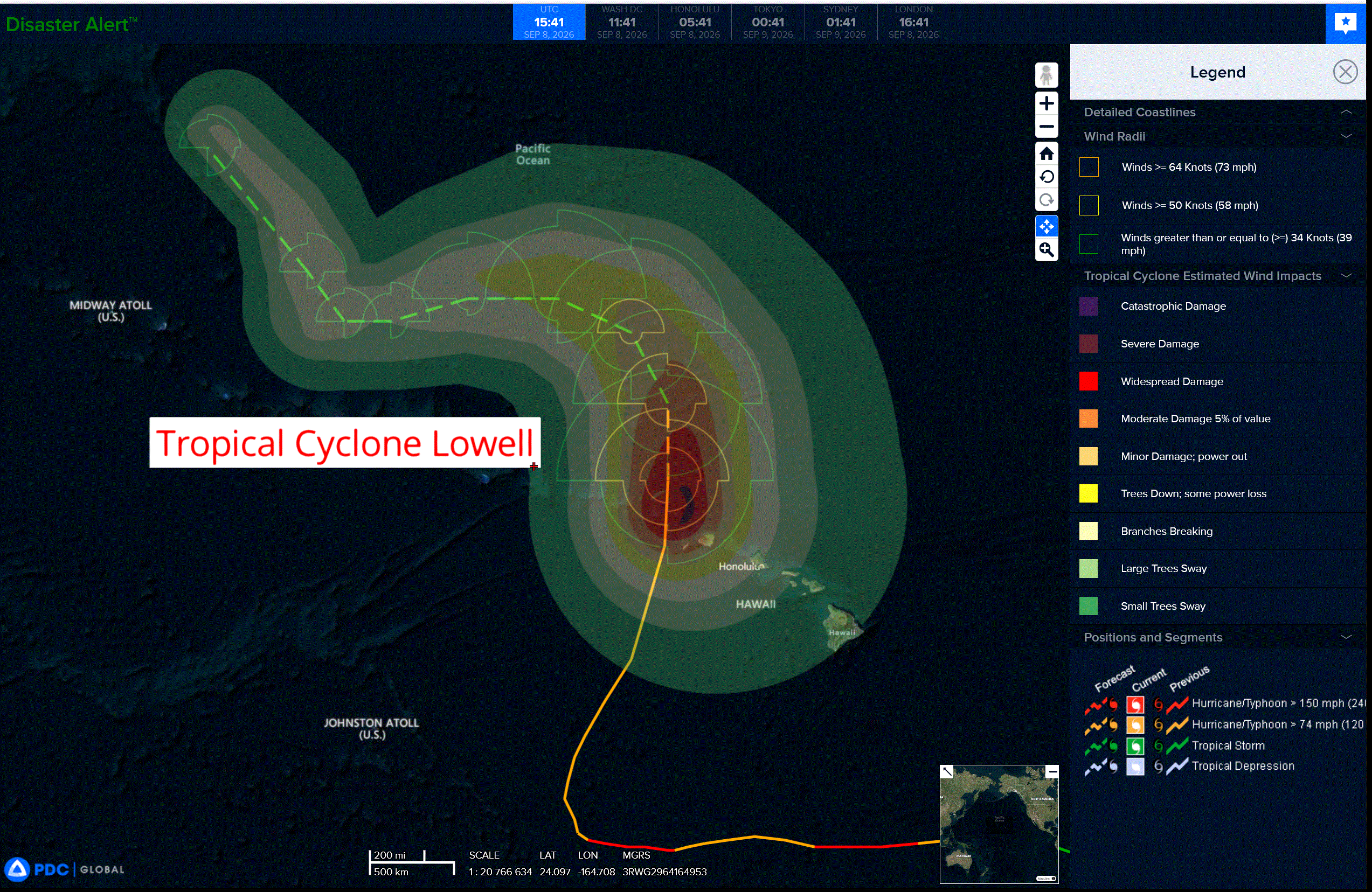
Tropical Cyclone 12E (Lowell) is located about 145 miles northwest of Lihue, Hawaii
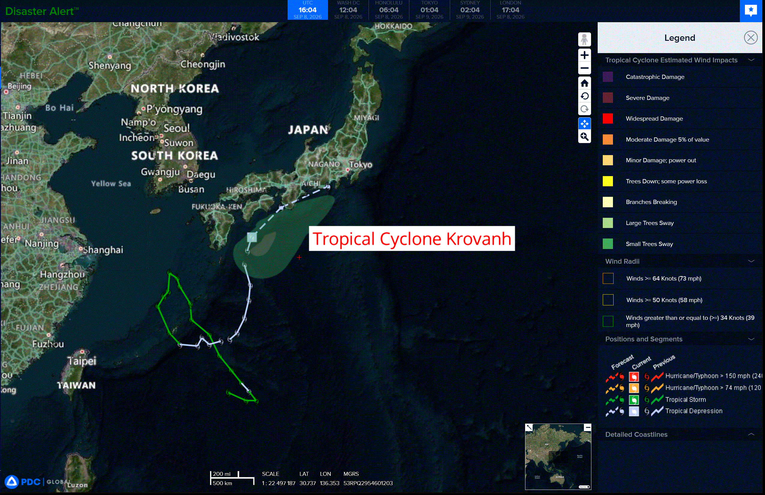
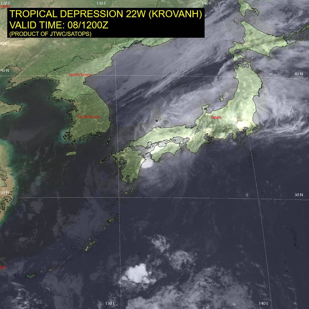
Tropical Cyclone 22W (Krovanh) is located approximately 153 miles south-southeast of Iwakuni, Japan
Northeast Pacific:
Post-Tropical Cyclone 13E (Marie) – Last Advisory
MARIE BECOMES A POST TROPICAL CYCLONE
According to the NHC advisory number 30…
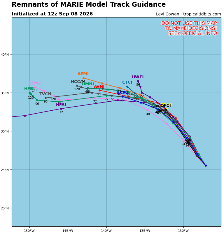
The post-tropical cyclone is moving toward the west-northwest near 9 mph (15 km/h) and is forecast to turn to the northwest over the next day or so. Maximum sustained winds are near 40 mph (65 km/h) with higher gusts. Steady weakening is expected to continue, and Marie is forecast to dissipate in a couple of days. Tropical-storm-force winds extend outward up to 115 miles (185 km) from the center. The estimated minimum central pressure is 1000 mb (29.53 inches).
HAZARDS AFFECTING LAND
SURF: Swells generated by Marie will continue to affect portions of the coast of the Baja California Peninsula and southern California for the next couple of days. These swells are likely to cause life-threatening surf and rip current conditions.
>>> Offshore of Southwestern Mexico:
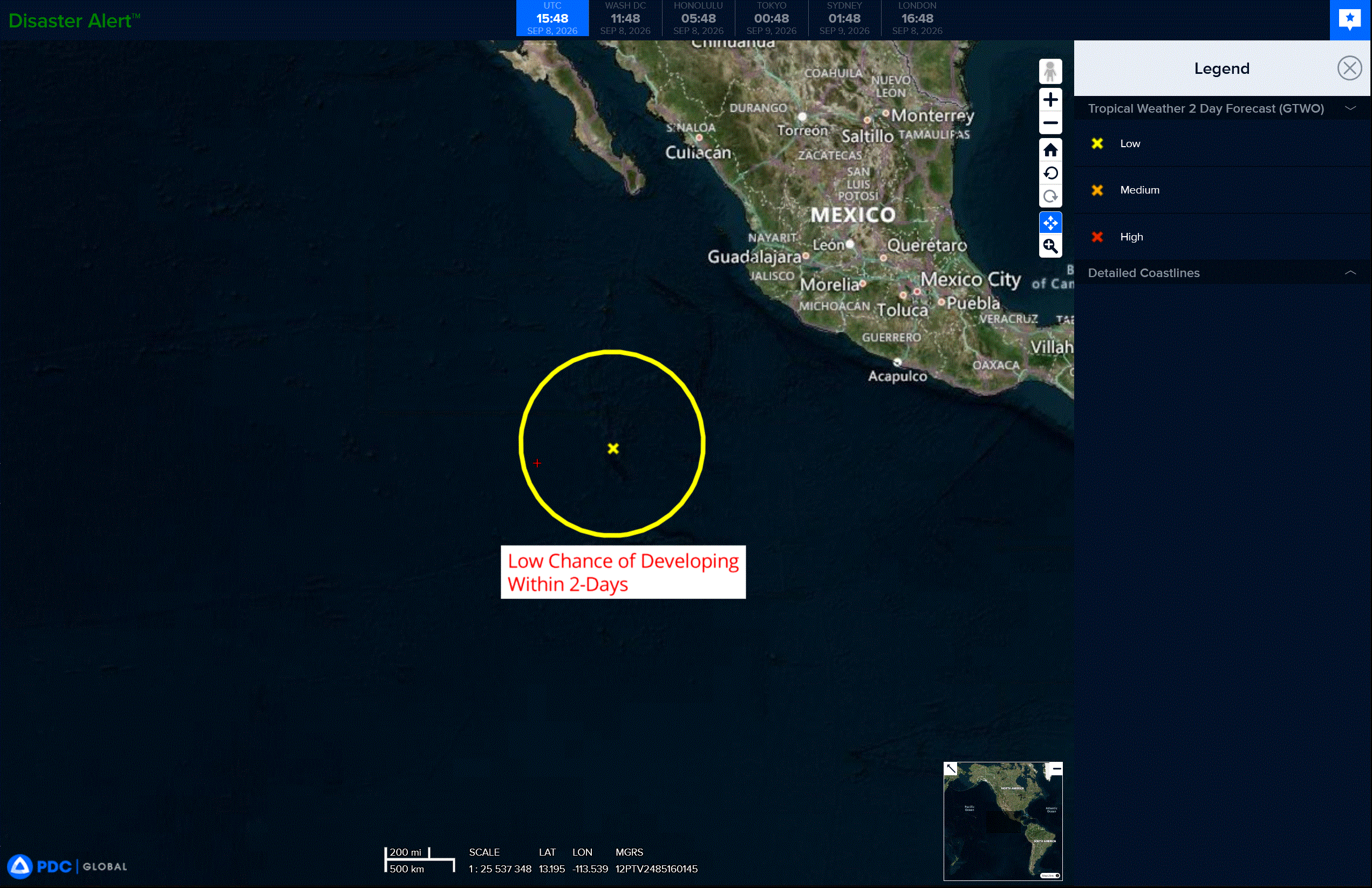
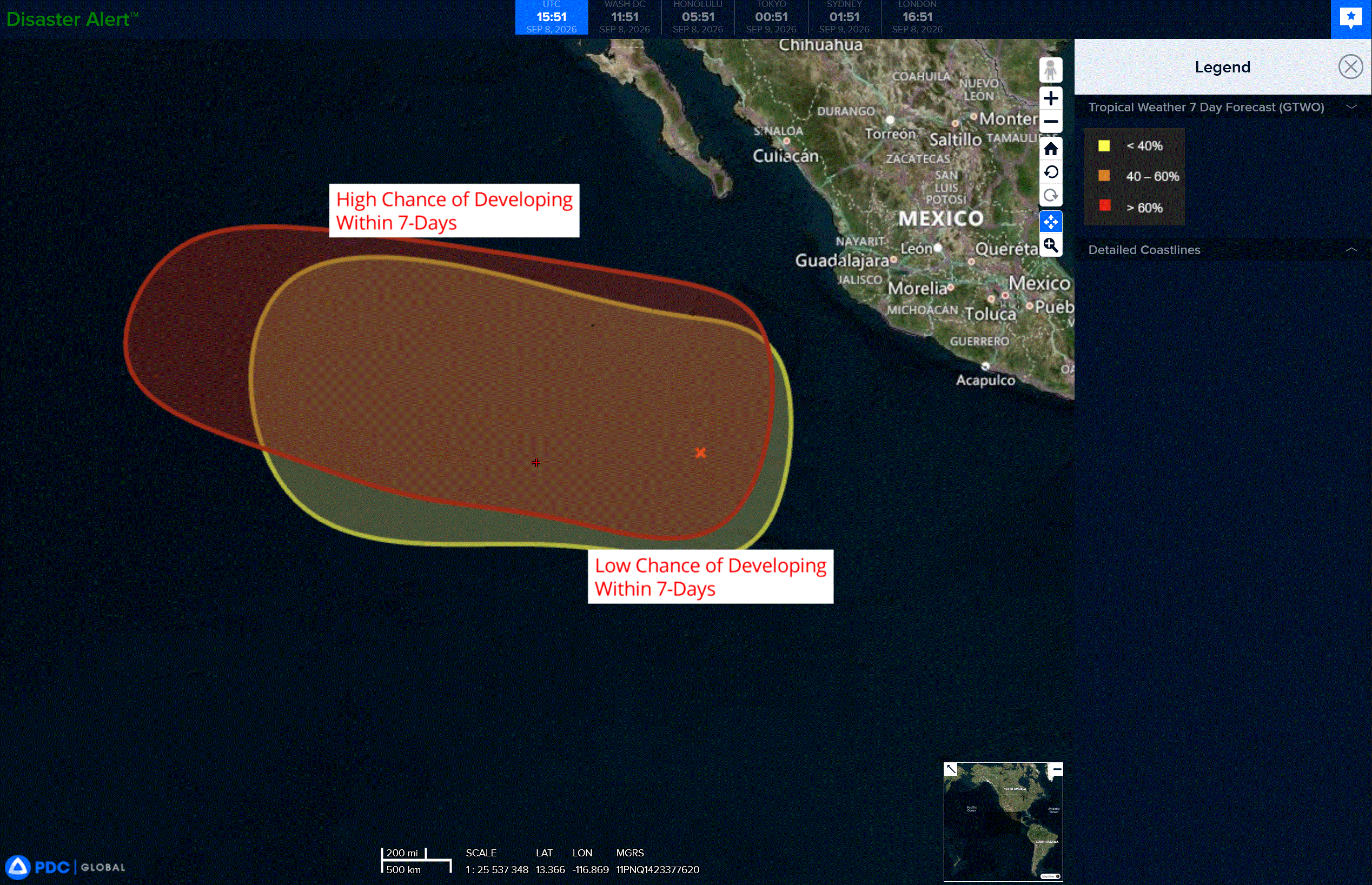
Showers and thunderstorms associated with a broad area of low pressure located several hundred miles southwest of southwestern Mexico are showing signs of organization. Gradual development of this system is likely, and a tropical depression is expected to form later this week while the system moves generally west-northwestward at 10 to 15 mph.
* Formation chance through 48 hours…low…20 percent
* Formation chance through 7 days…high…70 percent
>>> Well south of the southern tip of Baja California:
An area of low pressure is forecast to develop several hundred miles south of the southern tip of Baja California this weekend or early next week. Some slow development is possible as this system moves generally west-northwestward.
* Formation chance through 48 hours…low…0 percent
* Formation chance through 7 days…low…20 percent
Central North Pacific:
Tropical Cyclone 12E (Lowell)
FLASH FLOODING IN THE HAWAIIAN ISLANDS CONTINUES WITH LOWELL
According to the NHC advisory number 50…
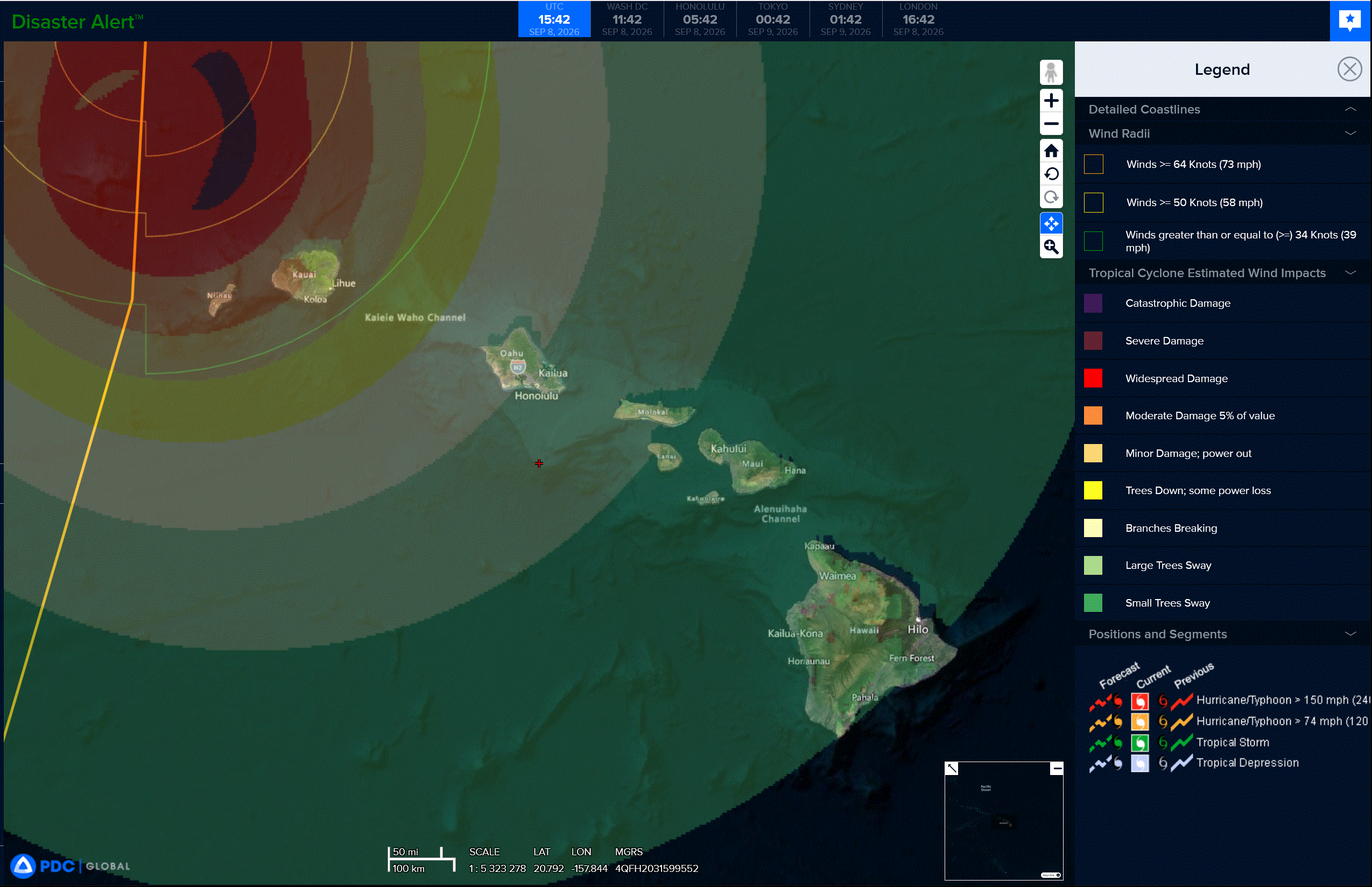
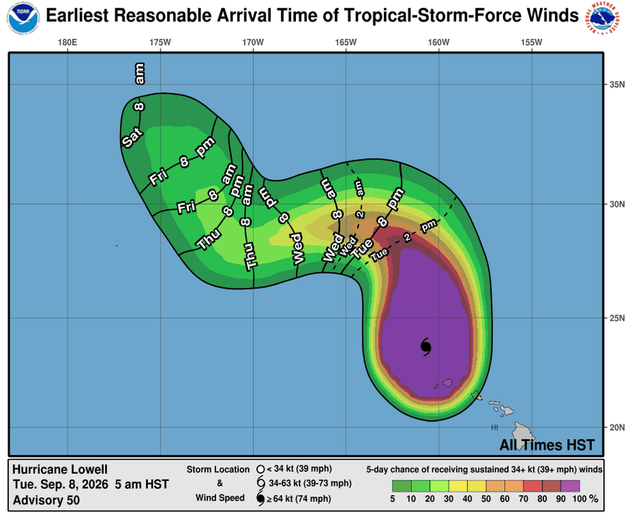
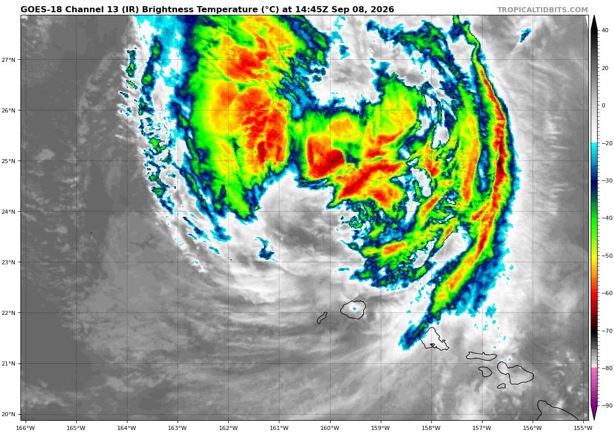
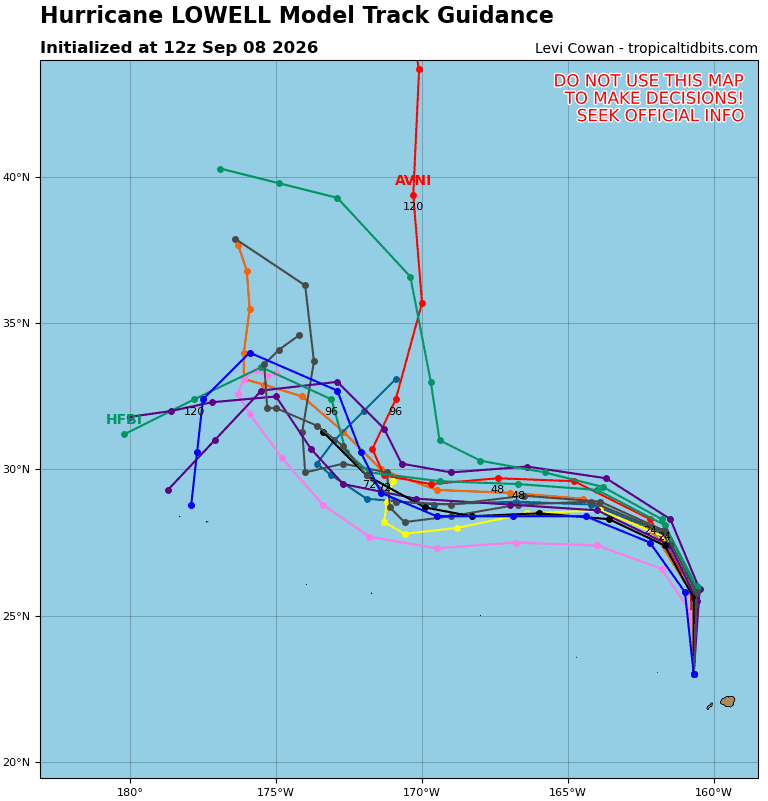
Lowell is moving toward the north near 18 mph (30 km/h). This general motion is forecast through today, taking the core of Lowell farther from Kauai County. Lowell is then forecast to turn toward the northwest and west and slow down on Wednesday and Thursday after passing the main Hawaiian Islands. Maximum sustained winds have decreased to near 90 mph (150 km/h) with higher gusts. Weakening is forecast, and Lowell should become a tropical storm later today and continue to weaken for the next couple of days. Hurricane-force winds extend outward up to 70 miles (110 km) from the center and tropical-storm-force winds extend outward up to 230 miles (370 km). Lihue Airport (PHLI) along the southeastern coast of Kauai recently reported sustained winds of 35 mph (56 km/h) with a gust to 47 mph (76 km/h). The estimated minimum central pressure is 967 mb (28.56 inches).
HAZARDS AFFECTING LAND
WIND: Hurricane conditions are occuring across portions of Kauai County. Wind speeds atop and on the windward and leeward sides of hills and mountains are often up to 30 percent stronger than the near-surface winds. Tropical storm conditions, especially in gusts, are occurring on Oahu.
Hurricane conditions are ongoing in the Papahanaumokuakea Marine National Monument between Nihoa and French Frigate Shoals.
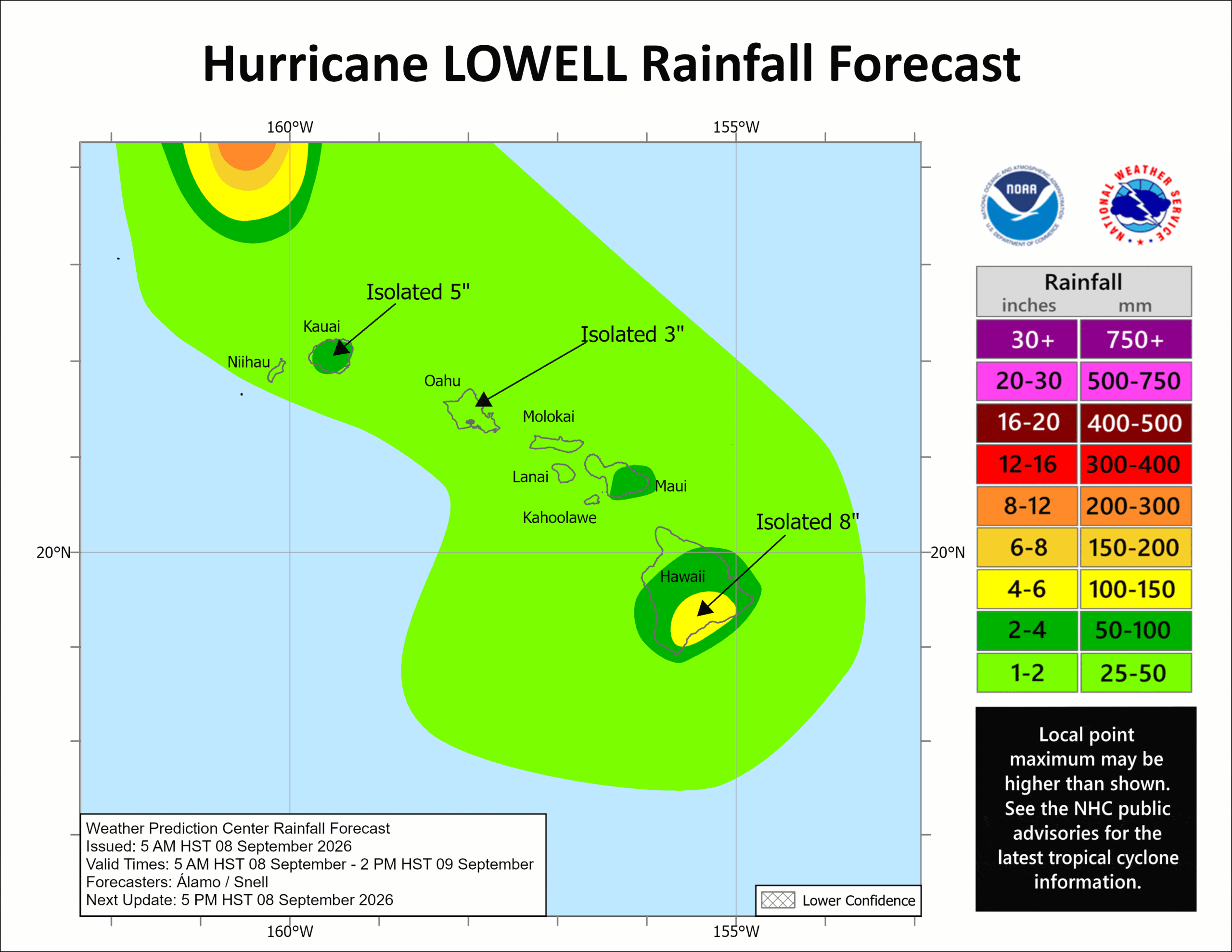
RAINFALL: Hurricane Lowell is expected to produce additional rainfall totals of 2 to 4 inches for Kauai, with maximum storm totals of 24 inches possible. For the Big Island, an additional 3 to 6 inches of rain is expected with isolated storm totals of 8 inches possible. For Oahu and Maui counties, an additional 1 to 3 inches of rain is expected with isolated storm totals of 8 inches possible. This rainfall may produce significant flash flooding and mudslides, especially across Kauai county and portions of the Big Island.
STORM SURGE: Water levels may remain elevated along the coasts of Niihau, Kauai, and Oahu due
SURF: Swells from Lowell will continue to generate life-threatening surf and rip current conditions during the next few days across many of the Hawaiian Islands.
Western Pacific, Indian Ocean, and adjacent Seas:
Western Pacific
Tropical Cyclone 22W (Krovanh)
According to the JTWC warning number 30…sustained winds were 30 knots with gusts to 40 knots
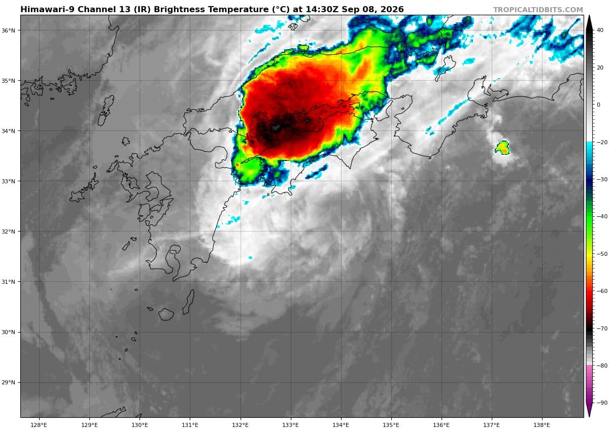
Animated enhanced infrared (eir) satellite imagery depicts tropical depression 22W (Krovanh) with a fully exposed low-level circulation center (llcc) that is now nearly completely void of deep convection. A 081115z metop-b ascat pass revealed a defined center with 30-knot winds along the western and eastern portions of the circulation.
Environmental analysis indicates that 22W remains placed within an unfavorable environment characterized by strong poleward outflow aloft and warm (28-29 c) sea surface temperatures greatly offset by moderate to high (20-25 kts) southerly vertical wind shear and extensive dry air entrainment.
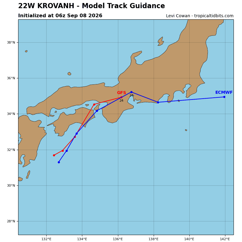
TD 22W has started on its northeastward turn over the past 6 hours, which is expected to become more
east-northeastward over the next 12 hours as the system continues to round the str. Near 12 hours, the system will skirt the southern coast of Japan, near the Shikoku and Kansai regions with increasing
track speeds. 22W will be heavily impacted by the stationary frontal boundary that is currently draped across Honshu, causing the circulation to become stretched and likely move unpredictably.
In terms of intensity, 22W is forecast to begin weakening as it approaches the coast due primarily to significantly increasing southwesterly vertical wind shear (over 40 kts). Once the system begins to interact with the mountainous terrain of Japan, 22W will quickly weaken with dissipation expected to occur around 24 hours.
Even though the vortex associated with 22W likely becomes absorbed within the frontal boundary, localized areas of enhanced winds may persist in areas such as Wakayama Bay and Ise Bay due to topographic funneling effects.