
")
Current Snapshot
For all the latest updates visit: DisasterAWARE
2
77
e
c
wpac
07W_271200sair
95w
himawari9_ir_95W_202606271520_lat5.3-lon168.3
95W_tracks_latest
By PDC’s Senior Weather
Specialist Glenn James

The Pacific Disaster Center’s (PDC Global) Saturday, June 27, 2026, Tropical Cyclone Activity Report…for the Pacific Ocean, the Indian Ocean, and adjacent Seas
Current Tropical Cyclones:
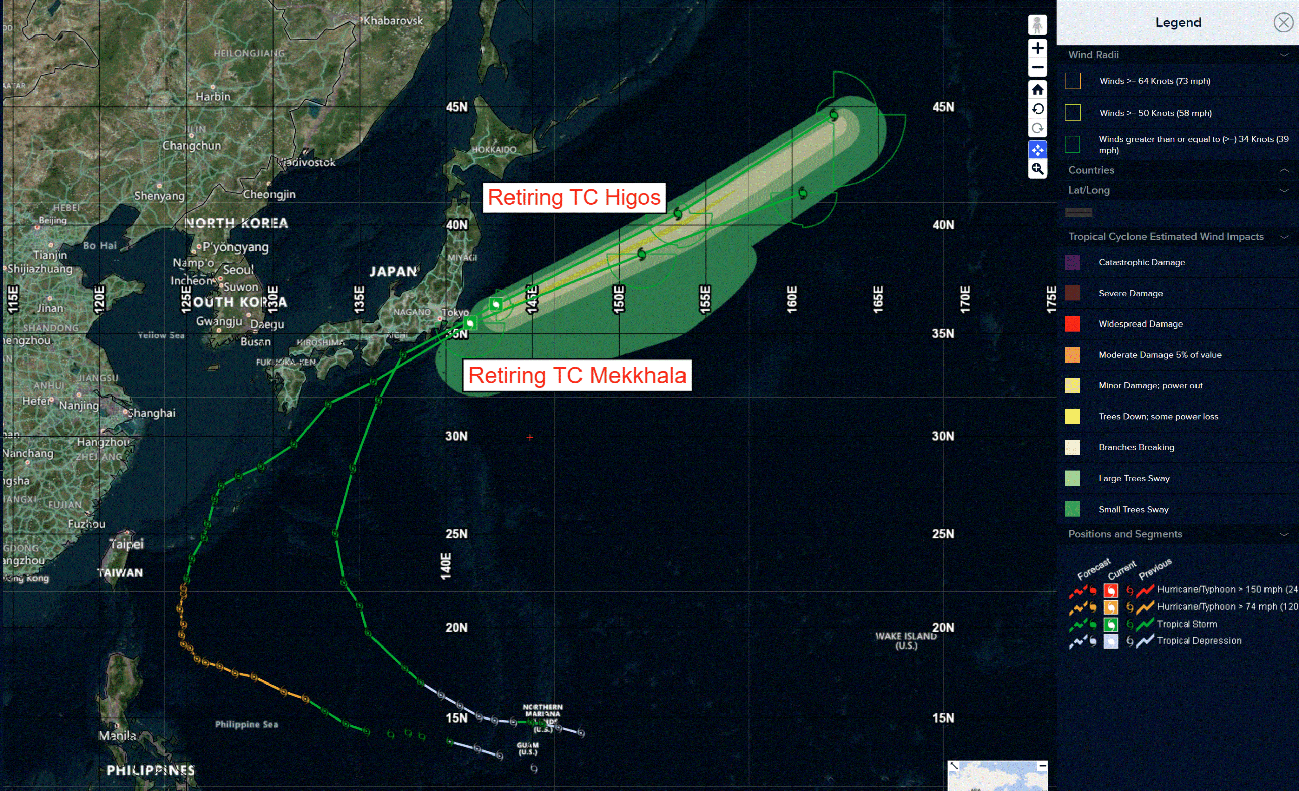
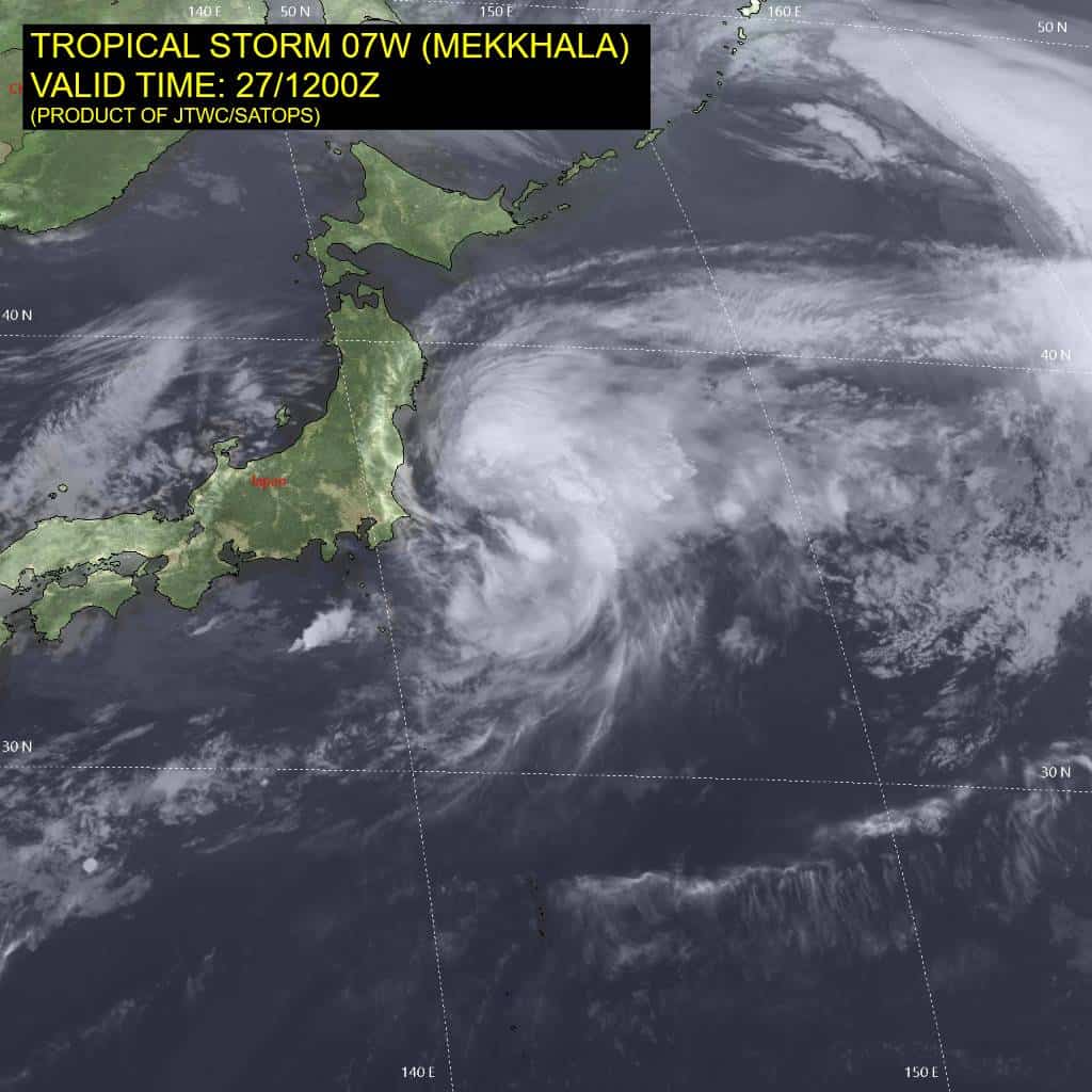
Tropical Cyclone 07W (Mekkhala)…is located 84 NM east of Yokosuka, Japan – Final Warning
Northeast Pacific Ocean: There are no Tropical Cyclones
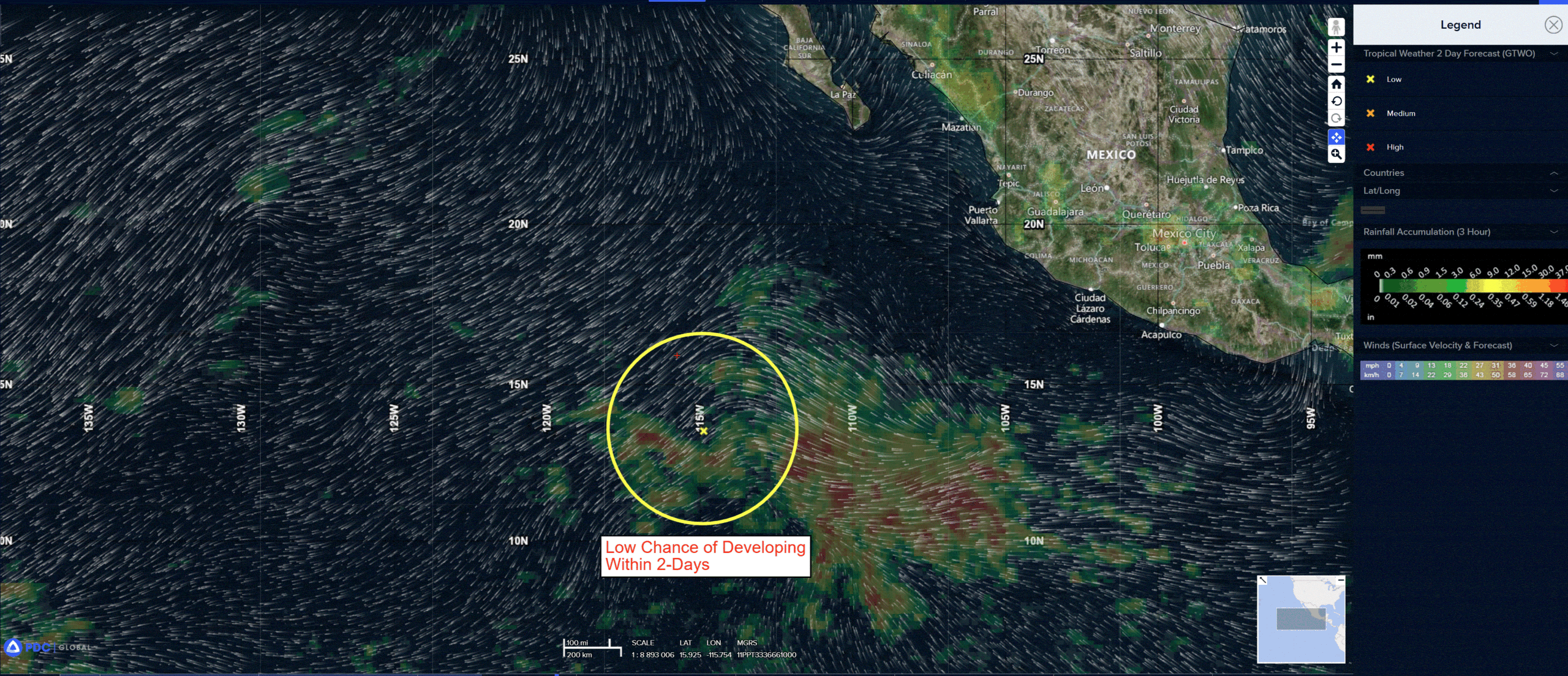
Central and western East Pacific:
>>> Showers and thunderstorms associated with a tropical wave located several hundred miles southwest of the southern tip of the Baja California Peninsula remain disorganized. Gradual development of this system is possible during the next few days, and a tropical depression could form around the middle of next week while the wave moves generally westward to west-northwestward. Environmental conditions are forecast to become less conducive for development by the second half of the week as the system moves over the western portion of the eastern North Pacific.
* Formation chance through 48 hours…low…10 percent
* Formation chance through 7 days…medium…50 percent
Central Pacific Ocean: There are no Tropical Cyclones
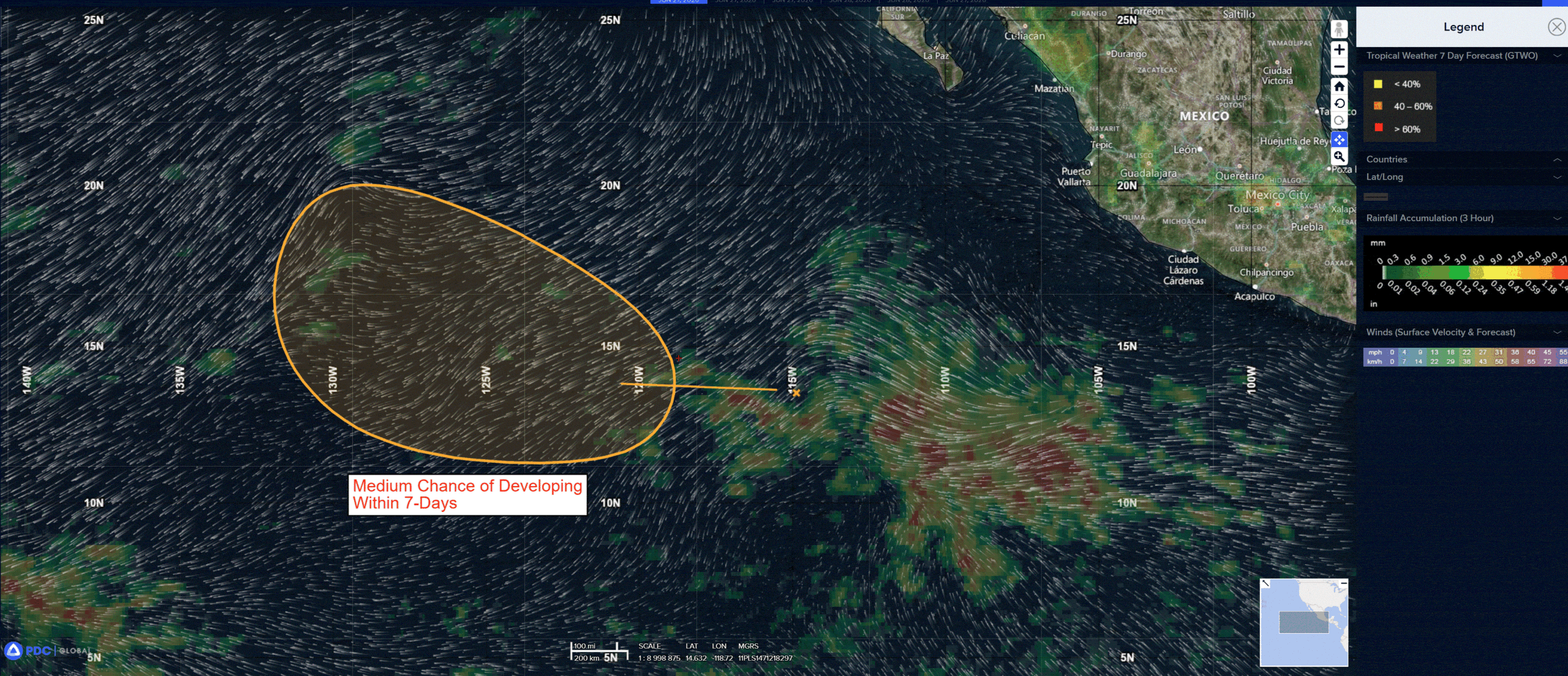
Central and western East Pacific:
>>> Showers and thunderstorms associated with a tropical wave located several hundred miles southwest of the southern tip of the Baja California Peninsula remain disorganized. Gradual development of this system is possible during the next few days, and a tropical depression could form around the middle of next week while the wave moves generally westward to west-northwestward. Environmental conditions are forecast to become less conducive for development by the second half of the week as the system moves over the western portion of the eastern North Pacific.
* Formation chance through 48 hours…low…10 percent
* Formation chance through 7 days…medium…50 percent
Western Pacific, Indian Ocean, and adjacent Seas:
Western Pacific
Tropical Cyclone 07W (Mekkhala) – Final Warning
According to the JTWC Warning number 36…sustained winds are 40 knots with gusts to 50 knots
Animated enhanced infrared satellite imagery depicts a highly elongated low-level circulation center with convection heavily sheared off to the east. The system is rapidly undergoing extratropical transition that is expected to complete within the next 12 hours. 07W is forecast to continue
tracking quickly east-northeastward, along the northern extent of a subtropical ridge, through 24 hours.
The intensity is forecast to be maintained over the next 12 hours before gradual weakening as the system interacts with a large frontal system located to the south of the Kamchatka Peninsula.
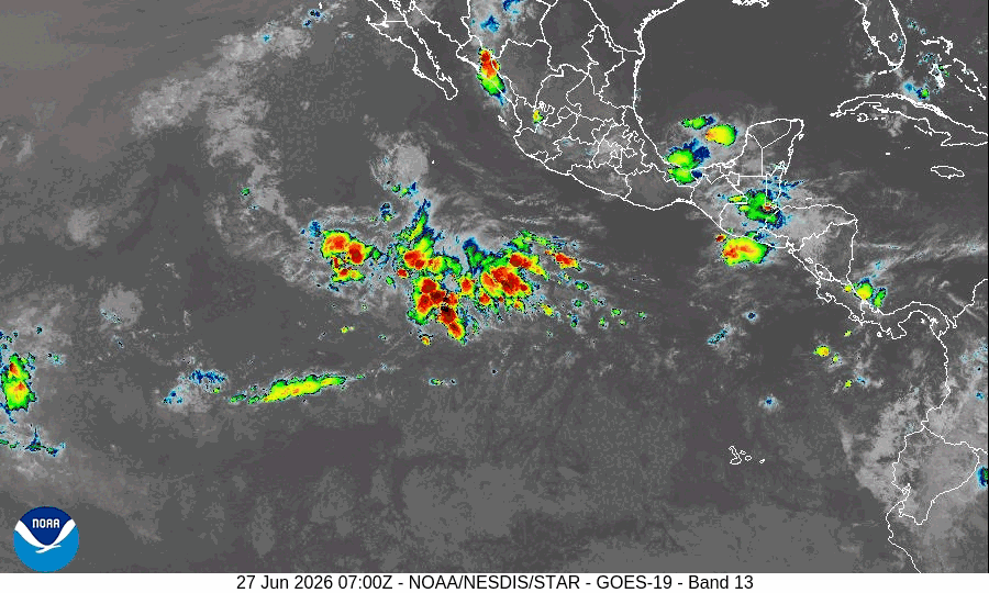
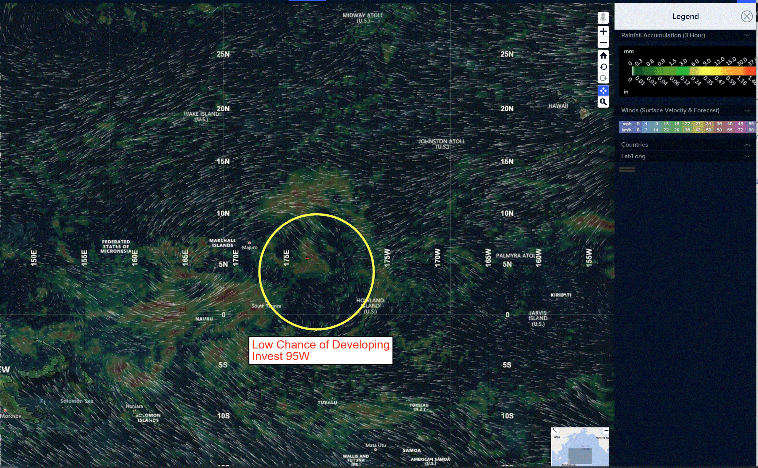
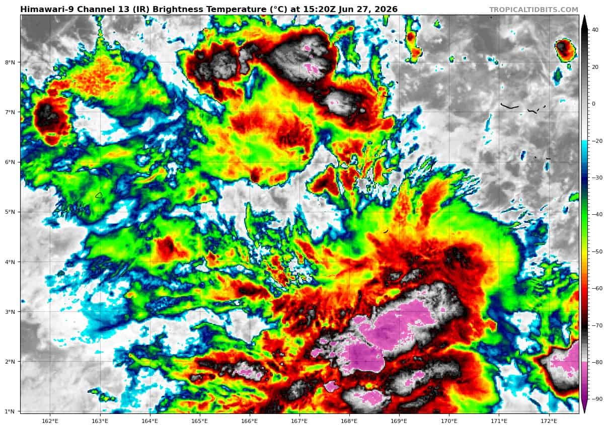
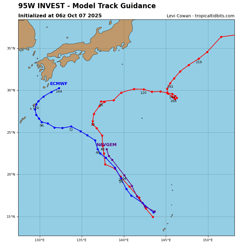
>>> There’s an area of disturbed weather being referred to as Invest 95W, which is located approximately 217 NM east-southeast of Kosrae
Animated multi-spectral satellite imagery depicts flaring, deep convection on the poleward and equatorward sides of a very broad, elongated lower level circulation. The 272237z ascat-c pass revealed a swath of 30 kt winds to the southeast, indicating that the elevated winds associated with a powerful westerly wind burst from yesterday have wrapped poleward and into the eastern periphery of the circulation.
Environmental analysis indicates a favorable environment for development with moderate poleward ventilation aloft, low vertical wind shear (10-15 kts), and warm sea surface temperatures (29-30 c).
Deterministic models show gradual development of the large circulation over the next 24-48 hours. The ensemble guidance strongly points to
significant development of 95W beyond 24 hours as it meanders westward.
Maximum sustained surface winds are estimated at 28 to 33 knots.
The potential for the development of a significant tropical cyclone within the next 24 hours is upgraded to medium.