The Pacific Disaster Center’s (PDC Global) Wednesday, August 12, 2026, Tropical Cyclone Activity Report…for the Pacific Ocean, the Indian Ocean, and adjacent Seas
Current Tropical Cyclones:
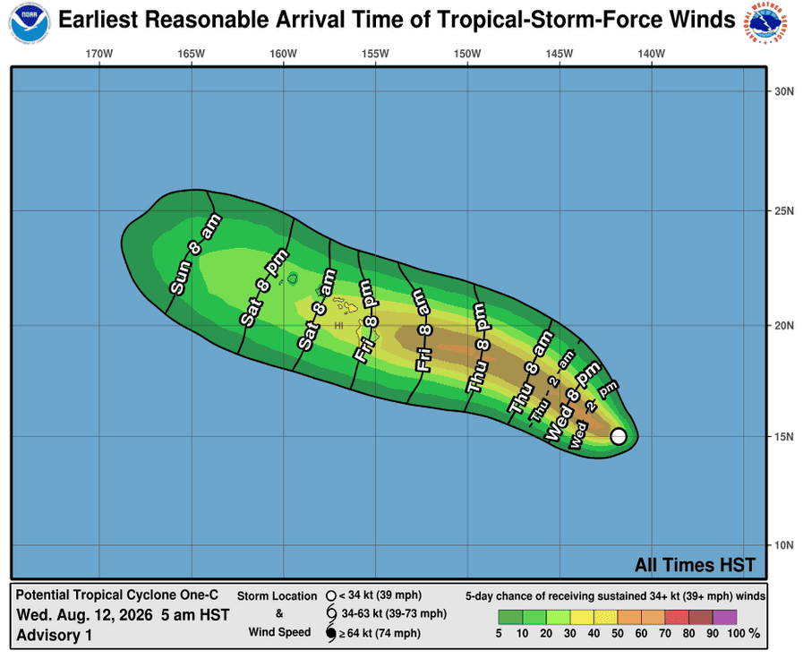
Potential Tropical cyclone 01C…is located approximately 895 NM east-southeast of Hilo, Hawaii
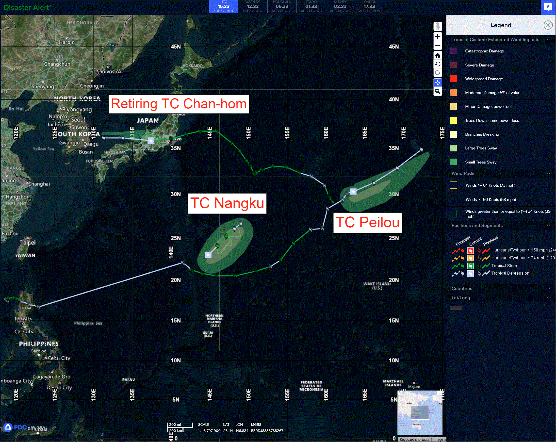
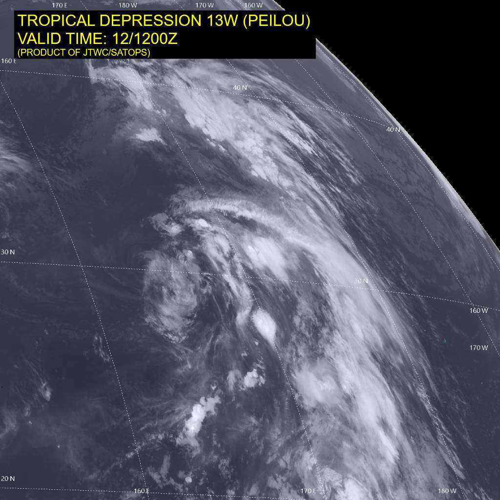
Tropical cyclone 13W (Peilou)…is located approximately 698 NM northeast of Minami Tori Shima
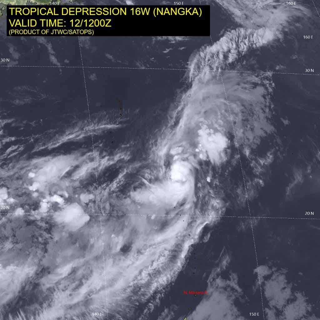
Tropical cyclone 16W (Nangka)…is located approximately 278 NM east of Iwo To
Northeast Pacific: There are no Tropical Cyclones
>>> Western East Pacific:
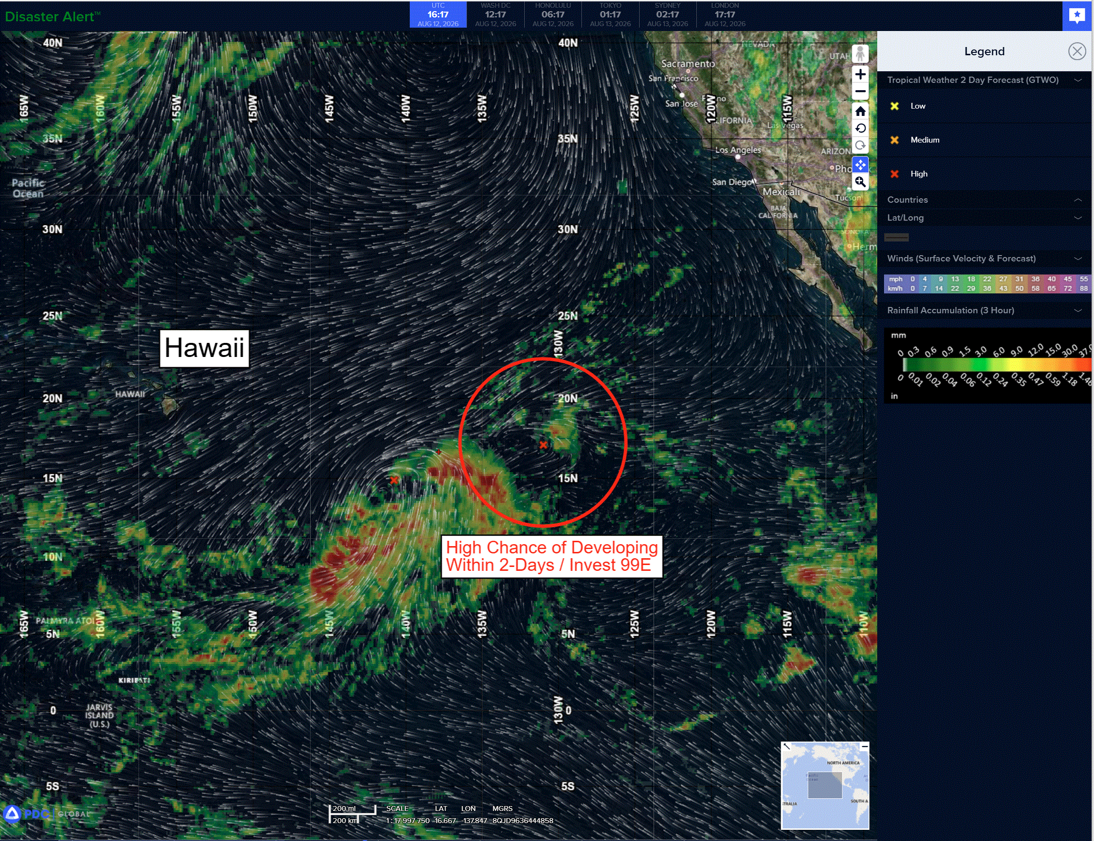
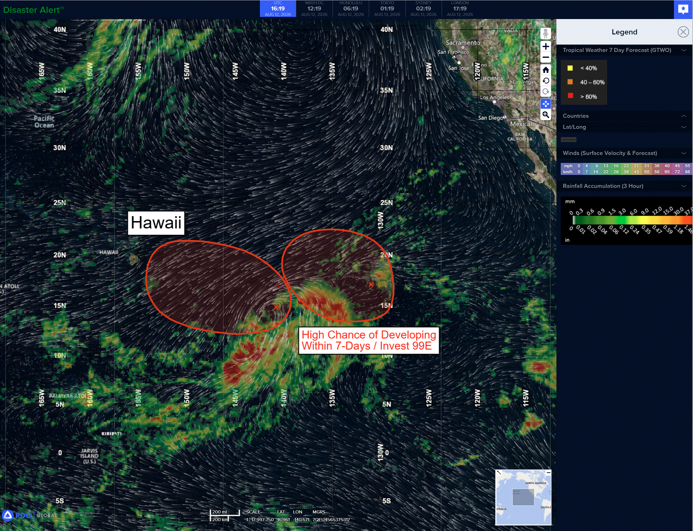
Invest 99E
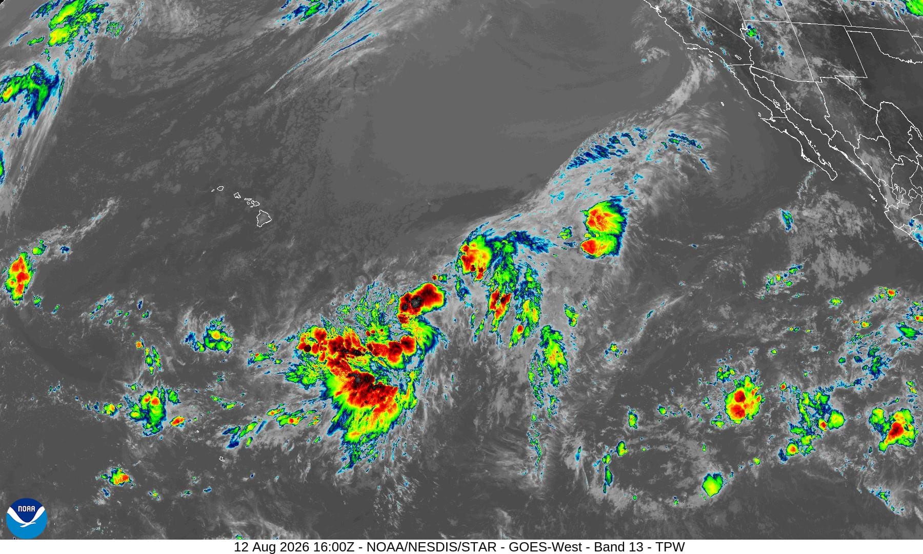
A low pressure system located about midway between Hawaii and the west coast of Mexico is producing disorganized shower and thunderstorm activity. These showers and thunderstorms have not become better organized since last night. However, a significant increase in organization could still result in the formation of a tropical depression later today or tonight before the system moves into less conducive environmental conditions thereafter.
*Formation chance through 48 hours…medium…60 percent
*Formation chance through 7 days…medium…60 percent
Central Pacific:
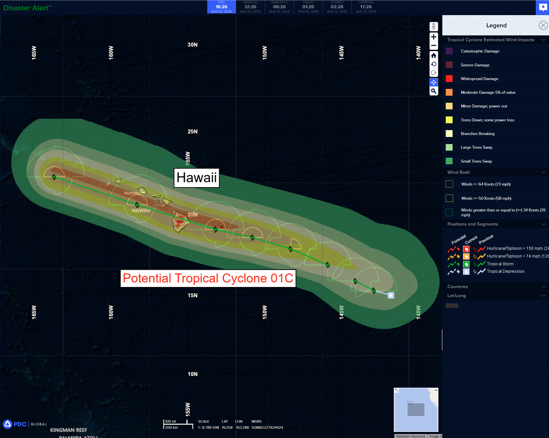
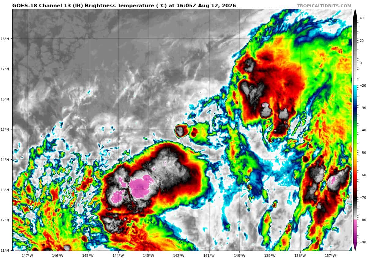
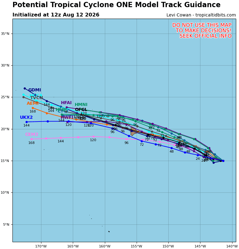
Potential Tropical Cyclone 01C
DISTURBANCE FORECAST TO STRENGTHEN BEFORE NEARING THE HAWAIIAN ISLANDS
According to the NHC advisory number 2
The system is moving toward the west near 9 mph (15 km/h), and a westward to west-northwestward motion is expected over the next few days. On the forecast track, the center will be nearing the Hawaiian Islands by late Friday. Maximum sustained winds are near 40 mph (65 km/h) with higher gusts, but the system still lacks organized shower and thunderstorm activity. The disturbance is forecast to become a tropical storm on Thursday, and additional strengthening is forecast thereafter.
* Formation chance through 48 hours…high…90 percent
* Formation chance through 7 days…high…90 percent
Western Pacific, Indian Ocean, and adjacent Seas:
Western Pacific
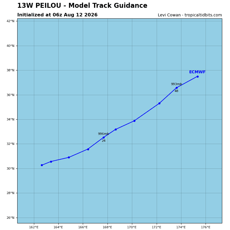
Tropical Cyclone 13W (Peilou)
According to the JTWC warning number 24, sustained winds were 30 knots…with gusts to 40 knots
Animated enhanced infrared (eir) satellite imagery depicts tropical depression (td) 13W (Peilou) as a highly sheared and fully exposed low level circulation center (llcc) completely devoid of convection. The copious amount of dry air enveloping the system is also identifyable in animated satellite imagery.
Environmental analysis reveals an unfavorable environment, characterized by moderate to high (20-25 kts) vertical wind shear (vws), marginal (26-27 c) sea surface temperatures (sst), poor outflow, and dry air entrainment.
TD 13W (Peilou) is forecast to continue tracking northeastward while it remains embedded within the strong
southwesterly monsoonal flow directed around the str centered to the southeast. Between 0-12 hours, Peilou is forecast to cross the 26c isotherm and encounter 30-35 kts of vws that will induce dramatic dry air entrainment into the core.
As a result, 13W is forecast to weaken throughout the forecast period. 13W is expected to ultimately be absorbed by the trough to its north and associated baroclinic low to its northeast by 36 hours.
Tropical Cyclone 16W (Nangka)
According to the JTWC warning number 2, sustained winds were 30 knots…with gusts to 40 knots
Animated enhanced infrared (eir) satellite imagery depicts tropical depression (td) 16W (Nangka) with consolidating low-level cloud banding wrapping into the center from all quadrants, indicating the low-level center has become significantly more defined over the past several hours. Additionally, the mid-level convection is
becoming better organized and is beginning to rotate at the center.
16W remains embedded within a trough, evidenced by the 121029z and 121207z ascat passes. The partial 121029z ascat also reveals that the eastern semicircle is tightly wound and symmetrical, with the 25-30 kt winds beginning to wrap into the system from the south.
Nangka sits in a favorable environment, characterized by low (10-15 kts) vertical wind shear (vws), warm (28-29 c) sea surface temperatures (sst), moderate equatorward outflow, and is currently located within a pocket of moisture.
TD 16W is forecast to track northeastward while it remains under the steering influence of the monsoonal flow enhanced by the str to the southeast and the deep layer low northwest. From 0 until 36 hours, the deep-layer low is expected to break down and weaken the steering gradient, causing 16W to slow its forward motion slightly at 48 hours. 16W is forecast to remain compact, shallow, and loosely organized for the duration of the forecast period, making it particularly susceptible to the surrounding environment.
Beginning around 24 hours, Nangka is expected to encounter an increasingly hostile environment, characterized by falling ssts, high (30-35 kts) vws, and significant mid-level dry air entrainment. The combination of those factors is expected to quickly weaken the system and cause dissipation no later than 48 hours.
Regarding intensity, 16W has approximately 24 hours to intensify before reaching the unfavorable environment. Therefore, the JTWC forecast depicts a slight intensification between 12-24 hours, then weakening until dissipation.