
")
Current Snapshot
For all the latest updates visit: DisasterAWARE
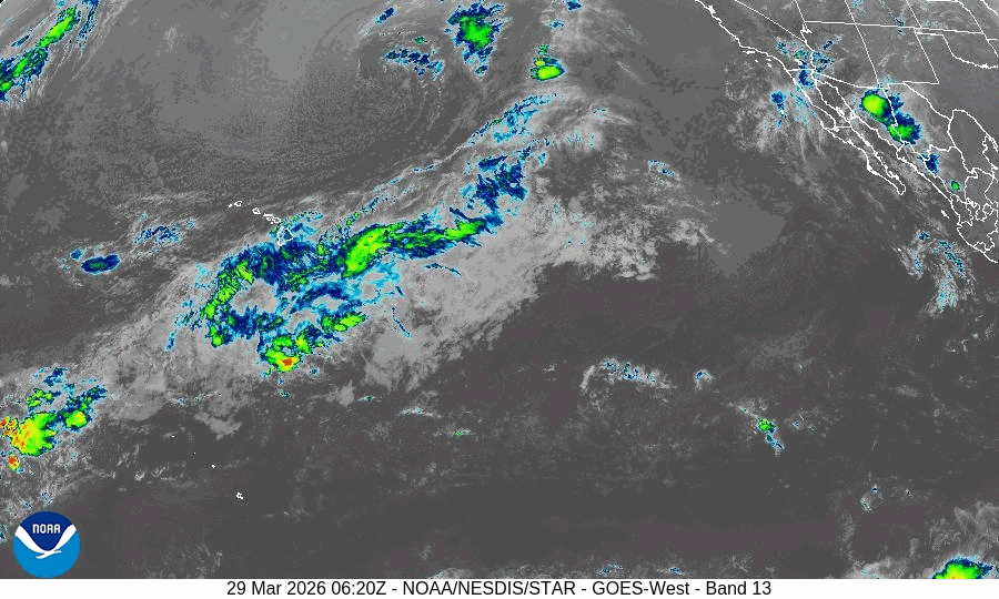
GOES18-TPW-13-900×540
99s
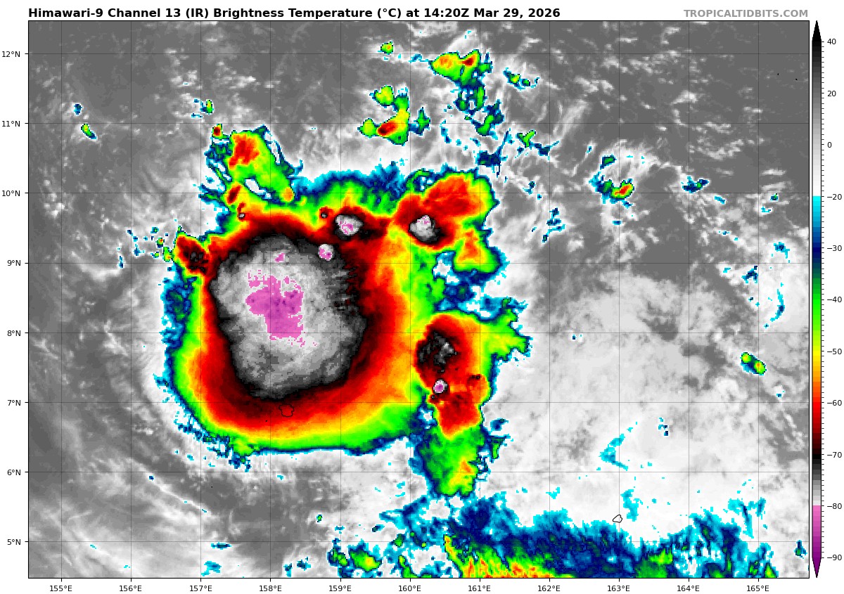
himawari9_ir_99W_202603291420_lat8.5-lon160.3

99W_tracks_latest
By PDC’s Senior Weather
Specialist Glenn James

The Pacific Disaster Center’s (PDC Global) Sunday, March 29, 2026, Tropical Cyclone Activity Report…for the Pacific Ocean, the Indian Ocean, and adjacent Seas
Current Tropical Cyclones:
There are no tropical cyclones
Northeast Pacific Ocean: There are no Tropical Cyclones
The last regularly scheduled Tropical Cyclone Activity Report of the 2025 eastern North Pacific Hurricane Season has been issued. Routine issuance of this section of the PDC product will resume on May 15, 2026. During the off-season, Special Tropical Weather Outlooks will be issued as conditions warrant by the NHC.
Central Pacific Ocean: There are no Tropical Cyclones
The 2025 central North Pacific hurricane season has ended. As such, the final routine Tropical Cyclone Activity Report for the 2025 season has been issued. Routine issuance of this section of the PDC product will resume on June 1, 2026. During the off-season, Special Tropical Weather Outlooks will be issued as conditions warrant by the CPHC.
Western Pacific, Indian Ocean, and adjacent Seas: There are no Tropical Cyclones
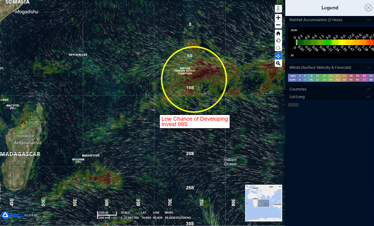
South Indian Ocean
>>> There’s an area of disturbed weather being referred to as Invest 99S, which is located approximately 253 NM east-southeast of Diego Garcia.
Animated enhanced infrared satellite imagery (eir) depicts a gradually consolidating llcc with flaring convection and elevated winds beginning to wrap along the northeastern periphery into the eastern quadrant as depicted in a 291531z metop-b ascat pass.
99S is currently in a marginally favorable environment for further development
with very warm (29-30 c) sea surface temperatures, moderate poleward outflow aloft, while also being placed within a pocket of lighter vertical wind shear (10-15 knots).
A factor that can negatively affect the system is a large dry air mass to the west that will be in the direct path of 99a as it continues to consolidate.
Global deterministic and ensemble models are in good agreement on a southwestward transit and slight intensification over the next 24-48 hours.
Maximum sustained surface winds are estimated at 18 to 23 knots.
The potential for the development of a significant tropical cyclone within the next 24 hours is low.