
")
Current Snapshot
For all the latest updates visit: DisasterAWARE
ddddd
llllllllll
By PDC’s Senior Weather
Specialist Glenn James

The Pacific Disaster Center’s (PDC Global) Sunday, May 3, 2026, Tropical Cyclone Activity Report…for the Pacific Ocean, the Indian Ocean, and adjacent Seas
Current Tropical Cyclones:
No Tropical Cyclones
Northeast Pacific Ocean: There are no Tropical Cyclones
The last regularly scheduled Tropical Cyclone Activity Report of the 2025 eastern North Pacific Hurricane Season has been issued. Routine issuance of this section of the PDC product will resume on May 15, 2026. During the off-season, Special Tropical Weather Outlooks will be issued as conditions warrant by the NHC.
Central Pacific Ocean: There are no Tropical Cyclones
The 2025 central North Pacific hurricane season has ended. As such, the final routine Tropical Cyclone Activity Report for the 2025 season has been issued. Routine issuance of this section of the PDC product will resume on June 1, 2026. During the off-season, Special Tropical Weather Outlooks will be issued as conditions warrant by the CPHC.
Western Pacific, Indian Ocean, and adjacent Seas: There are no Tropical Cyclones
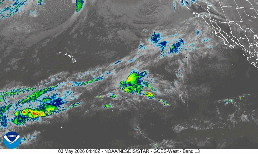
There’s an area of disturbed weather being referred to as Invest 93W, which is located approximately 14 NM southeast of Chuuk.
Animated multi-spectral satellite imagery (msi) depicts a partially obscured low level circulation center (llcc) with disorganized convection beginning to congeal into formative bands in the southeastern semicircle. A 032316z partial ascat pass reveals a weak, closed llcc centered in the vicinity of chuuk, with moderate westerlies along the southern flank and moderate northeasterlies to the north.
Environmental analysis depicts a favorable environment for development with good upper-level outflow provided by an upper-level point source in close proximity, low vertical wind shear (10-15 kts), and warm sea surface temperatures (29-30 c).
Both gefs and ecens depict 93W tracking westward over the next 24-48 hours as it slowly consolidates. The deterministic models are lagging behind, indicating a slower pace of consolidation and primarily supporting a later window for intensification. The ecmwf is the sole deterministic model depicting 93W reaching tropical depression strength within the next 48 hours.
Maximum sustained surface winds are estimated at 13 to 18 knots.
The potential for the development of a significant tropical cyclone within the next 24 hours is low.