
")
Current Snapshot
For all the latest updates visit: DisasterAWARE
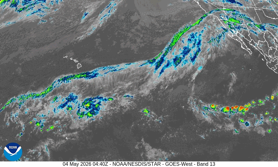
GOES18-TPW-13-900×540
10
By PDC’s Senior Weather
Specialist Glenn James

The Pacific Disaster Center’s (PDC Global) Monday, May 4, 2026, Tropical Cyclone Activity Report…for the Pacific Ocean, the Indian Ocean, and adjacent Seas
Current Tropical Cyclones:
No Tropical Cyclones
Northeast Pacific Ocean: There are no Tropical Cyclones
The last regularly scheduled Tropical Cyclone Activity Report of the 2025 eastern North Pacific Hurricane Season has been issued. Routine issuance of this section of the PDC product will resume on May 15, 2026. During the off-season, Special Tropical Weather Outlooks will be issued as conditions warrant by the NHC.
Central Pacific Ocean: There are no Tropical Cyclones
The 2025 central North Pacific hurricane season has ended. As such, the final routine Tropical Cyclone Activity Report for the 2025 season has been issued. Routine issuance of this section of the PDC product will resume on June 1, 2026. During the off-season, Special Tropical Weather Outlooks will be issued as conditions warrant by the CPHC.
Western Pacific, Indian Ocean, and adjacent Seas: There are no Tropical Cyclones
There’s an area of disturbed weather being referred to as Invest 93W, which is located approximately 130 NM west of Chuuk.
Animated multi-spectral satellite imagery (msi) depicts an obscured low-level circulation center (llcc) with deep convection building
over the center and increasing formative banding extending
from the northern quadrant cyclonically into the eastern semicircle.
Environmental analysis depicts a very favorable environment for
continued development, with good upper-level outflow provided by an anticyclone aloft, low vertical wind shear of less than 15 kts,
and warm sea surface temperatures between 29-30 c.
Global deterministic and ensemble models are in good agreement that 93W will track westward over the next 24-36 hours as it gradually intensifies, however, the development timeline differs slightly between ensemble and deterministic solutions. ensemble models are in favor of a more rapid and intense consolidation, whereas deterministic models intensify the system gradually as it approaches the Philippine Sea.
Additionally, gfs and ecmwf deterministic solutions continue to characterize dry air and increasing vertical wind shear as significant limiting factors throughout the systems westward track south of the Marianas.
Maximum sustained surface winds are estimated at 18 to 23 knots.
The potential for the development of a significant tropical cyclone within the next 24 hours is upgraded to medium.