

Current Snapshot
For all the latest updates visit: DisasterAWARE
1800x1080e
2e
7e
93E_tracks_latest

94E_tracks_latest
lala
goes18_ir_01C_202608271515_lat37.0-lon-178.5
01C_tracks_latest
7c
saudel
17W_271200sair
17W_tracks_latest
2w
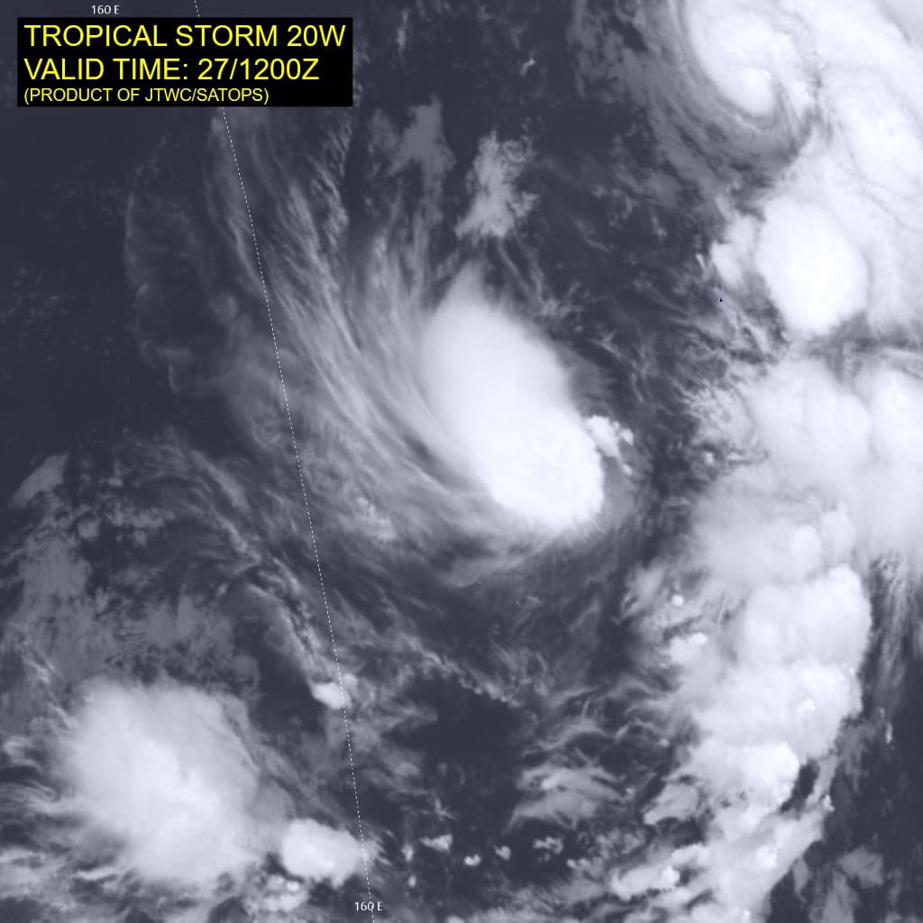
20W_271200sair
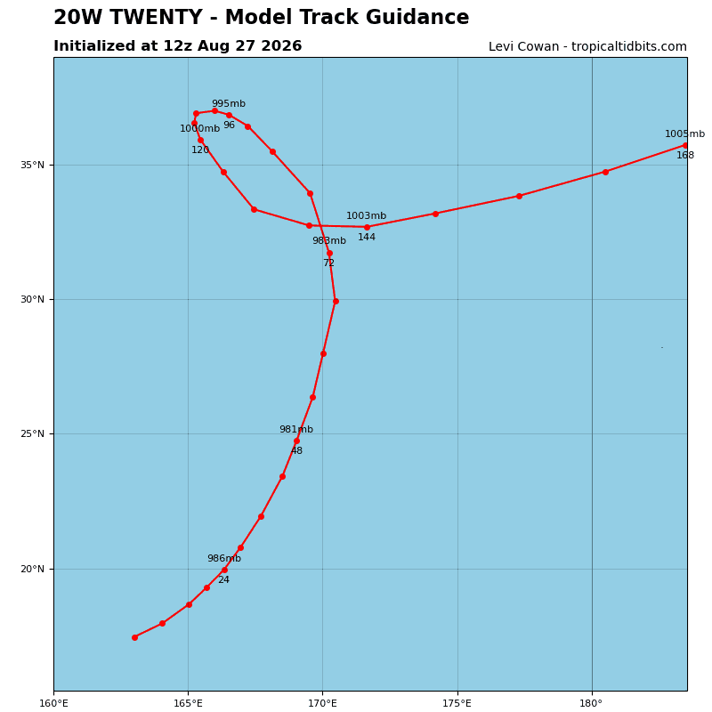
20W_tracks_latest
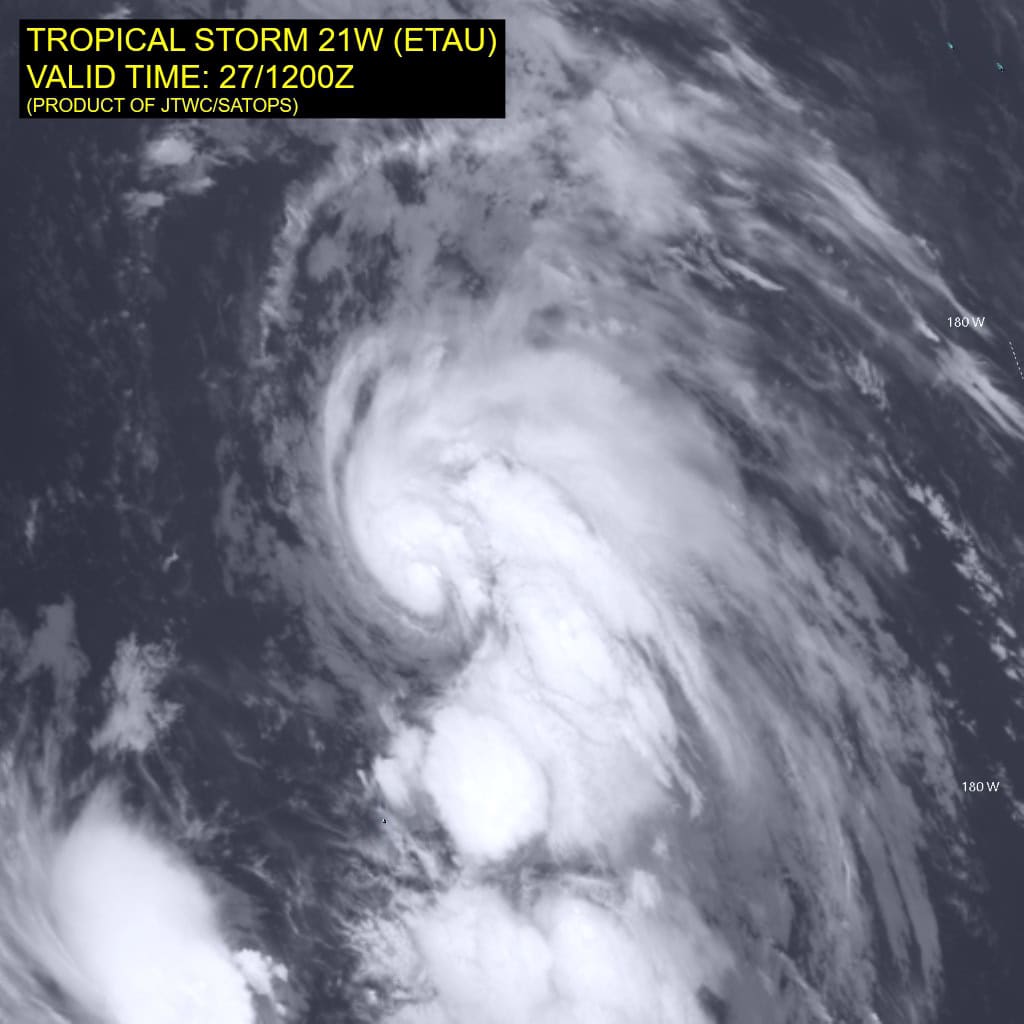
21W_271200sair
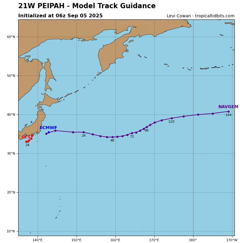
21W_tracks_latest
By PDC’s Senior Weather
Specialist Glenn James

The Pacific Disaster Center’s (PDC Global) Thursday, August 27, 2026, Tropical Cyclone Activity Report…for the Pacific Ocean, the Indian Ocean, and adjacent Seas.
Tropical Cyclones
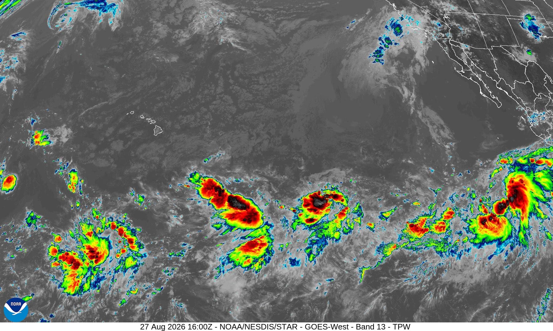
Tropical Cyclone 11E (Karina) is located about 780 miles south-southwest of the southern tip of Baja CA
Tropical Cyclone 12E (Lowell) is located about 1545 miles east-southeast of Hilo
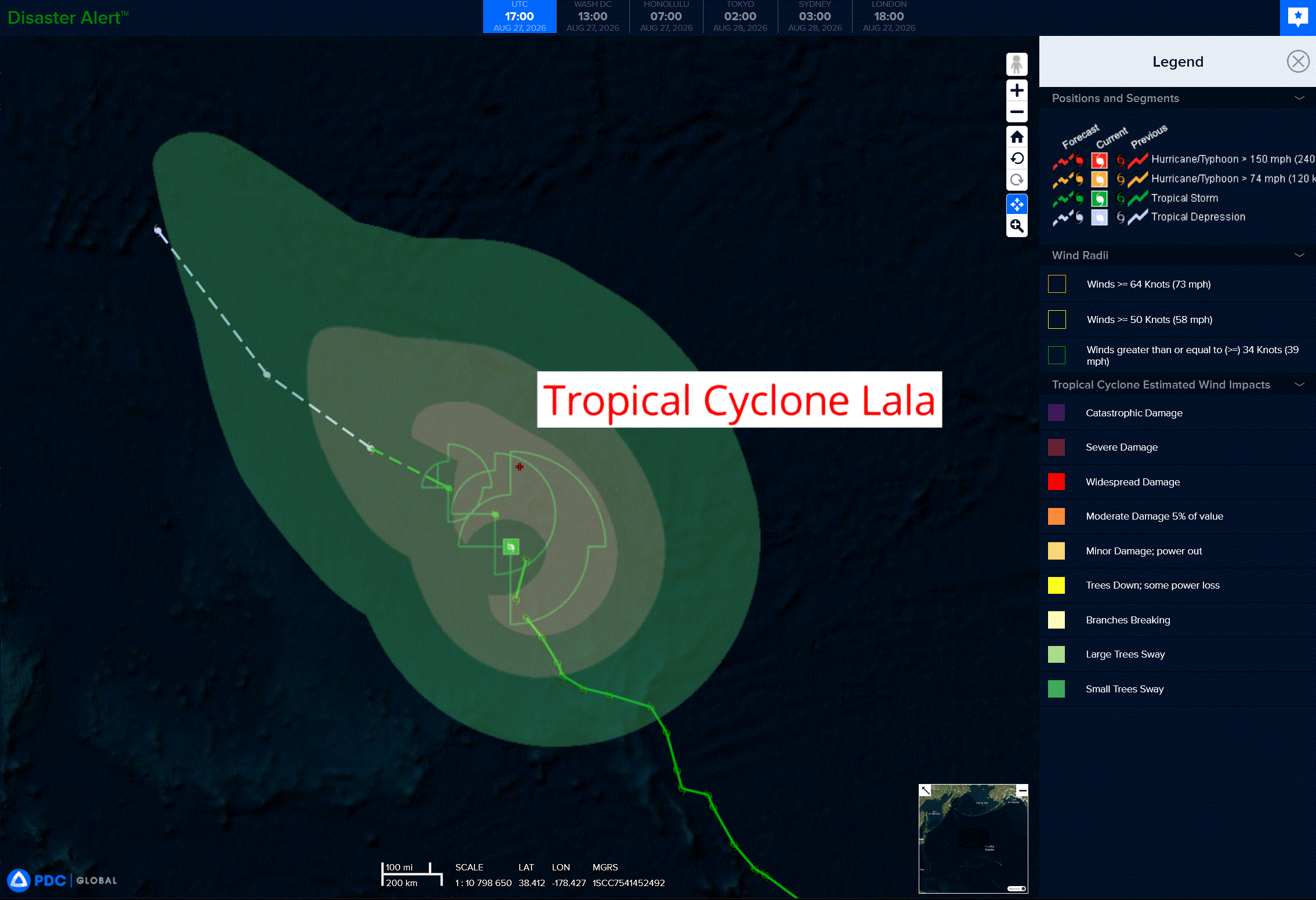
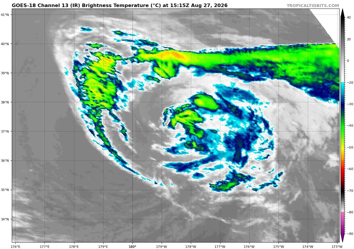
Tropical Cyclone 01C (Lala) is located about 650 miles north of Kure Atoll
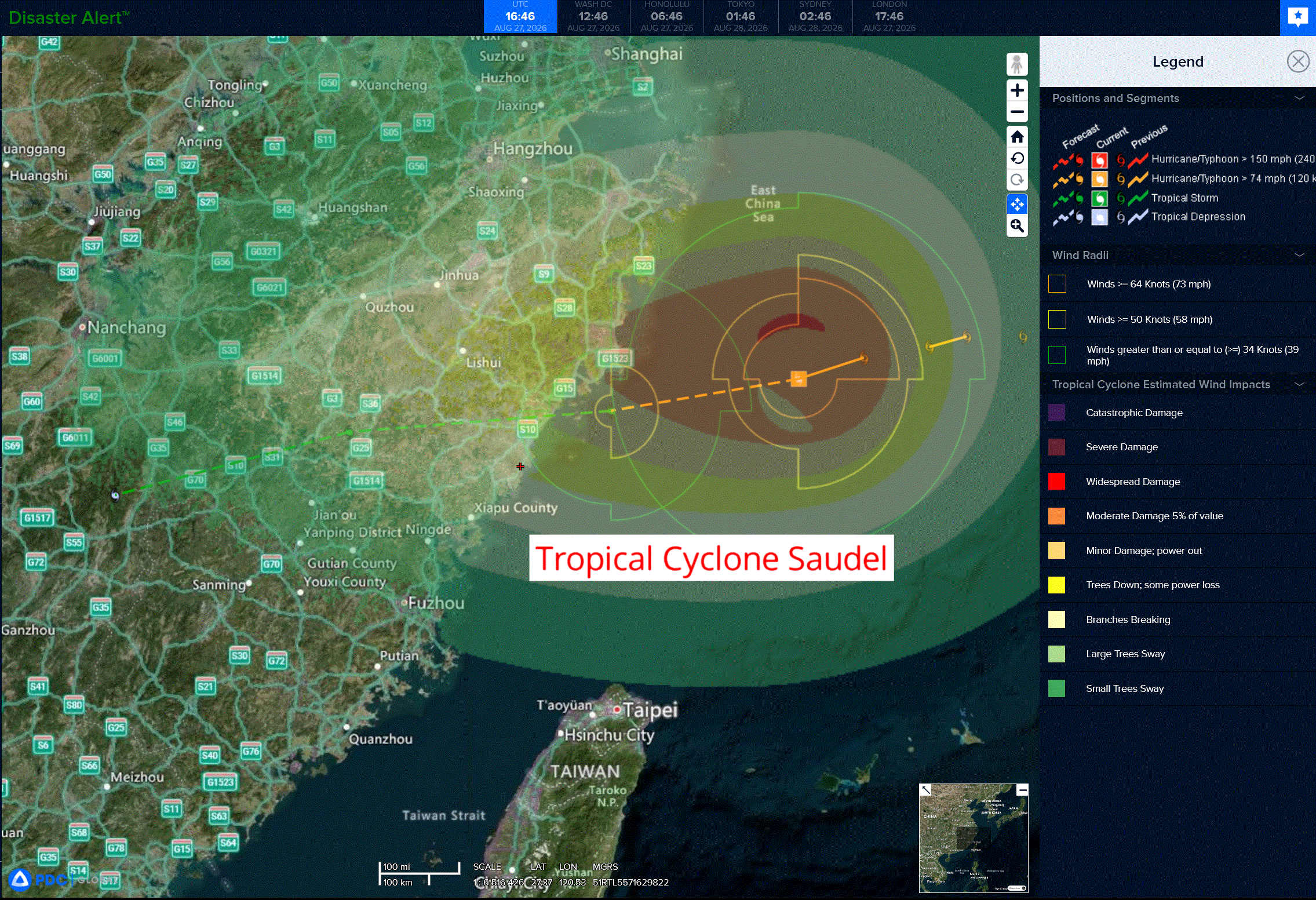
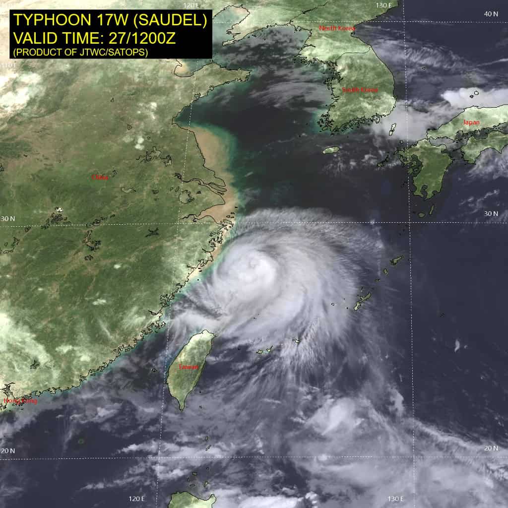
Tropical Cyclone 17W (Saudel)…is located approximately 375 NM west-northwest of Kadena AB – Final Warning
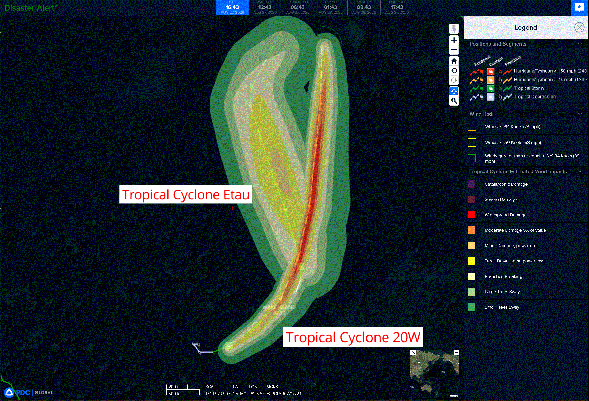
Tropical Cyclone 20W…is located approximately 117 NM southwest of Wake Island
Tropical Cyclone 21W (Etau) …is located approximately 291 NM north of Wake Island
Northeast Pacific:
Tropical Cyclone 11E (Karina)
TROPICAL STORM KARINA FORMS WELL OFFSHORE THE COAST OF SOUTHWEST MEXICO
According to the NHC advisory number 1…
Karina is moving toward the west-northwest near 13 mph and this general motion is expected to continue over the next several days. Maximum sustained winds are near 45 mph with higher gusts. Strengthening is anticipated, and Karina is forecast to become a hurricane over the weekend. Tropical-storm-force winds extend outward up to 205 miles from the center. The estimated minimum central pressure is 1001 mb (29.56 inches).
Tropical Cyclone 12E (Lowell)
LOWELL DRIFTING EAST-NORTHEASTWARD WITH LITTLE CHANGE IN STRENGTH
According to the NHC advisory number 2…
Lowell is moving toward the east-northeast near 5 mph (7 km/h). A gradual turn toward the north is expected by Friday, with a westward motion expected by Saturday. Maximum sustained winds are near 40 mph (65 km/h) with higher gusts. Strengthening is likely during the next several days, and Lowell is forecast to become a hurricane on Sunday. Tropical-storm-force winds extend outward up to 80 miles (130 km) from the center. The estimated minimum central pressure is 1004 mb (29.65 inches).
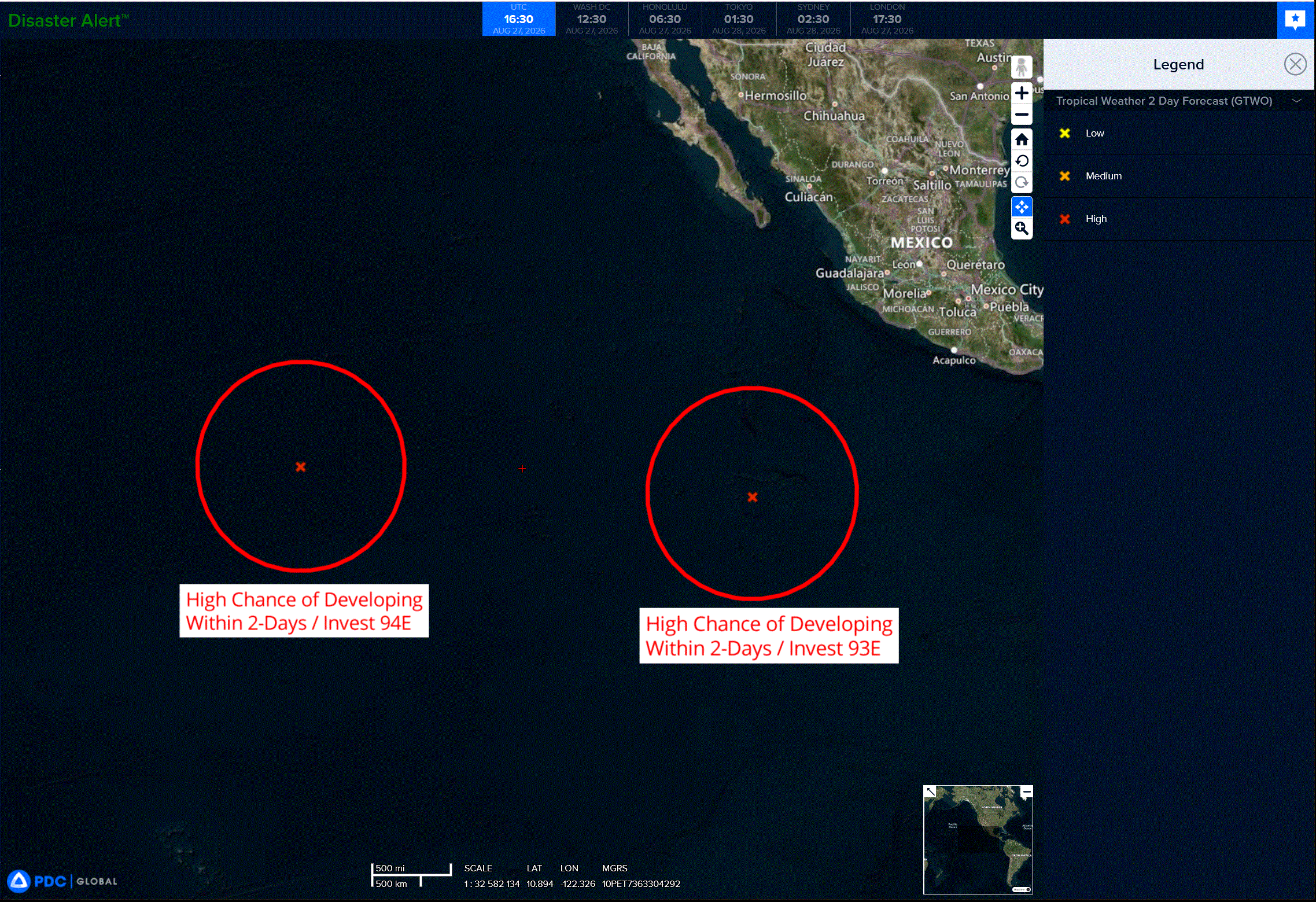
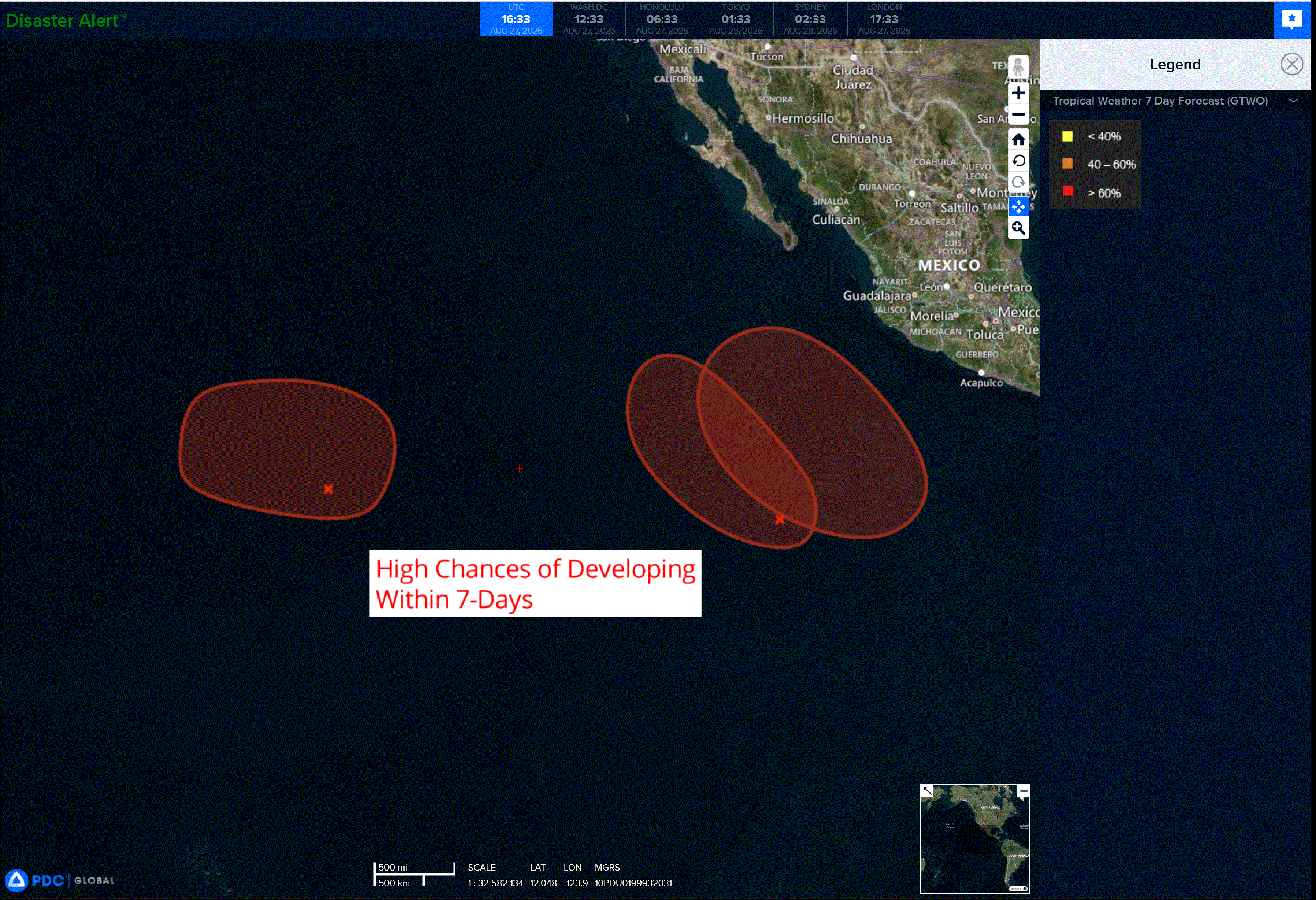
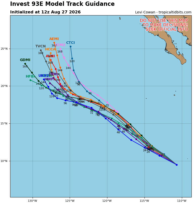
>>> Well offshore of Southwestern Mexico:
An area of low pressure is forecast to form this weekend well to the south of southwestern Mexico. Environmental conditions appear favorable for gradual development of this system, and a tropical depression is likely to form early next week while it moves west-northwestward to northwestward at 10 to 15 mph.
* Formation chance through 48 hours…low…near 0 percent
* Formation chance through 7 days…medium…80 percent
Central North Pacific:
Tropical Cyclone 01C (Lala)
LALA CONTINUES MOVING SLOWLY NORTHWARD
According to the NHC advisory number 61…
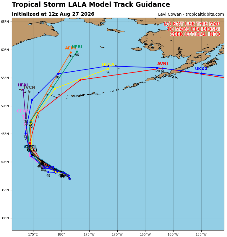
Lala is moving toward the north near 5 mph (7 km/h). A northward to north-northwestward motion is expected through today, followed by a gradual turn toward the west-northwest tonight and Friday. On the forecast track, Lala is forecast to cross the International Date line in about 30 h.
Maximum sustained winds are near 45 mph (75 km/h) with higher gusts. Gradual weakening is expected during the next couple of days, and Lala is forecast to become a post-tropical remnant low tonight or Friday morning.
Tropical-storm-force winds extend outward up to 125 miles (205 km) from the center.
The estimated minimum central pressure is 999 mb (29.50 inches).
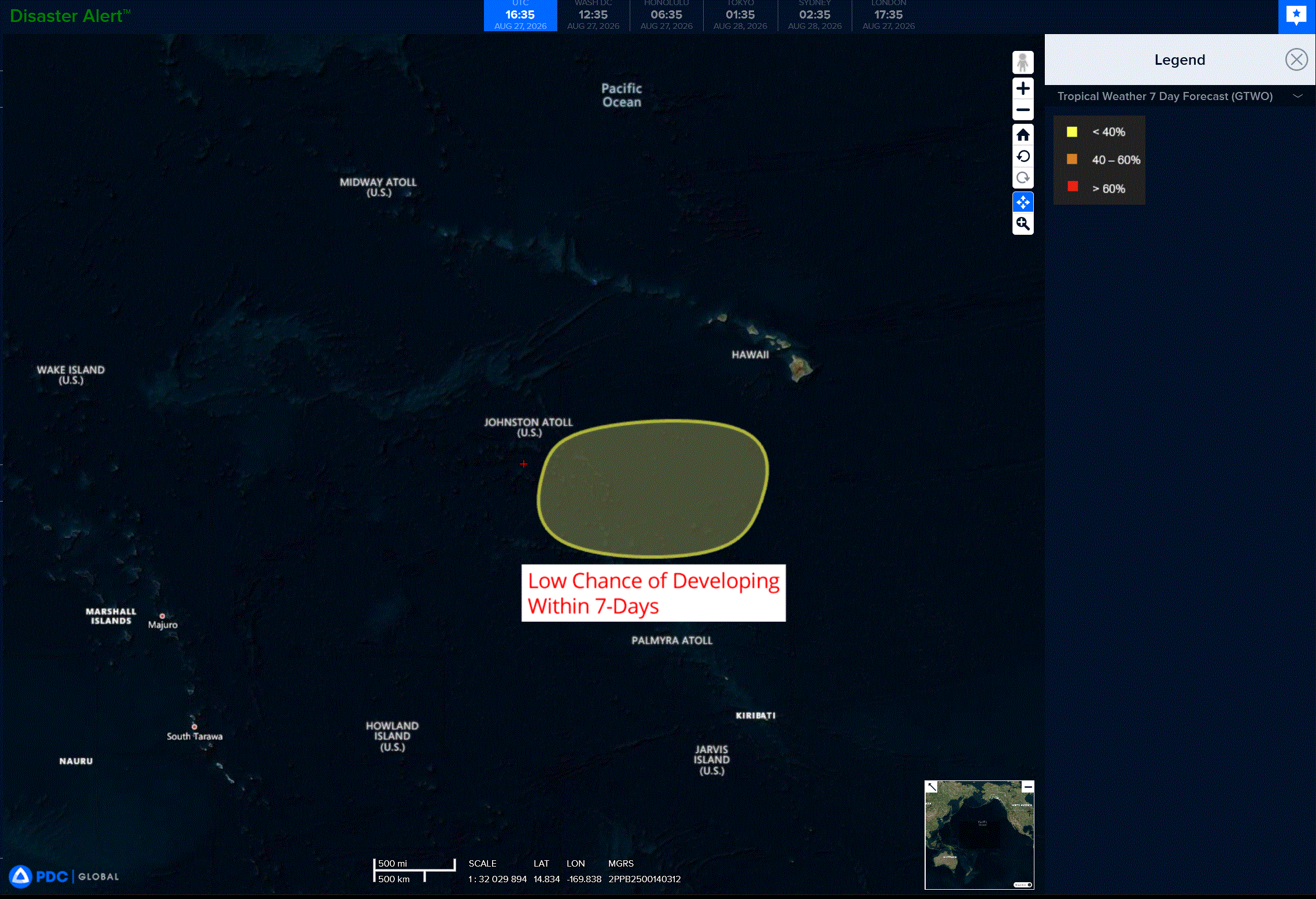
>>> Central Pacific:
An area of low pressure could form well south or southwest of the Hawaiian Islands in a few days. Some gradual development is possible thereafter and a tropical depression could form during the middle part of next week while the system moves slowly west-northwestward, well offshore of the Hawaiian Islands.
* Formation chance through 48 hours…low…near 0 percent
* Formation chance through 7 days…medium…40 percent
Western Pacific, Indian Ocean, and adjacent Seas:
Western Pacific
Tropical Cyclone 17W (Saudel) – Final Warning
According to the JTWC warning number 39…Sustained winds were 55 knots with gusts to 70 knots
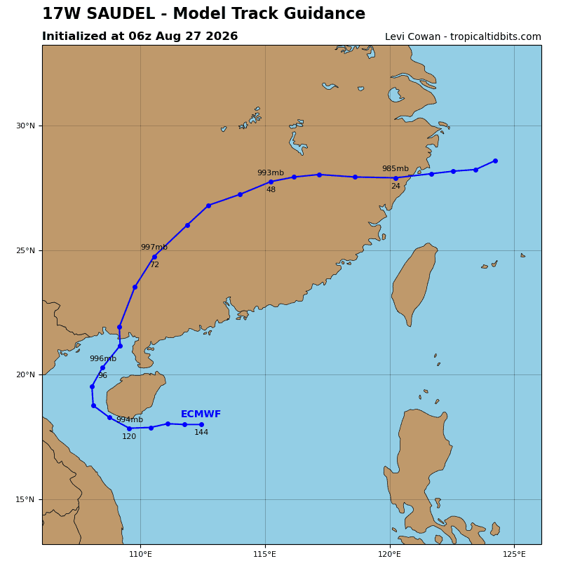
Animated radar imagery indicates the system has increased speed over the past six hours, making landfall over the Yuhuan Peninsula at 272330z. TS 17w is forecast to continue to track westward into central China under the influence of a subtropical ridge (str) centered to the northwest.
Intensity is expected to sharply decrease as the system interacts with the terrain, deteriorating the vortex rapidly and dissipating 17w as a tropical cyclone over land by 24 hours.
Tropical Cyclone 20W
According to the JTWC warning number 8…Sustained winds were 60 knots with gusts to 75 knots
Animated enhanced infrared (eir) satellite imagery depicts tropical storm 20w with an extremely compact and fully obscured low-level circulation center (llcc). The center is now embedded underneath an increasingly symmetric central dense overcast (cdo) with associated cloud tops measuring colder than -85 c in some areas. A 270727z rcm-2 sar pass showed a strikingly small circulation with a radius of maximum winds around 10 nm and a ring of 45-50 kts completely surrounding the center. A 271040z metop-c ascat pass allowed for high confidence in the initial wind radii, but was unable to measure the strongest winds due to the resolution limitations of the instrument.
TS 20w is forecast to track northeastward, along the southwestern extension of the str through 24 hours. Around 36 hours, the trajectory will become more northward as the system tracks along the western periphery of the str through 72 hours. After 72 hours, an upper-level trough is expected to dig in from the north and weaken the ridge. The trough will then interact with 20w and pull it further poleward. Subtropical transition is forecast to begin around 72 hours as the system crosses the 26 c isotherm and interacts with the strong mid-latitude trough.
Subtropical transition is then forecast to complete around 96 hours, once the system becomes completely embedded underneath the trough. Near 96 hours, binary interaction with 21w (etau) will increase as the distance between the two circulations decreases. As a result, the exact track near the end of the forecast period could differ depending on the relative strength and distance between the two systems. The likelihood of the absorption of 20w within the wind field of 21w is looking less and less likely; however, it is still a possibility if 20w does not intensify as much as anticipated.
In terms of intensity, 20w is forecast to quickly intensify over the next 36 hours as the environment remains conducive. The compact nature of the vortex is highly susceptible to small changes in the environment, causing the intensity to potentially be extremely volatile as a result. As it stands, a peak intensity of 85 kts is forecast to occur at around 48 hours. After 48 hours, westerly shear and dry air is expected to increase, causing the system to weaken through the remainder of the forecast period. Additionally, ocean heat content (ohc) will begin to significantly lower after 48 hours, further supporting the weakening trend.
Tropical Cyclone 21W (Etau)
According to the JTWC warning number 5…Sustained winds were 45 knots with gusts to 55 knots
Animated enhanced infrared (eir) satellite imagery depicts tropical storm 21w (etau) with curved convective banding along the eastern portion of the now obscured low-level circulation center (llcc). The wind field continues to appear asymmetric with the strongest winds located within the eastern semicircle, though ascat missed the system to confirm the winds near the core.
TS 21w (etau) is forecast to track generally northward, along the western periphery of the str to the east through 72 hours. After 72 hours, an upper-level trough is expected to dig in from the north, breaking down the steering ridge. This will cause track speeds to slow through 96 hours as the system moves northeastward. The interaction with ts 20w near the end of the forecast period could also cause the track of 21w to become erratic. Subtropical transition is forecast to complete near 96 hours as the system crosses the 26 c sst isotherm, becomes engulfed by dry air, and interacts with the strong mid-latitude trough.
Regarding intensity, 21w is forecast to gradually intensify through 36 hours, primarily due to the robust poleward outflow channel. Southwesterly shear and dry air entrainment is expected to
increase after 36 hours, causing the system to weaken through 96 hours as the system continues to track poleward. Additionally, ocean heat content (ohc) will significantly drop after 48 hours, further supporting the weakening trend.