

Current Snapshot
For all the latest updates visit: DisasterAWARE
x
04P_190600sair
goes18_ir_04P_202611191535_lat-10.6-lon-163.1
04P_tracks_latest

a
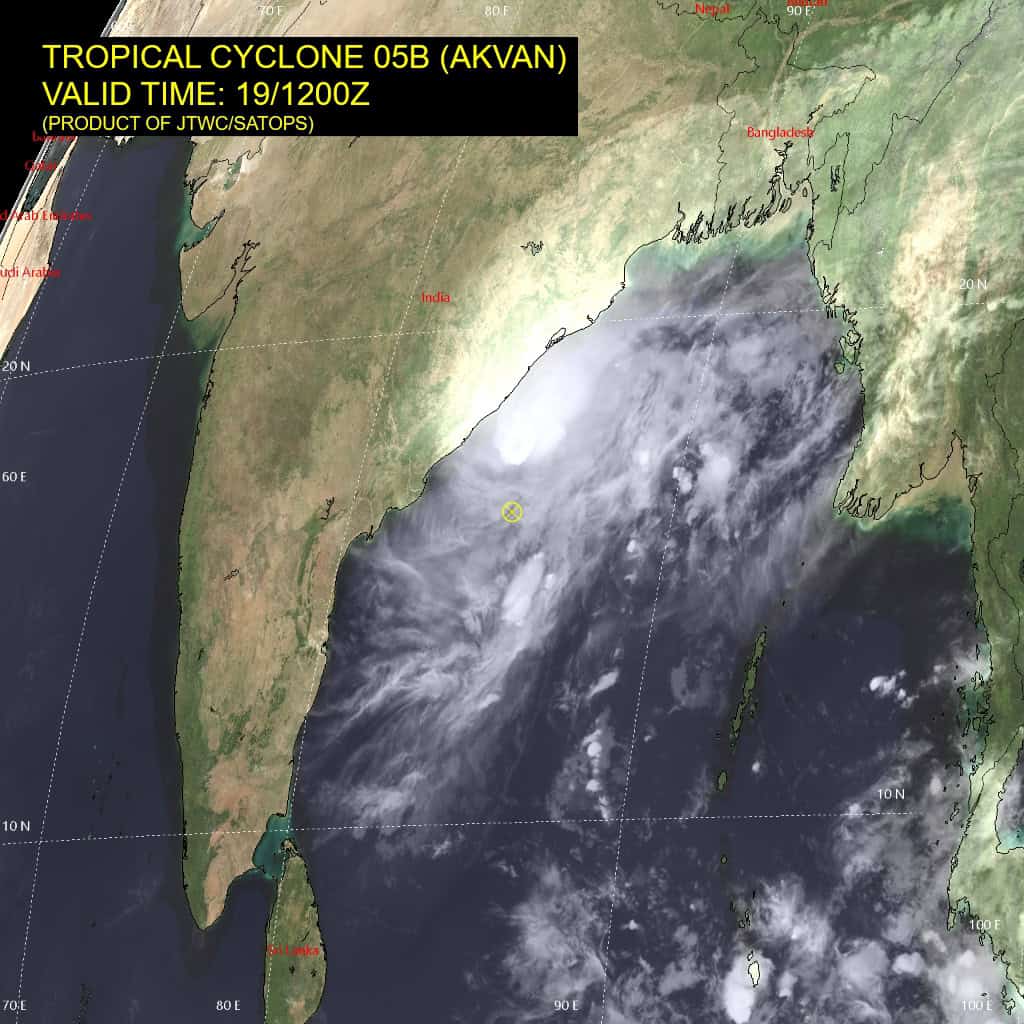
05B_191200sair
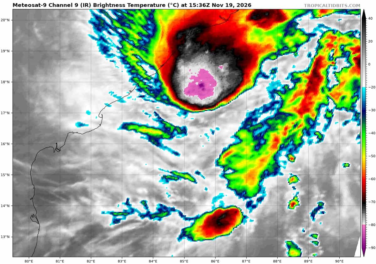
meteosat9_ir_05B_202611191536_lat16.0-lon85.3
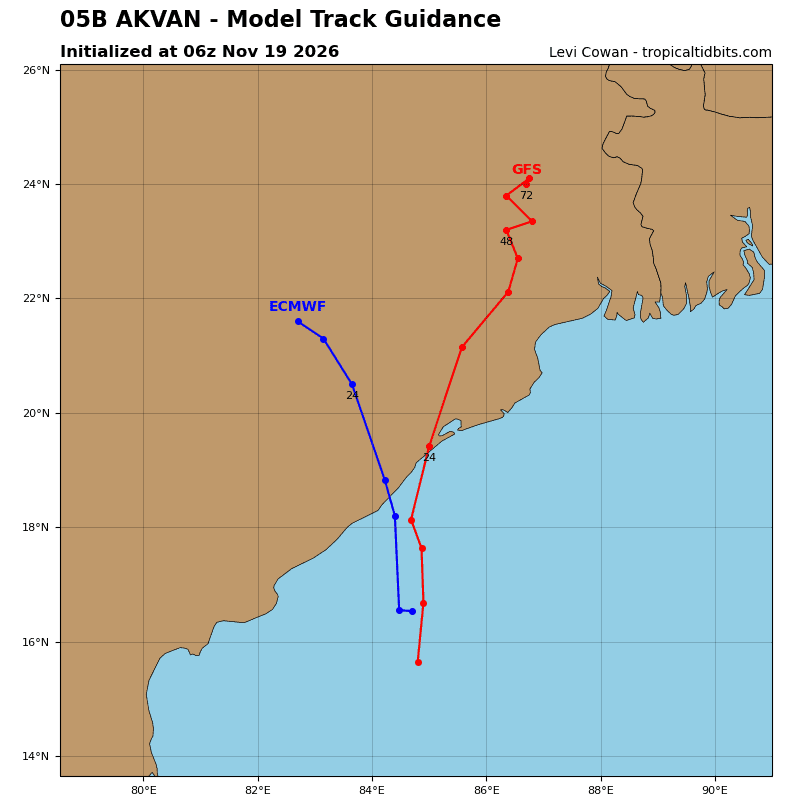
05B_tracks_latest
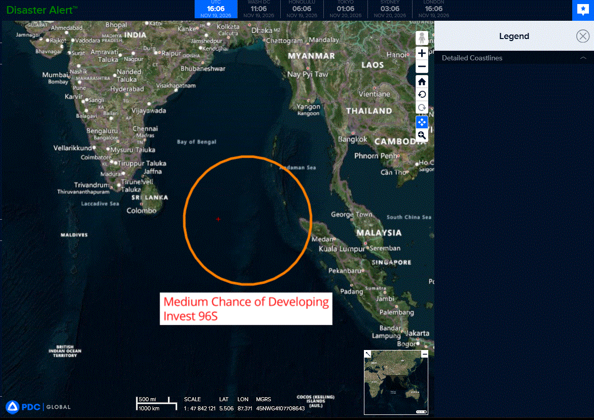
96s
meteosat9_ir_96S_202611191536_lat-9.0-lon89.0
96S_tracks_latest
By PDC’s Senior Weather
Specialist Glenn James

The Pacific Disaster Center’s (PDC Global) Thursday, November 19, 2026, Tropical Cyclone Activity Report…for the Pacific Ocean, the Indian Ocean, and adjacent Seas.
Tropical Cyclones
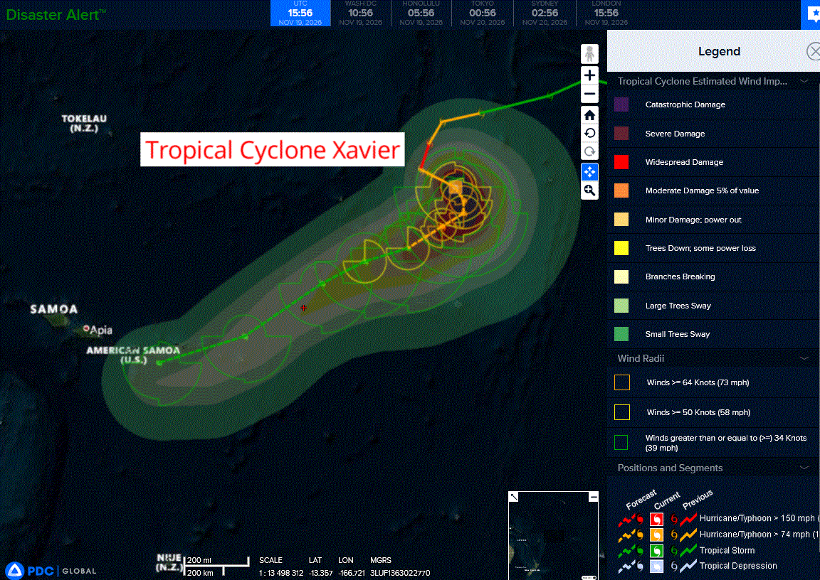
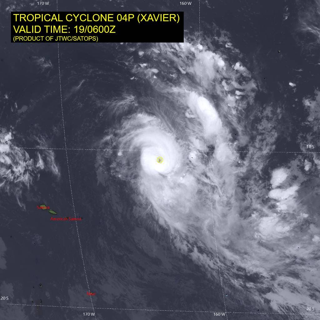
Tropical Cyclone 04P (Xavier)…is located approximately 436 NM east-northeast of Manua Islands
Tropical Cyclone 05B (Akvan)…is located approximately 433 NM south-southwest of Kolkata, India
Northeast Pacific: There are no Tropical Cyclones
Central North Pacific: There are no Tropical Cyclones
Western Pacific, Indian Ocean, and adjacent Seas:
Southwestern Pacific
Tropical Cyclone 04P (Xavier)
According to the JTWC warning number 9, sustained winds were 105 knots with gusts to near 130 knots
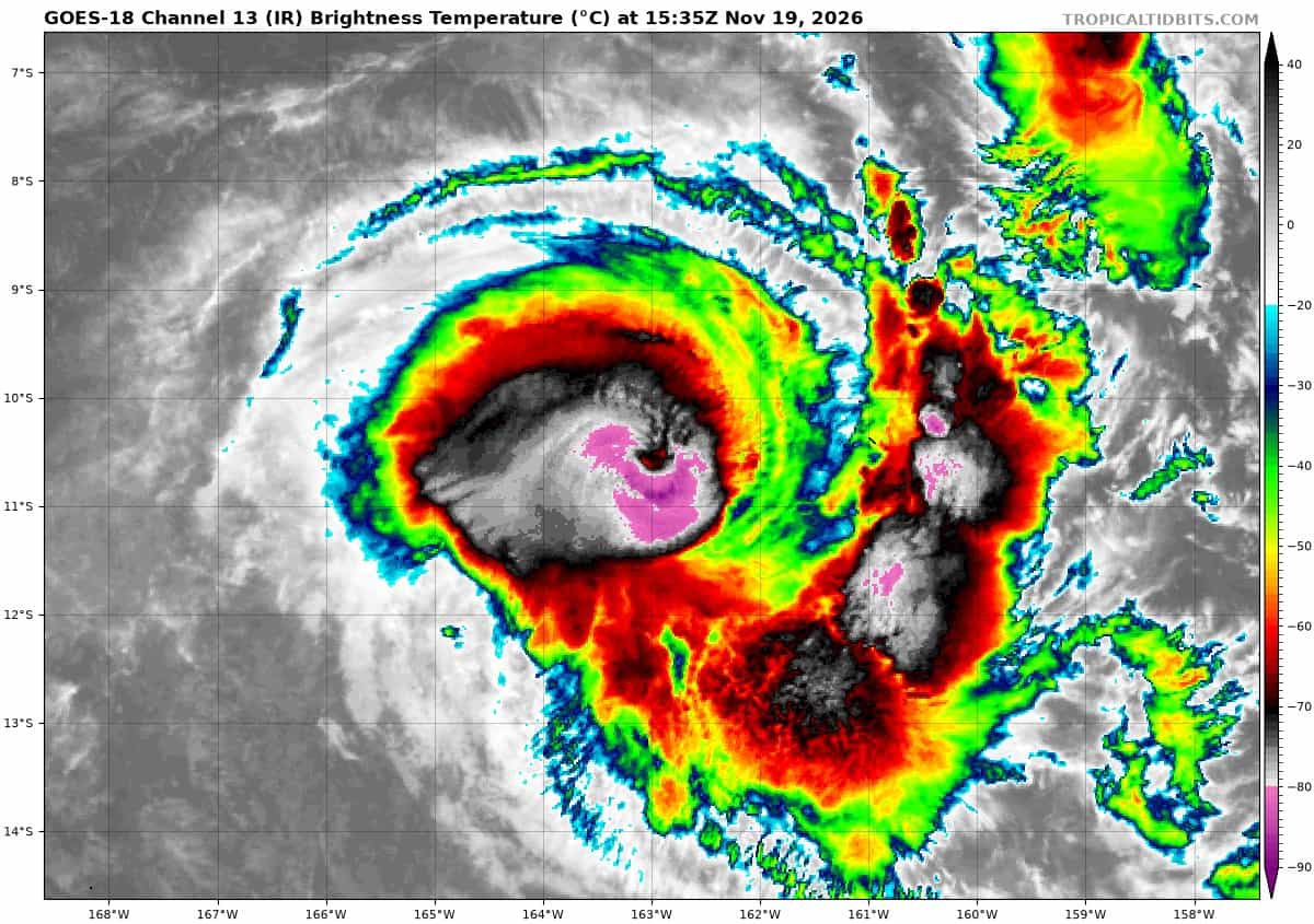
Animated enhanced infrared (eir) satellite imagery depicts tropical
cyclone (tc) 04P (Xavier) with an increasingly cloud-free eye over the last six hours, although in the last hour it has begun to somewhat fill once more.
A review of microwave data over the past 18 hours confirms Xavier likely completed an eyewall replacement cycle (erc), as a 190524z wsfm suite resolves a single, compact, robust eyewall with an eye measuring 15-20 nm in diameter, in comparison to an earlier 190017z amsr-3 pass which depicted the partially eroded inner eyewall surrounded by an incomplete secondary eyewall, measuring roughly 30 nm in diameter.
This supports the brief period of re-intensification of 04P over the last six to twelve hours as the secondary eyewall became the primary eyewall and constricted in, along with the clearing of the eye in eir. The most recent wsfm imagery also reveals that the upper-level eye feature remains slightly displaced to the northeast with height from the low-level circulation center (llcc), indicating more southwesterly shear than indicated by model and cimss analysis.
Environmental conditions are assessed as marginally favorable with low to moderate (10-15 kts) vertical wind shear (vws), strong poleward outflow aloft, and lowering ocean heat content (ohc) as tc 04P has transited into an area of 100 to 75 kj per cm squared.
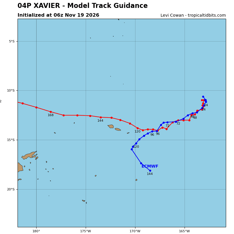
TC 04P has increased slightly in track speed as it continues southeastward within the weak steering environment of a col between the two deep-layer subtropical ridges (strs) centered to the east and west. a slow, meandering track within this col is forecast for the next 24 hours or so before an additional weak str centered to the southeast is expected to build, causing an
acceleration southwestward.
The forecast track is tightly coupled to the forecast intensity, as the strength of Xavier will determine its depth and thus what level of the steering flow will dominate. After 24 hours, an incoming mid-latitude trough is expected to weaken the southeastern str, which in combination with the forecast weakening of the system at this point will cause Xavier to become primarily steered by the low to mid level str centered to the southeast.
Between 96 and 120 hours, the track is expected to become more directly westward as an str centered to the southwest takes over steering influence as the mid-latitude trough weakens the southeastern str.
Regarding intensity, tc 04P is expected to weaken for the remainder of the forecast period as it continues transiting into lower ohcs and its current slow track speed induces upwelling of colder ssts. Beyond 24 hours, the weakening trend will become much sharper as vws becomes increasingly hostile, eventually decoupling the upper and lower vortexes and allowing dry air entrainment into the shallower core. The circulation is expected to open up and begin dissipating by 120 hours, although some global model fields suggest this could happen earlier.
North Indian Ocean
Tropical Cyclone 05B (Akvan)
According to the JTWC warning number 12, sustained winds were 35 knots with gusts to near 45 knots
Animated enhanced infrared (eir) satellite imagery depicts the low
level circulation center (llcc) of tropical cyclone (tc) 05B (Akvan) increasingly obscured by cirrus outflow of flaring convection along the southern flank of the circulation. The llcc is assessed to still be displaced south of the strongest convection, as depicted in an earlier 190649z amsr-3 37 ghz microwave image.
Environmental conditions are assessed as marginally favorable with warm (28-29 c) sea surface temperatures (ssts), low to moderate (10-15 kts) vertical wind shear (vws), and strong poleward outflow aloft, being offset by the continued broad and shallow nature of the vortex, which is unlikely to further consolidate before landfall.
TC 05B is forecast to continue tracking northward along the periphery of a subtropical ridge centered to the east of the system, causing a slight eastward turn after 24 hours as it becomes poleward of the str axis. The system is expected to make landfall just after 24 hours, near Brahmapur.
Regarding intensity, the system is forecast to maintain 35 kts out to 12 hours and begin weakening thereafter as 05B nears landfall and begins interacting with the terrain. potential passage over the Chilika Lake and southern portion of the Mahanadi River Delta could marginally offset initial weakening from terrain interaction, as the brown-ocean effect allows 05B to absorb latent heat from the warm, saturated terrain.
However, this is expected to be short-lived, as dissipation is ultimately forecast to occur no later than 36 hours as 05B proceeds further inland. While not within the official forecast, there remains a possibility for more rapid dissipation due to the low confidence in the current intensity and assessed borderline tropical-storm strength.
South Indian Ocean
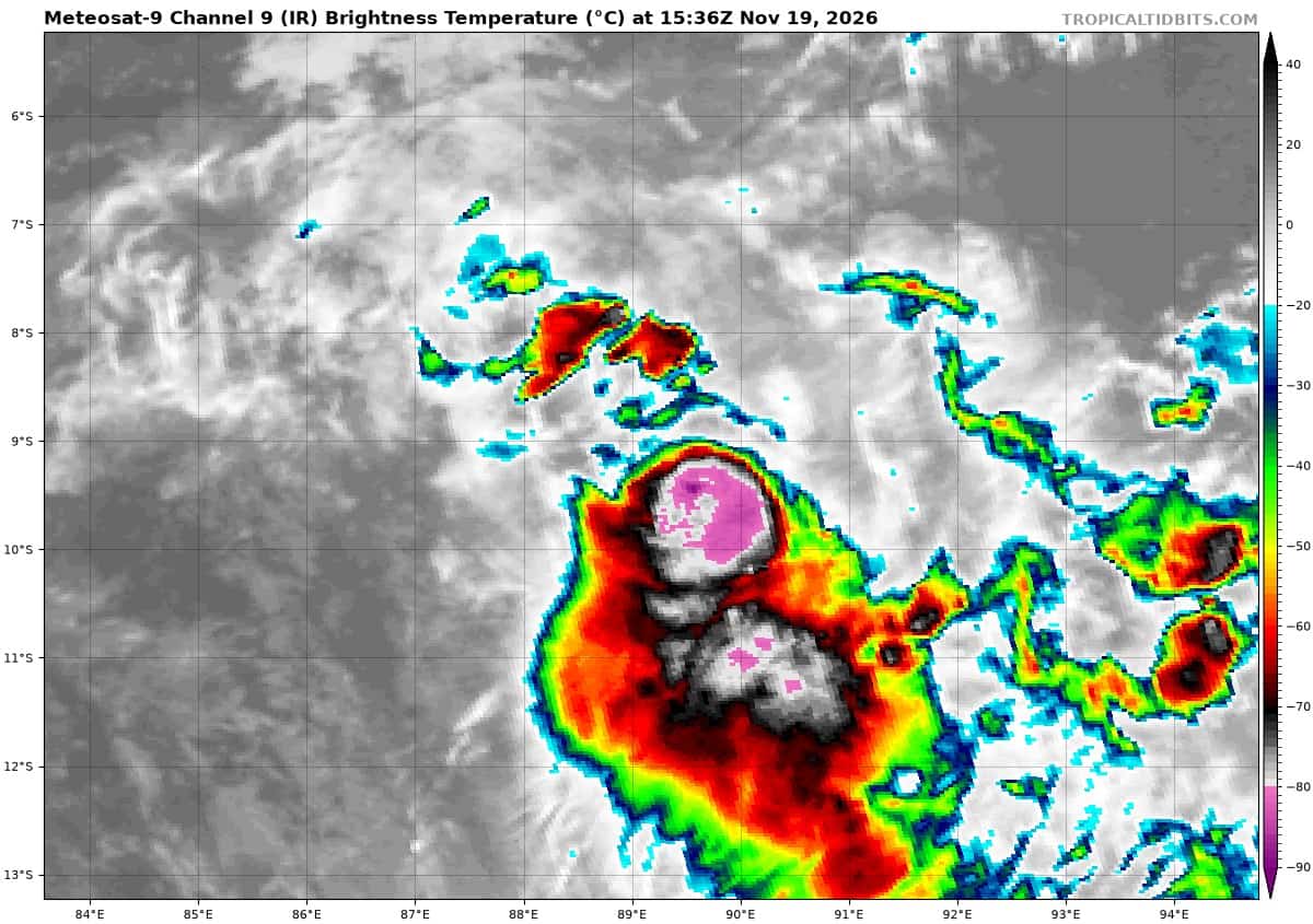
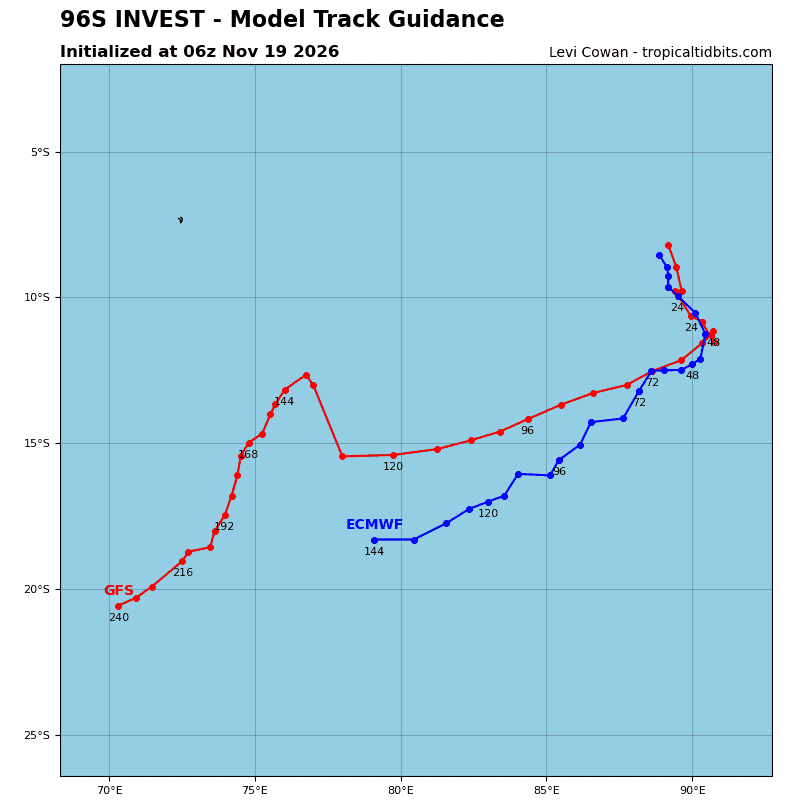
>>> There’s an area of disturbed weather that is being referred to as Invest 96S, which is located approximately 566 NM northwest of Coco Islands
Animated enhanced infrared (eir) satellite depicts a fully exposed low level circulation center (llcc), positioend to the north of a an area of persistent deep convection, sheared to the south due to persistent, moderate northeasterly vertical wind shear.
Environmental analysis reveals a marginal environment for development with a high vertical wind shear (vws) of (30 to 35 knots), moderate to strong poleward upper-level outflow, and warm sea surface temperatures (ssts) of (28 to 29 c).
Global deterministic models depict a clearly defined circulation however, the system struggles to meet wind speed criteria as it traverses southward. Ensemble models depict a steady-state intensity trend over the next 24-36 hours.
Maximum sustained surface winds are estimated at 28 to 33 knots.
Minimum sea level pressure is estimated to be near 1006 mb.
The potential for the development of a significant tropical cyclone within the next 24 hours is downgraded to medium.