

Current Snapshot
For all the latest updates visit: DisasterAWARE

1800×1080
2c
7c
1800×1080
infa
30W_031200sair
30W_tracks_latest
murasu
meteosat9_ir_04B_202611031521_lat16.2-lon80.1
04B_tracks_latest
By PDC’s Senior Weather
Specialist Glenn James

The Pacific Disaster Center’s (PDC Global) Tuesday, November 3, 2026, Tropical Cyclone Activity Report…for the Pacific Ocean, the Indian Ocean, and adjacent Seas.
Tropical Cyclones
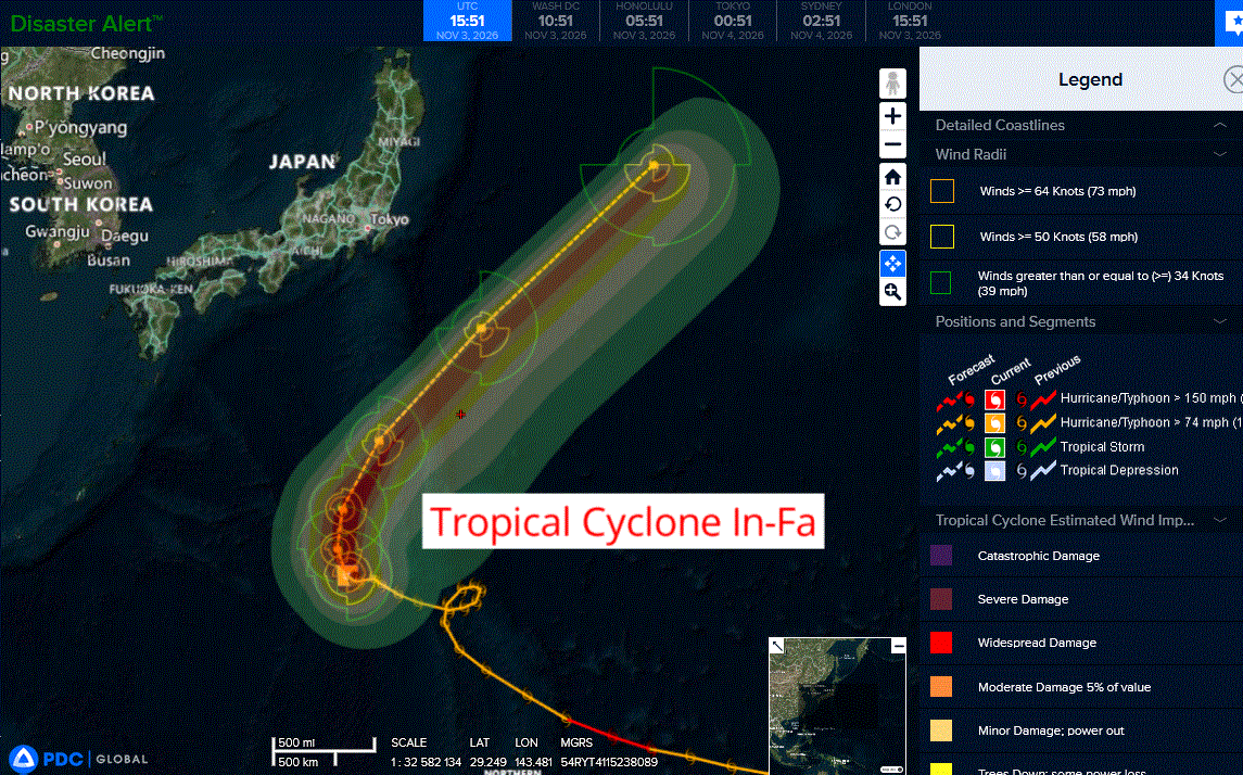
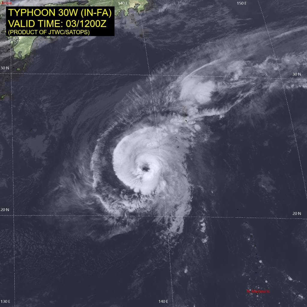
Tropical Cyclone 30W (In-fa)…is located approximately 164 NM west-southwest of Iwo To
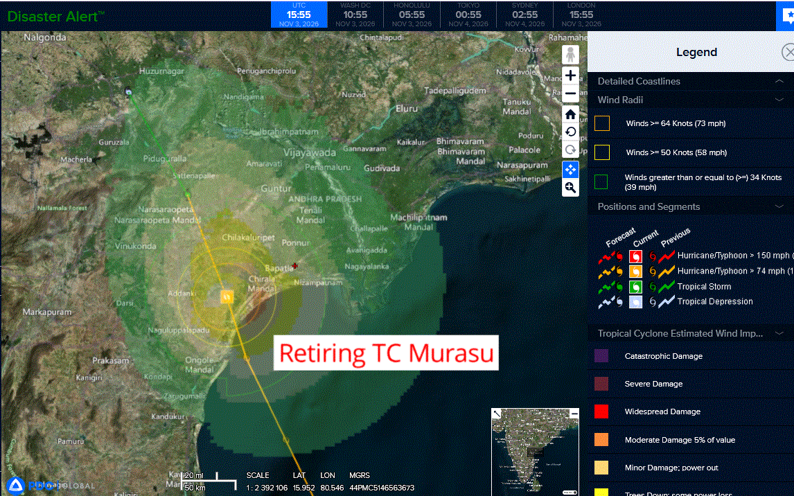
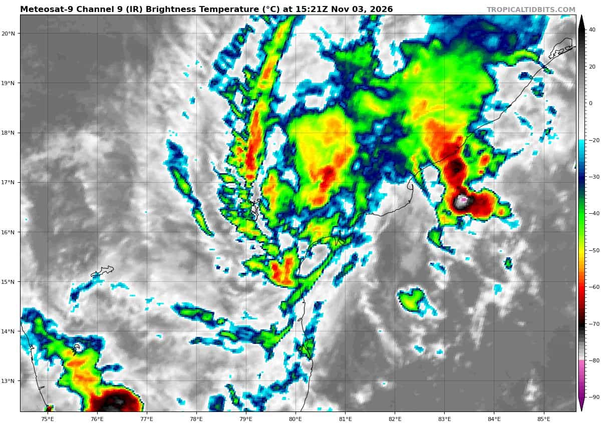
Tropical Cyclone 04B (Murasu)…is located approximately 618 NM southwest of Kolkata, India – Final Warning
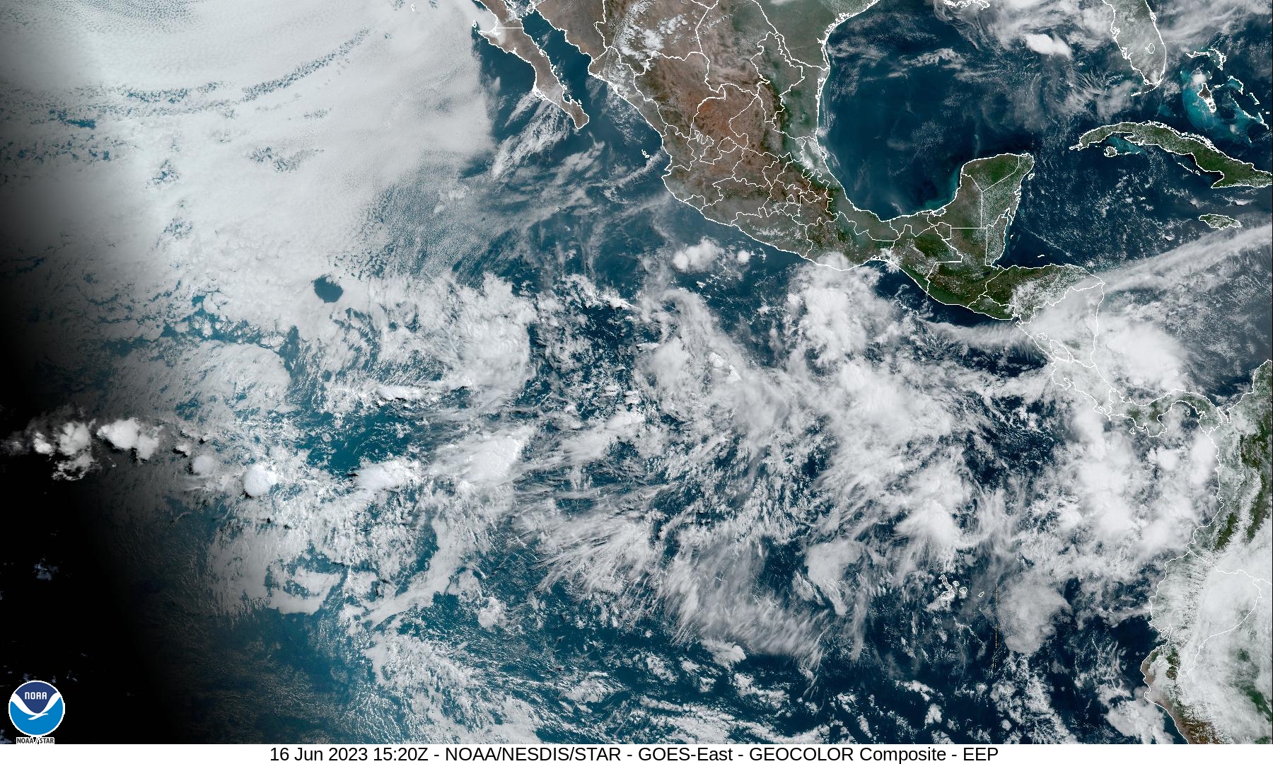
Northeast Pacific: There are no Tropical Cyclones
Central North Pacific: There are no Tropical Cyclones
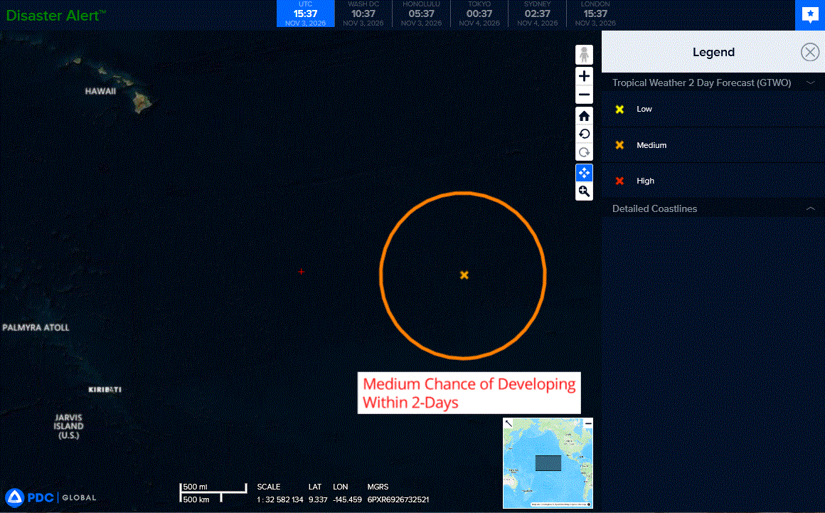
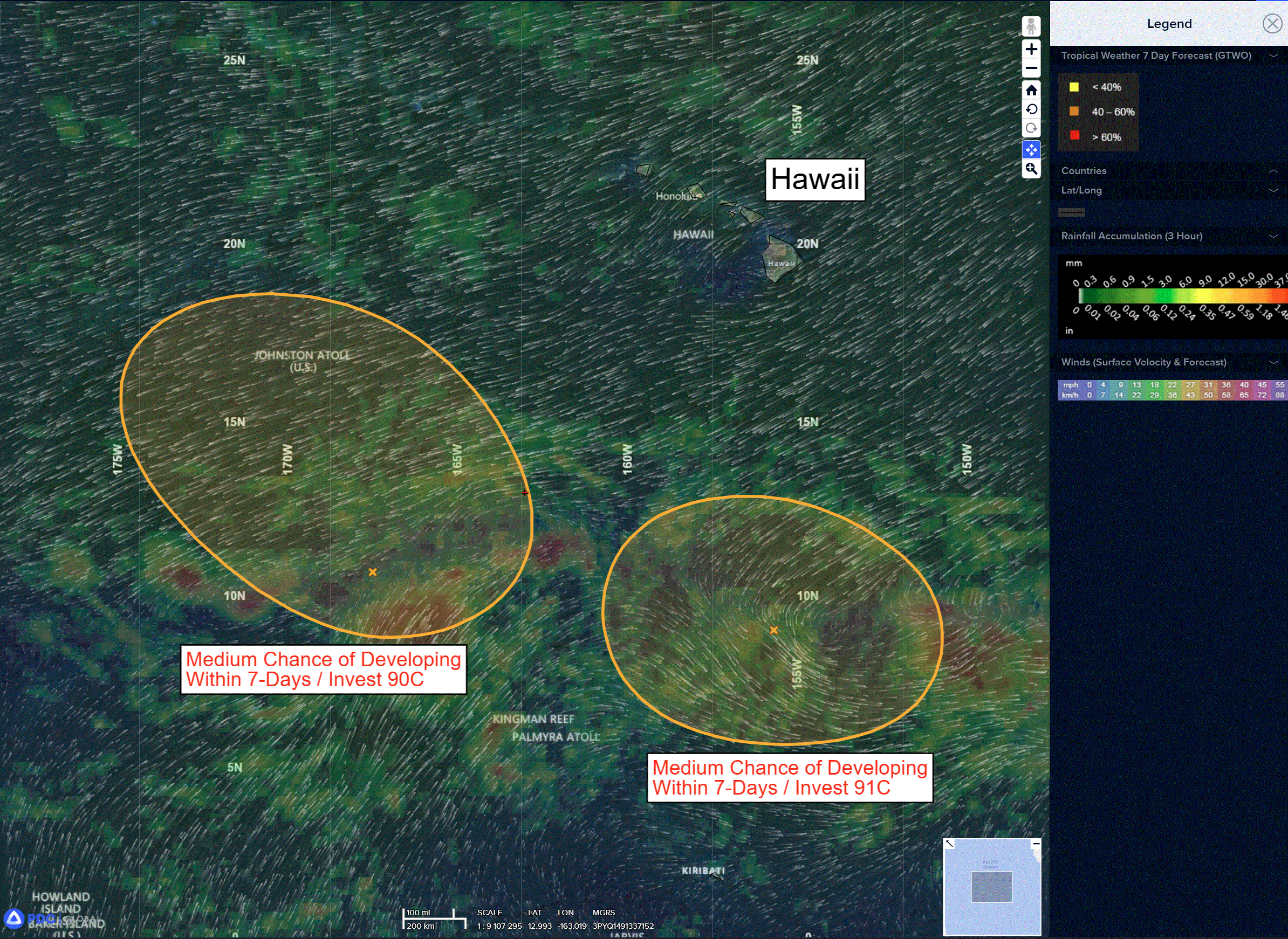
>>> Well Southeast of the Hawaiian Islands:
A broad area of low pressure located well east-southeast of the Hawaiian Islands is producing disorganized showers and thunderstorms.
Environmental conditions appear generally favorable for gradual development of this system, and a tropical depression is likely to form during the next few days as it moves westward to west-northwestward around 10 to 15 mph into the Central Pacific basin.
* Formation chance through 48 hours…medium…40 percent
* Formation chance through 7 days…high…70 percent
Western Pacific, Indian Ocean, and adjacent Seas:
Western Pacific
Tropical Cyclone 30W (In-Fa)
According to the JTWC warning number 45…sustained winds were 75 knots with gusts to 90 knots
Animated enhanced infrared (eir) satellite imagery depicts typhoon
30W (In-Fa) with a further improved appearance, indicated by the
presence of a ragged 28 nm eye and deep convection beginning to surround the eye in all quadrants. The western portion of the
system continues to be the weak point, likely hindered by the dry
air streaming down from the north into the vortex. A timely 031156z metop-b ascat pass revealed an asymmetry in the southwestern quadrant of the core, where the winds are weaker compared to the other 3 quadrants.
Environmental analysis indicates that 30W is in a marginally favorable environment characterized by strong poleward outflow aloft, low (5-10 kts) vertical wind shear, and warm (27-28 c) sea surface temperatures slightly offset by dry air entrainment from the west.
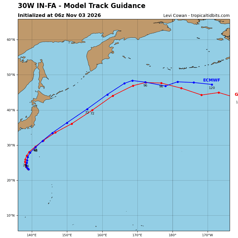
TY 30W has started to gain latitude over the past 6 hours as the str to the east becomes the dominant steering mechanism. The str to the west, centered south of Taiwan, has started to weaken, allowing the steering pattern to become more defined. As a result, the speed of advance of 30W is likely to begin steadily increasing in short order.
The system is forecast to track generally northward, along the western periphery of the str, through 24 hours. Following 24 hours, track speeds will significantly increase as 30W rounds the ridge axis and accelerates northeastward through the remainder of the forecast period.
In terms of intensity, 30W is forecast to continue intensifying through 24 hours in response to the robust poleward outflow and low to moderate vertical wind shear. By 36 hours, westerly shear is expected to increase to over 30 kts, which will initiate a weakening trend. By 48 hours, 30W will have crossed the 26 c sst isotherm, further aiding in weakening the system.
However, the exceptional poleward outflow channel and baroclinic forcing is forecast to allow 30W to maintain typhoon intensity throughout the transition into an extratropical cyclone. Extratropical transition is forecast to begin at 60 hours with completion around 72 hours, as the vortex becomes embedded
underneath the strong mid-latitude westerlies.
North Indian Ocean
Tropical Cyclone 04B – Final Warning
According to the JTWC warning number 10…sustained winds were 65 knots with gusts to 80 knots
Animated radar imagery showed 04B making landfall at around 030200z just northeast of Ongole as a highly compact cyclone. Following landfall, 04B has started to rapidly deteriorate with increasingly disorganized convection and warming cloud top temperatures.
The system is forecast to continue drifting slowly north-northwestward over the next 24 hours as it tracks further inland. Terrain interaction will further erode the compact vortex, with dissipation expected to occur no later than 24 hours.