

Current Snapshot
For all the latest updates visit: DisasterAWARE
1800×1080
7e
infa
30W_311200sair
himawari9_ir_30W_202610311540_lat22.8-lon143.5
30W_tracks_latest

91B_tracks_latest
By PDC’s Senior Weather
Specialist Glenn James

The Pacific Disaster Center’s (PDC Global) Saturday, October 31, 2026, Tropical Cyclone Activity Report…for the Pacific Ocean, the Indian Ocean, and adjacent Seas.
Tropical Cyclones
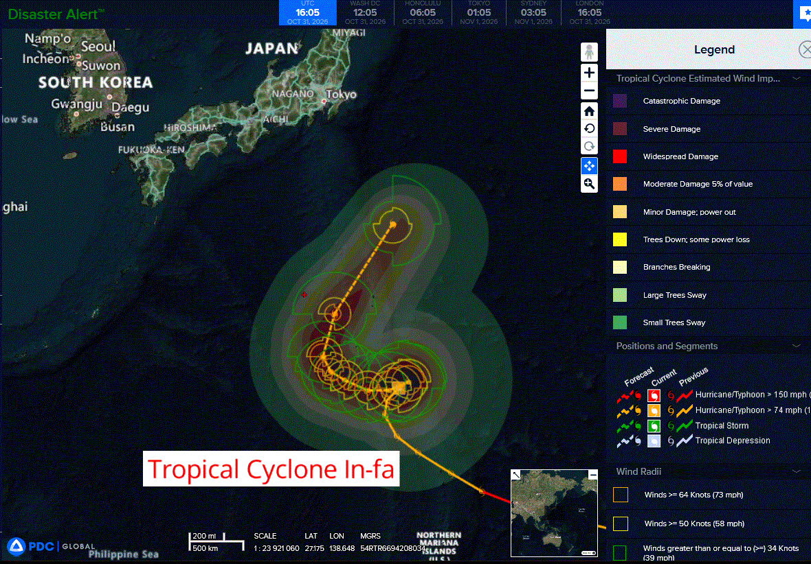
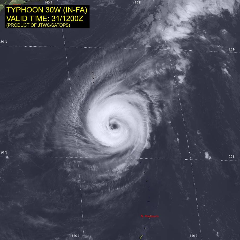
Tropical Cyclone 30W (In-fa)…is located approximately 170 NM southeast of Iwo To
Tropical Cyclone 04B…is located approximately 668 NM south of Kolkata, India
Northeast Pacific: There are no Tropical Cyclones
Central North Pacific: There are no Tropical Cyclones
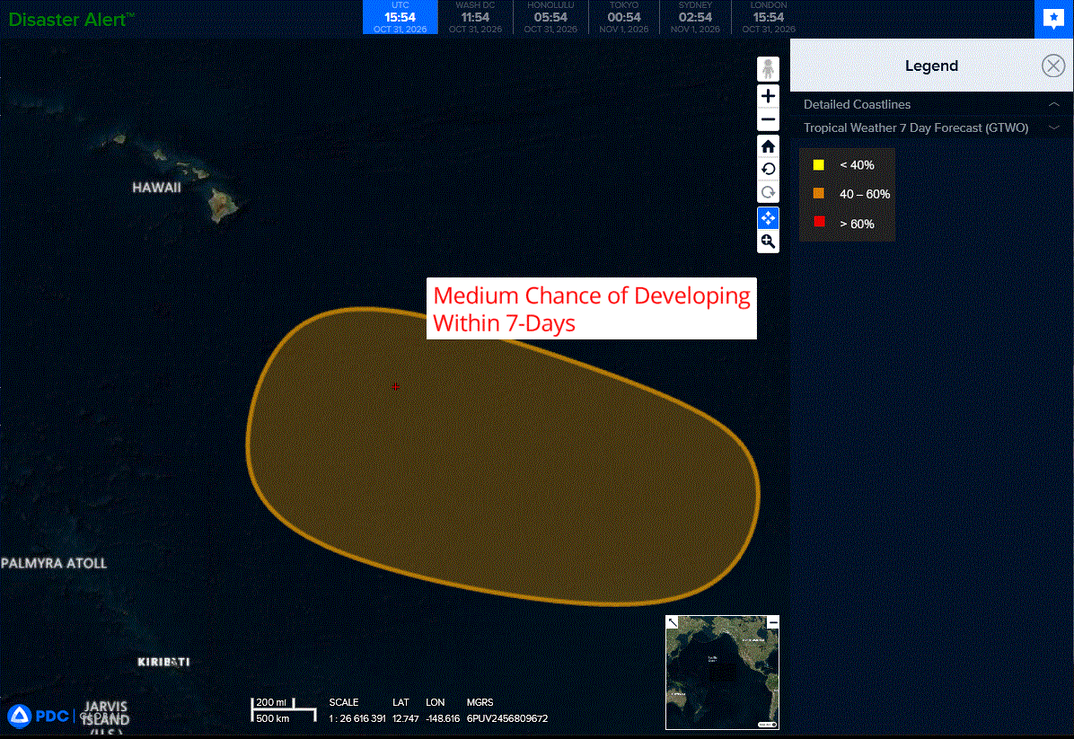
>>> Well Southeast of the Hawaiian Islands:
A broad area of low pressure is forecast to develop well to the southeast of the Hawaiian Islands by early next week. Thereafter, environmental conditions appear generally favorable for gradual development of this system, and a tropical depression could form by the end of next week as it moves westward to west-northwestward over the Central Pacific basin.
* Formation chance through 48 hours…low…near 0 percent
* Formation chance through 7 days…medium…40 percent
Western Pacific, Indian Ocean, and adjacent Seas:
Western Pacific
Tropical Cyclone 30W (In-fa)
According to the JTWC warning number 33…sustained winds were 110 knots with gusts to 135 knots
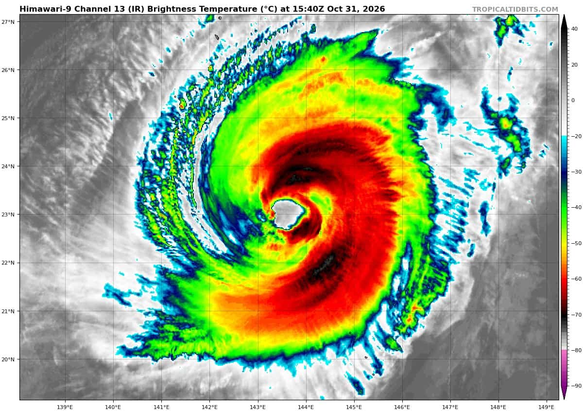
Animated enhanced infrared (eir) satellite imagery depicts a contracting eye, now measured at 31 nm, characterized by cooling eye temperatures (15c) and warming cloud-top temperatures within the central dense overcast (cdo). A series of microwave images, culminating with a 310926z ssmis 91 ghz pass, indicates the rapid progression of an eyewall replacement cycle (erc), which is nearly completed.
The cimss m-perc hovmoller diagram clearly reveals a weak remnant inner eyewall consolidating with the secondary eyewall as of the 0926z ssmis pass. This evolution is also evident in the animated eir imagery, as the decaying inner eyewall detaches from the secondary eyewall ring and structurally degrades, creating a well-defined moat feature, particularly in the southwestern quadrant.
At the synoptic scale, the frontal boundary to the northwest is rapidly
dissipating and fragmenting as it propagates southeastward, and is currently located approximately 300 nm northwest of typhoon (ty) 30W. Upper-level analysis reveals a mesoscale point-source directly over 30W providing symmetric radial outflow aloft, while a robust 200 mb anticyclone is positioned to the east, supporting enhanced poleward outflow.
The microwave suite also reveals that ty 30W is thermodynamically isolated within a narrow corridor of deep tropospheric moisture, peripherally encircled by a dry, subsiding air mass, especially to the northwest and south.
Environmental conditions are marginal, primarily due to structural disruptions from the erc and the inception of significant self-induced oceanic upwelling, which will temper otherwise favorable conditions of low deep-layer vertical wind shear (vws) and robust poleward outflow.
Typhoon (ty) 30W has begun its east-northeastward turn over the past six hours as the str to the east shifts subtly southward and its northwestern boundary erodes in response to a mid-latitude shortwave trough passing to the north. Themost recent frames of eir imagery, however, suggest the system is
exhibiting minor trochoidal wobbling as the erc concludes.
Once the trough passes to the north in the next 6-12 hours, the str to the west will strengthen and build eastward, while the ridge to the east weakens and shifts southward. By 12 hours, the entire synoptic-scale ridge pattern begins to shift westward, with the two primary ridging centers translating about 10 degrees longitude to the west while maintaining their overall relationship with one another.
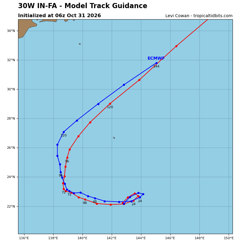
TY 30W will reach an inflection point by 12 hours, at roughly 144e, whereupon it will rapidly shift direction back toward the west-southwest, moving within the shifting synoptic pattern. Beyond 36 hours, a series of shortwave troughs will pass to the north, progressively eroding the northeastern portion of the str over Taiwan, allowing ty 30W to gradually turn northwestward through 60 hours.
After 60 hours, the str shifts sharply westward into China, while the ridge over the central Pacific builds and becomes the dominant steering influence on ty 30W.at 72 hours, the system begins to recurve around the ridge axis, assisted in its northward trajectory by the approach of a cold frontal boundary moving southeastward from Japan.
Regarding intensity, ty 30W is forecast to steadily weaken over the next 36
hours, primarily due to the onset of significant localized upwelling as its translational speed reduces. By 48 hours, as the system translates away from the self-induced cold pool, it will re-intensify slightly. By 96 hours, ty 30W will begin to weaken once more as it traverses cooler sea surface temperatures (ssts) and experiences sharply degraded dynamics from strengthening shear and dry air entrainment.
North Indian Ocean
Tropical Cyclone 04B
According to the JTWC warning number 1…sustained winds were 35 knots with gusts to 45 knots