

Current Snapshot
For all the latest updates visit: DisasterAWARE
vance
goes18_ir_22E_202610291505_lat21.4-lon-108.7
291431INTQPF_sm
22E_tracks_latest
7c

1800×1080
infa
30W_291200sair
himawari9_ir_30W_202610291500_lat16.6-lon151.3
30W_tracks_latest
91b
himawari9_ir_91B_202610291500_lat9.3-lon96.8
91B_tracks_latest
By PDC’s Senior Weather
Specialist Glenn James

The Pacific Disaster Center’s (PDC Global) Thursday, October 29, 2026, Tropical Cyclone Activity Report…for the Pacific Ocean, the Indian Ocean, and adjacent Seas.
Tropical Cyclones
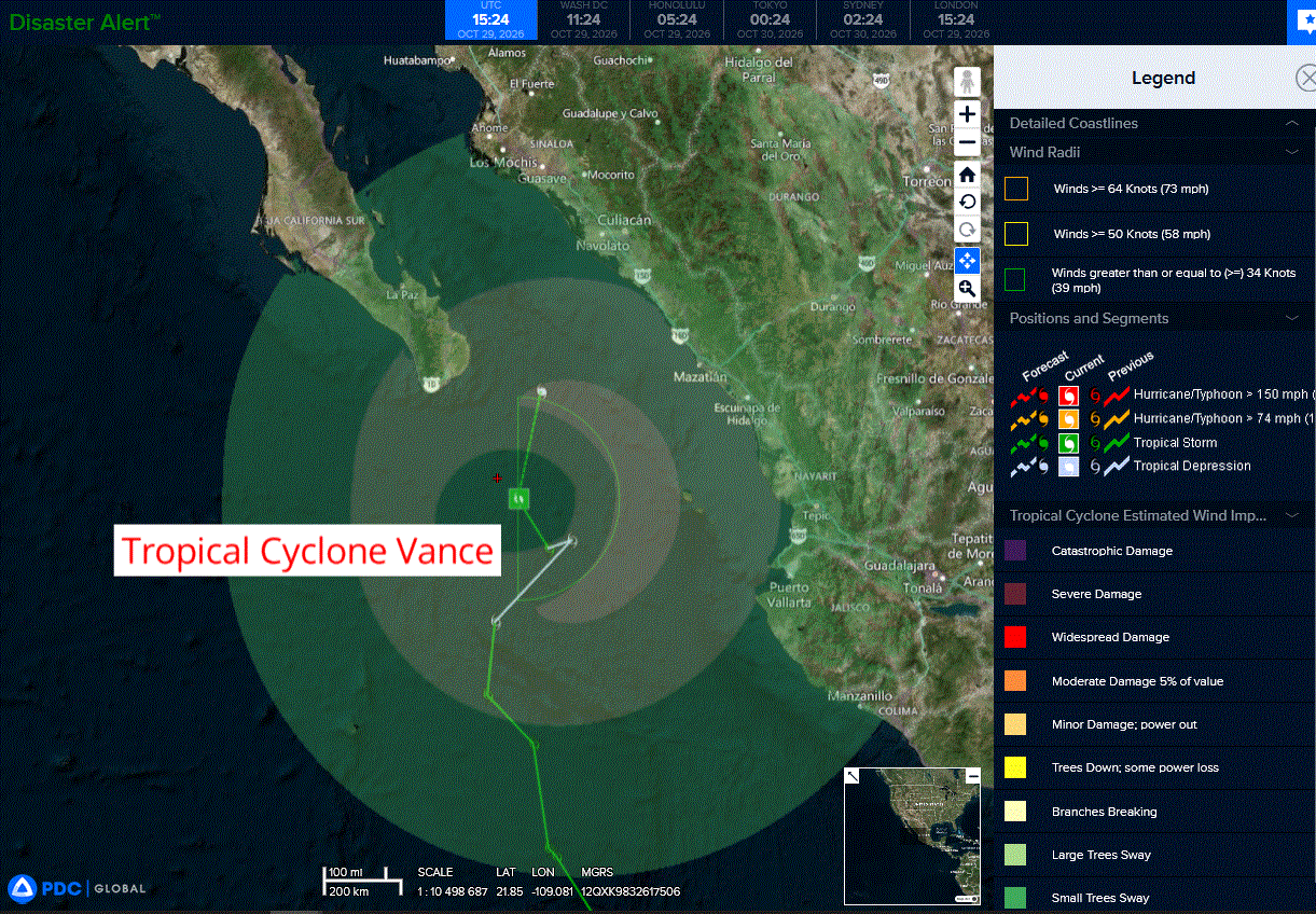
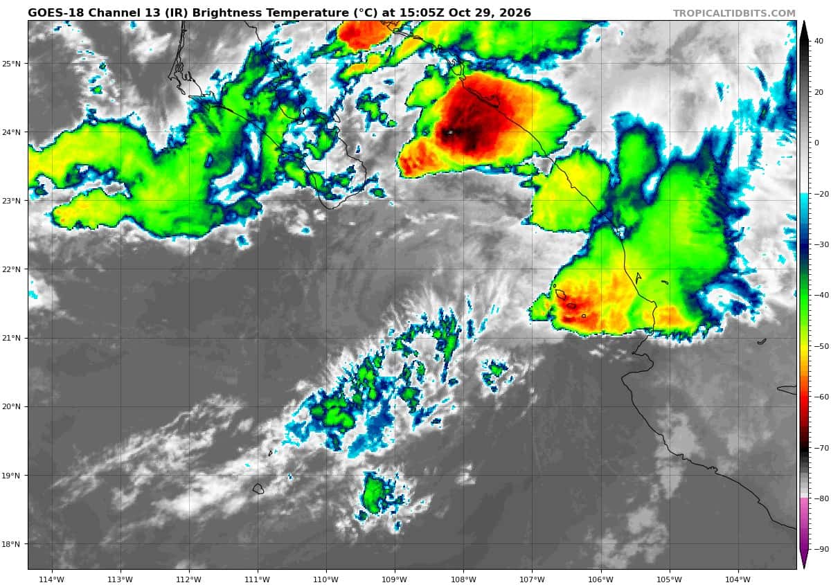
Tropical Cyclone 22E (Vance)…is located 115 miles southeast of the southern tip of Baja CA
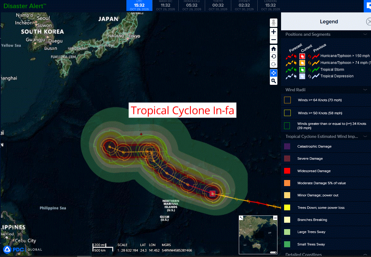
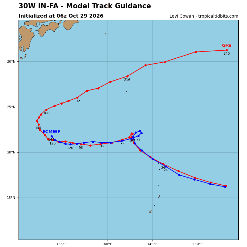
Tropical Cyclone 30W (In-fa)…is located approximately 328 NM east-northeast of Saipan
Northeast Pacific:
Tropical Cyclone 22E (Vance)
FLOOD AND MUDSLIDE THREAT CONTINUES FOR MEXICO DUE TO VANCE…MOISTURE FROM VANCE WILL SPREAD INTO PORTIONS OF THE SOUTH-CENTRAL AND SOUTHWESTERN UNITED STATES.
According to the NHC advisory number 33
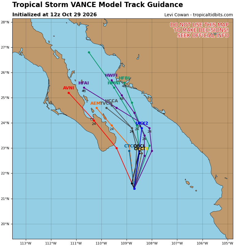
Vance is moving toward the north near 8 mph (13 km/h) and this motion is expected to continue until Vance dissipates tonight or early Friday. Maximum sustained winds are near 40 mph (65 km/h) with higher gusts. Weakening is forecast, and Vance is expected to become a post-tropical remnant low later today. Tropical-storm-force winds extend outward up to 90 miles (150 km) from the center. The estimated minimum central pressure is 1004 mb (29.65 inches).
HAZARDS AFFECTING LAND
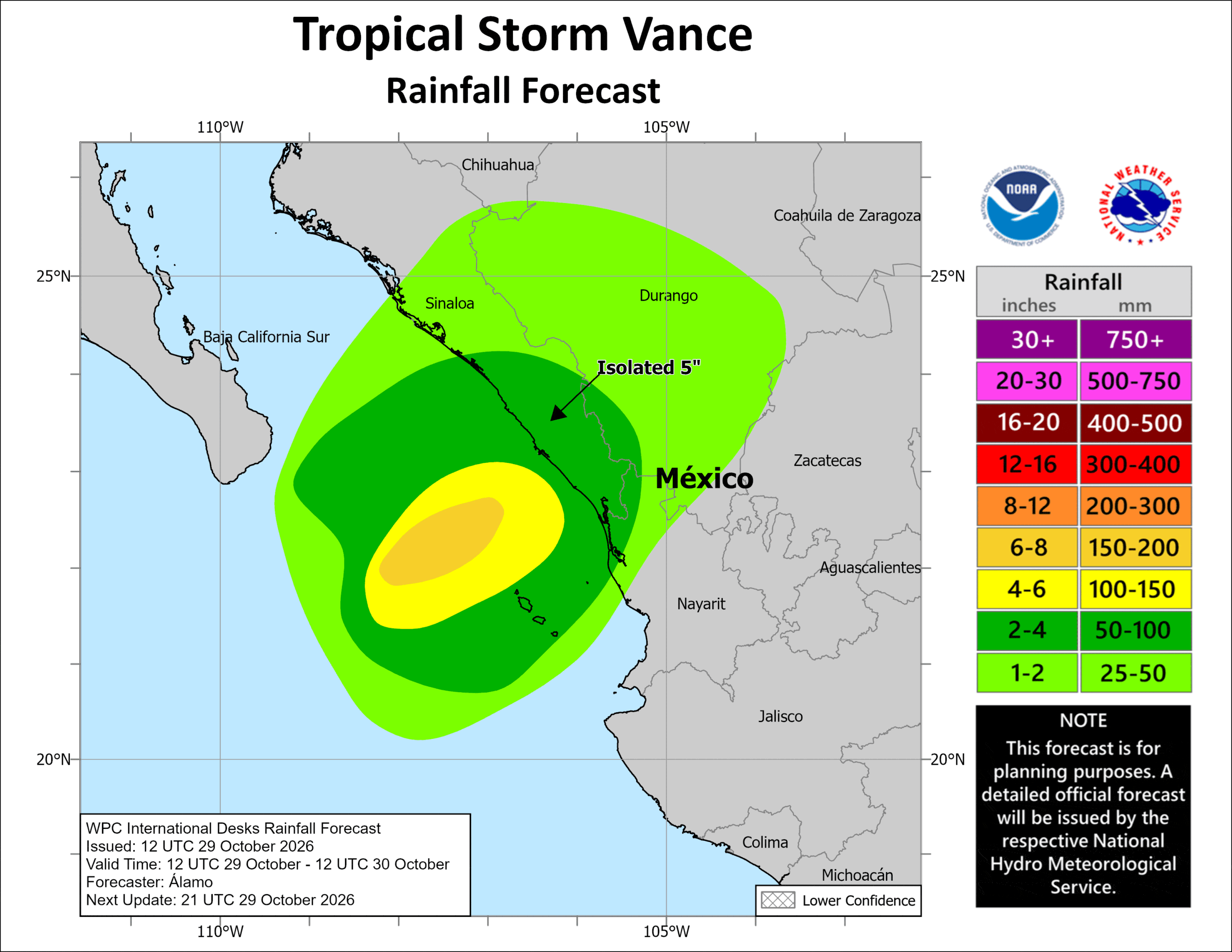
RAINFALL: Through tonight, Vance is expected to produce 2 to 4 inches of rain across central and southern Sinaloa, far southwestern Durango, and far northwestern Nayarit, with isolated higher totals over 5 inches possible across central and southern Sinaloa. This rainfall may produce flooding and mudslides, especially in areas along steep terrain.
Moisture carried northeastward from Vance combined with other Pacific moisture will begin to produce heavy rainfall across the U.S. Southern Plains and New Mexico today into Friday.
SURF: Swells generated by Vance will affect coastal portions of southwestern and west-central Mexico, as well as the southern portion of the Baja California Peninsula, during the next day or so. These swells are likely to cause life-threatening surf and rip current conditions.
Central North Pacific: There are no Tropical Cyclones
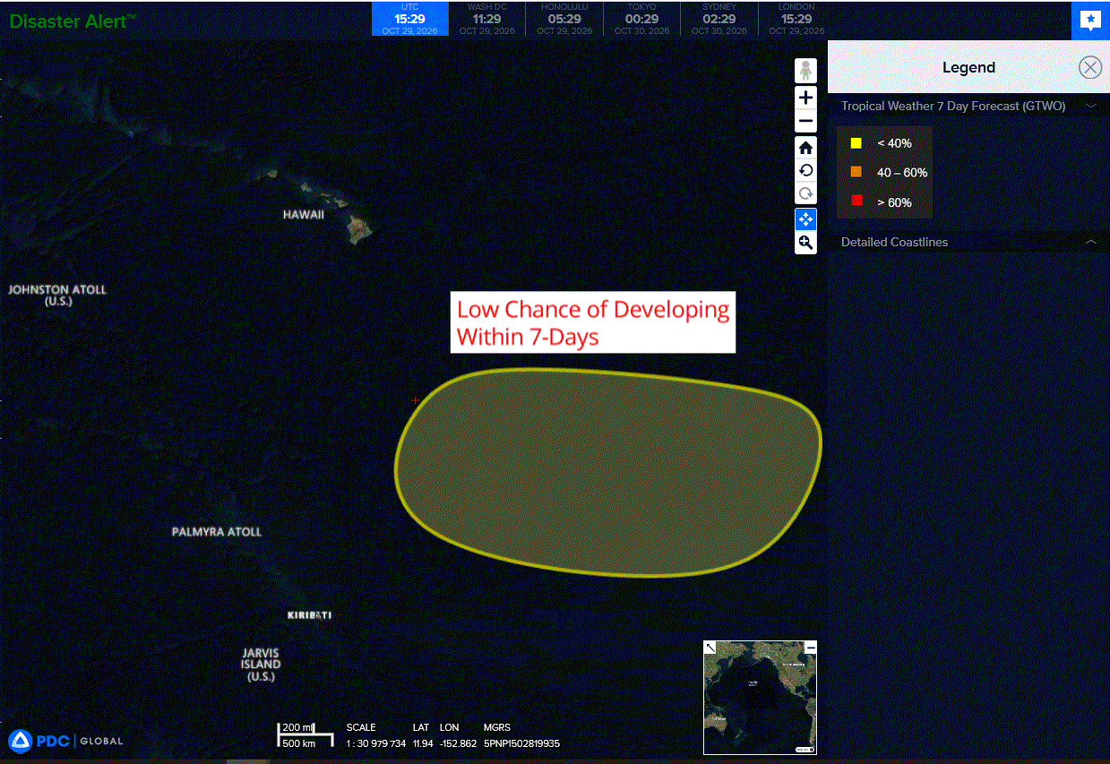
>>> Well Southeast of the Hawaiian Islands:
A broad area of low pressure is likely to develop well to the southeast of the Hawaiian Islands this weekend or early next week. Thereafter, environmental conditions appear generally favorable for some slow development of this system as it moves westward to west-northwestward into the Central Pacific basin.
* Formation chance through 48 hours…low…near 0 percent
* Formation chance through 7 days…low…30 percent
Western Pacific, Indian Ocean, and adjacent Seas:
Western Pacific
Tropical Cyclone 30W (In-fa)
According to the JTWC warning number 25…sustained winds were 130 knots with gusts to 160 knots
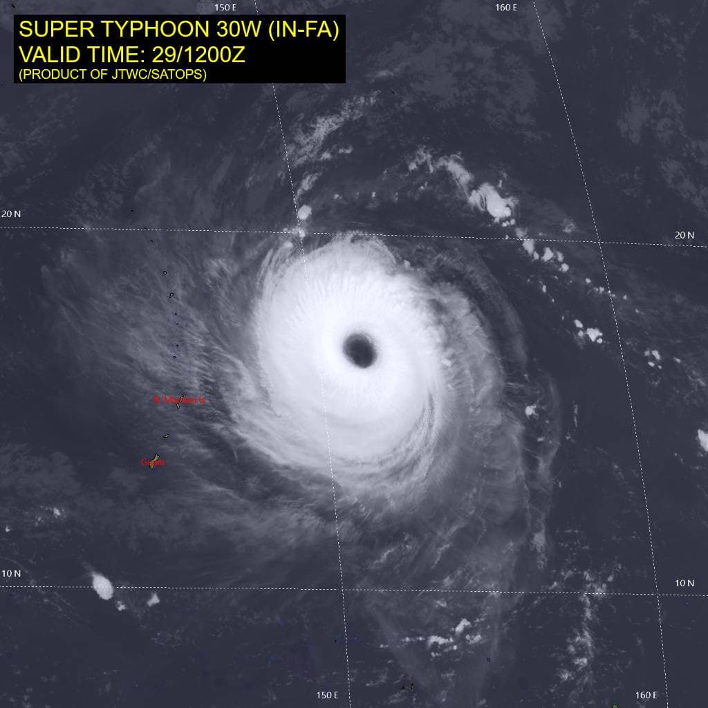
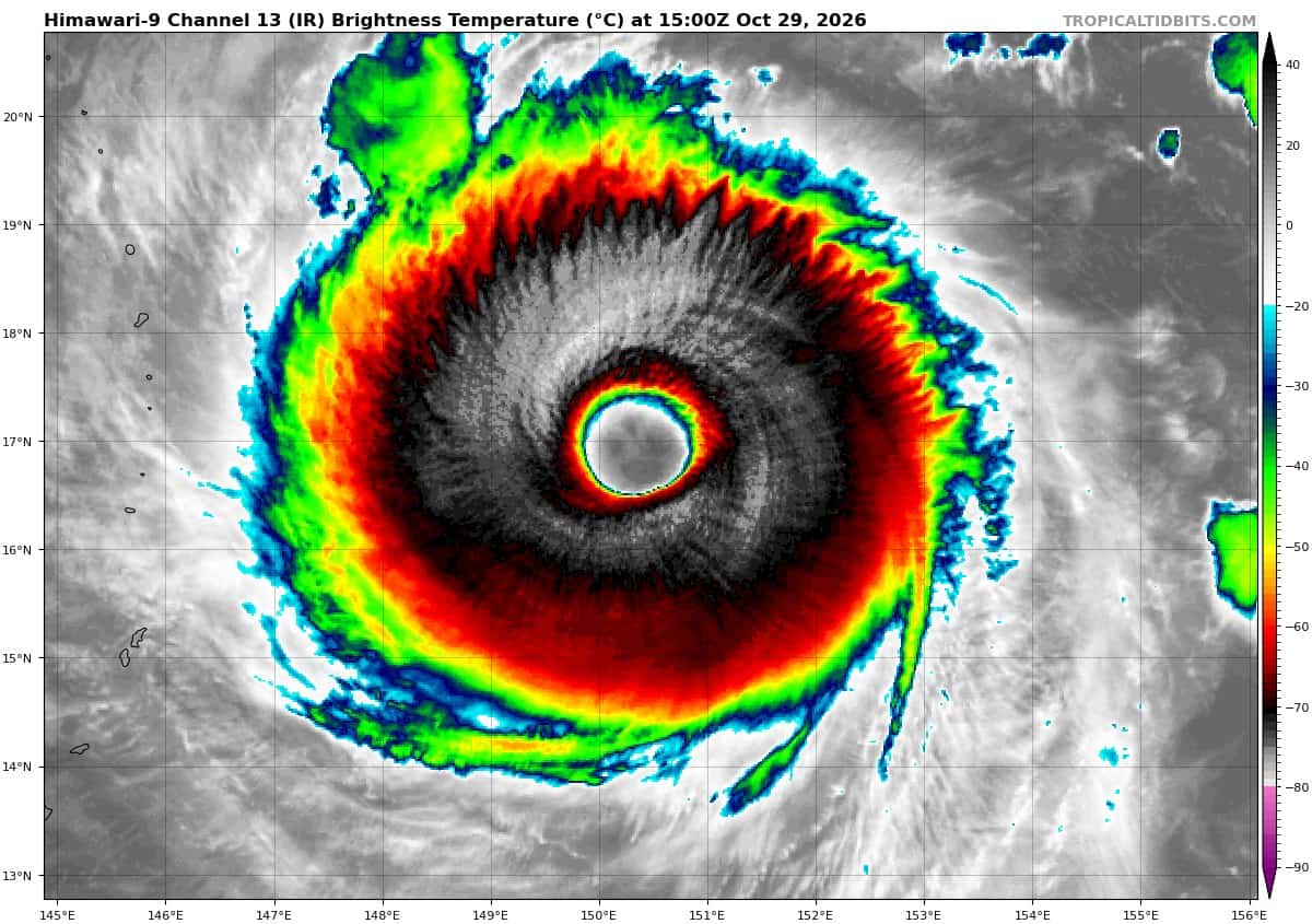
Animated multi-spectral satellite imagery (msi) depicts ty 30W with a semi-annular convective structure and a cloud-free, 40-nm-wide eye that has gradually warmed to +16 degrees celsius. over the past six hours, deep convection has continued to cycle in the upshear semicircle under low to moderate vertical wind shear (vws), and cloud-top temperatures have cooled.
The central dense overcast (cdo), which previously showed a weakness in the northern semicircle, has become more symmetric. A 282308z ascat-b uhr image revealed that the wind field has expanded, and the core of storm-and typhoon-force winds is rather large. The uhr scatterometer data also estimated peak winds of 115 kts at that time. because the storm’s satellite appearance has improved since then, the initial intensity has been raised to 120 kts with medium confidence.
The environment is largely favorable, with sufficiently high ocean heat content (ohc), low vertical wind shear (vws), and moderate radial outflow aloft.
TY 30W has accelerated west-northwestward to 17 kts along the southwestern periphery of the str, a motion that will continue over the next 24 hours. Then, a longwave trough passing over Honshu will create a large weakness in the str, allowing TY 30W to turn poleward and slow down. the progressive trough will pass quickly, and a separate str to the west will build
eastward and close off the opening. This evolution should cause ty 30W to deflect westward.
At the end of the forecast period, another trough passing to the north may create another opening. The forecast accordingly slows the system at 120 hours and depicts the beginning of a second poleward turn.
The intensity of ty 30W will largely be governed by internal changes in its structure and small changes in the environment over the next 48 hours. Conditions will remain favorable, with low vws and sufficiently high ohc values.The current intensification of ty 30W is consistent with a slight
decrease in shear and a slight increase in ohc. Therefore, the forecast calls for continued modest intensification to 125 kts at 12 hours as the system moves over a small pocket of slightly higher ohc. Tthe average ohc appears to be slightly lower after 12 hours, so the forecast holds the intensity steady at 120 kts from 24 to 48 hours.
thereafter, a significant slowing of the translation speed will likely promote upwelling of cooler waters, resulting in a period of steady weakening. The amount of weakening will depend on the time required to make the turn and the latitude of the turn, as the storm center will straddle a sharp gradient in ohc values. The intensity beyond 60 hours will depend on the structure and size of the system, and it remains to be determined whether ty 30W can recover before it slows down for a second time and begins a final poleward turn at 120 hours.
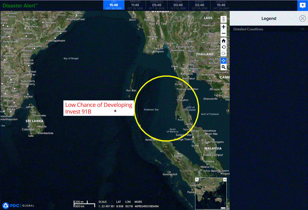
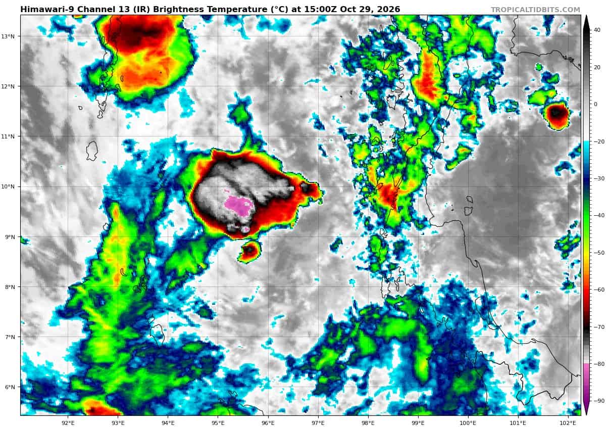
>>> There’s an area of disturbed weather, being referred to as Invest 91B, which is located approximately 99 NM northwest of Phuket
Animated multi-spectral satellite imagery portrays a broad area of persistent deep convection associated with a disorganized low-level circulation center, evident in a 282127z 91ghz ssmis partial pass
showing loosely curving cloud lines, consistent with an earlier ascat
pass around 281356z. The same ascat pass revealed elevated winds
concentrated within the western semicircle of the llcc, associated with
the region of deep convection.
System appears to be transiting slowly westward, away from the Malay Peninsula. Deep convection is concentrated mostly northwest of the llcc, with mid-level turning offset northwest of the assessed center position.
Environmental analysis of the area reveals a marginally favorable environment for development with warm (29-30c) sea surface temperatures and moderate radial outflow aloft, offset slightly by low to moderate (15-20 kts) easterly vertical wind shear.
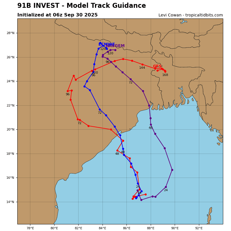
Global deterministic and ensemble models are in agreement with gradual
development expected over the next few days as the system transits west-
northwestward through the Bay of Bengal.
Maximum sustained surface winds are estimated at 18 to 23 knots.
Minimum sea level pressure is estimated to be near 1010 mb.
The potential for the development of a significant tropical cyclone within the next 24 hours remains low.