

Current Snapshot
For all the latest updates visit: DisasterAWARE
1800x1080e
vance
271439_earliest_reasonable_toa_34
goes18_ir_22E_202610271515_lat16.1-lon-107.3
271439INTQPF_sm
22E_tracks_latest
infa
30W_271200sair
himawari9_ir_30W_202610271510_lat14.5-lon161.6
30W_tracks_latest

a
02B_271200sair
meteosat9_ir_02B_202610271521_lat16.3-lon82.7
02B_tracks_latest
90b
meteosat9_ir_90B_202610271521_lat13.0-lon86.4

90B_tracks_latest
By PDC’s Senior Weather
Specialist Glenn James

The Pacific Disaster Center’s (PDC Global) Tuesday, October 27, 2026, Tropical Cyclone Activity Report…for the Pacific Ocean, the Indian Ocean, and adjacent Seas.
Tropical Cyclones
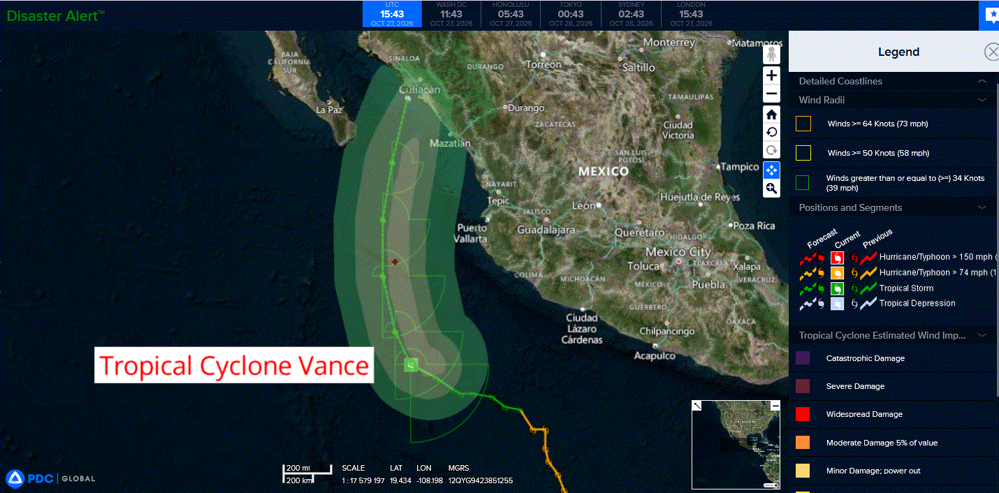
Tropical Cyclone 22E (Vance)…is located 290 miles southwest of Manzanillo, Mexico
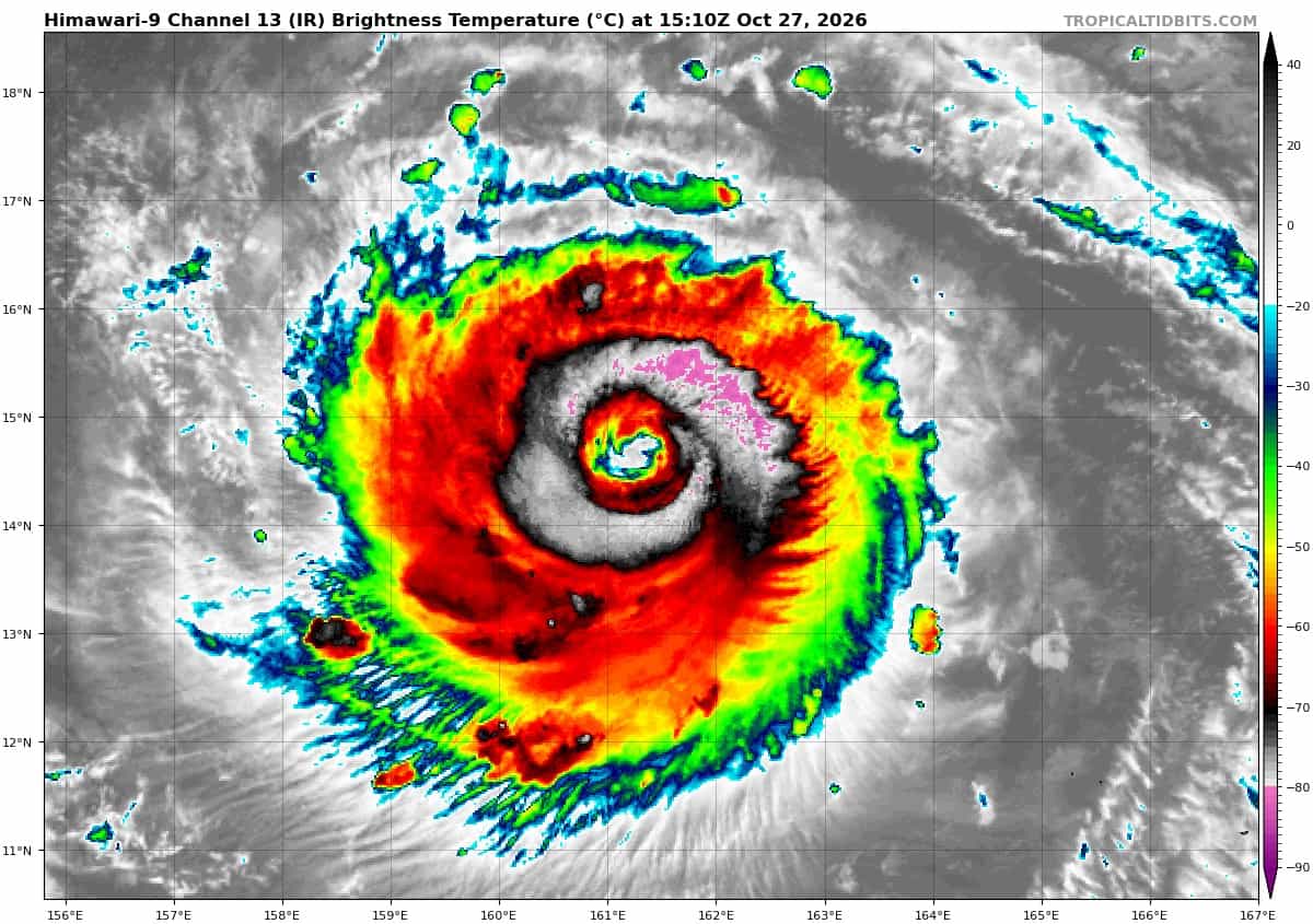
Tropical Cyclone 30W (In-fa)…is located approximately 407 NM southwest of Wake Island
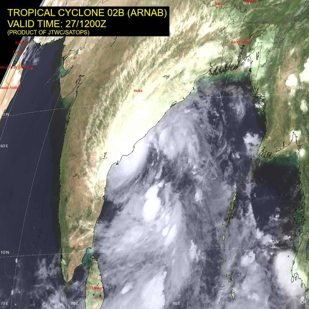
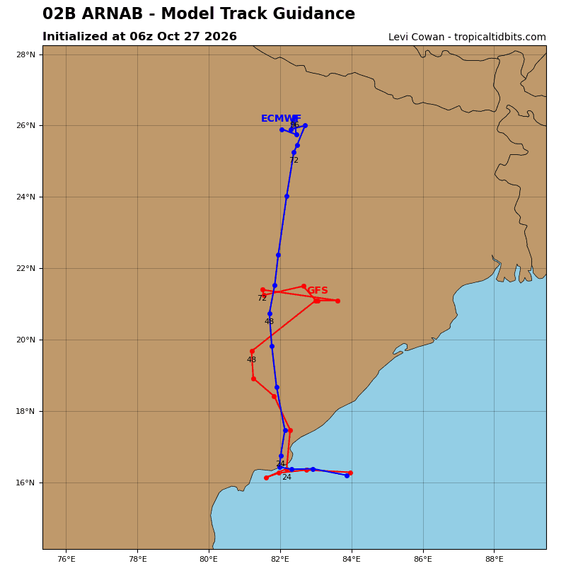
Tropical Cyclone 02B (Arnab)…is located approximately 497 NM southwest of Kolkata, India
Northeast Pacific:
Tropical Cyclone 22E (Vance)
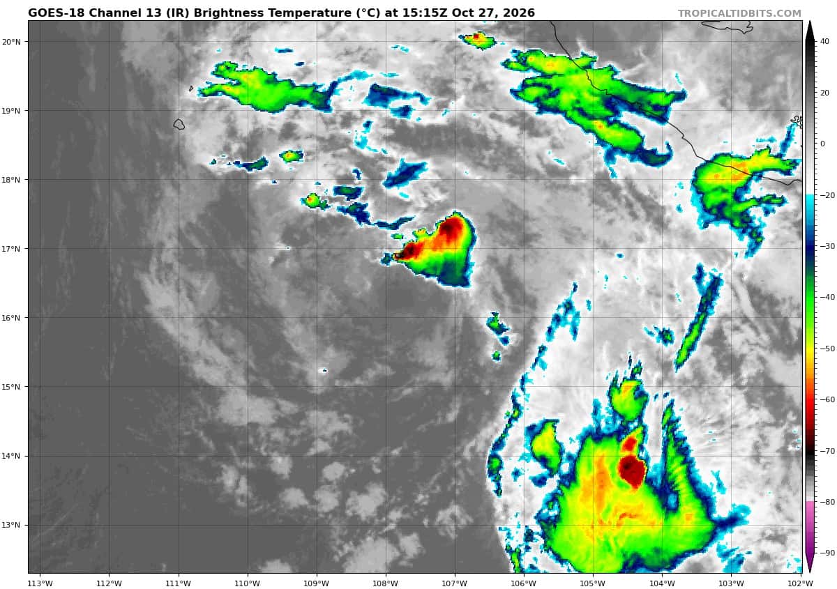
VANCE IS A POORLY ORGANIZED TROPICAL STORM
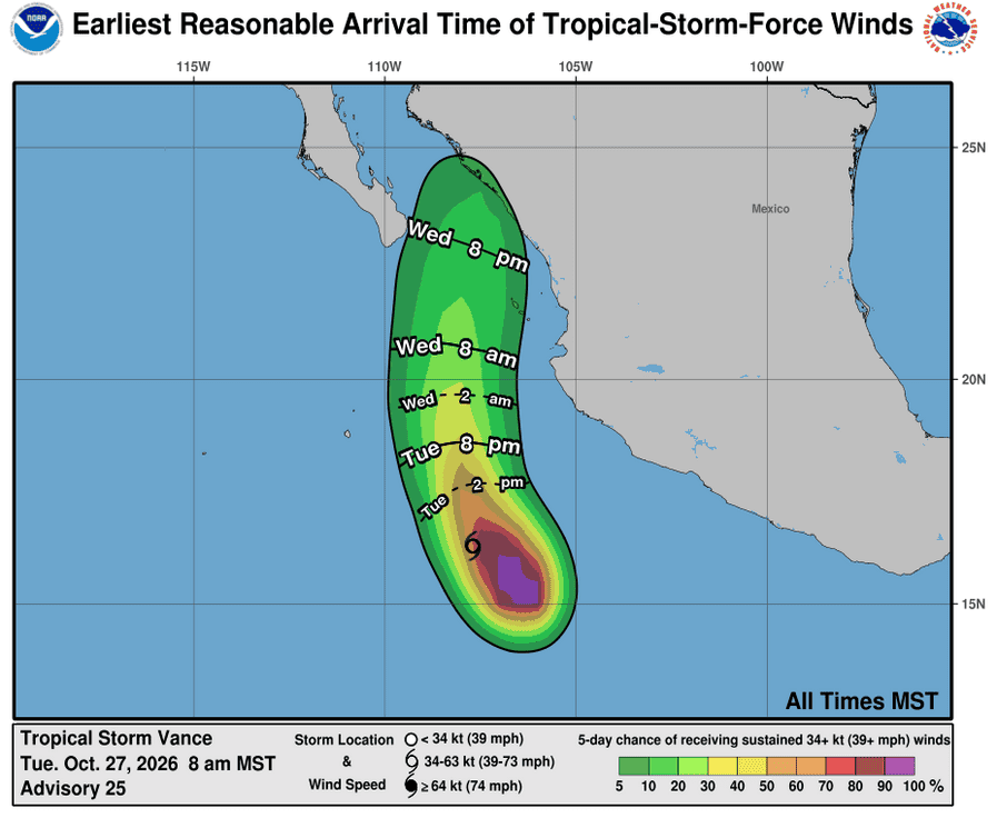
According to the NHC advisory number 25
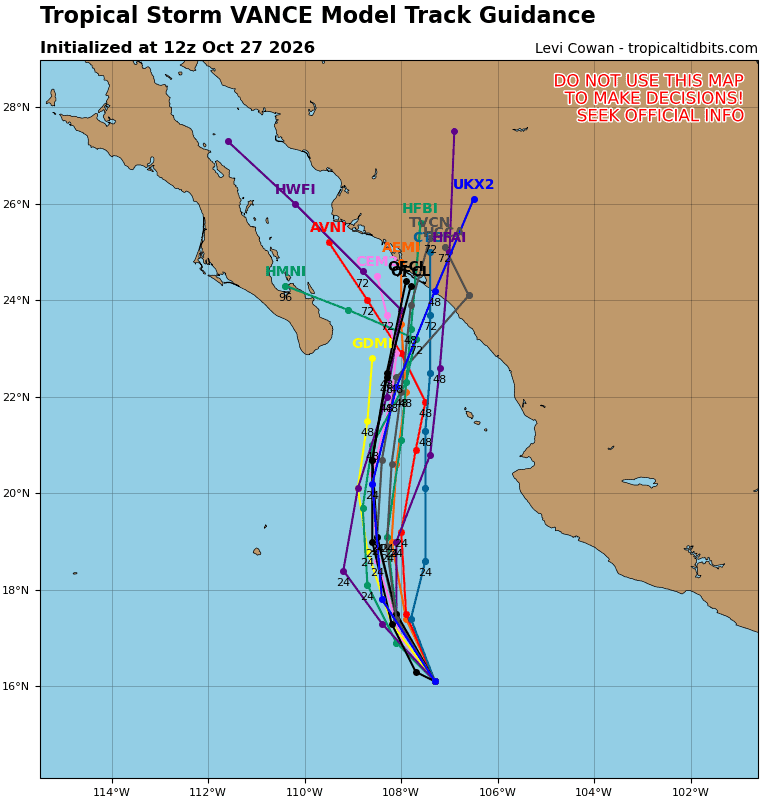
Vance is moving toward the northwest near 8 mph (13 km/h). A northwestward motion is expected to continue today, followed by a gradual turn toward the north through midweek.
Maximum sustained winds have decreased to near 40 mph (65 km/h) with higher gusts. Little change in strength is forecast during the next couple of days, and Vance could become a post-tropical cyclone during this time if it is unable to sustain organized convection.
Tropical-storm-force winds extend outward up to 175 miles (280 km) primarily to the southeast of the center. The estimated minimum central pressure is 1003 mb (29.62 inches).
HAZARDS AFFECTING LAND
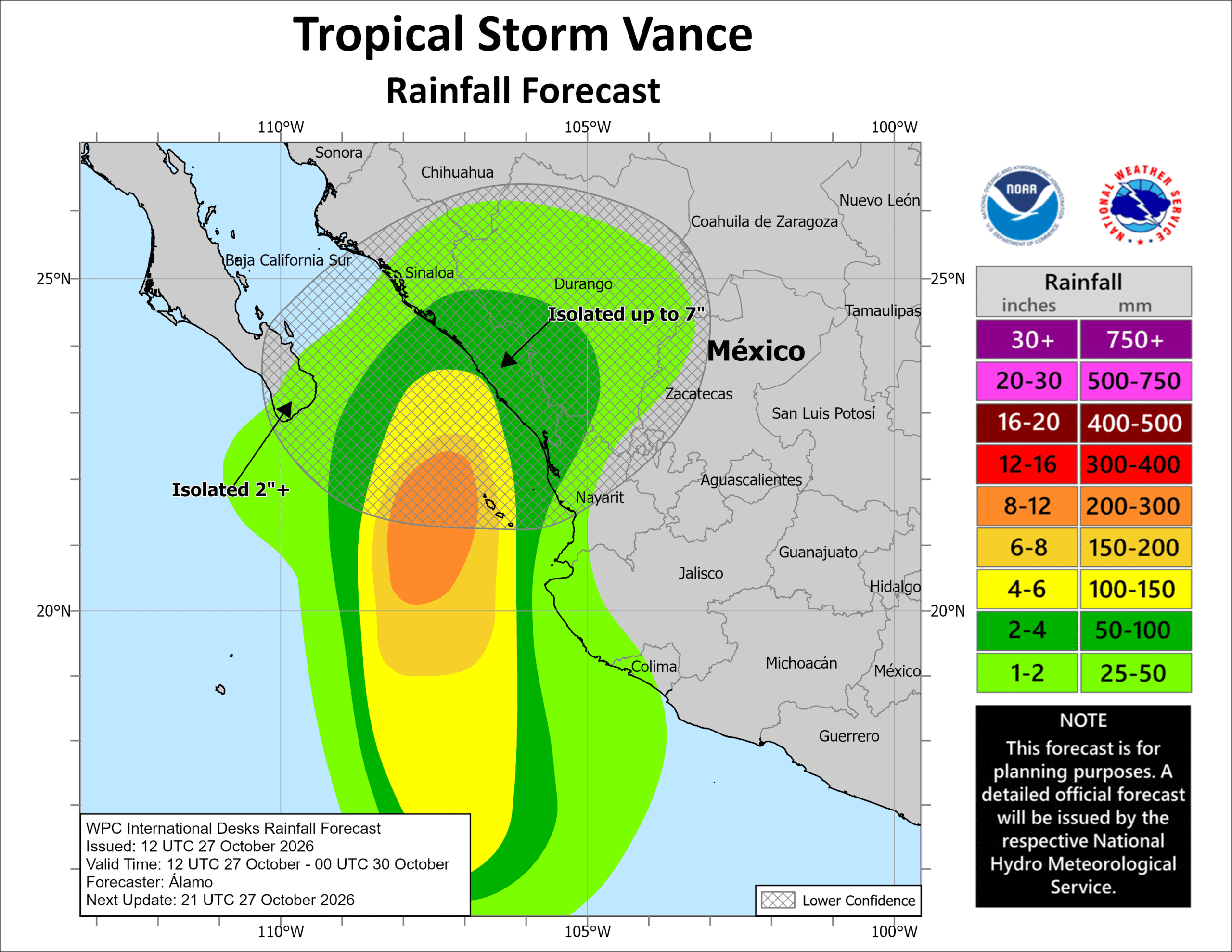
RAINFALL: Through Thursday, Vance is expected to produce 2 to 4 inches of rain across central and southern Sinaloa, western Durango, and northwestern Nayarit, with isolated higher totals of 7 inches possible over central and southern Sinaloa. This rainfall may produce flooding and mudslides, especially in areas along steep terrain.
SURF: Swells generated by Vance will affect coastal portions of southern, southwestern, and west-central Mexico during the next few days. These swells are likely to cause life-threatening surf and rip current conditions.
Central North Pacific: There are no Tropical Cyclones
Western Pacific, Indian Ocean, and adjacent Seas:
Western Pacific
Tropical Cyclone 30W (In-fa)
According to the JTWC warning number 17…sustained winds were 105 knots with gusts to 130 knots
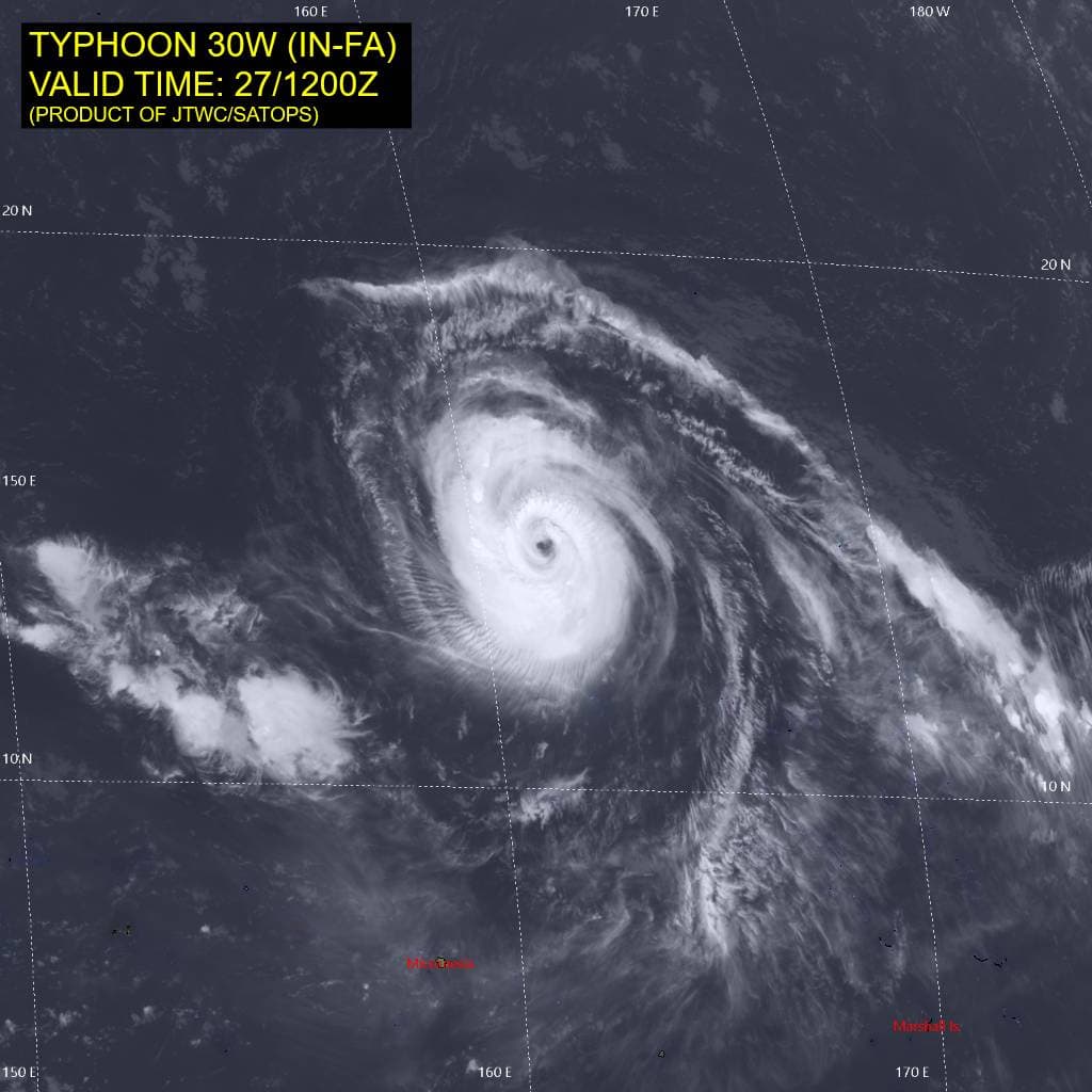
Animated enhanced infrared (eir) satellite imagery depicts a compact vortex with a ragged, cloud-filled eye, vigorous bands of deep convection anchored across the southeastern semicircle, and shallow convective banding along the northwestern flank. A partial 270300z wsf-m color-enhanced 89 ghz image revealed a weakened inner eyewall and a much larger, more robust secondary outer eyewall,
indicative of the onset of an eyewall replacement cycle (erc).
The cimss microwave-based probability of erc (m-perc) model, utilizing a 270540z ssmis 89 ghz image, depicts a strong secondary eyewall formation event, though it failed to resolve the weaker inner
eyewall noted in the wsf-m pass. Calculated erc probabilities have increased but remain moderate at 22 percent per m-perc. In the upper levels, upper-level divergence is partially impeded due to the
presence of the equatorward base of a 200 mb trough that lies just north of TY 30W. Otherwise, a mesoscale anticyclone positioned over the core provides favorable radial outflow.
Environmental conditions are generally favorable, characterized by low deep-layer vertical wind shear (vws), warm sea surface temperatures (ssts), high oceanic heat content (ohc), and moderate radial outflow aloft. however, the onset of an erc and localized sea-surface cooling induced by prolonged
translational slowdown partially offset otherwise favorable conditions.
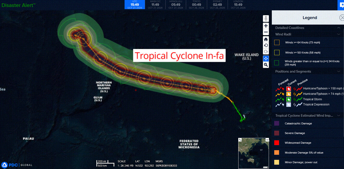
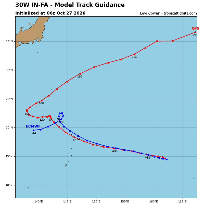
Typhoon (ty) 30W has remained nearly quasi-stationary over the past 24 hours, trapped between an ner to the southeast and an str to the northwest. Over the next 24 hours, the ner is forecast to weaken and drift northward, ultimately merging with the str, which is strengthening and expanding east. in response to these synoptic adjustments, TY 30W will begin a slow westward translation, accelerating through 72 hours as the str continues to build and retrograde to the west. After 72 hours, TY 30W will
decelerate in response to a weakness in the str induced by a deep mid-latitude trough progressing east from Japan.
by 96 hours, a significant col region will develop between the str to the east and a second mid-level anticyclone forming near Taiwan and extending eastward. TY 30W will enter this col region by 96 hours and become quasi-stationary by 120 hours, though significant uncertainty exists in the exact timing, structure, and placement of the col region.
Regarding intensity, once TY 30W begins moving westward, it will traverse a more conducive environment characterized by warmer unperturbed ssts (mitigating upwelling effects) and an improved
outflow pattern as it separates from the upper-level trough to the north. The system is forecast to steadily intensify to a peak of 125 kts by 36 hours, then plateau for 24 hours due to structural adjustments from secondary eyewall formation.
The system will then weaken steadily through the remainder of the forecast period as it encounters restricted outflow aloft and enhanced mid-level easterly shear. By 120 hours, more rapid weakening is likely as the system becomes stationary over diminished ohc waters, with rapid surface cooling due to persistent vertical mixing and upwelling.
Tropical Cyclone 02B (Arnab)
According to the JTWC warning number 07…sustained winds were 120 knots with gusts to 145 knots
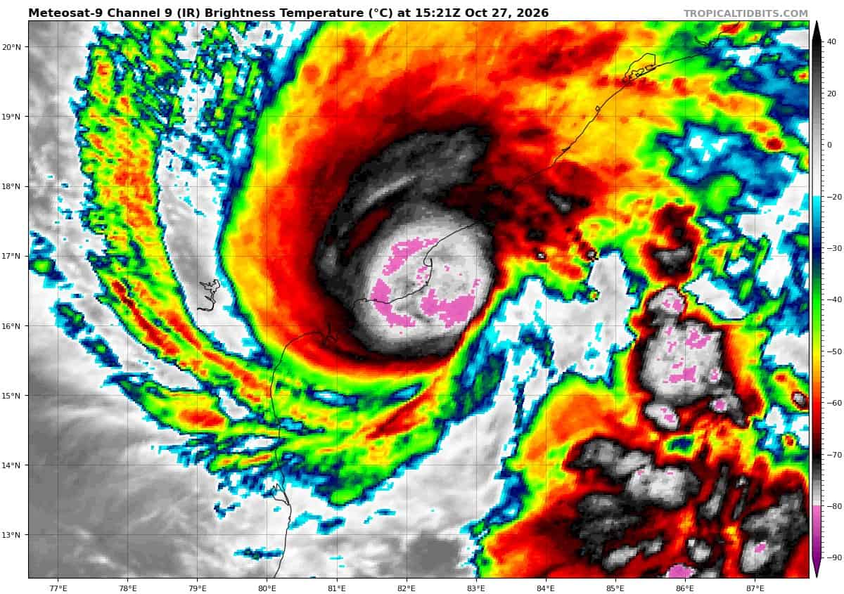
Animated enhanced infrared (eir) satellite imagery depicts a compact system approaching landfall with a deteriorating convective presentation, characterized by rapid cloud-top warming and contraction of the eye feature. Animated radar data from the India meteorological department (imd) depicts a quickly filling eye, with outermost spiral bands beginning to brush the shoreline of the Godavari River Delta. A 271046z ssmis 89 ghz microwave image revealed a small inner core of deep convection forming an inner eyewall, as well as significant dry air to the east wrapping into the core along the northern flank.
Environmental conditions remain favorable overall, with low to moderate easterly vertical wind shear (vws), warm sea surface temperatures (ssts), high oceanic heat content (ohc), and vigorous poleward outflow, tempered by proximity to land, increasing mid-level shear, and dry air entrainment.
Tropical cyclone (tc) 02B has maintained a faster-than-expected westward trajectory over the past six hours and is now approaching the coast slightly ahead of schedule. However, recent frames of both eir and radar imagery suggest the system is decelerating as it nears the coastline, as anticipated by global guidance, due to binary interaction with invest 90B, which is rapidly developing approximately 280 NM to the southeast.
As 90B propagates rapidly northward, it will impart a deflective pull, retarding tc 02B westward translation, delaying landfall, and causing a brief stall along the Godavari Delta coastline. Numerical model trackers smooth this motion out over 12-hour time steps; however, prognostic fields in gfs, ecmwf, hafs-a, and hwrf clearly resolve this near-term binary oscillation, differing only in where landfall occurs and how far inland the system tracks before stalling. The forecast track calls for landfall along the southwestern coast of the Godavari River Delta by 12 hours, but prior to landfall, the system is likely to skirt the coastline or stall briefly.
Invest 90B is moving rapidly northward, is expected to continue accelerating, and will be positioned northeast of tc 02B within the next 12-18 hours. As 90B ejects to the northeast, tc 02B will resume a northward track from 12 onward through the remainder of the forecast period along the western periphery of the low- to mid-level str to the east.
Regarding intensity, the system peaked near 271000z; land proximity, strengthening easterly shear, and dry air intrusion are now impinging on the inner core, leading to rapid convective deterioration.
weakening will continue, though landfall over the saturated delta region and the associated brown ocean effect will moderate the pace of weakening through 12 hours. More rapid weakening will occur after 12 hours, with tc 02B forecast to dissipate over land below the 35-kt warning threshold within 48 hours due to terrain friction.
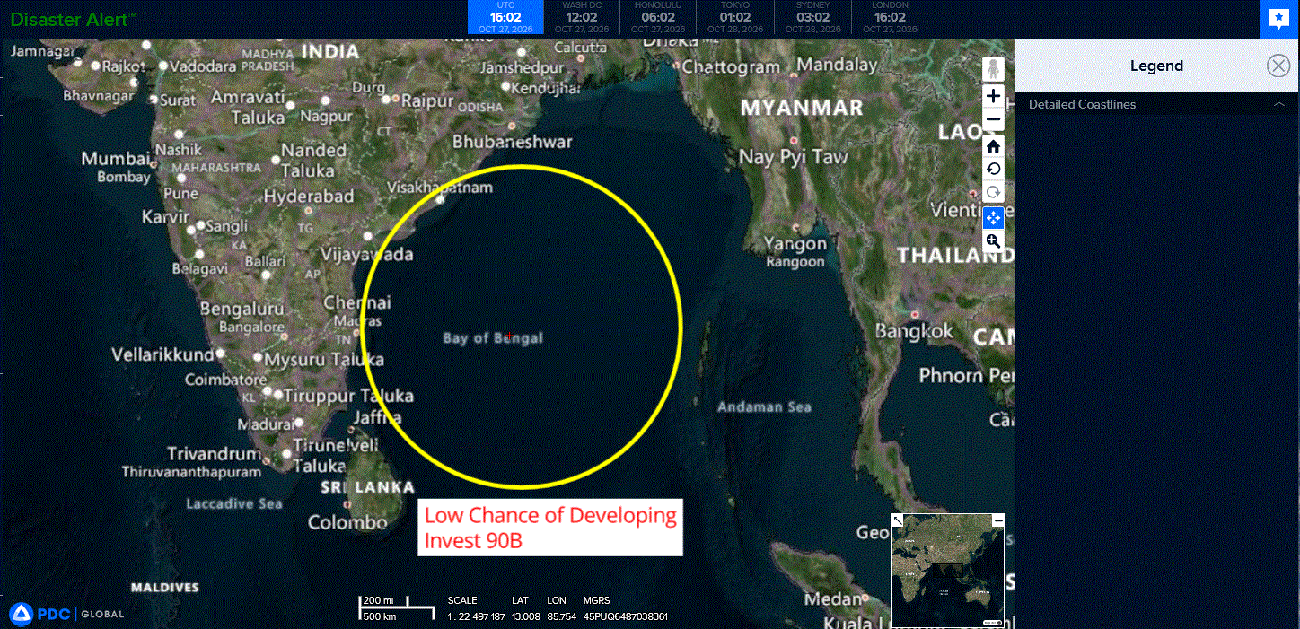
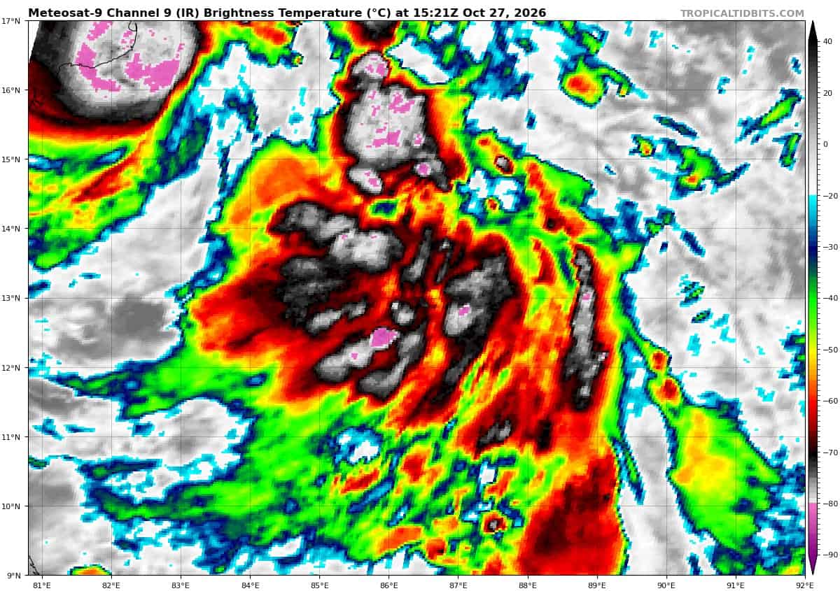
>>> There’s an area of disturbed weather being referred to as Invest 90B, which is located approximately 329 NM south-southeast of Visakhapatnam, India
Animated enhanced infrared (eir) satellite imagery depicts an obscured, developing low-level circulation (llc) with flaring convection over the assessed llc. A recent 271045z ssmis f18 91ghz
bullseye microwave reveals fragmented, weakly-defined banding features wrapping into a nascent llc.
Environmental analysis reveals a favorable environment for development with low to moderate vertical
wind shear (vws) of 15-20kts, moderate upper-level outflow, and warm sea surface temperatures (ssts) of 29-30c.
Global deterministic models depict a relatively weak circulation rapidly moving northward around the periphery of tc 02b, and undergoing weak binary interaction. Models suggest limited development, except for the gfs which depicts the system organizing into a tropical cyclone in less than 24 hours before making landfall in northeastern India. Ensemble guidance is not depicting 90B as a separate circulation yet.
Maximum sustained surface winds are estimated at 23 to 28 knots.
Minimum sea level pressure is estimated to be near 1003 mb.
The potential for the development of a significant tropical cyclone within the next 24 hours is low.