

Current Snapshot
For all the latest updates visit: DisasterAWARE
1800x1080e
vance
261433_earliest_reasonable_toa_34
goes18_ir_22E_202610261535_lat15.4-lon-105.5
261433INTQPF_sm
22E_tracks_latest
olana
goes18_ir_03C_202610261535_lat14.1-lon-176.8
03C_tracks_latest
champi
29W_251800sair
infa
30W_261200sair
30W_tracks_latest
arnab
02B_261200sair
meteosat9_ir_02B_202610261521_lat15.9-lon87.2
02B_tracks_latest
By PDC’s Senior Weather
Specialist Glenn James

The Pacific Disaster Center’s (PDC Global) Monday, October 26, 2026, Tropical Cyclone Activity Report…for the Pacific Ocean, the Indian Ocean, and adjacent Seas.
Tropical Cyclones
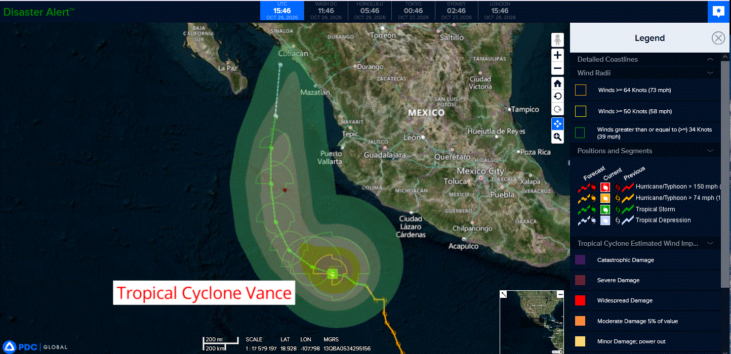
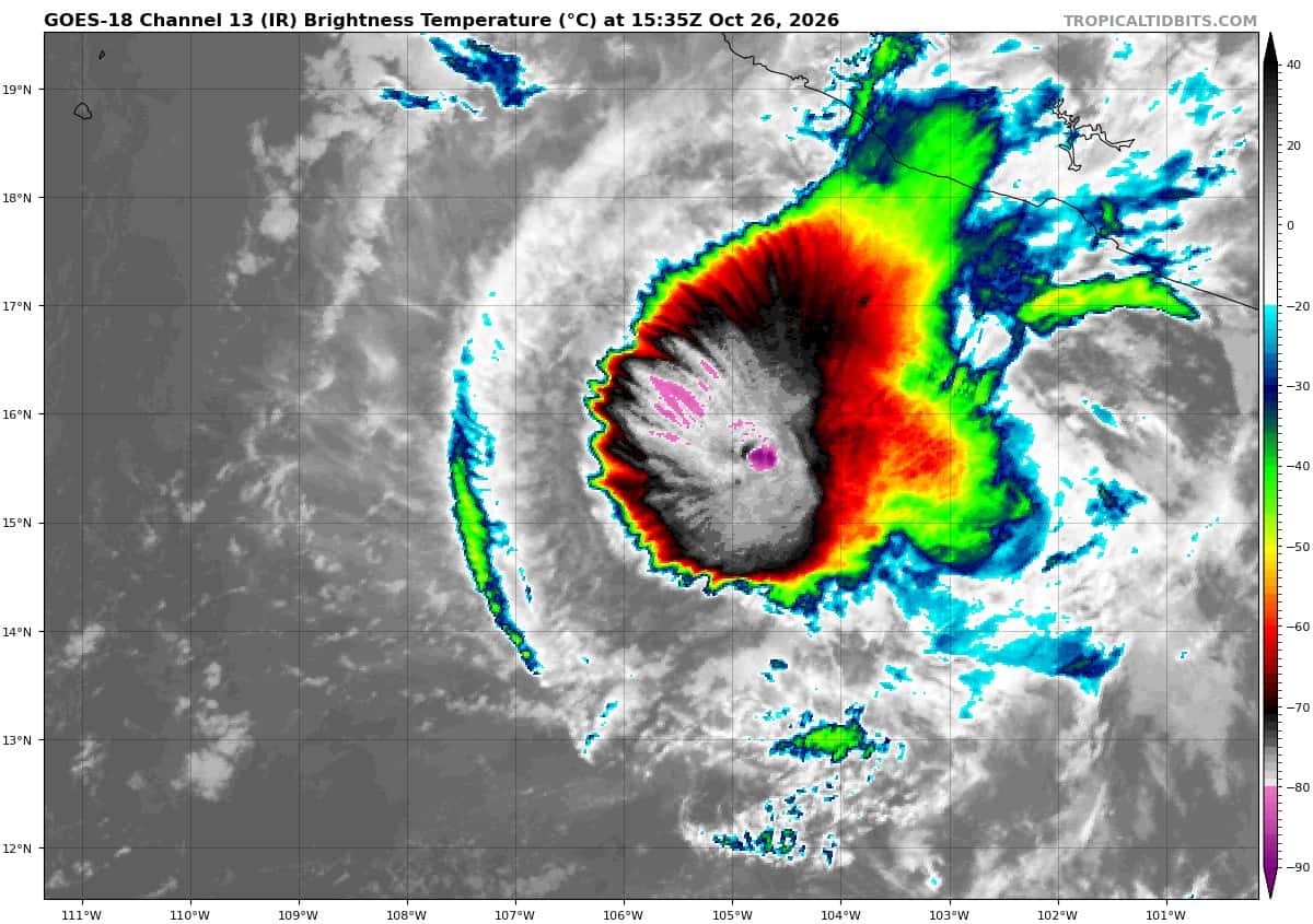
Tropical Cyclone 22E (Vance)…is located 265 miles south-southwest of Manzanillo, Mexico
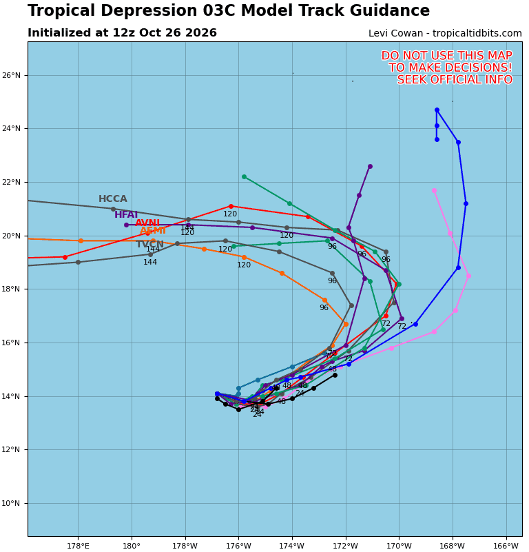
Tropical Cyclone 03C (Olana)…is located 525 miles southwest of Johnston Island
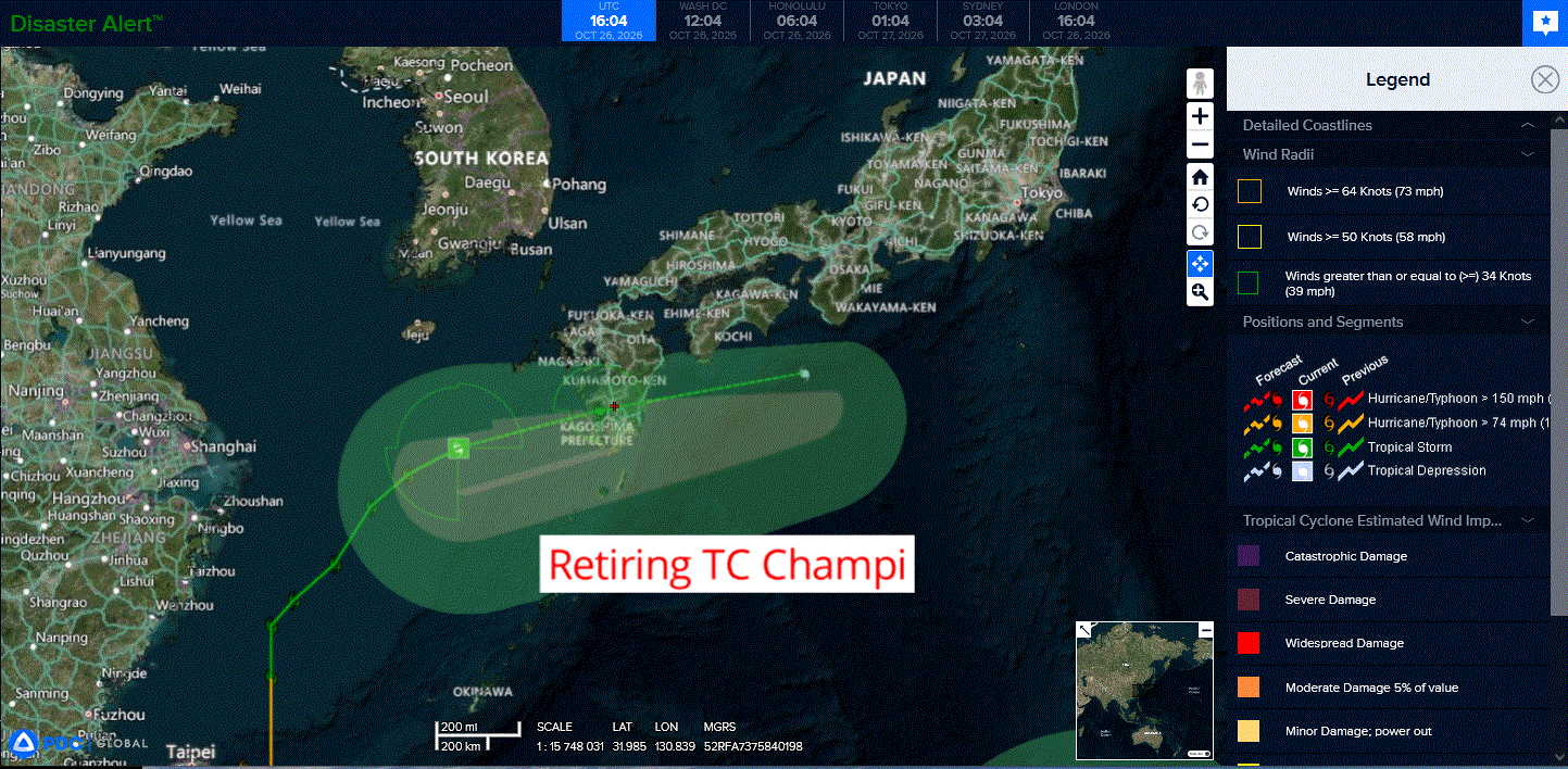
Tropical Cyclone 29W (Champi) is located approximately 163 NM southwest of Sasebo, Japan – Final Warning
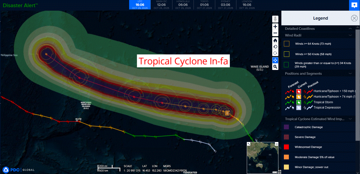
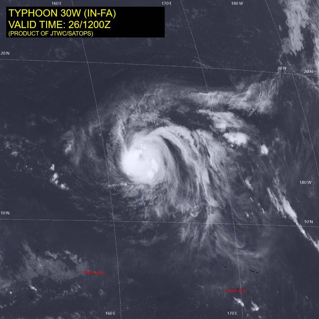
Tropical Cyclone 30W (In-fa) is located approximately 384 NM southwest of Wake Island
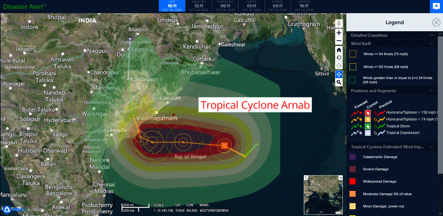
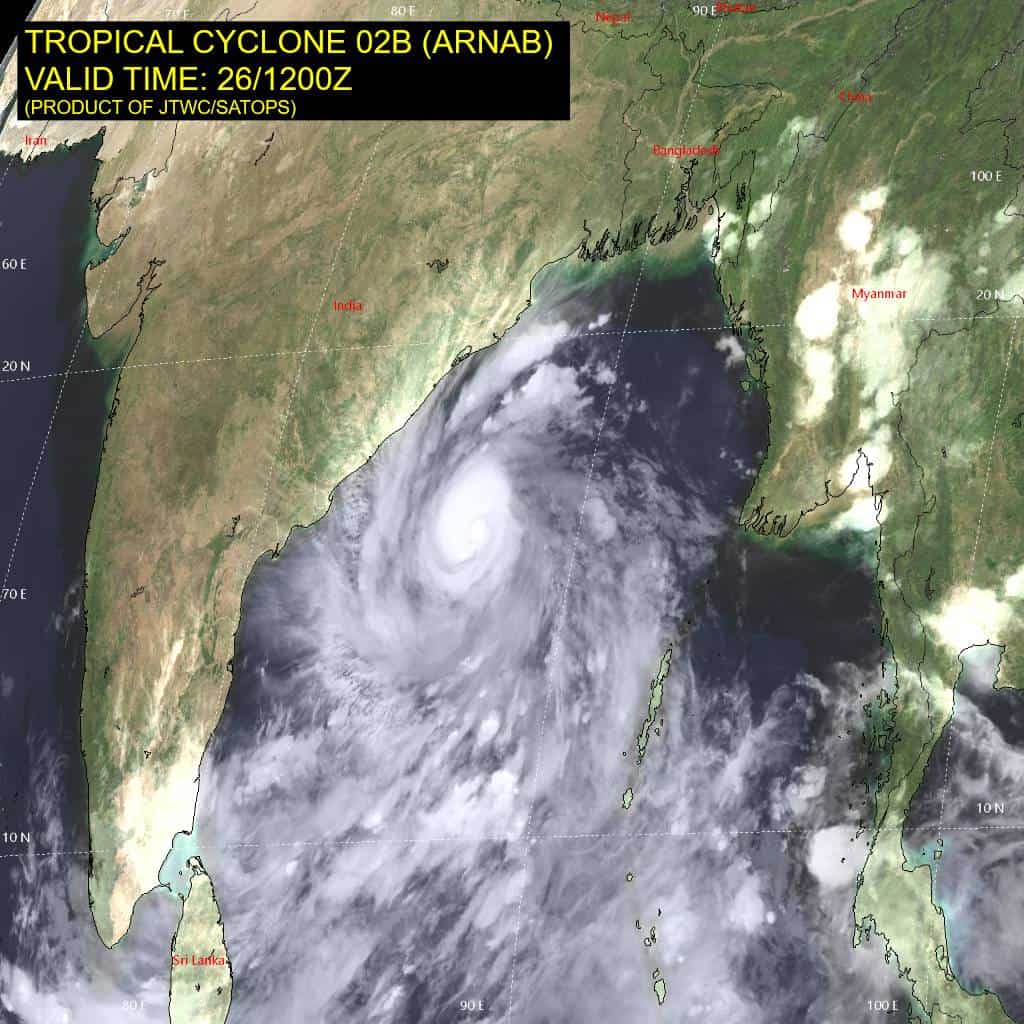
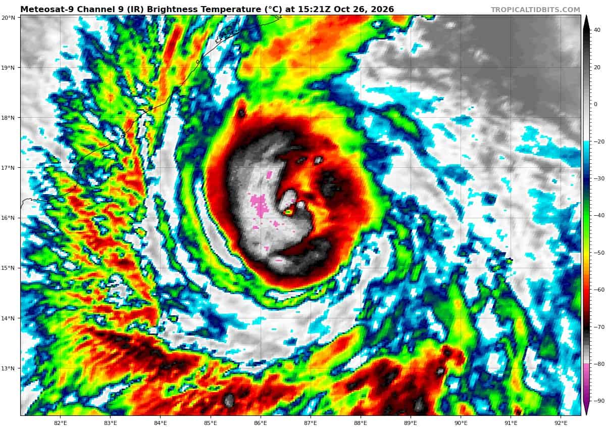
Tropical Cyclone 02B (Arnab) is located approximately 408 NM south of Kolkata
Northeast Pacific:
Tropical Cyclone 22E (Vance)
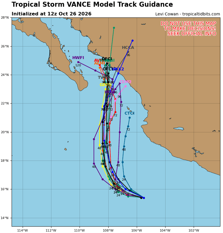
VANCE MOVING SLOWLY WEST-NORTHWESTWARD AND LIKELY TO WEAKEN
According to the NHC advisory number 21
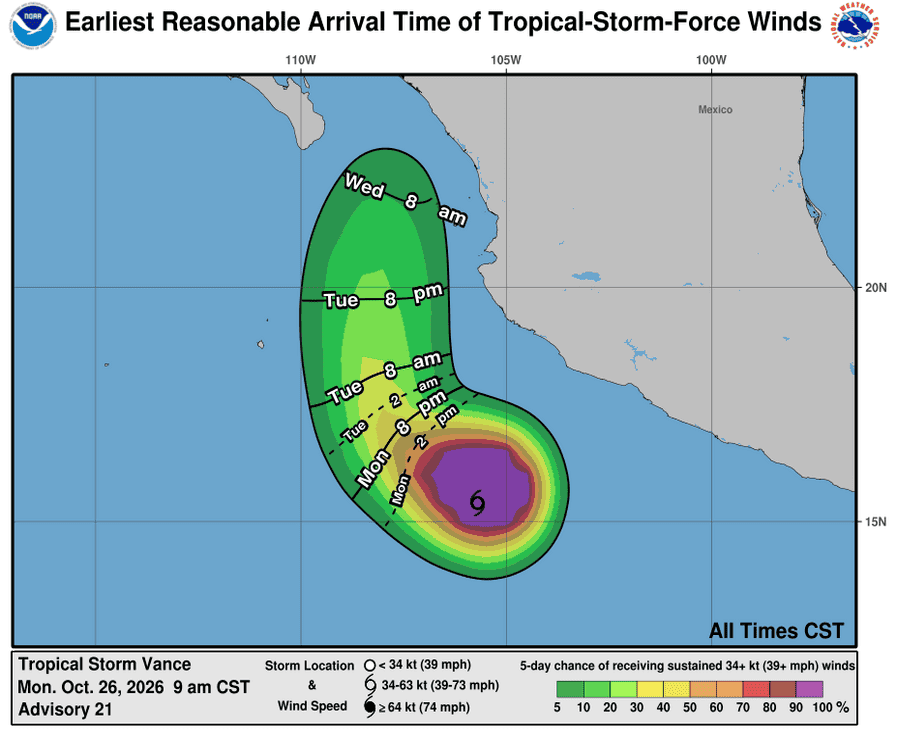
Vance is moving toward the west-northwest near 7 mph (11 km/h). This motion is expected to continue for the next day or so, followed by a turn to the northwest on Tuesday and north on Wednesday. Maximum sustained winds remain near 65 mph (100 km/h) with higher gusts. Gradual weakening is forecast during the next several days. Tropical-storm-force winds extend outward up to 125 miles (205 km) from the center. The estimated minimum central pressure is 997 mb (29.44 inches).
HAZARDS AFFECTING LAND
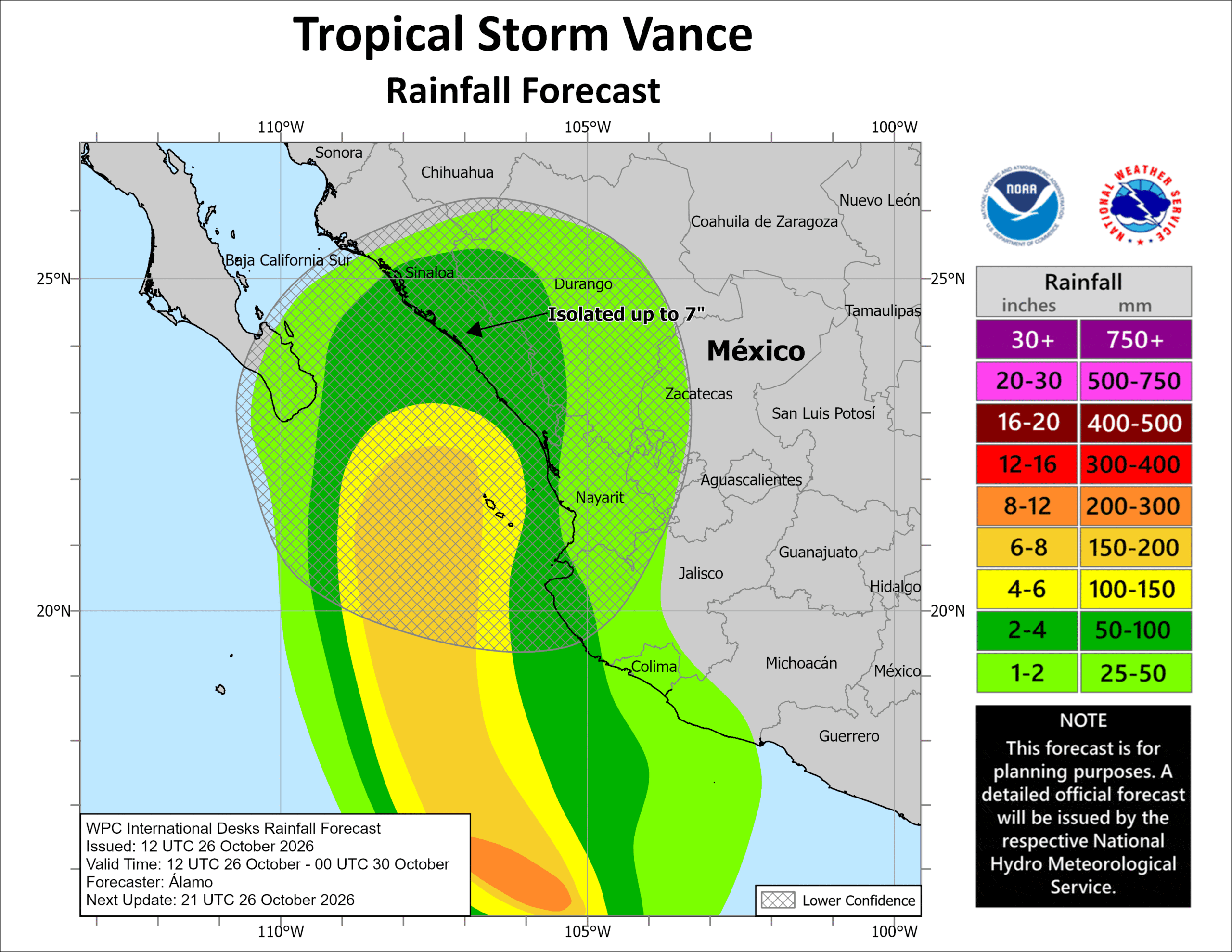
RAINFALL: Through Thursday, Vance is expected to produce 2 to 4 inches of rain, with isolated higher totals of 7 inches possible, across southern Sinaloa, southwest Durango and coastal sections of Nayarit, Jalisco, Colima and Michoacan. This rainfall may produce flooding and mudslides, especially in areas along steep terrain.
SURF: Swells generated by Vance will affect portions of the coast of southern, southwestern and west-central Mexico during the next few days. These swells are likely to cause life-threatening surf and rip current conditions.
Central North Pacific:
Tropical Cyclone 3C (Olana)
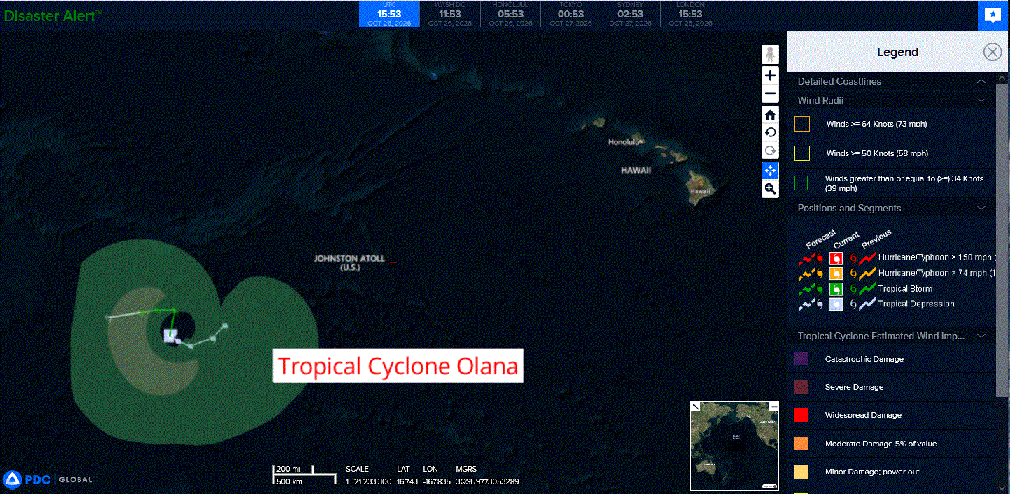
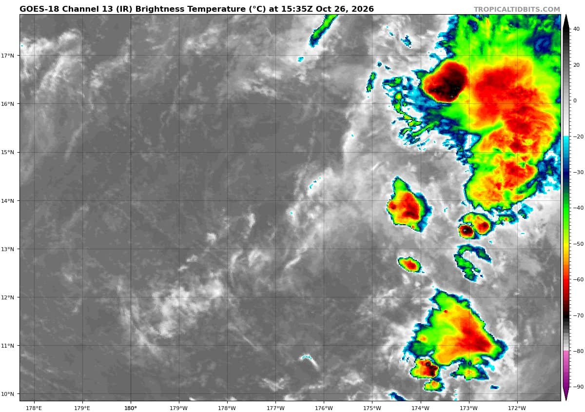
OLANA WEAKENS TO A TROPICAL DEPRESSION
The depression is moving toward the southeast near 5 mph (7 km/h). A general southeastward to eastward motion is expected during the next day or two.
Maximum sustained winds have decreased to near 35 mph (55 km/h) with higher gusts. Additional weakening is expected, and Olana is forecast to become a remnant low in a day or so.
The estimated minimum central pressure is 1005 mb (29.68 inches).
Western Pacific, Indian Ocean, and adjacent Seas:
Western Pacific
Tropical Cyclone 29W (Champi) – Final Warning
According to the JTWC warning number 46…sustained winds were 35 knots with gusts to 45 knots
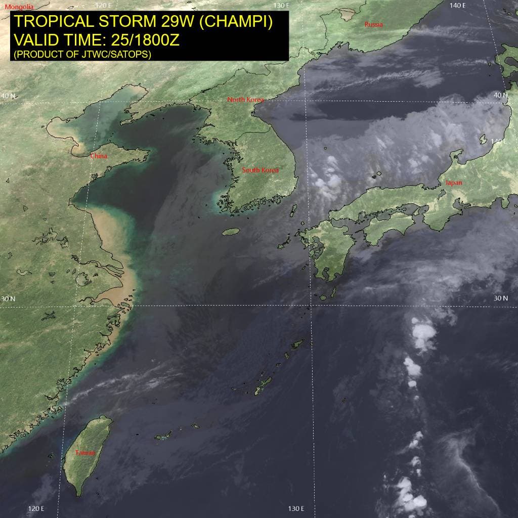
Animated multi-spectral imagery depicts tropical storm (ts) 29W (Champi) as a highly elongated and
shallow system devoid of convection. The 251144z ascat data revealed the system has opened into a trough, with the storm-force winds confined to the northeastern hemisphere and the cold side of the developing frontal system.
Environmental analysis reveals a hostile environment, characterized by high (30-35 kts) vertical wind
shear, cold (25-26 c) sea surface temperatures, copious amounts of dry air, and jet interaction.
Deterministic model guidance is in strong agreement that 29W will continue to track northeastward for
the next 24 hours while it further degrades. Elevated surface winds are possible as the trough passes over Kyushu.
Tropical Cyclone 30W (In-fa)
According to the JTWC warning number 13…sustained winds were 115 knots with gusts to 140 knots
Animated enhanced infrared (eir) satellite imagery depicts a slowly deteriorating convective structure, with warming cloud top temperatures associated with the central dense overcast and cooling eye temperatures. TY 30W has been moving at 3-4 kts over the past 12 hours as it turns westward. The slow speed has likely induced upwelling of cool subsurface waters, which would explain the deteriorating cloud pattern.
Additionally, an upper-level trough to the north has induced moderate to high west-northwesterly vertical wind shear (vws), restricting upper-level poleward outflow. These detrimental factors have caused the upward intensity trend to level off. A 260727z rcm-2 sar pass estimated maximum winds near 115 kts.
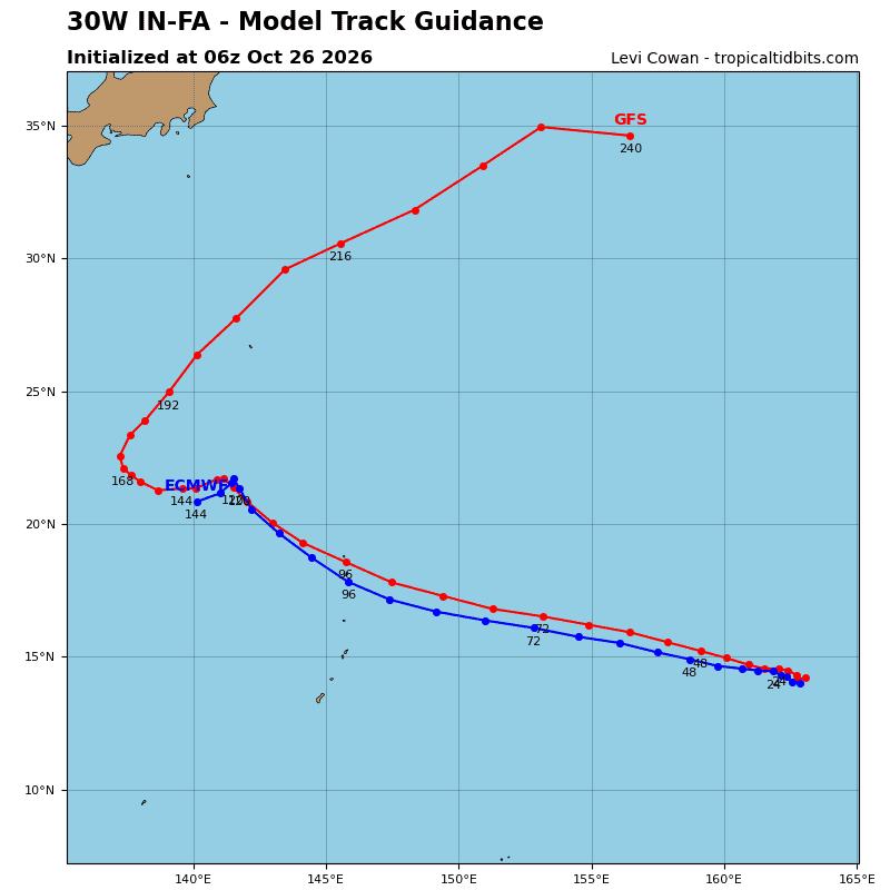
TY 30W is executing the expected westward turn as the deep-layer str to the northwest shifts eastward. The system will then accelerate along a westward to west-northwestward trajectory. Toward 96 hours, the vortex will begin to round the southwestern periphery of the ridge and turn northwestward toward a large weakness caused by a broad mid-level trough over Honshu.
Concurrently, a separate str positioned over southeast China will build eastward. The net effect will be a slower rate of motion toward the end of the forecast period.
The present motion of 3-4 kts has likely induced upwelling of cooler subsurface waters. This is explicitly depicted by the hafs-a mesoscale model analysis, which is coupled to the ocean. The cooler sst and ongoing vws will cause some near-term weakening. However, vws will quickly subside over the next 12-24 hours as the trough races downstream, while ohc remains high at around 100-110 kj per cm2 along the forecast track.
As the system gains a higher translation speed, these favorable conditions will support re-intensification through 96 hours, after which a patch of lower ohc will result in some weakening. The peak intensity of TY 30W will largely be governed by internal tropical cyclone structural processes that are difficult to predict.
Tropical Cyclone 02B (Arnab)
According to the JTWC warning number 03…sustained winds were 80 knots with gusts to 100 knots
TC 02B continues to rapidly intensify. deep convective bursts along the eyewall have obscured the previously visible ragged eye, while the central dense overcast (cdo) continues to consolidate and
tighten. A large banding feature persists along the western periphery of the system. TC 02B maintains moderate radial outflow aloft, strongest toward the west, as it moves generally west-northwestward over very warm sea surface temperatures (sst) of 29-30 degrees celsius and low vertical wind shear (vws).
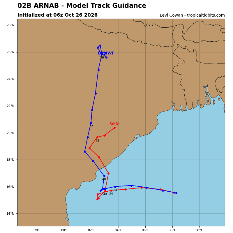
TC 02B lies between two competing steering influences. The deep-layer trough to the southwest contributes a southward component to the steering flow, while the str to the northeast favors a northwestward component. These competing influences have produced an unsteady track during the past 24 hours, including a southwestward component followed by the more recent northwestward motion. As the trough shifts eastward to a position south and southeast of tc 02B, the net steering flow will become more westward through 12 hours.
By 24 hours, the competing steering influences will weaken, causing tc 02B to slow to around 4 kts. A brief equatorward nudge remains possible during this period. Thereafter, the trough will lift poleward and east of the system, allowing the str to become the dominant steering influence. TC 02B will then turn sharply poleward near 36 hours and make landfall along the central coast of Andhra Pradesh. From 48 to 72 hours, the weakening vortex will accelerate northward along the western periphery of the str.
Environmental conditions will remain highly favorable for the next 12 to 18 hours, with low vws and sst near 29-30 degrees celsius. TC 02B will continue rapid intensification through 12 hours, then level off near 24 hours. After 24 hours, slower forward motion may increase the potential for upwelling of cooler
subsurface water. VWS will increase to 20-30 kts by 36 hours. The combination of increasing vws, land interaction, and possible upwelling will initiate steady to rapid weakening prior to landfall. Weakening will accelerate after landfall, and tc 02B will dissipate by 72 hours.