

Current Snapshot
For all the latest updates visit: DisasterAWARE
1800x1080e
vance
231442_earliest_reasonable_toa_34
goes19_ir_22E_202610231705_lat10.6-lon-102.1
22E_tracks_latest
1800×1080
c
champi
29W_231200sair
29W_tracks_latest
30w
30W_231200sair
30W_tracks_latest
s
02S_230600sair
02S_tracks_latest
98b
meteosat9_ir_98B_202610231651_lat16.6-lon89.2

98B_tracks_latest
By PDC’s Senior Weather
Specialist Glenn James

The Pacific Disaster Center’s (PDC Global) Friday, October 23, 2026, Tropical Cyclone Activity Report…for the Pacific Ocean, the Indian Ocean, and adjacent Seas.
Tropical Cyclones
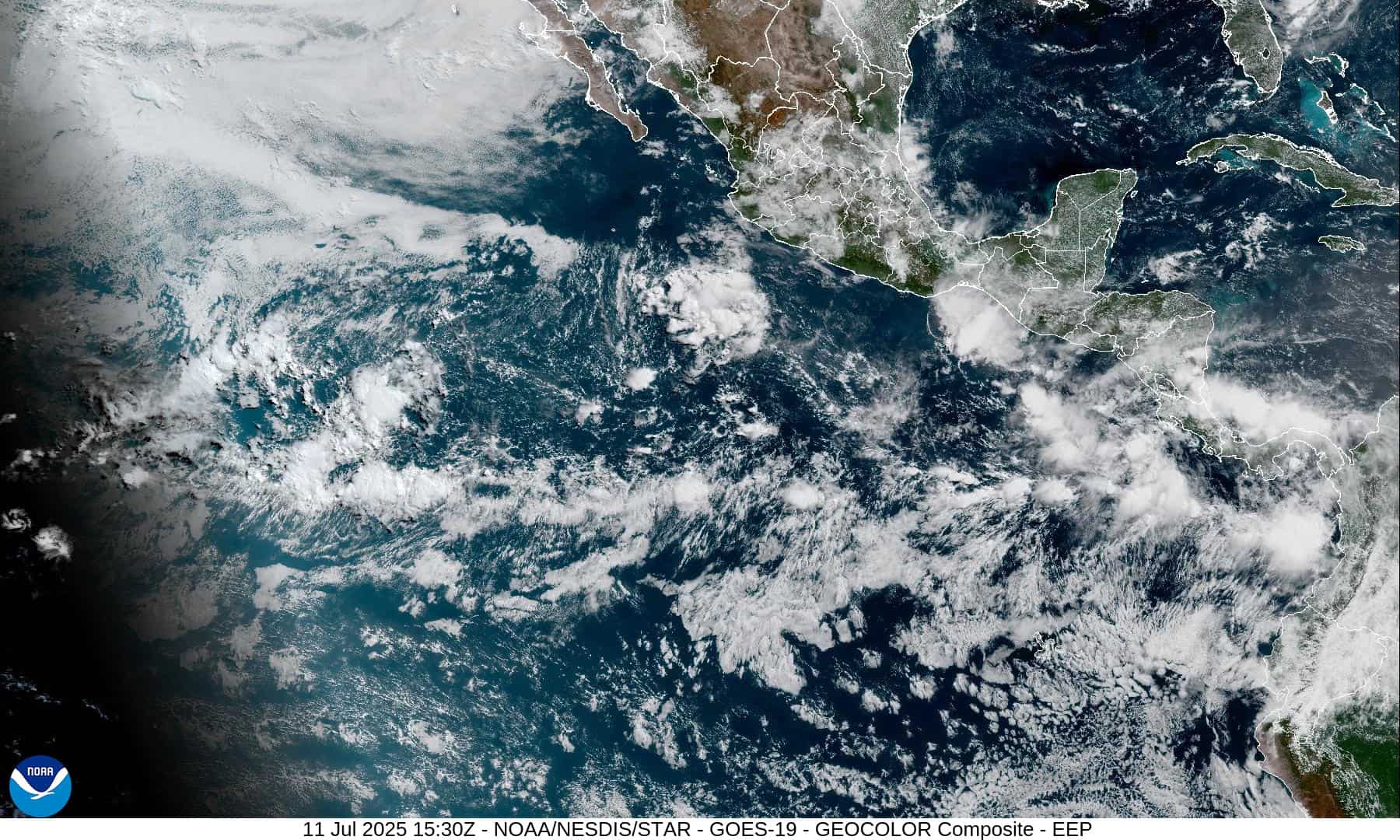
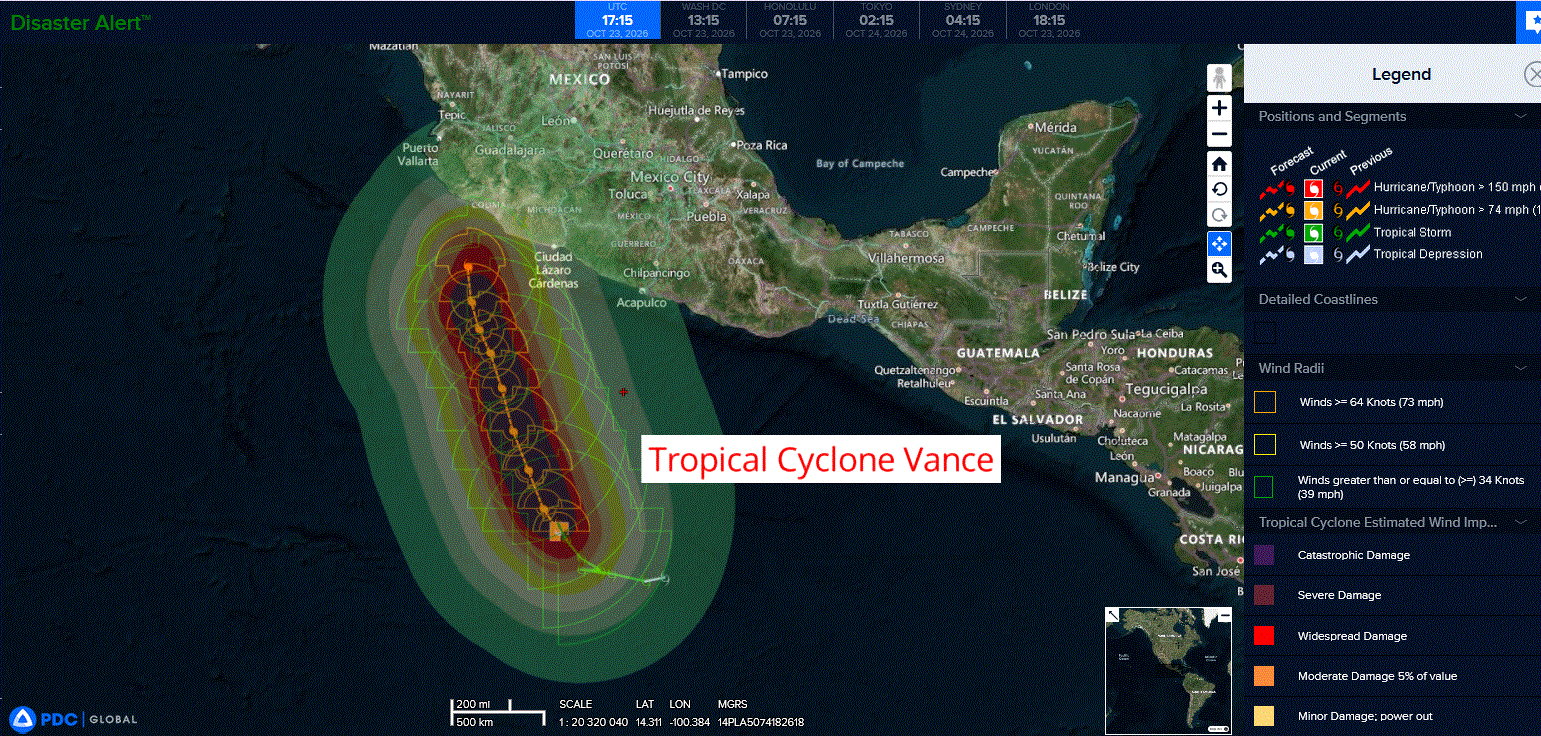
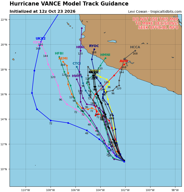
Tropical Cyclone 22E (Vance)…is located 590 miles south-southeast of Manzanillo, Mexico
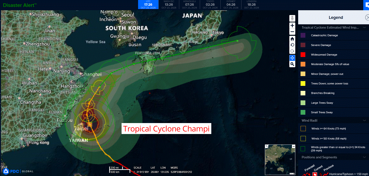
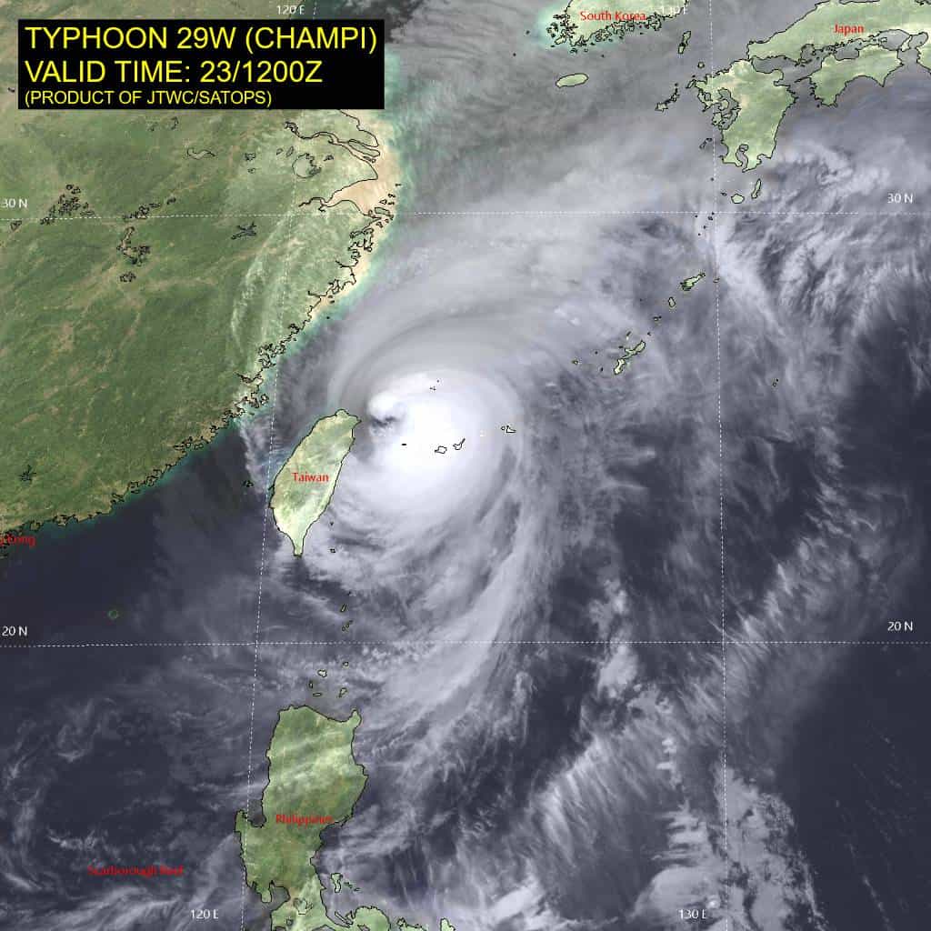
Tropical Cyclone 29W (Champi) is located approximately 290 NM west-southwest of Kadena AB
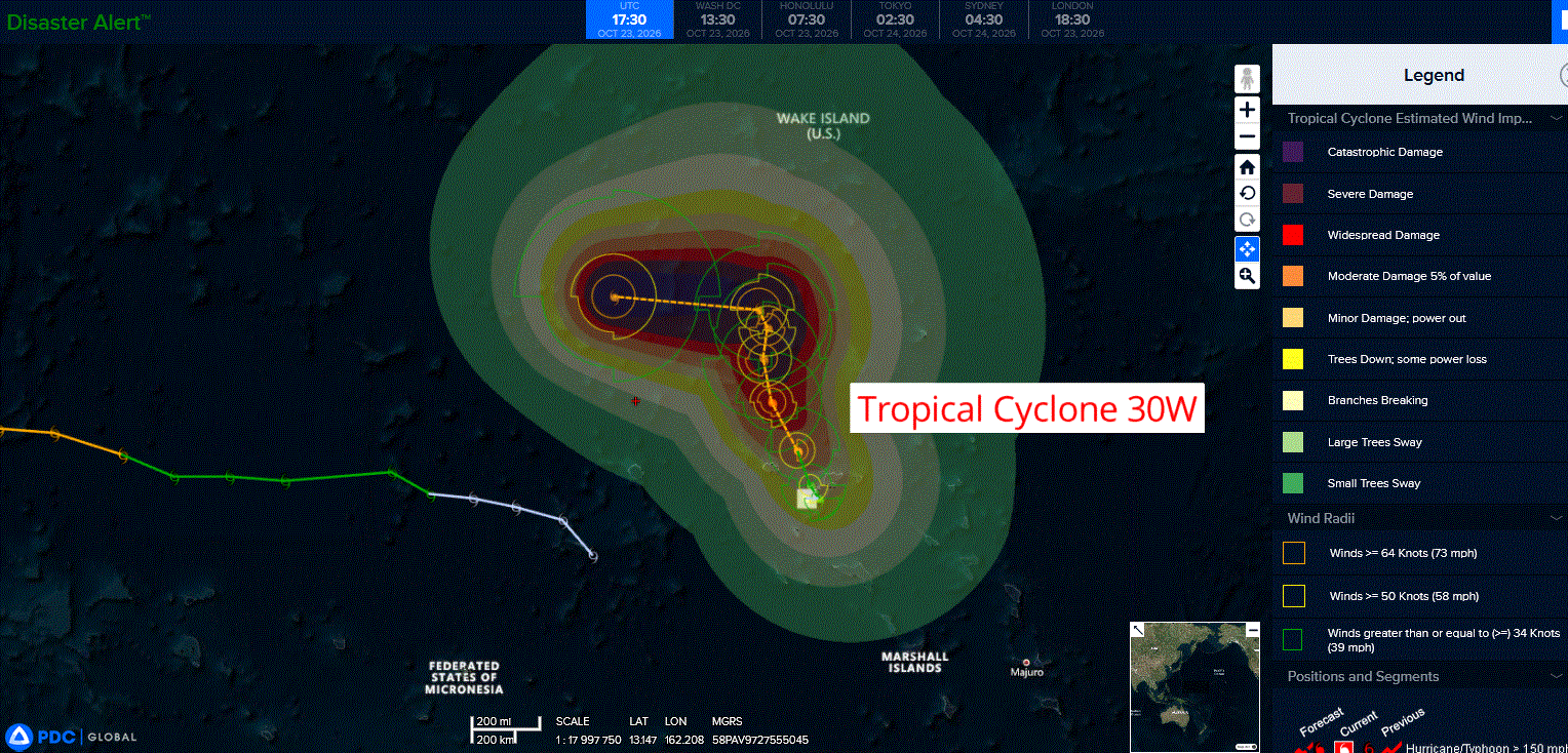
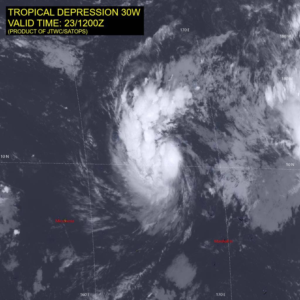
Tropical Cyclone 30W is located approximately 162 NM northwest of Kwajalein
Tropical Cyclone 02S (Agueda) is located approximately 612 NM east of Dar Es Salaam, Tanzania
Northeast Pacific:
Tropical Cyclone 22E (Vance)
VANCE CONTINUING TO INTENSIFY
According to the NHC advisory number 9
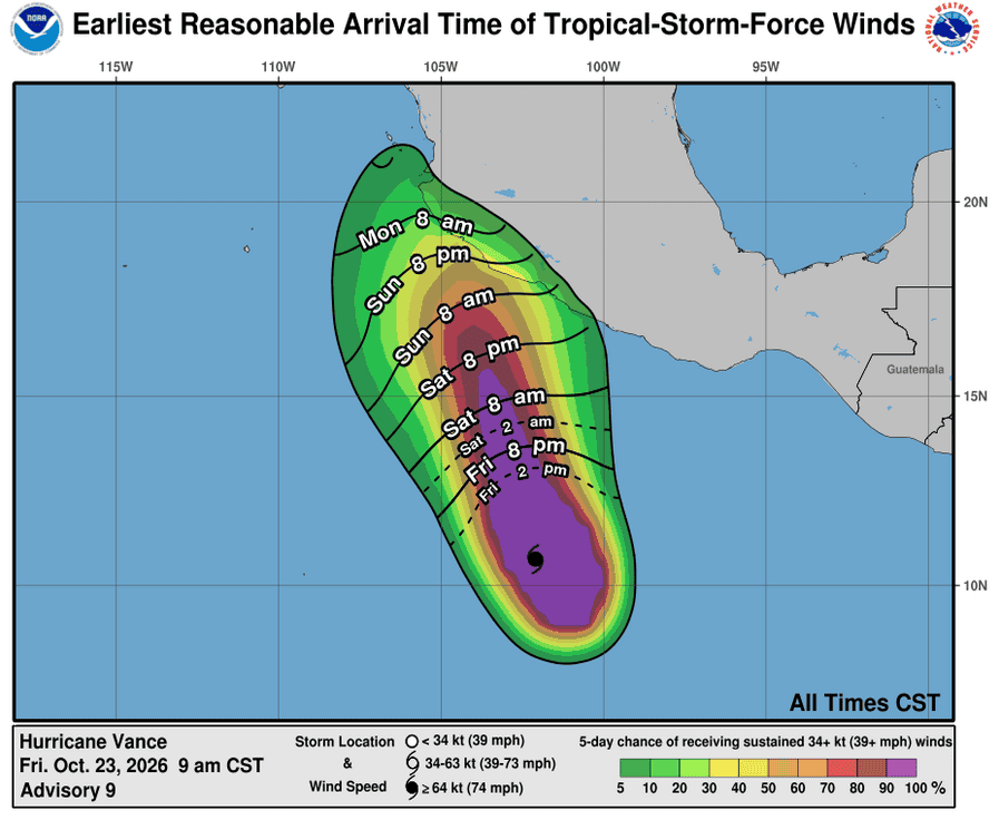
Vance is moving toward the northwest near 5 mph (7 km/h). A slow motion toward the north-northwest or northwest is expected to continue through the weekend.
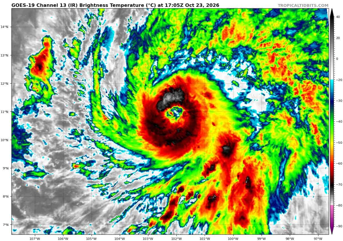
Maximum sustained winds have increased to 90 mph (150 km/h) with higher gusts. Steady to rapid strengthening is expected through Saturday morning, and Vance is forecast to become a major hurricane. After that, slow weakening is forecast on Saturday night and Sunday.
Hurricane-force winds extend outward up to 35 miles (55 km) from the center and tropical-storm-force winds extend outward up to 205 miles (335 km). The estimated minimum central pressure is 979 mb (28.91 inches). A NOAA drifting buoy reported a minimum pressure of 988.5 mb (29.19 inches) several hours ago as it passed not far from the center of Vance.
HAZARDS AFFECTING LAND
SURF: Swells generated by Vance are expected to begin affecting portions of the coast of southern and southwestern Mexico this weekend and continue into next week. These swells are likely to cause life-threatening surf and rip current conditions.
Central North Pacific: There are no Tropical Cyclones
>>> Western Central Pacific:
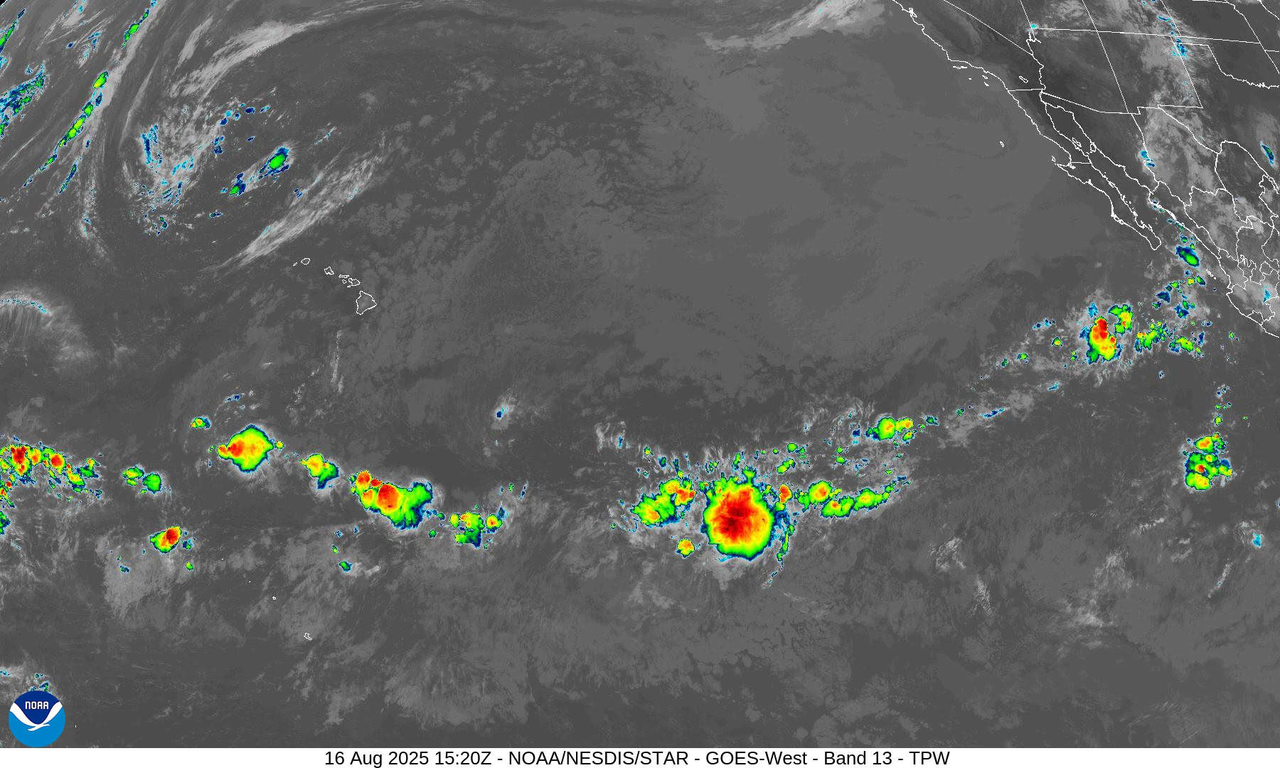
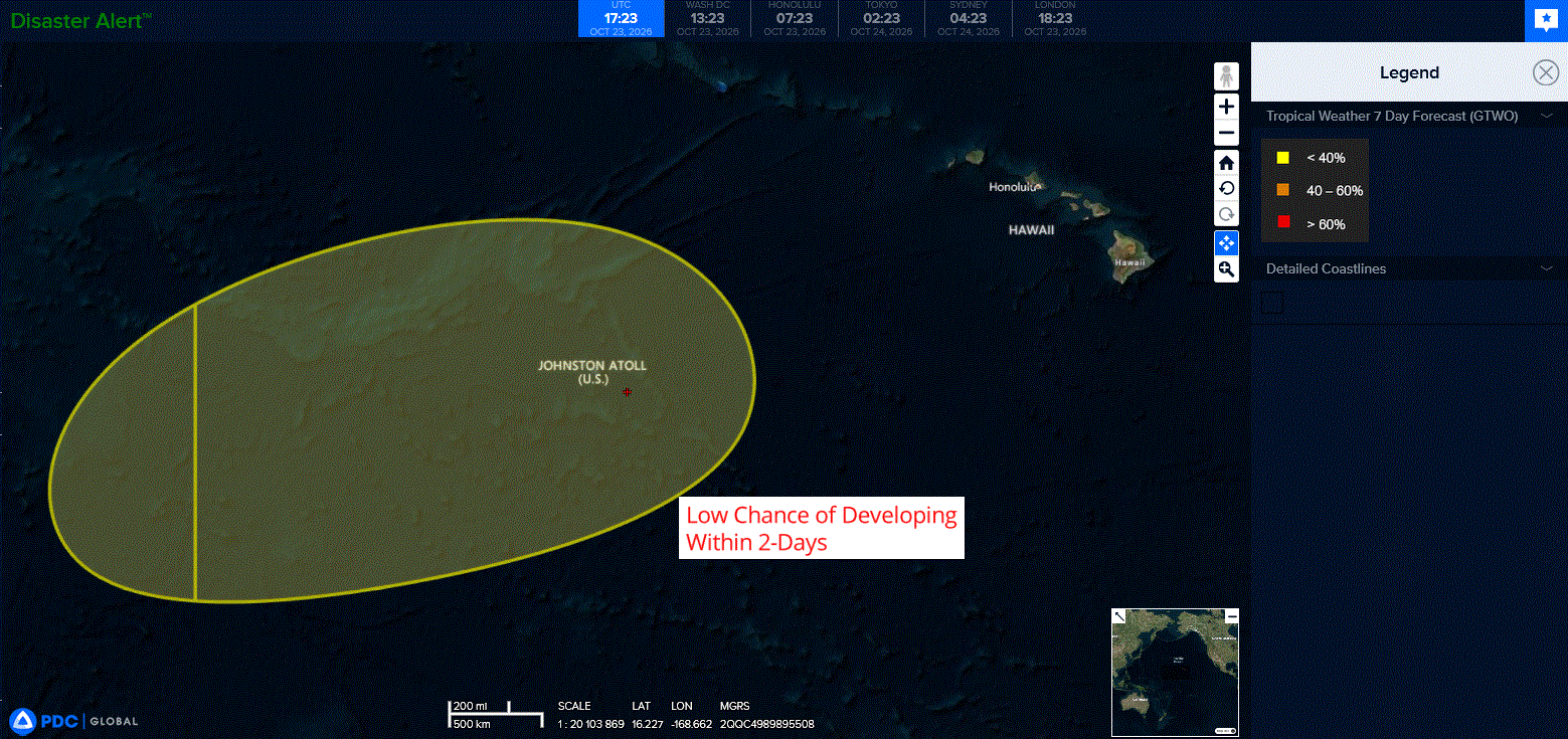
An area of low pressure is forecast to form near the International Date Line, several hundred miles west of Johnston Atoll late this weekend or early next week.
Environmental conditions could support some slow development thereafter while the system moves generally eastward to east-northeastward.
* Formation chance through 48 hours…low…near 0 percent
* Formation chance through 7 days…low…20 percent
Western Pacific, Indian Ocean, and adjacent Seas:
Western Pacific
Tropical Cyclone 29W (Champi)
According to the JTWC warning number 37…sustained winds were 100 knots with gusts to 125 knots
Animated enhanced infrared (eir) satellite imagery depicts typhoon (ty) 29W undergoing rapid structural degradation, quickly losing its eye and exhibiting pronounced trochoidal motion as it interacts with the topography of northern Taiwan. The well-defined eye passed just east of Yonaguni Island around 230930z, where the surface station reported maximum wind gusts of 89 kts and a minimum mean sealevel pressure (mslp) of 948.9 mb. Immediately following passage of Yonaguni Island, the eye began to fill, disappearing in eir imagery within one hour.
TY 29W also initiated a large northwestward trochoidal wobble, consistent with earlier hafs-a and hwrf guidance, and the circulation center is now positioned just off the extreme northeastern tip of Taiwan. Topographic interaction with the central mountain range (cmr) is the primary driver of both structural and track changes. Warm, dry, subsident downslope westerly flow off the lee slopes of the cmr advected directly into the circulation of ty 29W, rapidly eroding the western semicircle of the inner core. The
trochoidal deflection is likewise a direct dynamical response to terrain interaction, a well-documented phenomenon in this region.
The eye, while rapidly expanding and becoming increasingly ragged, remains well defined in animated doppler radar data from the central weather administration (cwa) in Taiwan, supporting high confidence in the initial position.
Environmental conditions remain synoptically favorable; however, land proximity, ongoing low-enthalpy dry air entrainment into the inner core, and translation over cooler upwelled waters render the mesoscale environment marginal.
TY 29W is exhibiting highly erratic motion as it wobbles toward the northeastern tip of Taiwan. typical trochoidal oscillations persist for roughly 6-12 hours, and ty 29W may execute a small cyclonic loop, a common occurrence for typhoons in this regime. Regardless, ty 29E should resume a poleward track by 12 hours.
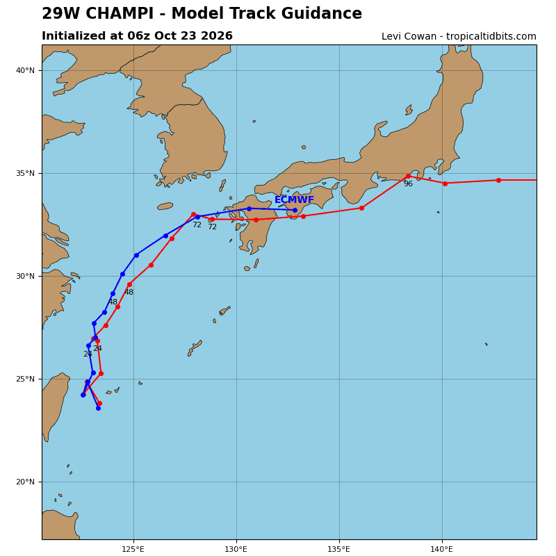
The official forecast track smooths these short-term mesoscale perturbations into an integrated 12-hour trajectory. All available numerical guidance, including mesoscale models, supports a resumption of poleward motion by 12hours, followed by northeastward acceleration after 24 hours as an approaching mid-latitude shortwave trough erodes the northwestern periphery of the str. by 48 hours, ty 29W will become
embedded in strong southwesterly mid-latitude flow and accelerate east-northeastward through the remainder of the forecast period.
Landfall along the western coast of Kyushu is forecast between 60 and 72 hours, after which the system will re-emerge over the open waters south of Shikoku and Honshu as the system approaches Kyushu and phases with the 500 mb shortwave trough, it will initiate extratropical transition (ett), completing transformation between 72 hours and 96 hours.
Regarding intensity, rapid inner-core erosion driven by terrain-induced low-enthalpy air
entrainment will steadily weaken the system over the next 12 hours. As TY 29W tracks further poleward, increasing westerly vertical wind shear (vws) and an influx of dry mid-level air from the west will maintain a steady weakening trend through 48 hours. As the system undergoes ett, the weakening rate will moderate, and the vortex is forecast to slightly re-intensify upon completing ett due to robust baroclinic forcing over the warm Kuroshio Current.
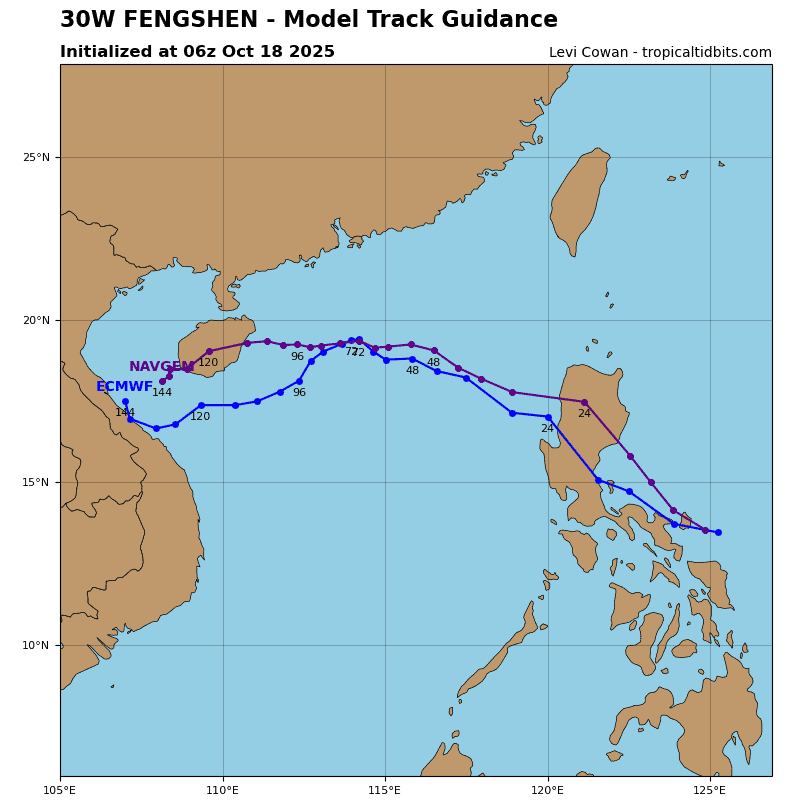
Tropical Cyclone 30W
According to the JTWC warning number 1…sustained winds were 30 knots with gusts to 40 knots
Animated enhanced infrared (eir) satellite imagery depicts a rapidly consolidating tropical depression (td), characterized by a formative band of deep convection along the western semicircle wrapping into an obscured low-level circulation center (llcc). Aloft, a 200 mb anticyclonic point source is analyzed in both automated atmospheric motion vector (amv) data and JTWC subjective upper-air analysis. Additionally, a late-season tropical upper-tropospheric trough (tutt) extends southward to a position northwest of td 30W, placing the system in a favorable divergent quadrant relative to the tutt.
Environmental conditions are highly favorable for intensification, characterized by moderate to strong dual-channel outflow enhanced by the overhead point source, low vertical wind shear (vws), warm sea surface temperatures (ssts), and high oceanic heat content (ohc).
TD 30W is currently quasi-stationary with a slight eastward drift in a weak ambient steering environment, governed primarily by enhanced low-level southwesterlies near the equator. Over the next 24 hours, as the system intensifies and the vortex deepens, it will come under the steering influence of a mid- to deep-layer near-equatorial ridge (ner) anchored near the equator and track northward. By 36 hours, an amplifying mid-latitude trough will dig north of td 30W while the ner to the east simultaneously builds, steering the system poleward.
By 72 hours, the mid-latitude trough will lift northeastward as an expansive subtropical ridge (str) builds in from the west and the ner retrogrades westward south of td 30W. This synoptic evolution places the system within a col region between the two ridge complexes, inducing quasi-stationary motion between 72 hours and 96 hours. After 96 hours, the str will continue building rapidly eastward north of the vortex, deflecting the system westward by 120 hours.
significant bifurcation exists within the global model suite, particularly between the gfs and ecmwf, regarding the evolution of the northern str. The gfs maintains a more elongated, northeast-southwest oriented ridge, yielding a northeastward recurvature for td 30W. Conversely, the ecmwf and ai models depict a more compact zonal ridge building eastward, driving td 30W onto a westward trajectory by the end of the forecast period.
Regarding intensity, td 30W resides in a near-optimal environment. Over the next 24 hours, the tutt to the northwest is expected to cut off into a discrete tutt cell, placing td 30W in a prime upper-level diffluent regime and supporting near-rapid intensification through 24 hours. Rapid intensification (ri) is explicitly forecast from 24 to 48 hours before the tutt cell propagates westward.
From 72 to 96 hours, the base of the mid-latitude trough to the north will encroach upon td 30W, inducing upper-level convergence and temporarily arresting intensification. After 96 hours, td 30W will separate from the upper-level trough and resume steady intensification through tau 120.
South Indian Ocean
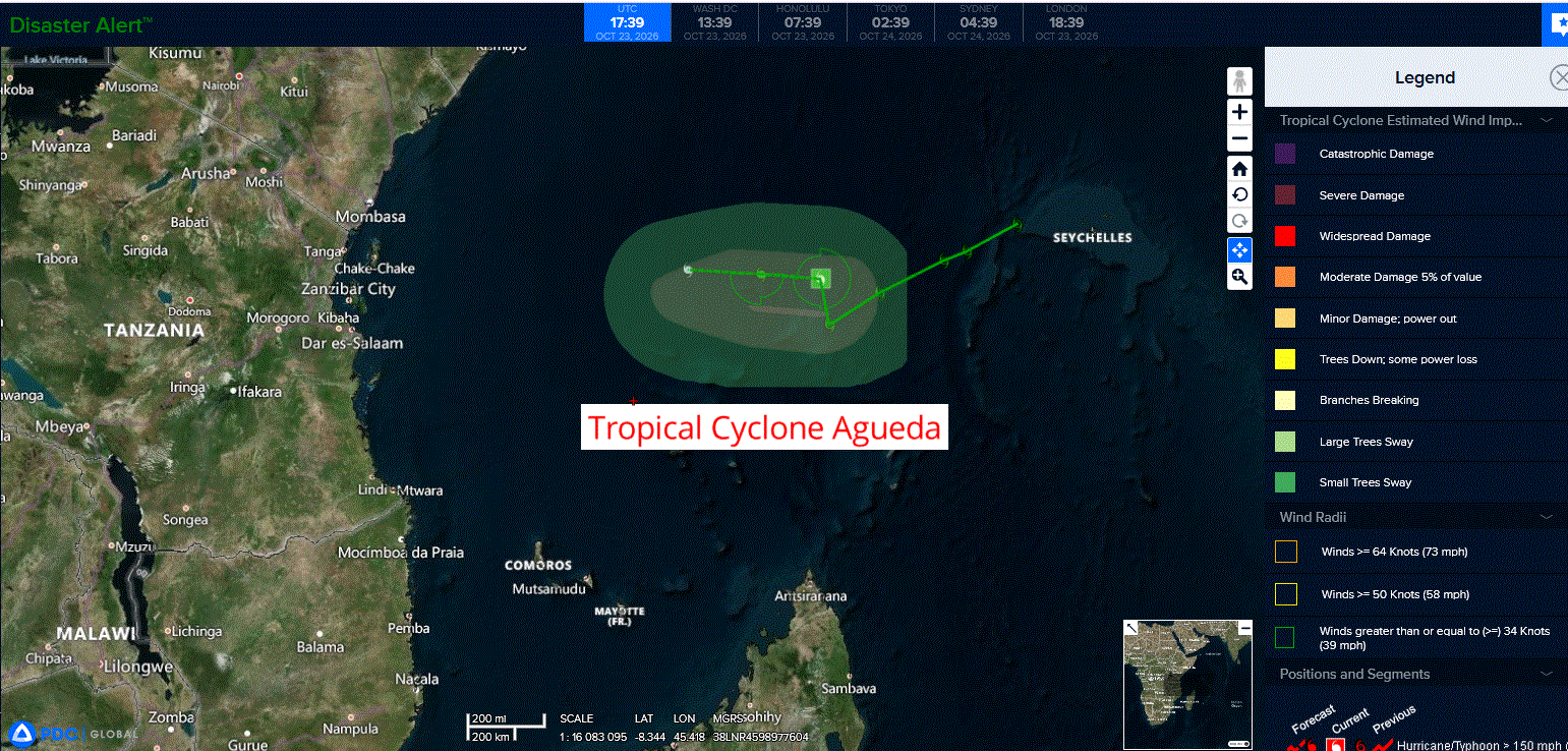
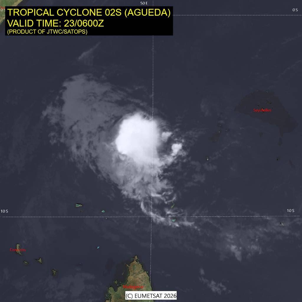
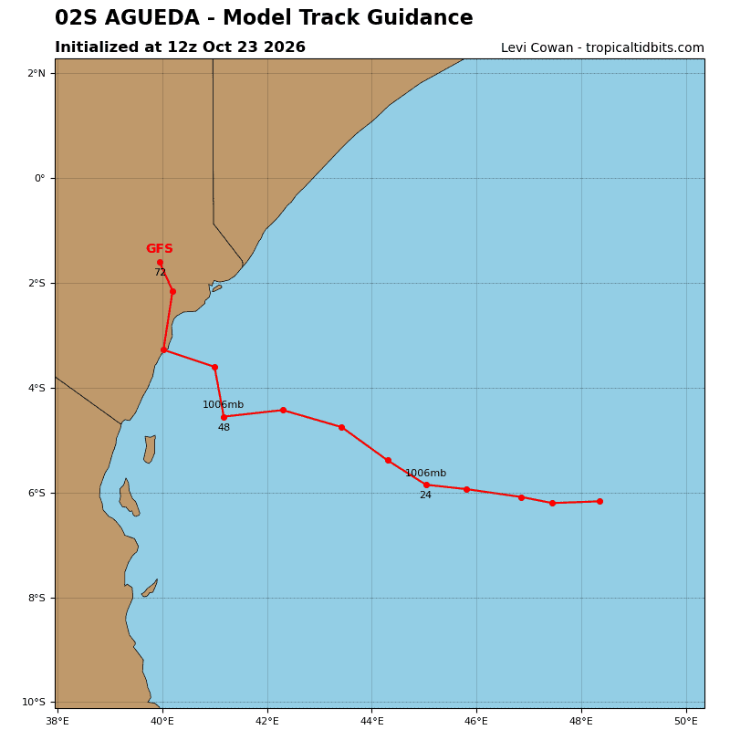
Tropical Cyclone 02S (Agueda)
According to the JTWC warning number 7…sustained winds were 35 knots with gusts to 45 knots
Animated multi-spectral satellite imagery (msi) depicts that over the past 6-12 hours, tc 02S has undergone two distinct convective pulses, characterized by flaring deep convection obscuring the low-level circulation center (llcc), followed by rapid collapse that temporarily exposed the llcc before rebuilding over the center within the past few hours. The animated msi also reveals a sharp, well-defined western convective boundary, indicative of moderate mid-level westerly wind shear impinging on the system. A 230227z rcm-3 sar pass indicated a compact llcc supported by surface winds of 30-35 kts prior to the recent convective redevelopment.
Environmental conditions are unfavorable, characterized by moderate westerly mid-level shear, mid-level dry air entrainment, weak upper-level outflow, and marginal sea surface temperatures (ssts).
TC 02S will track westward along the northern periphery of an extensive str extending from southern Mozambique, across Madagascar, and far into the Southern Indian Ocean.
Regarding intensity, the current convective burst is likely the final pulse, as increasing mid-level westerly shear and robust dry air intrusion will vertically decouple the system. the shallow remnant vortex will continue tracking westward into an increasingly hostile environment, resulting in dissipation below the 35-kt warning threshold within the next 24 hours.
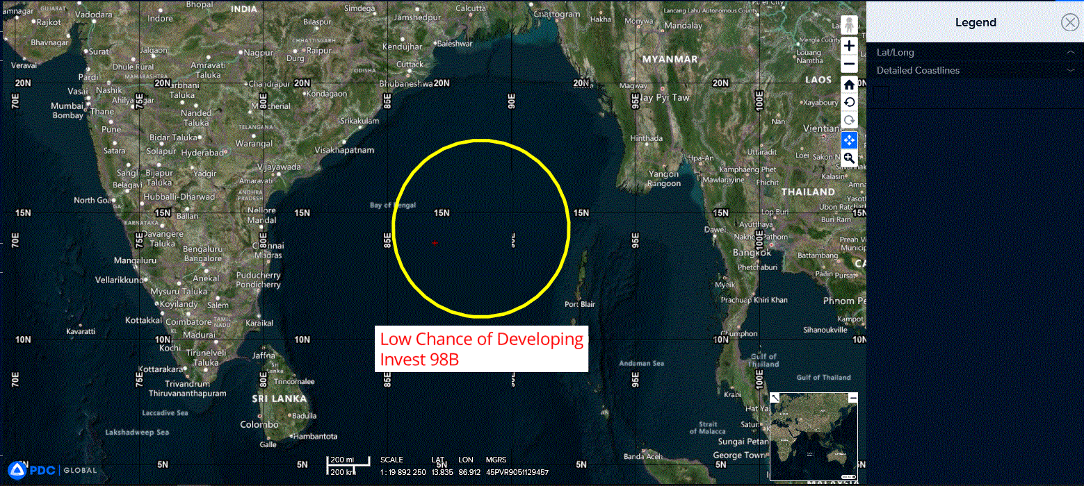
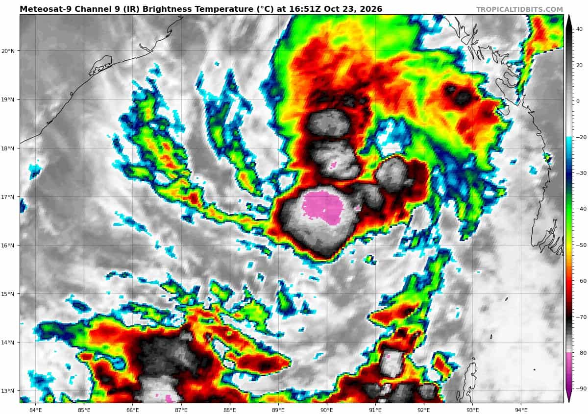
>>> There’s an area of disturbed weather that’s being referred to as Invest 98W, which is located approximately 271 NM northwest of Port Blair
Animated enhanced infrared satellite imagery (eir) depicts an area of a slowly consolidating llc with persistent deep convection and a fragmented, formative banding. a 221424z metop-b ascat pass reveals enhanced winds along the northeastern periphery of the asymmetric circulation center.
Environmental analysis reveals low vertical wind shear (5-10kts), warm sea surface temperatures (29-30c), and moderate equatorward outflow aloft.
Global deterministic and ensemble models are in agreement in the gradual development of 98B, both showing high confidence in development. 98B is expected to transit generally northwestward as it consolidates.
Maximum sustained surface winds are estimated at 5 to 10 knots.
Minimum sea level pressure is estimated to be near 1007 mb.
The potential for the development of a significant tropical cyclone within the next 24 hours is low.