

Current Snapshot
For all the latest updates visit: DisasterAWARE
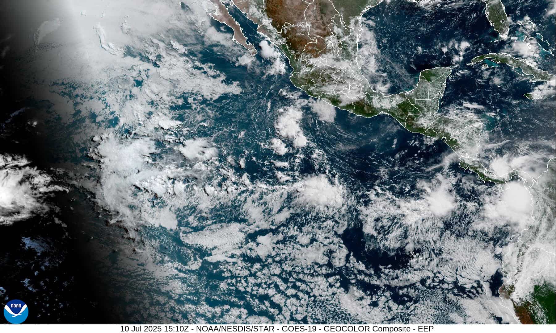
1800x1080e
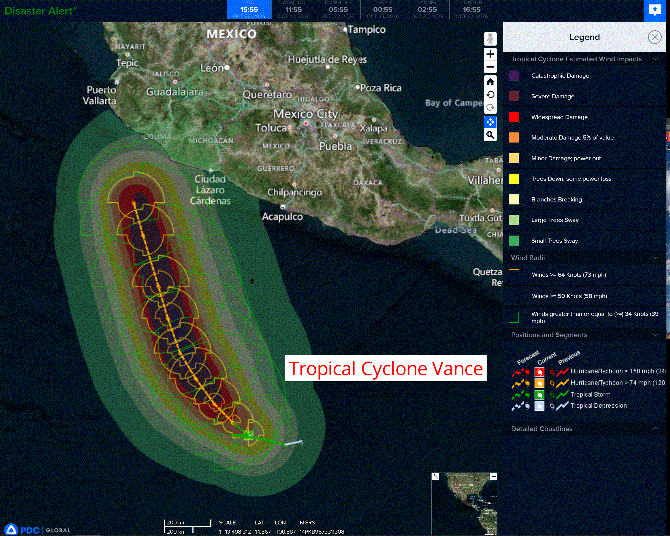
vance
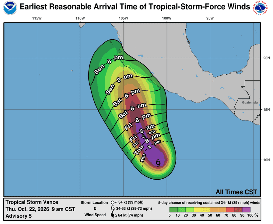
221446_earliest_reasonable_toa_34
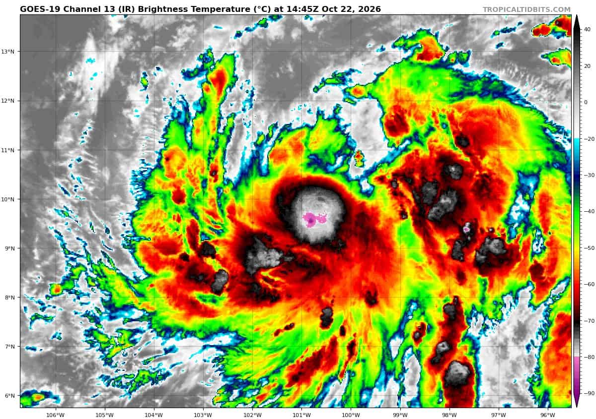
goes19_ir_22E_202610221445_lat9.7-lon-100.9
22E_tracks_latest
1800×1080
c
champi
29W_221200sair
himawari9_ir_29W_202610221430_lat21.2-lon124.9
29W_tracks_latest
a
02S_220600sair
02S_tracks_latest
97w
himawari9_ir_97W_202610221430_lat12.2-lon165.6
97W_tracks_latest
By PDC’s Senior Weather
Specialist Glenn James

The Pacific Disaster Center’s (PDC Global) Thursday, October 22, 2026, Tropical Cyclone Activity Report…for the Pacific Ocean, the Indian Ocean, and adjacent Seas.
Tropical Cyclones
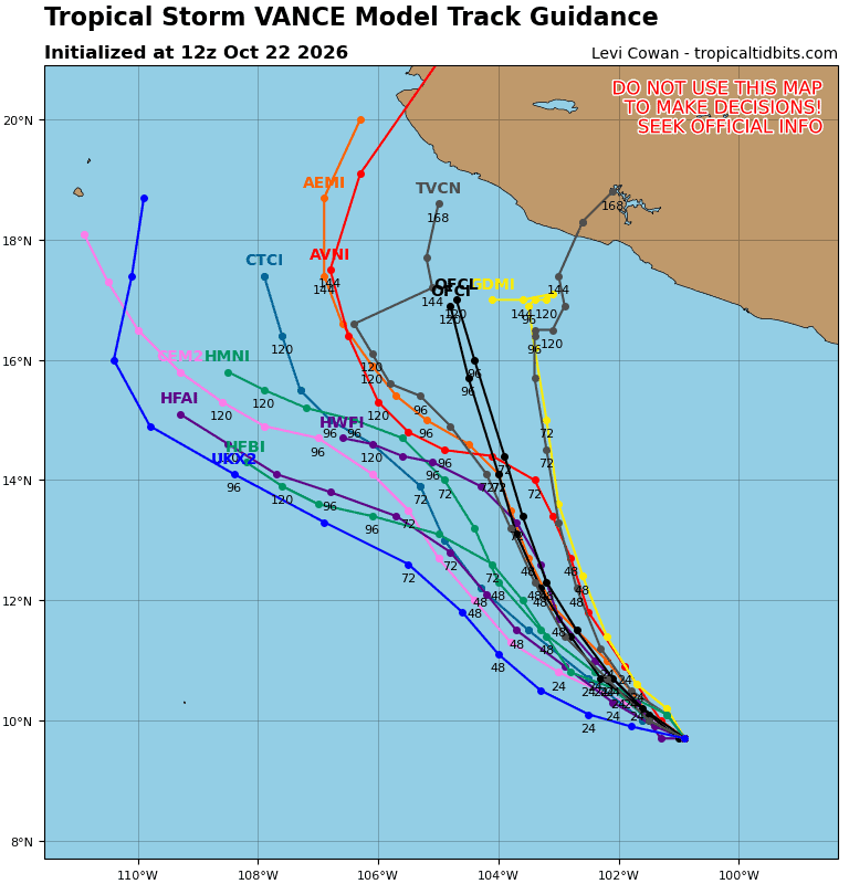
Tropical Cyclone 22E (Vance)…is located 680 miles south-southeast of Manzanillo, Mexico
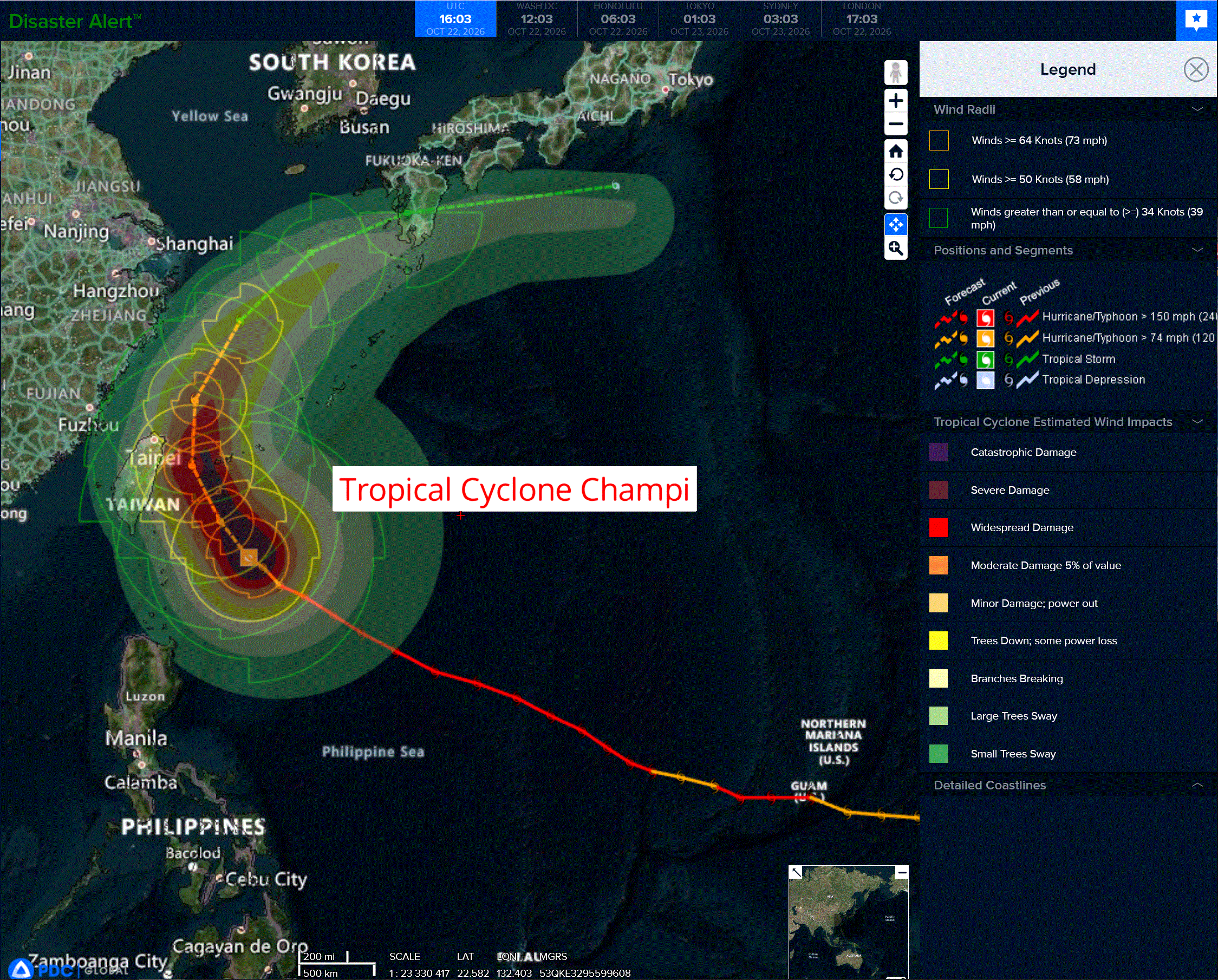
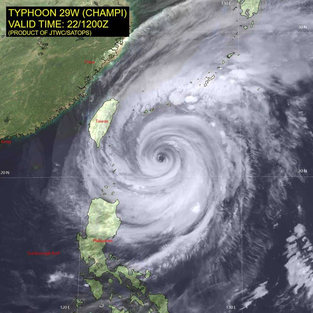
Tropical Cyclone 29W (Champi) is located approximately 356 NM south-southwest of Kadena AB
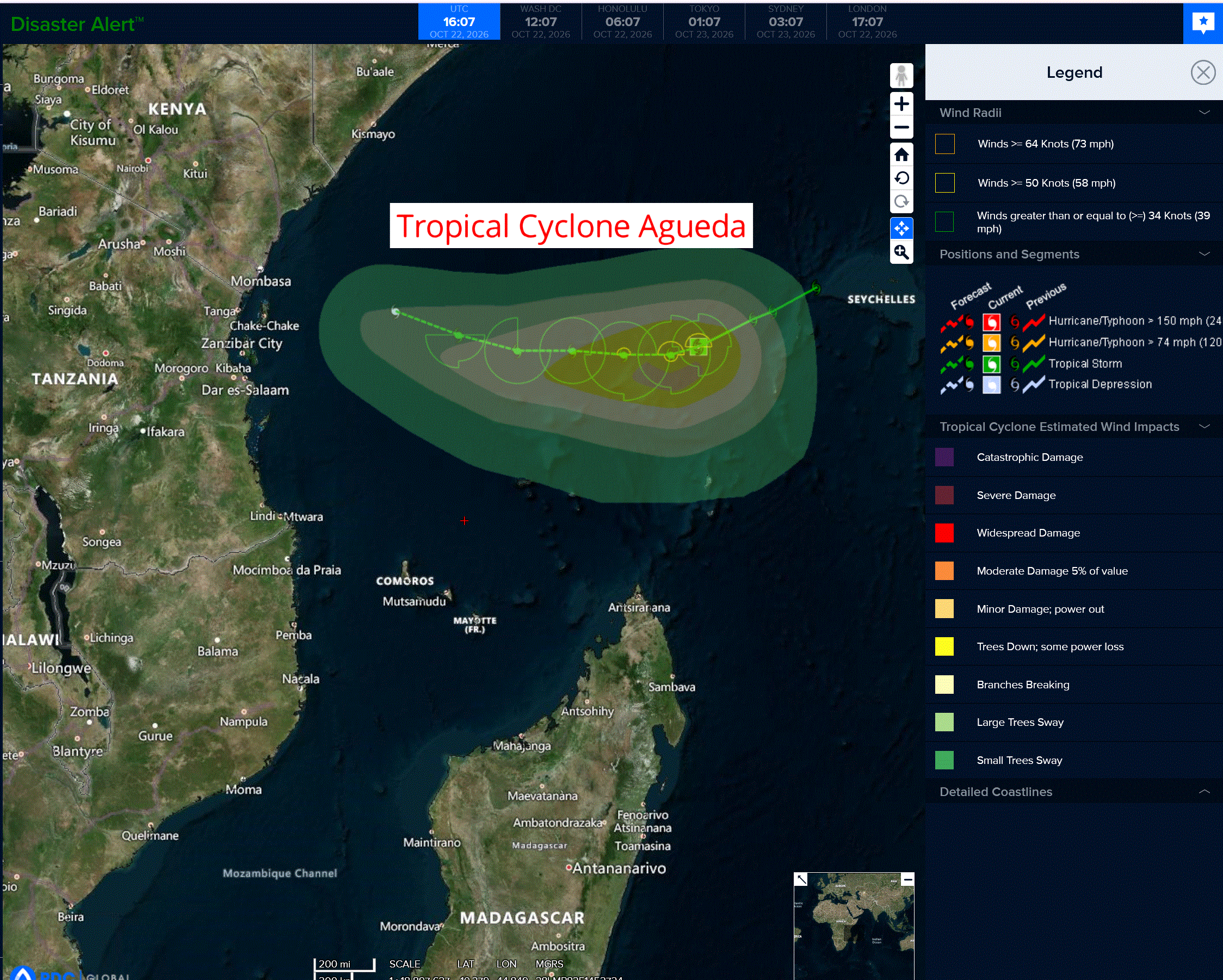
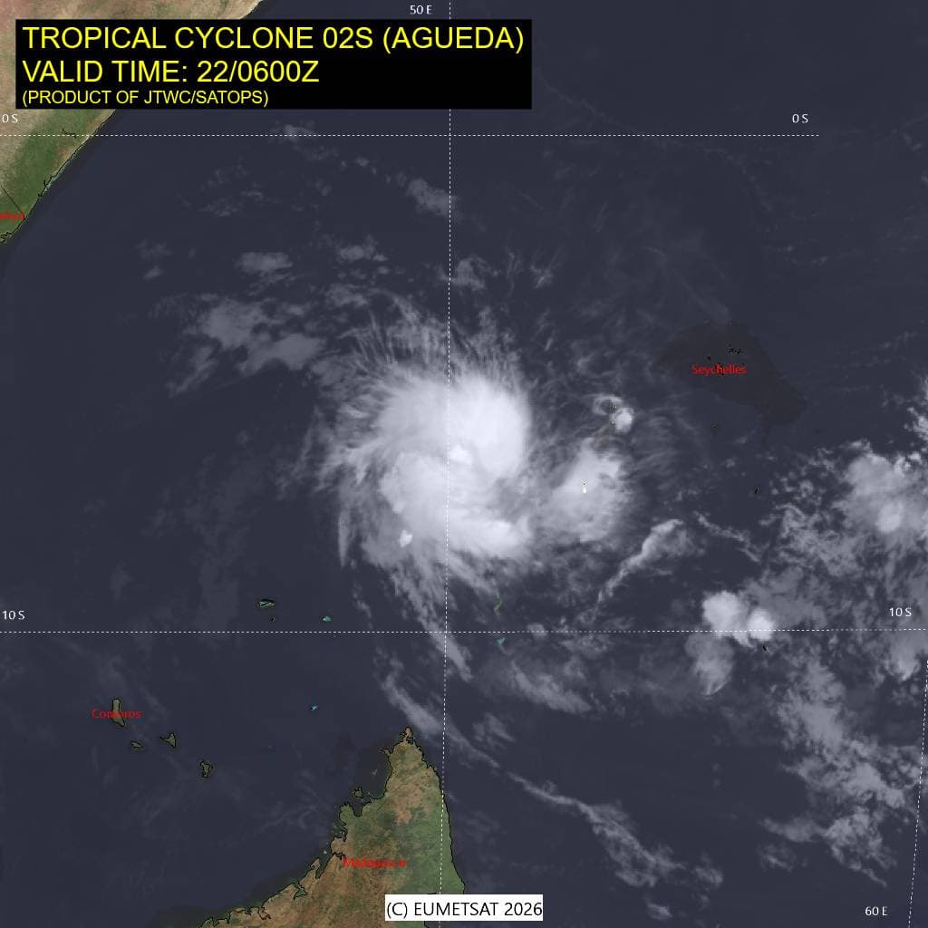
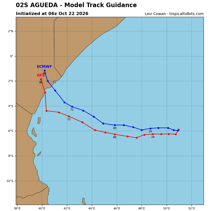
Tropical Cyclone 02S (Agueda) is located approximately 687 NM east of Dar Es Salaam, Tanzania
Northeast Pacific:
Tropical Cyclone 22E (Vance)
VANCE GETTING STRONGER WELL SOUTH OF MEXICO
According to the NHC advisory number 5
Vance is moving toward the northwest near 3 mph (6 km/h), and a slow northwest to north-northwest motion is expected for the next few days.
Satellite imagery indicate that the maximum sustained winds have increased to near 60 mph (95 km/h) with higher gusts. Vance is forecast to become a hurricane tonight and could become a major hurricane by the weekend.
Tropical-storm-force winds extend outward up to 90 miles (150 km) from the center. The estimated minimum central pressure is 997 mb (29.44 inches).
HAZARDS AFFECTING LAND
SURF: Swells generated by Vance are expected to begin affecting portions of the coast of southern and southwestern Mexico this weekend and continue into next week. These swells are likely to cause life-threatening surf and rip current conditions.
Central North Pacific: There are no Tropical Cyclones
>>> Western Central Pacific:
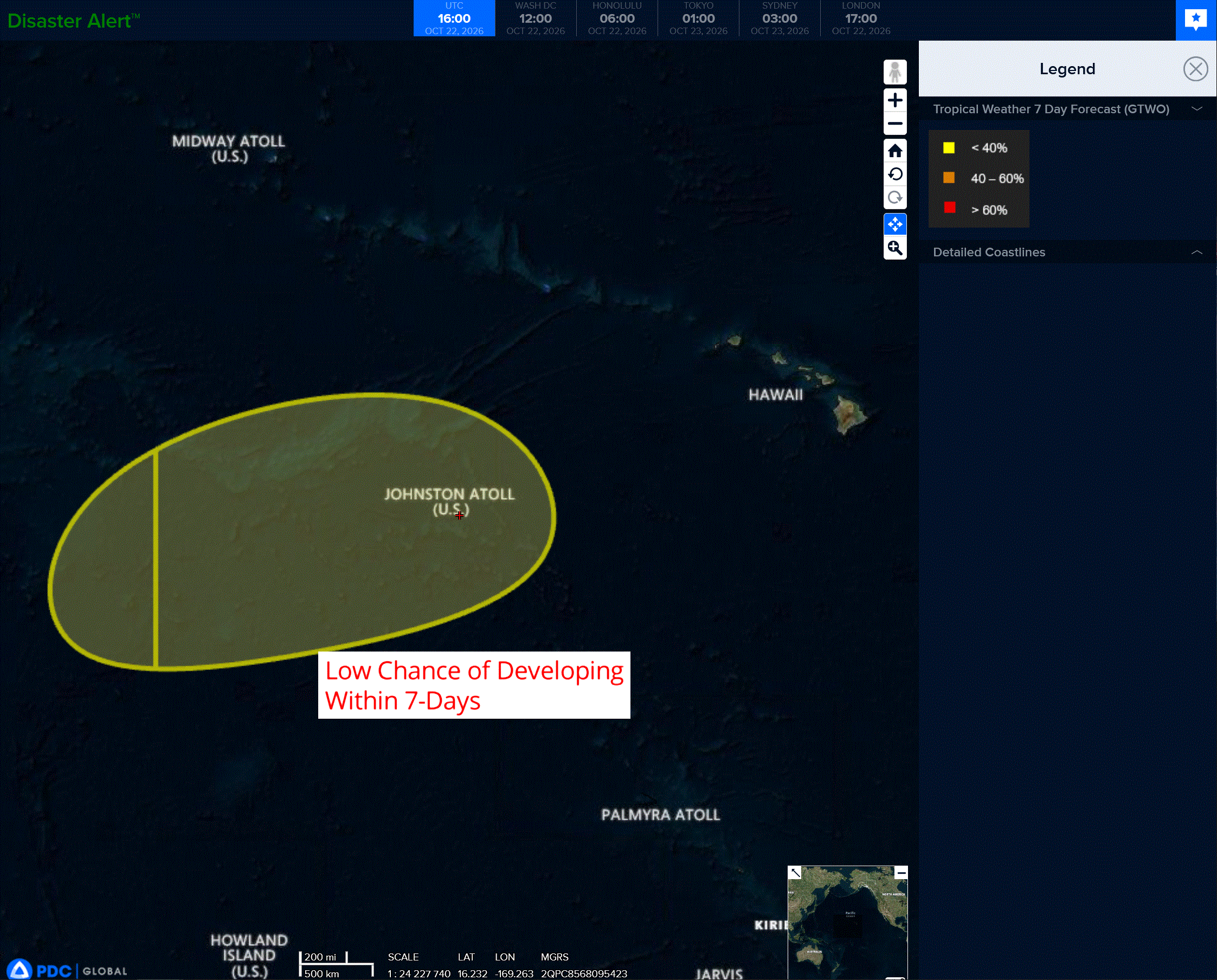
An area of low pressure is forecast to form near the International Date Line, a few hundred miles west-southwest of Johnston Atoll late this weekend or early next week.
Environmental conditions appear conducive for some gradual development thereafter while the system moves generally eastward to east-northeastward.
* Formation chance through 48 hours…low…near 0 percent
* Formation chance through 7 days…low…30 percent
Western Pacific, Indian Ocean, and adjacent Seas:
Western Pacific
Tropical Cyclone 29W (Champi)
According to the JTWC warning number 33…sustained winds were 100 knots with gusts to 125 knots
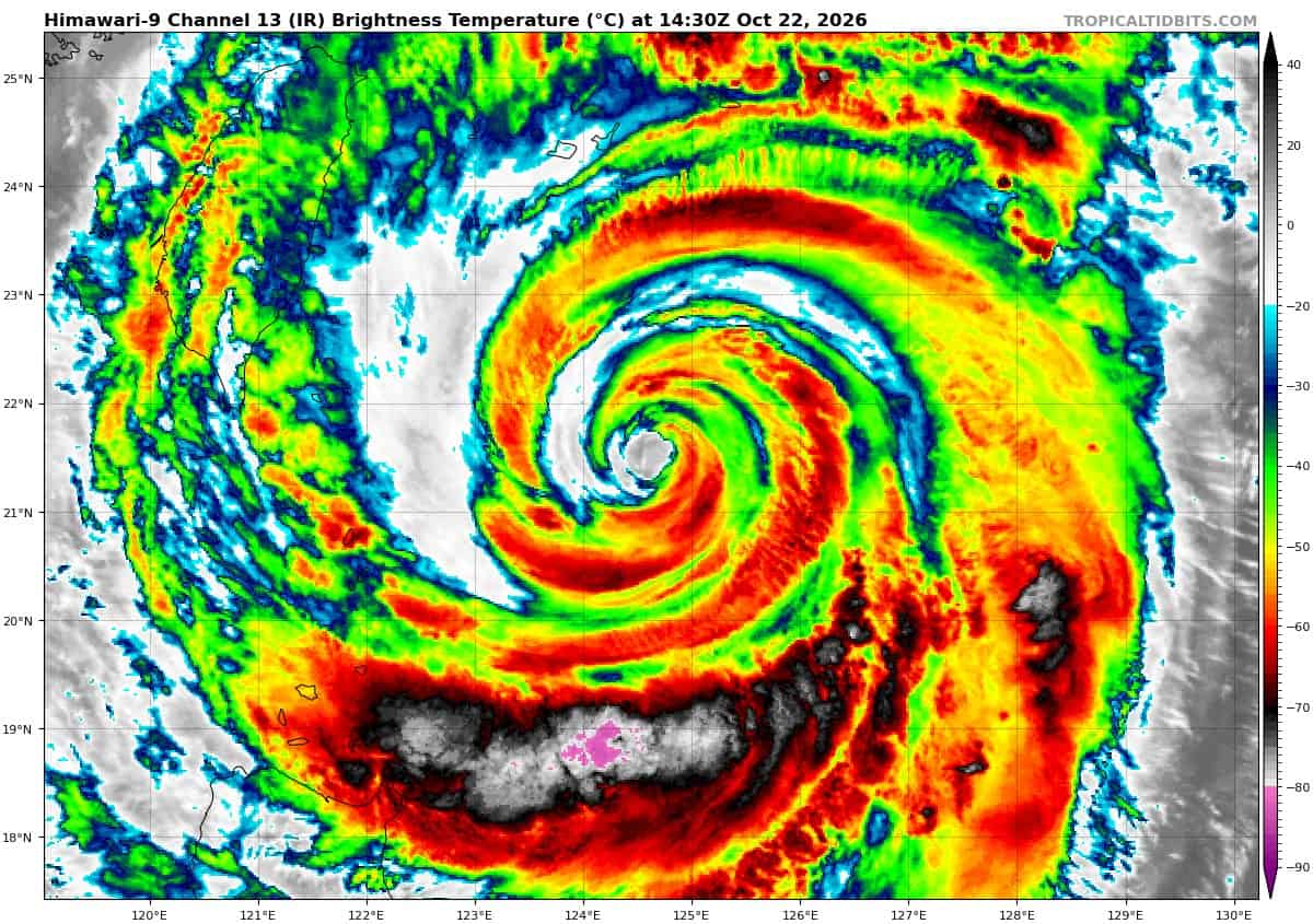
Animated enhanced infrared (eir) satellite imagery depicts a very large typhoon (ty), exhibiting a rapidly shrinking eye, a degrading inner eyewall, and a nascent secondary eyewall. A 220955z wsf-m color-enhanced 89ghz microwave image depicted a concentric eyewall formation. The inner eyewall is strongest on the eastern flank and open in the southwestern quadrant.
Beyond the distinct moat feature, the secondary eyewall persists at about double the radial distance of the inner eyewall, and is likewise strongest on the eastern flank and fragmented in the southwestern quadrant. Due to its decelerating translational speed, TY 29W is upwelling significantly cooler water to the ocean surface, inhibiting the air-sea fluxes needed for the erc to progress, resulting in a stalled concentric eyewall formation.
The system has also exhibited pronounced trochoidal motion over the past six hours as it moves into a weaker steering environment and convective forcing is disrupted by the stalled erc.
Environmental conditions are marginal. Though vertical wind shear is low and outflow aloft is very strong, ssts are relatively cool, which along with the stalled erc, is resulting in a pronounced weakening trend.
TY 29W is currently moving slowly in a trochoidal fashion as it moves into a weak steering pattern, due south of a large col in the deep-layer steering pattern. Tthe
trochoidal motion is expected to continue for the next 12 to 24 hours as the system drifts deeper into the col region and the erc remains stalled. However, the mean motion vector will remain toward the northwest, independent of the short-term erratic, trochoidal motions. the system will maintain a 6-8 knot speed of advance over the next 12 to 24 hours as it nears the axis of the str to the east.
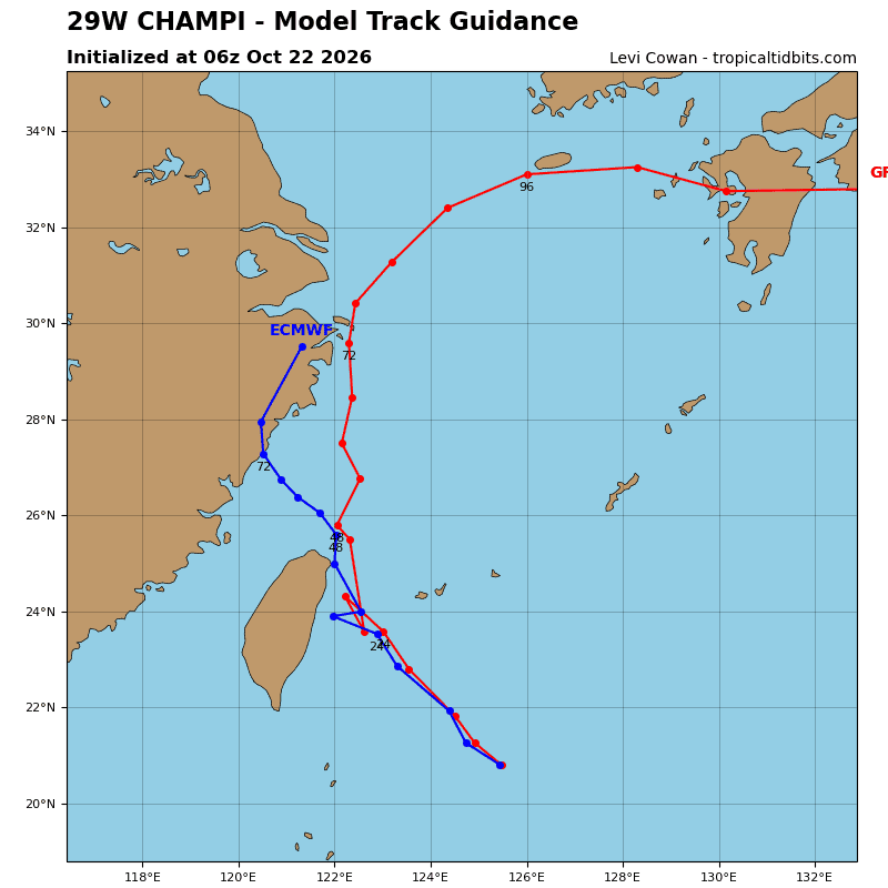
The forecast keeps the core of ty 29W offshore of the northeast tip of Taiwan as
it begins recurvature. After 24 hours, ty 29W will turn northeastward and accelerate along the northwestern flank of the str south of Japan, move into the central portion of the East China Sea (ecs), and make landfall along the southwestern coast of Kyushu around 72 hours. The system will then quickly cross the southern portion of Kyushu and reemerge over water, tracking south of Shikoku through the remainder of the forecast period.
Regarding intensity, ty 29W will continue to weaken over the next 12 hours due to the reasons outlined previously. However, it will soon move over a region of high ocean heat content (ohc) which lies to the south and southwest of Ishigakijima. As the system passes over this region, the weakening trend will be briefly arrested, and ty 29W will maintain 90 knots intensity from 12 to 24 hours. After passing through the southern Ryukyus, ty 29W will begin to quickly weaken as it moves over cooler waters and encounters increasing shear and entrainment of dry mid-level air from the west.
After 36 hours, the system will weaken more rapidly as shear increases sharply and ty 29W becomes enveloped in dry air. By 60 hours, ty 29W begins extratropical transition (ett) as it phases with a 500mb shortwave trough. Assuming the system does not dissipate prior to 72 hours, which remains a distinct possibility, it is forecast to complete ett between 72 and 96 hours.
South Indian Ocean
Tropical Cyclone 02S (Agueda)
According to the JTWC warning number 5…sustained winds were 50 knots with gusts to 65 knots
Animated multi-spectral satellite imagery (msi) depicts a compact, well-defined circulation, with persistent convection becoming increasingly organized over the past few hours. A 220504z ascat-b pass reveals a compact inner core of intense, storm-force winds, with a small radius of gale-force winds extending outward
approximately 70nm. An earlier 220215z sentinel-1c synthetic aperture radar (sar) pass depicted a mean maximum wind measurement of 50 knots.
Environmental conditions are favorable, with warm sea surface temperatures (ssts), strong poleward outflow aloft, and low deep-layer vertical wind shear (vws).
Tropical cyclone (tc) 02S is currently moving southwestward along the southwestern periphery of a deep-layer str positioned to the northeast. The str is forecast to shift southward over the next 24 hours. Concurrently, as tc 02S reaches its peak intensity, the system will gradually turn onto a westward heading in response to the ridge building to the south. After 48 hours, as tc 02S begins to weaken, it will come under the steering influence of a low- to mid-level ridge building in from the southwest, initiating a turn northwestward toward the eastern coast of Africa.
Regarding intensity, the system has an approximate 12-hour window of favorable conditions for further intensification; consequently, tc 02S is forecast to reach a peak intensity of 55 knots by 12 hours. Thereafter, while deep-layer vws is expected to remain relatively low, moderate mid-level westerly shear will increase as early as 24 hours. By 48 hours, the westerly mid-level shear will exceed 25 knots, and dry mid-level air entrainment accelerated by the elevated westerly shear will degrade 02S, leading to steady decay. TC 02S is forecast to dissipate as a significant tropical cyclone by 72 hours.
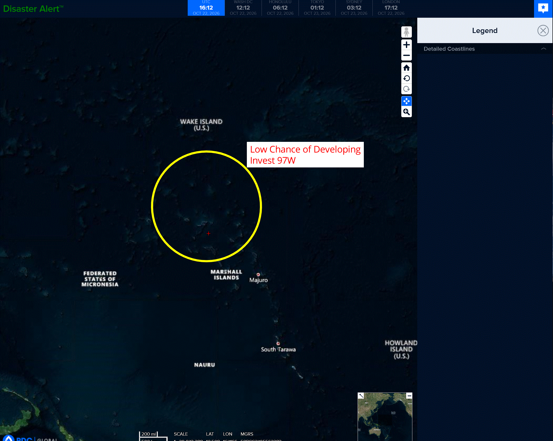
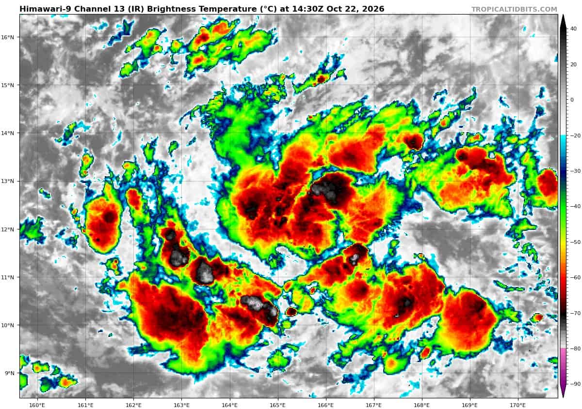
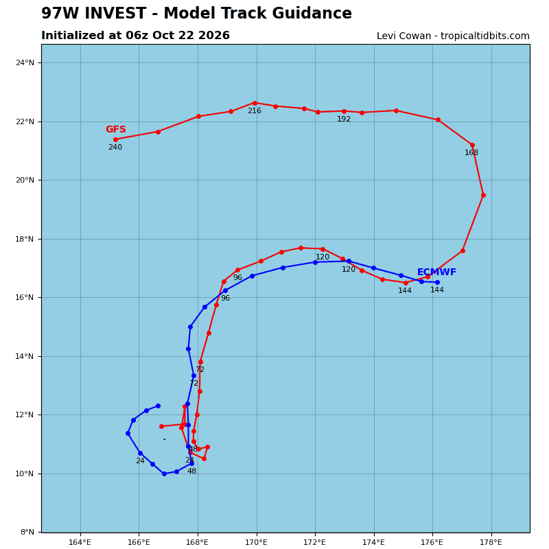
>>> There’s an area of disturbed weather that’s being referred to as Invest 97W, which is located approximately 437 NM south of Wake Island
Animated multi-spectral satellite imagery depicts a compact area of rotation with
flaring, disorganized convection.
Environmental analysis reveals a favorable environment for development with strong upper-level outflow, low vertical wind shear (10-15 kts), and warm sea surface temperatures (29-30c).
Global models show 97W staying quasi-stationary as it consolidates over the next 24-48 hours before slowly tracking generally northeastward.
Maximum sustained surface winds are estimated at 13 to 18 knots.
Minimum sea level pressure is estimated to be near 1008 mb.
The potential for the development of a significant tropical cyclone within the next 24 hours is low.