

Current Snapshot
For all the latest updates visit: DisasterAWARE
1800x1080e
simon
close
121458_earliest_reasonable_toa_34
goes18_ir_20E_202610121545_lat20.0-lon-106.4
121458INTQPF_sm
20E_tracks_latest
2e
7e
goes19_ir_93E_202610121545_lat7.9-lon-93.1

93E_tracks_latest
1800x1080ec
10
2w
27W_121200sair
himawari9_ir_27W_202610121540_lat31.4-lon148.6
27W_tracks_latest
28W_121200sair
himawari9_ir_28W_202610121540_lat17.1-lon149.1
28W_tracks_latest
96w
himawari9_ir_96W_202610121540_lat7.9-lon164.8
96W_tracks_latest
By PDC’s Senior Weather
Specialist Glenn James

The Pacific Disaster Center’s (PDC Global) Monday, October 12, 2026, Tropical Cyclone Activity Report…for the Pacific Ocean, the Indian Ocean, and adjacent Seas.
Tropical Cyclones
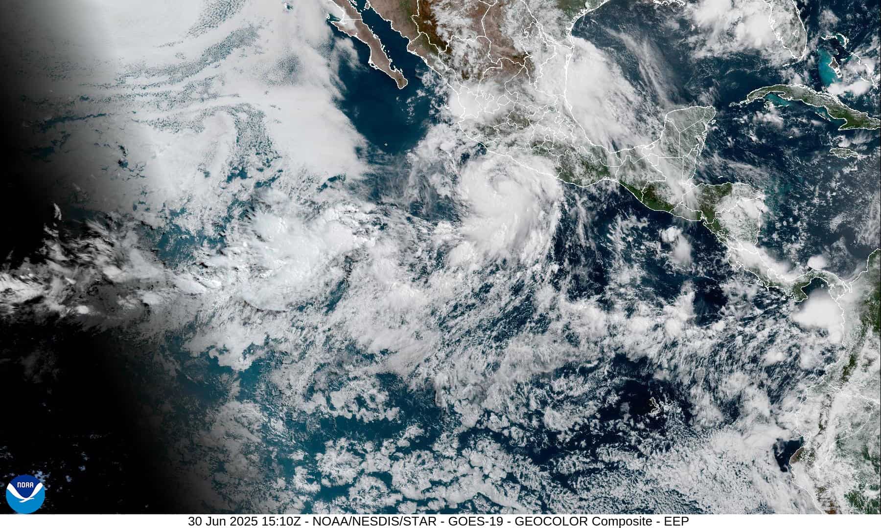
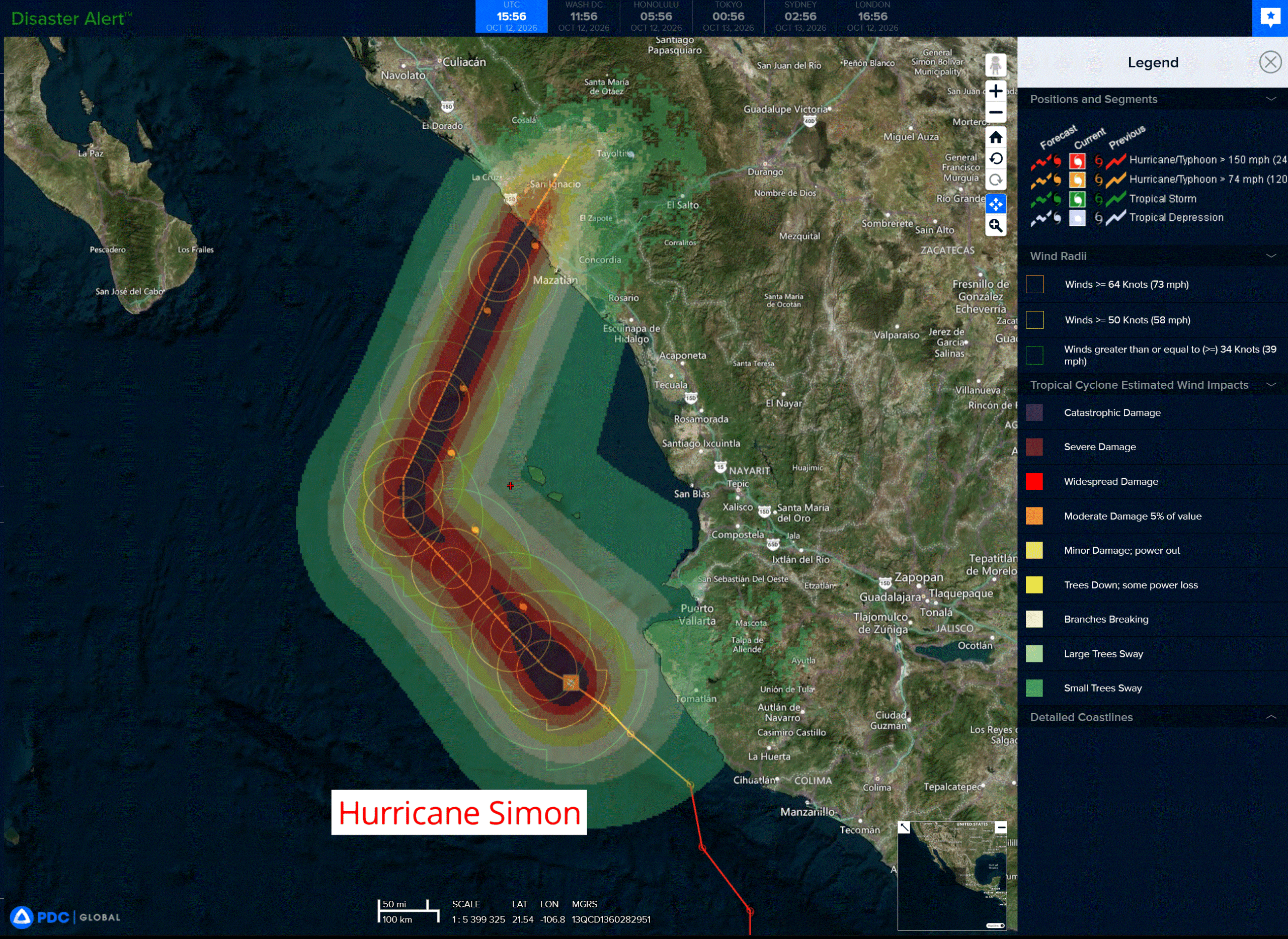
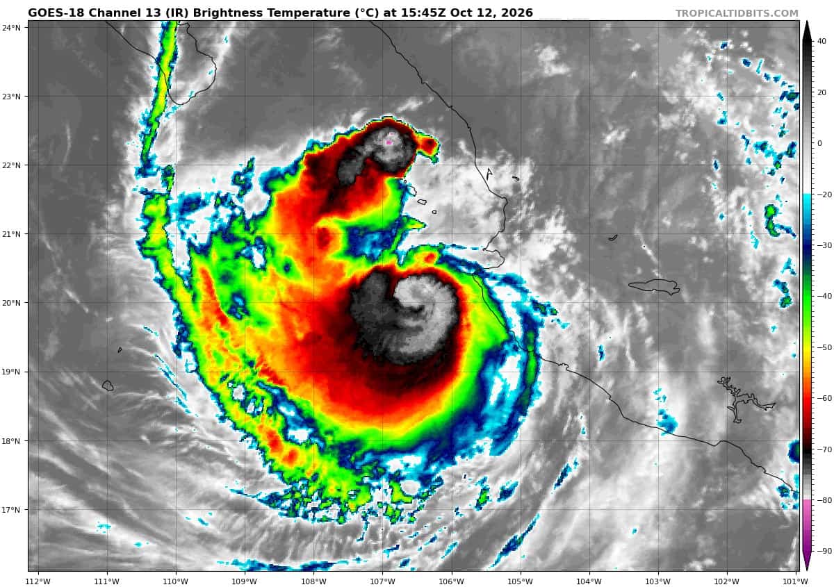
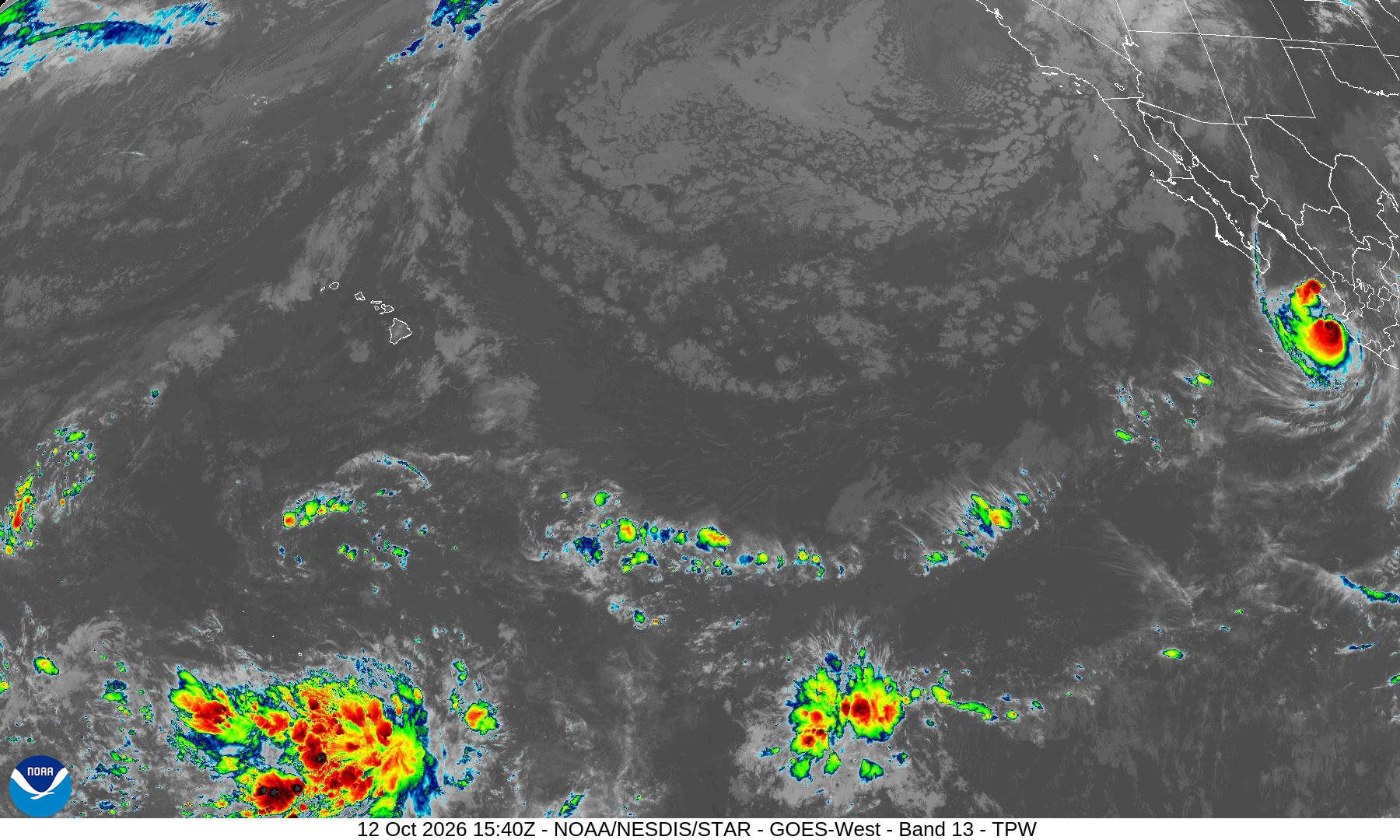
Tropical Cyclone 20E (Simon) is located about 215 miles south of Mazatlan, Mexico
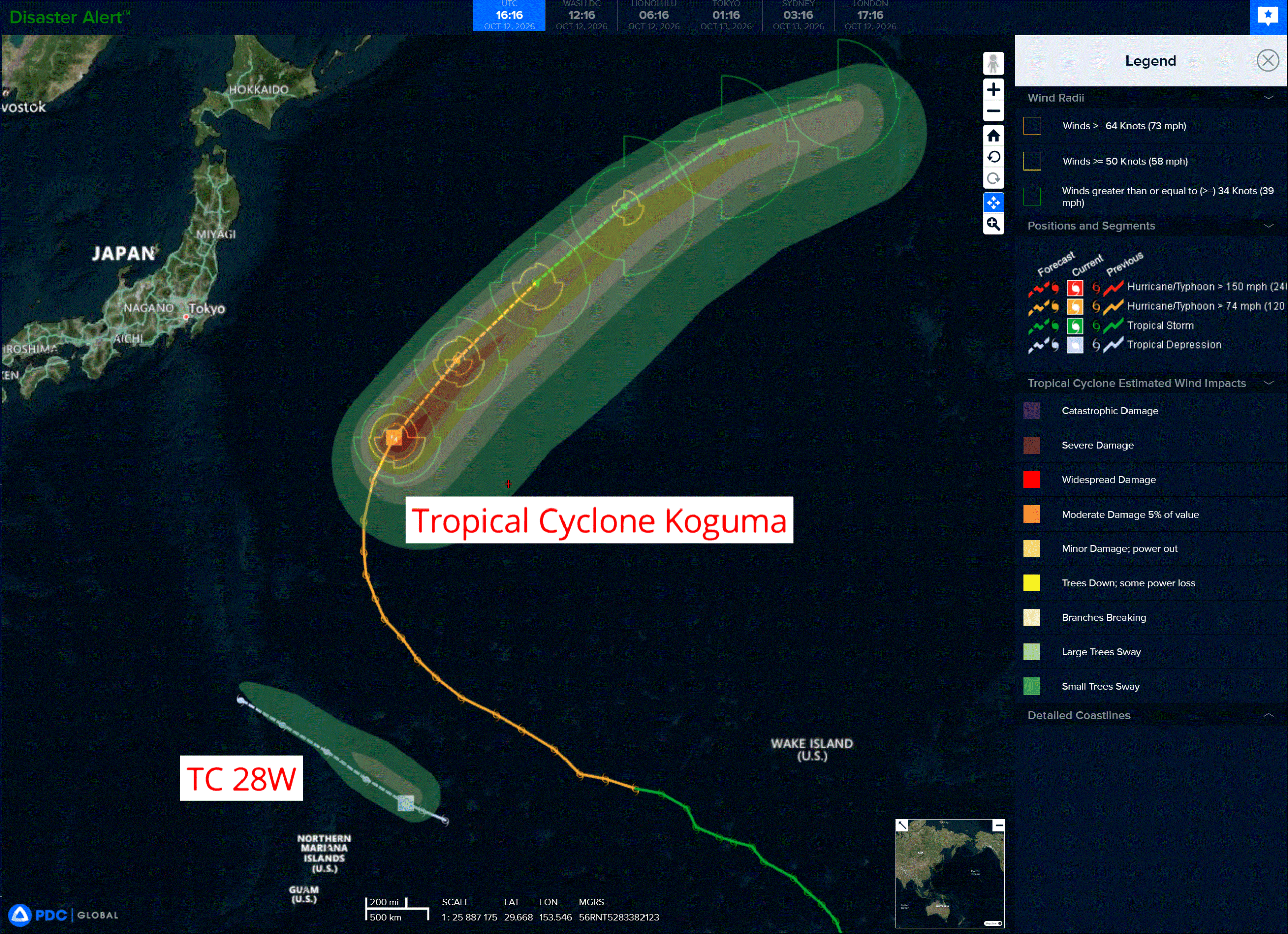
Tropical Cyclone 27W (Koguma) is located approximately 503 NM east-southeast of Yokosuka, Japan
Tropical Cyclone 28W is located approximately 317 NM northeast of Andersen AFB
Northeast Pacific:
Tropical cyclone 20E (Simon)
SIMON CONTINUES MOVING SLOWLY NORTHWESTWARD OFFSHORE OF MEXICO …DANGEROUS WINDS EXPECTED FOR A FEW MORE HOURS WITH FLOODING RAINS TO CONTINUE ALONG THE COAST
According to the NHC advisory number 21
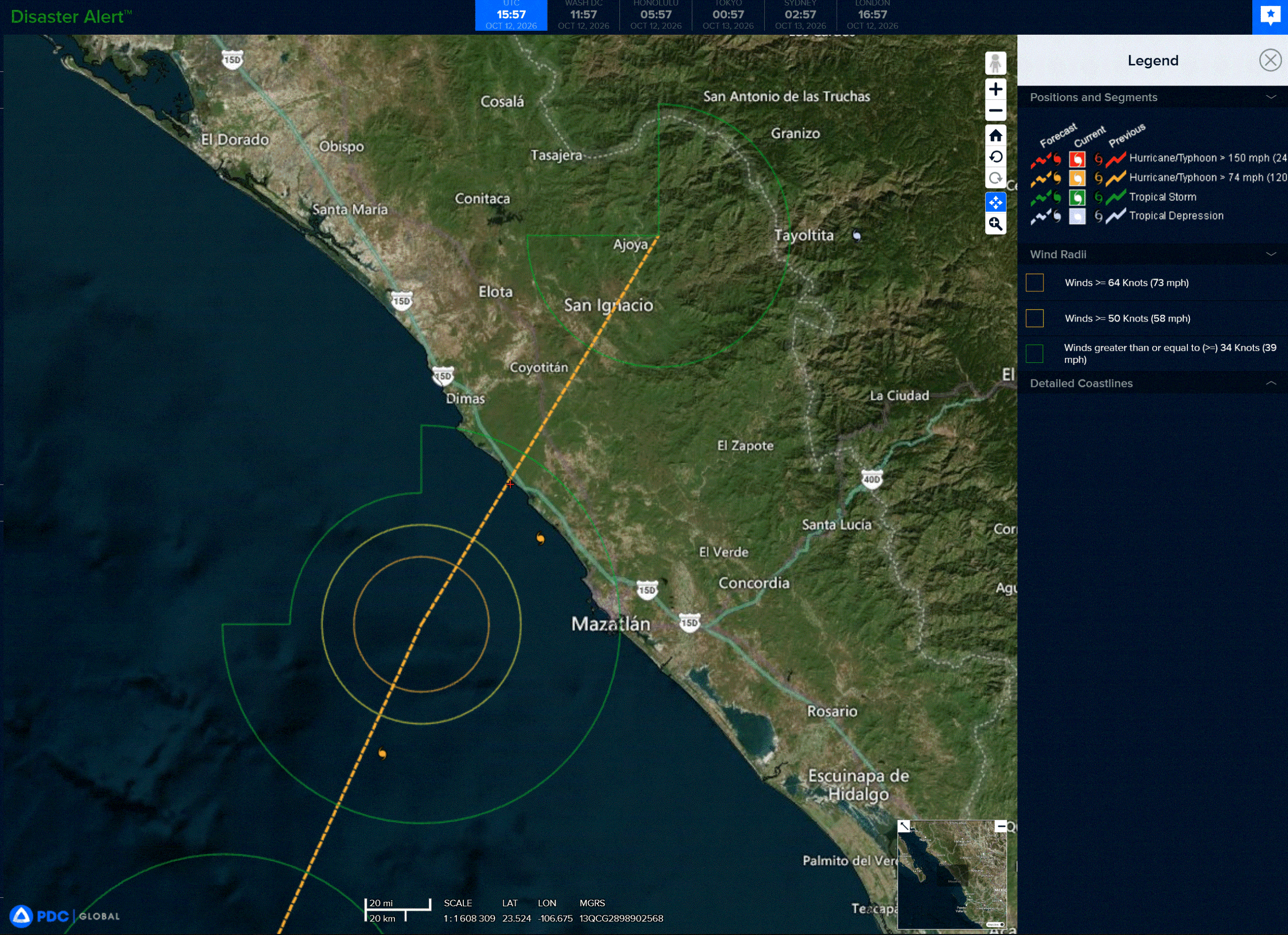
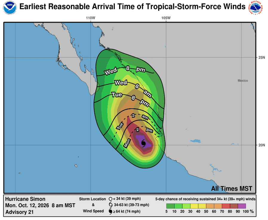
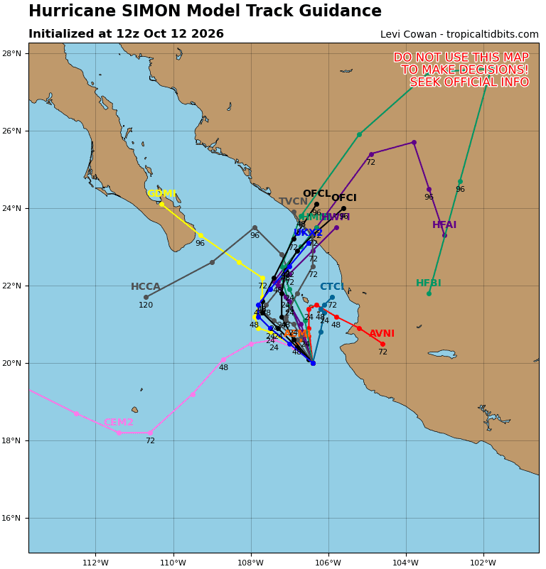
Simon is moving toward the northwest near 3 mph (6 km/h) and this general motion is expected to continue into early Tuesday. A gradual turn toward the northeast is forecast thereafter, and Simon is expected to approach the west-central Mexico coastline on Wednesday into Thursday.
Maximum sustained winds have decreased to near 110 mph (175 km/h) with higher gusts. Some additional weakening is forecast today, but Simon could re-intensify some on Tuesday and Wednesday and is expected to remain a hurricane through midweek. Rapid weakening is likely after Simon moves inland late this week.
Hurricane-force winds extend outward up to 15 miles (30 km) from the center and tropical-storm-force winds extend outward up to 60 miles (95 km). The estimated minimum central pressure is 962 mb (28.41 inches).
HAZARDS AFFECTING LAND
WIND: Hurricane conditions are likely to occur in the Hurricane Warning area of Las Islas Marias. Tropical storm conditions are expected to occur for a few more hours in the Tropical Storm warning area. Hurricane conditions are possible within the watch area by Wednesday, with tropical storm conditions possible by Tuesday night.
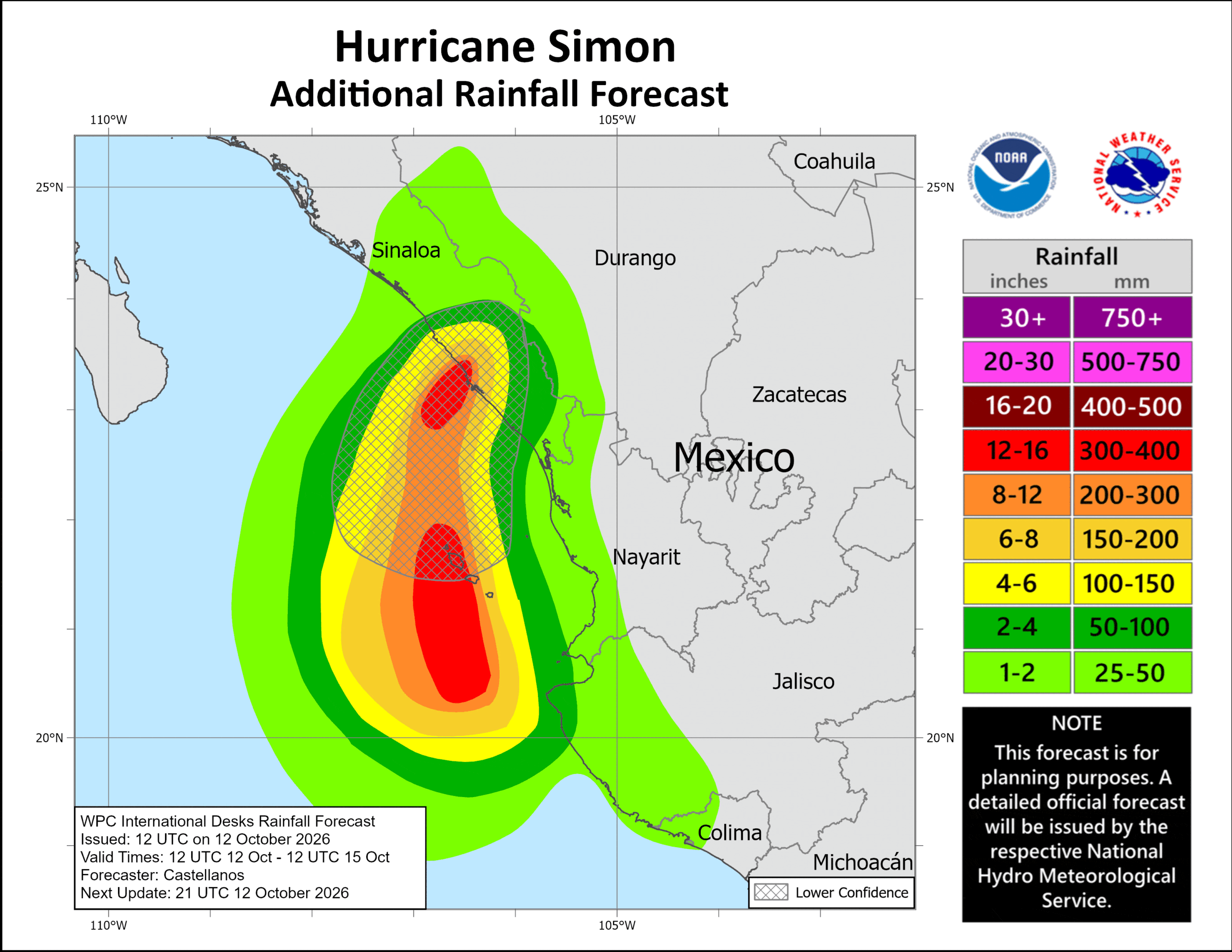
RAINFALL: Simon is expected to produce additional rainfall totals of 2 to 4 inches across coastal portions of southwest and west-central Mexico with isolated additional amounts of 6 to 8 inches over portions of the state of Jalisco through early this week, and the state of Sinaloa mainly Wednesday and Thursday. Isolated maximum storm totals of 30 inches are possible over portions of the states of Michoacan, Colima, and Jalisco. This rainfall will produce life-threatening flooding and mudslides or worsen any on-going flooding, especially in areas of steep terrain.
STORM SURGE: A dangerous storm surge is expected along the immediate coast near and to the east of where the center approaches land. Near the coast, the surge will be accompanied by large and destructive waves.
SURF: Swells generated by Simon will affect portions of the coast of southwestern and west-central Mexico during the next few days. These swells are likely to cause life-threatening surf and rip current conditions.
>>> South of southern Mexico:
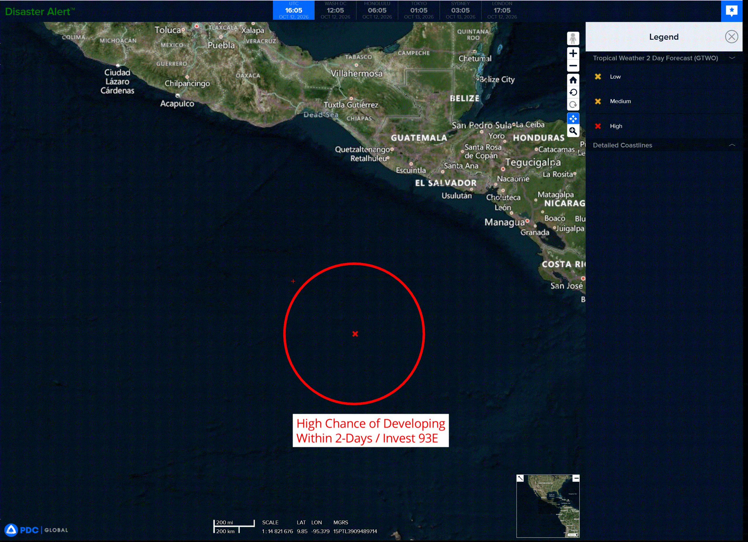
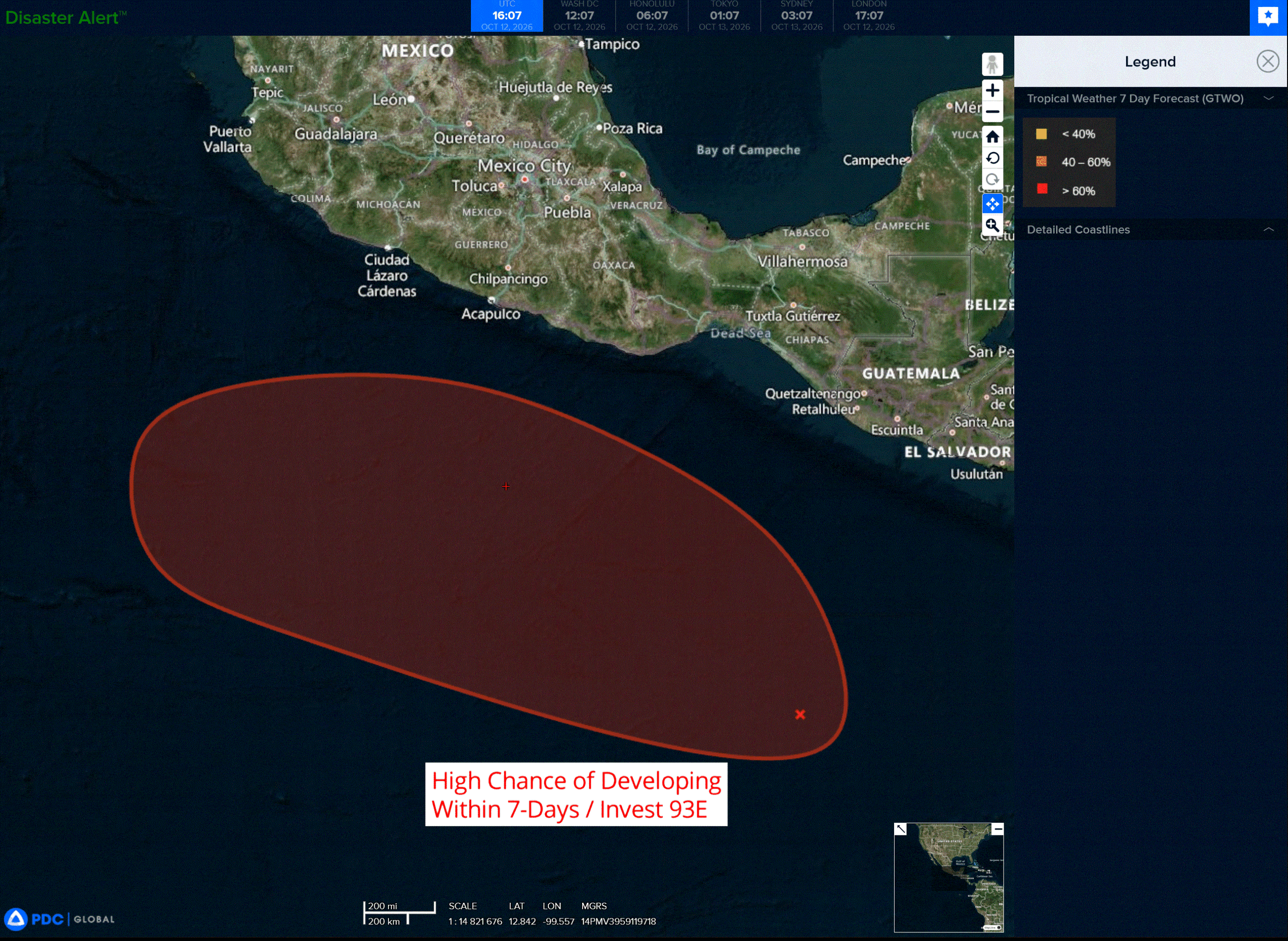
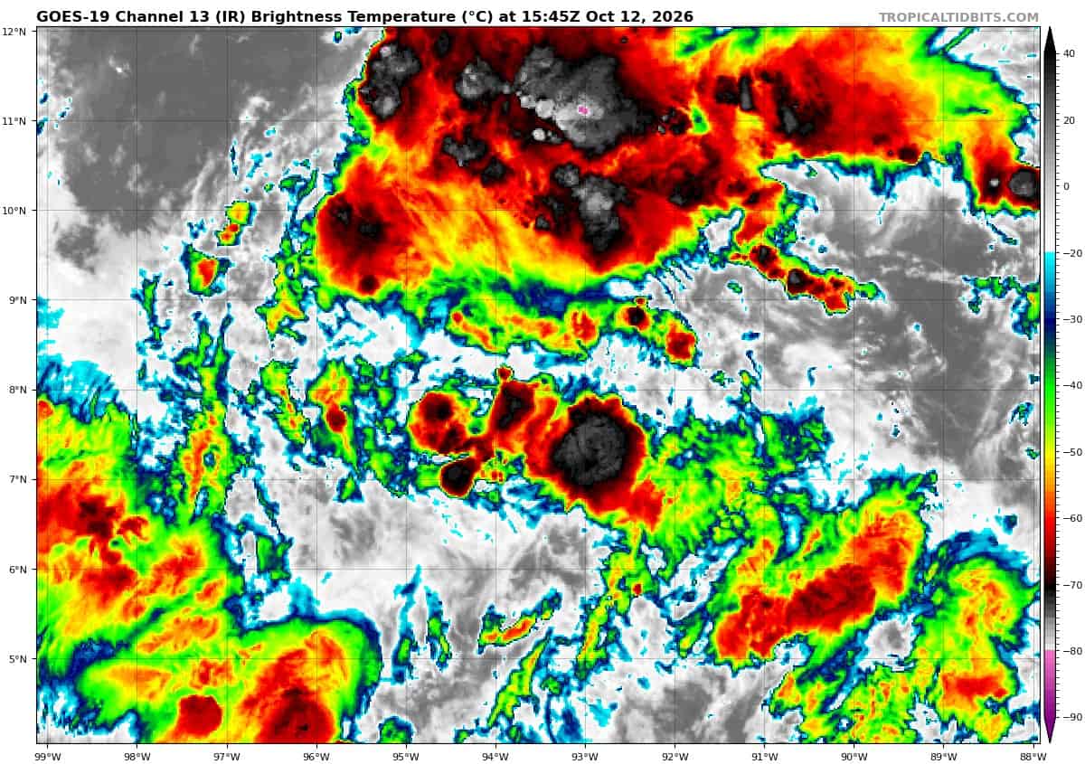
Invest 93E
A broad area of low pressure located several hundred miles south-southwest of the coast of Guatemala continues to produce disorganized showers and thunderstorms.
This system is gradually becoming better defined, and environmental conditions are forecast to be conducive for further development.
A tropical depression is expected to form well south of southern Mexico in the next two days while the system moves generally west-northwestward at around 10 mph.
* Formation chance through 48 hours…high…80 percent
* Formation chance through 7 days…high…90 percent
Central North Pacific: There are no Tropical Cyclones
Tropical cyclone formation is not expected during the next 7 days.
Western Pacific, Indian Ocean, and adjacent Seas:
Western Pacific
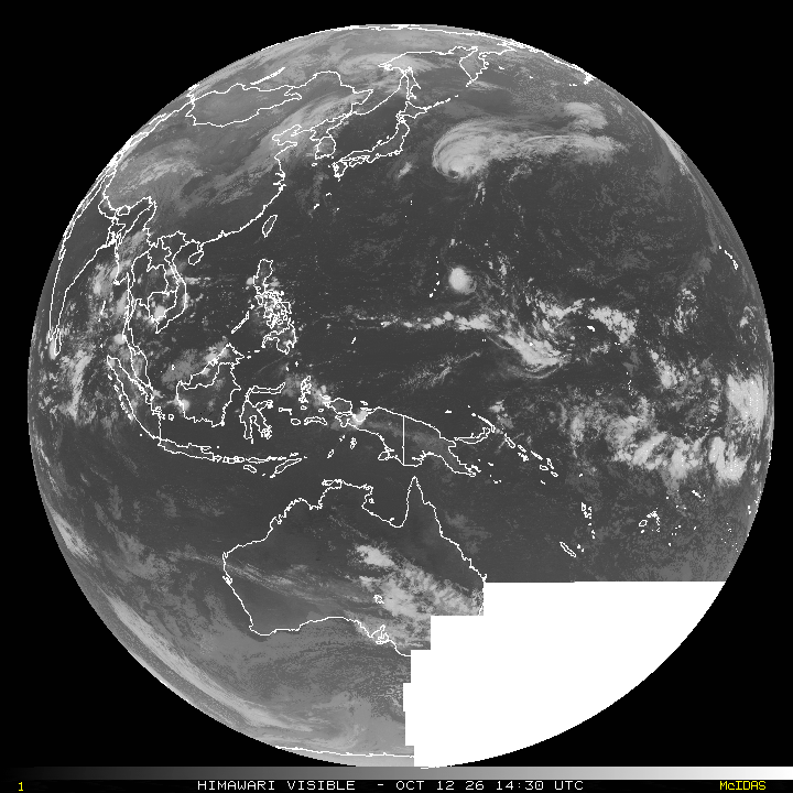
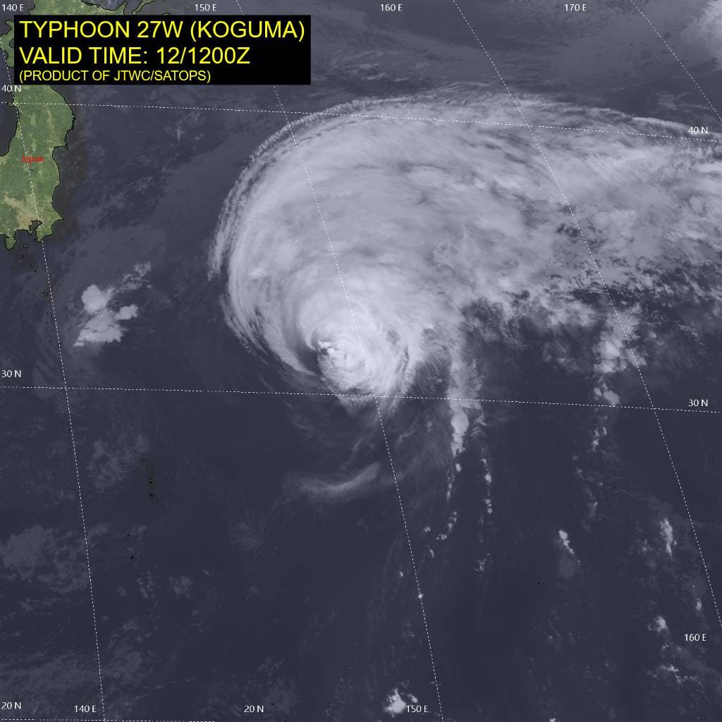
Tropical Cyclone 27W (Koguma)
According to the JTWC warning number 31…sustained winds were 80 knots with gusts to 100 knots
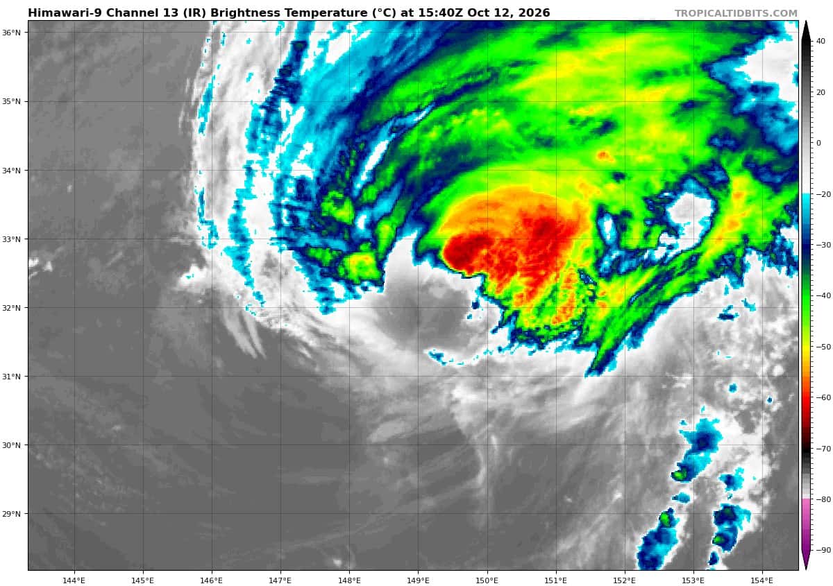
The convective structure of typhoon 27W has significantly degraded over the past six hours. The eye is no longer evident in animated enhanced infrared (eir) satellite imagery. Instead, a ragged central dense overcast (cdo) is displaced from the low-level circulation center (llcc), indicating an increasingly vertically
tilted vortex. This tilt is evident in a comparison of the 120816z wsf-m mwi 89 ghz and 37 ghz images, which reveal a northeastward displacement with height.
The system is straddling the 26-degree celsius isotherm, and southwesterly vertical wind shear (vws) has
increased to 20-30 kts. equatorward outflow is restricted, while TY 27W is phasing with the right-front entrance region of a jet streak, leading to strong poleward outflow. Overall, the environment is highly unfavorable.
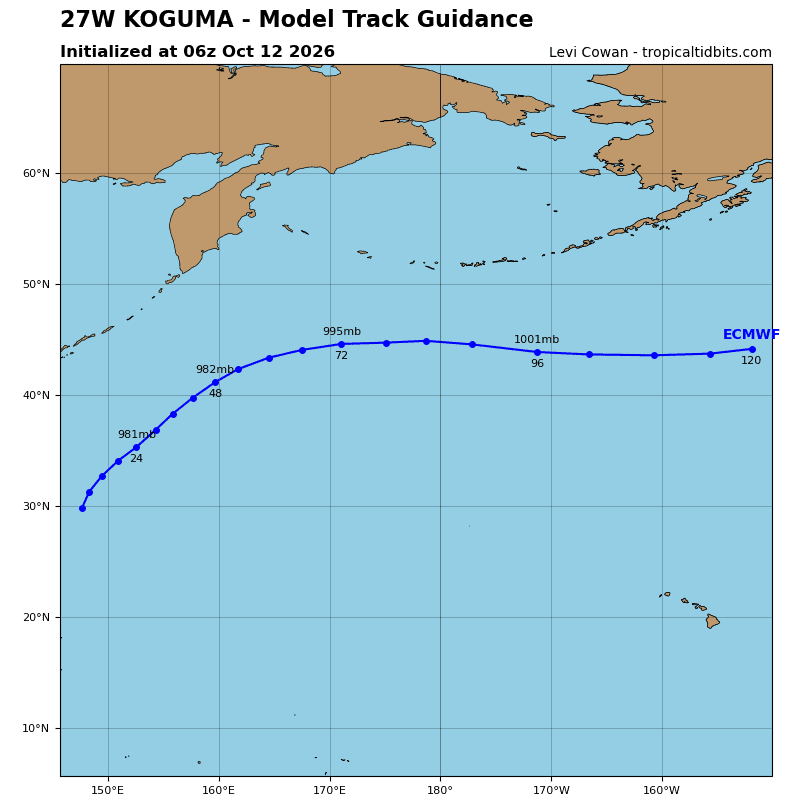
TY 27W is now traveling north-northeastward at 18 kts along the northwestern periphery of a str. The system will continue to accelerate as it becomes increasingly embedded in deep-layer westerly flow. The enhanced poleward outflow is not sufficient to offset the highly detrimental effects of vws and marginal sea surface temperatures (sst). Shear will increase to 35-45 kts by 24 hours and 45-55 kts by 48 hours, while the sst will drop below 25 degrees celsius near 12 hours.
These hostile conditions will maintain a steady to rapid weakening trend through 24 hours. TY 27W will gradually enter the baroclinic zone, begin extratropical transition (ett) at 48 hours, and complete ett by 60 hours. As this occurs, the rate of weakening will slow as the system broadens out and acquires frontal characteristics.
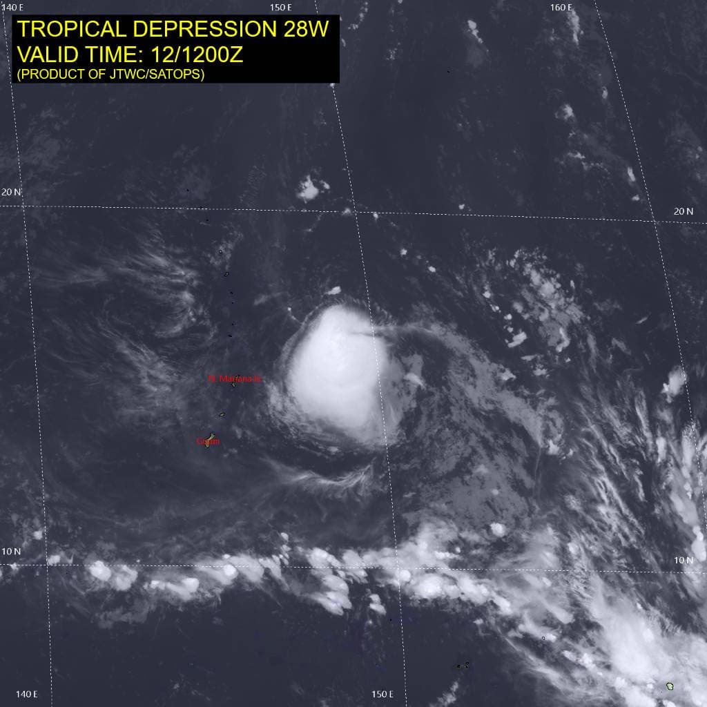
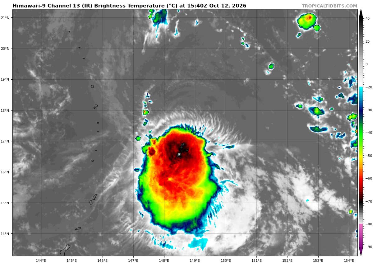
Tropical Cyclone 28W
According to the JTWC warning number 3…sustained winds were 30 knots with gusts to 40 knots
Animated enhanced infrared (eir) satellite imagery depicts persistent deep convection confined to the southern periphery of the compact low-level circulation center (llcc). Over the past six hours, the low-level cloud lines along the eastern side have accelerated, suggesting improved low-level rotation. A 121108z
ascat-b pass reveals an oblong, closed wind field with a patch of 25-30 kt winds in the southern semicircle.
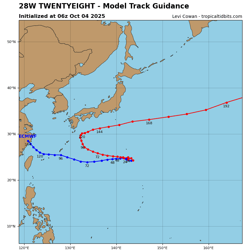
Tropical depression 28W has become better organized while traversing warm sea surface temperatures (sst) of 28-29 degrees celsius in an otherwise marginal environment of dry air and northerly vertical wind shear (vws) of 15-20 kts, largely associated with a tropical upper-tropospheric trough (tutt) just to the west. TD 28W will continue to track generally northwestward along the southwestern flank of a low- to mid-level
str.
Significant intensification appears unlikely. Marginal environmental conditions, consisting of extensive dry air and moderate vws, will persist and limit further development. Concurrently, the tutt will pass over the system during the next 12-24 hours. This may suppress vertical motion and limit upper-level outflow. If the system persists past 36 hours, the shallow vortex will approach a shear line oriented from the southwest to the northeast. This feature will disrupt the low-level circulation, causing TD 28W to degenerate into a trough. the system could dissipate before 48 hours.
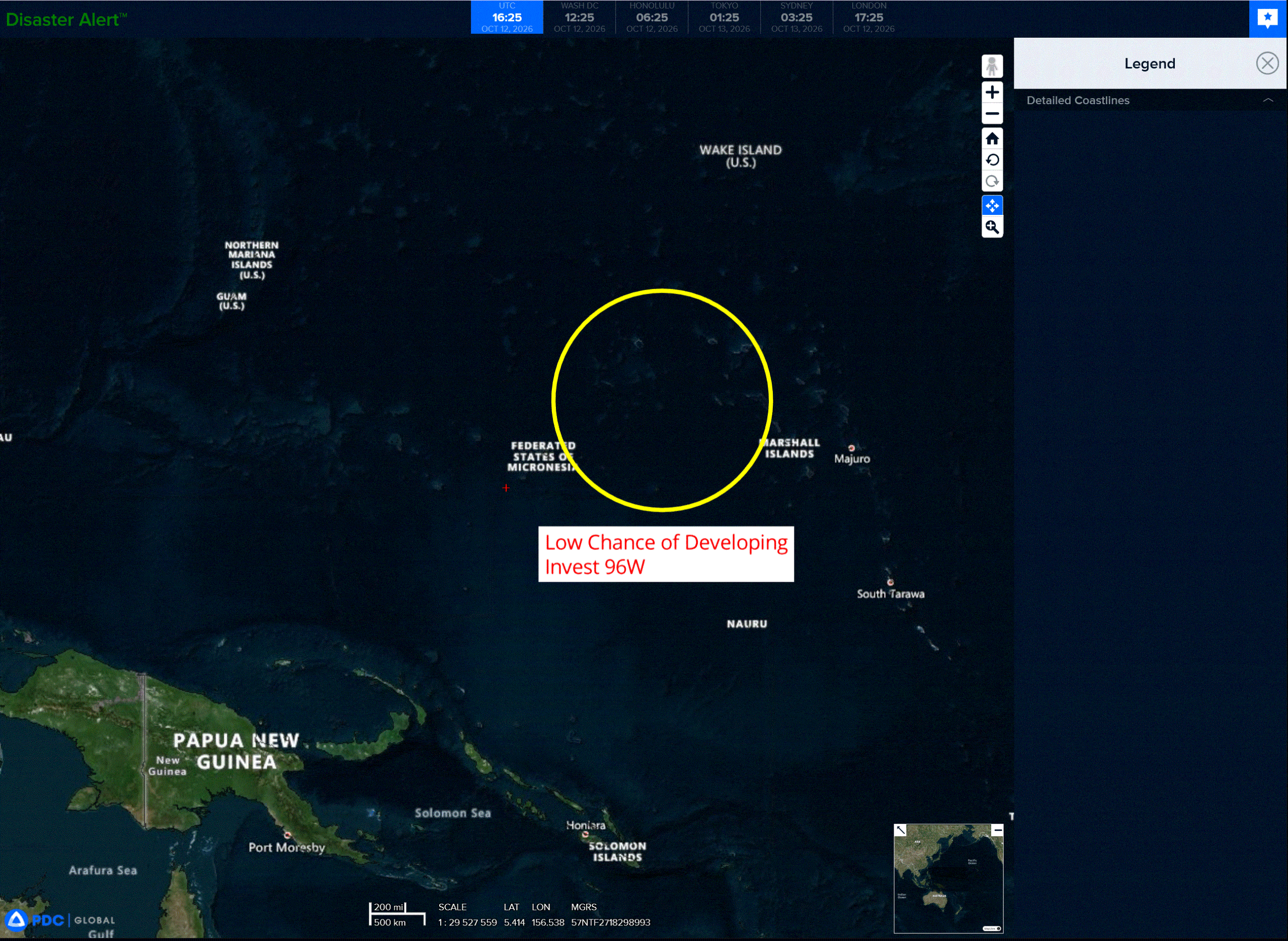
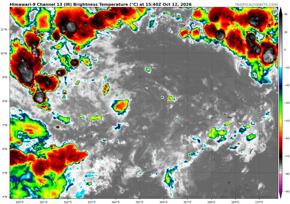
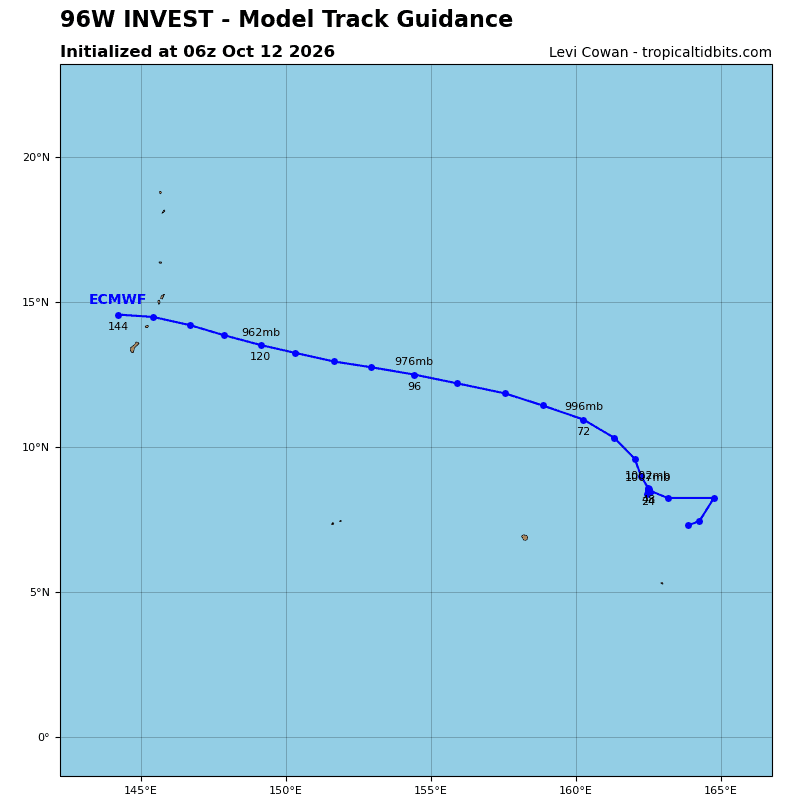
>>> There’s an area of disturbed weather being referred to as Invest 96W, which is located approximately 146 NM east-southeast of Ujelang
Multi-spectral satellite imagery (msi) depicts a disorganized low level circulation, with flaring convection to the southwest. A 102303z ascat pass depicts 20-25 kt winds along the southern periphery of a cusp in the westerly wind burst. Satellite and scatterometer data indicates that 96W does not have a closed low-level circulation.
Environmental analysis reveals a favorable area for development with low vertical wind shear (10-15 kts), moderate radial outflow, and warm sea surface temperatures (29-30c).
Global deterministic and ensemble models depict steady development over the next 48 hours while the system tracks west-northwestward.
Maximum sustained surface winds are estimated at 13-18 knots.
Minimum sea level pressure is estimated to be near 1009 mb.
The potential for the development of a significant tropical cyclone within the next 24 hours remains low.