

Current Snapshot
For all the latest updates visit: DisasterAWARE

1800x1080e
e2
081445_earliest_reasonable_toa_34
goes18_ir_18E_202610081445_lat22.0-lon-124.0
18E_tracks_latest
081435_earliest_reasonable_toa_34
goes19_ir_20E_202610081445_lat15.4-lon-103.1
081435INTQPF_sm
20E_tracks_latest
med

1800×1080
10
2w
15E_081200sair
15E_eps_latest
27W_081200sair
27W_tracks_latest
By PDC’s Senior Weather
Specialist Glenn James

The Pacific Disaster Center’s (PDC Global) Thursday, October 8, 2026, Tropical Cyclone Activity Report…for the Pacific Ocean, the Indian Ocean, and adjacent Seas.
Tropical Cyclones
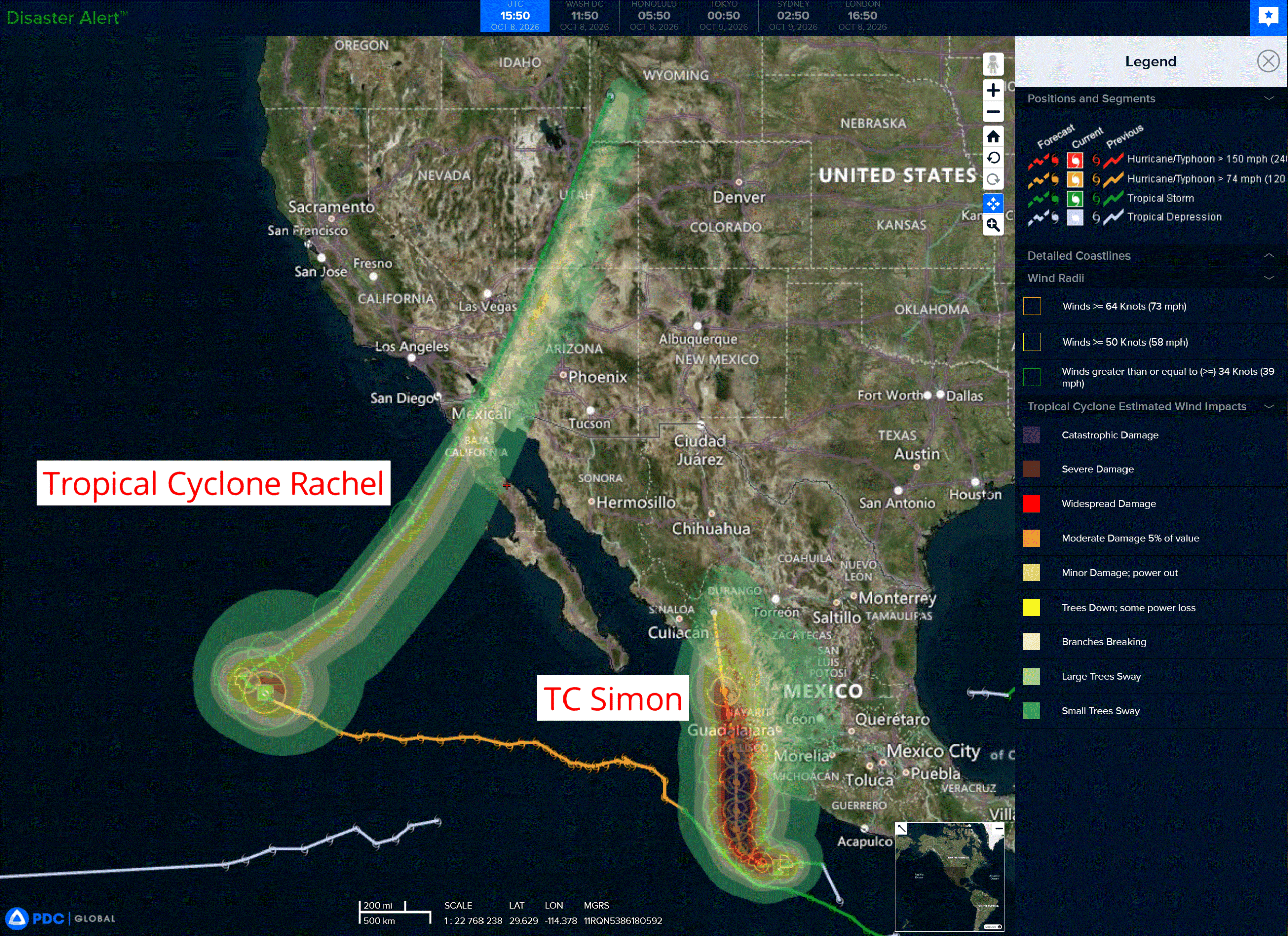
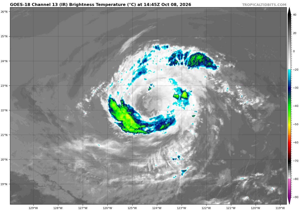
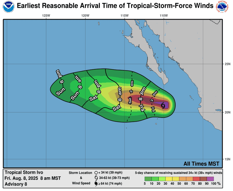
Tropical Cyclone 18E (Rachel) is located about 915 miles west of the southern tip of Baja CA
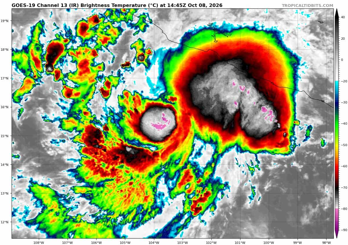
Tropical Cyclone 20E (Simon) is located about 255 miles south-southeast of Manzanillo, Mexico
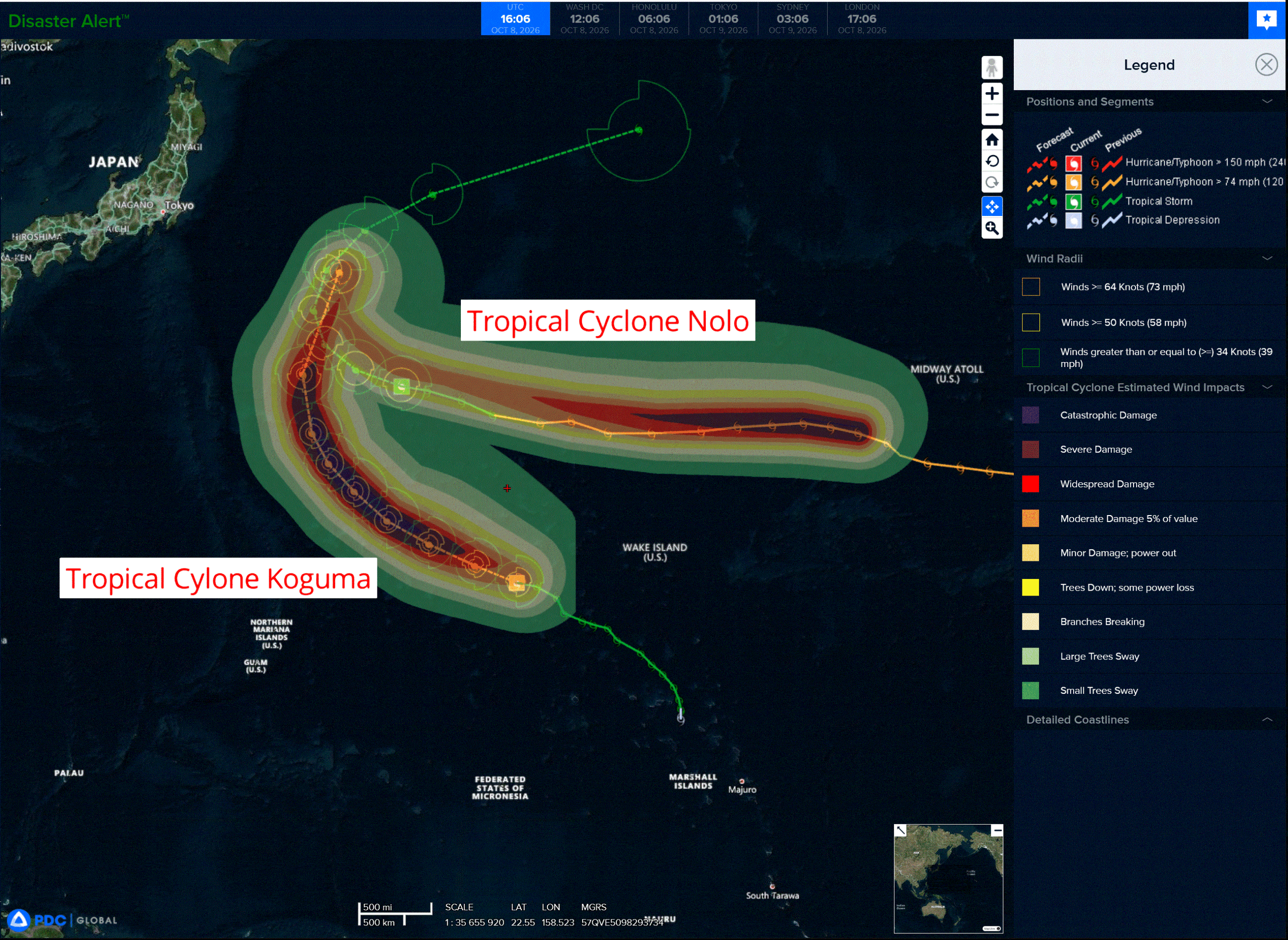
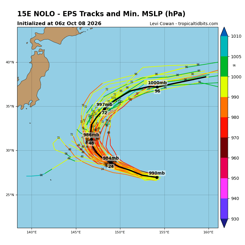
Tropical Cyclone 15E (Nolo) is located about 815 NM east-southeast of Tokyo, Japan
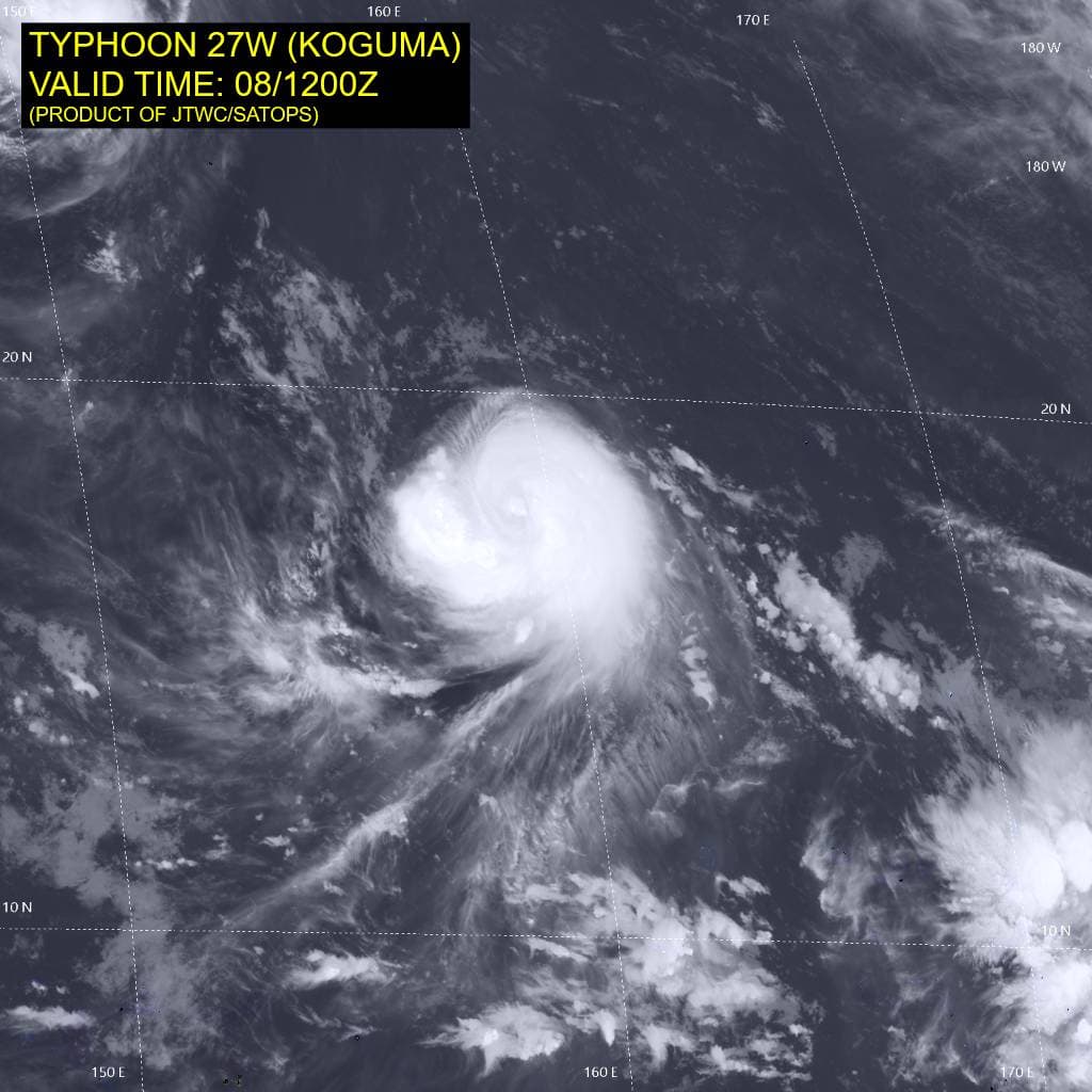
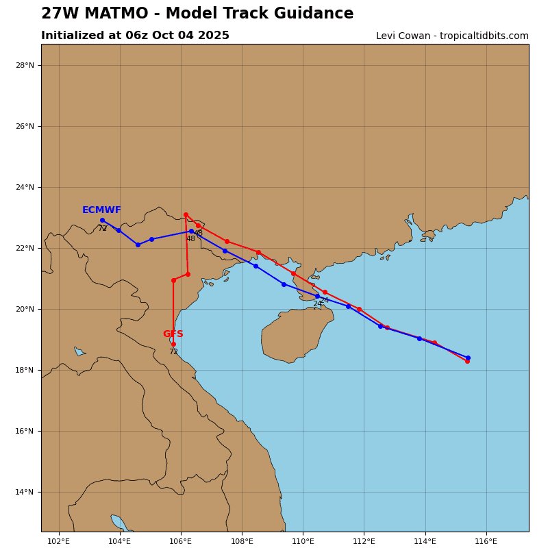
Tropical Cyclone 27W (Koguma) is located approximately 774 NM east-northeast of Saipan
Northeast Pacific:
Tropical cyclone 18E (Rachel)
RACHEL HOLDS STEADY OVER THE EASTERN PACIFIC OCEAN
According to the NHC advisory number 46
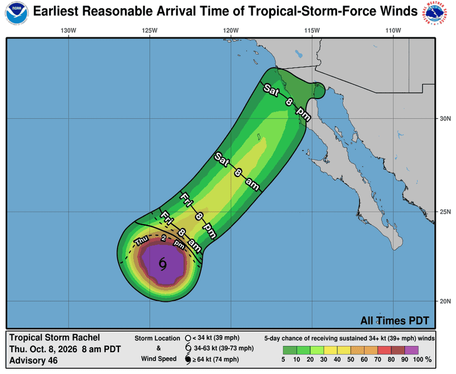
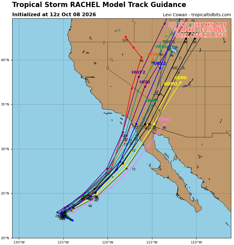
Rachel is moving toward the west-northwest near 7 mph (11 km/h). This general motion is expected to continue over the next day, before a sharp turn to the northeast, along with an increase in forward speed, occurs on Saturday. On the forecast track the center of Rachel is expected to approach the northern portion of Baja California on late Saturday.
Maximum sustained winds are near 70 mph (110 km/h) with higher gusts. Gradual weakening is expected over the next few days, but Rachel is still expected to be at tropical storm strength when it approaches northern Baja California.
Tropical-storm-force winds extend outward up to 115 miles (185 km) from the center. The estimated minimum central pressure is 985 mb (29.09 inches).
HAZARDS AFFECTING LAND
SURF: Swells partly generated by Rachel will build along the coast of Southern California and northern Baja California through the weekend. These swells are likely to cause life-threatening surf and rip current conditions.
Tropical cyclone 20E (Simon)
HURRICANE WATCH ISSUED FOR A PORTION OF WEST-CENTRAL MEXICO …SIMON FORECAST TO RAPIDLY STRENGTHEN
According to the NHC advisory number 5
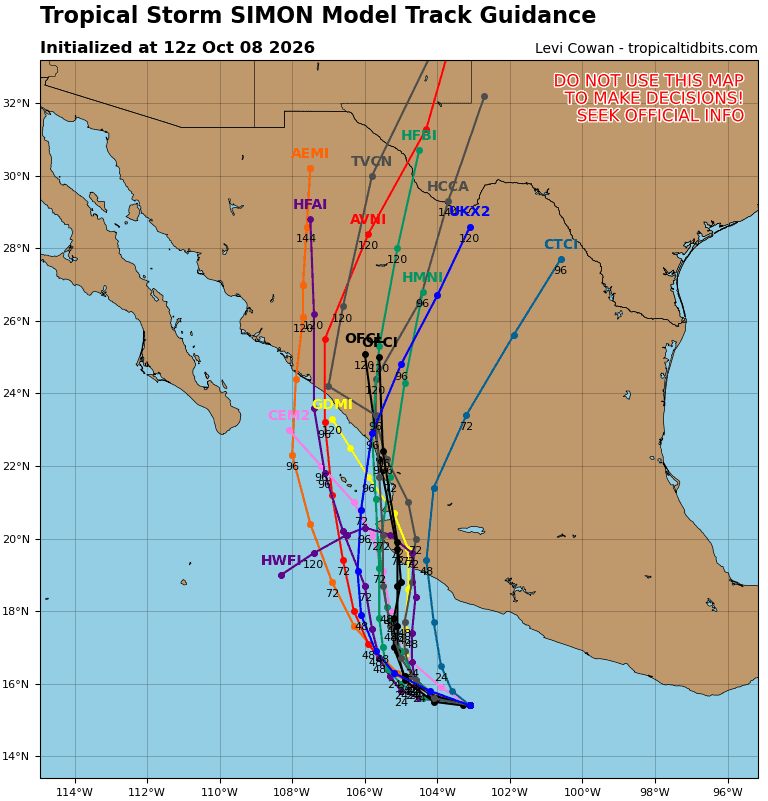
Simon is moving toward the west near 5 mph (7 km/h). A slow west to west-northwest motion is expected through tonight, followed by a turn toward the north-northwest or north on Friday and Saturday. On the forecast track, Simon is expected to approach the coast of southwestern and west-central Mexico late Saturday.
Maximum sustained winds have increased to near 65 mph (100 km/h) with higher gusts. Rapid strengthening is forecast, and Simon is expected to become a hurricane later today and a very dangerous category 4 hurricane before it reaches the coast of Mexico.
Tropical-storm-force winds extend outward up to 70 miles (110 km) from the center. The estimated minimum central pressure is 995 mb (29.39 inches).
HAZARDS AFFECTING LAND
WIND: Hurricane conditions are possible within the hurricane watch area by Saturday night, with tropical storm conditions beginning on Saturday. Tropical storm conditions are possible within the tropical storm watch area beginning Friday.
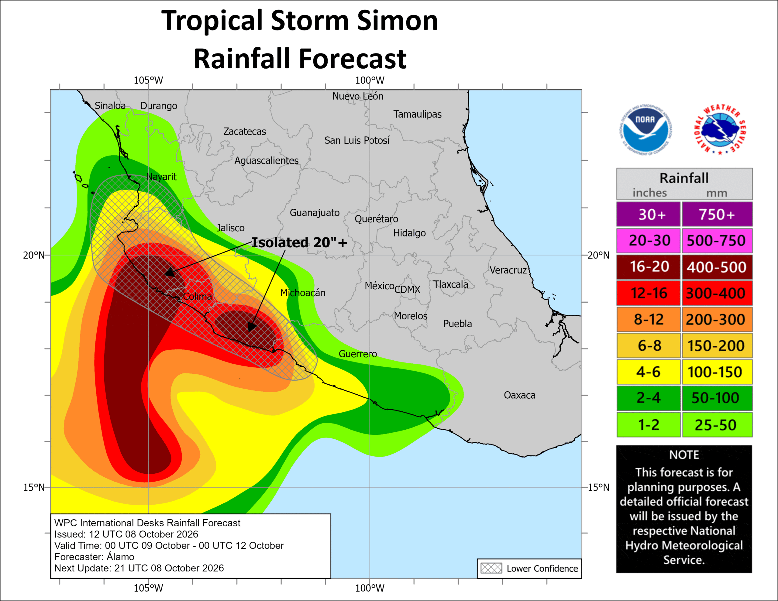
RAINFALL: Simon is expected to produce rainfall totals of 8 to 15 inches over portions of southwestern Mexico, with isolated maximum totals between 15 and 25 inches possible across portions of Michoacan, Colima and Jalisco through Sunday. This rainfall may produce life-threatening flooding and mudslides, especially in areas of steep terrain.
STORM SURGE: A dangerous storm surge is possible along the immediate coast near and to the east of where the center makes landfall. Near the coast,the surge will be accompanied by large and destructive waves.
SURF: Swells generated by Simon will affect portions of the coast of southwestern and west-central Mexico during the next few days. These swells are likely to cause life-threatening surf and rip current conditions.
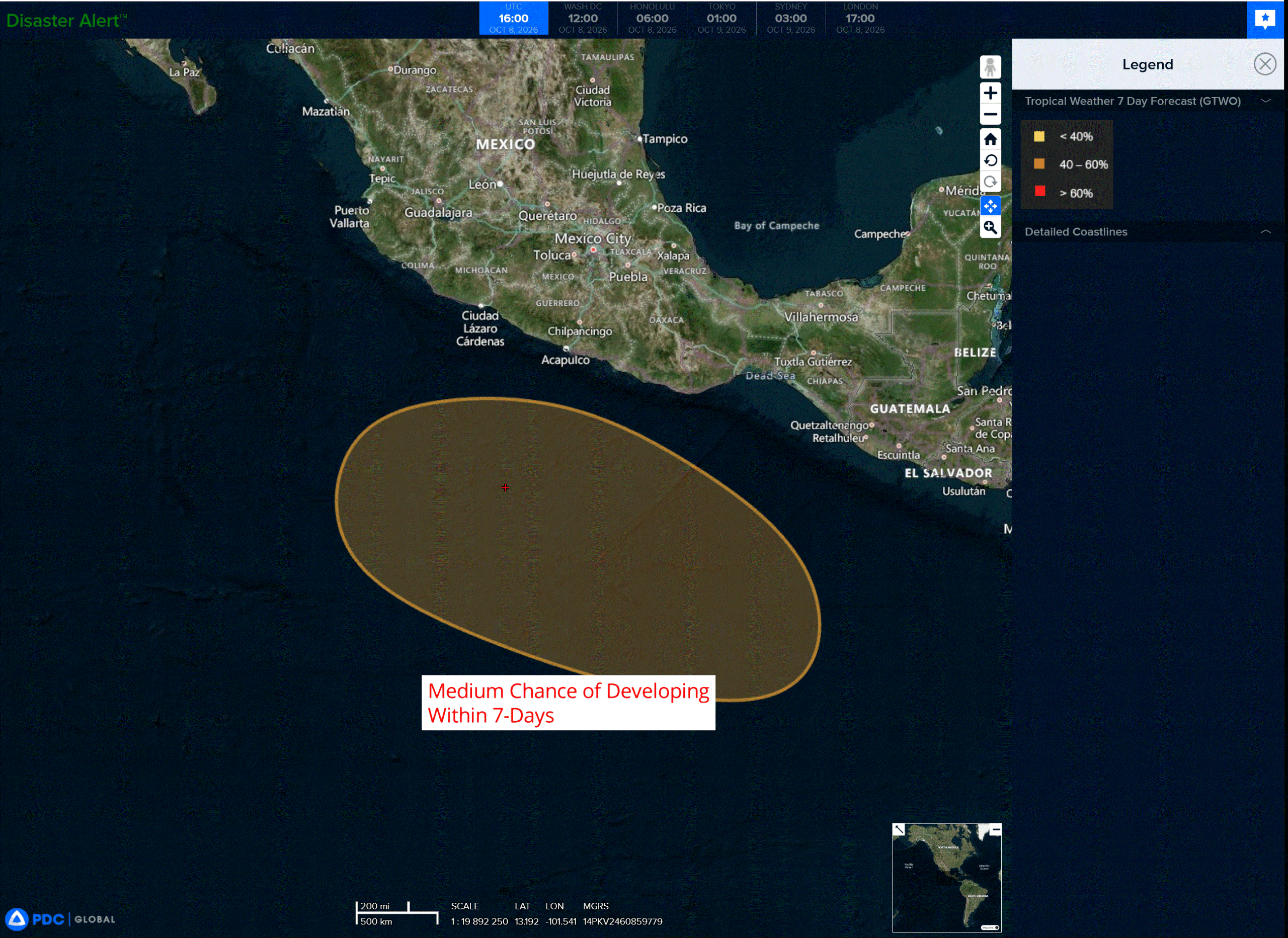
>>> South of Guatemala:
An area of low pressure is forecast to form south of the coast of Guatemala early next week.
Environmental conditions appear conducive for some gradual development of this system thereafter, and a tropical depression could form as it moves generally west-northwestward at around 10 mph.
* Formation chance through 48 hours…near…0 percent
* Formation chance through 7 days…medium…50 percent
Central North Pacific: There are no Tropical Cyclones
Tropical cyclone formation is not expected during the next 7 days.
Western Pacific, Indian Ocean, and adjacent Seas:
Western Pacific
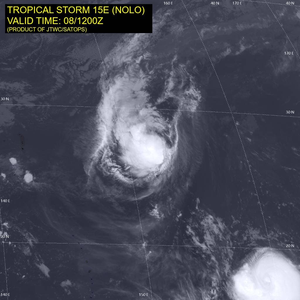
Tropical Cyclone 15E (Nolo)
According to the JTWC warning number 72…sustained winds were 50 knots with gusts to 65 knots
Animated enhanced infrared (eir) satellite imagery depicts tropical storm 15E (Nolo) with a deep convection offset to the west of the low-level circulation center (llcc). A 081053z metop-b ascat bullseye pass revealed an elongated and somewhat asymmetric wind field with the bulk of the strongest winds located within the
northern semicircle.
Environmental analysis indicates that 15E is placed within a marginally favorable environment characterized by strong poleward outflow aloft, low to moderate (15-20 kts) vertical wind shear, dry air entrainment, and warm (27-28 c) sea surface temperatures.
TS 15E is forecast to continue tracking west-northwestward, along the southwestern periphery of the
str through 24 hours. 15E will then approach the steering ridge axis near 24 hours and begin a northward turn. Around 60 hours, the system will accelerate northeastward as it tracks along the northwestern extent of the str and starts to interact with the strong upper-level flow. Extratropical transition is forecast to commence at 72 hours with completion no later than 96 hours, once 15E becomes embedded underneath the jet.
In terms of intensity, 15E is forecast to marginally intensify from through 24 hours due to improving poleward outflow and briefly decreasing vertical wind shear. After 36 hours, southwesterly shear will quickly increase and sea surface temperatures will drop, causing 15E to weaken as it transitions into an extratropical cyclone.
Tropical Cyclone 27W (Koguma)
According to the JTWC warning number 15…sustained winds were 65 knots with gusts to 80 knots
Animated multi-spectral satellite imagery (msi) depicts tropical storm 27W (Koguma) with a partially exposed low-level circulation center (llcc) that is steadily becoming further embedded underneath the central dense overcast (cdo). The northeasterly shear appears to be backing off, indicated by the cdo expanding to the north.
The convective bursts have also become more vigorous over the past 6 hours with overshooting tops now measuring colder than -90 c in some areas. a 080510z ssmis 91 ghz microwave image revealed a defined curved band of convection wrapping into the center along the southern semicircle of 27w. the same image also showed tightly curved low-level cloud lines outlining the llcc within the northern semicircle.
TS 27W is forecast to continue tracking west-northwestward, along the southwestern periphery of the str
through 72 hours. The system will then turn northward as it traverses the western extent of the str through 120.
Regarding intensity, 27W is forecast to rapidly intensify through 48 hours to a peak of around 120 kts as the environment remains highly favorable and the circulation retains its compact size. After 48 hours, ocean heat content will lower and vertical wind shear will begin to increase. By 96 hours, 27W will approach the 26 c sst isotherm and southwesterly shear is expected to increase to over 20 kts, further supporting the weakening trend.