

Current Snapshot
For all the latest updates visit: DisasterAWARE

1800x1080e
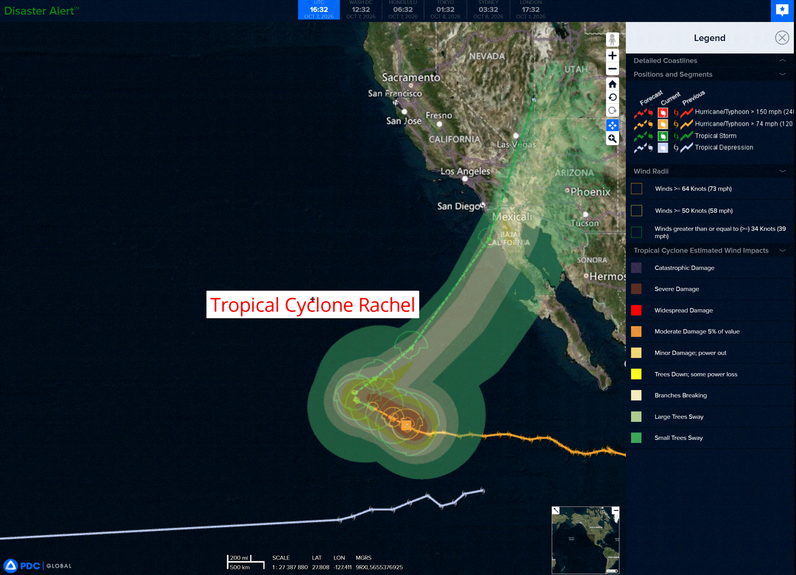
rachel
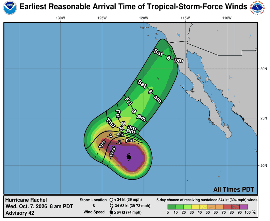
071452_earliest_reasonable_toa_34
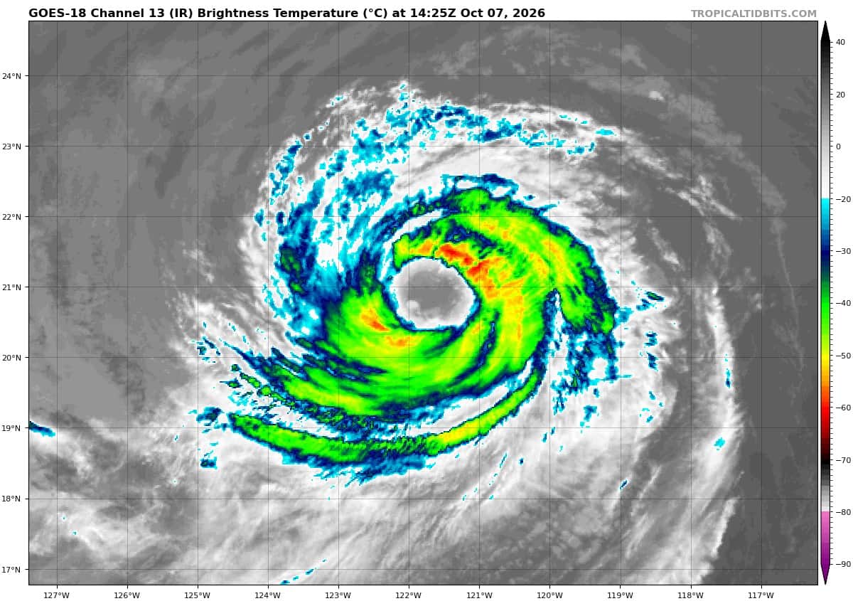
goes18_ir_18E_202610071425_lat20.7-lon-121.5
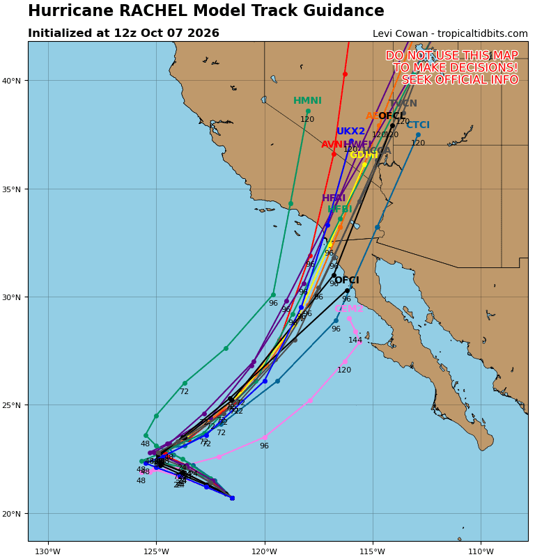
18E_tracks_latest
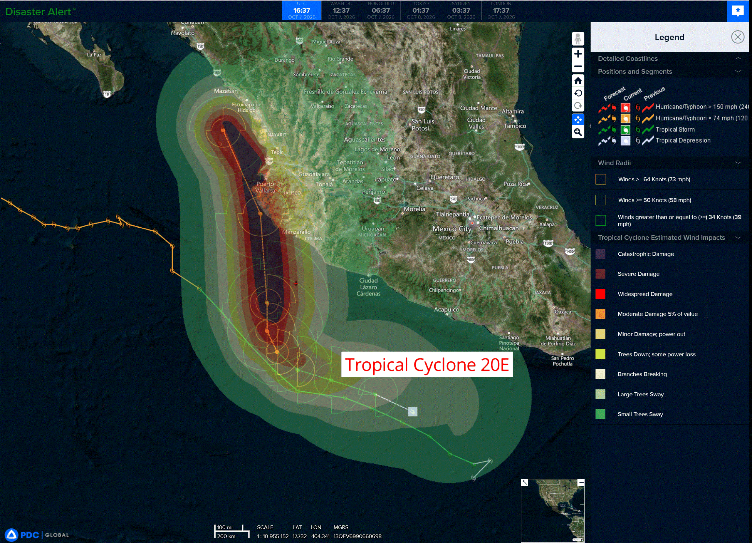
20e
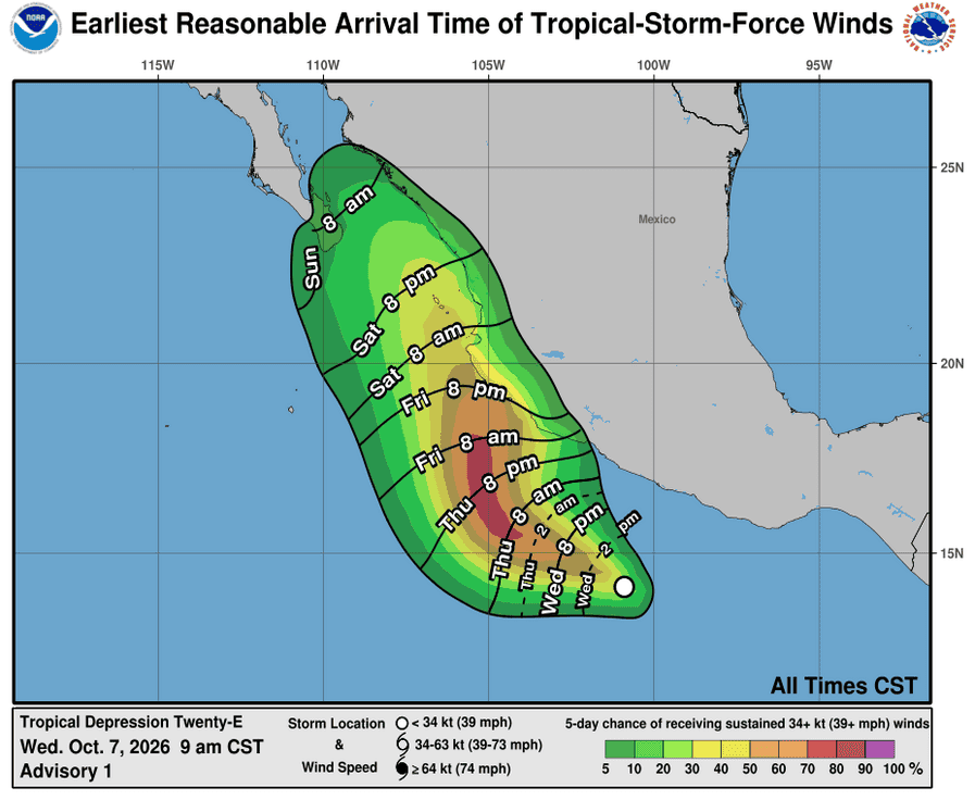
071457_earliest_reasonable_toa_34
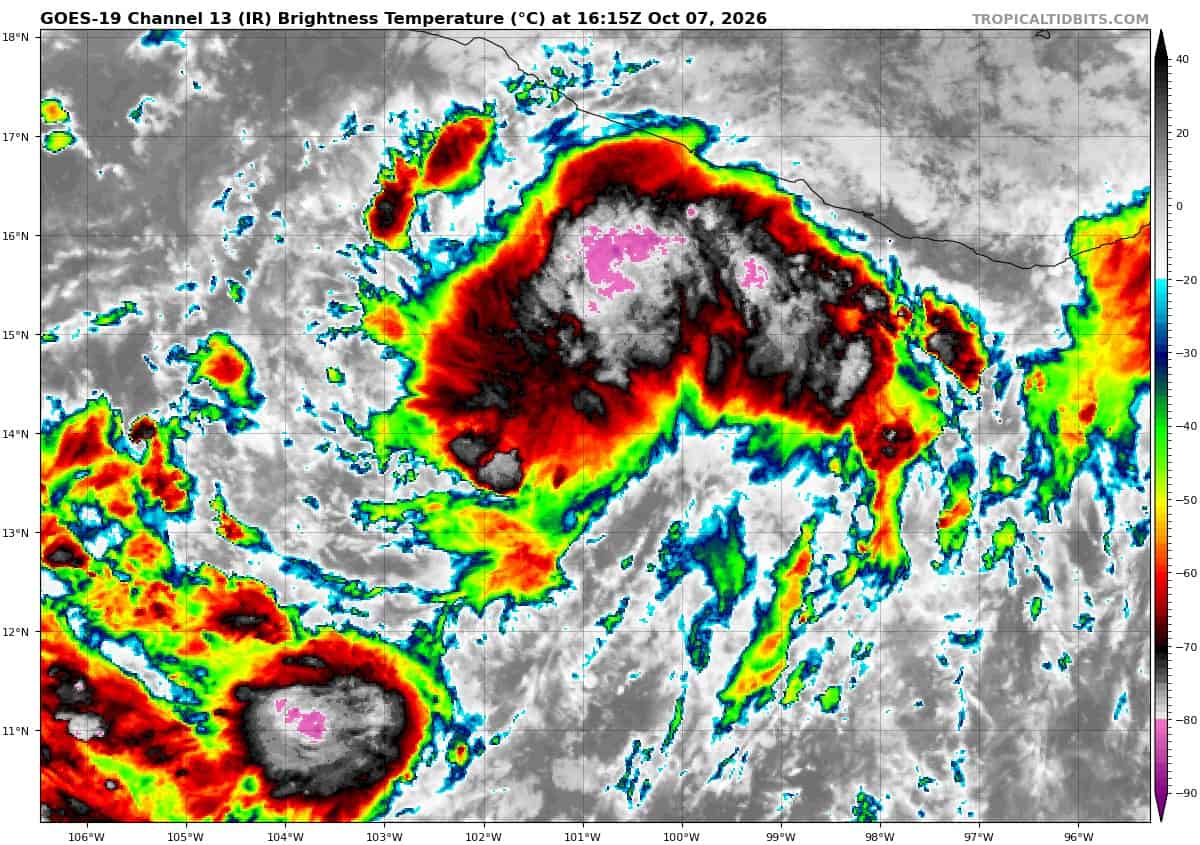
goes19_ir_20E_202610071615_lat13.9-lon-100.6
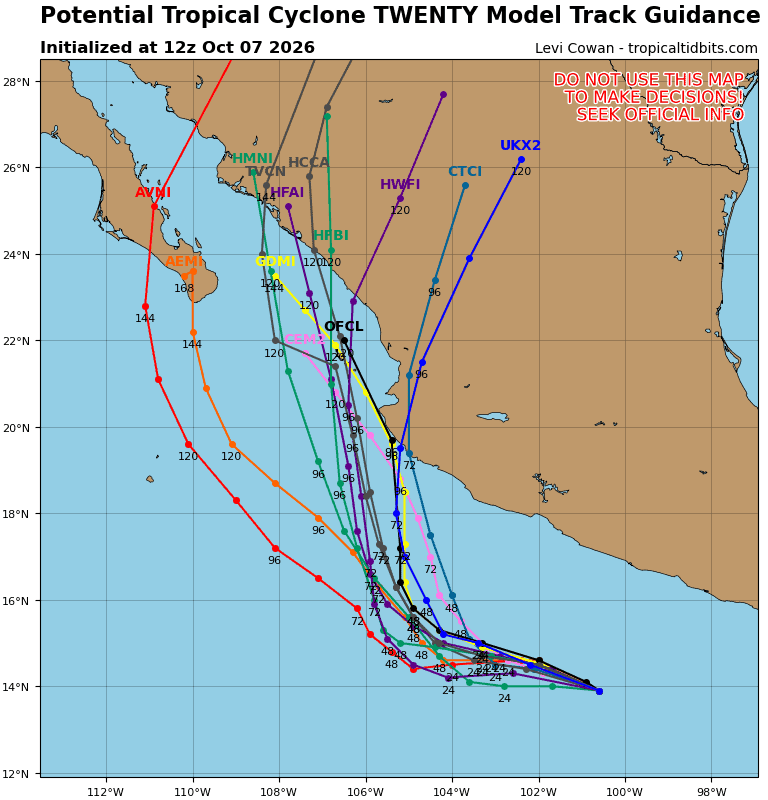
20E_tracks_latest
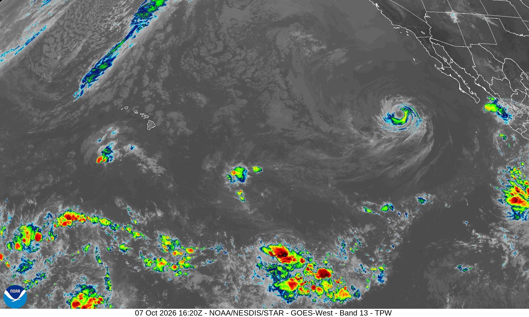
1800x1080ec
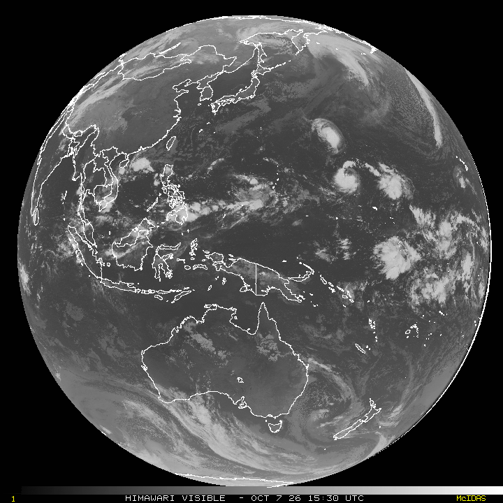
10
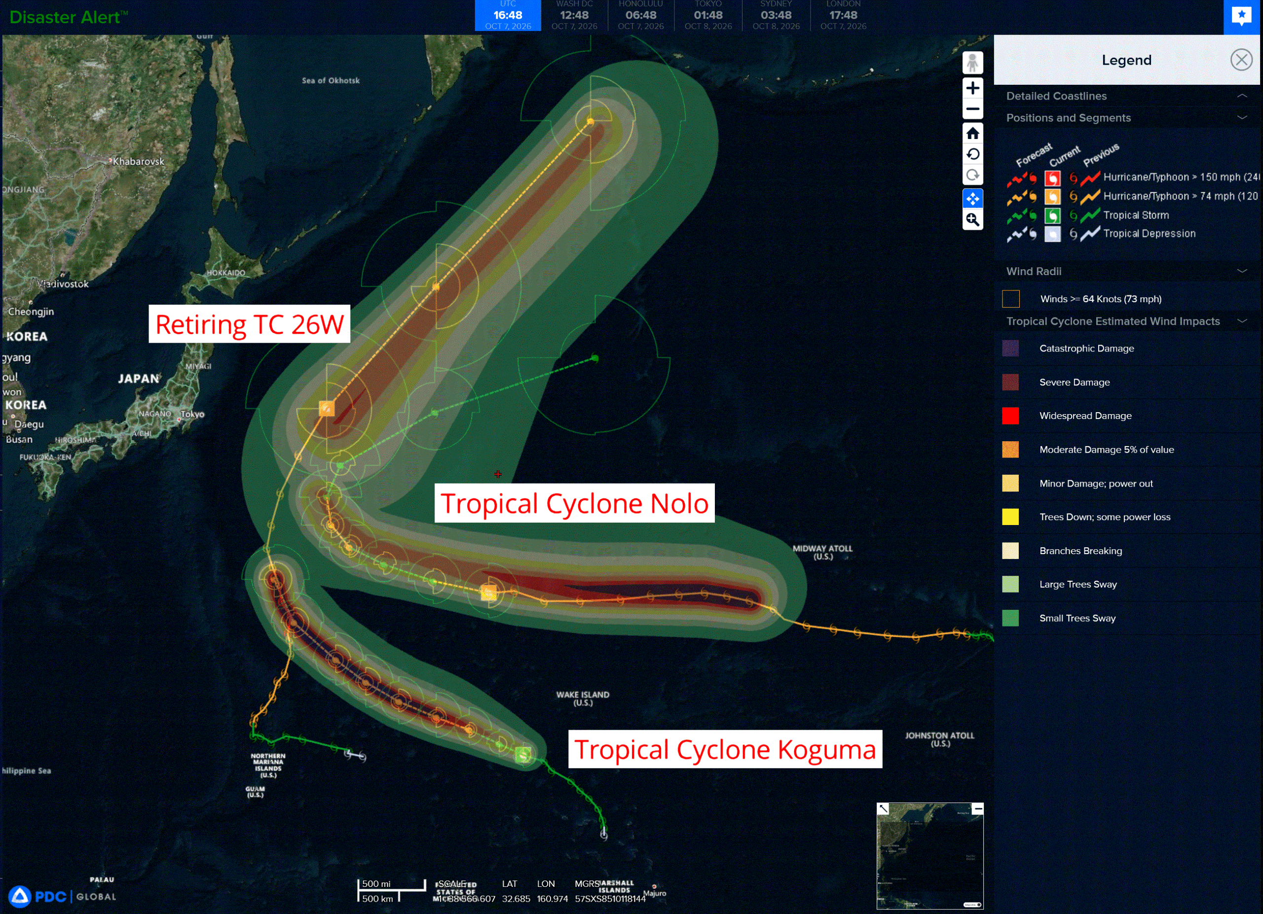
3w
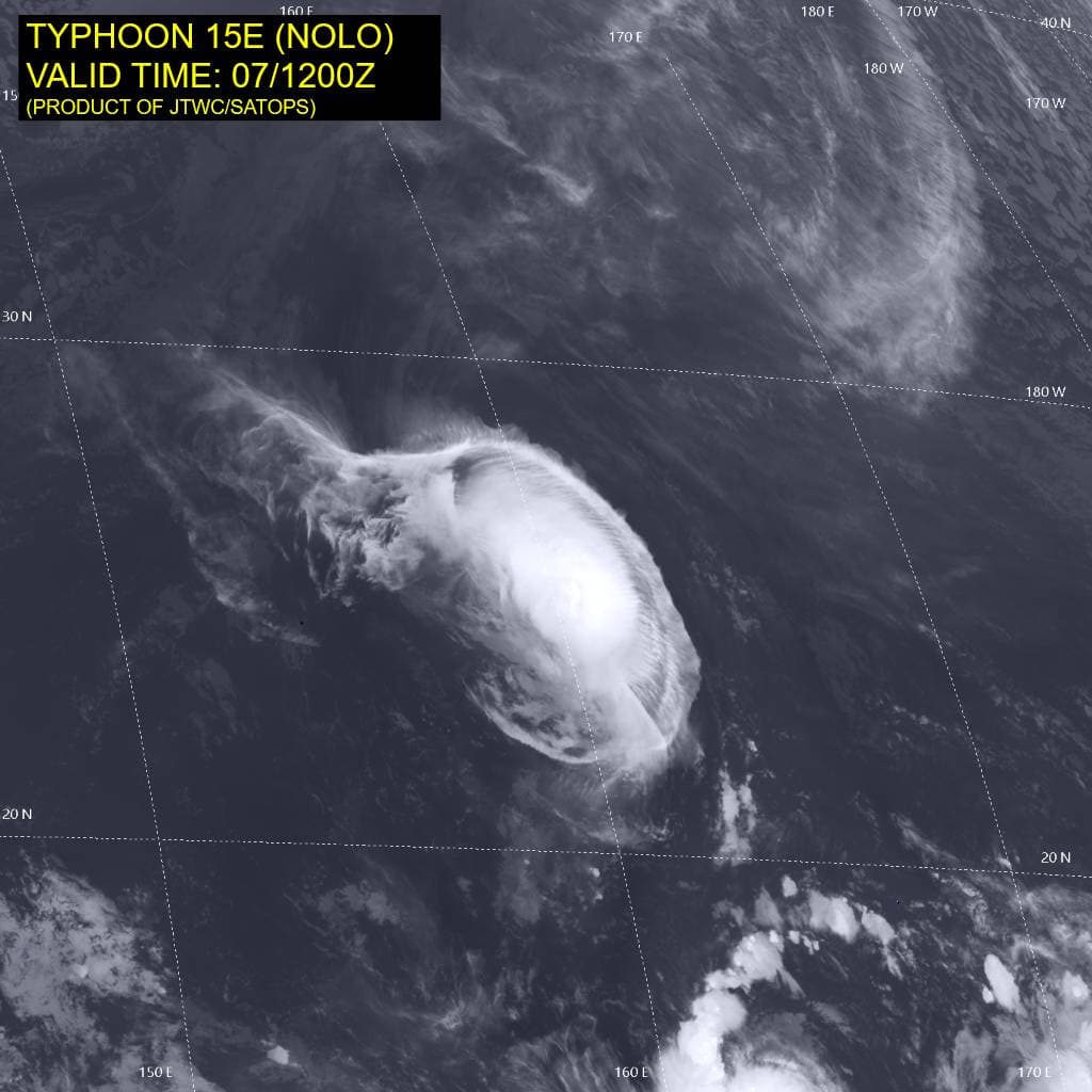
15E_071200sair
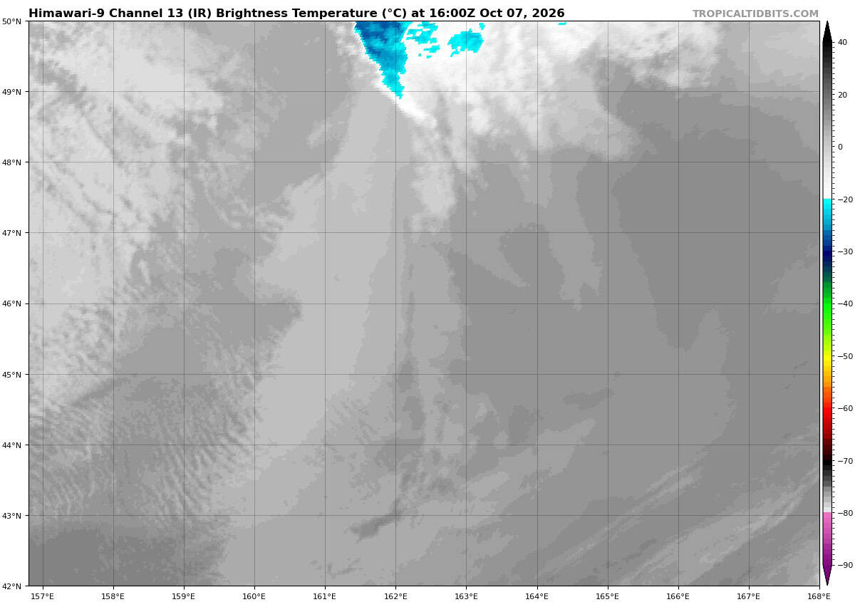
himawari9_ir_26W_202610071600_lat46.0-lon162.4
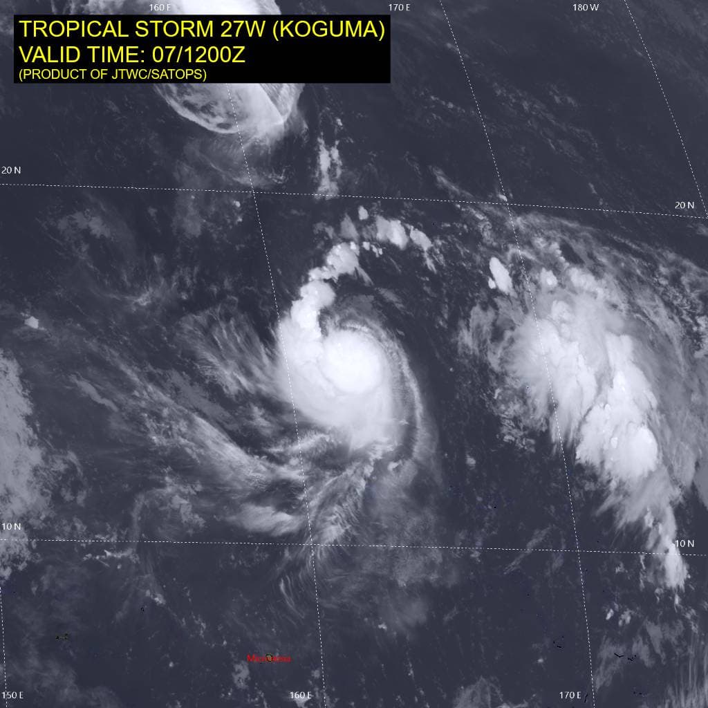
27W_071200sair
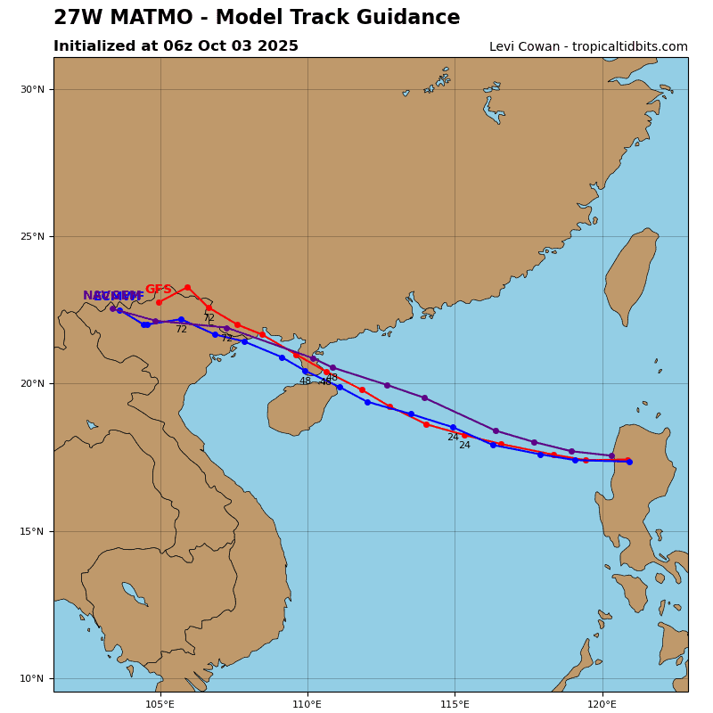
27W_tracks_latest
By PDC’s Senior Weather
Specialist Glenn James

The Pacific Disaster Center’s (PDC Global) Wednesday, October 7, 2026, Tropical Cyclone Activity Report…for the Pacific Ocean, the Indian Ocean, and adjacent Seas.
Tropical Cyclones
Tropical Cyclone 18E (Rachel) is located about 775 miles west of the southern tip of Baja CA
Tropical Cyclone 20E is located about 405 miles southeast of Manzanillo, Mexico
Tropical Cyclone 15E (Nolo) is located about 1770 NM west-northwest of Johnston Island
Tropical Cyclone 26W (Choi-Wan) is located approximately 461 NM east-southeast of Misawa, Japan – Final Warning
Tropical Cyclone 27W (Koguma) is located approximately 315 NM southwest of Wake Island
Northeast Pacific:
Tropical cyclone 18E (Rachel)
RACHEL MOVES WEST-NORTHWESTWARD OVER THE EASTERN PACIFIC OCEAN
According to the NHC advisory number 42
Rachel is moving toward the west-northwest near 7 mph (11 km/h), and a generally west to west-northwestward motion is expected during the next couple of days. Rachel is then forecast to slow down before making a sharp turn to the northeast by the end of the week.
Maximum sustained winds are near 80 mph (130 km/h) with higher gusts. Gradual to steady weakening is forecast over the next few days.
Hurricane-force winds extend outward up to 35 miles (55 km) from the center and tropical-storm-force winds extend outward up to 140 miles (220 km). The estimated minimum central pressure is 979 mb (28.91 inches).
Tropical cyclone 20E
NEW TROPICAL DEPRESSION FORMS SOUTH OF MEXICO
According to the NHC advisory number 1
The depression is moving toward the west-northwest near 8 mph (13 km/h), and this general motion is expected to continue for the next couple of days.
Maximum sustained winds are near 35 mph (55 km/h) with higher gusts. Some strengthening is forecast during the next 48 hours, and the depression is forecast to become a tropical storm by tonight.
The estimated minimum central pressure is 1006 mb (29.71 inches).
>>> South of Guatemala:
An area of low pressure is forecast to form south of the coast of Guatemala during the early portion of next week.
Environmental conditions appear conducive for some gradual development of this system thereafter while it moves generally west-northwestward around 10 mph.
* Formation chance through 48 hours…near…0 percent
* Formation chance through 7 days…low…30 percent
Central North Pacific: There are no Tropical Cyclones
Tropical cyclone formation is not expected during the next 7 days.
Western Pacific, Indian Ocean, and adjacent Seas:
Western Pacific
Tropical Cyclone 15E (Nolo)
According to the JTWC warning number 68…sustained winds were 65 knots with gusts to 80 knots
Animated enhanced infrared (eir) satellite imagery depicts significant degradation of the central dense overcast (cdo), which now lacks discernible spiral banding. A sharp eastern edge to the cirrus canopy is consistent with 25-35 kts of easterly vertical wind shear (vws) associated with a strong upper-level ridge
centered to the north.
Despite marginally favorable sea surface temperatures (sst) of 27-28 degrees celsius, the environment is
unfavorable. a 070815z ssmis pass revealed modest vortex tilt with height. A 070933z ascat-b pass indicated that the wind field has contracted and become asymmetric, with the highest winds confined to the eastern semicircle.
Typhoon 15E has been moving nearly due west over the past 12 hours along the southern flank of a
deep-layer str centered to the northeast. The system will gradually turn poleward and decelerate through 24 hours as it approaches a weakwestern extension of the str. A trough passing to the north will erode the str, allowing TY 15E to turn sharply poleward, cross the ridge axis near 60 hours, and accelerate east-northeastward motion as it encounters deep-layer mid-latitude westerly flow.
VWS will ease to 15-20 kts over the next 12 hours, which will slow the rate of weakening. The forecast calls for TY 15E to bottom out at 60 kts at 12-24 hours, then briefly re-intensify when it turns northward and taps into a poleward outflow channel connected to a jet stream to the north.
Thereafter, steady weakening will commence as shear increases, the sst falls below 26 degrees celsius, and the vortex moves beneath the jet stream. Increasing baroclinicity toward the end of the forecast will lead to extratropical transition, which will complete by 120 hours.
Tropical Cyclone 26W (Choi-wan)
According to the JTWC warning number 28…sustained winds were 75 knots with gusts to 90 knots
Animated enhanced infrared satellite imagery (eir) depicts 26W with a remnant, compact inner core, which is undergoing a rapid decoupling with the lower-level vortex due to persistent, high southwesterly shear. the decoupling has not yet progressed far enough to see clear evidence of it in the eir, and a lack of recent microwave imagery or scatterometer data limits analysis confidence.
However, the outer edges of the low-level banding features can be seen starting to emerge on the southwestern edge of the small cdo feature which is very rapidly translating off to the northeast. Phase-space analyses suggest 26W is already beginning the process of extratropical transition (ett) and its transition is exepected to occur very rapidly now that it has commenced. The system will continue to accelerate northeastward through the forecast period, reaching over 50 knots of forward speed by the end of the forecast.
In terms of intensity, while the bulk of the subjective and objective intensity estimates have begun a sharp decline due to the decrease in deep convective activity, the satcon remains near 77 knots which is very likely very close to reality, as the system will take time to spin down. The addition of baroclinic forcings will slow the rate of weakening even more, and 26W is forecast to remain at typhoon strength as it completes ett within the next 12 hours.
Tropical Cyclone 27W (Koguma)
According to the JTWC warning number 11…sustained winds were 50 knots with gusts to 65 knots
Animated enhanced infrared (eir) satellite imagery depicts curved banding wrapping into a ragged central dense overcast (cdo), which is displaced southwest of the low-level circulation center (llcc). This compact circulation has been struggling to consolidate in the face of 15-20 kts of northeasterly vertical wind shear (vws). While cloud top temperatures as cold as -90 degrees celsius have been observed near the center, the convection has been unable to fully wrap around the llcc, indicating that the vortex is still vertically misaligned. A 070930z ascat-b pass indicates that the intensity of tropical storm 27W has been overestimated and suggests that the intensity may have been nearly steady over the past 30 hours.
TS 27W will maintain a west-northwestward trajectory through 60 hours along the southwestern flank of a str positioned far to the north-northeast. Over the next 24 hours, the ridge will amplify and migrate westward, inducing a slightly faster translation speed. Typhoon 15E, located approximately 630 NM to the north-northwest, will produce a weakness in the western extension of the ridge to the north.
As TS 27W approaches this weakness around 72 hours, the system will gradually turn poleward and slow down. The persistent shear and structural issues plaguing TS 27W will limit intensification for the first 12 hours. VWS will begin easing after 12 hours, reaching to less than 10 kts by 24 hours, and provide the system an opportunity to quickly consolidate as it traverses very warm sst and very high ocean heat content (ohc) exceeding 150 kj per cm2.
These highly favorable conditions will enable the compact vortex to undergo rapid intensification (ri) after 12 houea to a peak of 120 kts at 60 hours. By 96-120 hours, the system will move over lower ohc, which will initiate a weakening trend. Compact circulations have the potential to intensify very aggressively, and the forecast rate of intensification and peak intensity may be conservative.