

Current Snapshot
For all the latest updates visit: DisasterAWARE
1800x1080e
rachel
021449_earliest_reasonable_toa_34
goes18_ir_18E_202610021535_lat19.3-lon-110.6
18E_eps_latest
7e
1800x1080ec
nolo
021447_earliest_reasonable_toa_34
goes18_ir_15E_202610021535_lat23.2-lon-167.0
15E_eps_latest
10
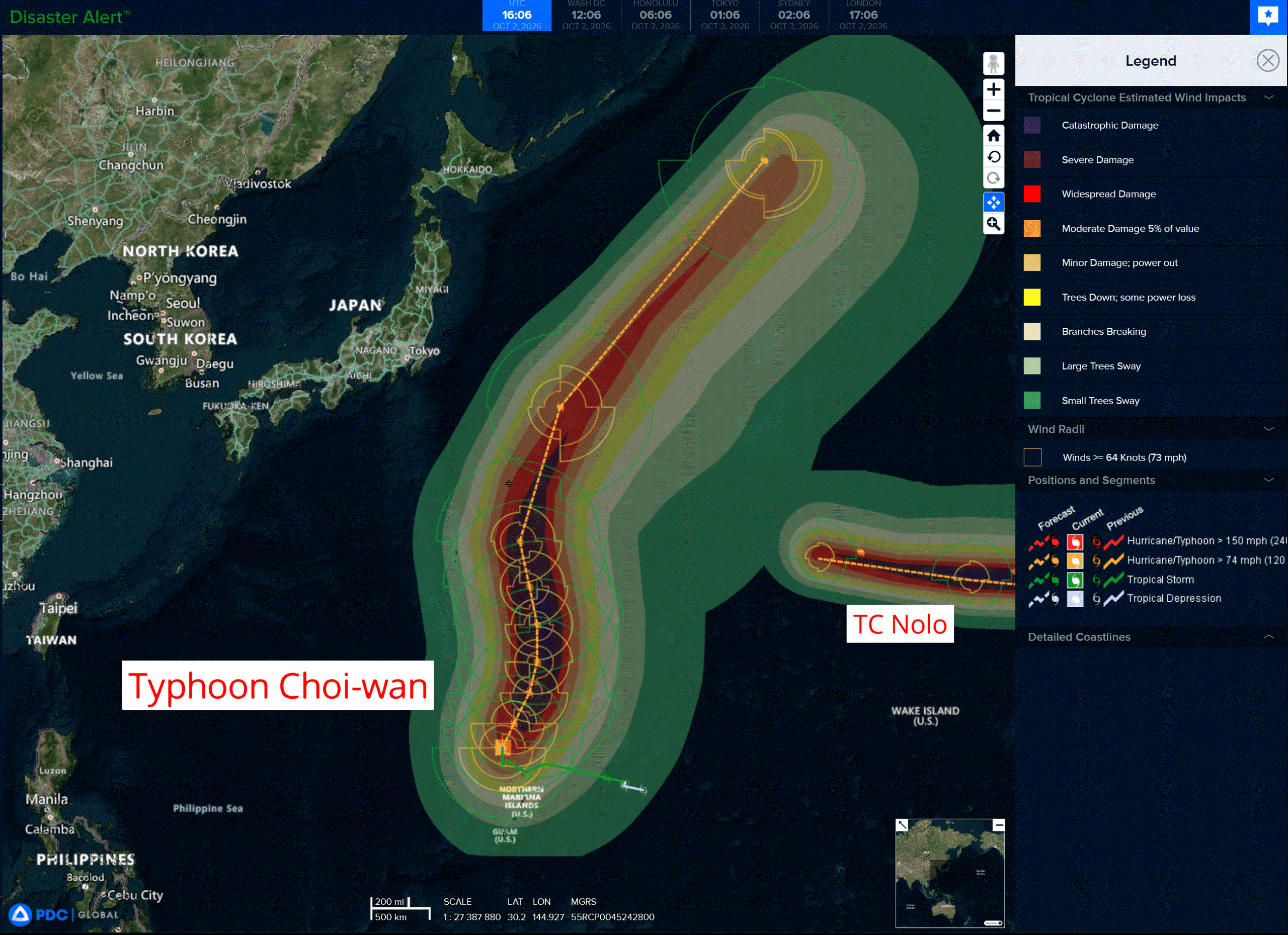
choi-wan
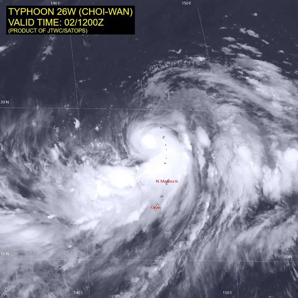
26W_021200sair
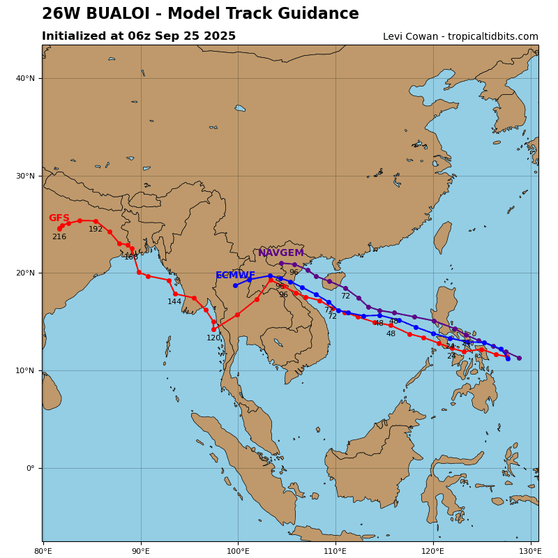
26W_tracks_latest
By PDC’s Senior Weather
Specialist Glenn James

The Pacific Disaster Center’s (PDC Global) Friday, October 2, 2026, Tropical Cyclone Activity Report…for the Pacific Ocean, the Indian Ocean, and adjacent Seas.
Tropical Cyclones
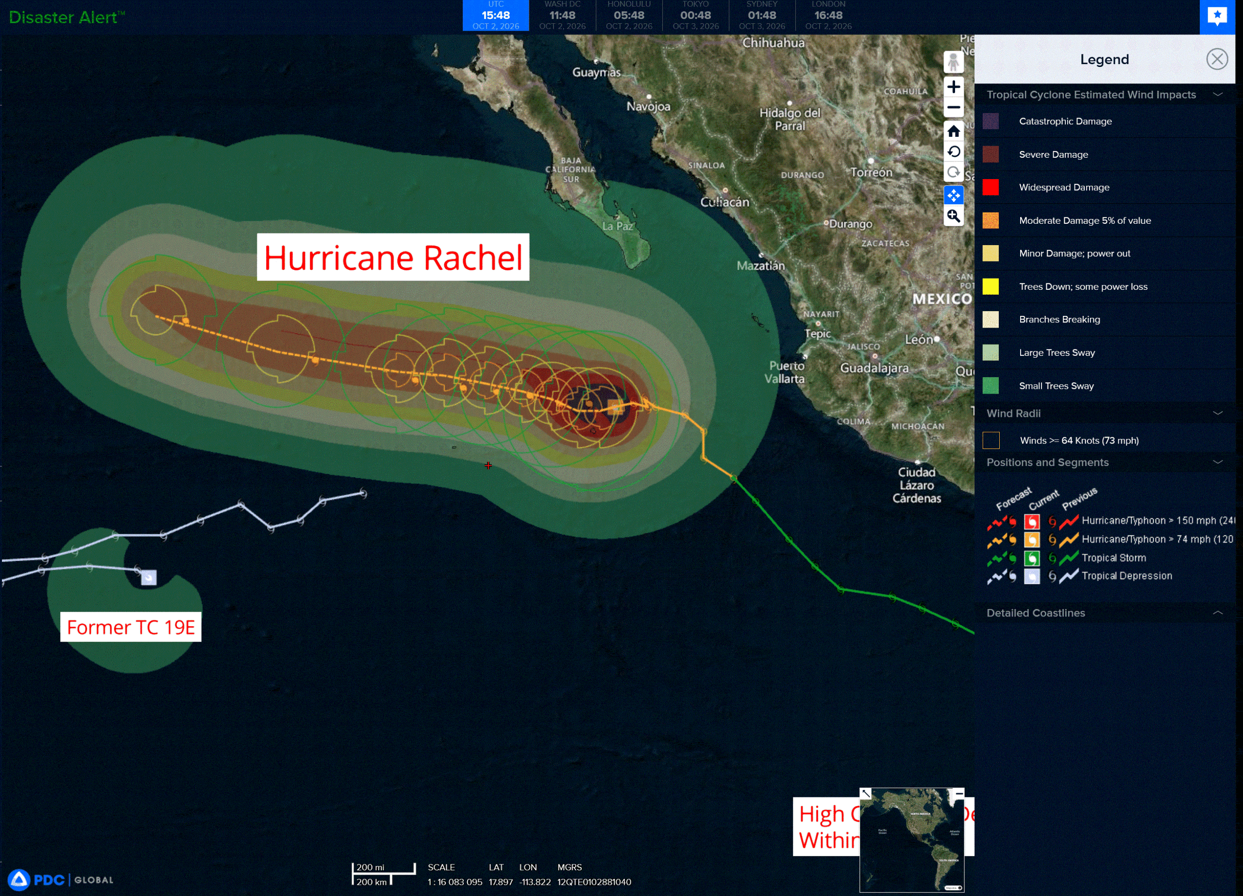
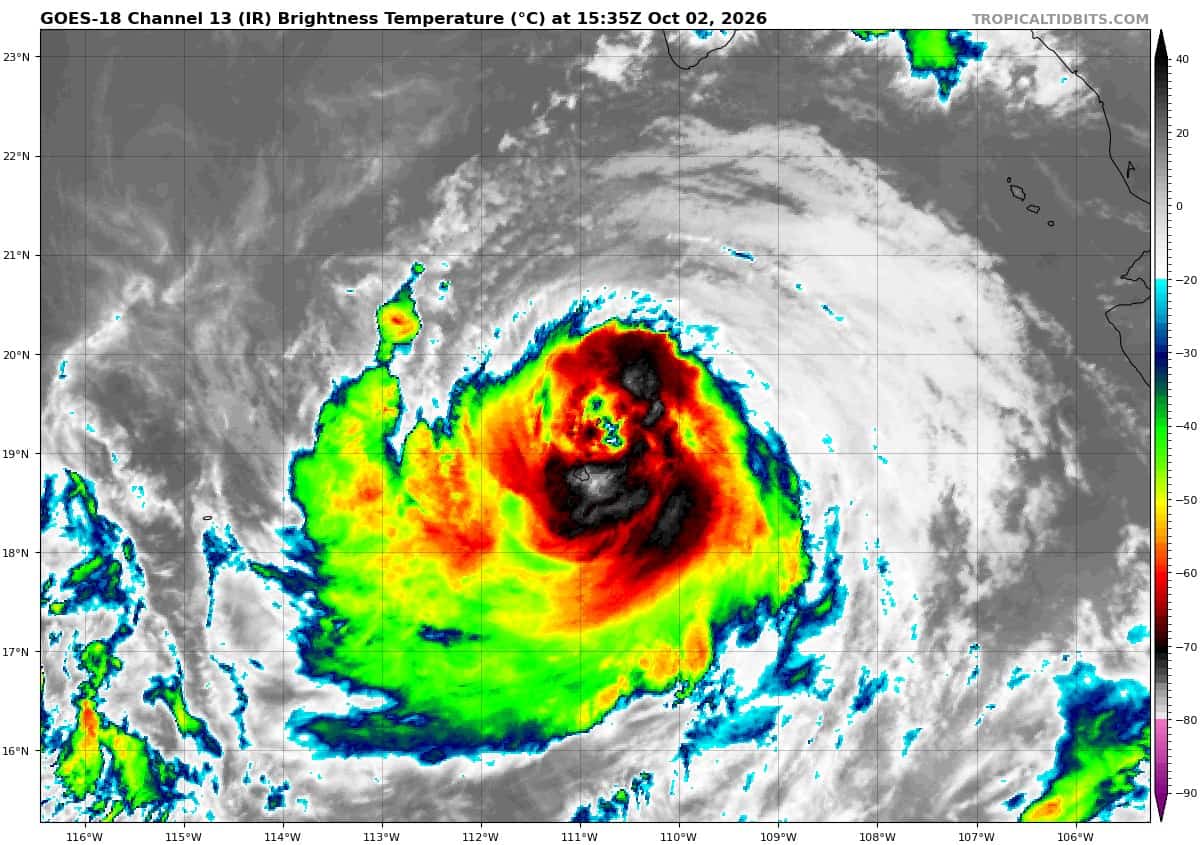
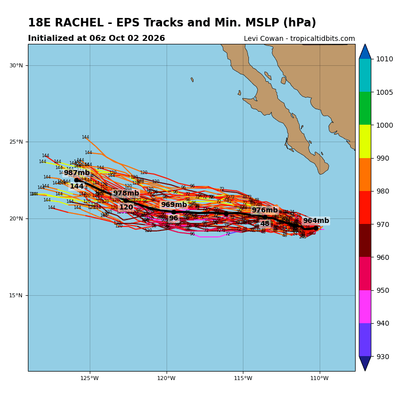
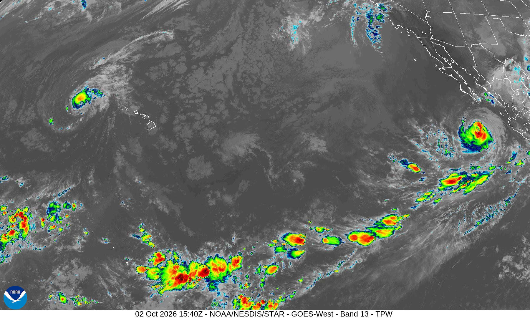
Tropical Cyclone 18E (Rachel) is located about 255 miles south-southwest of the southern tip of Baja CA
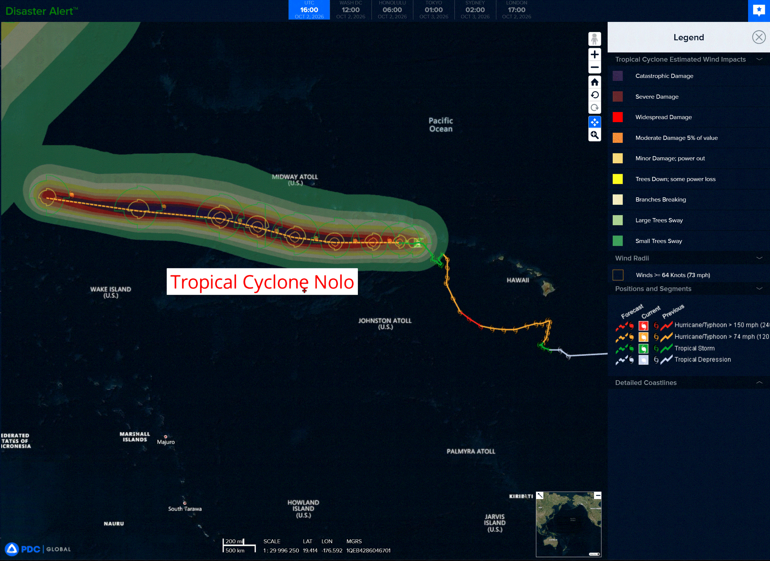
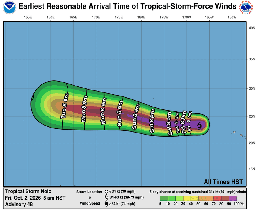
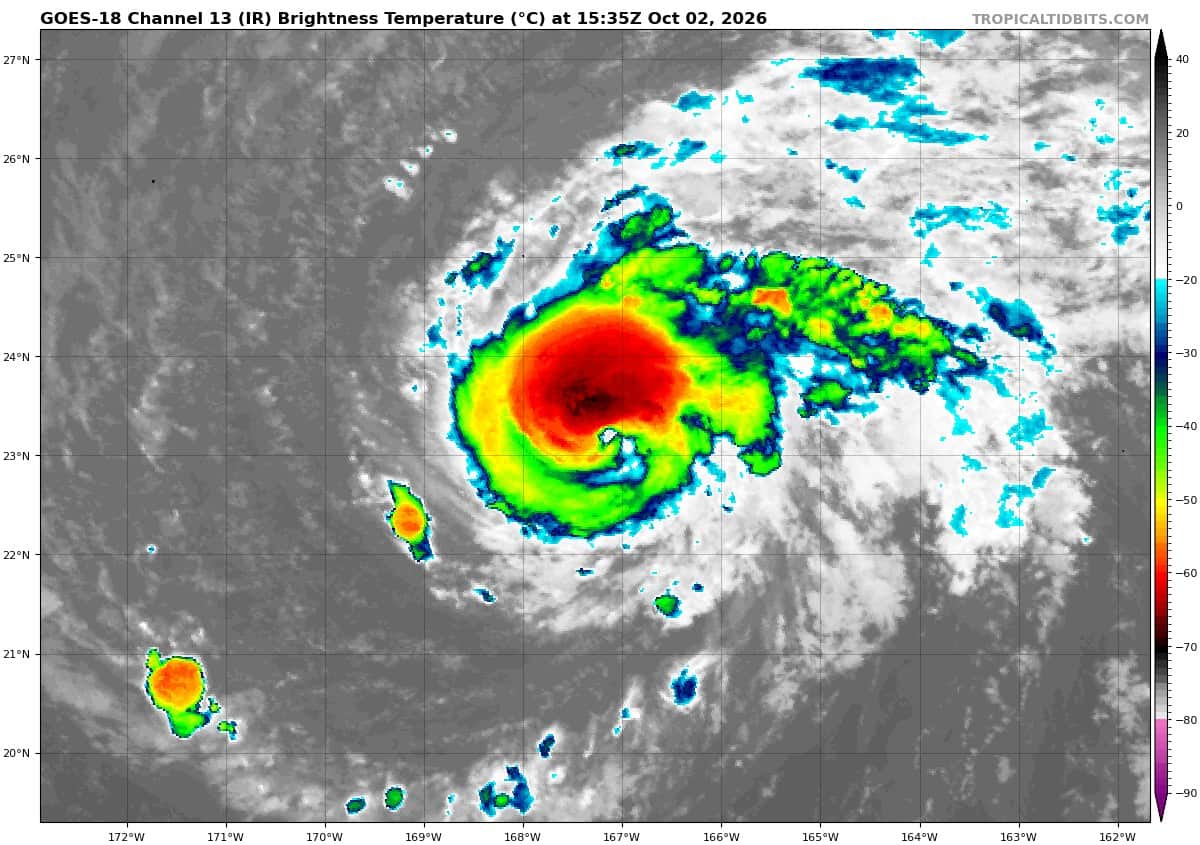
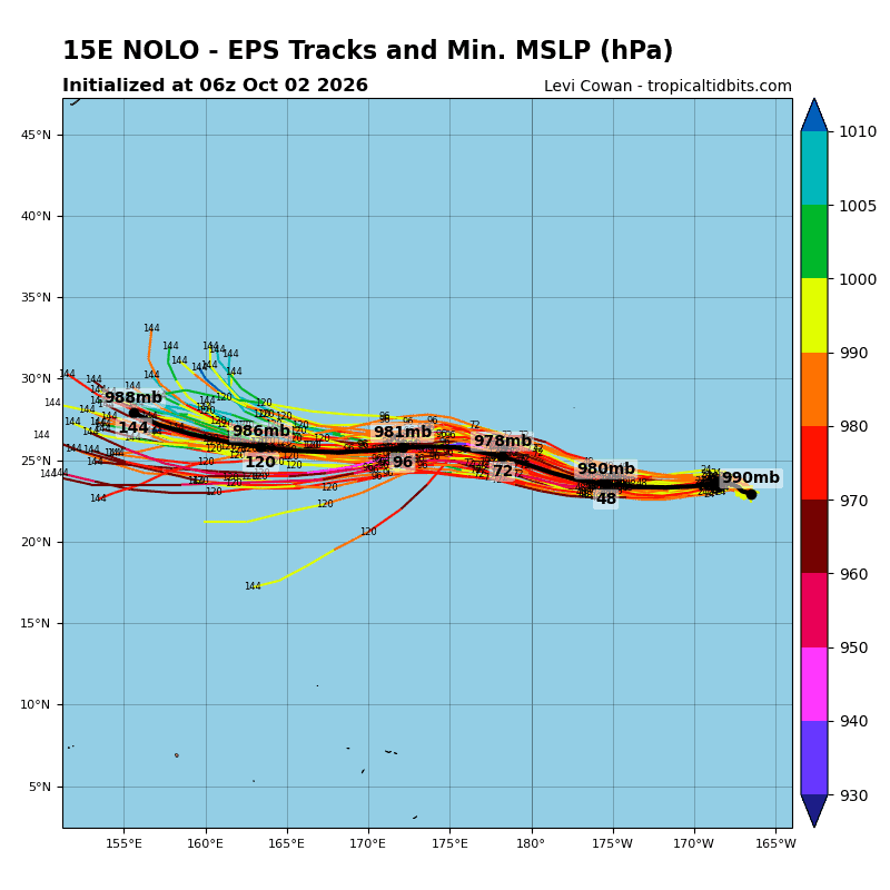
Tropical Cyclone 15E (Nolo) is located about 255 miles southeast of Maro Reef
Tropical Cyclone 26W (Choi-Wan) is located approximately 165 NM north-northwest of Saipan
Northeast Pacific:
Tropical cyclone 18E (Rachel)
RACHEL PASSING JUST NORTH OF SOCORRO ISLAND
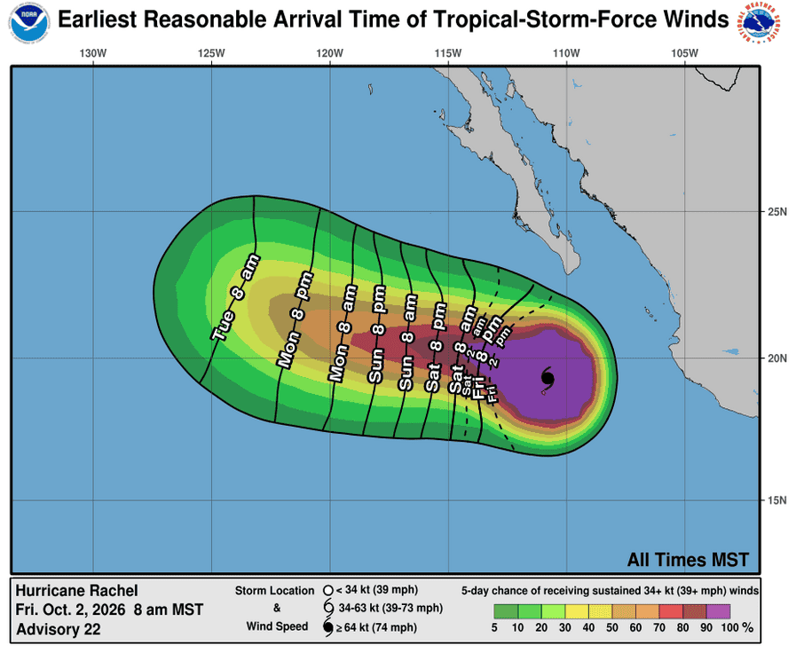
According to the NHC advisory number 22
Rachel is moving toward the west near 6 mph (9 km/h), and this general motion is expected to continue through the weekend. A gradual turn toward the west-northwest with an increase in forward speed is expected by Monday.
Maximum sustained winds have decreased to near 110 mph (175 km/h) with higher gusts. Additional weakening is expected over the next day or two. However, Rachel is expected to remain a hurricane for the next several days.
Hurricane-force winds extend outward up to 45 miles (75 km) from the center and tropical-storm-force winds extend outward up to 150 miles (240 km). The weather station on Socorro Island recently measured sustained winds of 57 mph (92 km/h) with a gust to 79 mph (127 km/h). The estimated minimum central pressure is 959 mb (28.32 inches).
HAZARDS AFFECTING LAND
SURF: Swells generated by Rachel will affect the coast of west-central Mexico and the Baja California Peninsula through the weekend. These swells are likely to cause life-threatening surf and rip current conditions.
>>> South of Southern Mexico:
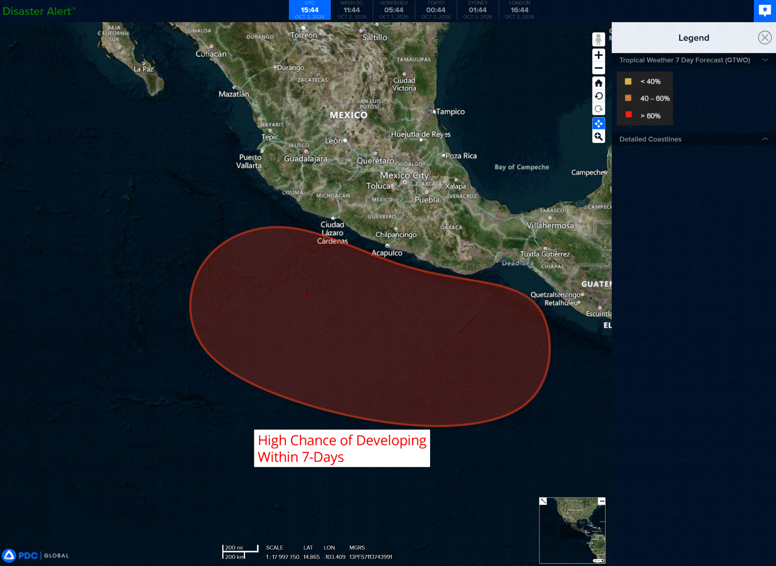
An area of low pressure is forecast to form late this weekend or early next week south of the southern coast of Mexico.
Thereafter, environmental conditions appear favorable for gradual development, and a tropical depression is likely to form by the middle of next week while the system moves slowly west-northwestward to northwestward.
* Formation chance through 48 hours…low…near 0 percent
* Formation chance through 7 days…high…80 percent
Central North Pacific:
Tropical Cyclone 15E (Nolo)
NOLO ALMOST A HURRICANE AGAIN
According to the NHC advisory number 48
Nolo is moving toward the west-northwest near 6 mph (9 km/h). A westward or west-northwestward motion with an increase in forward speed is expected during the next few days. On the forecast track, the center of Nolo will continue to move through the Papahanaumokuakea Marine National Monument but remain just south of the Northwestern Hawaiian Islands west of French Frigate Shoals.
Maximum sustained winds have increased to near 70 mph (110 km/h) with higher gusts. Additional strengthening is forecast, and Nolo is expected to become a hurricane later today and a major hurricane by early Sunday.
Tropical-storm-force winds extend outward up to 115 miles (185 km) from the center. The estimated minimum central pressure is 987 mb (29.15 inches).
HAZARDS AFFECTING LAND WIND:
WIND: Tropical storm conditions are expected within the Tropical Storm Warning area from Nihoa to Maro Reef through early Saturday. Farther west, tropical storm conditions are expected from Maro Reef to Lisianski Island by Saturday.
SURF: Large surf associated with Nolo will continue to affect the Papahanaumokuakea Marine National Monument over the next several days. These large waves will likely inundate some of the low-lying atolls, especially from French Frigate Shoals to Maro Reef into the weekend, then from Maro Reef to Lisianski Island during the weekend.
Western Pacific, Indian Ocean, and adjacent Seas:
Western Pacific
Tropical Cyclone 26W (Choi-wan)
According to the JTWC warning number 11…sustained winds were 70 knots with gusts to 85 knots
Animated enhanced infrared (eir) satellite imagery depicts typhoon 26W as a quickly developing system with robust deep convection and an improving poleward outflow channel. The upper-level convection is struggling to maintain organization, though it is still fighting to wrap upshear. The lower-level cloud banding is still partially exposed along the northwestern edge of the circulation. The 020832z sar pass revealed a wide swath of typhoon-force winds and a symmetrical inner core.
Environmental analysis reveals a highly favorable environment characterized by low (5-10 kts) vertical wind shear (vws), warm (29-30 c) sea surface temperatures (sst), high (100-120 kj per cm squared) ocean heat
content (ohc), and strong divergence aloft.
TY 26W (Choi-wan) is currently tracking poleward as the str to its northeast is eroded by a passing
shortwave trough to the north. The trough will continue to erode the western flank of the str through 36-48 hours, inducing a northeastward track for Choi-wan. By 48 hours, the trough is expected to have passed, and the str is expected to re-orient and build westward. This is expected to cause 26W to curve northwestward between 48-72 hours. Just after 72 hours, 26W is anticipated to round the ridge axis and skirt the edge of the upper-level westerlies. 26W is forecast to maintain a northeastward track through the end of the forecast.
The environment will deteriorate drastically as 26W tracks further poleward. Choi-wan is expected to cross the 26c isotherm around 96 hours and encounter high (30+ kts) vws due to the proximity to the westerlies, which will force high amounts of dry air into the core and induce thermal advection. In response to the
hostile environment, 26W is forecast to begin extratropical transition at 96 hours and complete transition no later than 120 hours.
Regarding intensity, 26W is forecast to undergo a period of rapid intensification beginning imminently and lasting through 24 hours. Within the next 12 hours, the environment will become increasingly favorable, with reduced vws of 10-15 kts, an enhanced poleward outflow channel provided by the retreating str, and higher (150+ kj per cm squared) ohc. By 36 hours, 26W is forecast to enter into a region of lower ohc (50-75 kj per cm squared), which is expected to induce a weakening trend beginning at 48 hours.The weakening trend will be exacerbated by the deteriorating environment as Choi-wan tracks poleward. choi-wan is expected to maintain an expansive wind field through the duration of the forecast.