

Current Snapshot
For all the latest updates visit: DisasterAWARE
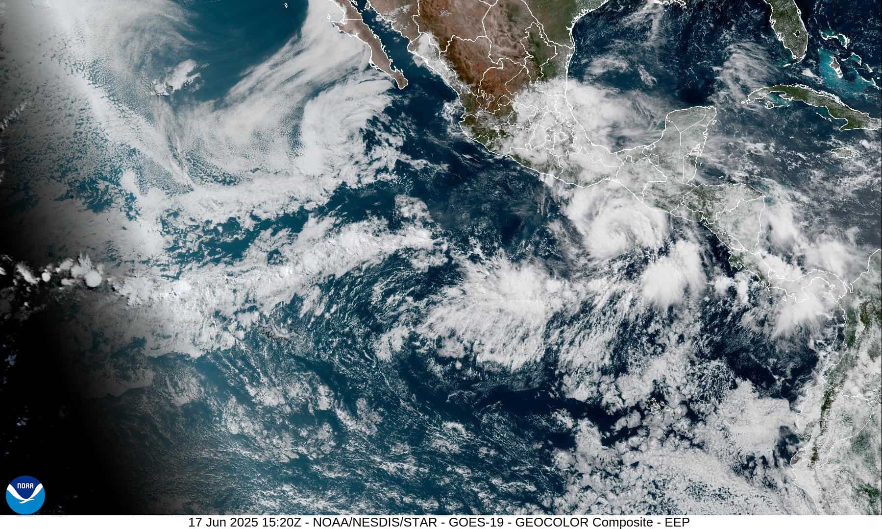
1800x1080e
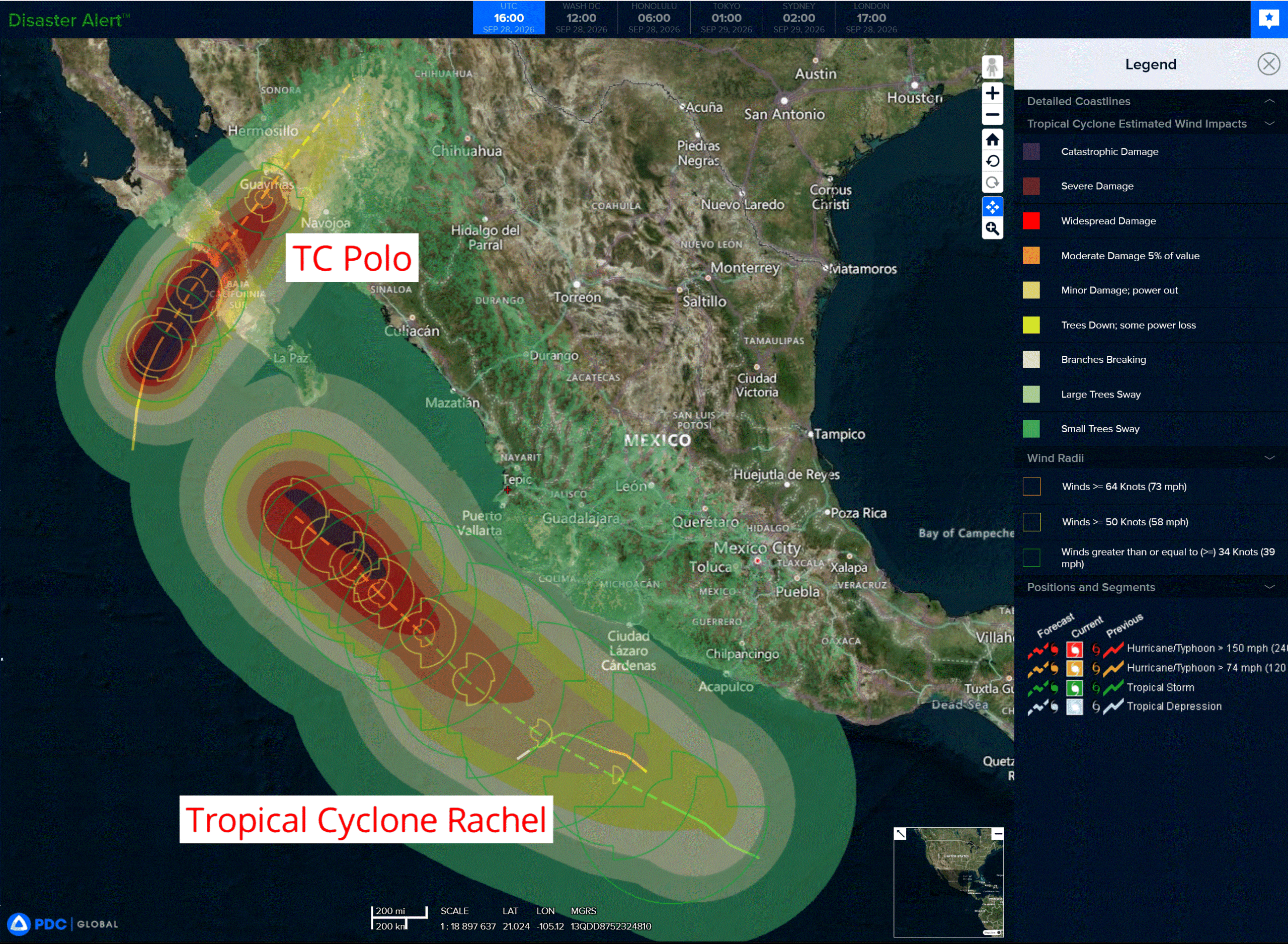
2e
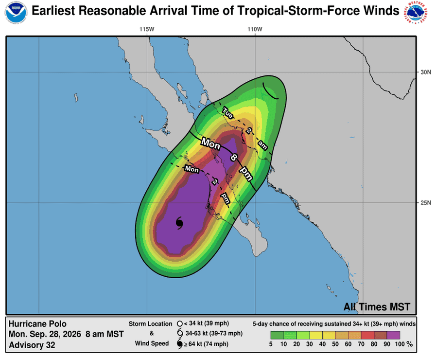
281444_earliest_reasonable_toa_34P
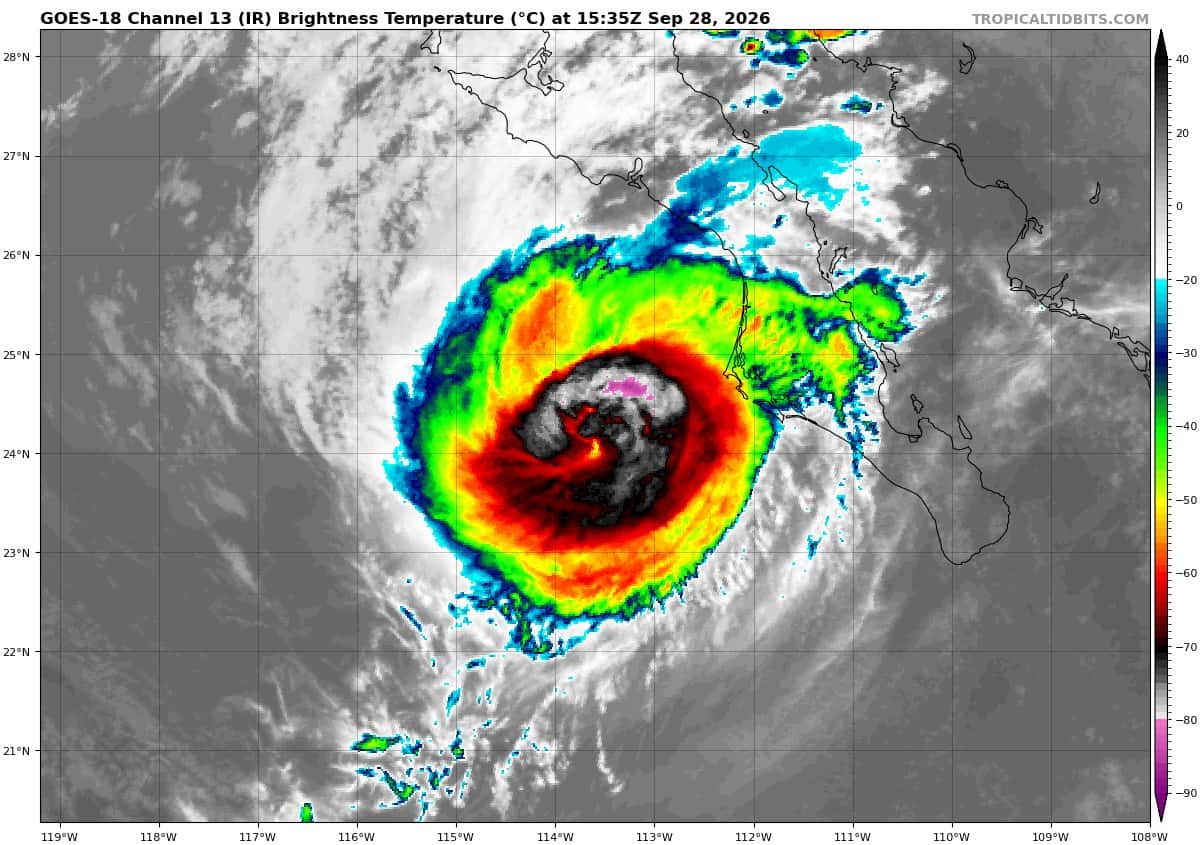
goes18_ir_17E_202609281535_lat23.9-lon-113.7
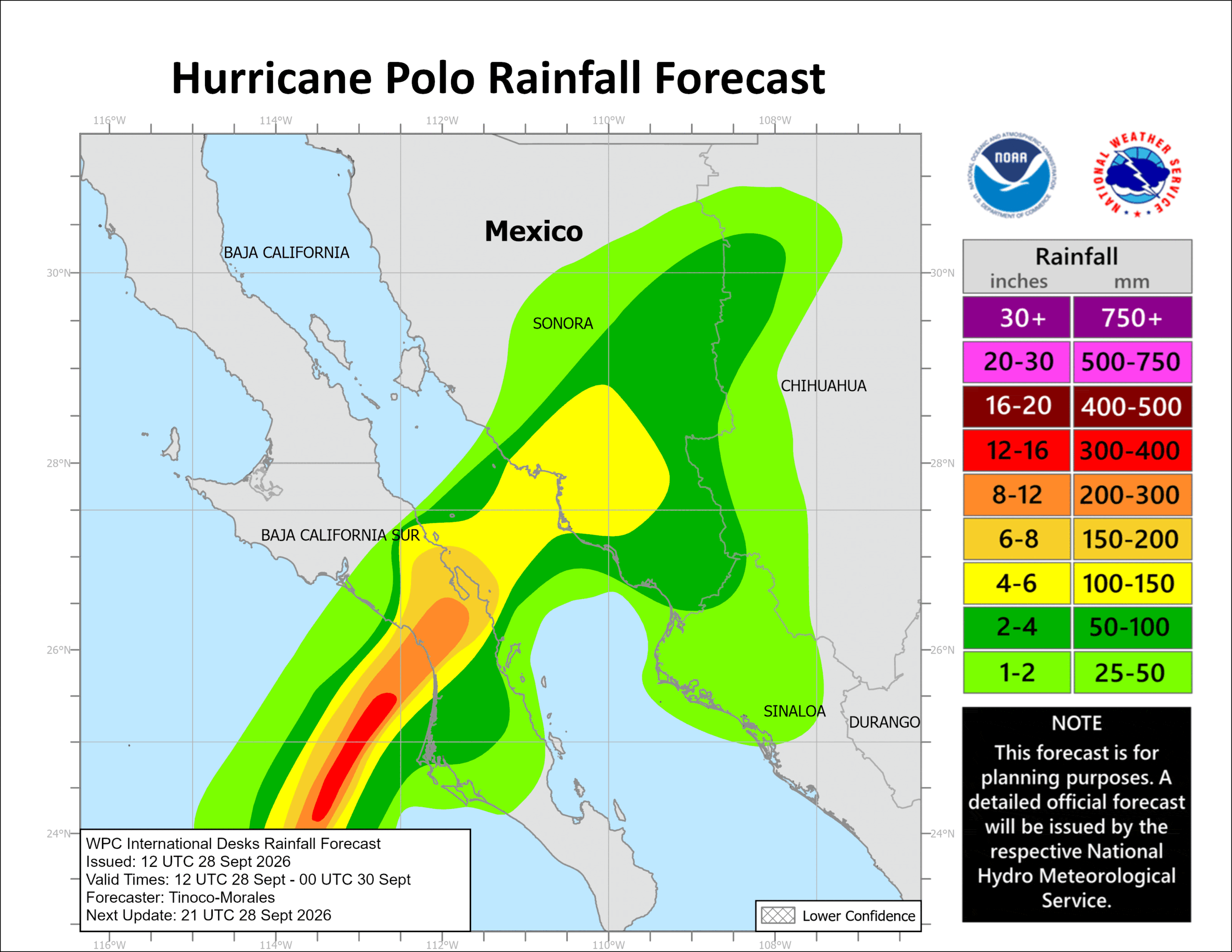
281444INTQPF_sm
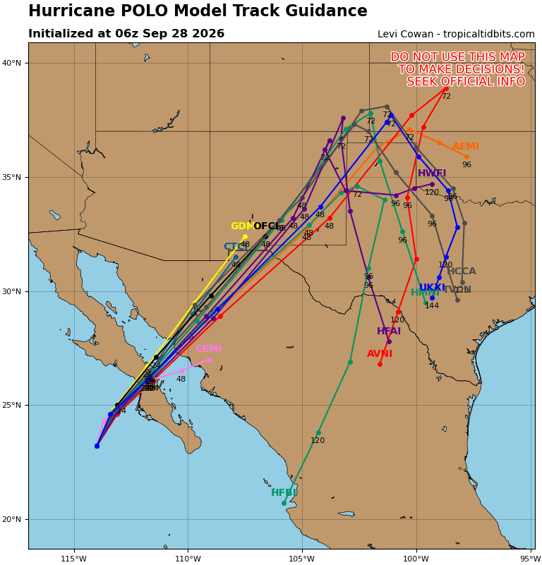
17E_tracks_latest
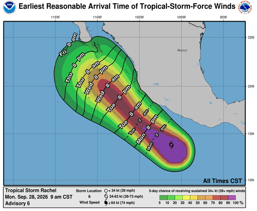
281438_earliest_reasonable_toa_34R
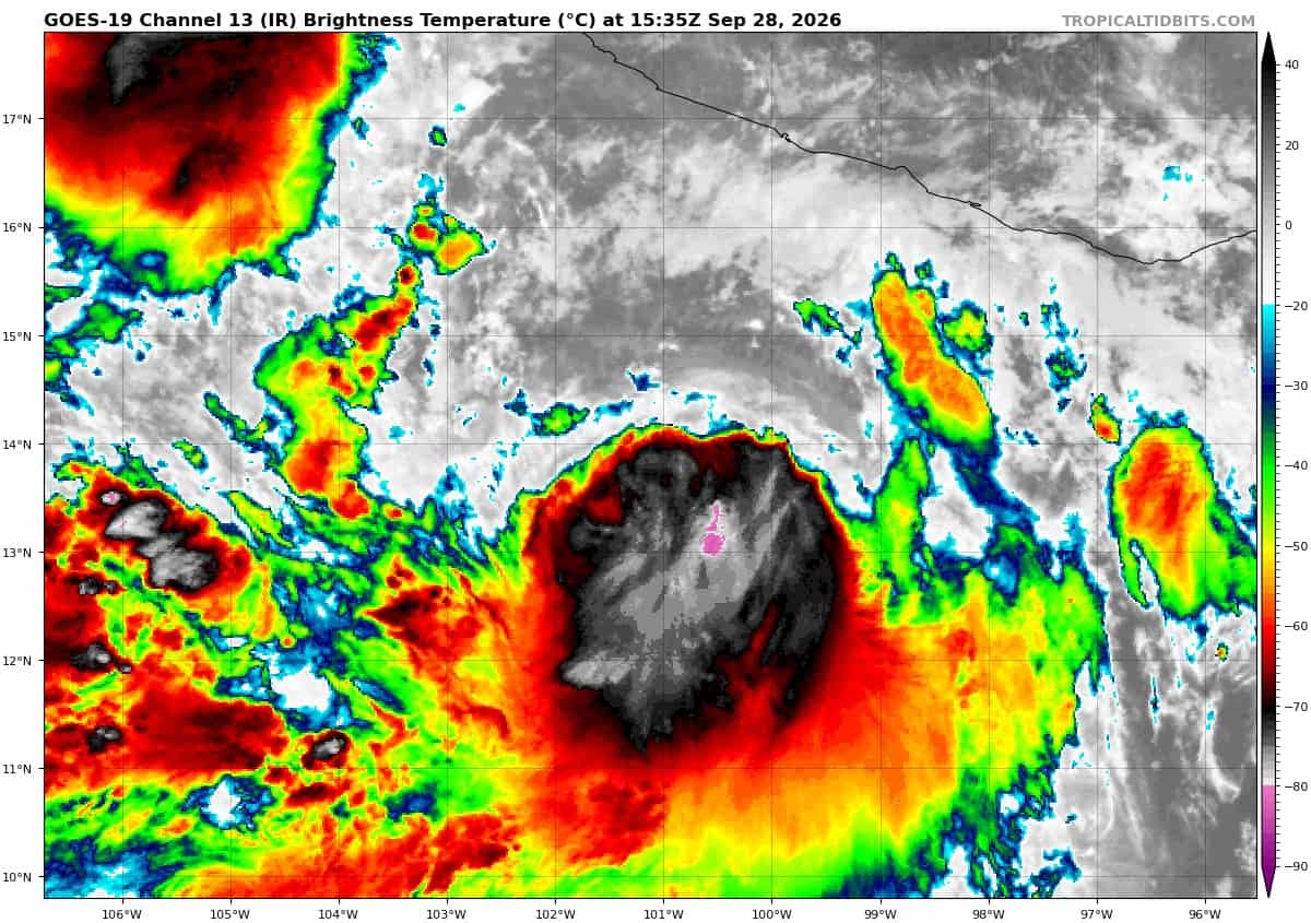
goes19_ir_18E_202609281535_lat13.6-lon-100.8
18E_tracks_latest
91E
7
91E_tracks_latest
1800x1080ec
nolo
281452_earliest_reasonable_toa_34N
goes18_ir_15E_202609281535_lat16.8-lon-161.9
15E_tracks_latest
s
25W_281200sair
himawari9_ir_25W_202609281550_lat27.5-lon132.8
25W_tracks_latest
92w
92W_tracks_latest
93w
himawari9_ir_93W_202609281610_lat15.2-lon156.1

93W_tracks_latest
By PDC’s Senior Weather
Specialist Glenn James

The Pacific Disaster Center’s (PDC Global) Monday, September 28, 2026, Tropical Cyclone Activity Report…for the Pacific Ocean, the Indian Ocean, and adjacent Seas.
Tropical Cyclones
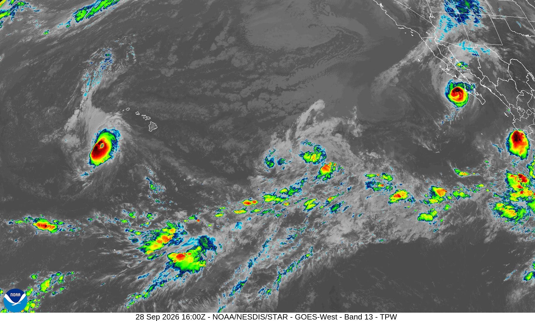
Tropical Cyclone 17E (Polo) is located about 85 miles west-southwest of Cabo San Lazaro, Mexico
Tropical Cyclone 18E (Rachel) is located about 230 miles south-southwest of Acapulco, Mexico
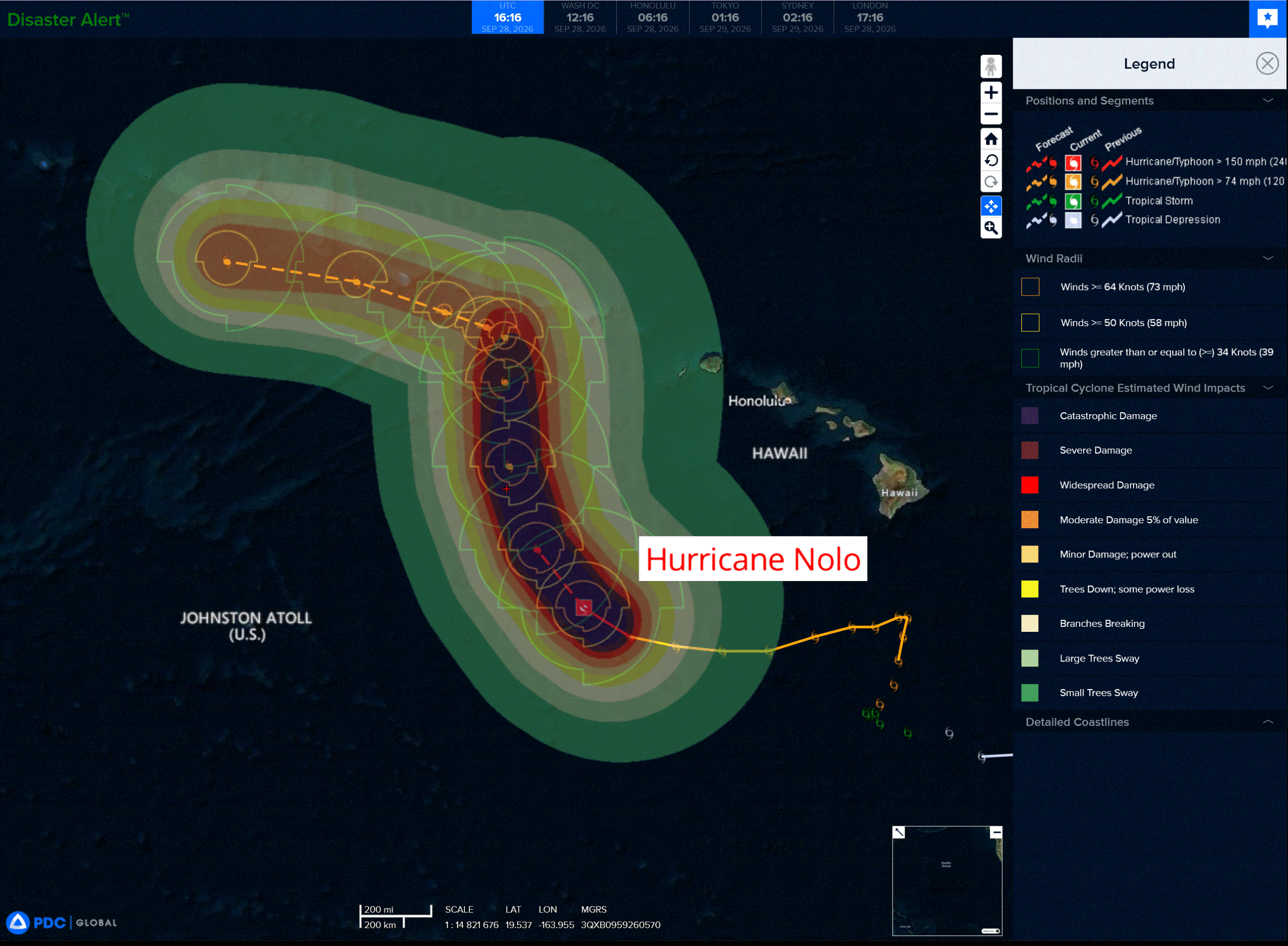
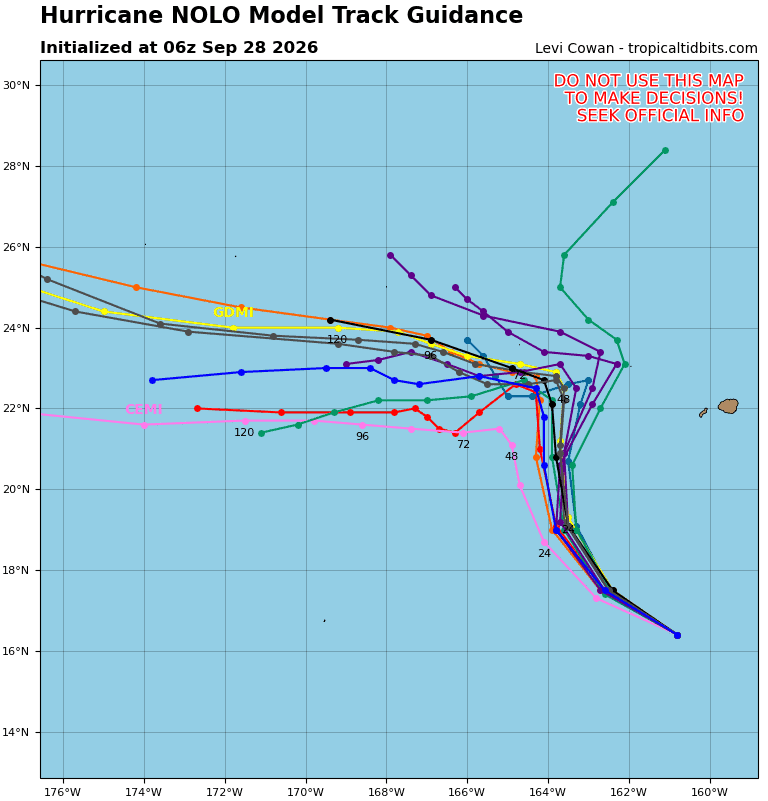
Tropical Cyclone 15E (Nolo) is located about 410 miles southwest of Honolulu, Hawaii
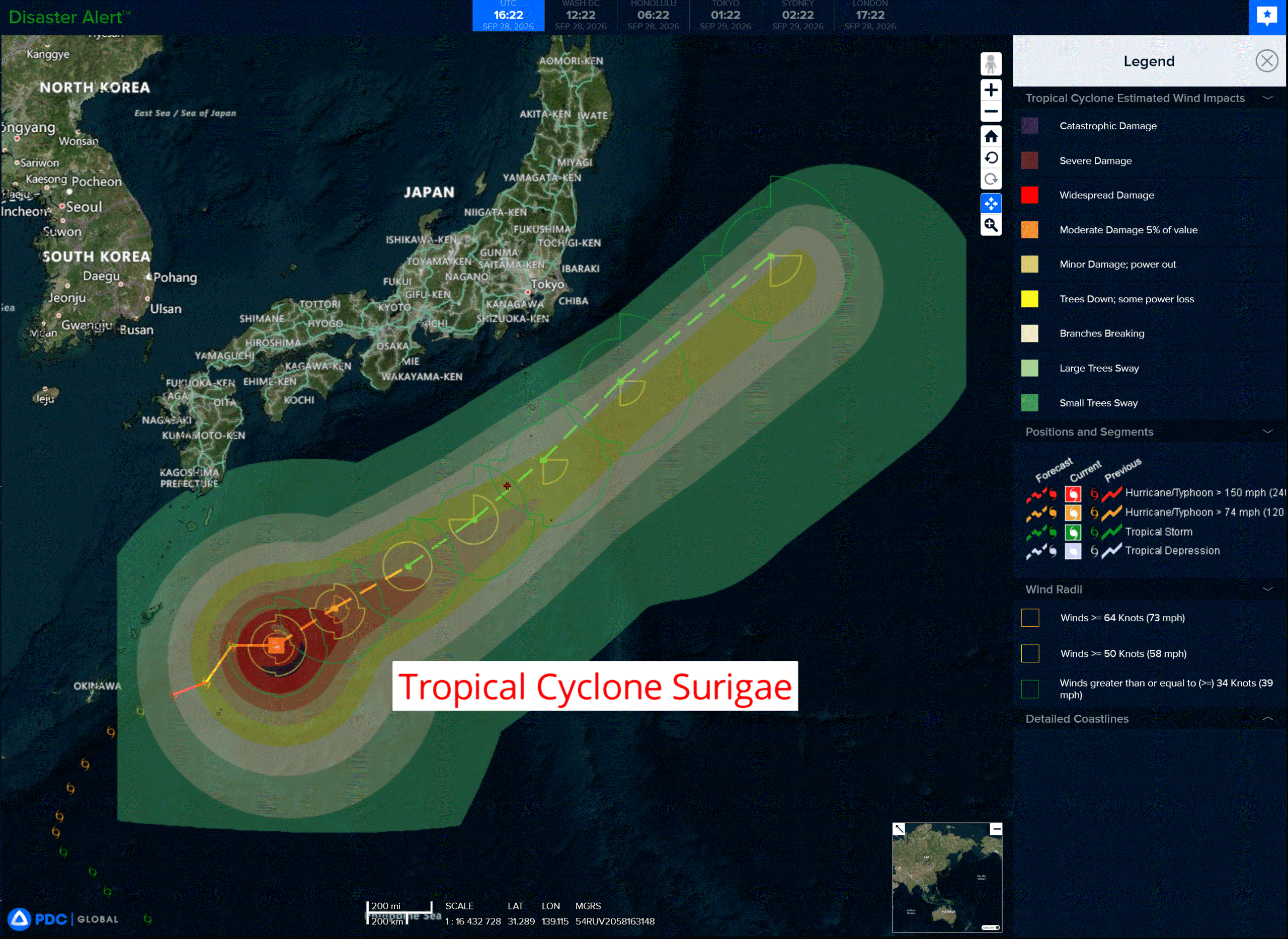
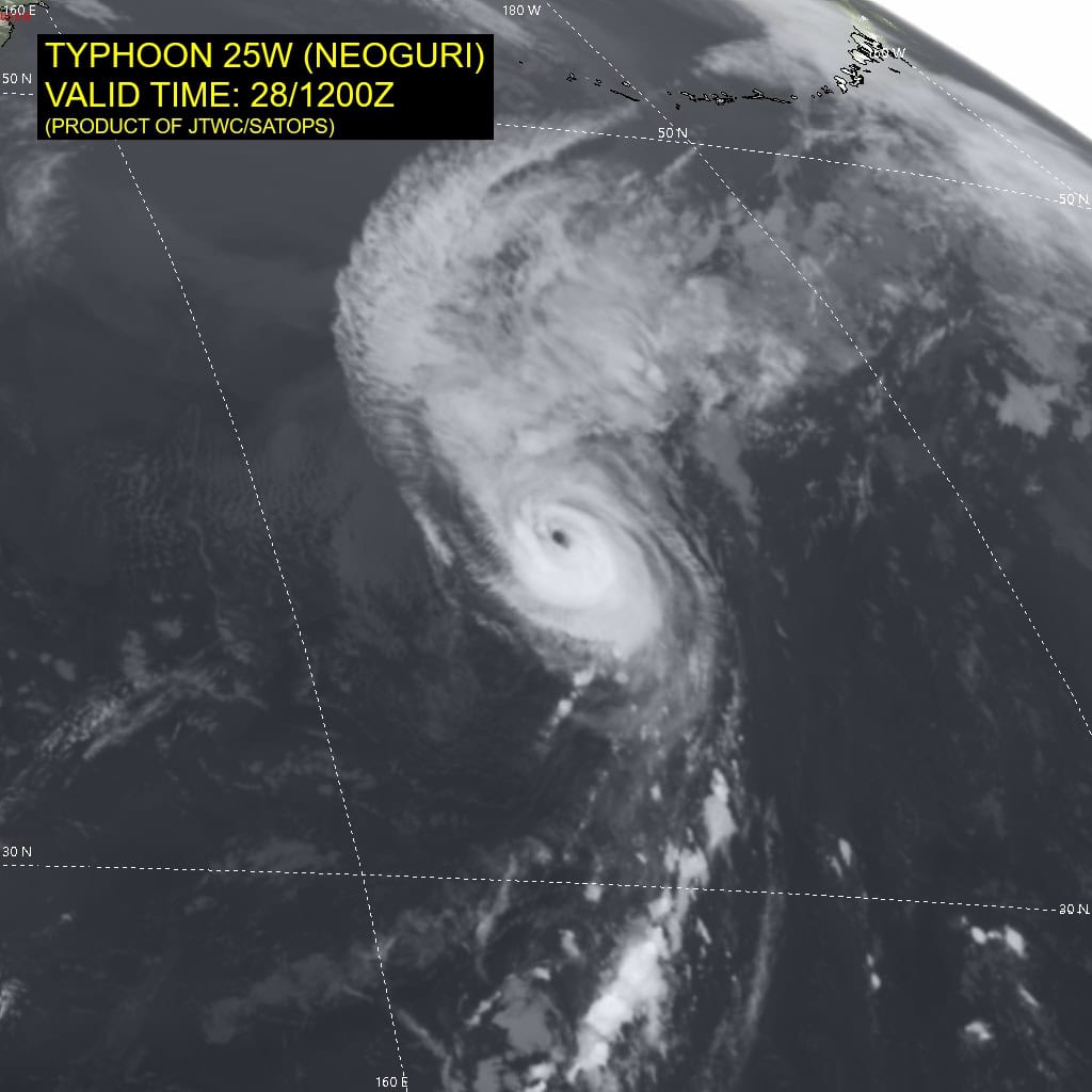
Tropical Cyclone 25W (Surigae) is located approximately 586 NM southwest of Yokosuka, Jaspan
Northeast Pacific:
Tropical cyclone 17E (Polo)
POLO STILL A MAJOR HURRICANE AS IT APPROACHES THE BAJA CALIFORNIA PENINSULA …CONDITIONS TO SOON DETERIORATE AS LIFE-THREATENING WINDS AND FLASH FLOODS EXPECTED OVER PORTIONS OF BAJA CALIFORNIA SUR AND SONORA TODAY AND TUESDAY
According to the NHC advisory number 32
Polo is now moving toward the northeast near 10 mph (17 km/h) and this motion with gradual acceleration is expected this afternoon through Tuesday. On the forecast track, the center of Polo is expected to move inland along the coast of Baja California Sur this evening, then move inland into southern Sonora on Tuesday morning.
Maximum sustained winds are near 115 mph (185 km/h) with higher gusts. Polo is a category 3 hurricane on the Saffir-Simpson Hurricane Wind Scale. Fluctuations in intensity are possible today.
However, Polo is forecast to be near major hurricane strength when it reaches Baja California Sur this evening, and is anticipated to be a hurricane when it makes landfall in mainland Mexico late early Tuesday morning. Rapid weakening is expected after Polo moves well inland into mainland Mexico.
Hurricane-force winds extend outward up to 40 miles (65 km) from the center and tropical-storm-force winds extend outward up to 105 miles (165 km). The estimated minimum central pressure is 958 mb (28.29 inches).
HAZARDS AFFECTING LAND
WIND: Hurricane conditions are expected within the warning area along the west coast of Baja California Sur by late this afternoon, with tropical storm conditions beginning in the southern portion of the warning area later this morning. These conditions are expected to spread northward and eastward across Baja California Sur later today and tonight. Hurricane conditions are expected within the Hurricane Warning area and possible in the watch area in mainland northwestern Mexico late tonight through early Tuesday with tropical storm conditions expected to begin tonight.
RAINFALL: Polo is expected to produce rainfall totals of 6 to 12 inches across portions of Baja California Sur. Rainfall totals of 4 to 6 inches with maximum totals of 8 inches are expected across southern and central portions of Sonora. This rainfall may produce life-threatening flooding and mudslides, especially in areas of steep terrain.
STORM SURGE: A storm surge could produce significant coastal flooding in areas of onshore winds. Near the coast, the surge will be accompanied by large and destructive waves.
SURF: Swells generated by Polo will continue affecting the coast of west-central Mexico and the Baja California peninsula during the next couple of days. These swells are likely to cause life-threatening surf, rip currents, and coastal flooding.
Tropical cyclone 18E (Rachel)
RACHEL A LITTLE STRONGER AS IT MOVES WEST-NORTHWESTWARD…TROPICAL STORM WARNING ISSUED FOR A PORTION OF THE COAST OF SOUTHWESTERN MEXICO
According to the NHC advisory number 6
Rachel is moving toward the west-northwest near 8 mph (13 km/h). A continued west-northwestward motion at a faster forward speed are expected for the next few days. On the forecast track, the center of Rachel is expected to move parallel to, but stay offshore of, the coast of southwestern Mexico.
Maximum sustained winds are now near 50 mph (85 km/h) with higher gusts. Gradual strengthening is expected during the next few days, and Rachel is forecast to become a hurricane by mid-week.
Tropical-storm-force winds extend outward up to 160 miles (260 km) from the center. The estimated minimum central pressure is 999 mb (29.50 inches).
HAZARDS AFFECTING LAND
WIND: Tropical storm conditions are expected in the Tropical Storm Warning area by Tuesday. Tropical storm conditions are possible within the Tropical Storm Watch area by Tuesday night or Wednesday.
RAINFALL: Rachel is expected to produce rainfall totals of 3 to 6 inches, with isolated maximum totals of 8 inches across coastal portions of the Mexican states of Guerrero, Michoacán and Colima. This rainfall may produce flooding and mudslides, especially in areas of steep terrain.
SURF: Swells generated by Rachel will begin affecting portions of southern coast of Mexico during the next couple of days. These swells are likely to cause life-threatening surf and rip current conditions.
>>> Well East-Southeast of the Hawaiian Islands:
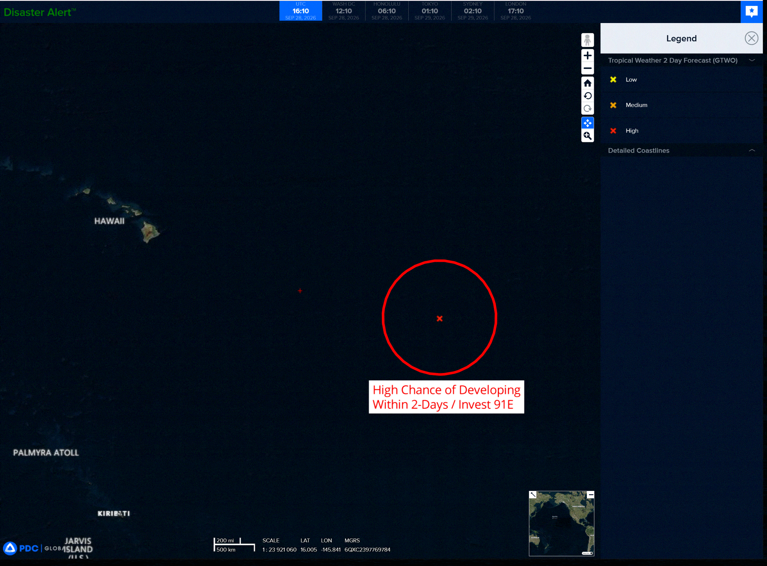
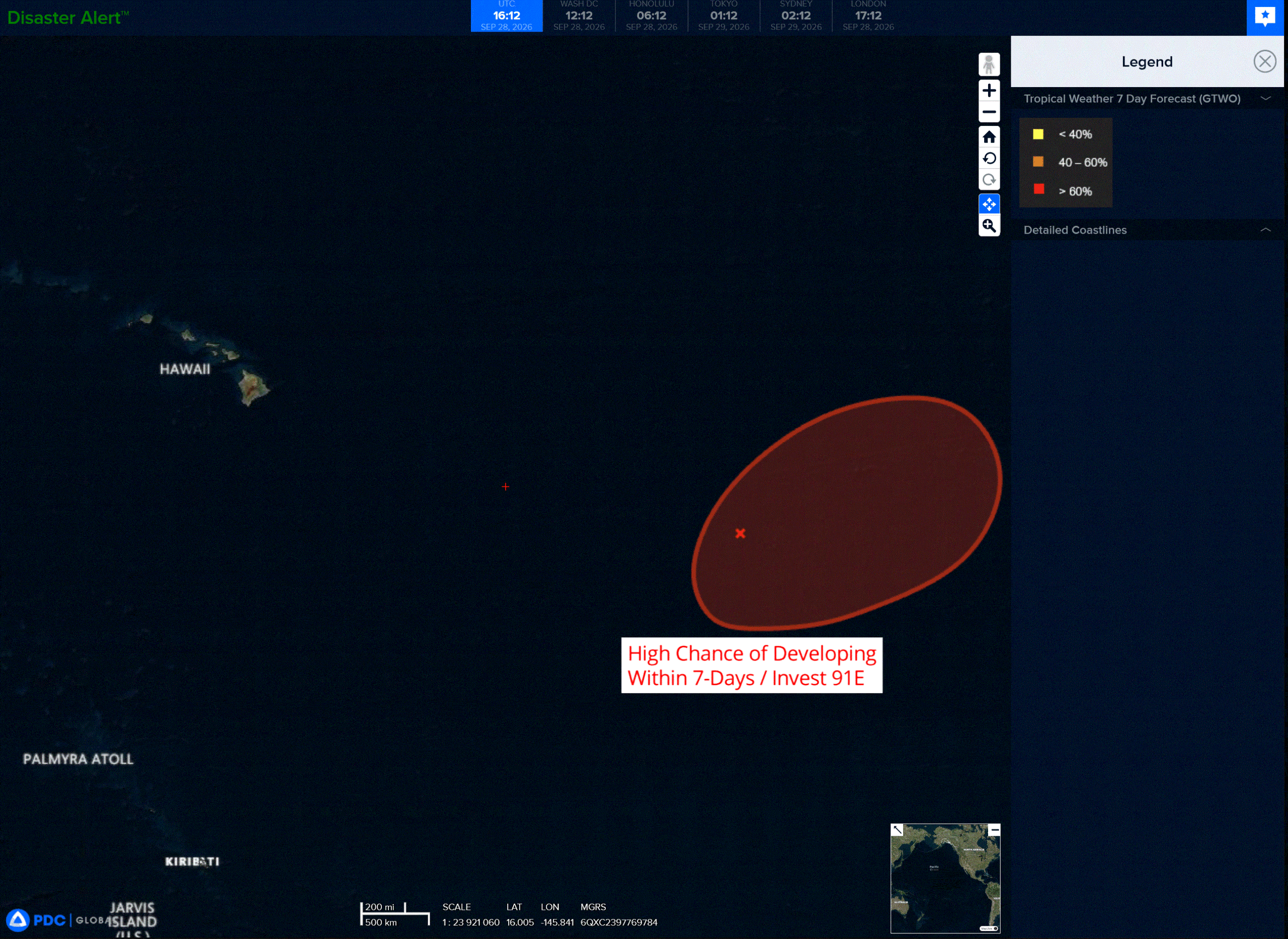
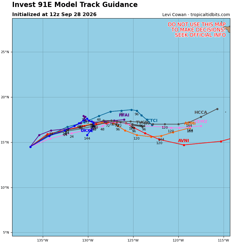
Invest 91E
A broad area of low pressure located well east-southeast of the Hawaiian Islands continues to become better organized. Environmental conditions are conducive for further development, and a tropical depression is expected to form later today or tomorrow. The system should move generally northeastward and remain well east of the Hawaiian Islands.
* Formation chance through 48 hours…high…90 percent
* Formation chance through 7 days…high…90 percent
Central North Pacific:
Tropical Cyclone 15E (Nolo)
HURRICANE WARNING ISSUED FOR A PORTION OF THE PAPAHANAUMOKUAKEA MARINE NATIONAL MONUMENT
According to the NHC advisory number 32
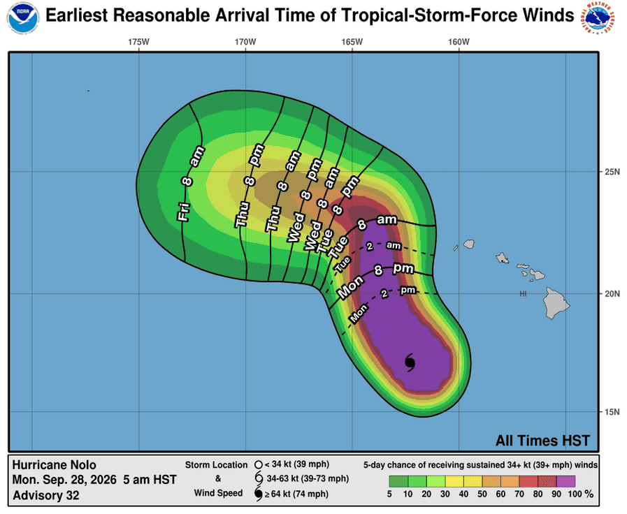
Nolo is moving toward the west-northwest near 13 mph (20 km/h). A turn toward the northwest is forecast later today, with a turn toward the north expected on Tuesday. On the forecast track, the center of Nolo will remain well southwest of the main Hawaiian Islands but will approach the Papahanaumokuakea Marine National Monument on Tuesday.
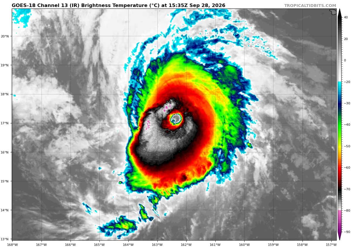
Maximum sustained winds are near 155 mph (250 km/h) with higher gusts. Nolo is a category 4 hurricane on the Saffir-Simpson Hurricane Wind Scale. A gradual weakening trend is likely to begin tonight, followed by faster weakening through the middle of the week.
Hurricane-force winds extend outward up to 40 miles (65 km) from the center and tropical-storm-force winds extend outward up to 150 miles (240 km). The estimated minimum central pressure is 929 mb (27.44 inches).
HAZARDS AFFECTING LAND WIND:
WIND: Hurricane conditions are expected in the Hurricane Warning area in the Papahanaumokuakea Marine National Monument by Wednesday, with Tropical Storm conditions likely by Tuesday.
SURF: Swells generated by Nolo will affect south-facing shores of the main Hawaiian Islands for the next few days. These swells are likely to cause life-threatening surf and rip current conditions. Large surf associated with Nolo will affect the Papahanaumokuakea Marine National Monument beginning later today. These large waves will likely inundate some of the low-lying atolls, especially from French Frigate Shoals to Nihoa.
Western Pacific, Indian Ocean, and adjacent Seas:
Western Pacific
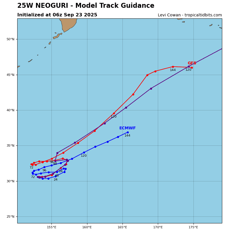
Tropical Cyclone 25W (Surigae)
According to the JTWC warning number 22…sustained winds were 90 knots with gusts to 110 knots
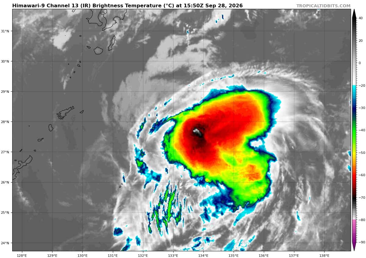
Animated enhanced infrared (eir) satellite imagery depicts typhoon 25W with partially exposed low-level banding along the western periphery in response to the high (25-30 kts) vertical wind shear (vws) that is continuing to compress the deep convection on the western edge and suppress poleward outflow.
Environmental analysis reveals a marginal environment dominated by high vws and dry air entrainment, offset slightly by the moderate equatorward outflow and warm (28-29 c) sea surface temperatures.
TY 25W (surigae) is forecast to continue tracking generally northeastward for the duration of the forecast
period. 25W is forecast to maintain a relatively consistent track speed until about 36 hours, at which point it will begin to interact with the mid-latitude westerlies and accelerate poleward.
As 25W tracks poleward, it will encounter an increasingly hostile environment characterized by dry air, increasing vws, and cooling sea surface temperatures. 25W is forecast to begin extratropical transition (ett) by 60 hours and complete transition no later than 72 hours.
Regarding intensity, 25W is expected to rapidly weaken through 24 hours, followed by a more gradual weakening trend from 24-36 hours as the vws abates slightly. Intensity is expected to remain relatively
stable as Surigae undergoes ett.
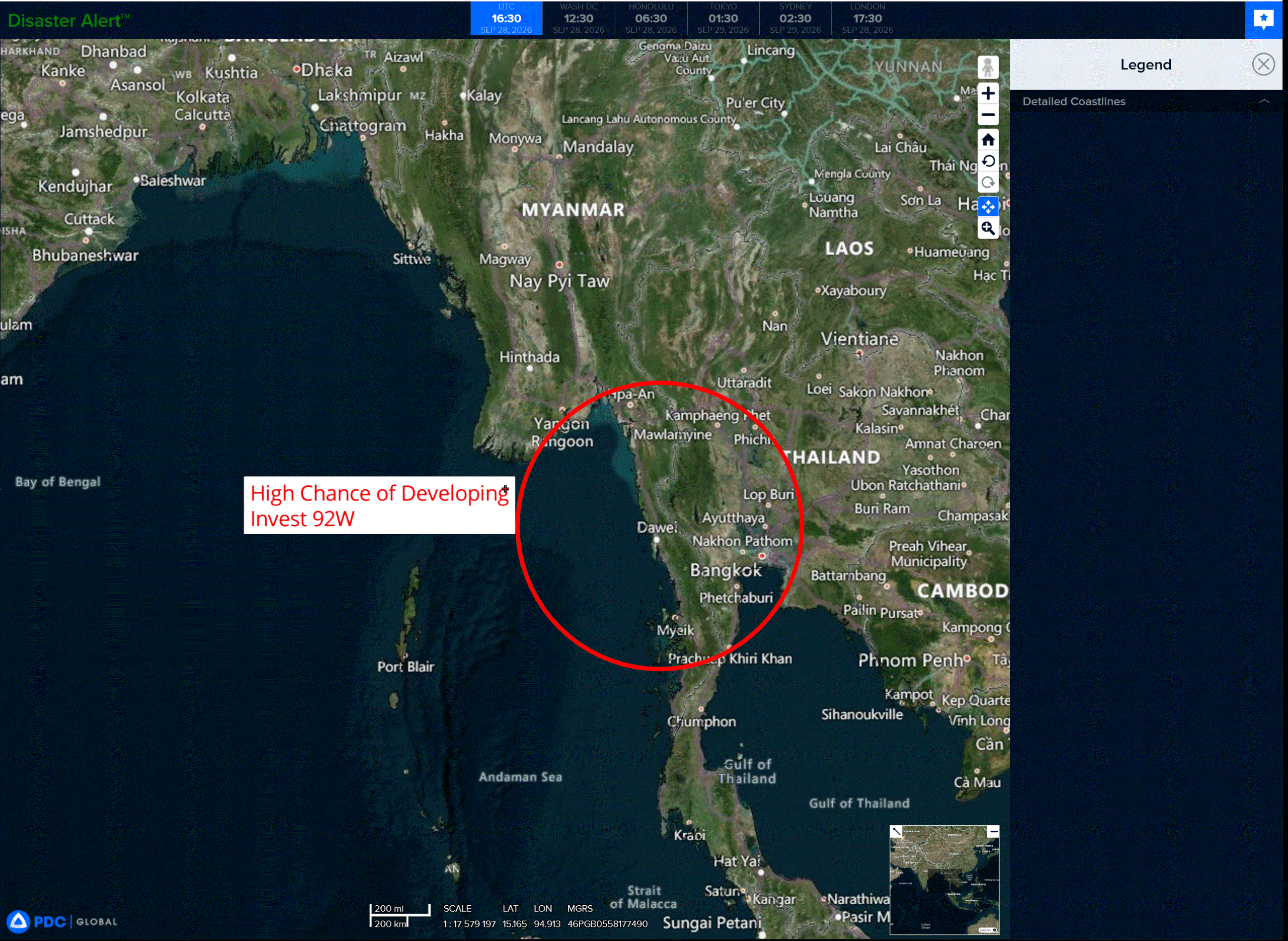
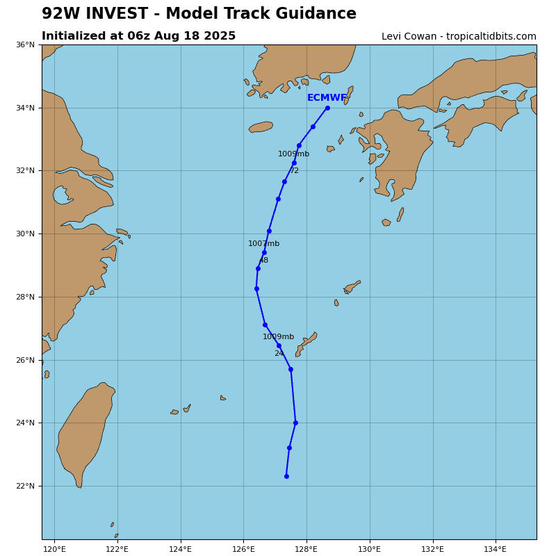
>>> There’s an area of disturbed weather that’s being referred to as Invest 92W, which is located approximately 177 NM southeast of Yangon, Myanmar
Animated enhanced infrared (eir) satellite imagery depicts an obscured low-level circulation center (llcc) with good mid-level rotation present just offshore Myanmar.
Environmental analysis indicates a marginal environment for development with low to moderate (15-20 kts) vertical wind shear, good equatorward and westward outflow aloft, and warm (28-29 c) sea surface temperatures, offset by the limited time over water.
Global deterministic and ensemble models indicate steady development over the upcoming 24 hours as the system transits northwestward off the coast of Myanmar over coastal water.
Maximum sustained surface winds are estimated at 23 to 28 knots.
Minimum sea level pressure is estimated to be near 1001 mb.
The potential for the development of a significant tropical cyclone within the next 24 hours is upgraded to high.
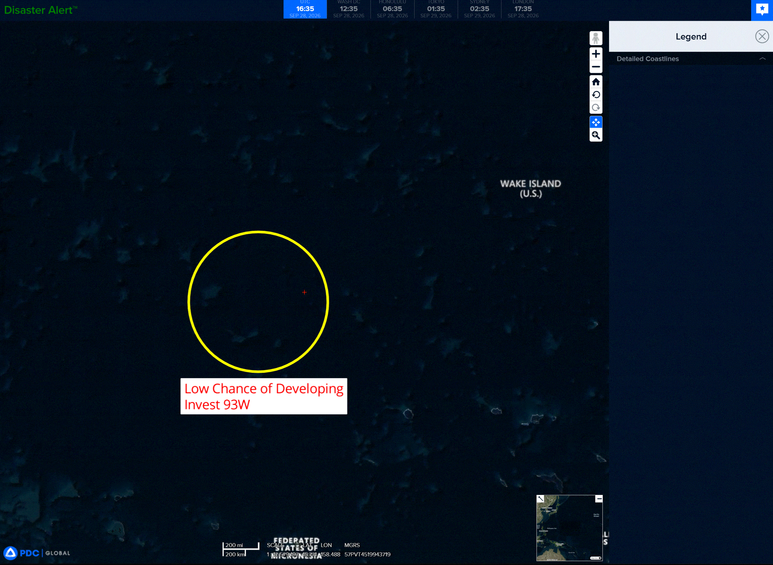
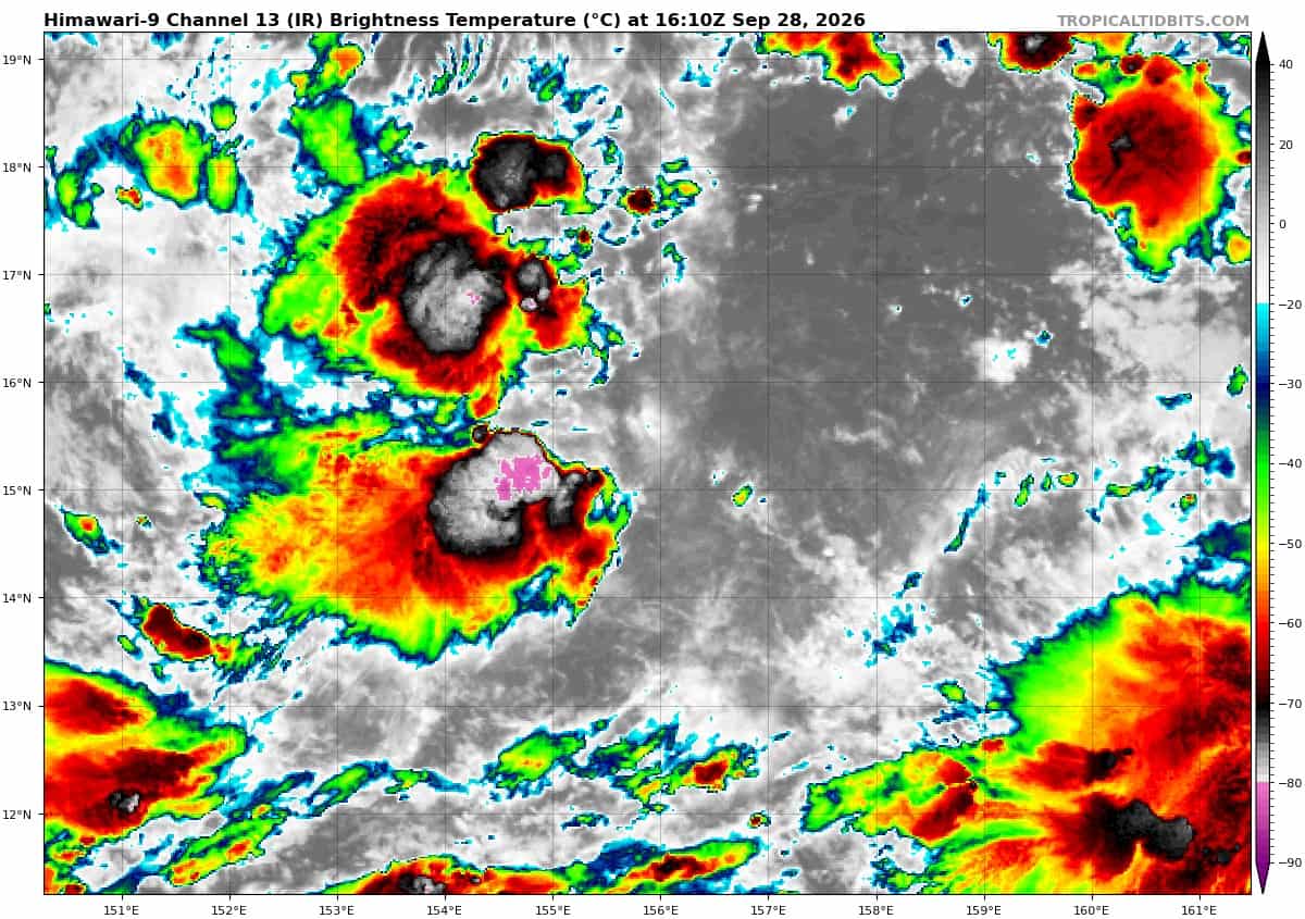
>>> There’s an area of disturbed weather that’s being referred to as Invest 93W, which is located approximately 673 NM east of Guam
Animated enhanced infrared satellite imagery (eir) depicts a broad and elongated low-level circulation obscured by persistent convection. A 281118z metop-c ascat pass reveals slightly elevated winds wrapping along the southwestern periphery.
Environmental analysis indicates favorable conditions for development with low (15-20 kts) vertical wind shear, slight radial outflow aloft, and warm (29-30 c) sea surface temperatures.
Global deterministic and ensemble models agree on gradual development of the system as 93W transits generally west-northwestward.
Maximum sustained surface winds are estimated at 15 to 20 knots.
Minimum sea level pressure is estimated to be near 1008 mb.
The potential for the development of a significant tropical cyclone within the next 24 hours is low