

Current Snapshot
For all the latest updates visit: DisasterAWARE
1800x1080e
2e
241448_earliest_reasonable_toa_34O
goes18_ir_16E_202609241415_lat16.2-lon-125.8
16E_tracks_latest
241439_earliest_reasonable_toa_34P
goes19_ir_17E_202609241415_lat16.7-lon-103.9
241439INTQPF_sm
17E_tracks_latest
7e
nolo
241449_earliest_reasonable_toa_34
goes18_ir_15E_202609241415_lat14.9-lon-156.1
241449WPCQPF_sm
241449_peak_surge
15E_tracks_latest
surigae
25W_241200sair
25W_tracks_latest
01b
meteosat9_ir_01B_202609241406_lat19.3-lon82.9
01B_tracks_latest
By PDC’s Senior Weather
Specialist Glenn James

The Pacific Disaster Center’s (PDC Global) Wednesday, September 23, 2026, Tropical Cyclone Activity Report…for the Pacific Ocean, the Indian Ocean, and adjacent Seas.
Tropical Cyclones
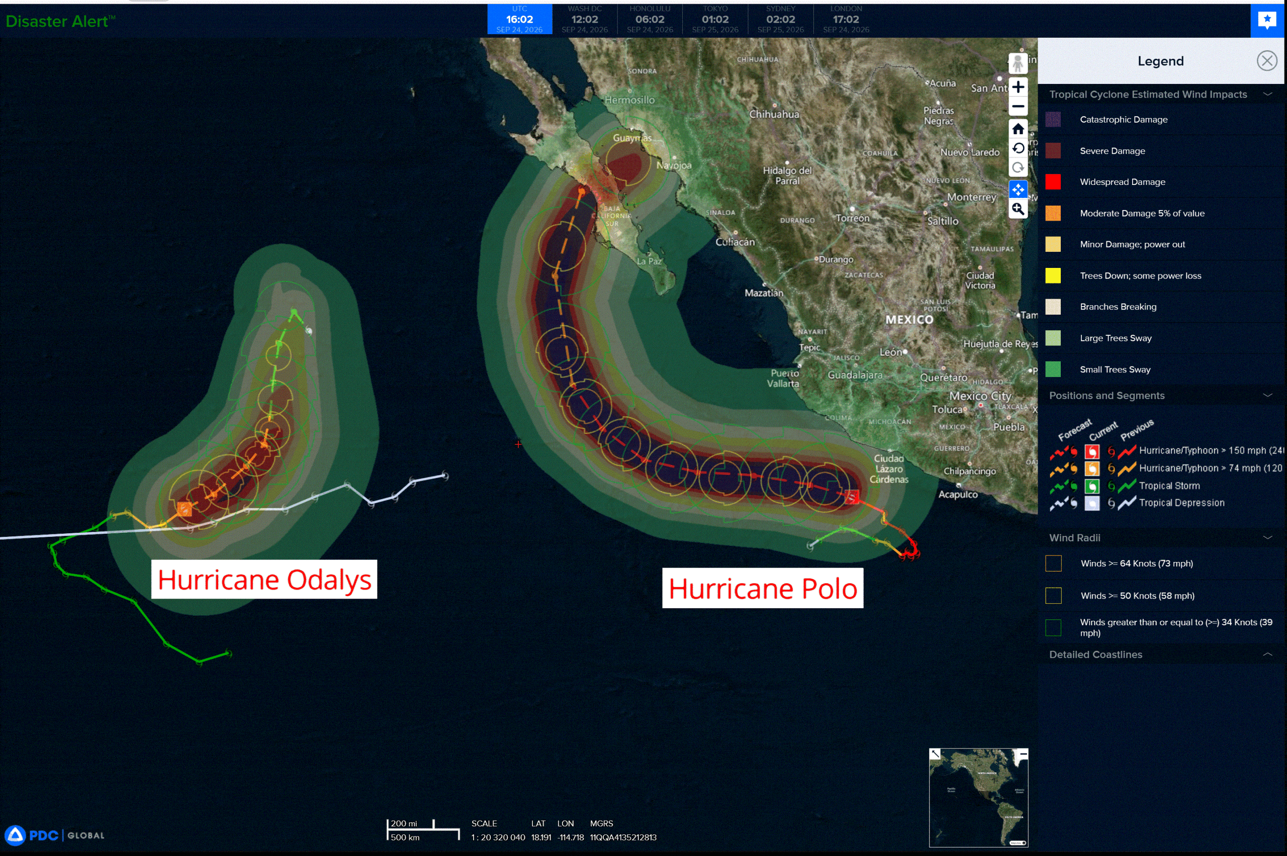
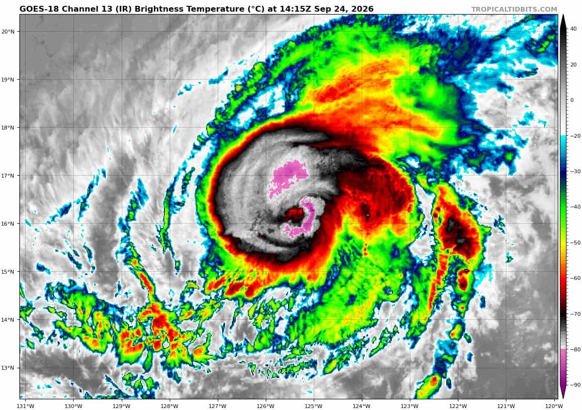
Tropical Cyclone 16E (Odalys) is located about 1110 miles west-southwest of the southern tip of Baja California
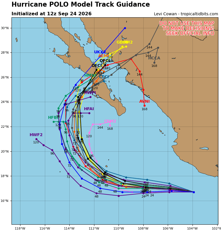
Tropical Cyclone 17E (Polo) is located about 150 miles south of Manzanillo, Mexico
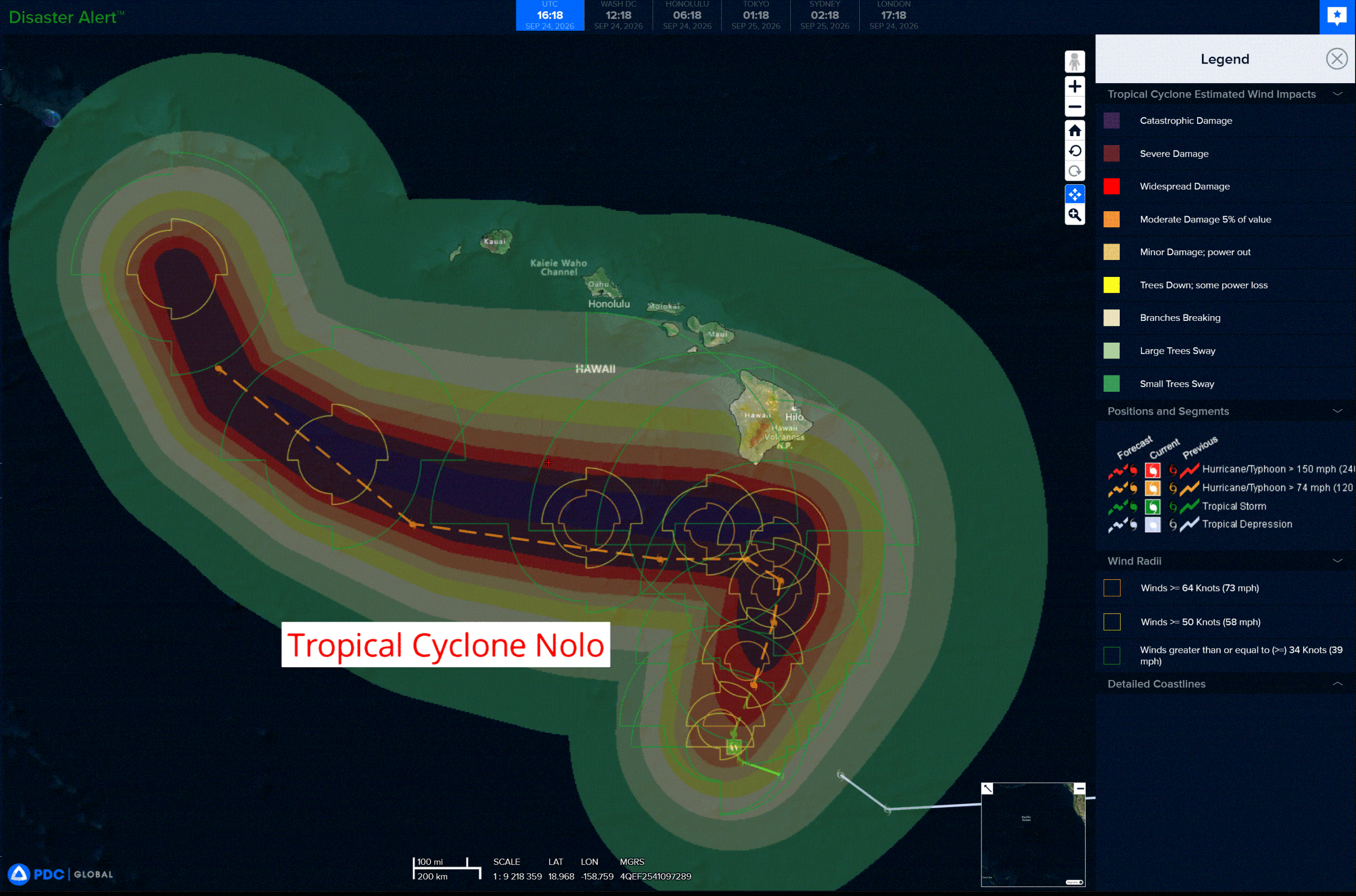
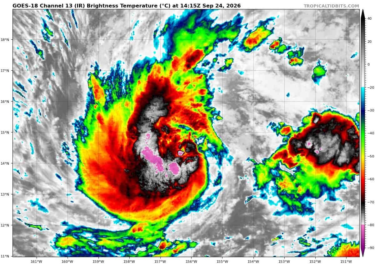
Tropical Cyclone 15E (Nolo) is located about 285 miles south of South Point, Hawaii
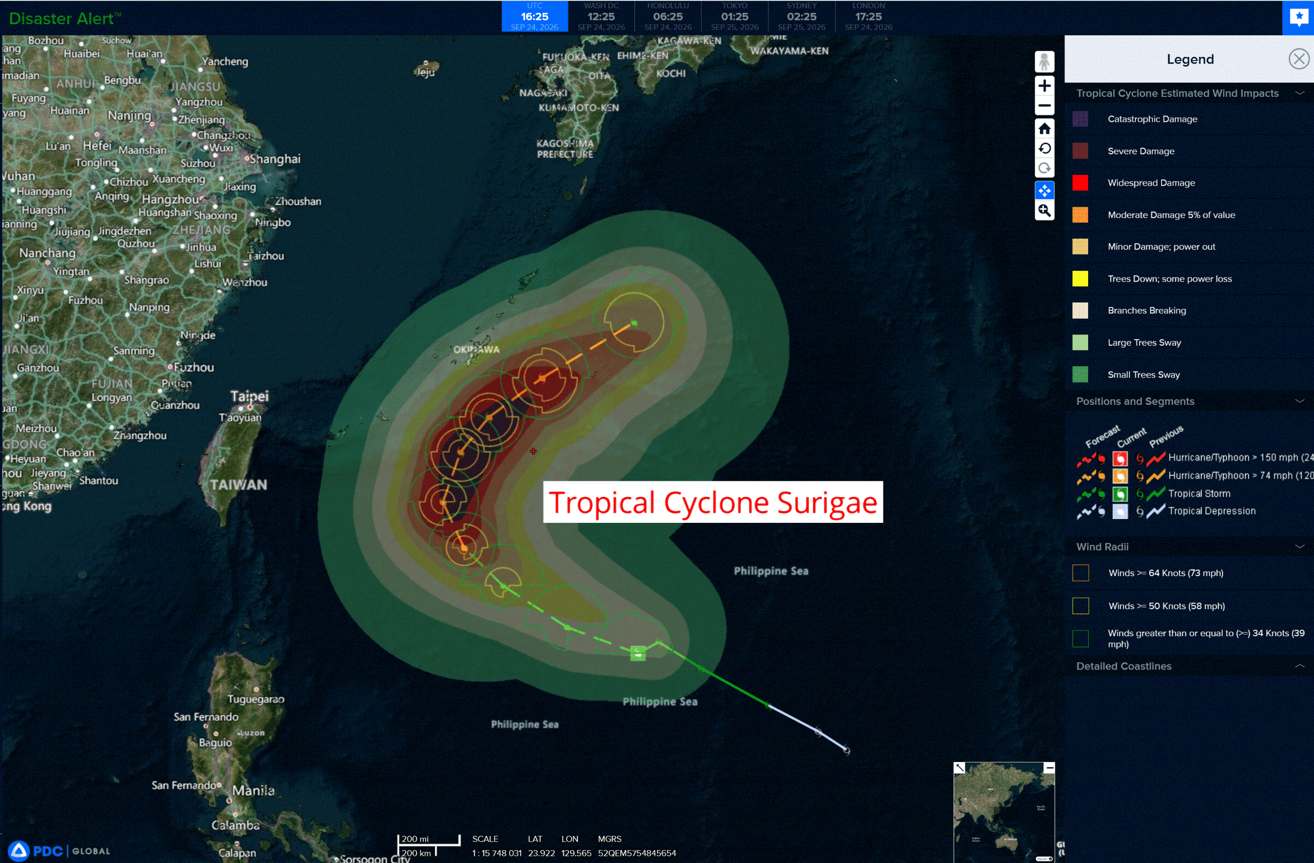
Tropical Cyclone 25W (Surigae) is located approximately 541 NM south-southeast of Kadena AB
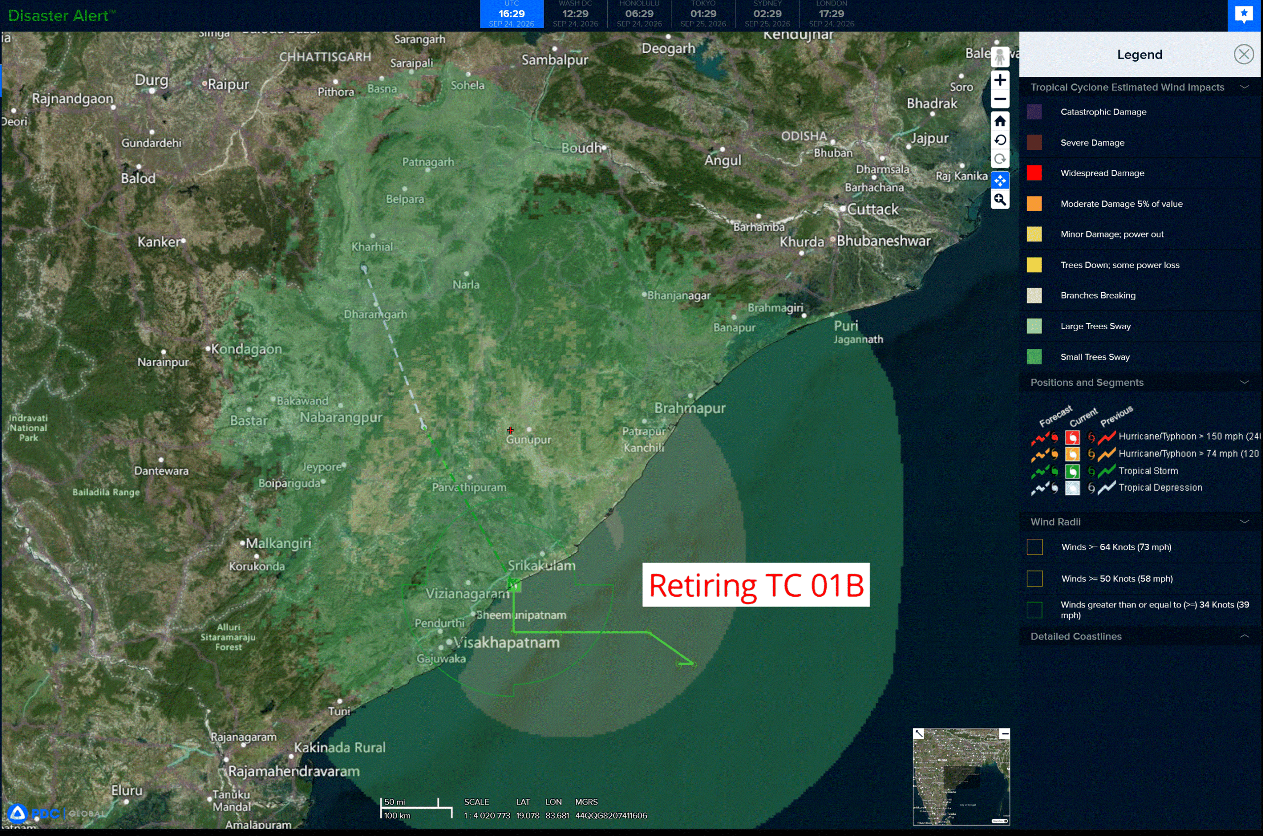
Tropical Cyclone 01B is located approximately 380 NM southwest of Kolkata, India – Final Warning
Northeast Pacific:
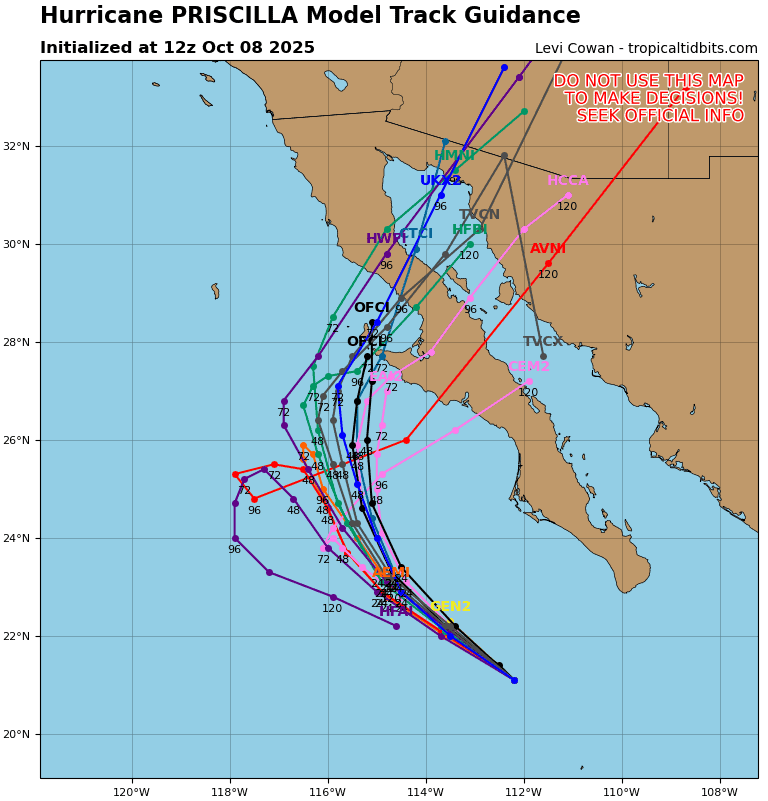
Tropical cyclone 16E (Odalys)
ODALYS A LITTLE STRONGER
According to the NHC advisory number 17
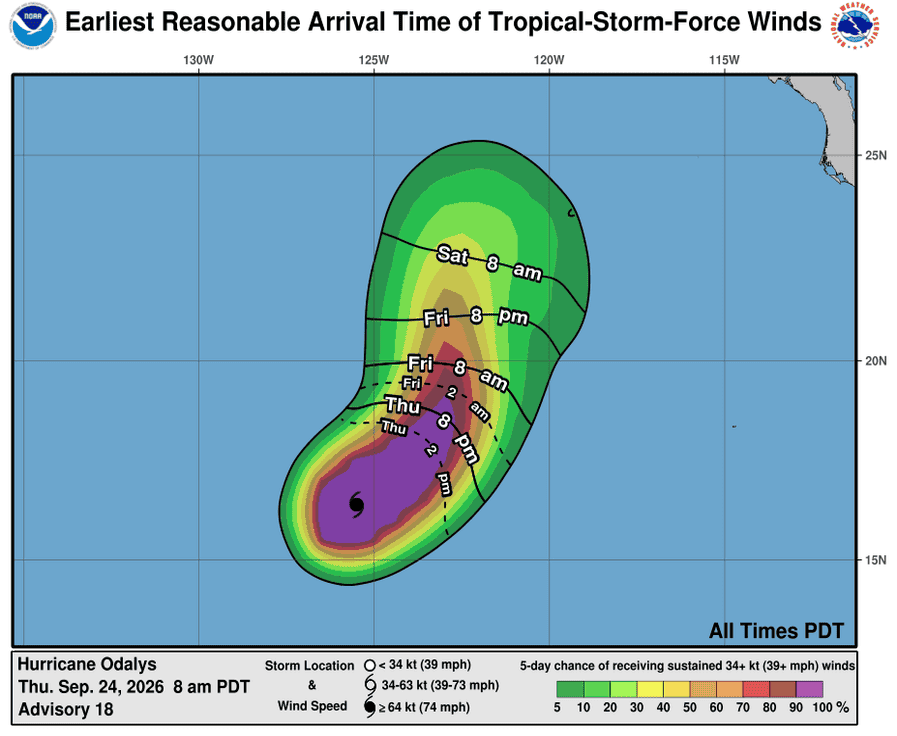
Odalys is moving toward the east-northeast near 7 mph, and this general motion should continue through tonight. A gradual turn toward the northeast is expected Friday followed by a turn toward the north by the weekend. Maximum sustained winds have increased to near 90 mph with higher gusts. Some further strengthening is expected through tonight, followed by gradual weakening on Friday. Hurricane-force winds extend outward up to 35 miles from the center and tropical-storm-force winds extend outward up to 140 miles (220 km). The estimated minimum central pressure is 976 mb (28.82 inches).
Tropical cyclone 17E (Polo)
POLO STARTING TO MOVE AWAY FROM THE COAST OF SOUTHWESTERN MEXICO
According to the NHC advisory number 16
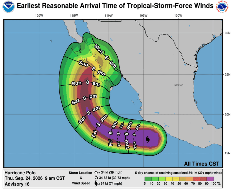
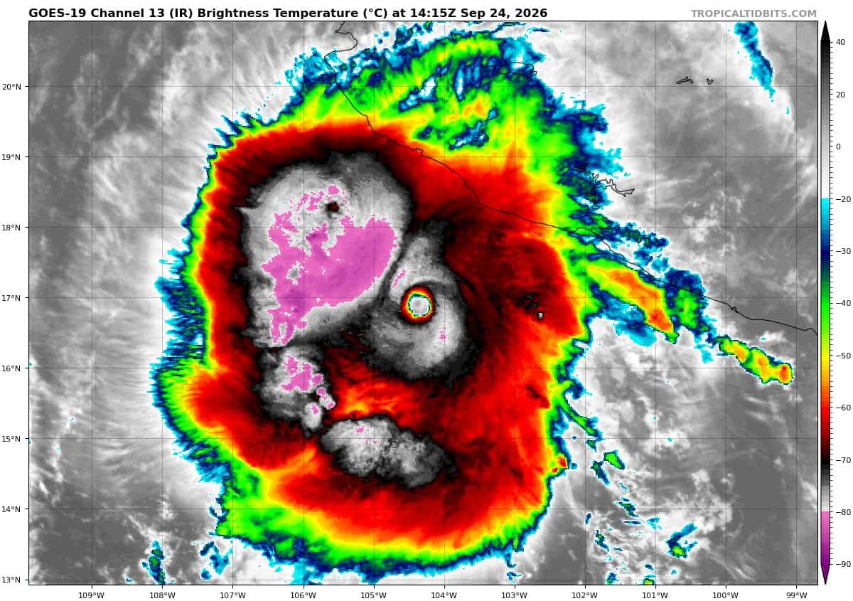
Polo is moving toward the west-northwest near 10 mph. A turn toward the west is expected later today and Friday, followed by a west- northwestward motion on Saturday. On the forecast track, the core of Polo is expected to move away from the coast of southwestern Mexico today. Maximum sustained winds are near 155 mph with higher gusts. Polo is a category 4 hurricane on the Saffir-Simpson Hurricane Wind Scale. Some fluctuations in strength are possible during the next couple of days. Hurricane-force winds extend outward up to 40 miles from the center and tropical-storm-force winds extend outward up to 125 miles. The estimated minimum central pressure is 928 mb (27.41 inches).
HAZARDS AFFECTING LAND
WIND: Tropical storm conditions are occurring along the coast of Mexico in the warning area and should continue for a few more hours. Tropical storm conditions are possible within the watch area along the coast of Mexico during the next several hours.
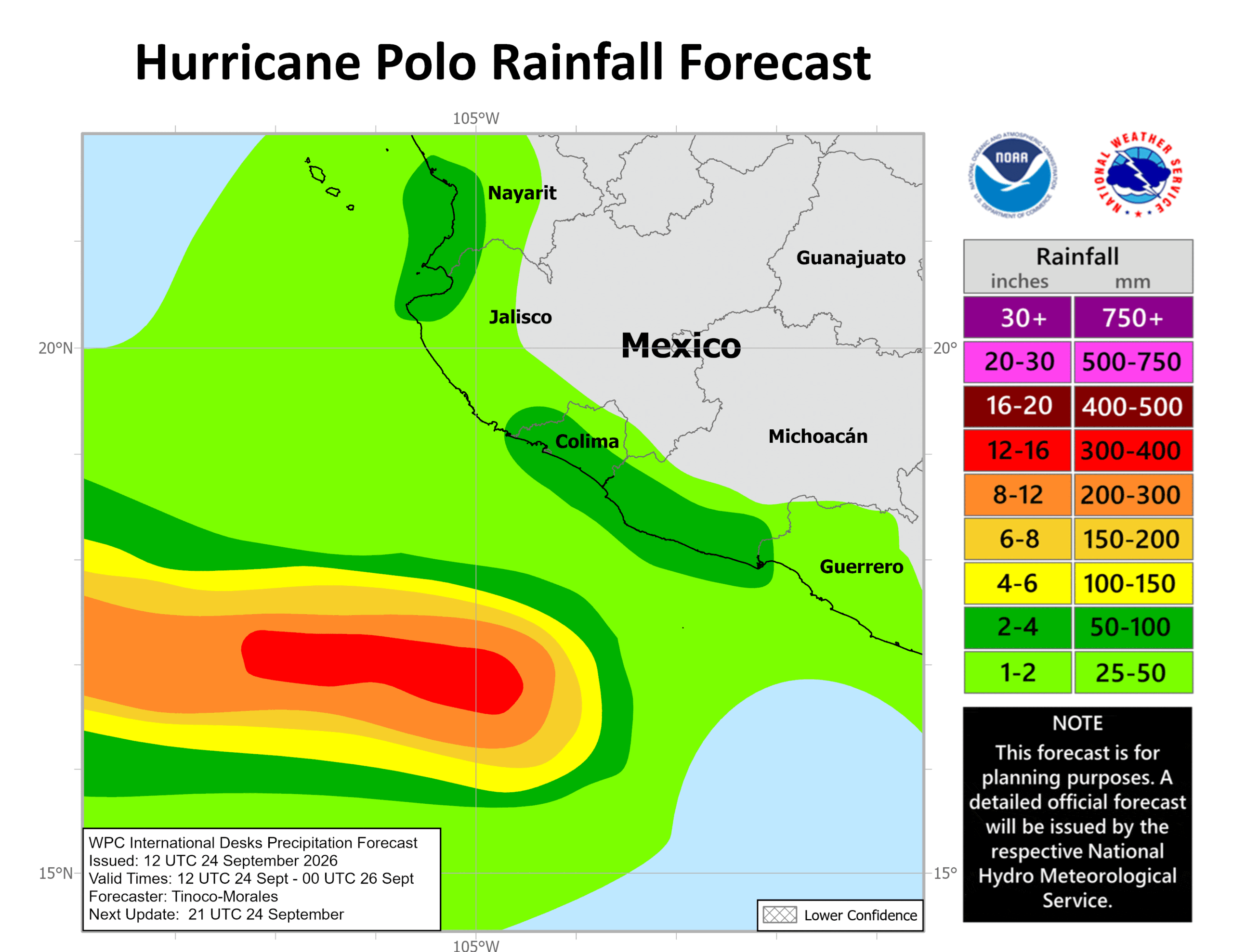
RAINFALL: Polo is expected to produce additional rainfall totals of 2 to 4 inches, with isolated maximum totals up to 6 inches across coastal portions of the Mexican states of Michoacan, Colima, northern and southern Jalisco, and Nayarit. This rainfall may produce life-threatening flooding and mudslides, especially in areas of steep terrain. Additional rainfall of 1 to 2 inches is possible in coastal portions of the Mexican states of central Jalisco and Guerrero.
SURF: Swells generated by Polo will affect portions of the coast of southwestern Mexico during the next couple of days. Swells will spread northward along the coast of west-central Mexico and toward Baja California Sur on Friday and into the weekend. These swells are likely to cause life-threatening surf, rip currents, and coastal flooding.
>>> South of the Gulf of Tehuantepec:
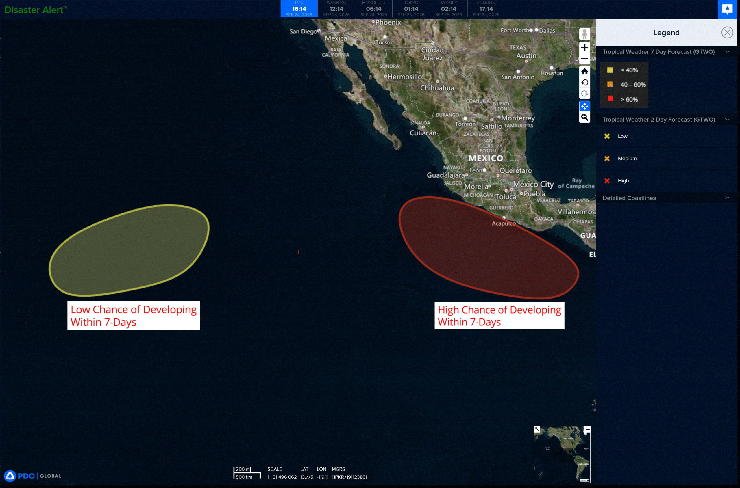
An area of low pressure is expected to form in a couple of days to the south of the Gulf of Tehuantepec. Afterwards, environmental conditions should be favorable for gradual development, and a tropical depression is likely to form early next week as the system moves slowly west-northwestward to northwestward, parallel to the coast of southern and southwestern Mexico.
* Formation chance through 48 hours…low…near 0 percent
* Formation chance through 7 days…high…80 percent
>>> Well East-Southeast of the Hawaiian Islands:
An area of low pressure could form about 1000 miles east-southeast of the Hawaiian Islands over the weekend. Environmental conditions could support some gradual development of this system thereafter as it moves generally northeastward, remaining well east-southeast of the Hawaiian Islands.
* Formation chance through 48 hours…low…near 0 percent
* Formation chance through 7 days…low…30 percent
Central North Pacific:
Tropical Cyclone 15E (Nolo)
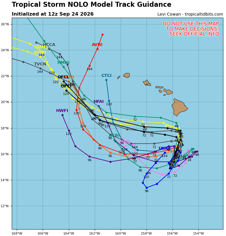
TROPICAL STORM NOLO HOLDING STEADY AND IS EXPECTED TO TURN NORTHWARD TONIGHT…HURRICANE WATCH REMAINS IN EFFECT FOR HAWAII COUNTY
According to the NHC advisory number 16
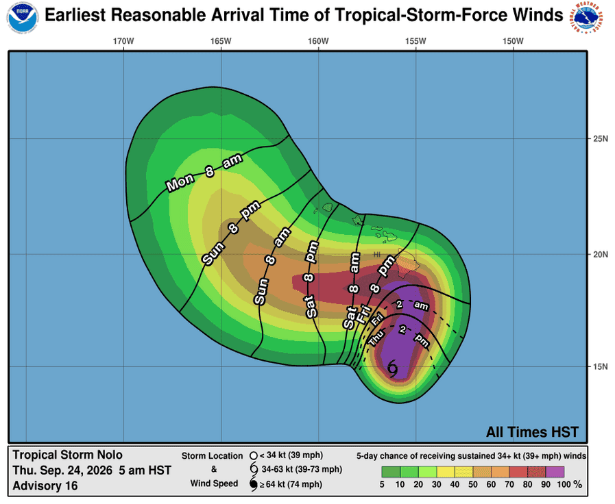
Nolo is moving toward the west-northwest near 6 mph. A sharp turn to the north and north-northeast is expected late tonight, with this motion continuing through the end of the week. On the forecast track, the system is expected to approach the Big Island of Hawaii on Friday and Saturday. Maximum sustained winds are near 45 mph with higher gusts. Nolo is forecast to become a hurricane by Thursday night and could become a major hurricane by the weekend. Tropical-storm-force winds extend outward up to 80 miles from the center. The estimated minimum central pressure is 1002 mb (29.59 inches).
HAZARDS AFFECTING LAND WIND:
WIND: Hurricane conditions are possible in the watch area starting as early as Friday night.
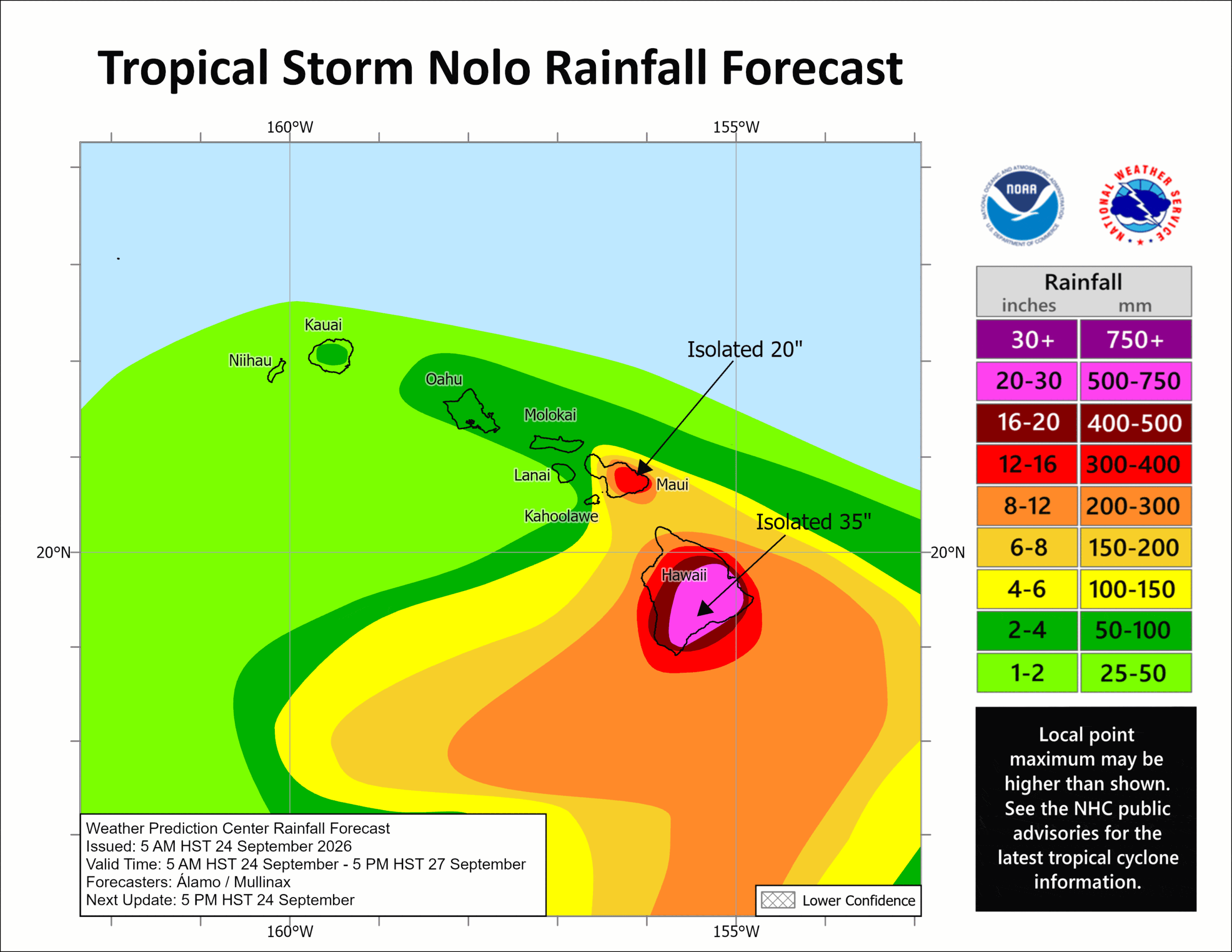
RAINFALL: For the Big Island, Nolo will produce rainfall totals of 15 to 20 inches with maximum amounts of 35 inches. This rainfall could produce catastrophic life-threatening flooding and mudslides, especially in areas of steep terrain.
For Maui, rainfall totals of 5 to 10 inches with maximum amounts of 20 inches are expected. Life-threatening flooding and mudslides are possible, especially in areas of high terrain. Across the remainder of the Hawaiian Islands, rainfall totals of 1 to 3 inches with maximum amounts of 6 inches are expected with isolated flooding possible.
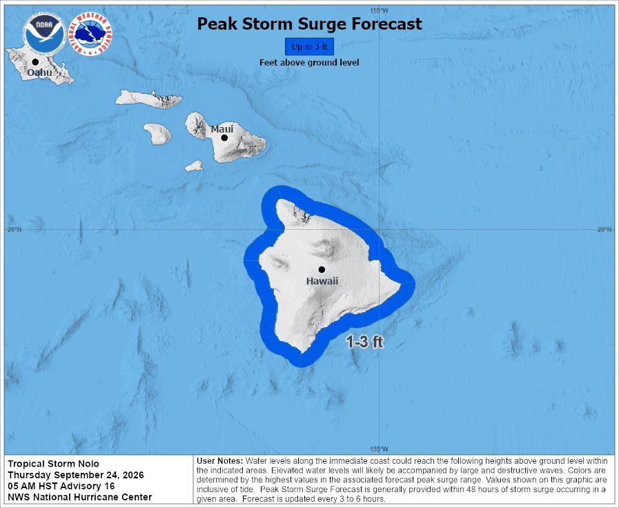
STORM SURGE: The combination of a dangerous storm surge and the tide will cause normally dry areas near the coast to be flooded by rising waters moving inland from the shoreline. The water could reach the following heights above ground somewhere in the indicated areas if the peak surge occurs at the time of high tide…
Hawaii County…1 to 3 ft
The deepest water will occur along the immediate coast near and to the right of the landfall location, where the surge will be accompanied by large and dangerous waves. Surge-related flooding depends on the relative timing of the surge and the tidal cycle, and can vary greatly over short distances.
SURF: Swells generated by Nolo are expected to reach exposed east and south-facing shores of the Big Island by Friday, spreading westward and building through the weekend. These swells are likely to cause life-threatening surf and rip current conditions.
Western Pacific, Indian Ocean, and adjacent Seas:
Western Pacific
Tropical Cyclone 25W (Surigae)
According to the JTWC warning number 6…sustained winds were 40 knots with gusts to 50 knots
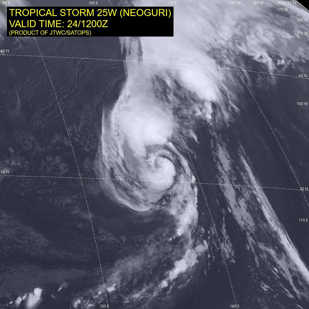
Animated shortwave infrared (swir) and proxy visible (proxyvis) satellite imagery depicts a fully exposed low level circulation
center (llcc) displaced to the southeast of an area of robust convection and mid-level rotation. A 240912z wsf-m color-enhanced
89ghz microwave image was the first piece of data to reveal the onset of rapid vortex decoupling, with the llcc having emerged from the southeastern edge of the convective mass.
A 241212z ascat-b pass provided additional evidence that the vortex had by the 1200z hour, completely decoupled and become exposed, though still under thin cirrus, under the influence of moderate to high southerly vertical wind shear. The ascat data also depicted a much weaker wind field than expected, with maximum winds of 40 knots to the north under the convection, and the bulk of the winds being 30-35 knots. The wind field remains highly asymmetric as well, with maximum winds across the southern portion of the circulation restricted to just 15-20 knots.
Environmental conditions are marginally favorable, characterized by very warm ssts, high ohc, and moderate poleward outflow offset by moderate to strong southerly shear, dry air entrainment and significant vortex decoupling.
Tropical storm 25W has been relocated based on recent microwave and scatterometer data which definitively established that the system vortex has fully decoupled. This has resulted in a slightly more west-northwestward track, but more importantly has slowed the track speed by nearly half, from 16 knots to 9 knots. The mid-level vortex is embedded within the central dense overcast (cdo) feature to the northwest of the llcc.
While the system has decoupled, the overall synoptic steering pattern has not changed and the forecast calls for 25W to continue tracking northwestward for the next 36 hours at a steady 9-10 knots. By 36 hours, the system will begin to decelerate as it approaches a break in the ridge and reaches the ridge axis by 48 hours. However, ridge axis in this case is loosely defined as the str itself is extended along the north-south axis, with a very large col region between it and a secondary ridge center over southern China. So while 25W will move into the col region and begin to recurve after 48 hours, track speeds will remain slow through 96 hours as it will remain under the influence of a relatively weak steering gradient.
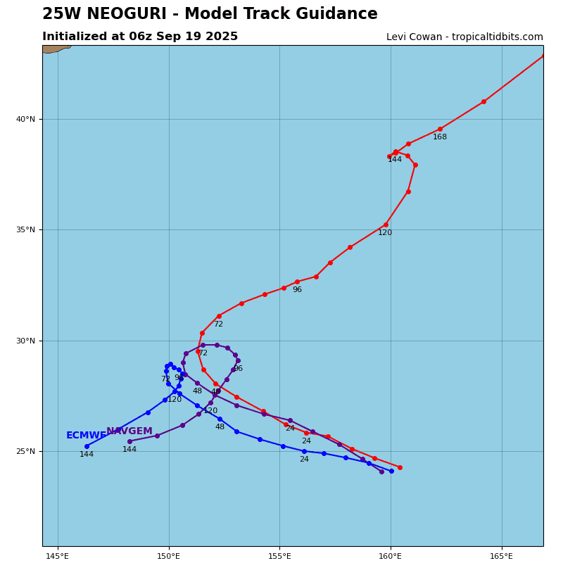
The JTWC forecast calls for the system to be pulled northward by two factors; firstly the str shifts north and east and second, the passage of a mid-latitude trough to the north. By 120 hours, 25W will begin to accelerate northeastward as it starts its recurve. There remains considerable uncertainty in the forecast, especially after 48 hours, when the system moves into the weak steering pattern associated with the col region. The key determinant in whether 25W recurves or not will be the strength of
the trough to the north. The ecmwf and AI models show a slightly deeper trough, with enough support to pull 25W poleward and the JTWC forecast is based on this scenario.
The alternate scenario, as depicted by the gfs and to varying degrees by all of the other deterministic models except ecmwf, shows a weaker trough with limited dynamic support, insufficient to bring 25wW poleward, resulting in 25W becoming quasi-stationary in the vicinity of the southern Ryukyus by 120 hours.
Regarding intensity, the system has weakened due to the vortex decoupling brought on by persistent southerly shear. Global models are in agreement that shear will abate over the next 24 hours, and the system will gradually achieve vortex alignment once the shear decreases. Assuming 25W achieves axisymmetrization by 36 hours, it should rapidly intensify (ri) between 36 hours and 60 hours to a peak of 100 knots. Upon commencing its recurve, 25W will gradually weaken through the end of the
forecast period under deteriorating environmental conditions of increased shear and dry air entrainment. However, the intensity
forecast is highly dependent upon the track forecast and in the alternate scenario, 25W will likely achieve a higher peak intensity
roughly 24 hours later.
North Indian Ocean
Tropical Cyclone 01B – Final Warning
According to the JTWC warning number 6…sustained winds were 35 knots with gusts to 45 knots
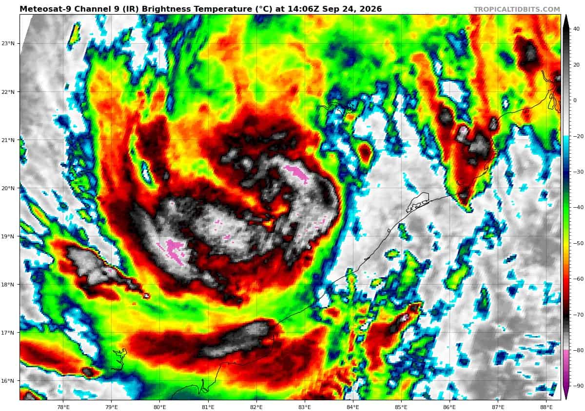
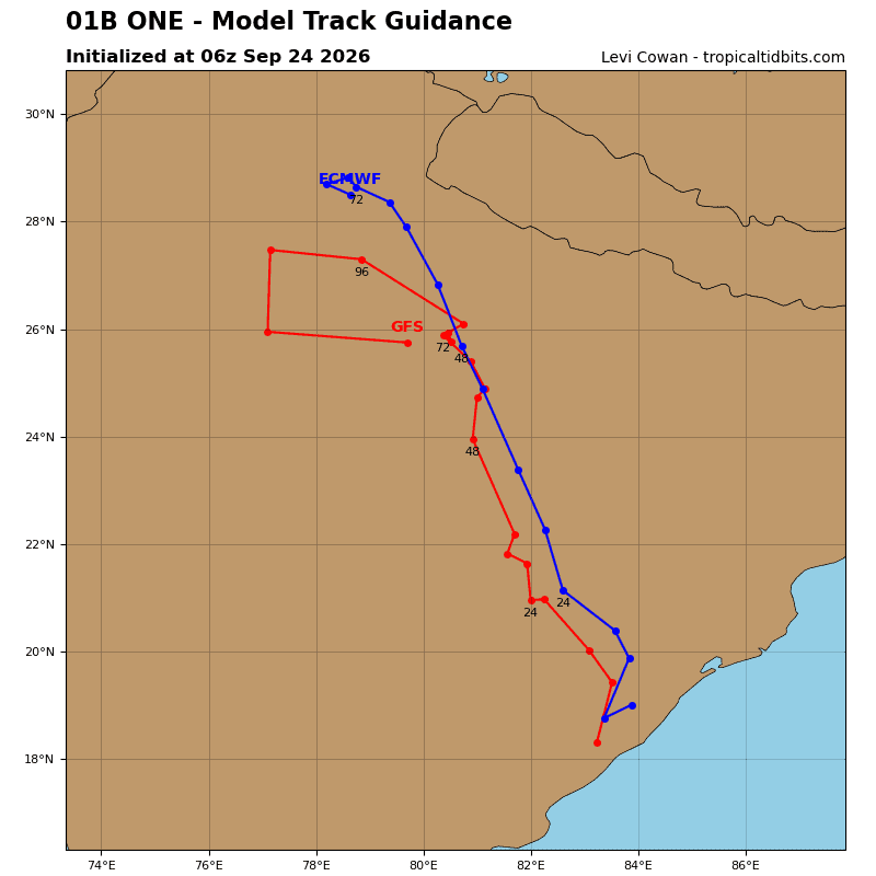
Radar imagery confirms that the low-level circulation center has made landfall between Srikakulam and Vizianagaram. Animated enhanced infrared imagery depicts the deep convection that had been persistent is now shrinking, indicating that the system is on a weakening trend. The llcc will continue to track inland on a north-northwestward trajectory, with dissipation predicted by 24 hours.