

Current Snapshot
For all the latest updates visit: DisasterAWARE
1800x1080e
2e
231444_earliest_reasonable_toa_34O
16E_tracks_latest
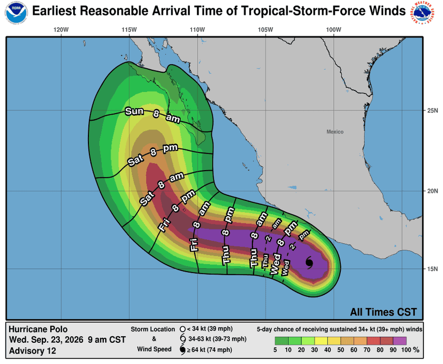
231443_earliest_reasonable_toa_34P
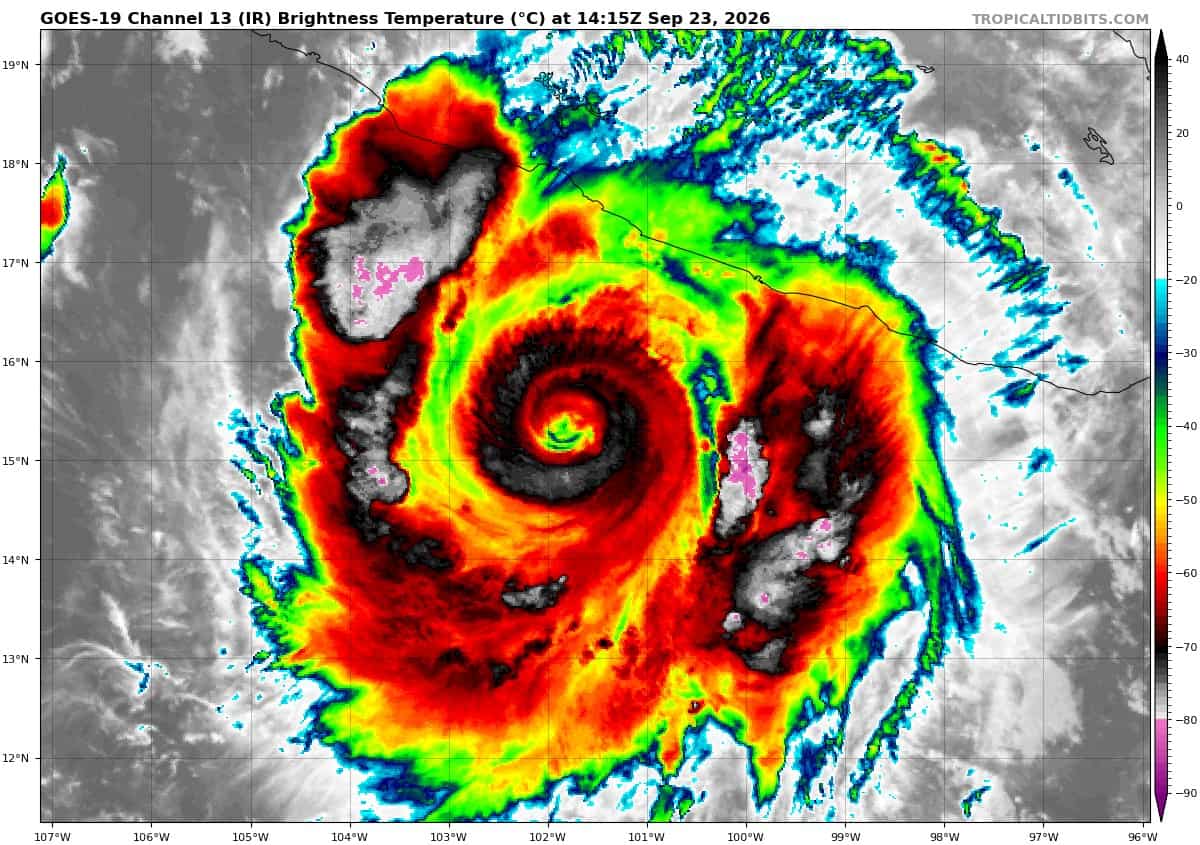
goes19_ir_17E_202609231415_lat15.2-lon-101.5
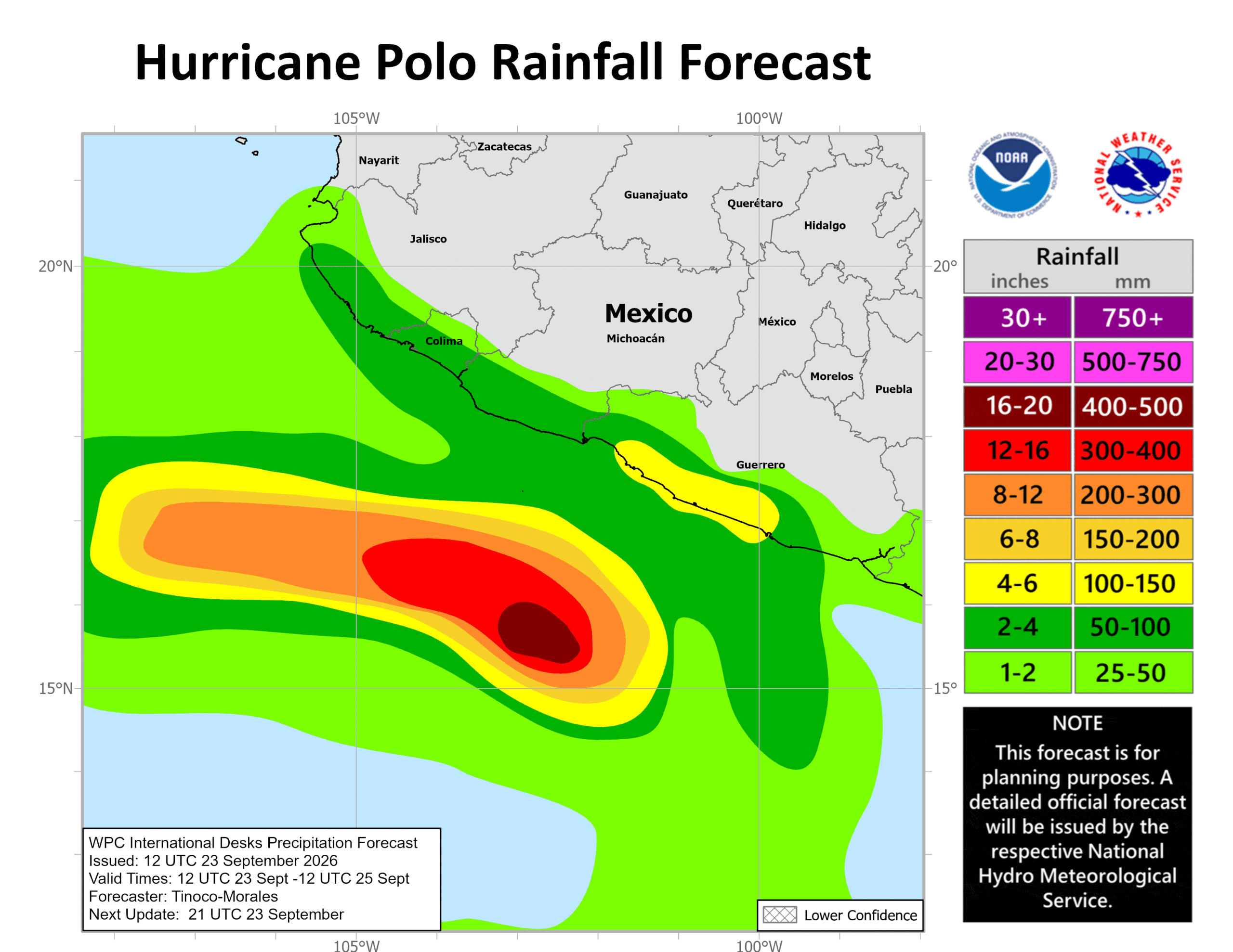
231443INTQPF_sm
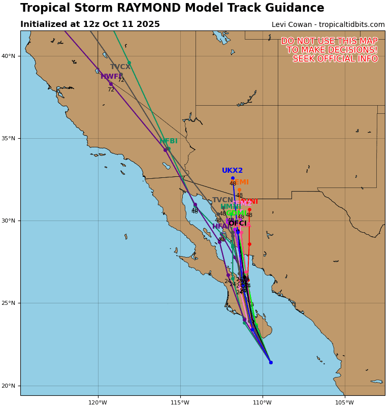
17E_tracks_latest
7e
1800x1080ec
15e
231448_earliest_reasonable_toa_34
goes18_ir_15E_202609231415_lat14.4-lon-154.3
231448WPCQPF_sm
15E_tracks_latest
sur
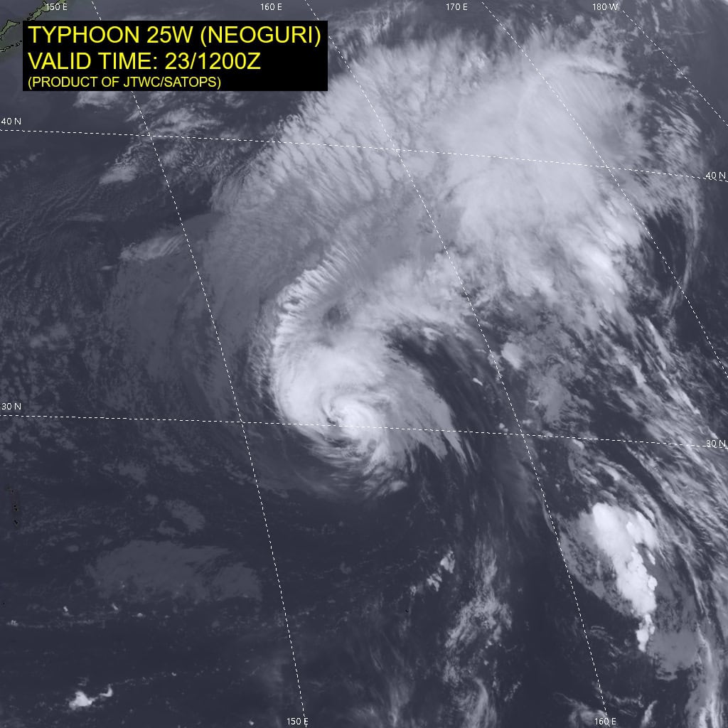
25W_231200sair
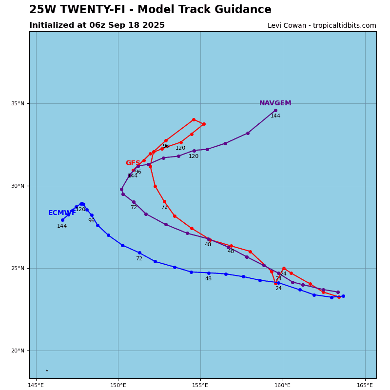
25W_tracks_latest
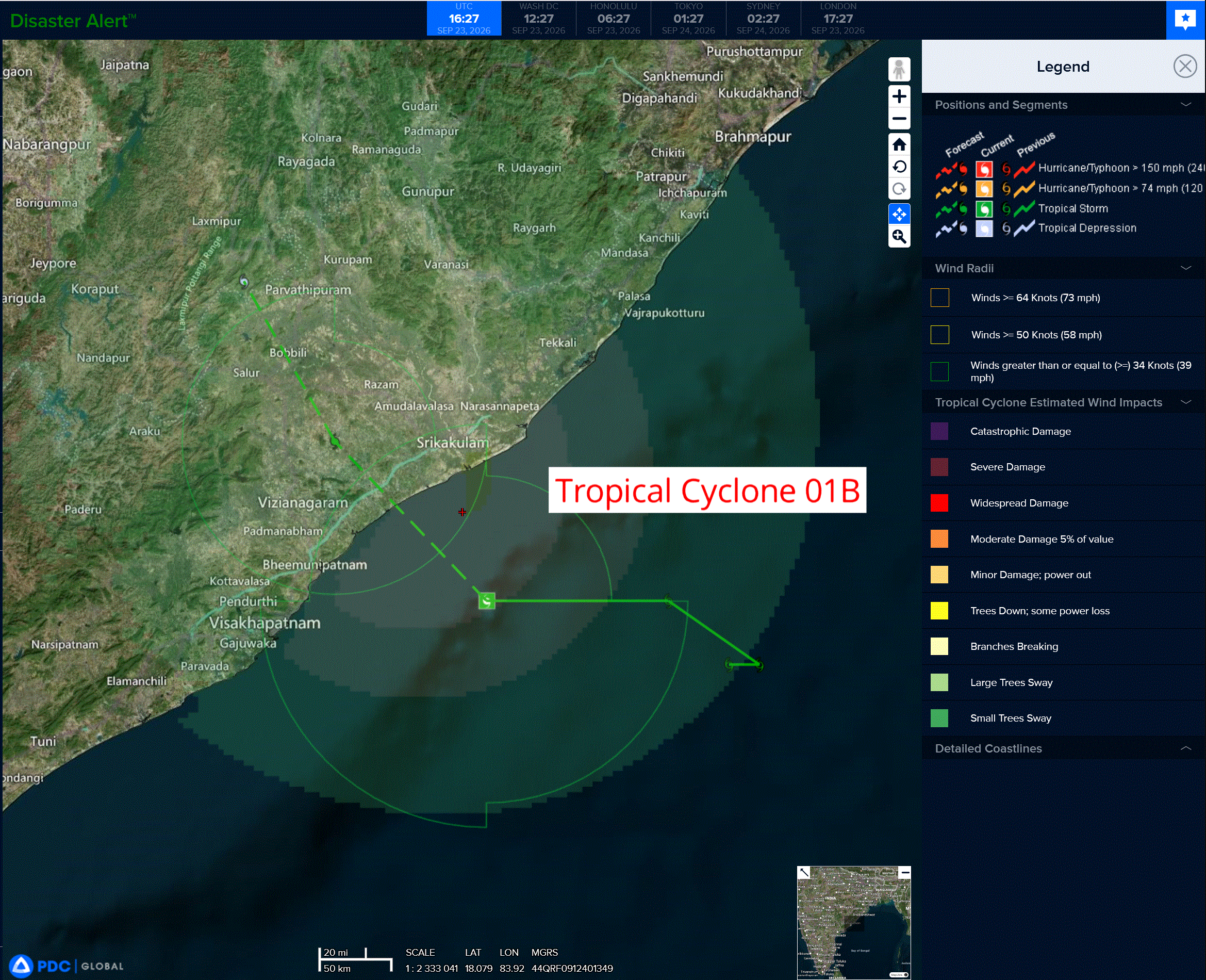
01b
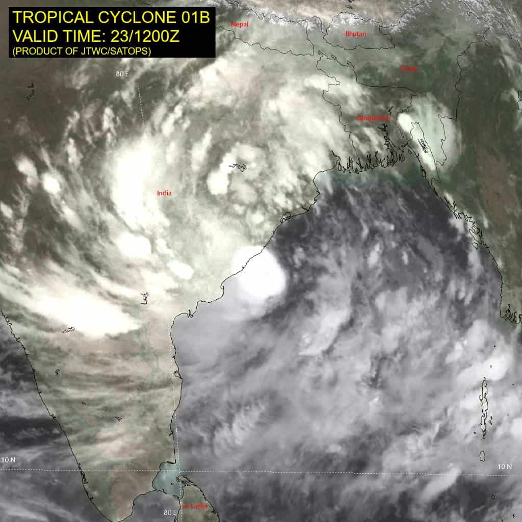
01B_231200sair
01B_tracks_latest
By PDC’s Senior Weather
Specialist Glenn James

The Pacific Disaster Center’s (PDC Global) Wednesday, September 23, 2026, Tropical Cyclone Activity Report…for the Pacific Ocean, the Indian Ocean, and adjacent Seas.
Tropical Cyclones
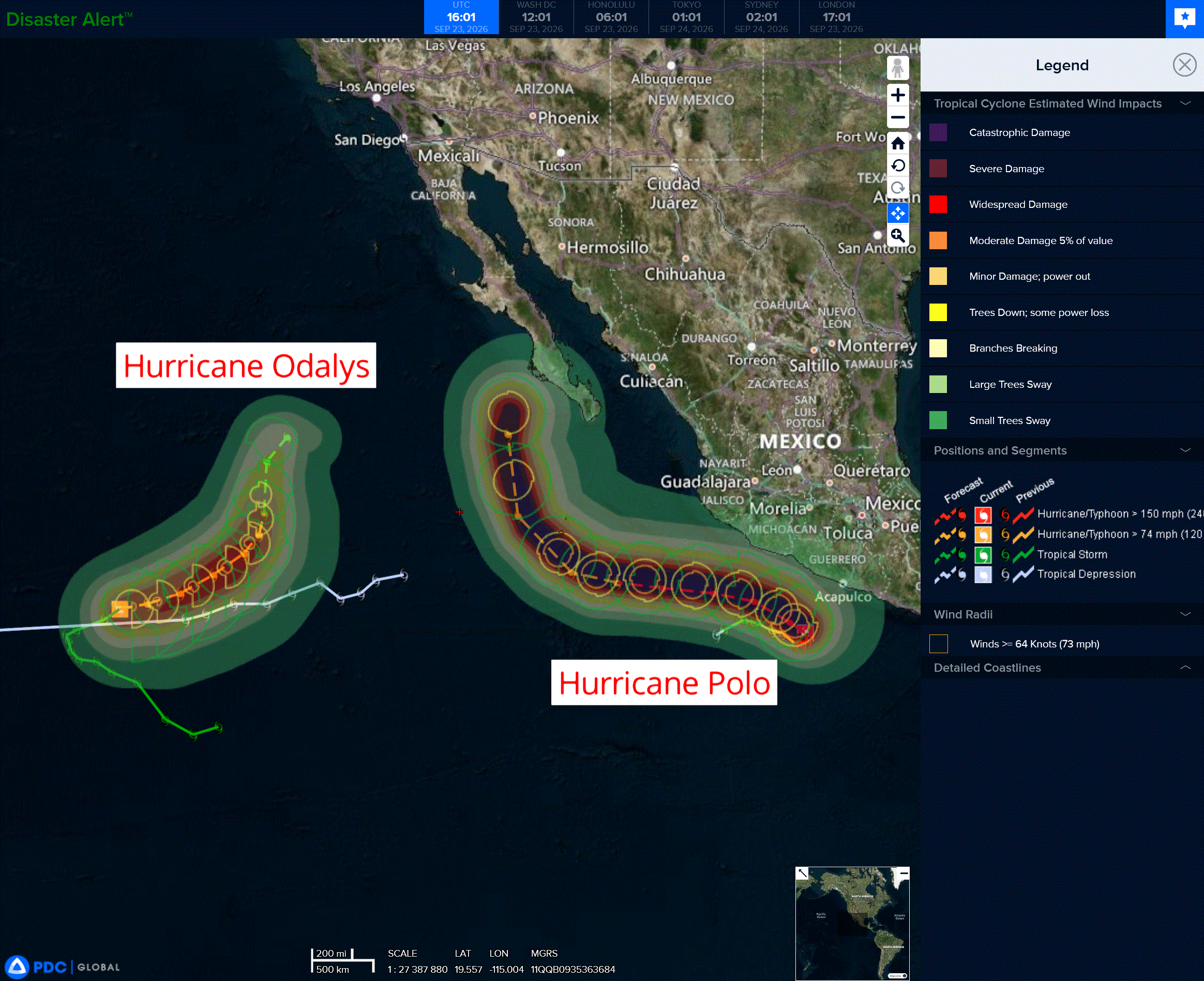
Tropical Cyclone 16E (Odalys) is located about 1265 miles west-southwest of the southern tip of Baja California
Tropical Cyclone 17E (Polo) is located about 300 miles southeast of Manzanillo, Mexico
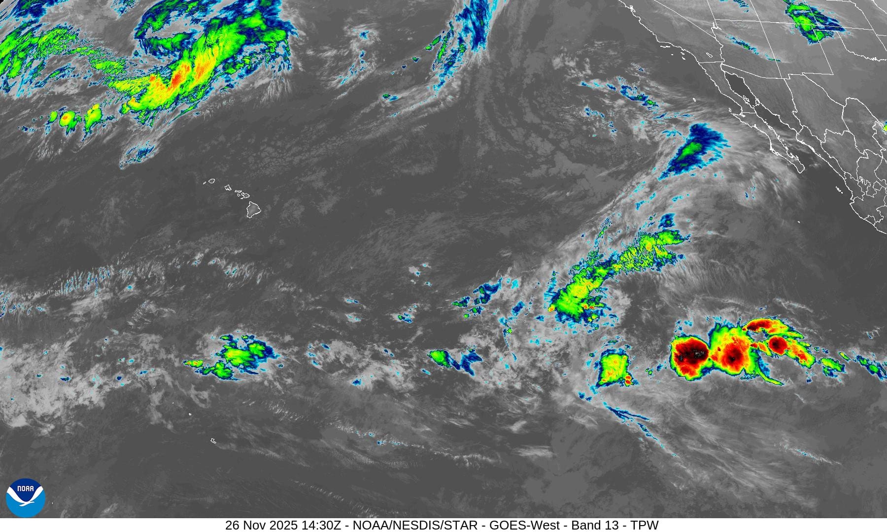
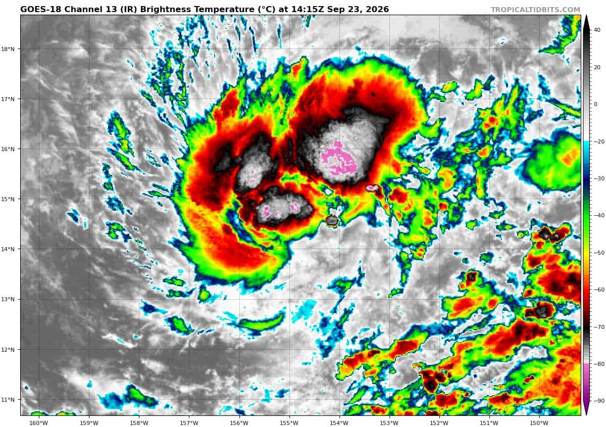
Tropical Cyclone 15E is located about 320 miles south-southeast of Hilo, Hawaii
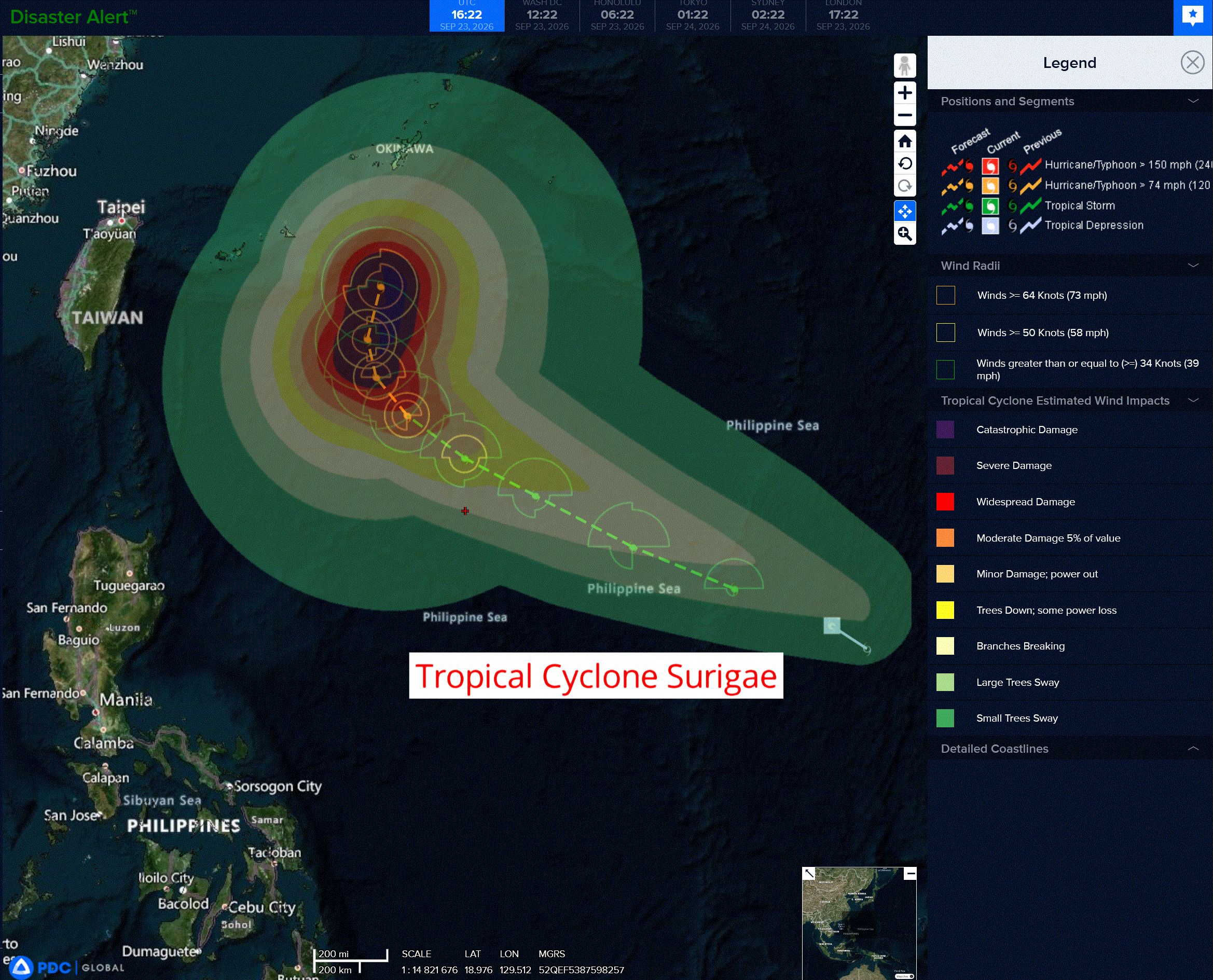
Tropical Cyclone 25W (Surigae) is located approximately 413 NM north-northwest of Ulithi
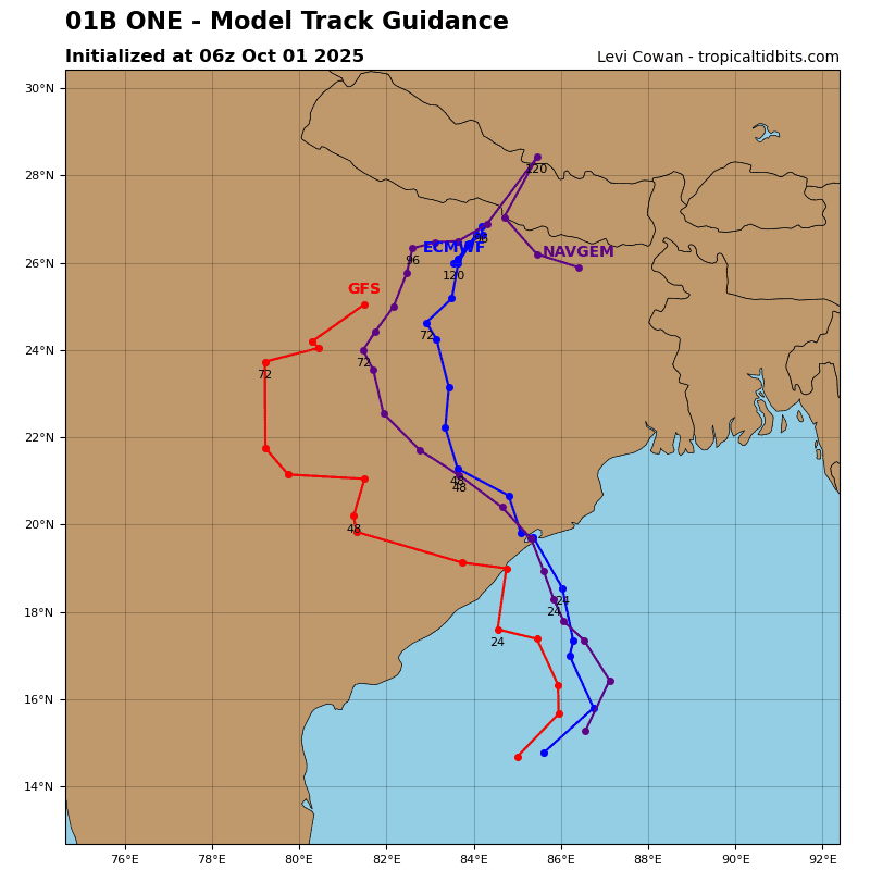
Tropical Cyclone 01B is located approximately 380 NM southwest of Kolkata, India
Northeast Pacific:
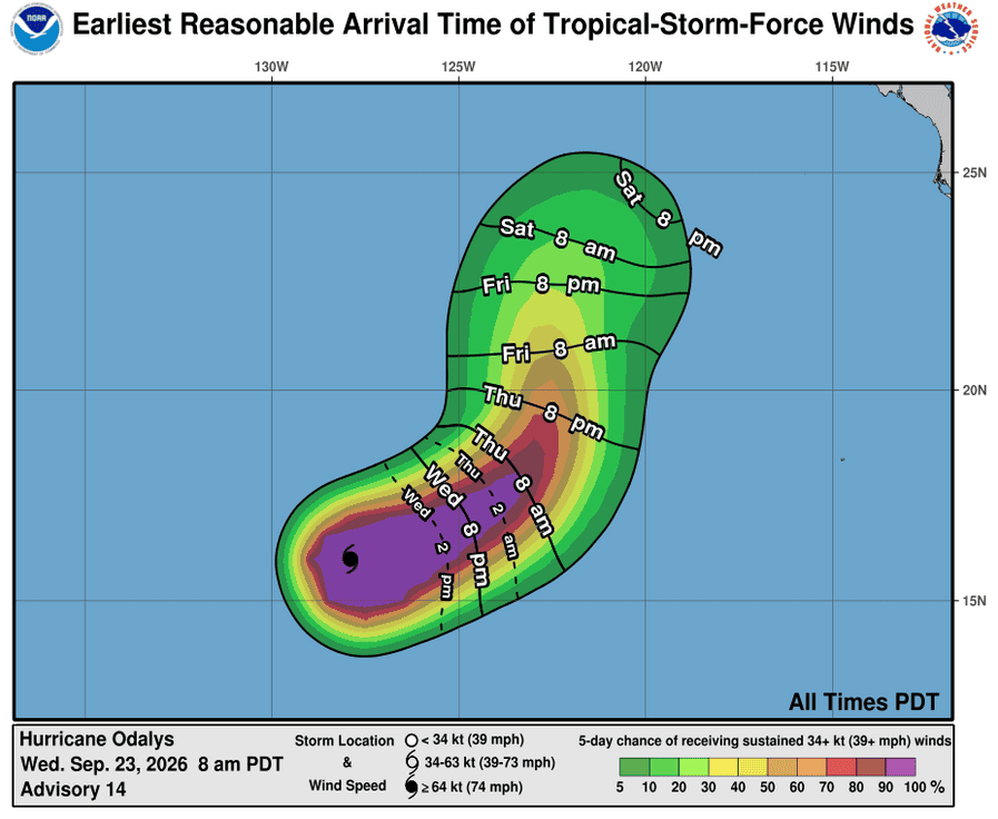
Tropical cyclone 16E (Odalys)
ODALYS MAINTAINING ITS INTENSITY
According to the NHC advisory number 14
Odalys is moving toward the east-northeast near 8 mph (13 km/h). An eastward to east-northeastward motion at a slightly slower speed is expected for the next couple of days, followed by a gradual turn toward the northeast then north later this week.
Maximum sustained winds are near 75 mph (120 km/h) with higher gusts. Additional strengthening is expected during the next day or two, followed by a weakening trend late this week.
Hurricane-force winds extend outward up to 10 miles (20 km) from the center and tropical-storm-force winds extend outward up to 150 miles (240 km).
Tropical cyclone 17E (Polo)
POLO NOW MOVING SLOWLY NORTHWESTWARD
According to the NHC advisory number 12
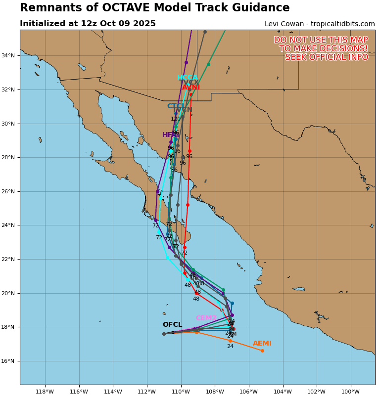
Polo is now moving toward the northwest near 5 mph (7 km/h), and this motion is expected to continue through Thursday. A general west-northwestward motion is forecast on Friday and over the weekend. On the forecast track, the core of Polo is expected to be near the coast of southwestern Mexico during the next day or two, although it is forecast to remain offshore.
Maximum sustained winds are near 150 mph (240 km/h) with higher gusts. Polo is a category 4 hurricane on the Saffir-Simpson Hurricane Wind Scale. Fluctuations in intensity are expected, but Polo is expected to remain a very powerful major hurricane during the next few days.
Hurricane-force winds extend outward up to 40 miles (65 km) from the center and tropical-storm-force winds extend outward up to 105 miles (165 km). The estimated minimum central pressure is 927 mb (27.38 inches).
HAZARDS AFFECTING LAND
WIND: Tropical storm conditions are expected within the warning area along the coast of Mexico later today. Tropical storm conditions are possible within the watch area along the coast of Mexico on Thursday.
RAINFALL: Polo is expected to produce rainfall totals of 4 to 6 inches, with isolated maximum totals up to 8 inches across coastal portions of the Mexican state of Guerrero through Thursday. This rainfall may produce life-threatening flooding and mudslides, especially in areas of steep terrain. Rainfall of 2 to 4 inches is possible in coastal portions of the Mexican states of Michoacan, Colima, and Jalisco through Thursday.
SURF: Swells generated by Polo are expected to affect portions of the coast of southwestern Mexico during the next few days. These swells are likely to cause life-threatening surf, rip current conditions, and coastal flooding.
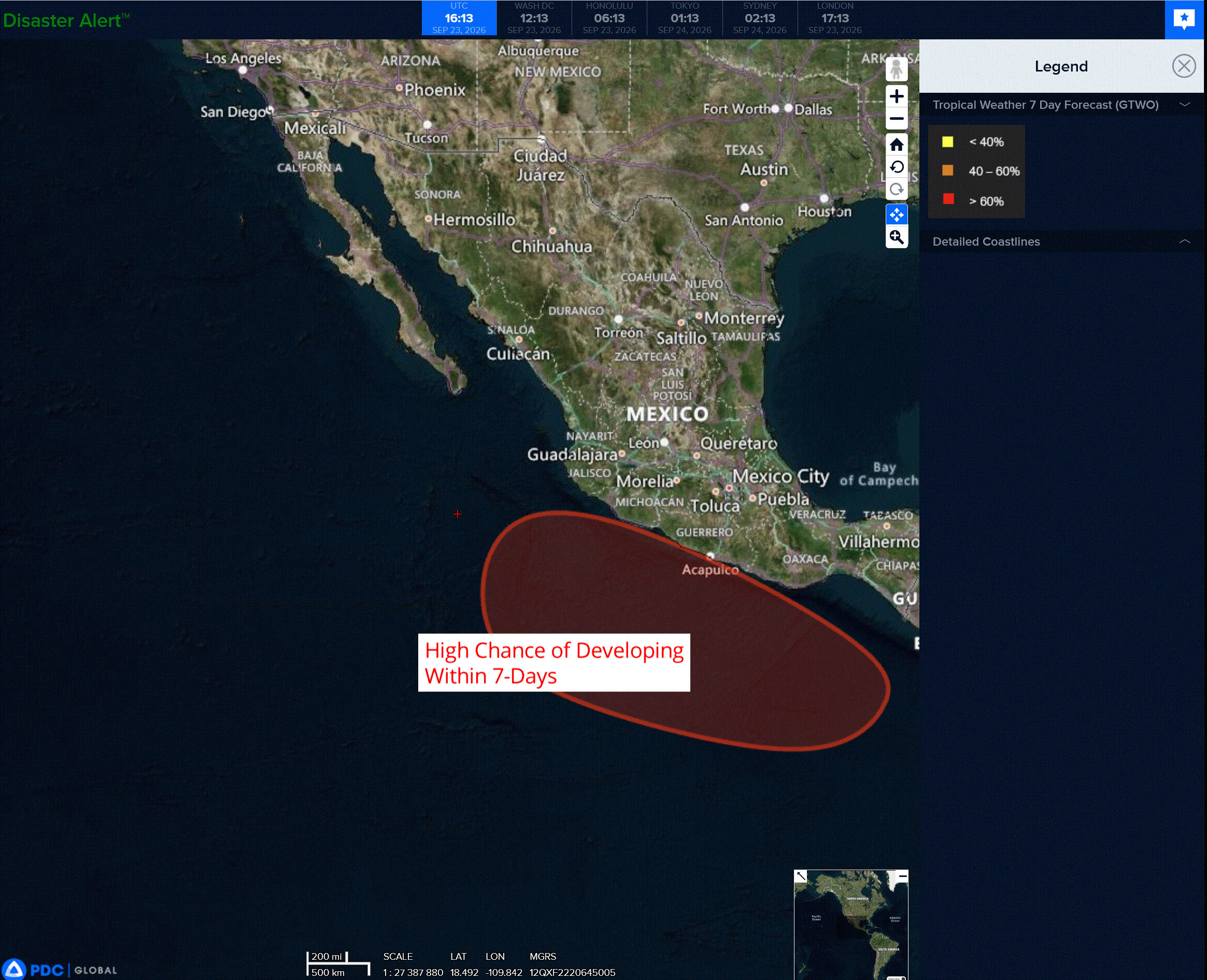
>>> South of the Gulf of Tehuantepec:
An area of low pressure is expected to form in a couple of days to the south of the Gulf of Tehuantepec.
Afterwards, environmental conditions should be favorable for gradual development, and a tropical depression is likely to form late this week or this weekend as the system moves slowly west-northwestward to northwestward, parallel to the coast of southern and southwestern Mexico.
* Formation chance through 48 hours…low…near 0 percent
* Formation chance through 7 days…high…80 percent
Central North Pacific:
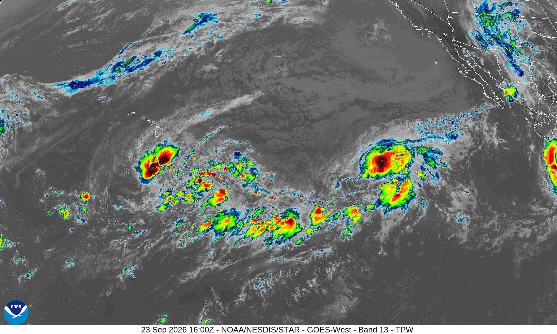
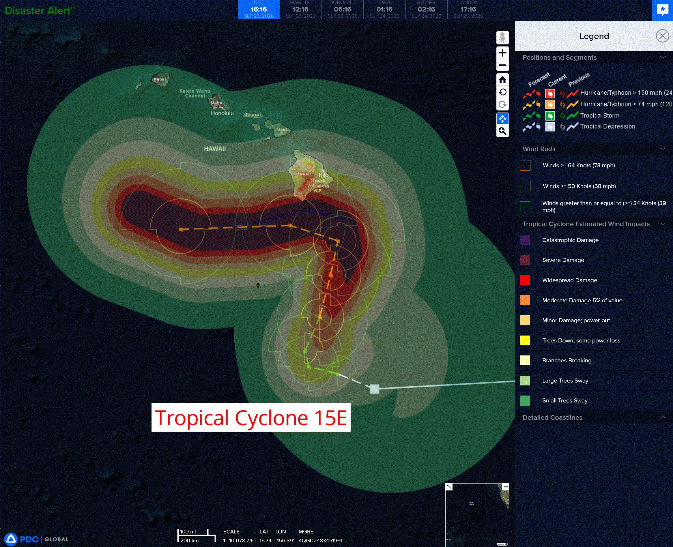
Tropical Cyclone 15E is located about 320 south of South Point, Hawaii
INTERESTS IN THE HAWAIIAN ISLANDS SHOULD CLOSELY MONITOR THE PROGRESS OF THIS SYSTEM
According to the NHC advisory number 12
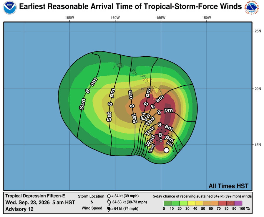
The depression is moving toward the west-northwest near 6 mph, and this motion is expected for the next day or so. A sharp turn to the north and north-northeast is expected on Thursday, with this motion continuing through the end of the week. On the forecast track, the system is expected to approach the Big Island of Hawaii on Friday and Saturday.
Maximum sustained winds remain near 35 mph with higher gusts. The system is expected to become a tropical storm later today, with further strengthening to a hurricane likely on Thursday and possibly a major hurricane by this weekend.
The estimated minimum central pressure is 1004 mb (29.65 inches).
HAZARDS AFFECTING LAND WIND:
There is an increasing risk of wind impacts in the Hawaiian Islands regardless of the exact track of this system.
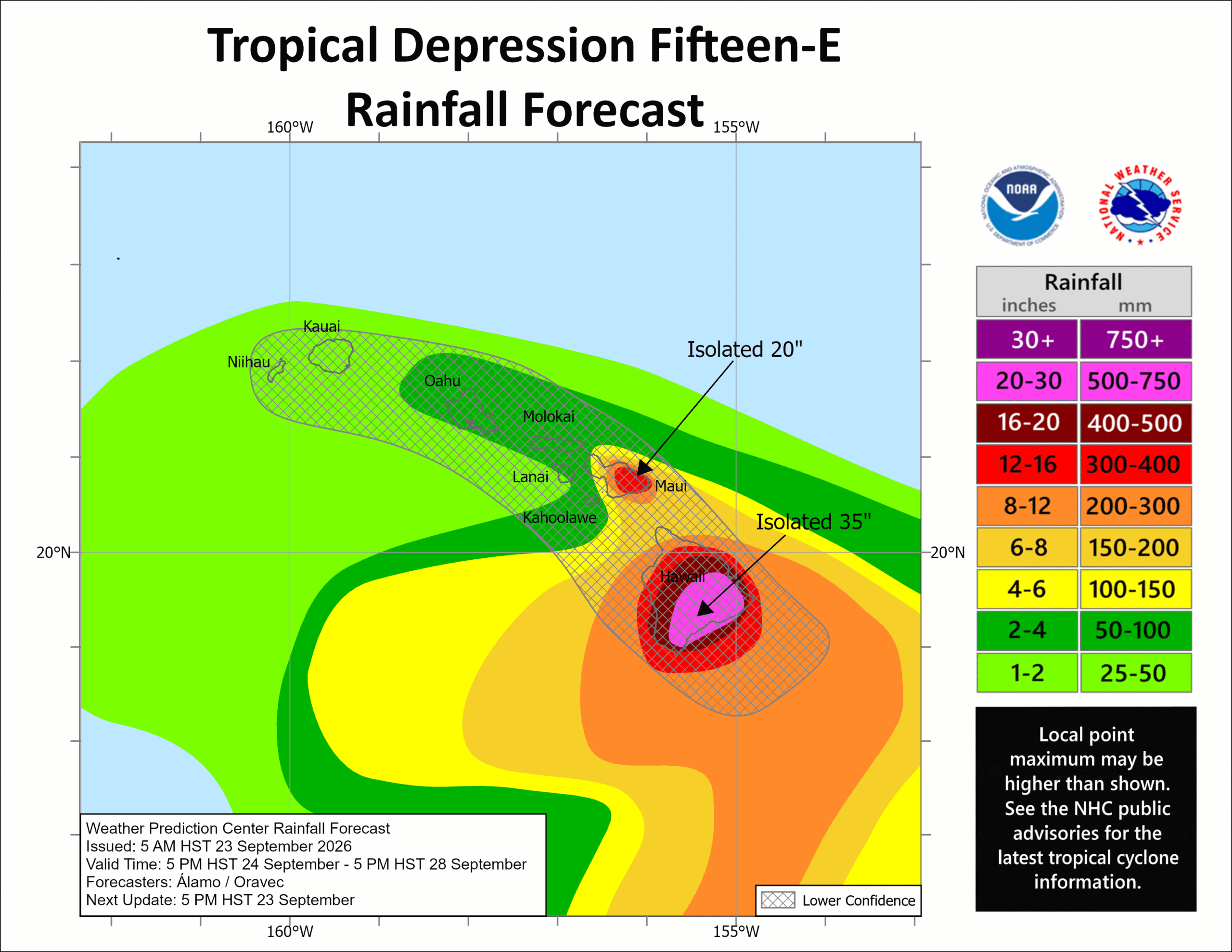
RAINFALL: Tropical Depression 15E will produce rainfall totals of 15 to 20 inches across the Big Island with maximum amounts of 35 inches. This rainfall may produce catastrophic life-threatening flooding and mudslides, especially in areas of steep terrain. Rainfall totals of 5 to 10 inches with maximum amounts of 20 inches expected across Maui. Life-threatening flooding and mudslides possible across Maui, especially in areas of high terrain, Across the remainder of the Hawaiian Islands, rainfall totals of 1 to 3 inches with maximum amounts of 6 inches are expected with isolated flooding possible.
SURF: Swells generated by Tropical Depression 15E are expected to reach the east and south-facing shores of the Big Island on Friday, spreading westward and building through the weekend. These swells are likely to cause life-threatening surf and rip current conditions.
Western Pacific, Indian Ocean, and adjacent Seas:
Western Pacific
Tropical Cyclone 25W (Surigae)
According to the JTWC warning number 2…sustained winds were 30 knots with gusts to 45 knots
Animated enhanced infrared (eir) satellite imagery depicts tropical depression 25W (Surigae) as a completely obscured low-level circulation center with periphery low-level cloud banding visible from under the expanding canopy. The 231101z partial ascat pass
reveals the eastern semicircle and an asymmetric wind field. the highest 30 kt wind speeds are a respectably sized swath confined to the northeastern quadrant, while the southeastern quadrant is relegated to a small strip of 15-20 kt winds.
Environmental analysis reveals a highly favorable environment, characterized by low (10-15 kts) vertical wind shear (vws), very warm (29-30 c) sea surface temperatures (sst), high (100-120 kj per cm squared) ocean heat content (ohc), strong poleward outflow, and ample moisture throughout the air column.
TD 25W (Surigae) is forecast to continue tracking northwestward while it remains under the steering influence of the deep-layer str currently centered to its north-northeast. 25W is expected to maintain a relatively consistent track speed through 48-60 hours, at which point, the storm is forecast to slow slightly as it approaches a weakness between the steering ridge and a weaker mid-layer str currently centered over China.
Around 60-72 hours, Surigae will continue to slow its speed of advance and turn north-
northwestward into the weakness and begin to track around the southwestern periphery of the steering ridge towards the ridge axis. Between 72-96 hours, 25W is forecast to recurve about the steering ridge while tracking considerably slower. From 96 hours through the end of the forecast period, 25W will begin to accelerate to the north-northeast while the deep-layer str maintains steering authority over the system.
Regarding intensity, 25W is forecast to steadily intensify while it continues to consolidate through 48 hours. At that point, 25W may undergo a period of rapid intensification.
The environment is expected to be highly favorable through the entire forecast period,
especially between 48-96 hours. during that time, Surigae is expected to develop a robust poleward outflow channel, in addition to decreasing vws and slower track speeds over high ohc values. 25W is currently forecast to peak at 120 hours, with additional
intensification possible outside the forecast period.
North Indian Ocean
Tropical Cyclone 01B
According to the JTWC warning number 4…sustained winds were 45 knots with gusts to 55 knots
Animated enhanced infrared (eir) satellite imagery depicts tropical cyclone 01B completely obscured by mid and upper-level cloud coverage. Animated composite radar from the area reveals a compact and symmetrical circulation center tracking towards the Indian coast.
Environmental analysis reveals a marginal environment for development, characterized by warm (28-29 c) sea surface temperatures and moderate equatorward outflow, offset by land interaction and moderate to high vertical wind shear (vws).
TC 01B is forecast to continue tracking slowly northwestward while it remains in a weak steering environment on the outskirts of a mid-layer str centered far to the northeast. 01B is forecast to make landfall northeast of Visakhapatnam prior to 12 hours.
Regarding intensity, 01B is currently at its peak intensity, as the system approaches the coast and encounters increased land interaction that will prohibit further intensification. Dissipation over land is expected no later then 24 hours.