

Current Snapshot
For all the latest updates visit: DisasterAWARE
1800x1080e
lowe
7
goes18_ir_98E_202609181435_lat12.0-lon-118.0

98E_tracks_latest
goes18_ir_15E_202609181435_lat15.5-lon-136.0
15E_tracks_latest
1800x1080ec
dujuan
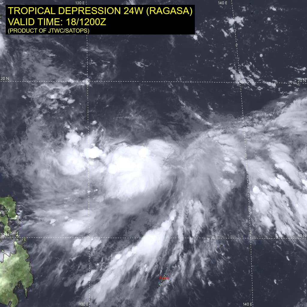
24W_181200sair
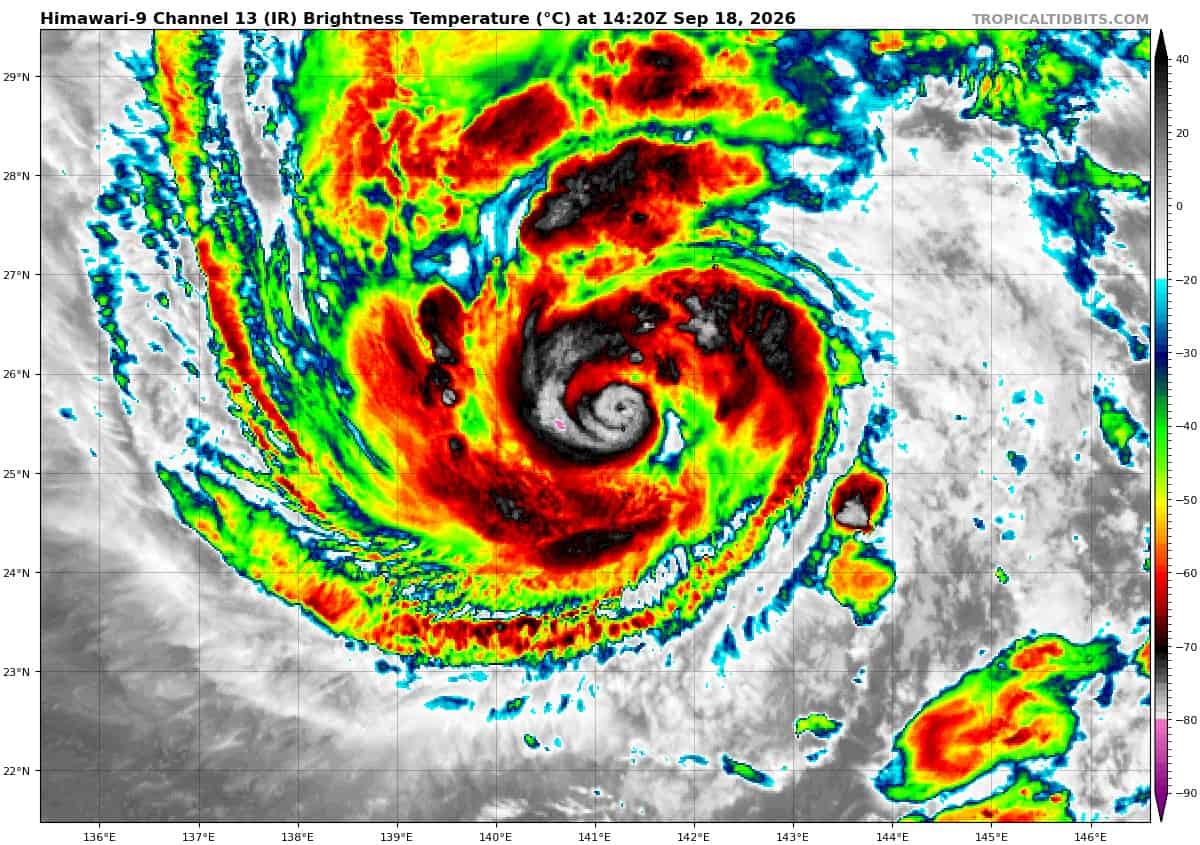
himawari9_ir_24W_202609181420_lat25.4-lon141.7

24W_tracks_latest
By PDC’s Senior Weather
Specialist Glenn James

The Pacific Disaster Center’s (PDC Global) Friday, September 18, 2026, Tropical Cyclone Activity Report…for the Pacific Ocean, the Indian Ocean, and adjacent Seas.
Tropical Cyclones
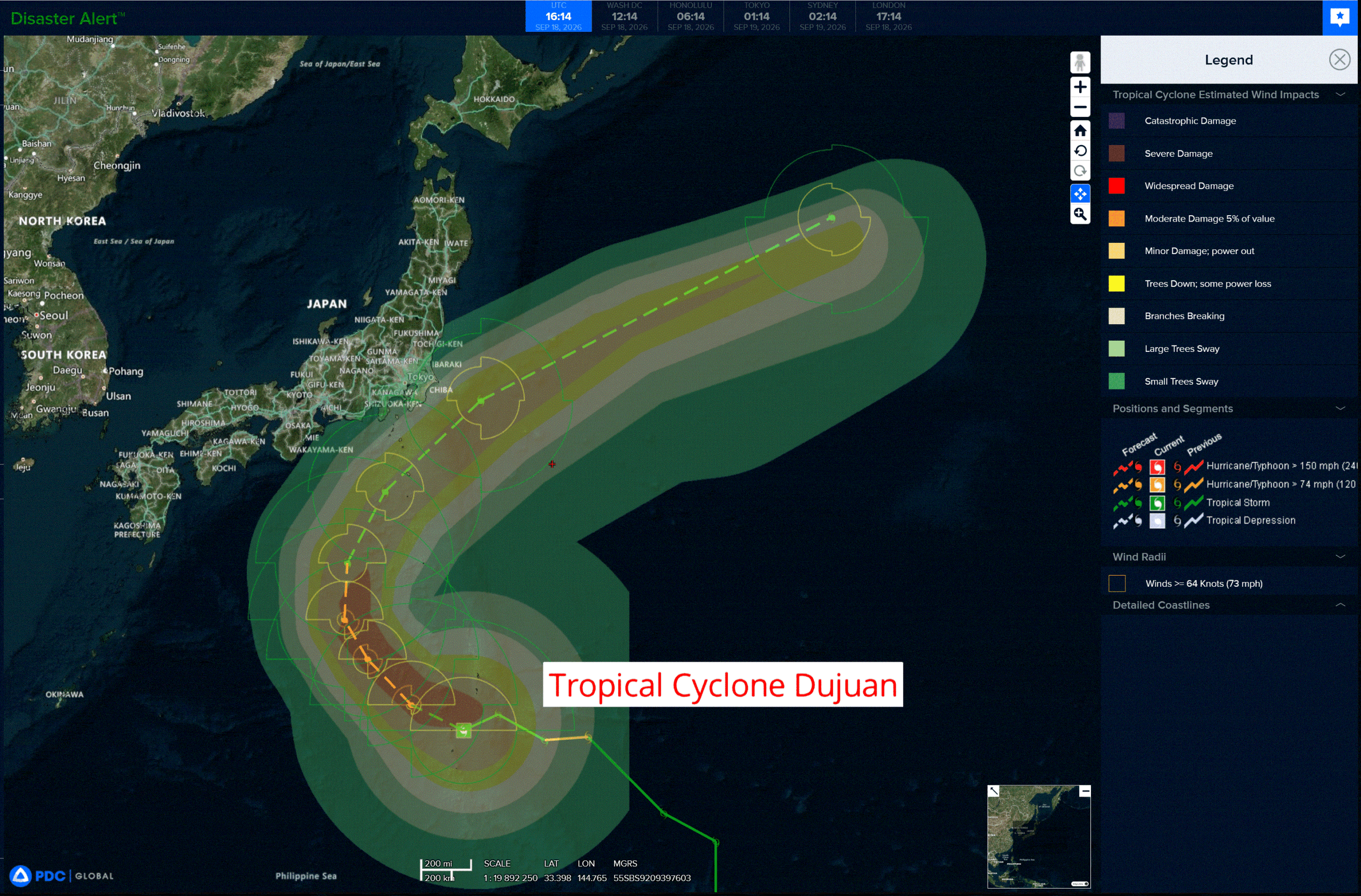
Tropical Cyclone 24W (Dujuan) is located about 42 NM north-northeast of Iwo-To
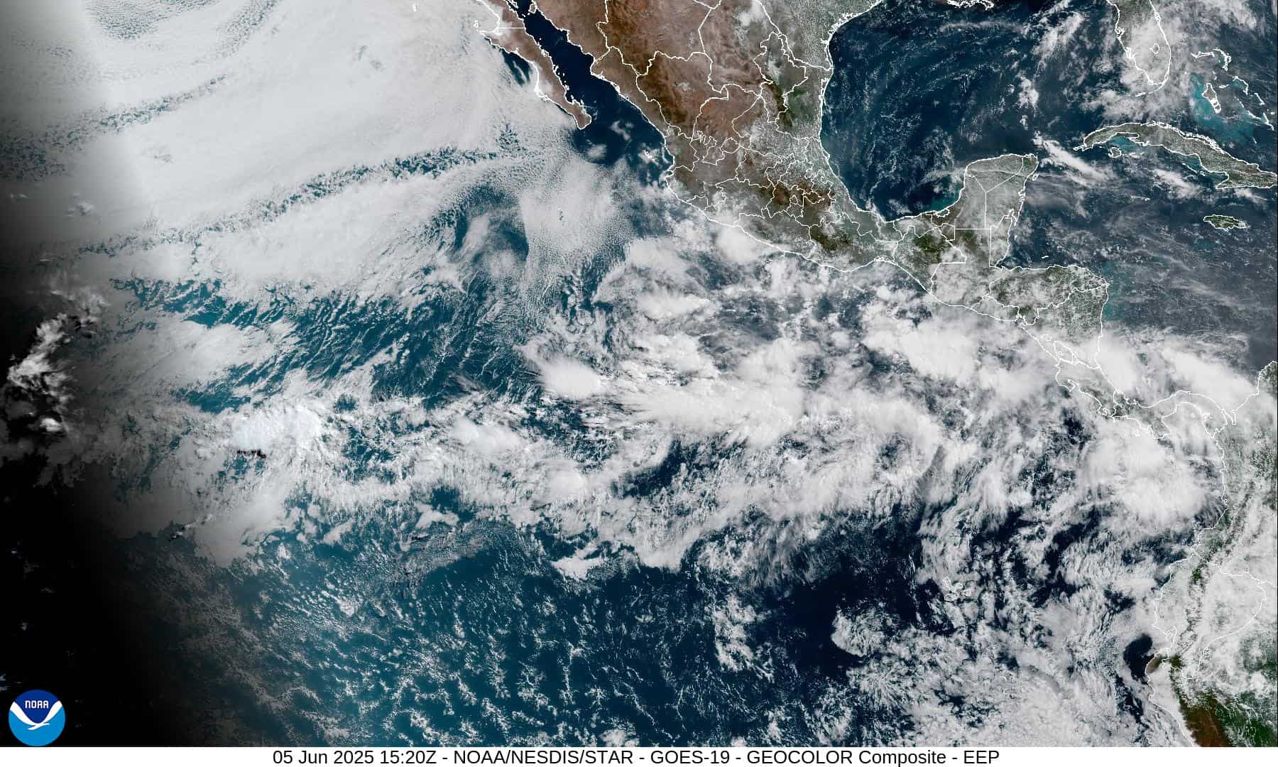
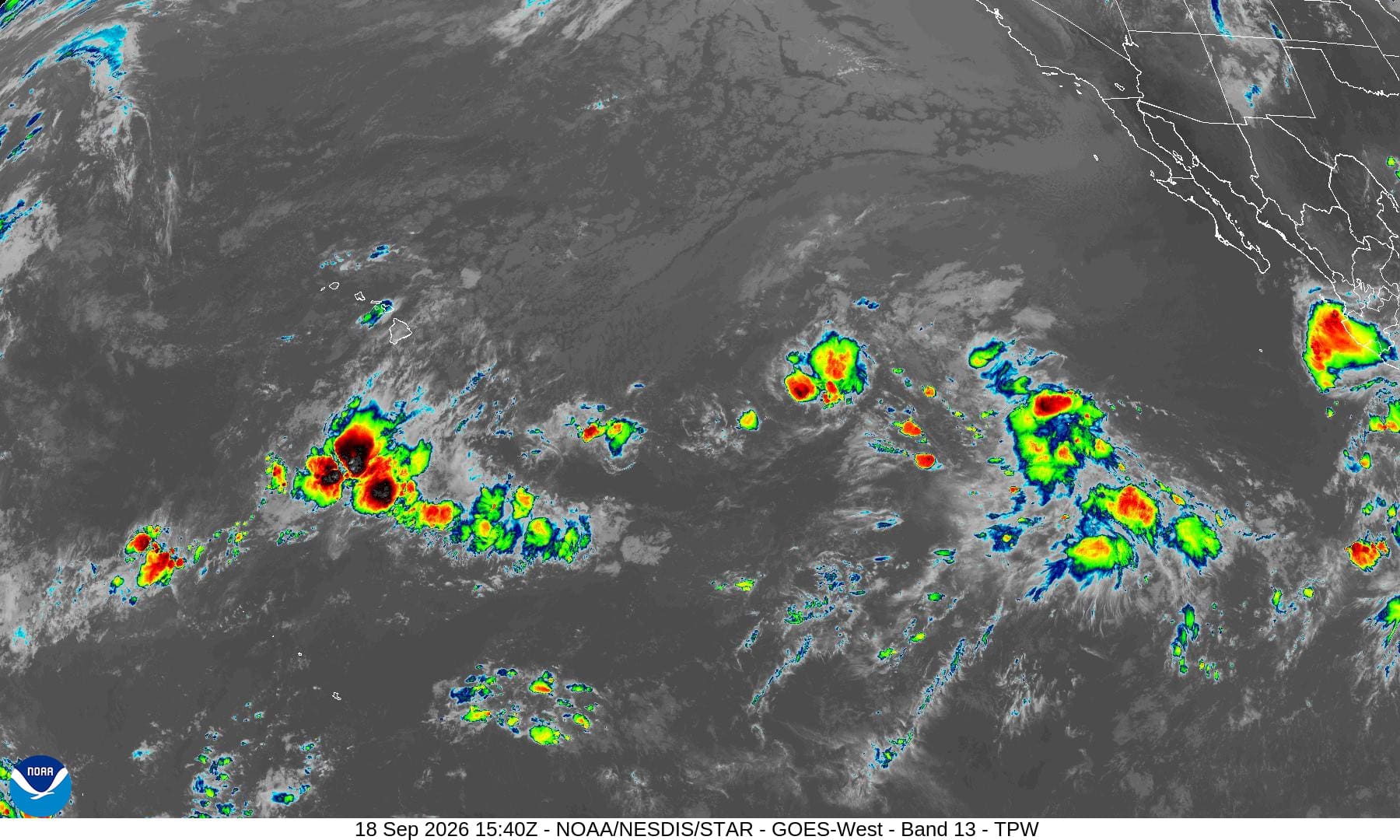
Northeast Pacific: There are no Tropical Cyclones
Western East Pacific:
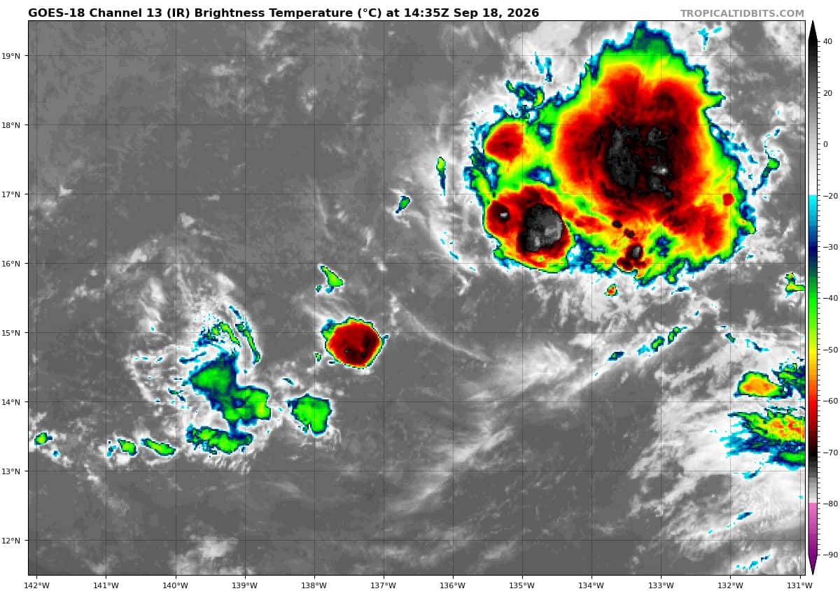
Invest 98E
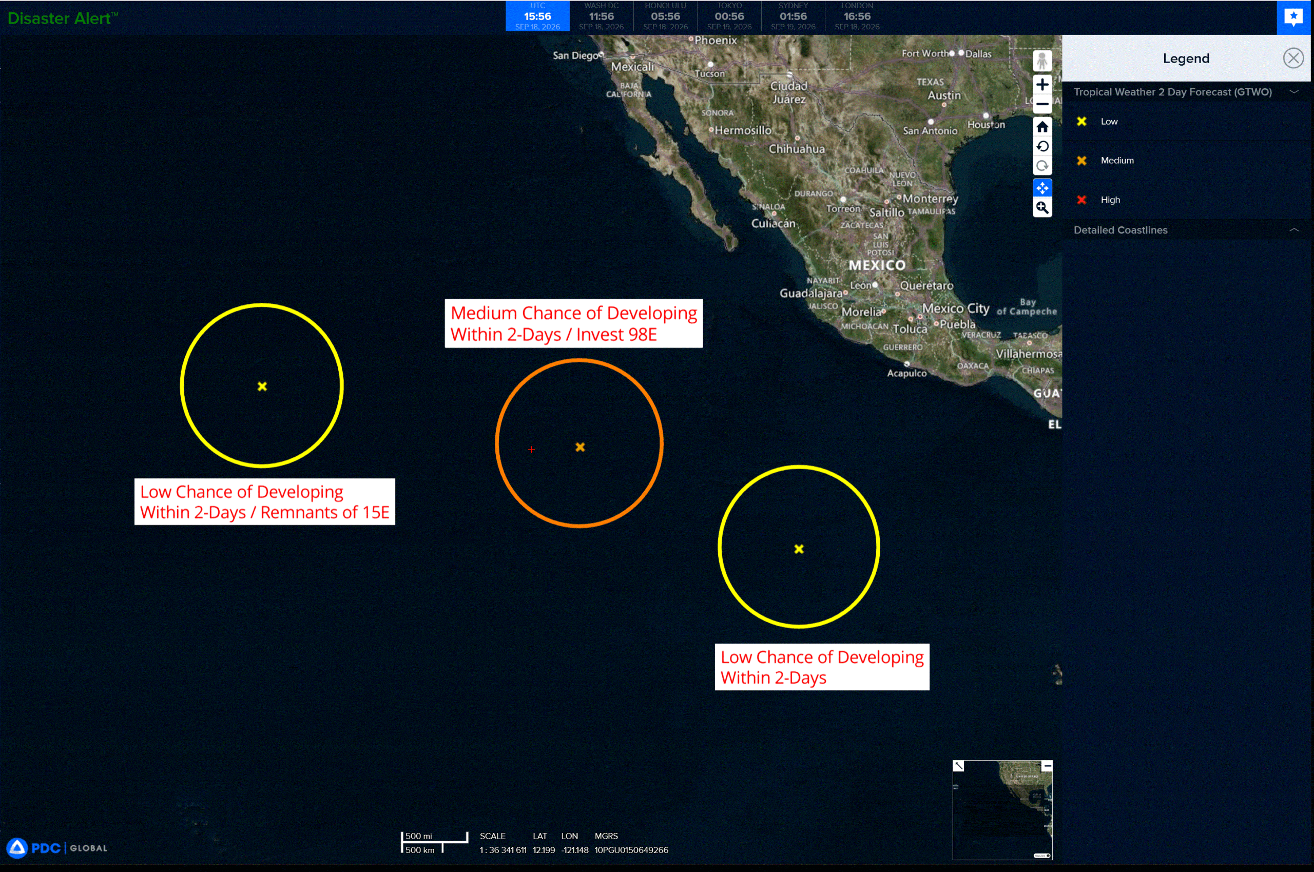
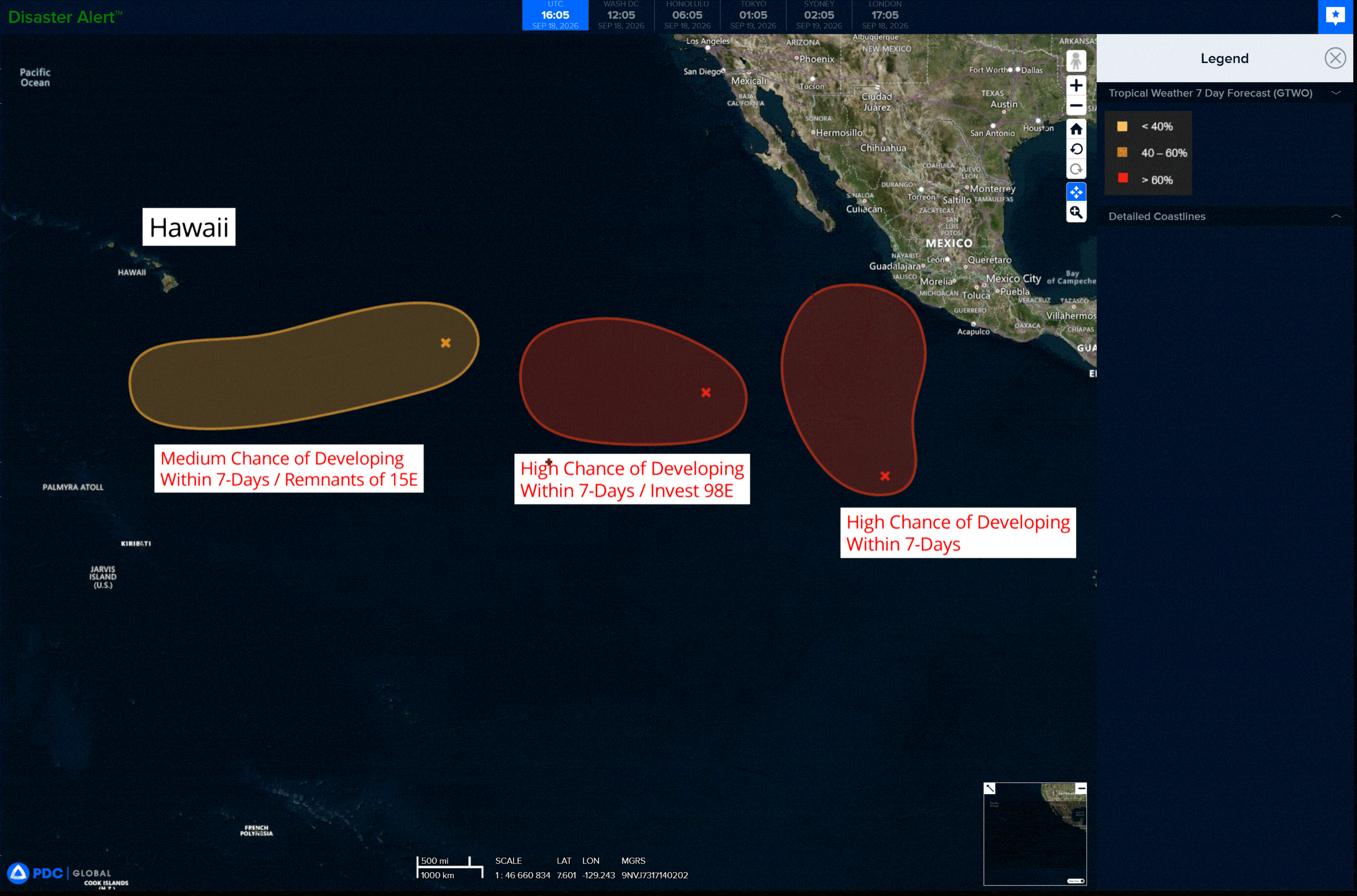
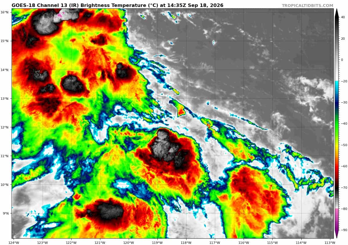
>>> Showers and thunderstorms associated with a broad area of low pressure located well southwest of the southern tip of the Baja California Peninsula remain disorganized. Environmental conditions appear conducive for additional development of this system, and a tropical depression is likely to form this weekend as it moves westward at 10 to 15 mph across the western East Pacific.
* Formation chance through 48 hours…medium…60 percent
* Formation chance through 7 days…high…80 percent
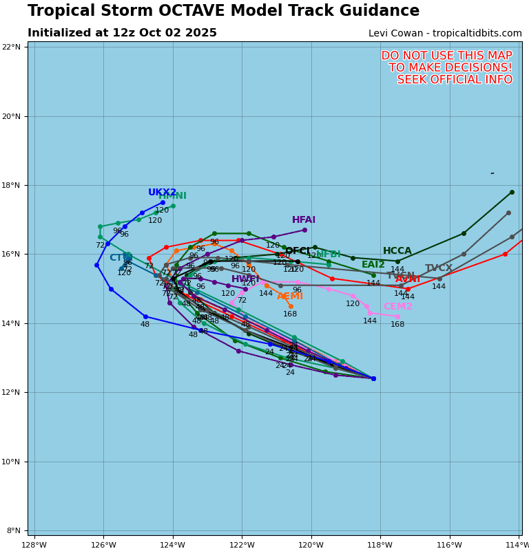
>>> Well East-Southeast of the Hawaiian Islands:
(Former TD 15E)
Showers and thunderstorms associated with the remnants of Tropical Depression Fifteen-E, located more than 1000 miles east-southeast of the Hawaiian Islands, have increased somewhat this morning but remain disorganized. Environmental conditions appear conducive for some development of this system as it moves westward to west-southwestward, and a tropical depression could form well to the south or southeast of the Hawaiian Islands by the middle to latter part of next week.
* Formation chance through 48 hours…low…10 percent
* Formation chance through 7 days…medium…40 percent
>>> South of Southwestern Mexico:
A broad area of low pressure located about 800 miles south-southwest of the southwestern coast of Mexico is producing disorganized shower and thunderstorm activity. Environmental conditions are conducive for development, and a tropical depression is likely to form late this weekend or early next week while it moves gradually north-northwestward and northward off the coast of southwestern Mexico.
* Formation chance through 48 hours…low 20 percent
* Formation chance through 7 days…high…80 percent
Central North Pacific: There are no Tropical Cyclones
Western Pacific, Indian Ocean, and adjacent Seas:
Western Pacific
Tropical Cyclone 24W (Dujuan)
According to the JTWC warning number 14
Animated enhanced infrared (eir) satellite imagery depicts tropical storm 24W relatively unchanged for the past several hours. The
comma shape of the upper-level convection remains prominent and well-defined. The 181129z ascat data reveals a petite core and asymmetric wind field. A large swath of storm-force winds persists within the northern semi-circle but do not wrap around to the southern semi-circle, where the wind speeds are significantly weaker.
Environmental analysis reveals a favorable environment, characterized by low (10-15 kts) vertical winds shear, warm (28-29c) sea surface temperatures, and robust poleward outflow.
TS 24W (Dujuan) is forecast to begin tracking northwestward imminently while it remains on the southwestern periphery of the steering str. Beginning around 12-24 hours, track speeds will slow as 24W approaches the axis of the ridge. At around 36 hours, 24W will cross the ridge axis and begin accelerating to the northeast. Dujuan will remain on a northeastward trajectory from 36-48 hours through the end of the forecast period.
As 24W tracks poleward, it will encounter an increasingly hostile environment. It is expected to cross the 26c isotherm just after 72 hours, along with increasing vertical wind shear to 30-40 kts, which will induce significant dry air entrainment. Concurrently with increasing shear, 24W will begin interacting with the upper-level jet prompting weak temperature advection. In response to the hostile environment, 24W is forecast to begin extratropical transition at 72 hours and complete transition no later than 96 hours.
Regarding intensity, 24W is expected to gradually intensify through its peak at 12-36 hours. 24W is forecast to weaken thereafter as a result of the environment, ultimately completing extratropical transition at around 50 kts.