

Current Snapshot
For all the latest updates visit: DisasterAWARE
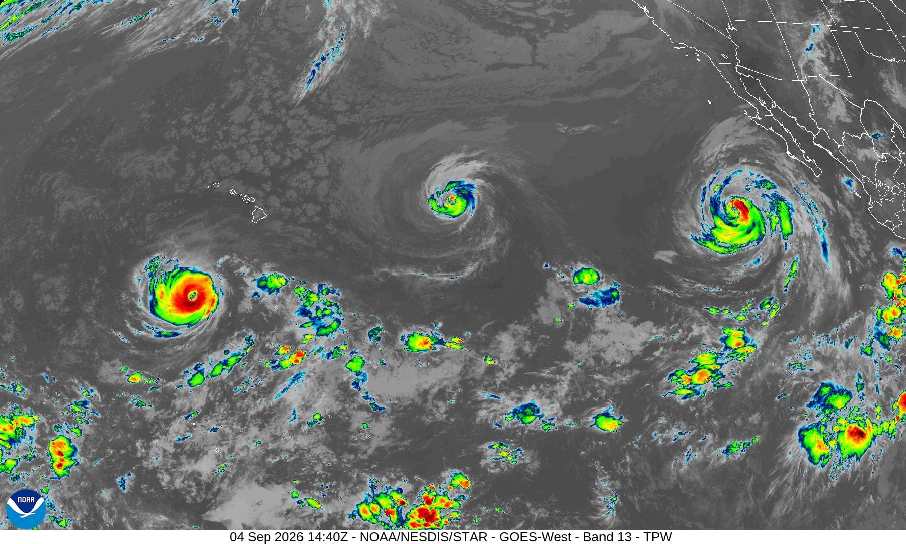
1800x1080ec
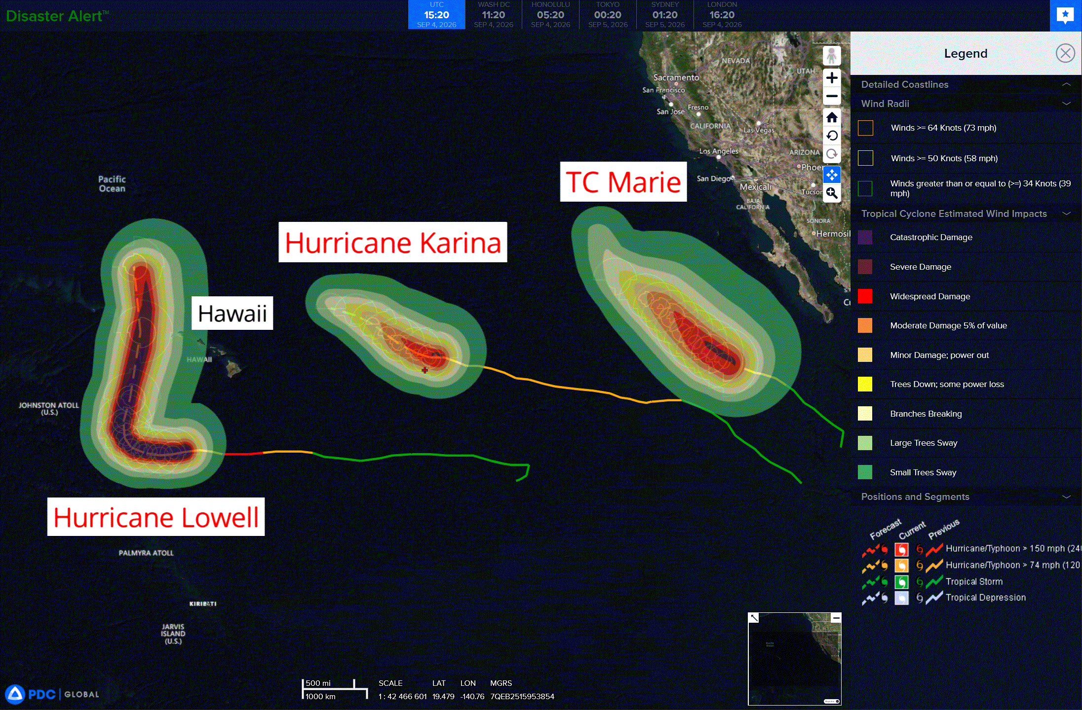
3
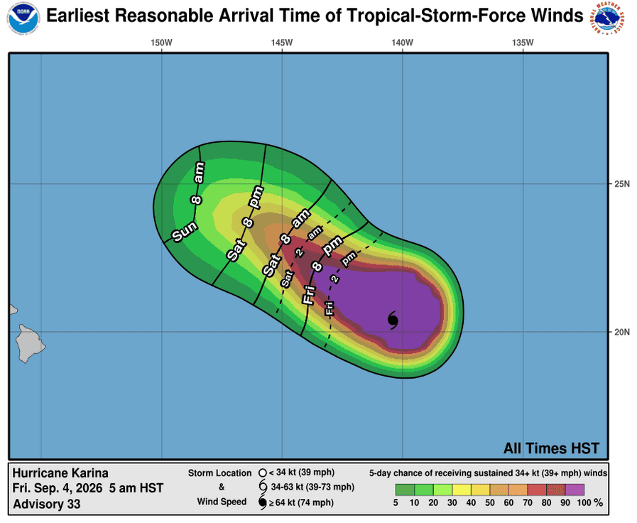
041444_earliest_reasonable_toa_34K
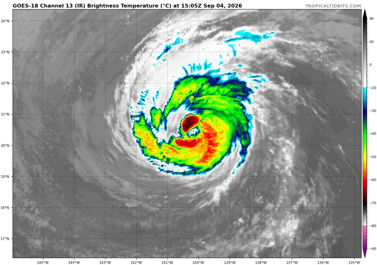
goes18_ir_11E_202609041505_lat20.3-lon-139.9
11E_tracks_latest
041441_earliest_reasonable_toa_34
goes18_ir_13E_202609041505_lat19.9-lon-117.6
13E_tracks_latest
close
041447_earliest_reasonable_toa_34
goes18_ir_12E_202609041505_lat13.3-lon-159.8
12E_tracks_latest
2w
22W_040600sair
himawari9_ir_22W_202609041450_lat28.7-lon127.4
22W_tracks_latest
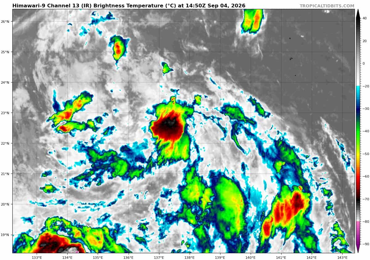
himawari9_ir_23W_202609041450_lat22.4-lon137.8
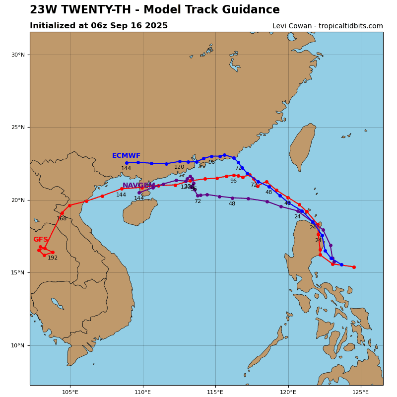
23W_tracks_latest
By PDC’s Senior Weather
Specialist Glenn James

The Pacific Disaster Center’s (PDC Global) Friday, September 4, 2026, Tropical Cyclone Activity Report…for the Pacific Ocean, the Indian Ocean, and adjacent Seas.
Tropical Cyclones
Tropical Cyclone 11E (Karina) is located about 955 miles east of Hilo, Hawaii
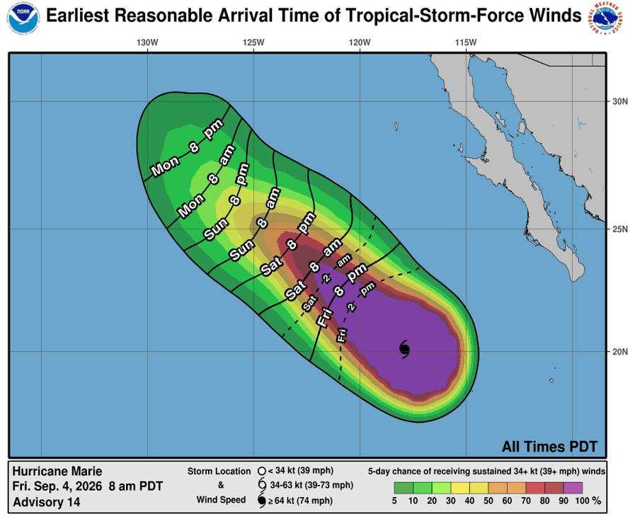
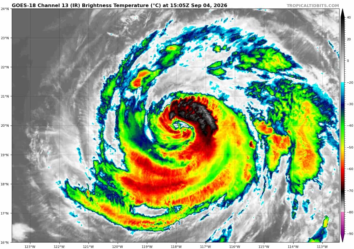
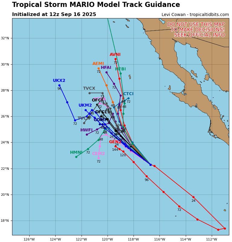
Tropical Cyclone 13E (Marie) is located about 550 miles west-southwest of of the southern tip of Baja California
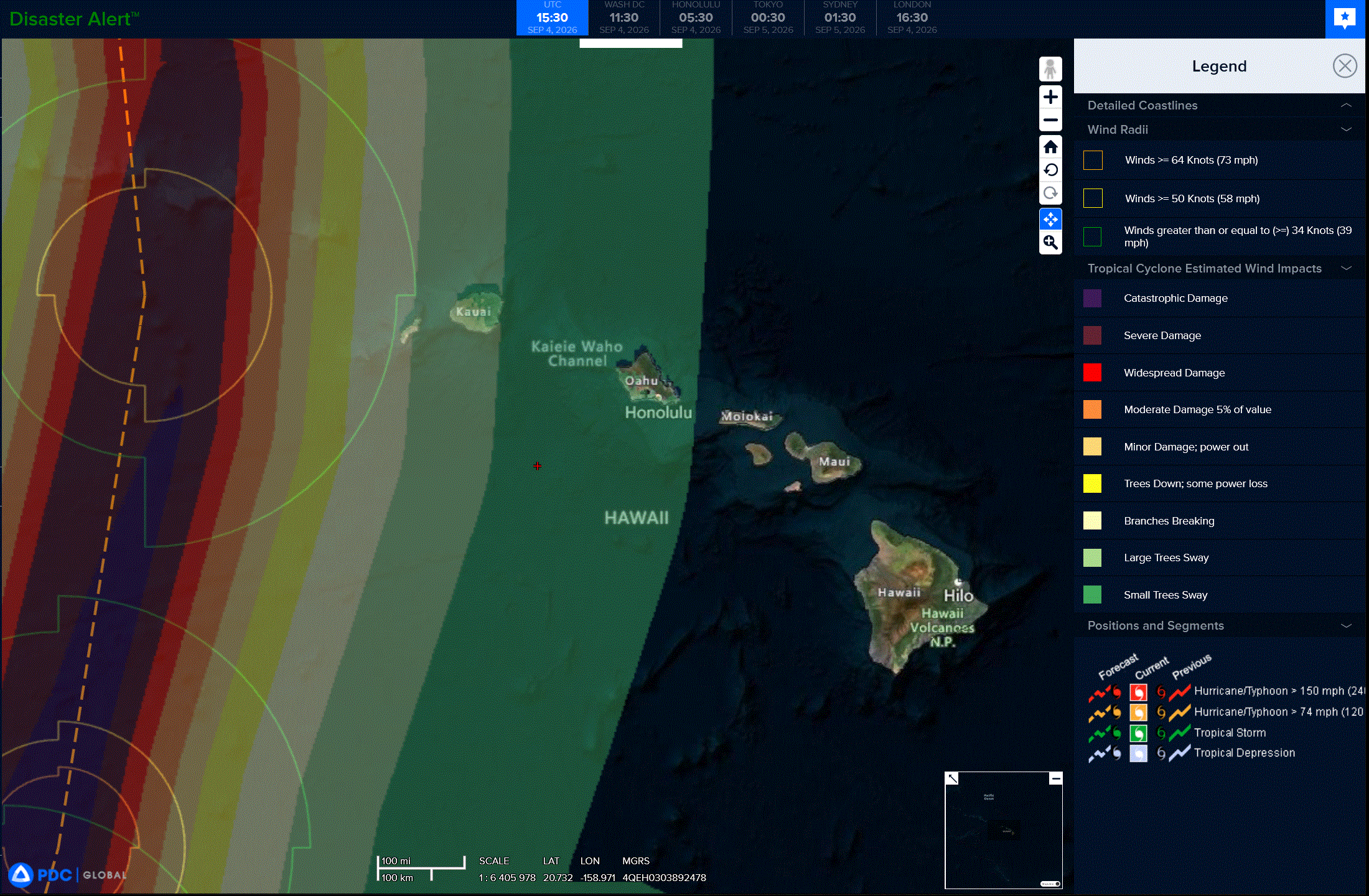
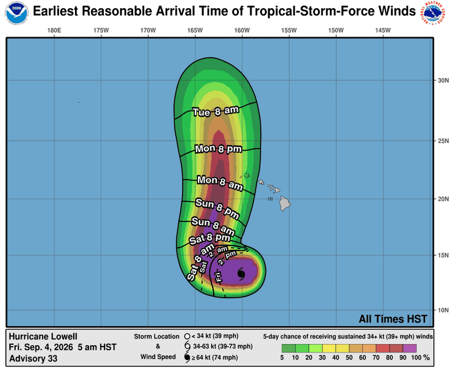
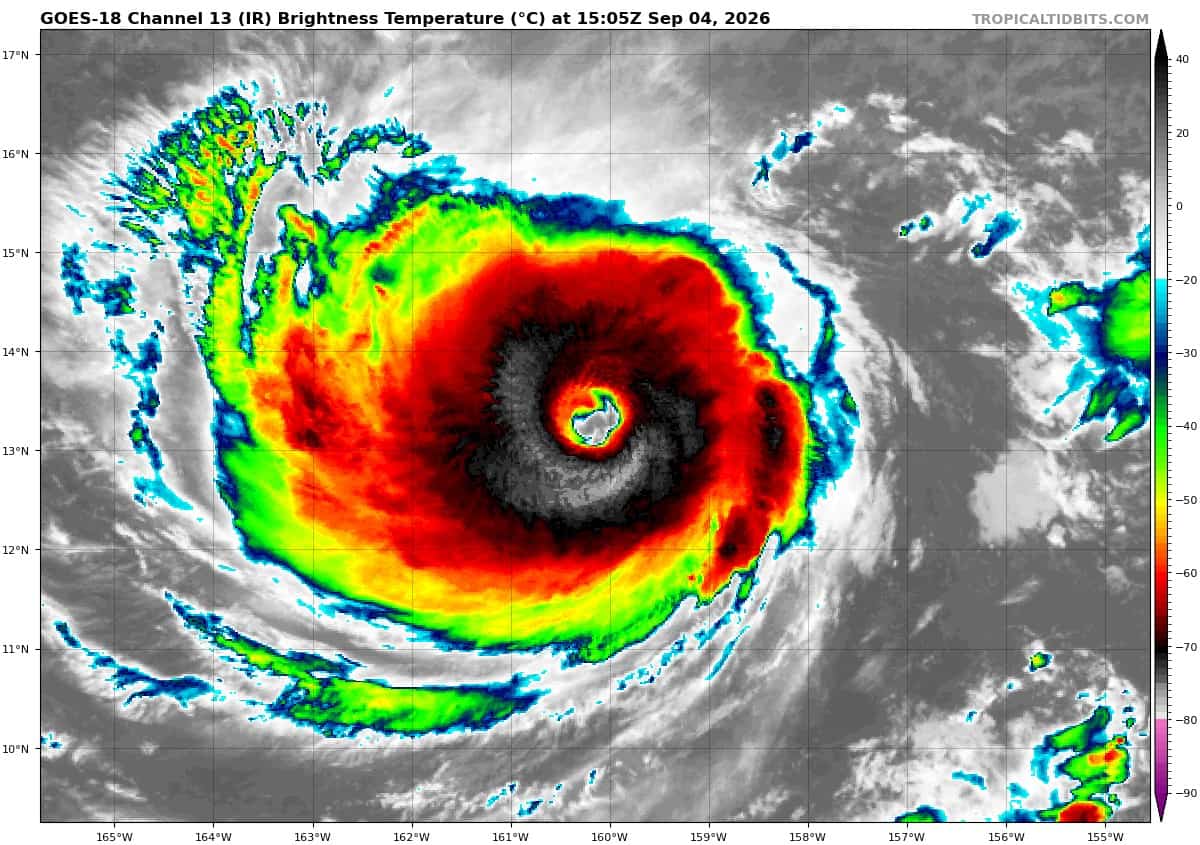
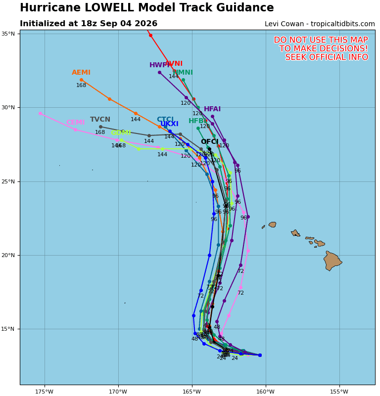
Tropical Cyclone 12E (Lowell) is located about 600 miles south of Lihue, Hawaii
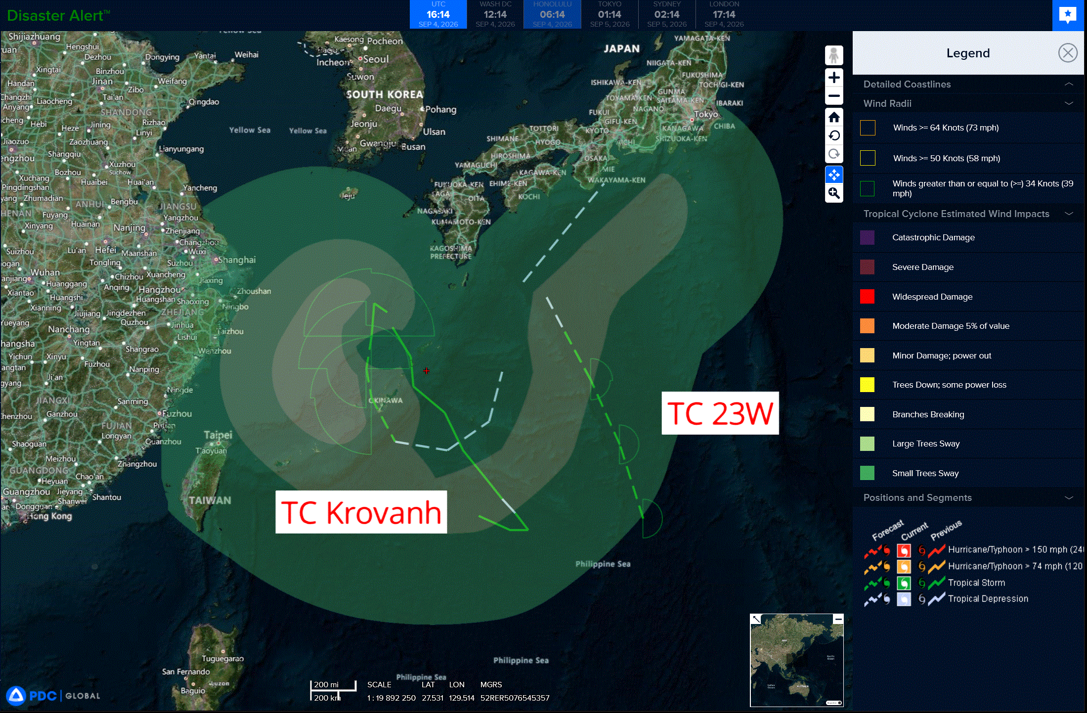
Tropical Cyclone 22W (Krovanh) is located approximately 134 miles north of Kadena AB
Tropical Cyclone 23W is located approximately 240 miles southwest of Iwo To
Northeast Pacific:
Tropical Cyclone 13E (Marie)
MARIE MOVING WEST-NORTHWESTWARD AWAY FROM LAND
According to the NHC advisory number 14…
Marie is moving toward the west-northwest near 9 mph (15 km/h), and a gradual turn toward the northwest is expected within the next day or so. Maximum sustained winds are near 100 mph (155 km/h) with higher gusts. A slow weakening trend is expected to begin on Saturday. Hurricane-force winds extend outward up to 45 miles (75 km) from the center and tropical-storm-force winds extend outward up to 185 miles (295 km). The estimated minimum central pressure is 972 mb (28.71 inches).
HAZARDS AFFECTING LAND
SURF: Swells generated by Marie will continue to affect portions of the coast of southwest Mexico and the Baja California Peninsula for the next few days and are expected to spread northward to Southern California through the weekend. These swells are likely to cause life-threatening surf and rip current conditions.
Central North Pacific:
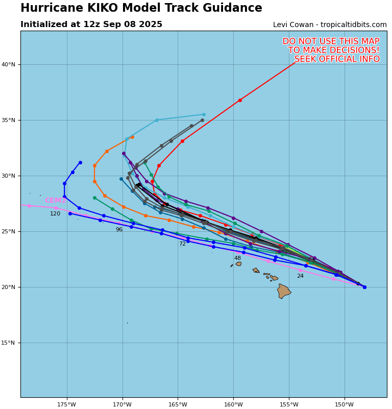
Tropical Cyclone 11E (Karina)
KARINA STILL A HURRICANE AS IT MOVES INTO THE CENTRAL PACIFIC
According to the NHC advisory number 33…
Karina is moving toward the west near 10 mph (17 km/h), and it is expected to turn to the northwest over the weekend. Maximum sustained winds are near 90 mph (150 km/h) with higher gusts. Gradual weakening is forecast during the next 48 hours, although Karina is expected to remain a hurricane during the next day or so. Hurricane-force winds extend outward up to 40 miles (65 km) from the center and tropical-storm-force winds extend outward up to 160 miles (260 km). The estimated minimum central pressure is 973 mb (28.74 inches).
Tropical Cyclone 12E (Lowell)
LOWELL REMAINS A MAJOR HURRICANE …INTERESTS IN THE HAWAIIAN ISLANDS SHOULD CONTINUE TO CLOSELY MONITOR ITS PROGRESS
According to the NHC advisory number 33…
Lowell is moving toward the west near 8 mph (13 km/h). This general motion with a gradual decrease in forward speed is expected during the next day or two, followed by a sharp turn to the north or north-northeast on Sunday. Maximum sustained winds remain near 125 mph (205 km/h) with higher gusts. Lowell is a category 3 hurricane on the Saffir-Simpson Hurricane Wind Scale. Some re-strengthening is forecast during the next couple of days. Hurricane-force winds extend outward up to 45 miles (75 km) from the center and tropical-storm-force winds extend outward up to 140 miles (220 km). The estimated minimum central pressure is 947 mb (27.97 inches).
HAZARDS AFFECTING LAND
RAINFALL: Hurricane Lowell is expected to produce rainfall totals of 3 to 6 inches, with maximum totals exceeding 10 inches possible, for Kauai and the Big Island. For Maui, 2 to 4 inches of rain is expected, with isolated maximum totals of 8 inches possible. Across the remaining islands, rainfall of 1 to 2 inches with maximum amounts of 4 inches is possible. This rainfall may produce flash flooding and mudslides, especially in areas of steep terrain.
SURF: Swells from Lowell are likely to cause life-threatening surf and rip current conditions during the next several days across many of the Hawaiian islands.
Western Pacific, Indian Ocean, and adjacent Seas:
Western Pacific
Tropical Cyclone 22W (Krovanh)
According to the JTWC warning number 14…sustained winds were 40 knots with gusts to 50 knots
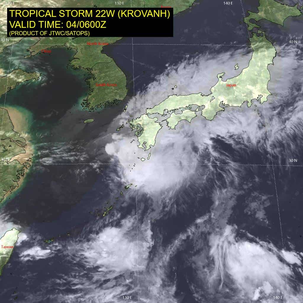
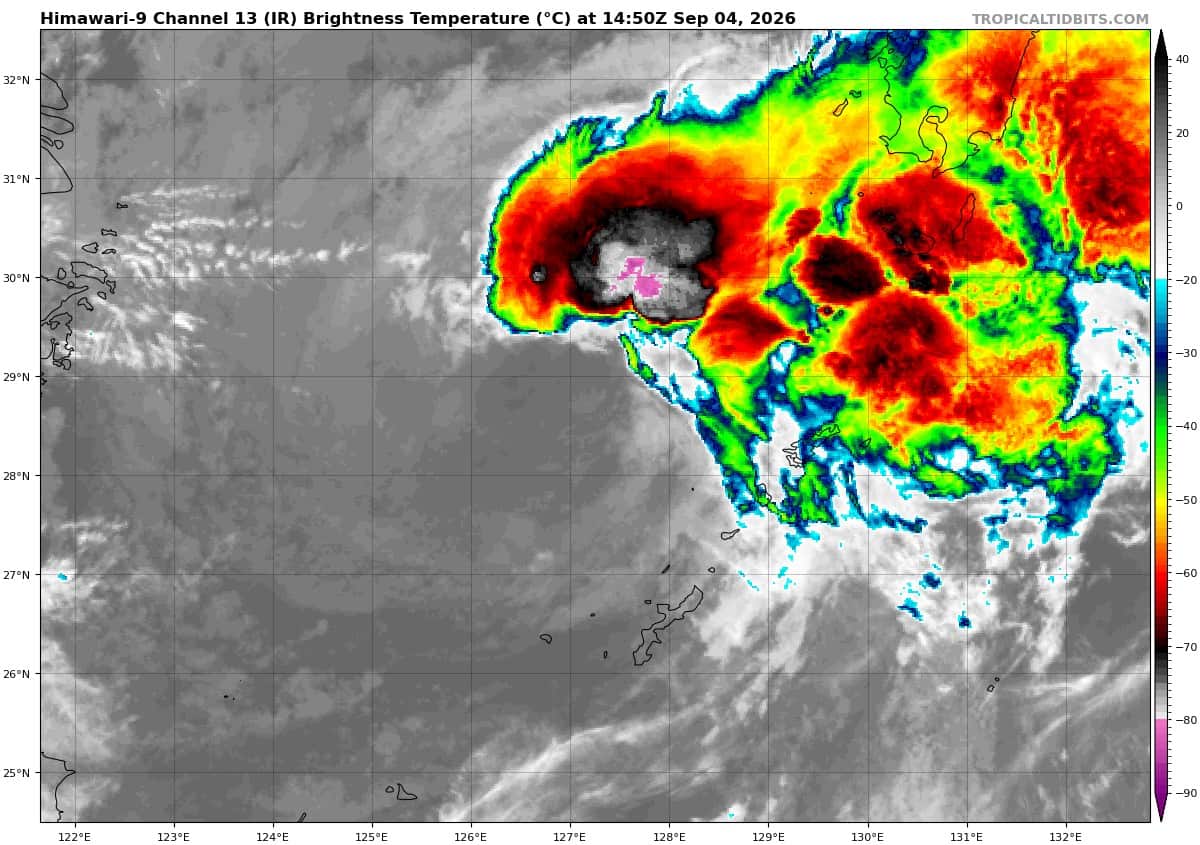
Animated multi-spectral satellite imagery (msi) depicts a fully exposed, well-defined low-level circulation center (llcc), with persistent convection displaced to the eastern periphery. The
convection is being enhanced by a strong poleward outflow channel associated with a 160-kt jet streak ahead of a fast-moving trough over the Sea of Japan. Concurrently, an upper-level ridge is building in behind the trough, resulting in moderate to high northwesterly vertical wind shear (vws).
Very dry, cool air from the Yellow Sea is advecting southward and into the circulation. In
combination with the shear, this dry-air intrusion explains the absence of convection over the western semicircle. Despite the unfavorable environment, recent ship observations in the
northwestern quadrant reported winds of 33 to 42 kts, and a 040144z ascat-c pass revealed a broad area of gale-force winds in the northern semicircle. A vigorous northeasterly cool surge interacting with the broad circulation of tropical storm (ts) 22W is maintaining the asymmetric wind field and enhancing the surface pressure gradient.
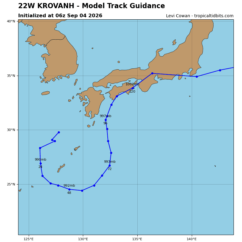
TS 22W has slowed considerably and will turn equatorward imminently as a ridge over northeast China builds southeastward. The system will continue southward through 36 hours in response. At that time, TS 22W will turn eastward as it encounters the southern periphery of a large cyclonic cauldron of the monsoon trough south of Honshu. Between 60 and 72 hours, a str east of Honshu will steer TS 22W poleward. After 96 hours, an approaching trough near Honshu will flatten the str, allowing for the mid-latitude westerlies to carry the circulation eastward.
Forecast confidence is low after 72 hours due to uncertainty in the evolution of tropical disturbance 97W, its potential interaction with TS 22W and the surrounding steering environment, and the effects of the approaching trough on the str. A weaker or more rapidly eroding str could result in an earlier eastward turn toward the Kanto Plain, while a stronger ridge would support a more poleward track. The 40-kt forecast intensity will persist through 12 hours due to the strong pressure gradient between TS 22W and the northeasterly cool surge. Thereafter, the system will weaken as the surge eases and the pressure gradient relaxes.
As TS 22W weakens to 30 kts, it will move into a more favorable environment of lower shear and higher moisture content. However, the intensity will remain at 30 kts for a time as it mixes out the entrenched dry air and reorganizes its inner-core structure. If sufficient organization occurs, slight re-intensification is possible late in the forecast period as the system may benefit from enhanced outflow associated with an upper-level jet streak ahead of a passing trough to the north.
Tropical Cyclone 23W
According to the JTWC warning number 1…sustained winds were 40 knots with gusts to 50 knots
Animated enhanced infrared (eir) satellite imagery depicts a small convective mass over an obscured low-level circulation center (llcc). An earlier 040030z ascat-c pass revealed a compact circulation with 20-25 kt winds near the center. 12 hours later, a partial ascat pass revealed 35-40 kt winds along the eastern periphery, indicating that the compact llcc has rapidly spun up. Therefore, this system has been designated a 40-kt tropical storm.
The environment is marginal, characterized by very warm sea surface temperatures (sst) offset by moderate vertical wind shear. The compact core is embedded in deep-layer southerly flow.
TS 23W will continue on a north-northwestward trajectory along the western flank of a str to the east. A turn toward the west is indicated in the forecast as the shallow system reaches the northern extent of cyclonic cauldron of the monsoon trough, where the low-level flow is easterly.
The environment ahead of TS 23W will not improve due to persistent shear and interaction
with the larger circulation of TS 22W. Therefore, the forecast calls for the miniature vortex to succumb to the unfavorable conditions, with a gradual weakening trend after 12 hours.