

Current Snapshot
For all the latest updates visit: DisasterAWARE
3
3
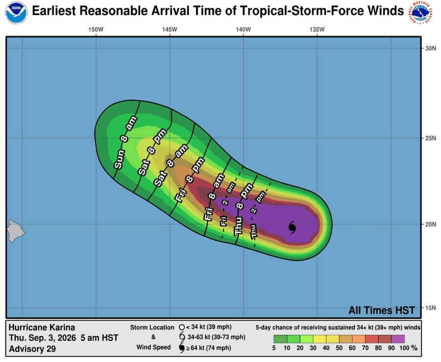
031436_earliest_reasonable_toa_34
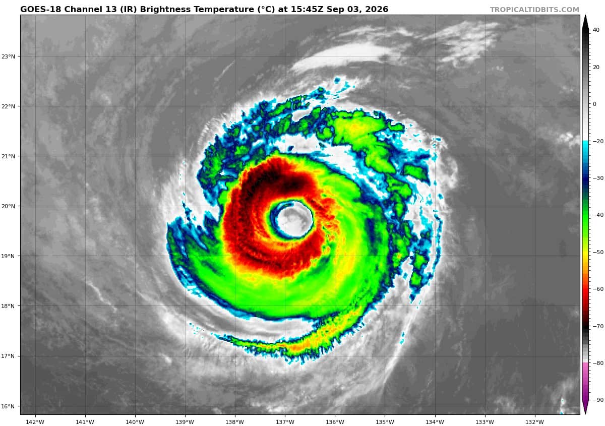
goes18_ir_11E_202609031545_lat19.7-lon-136.2
11E_tracks_latest
031447_earliest_reasonable_toa_34
goes18_ir_13E_202609031545_lat19.0-lon-114.4
13E_tracks_latest
031449_earliest_reasonable_toa_34
goes18_ir_12E_202609031545_lat13.4-lon-156.7
12E_tracks_latest
2w
himawari9_ir_17W_202609031540_lat24.6-lon115.4
17W_tracks_latest
22W_031200sair
himawari9_ir_22W_202609031540_lat28.0-lon128.9
22W_tracks_latest
97w
himawari9_ir_97W_202609031540_lat16.4-lon139.7

97W_tracks_latest
By PDC’s Senior Weather
Specialist Glenn James

The Pacific Disaster Center’s (PDC Global) Thursday, September 3, 2026, Tropical Cyclone Activity Report…for the Pacific Ocean, the Indian Ocean, and adjacent Seas.
Tropical Cyclones
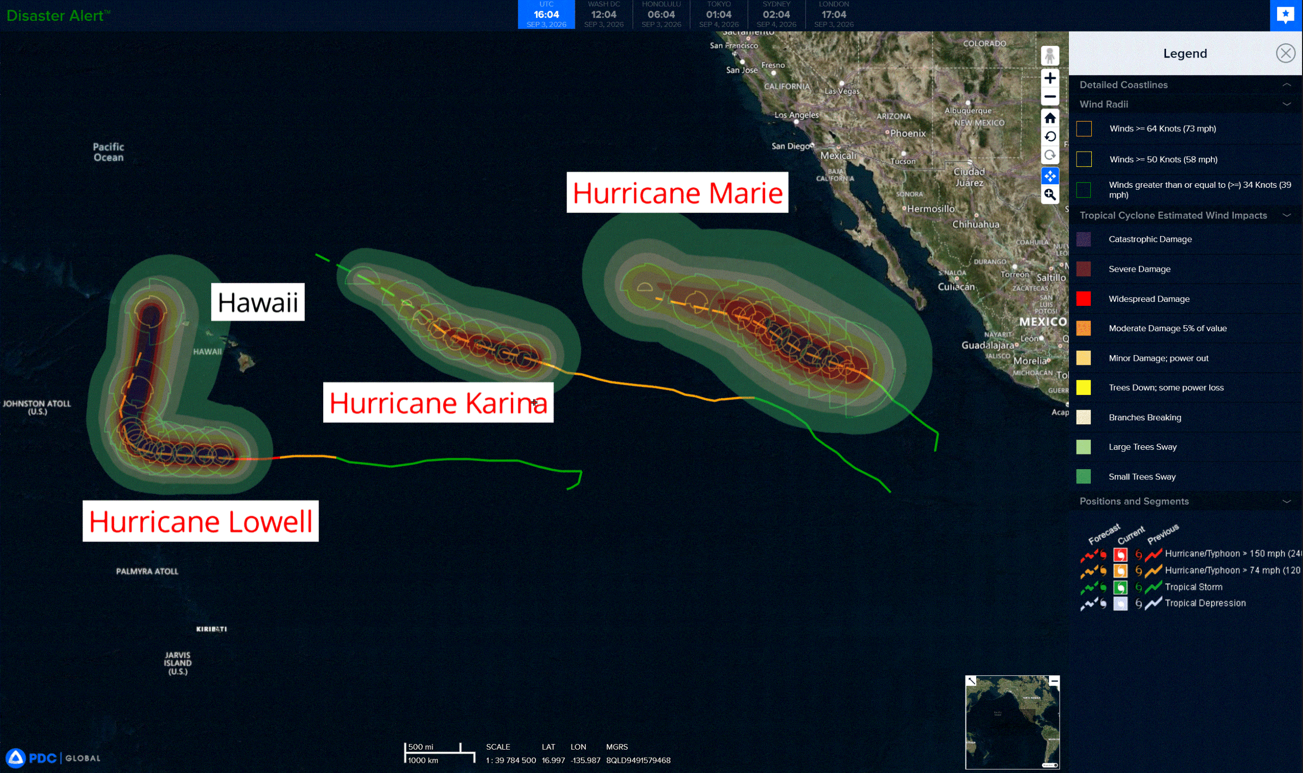
Tropical Cyclone 11E (Karina) is located about 1195 miles east of Hilo, Hawaii
Tropical Cyclone 13E (Marie) is located about 410 miles southwest of of the southern tip of Baja California
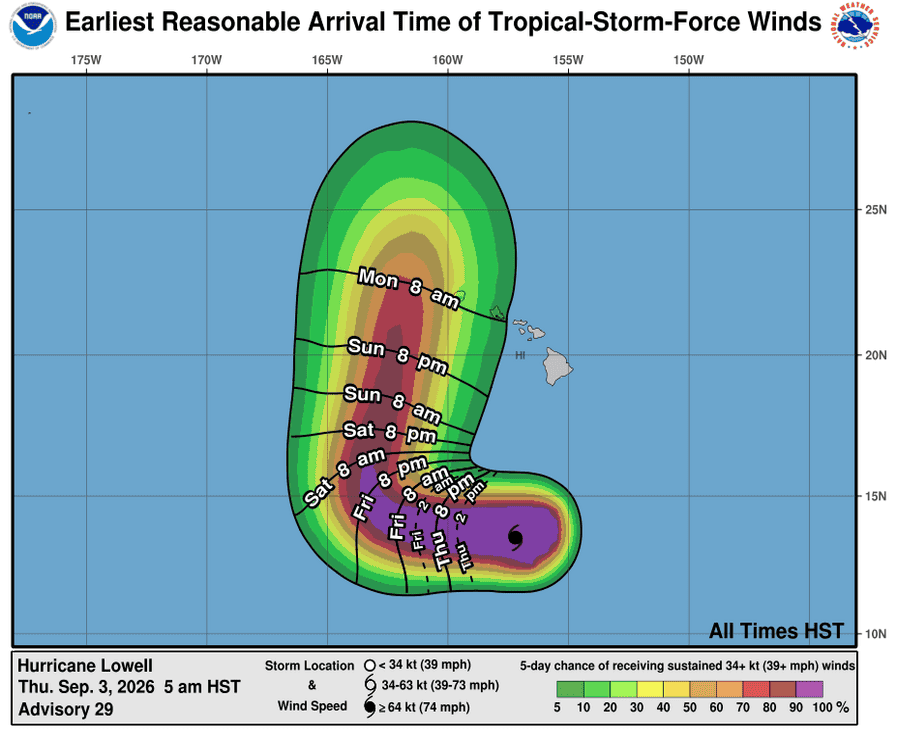
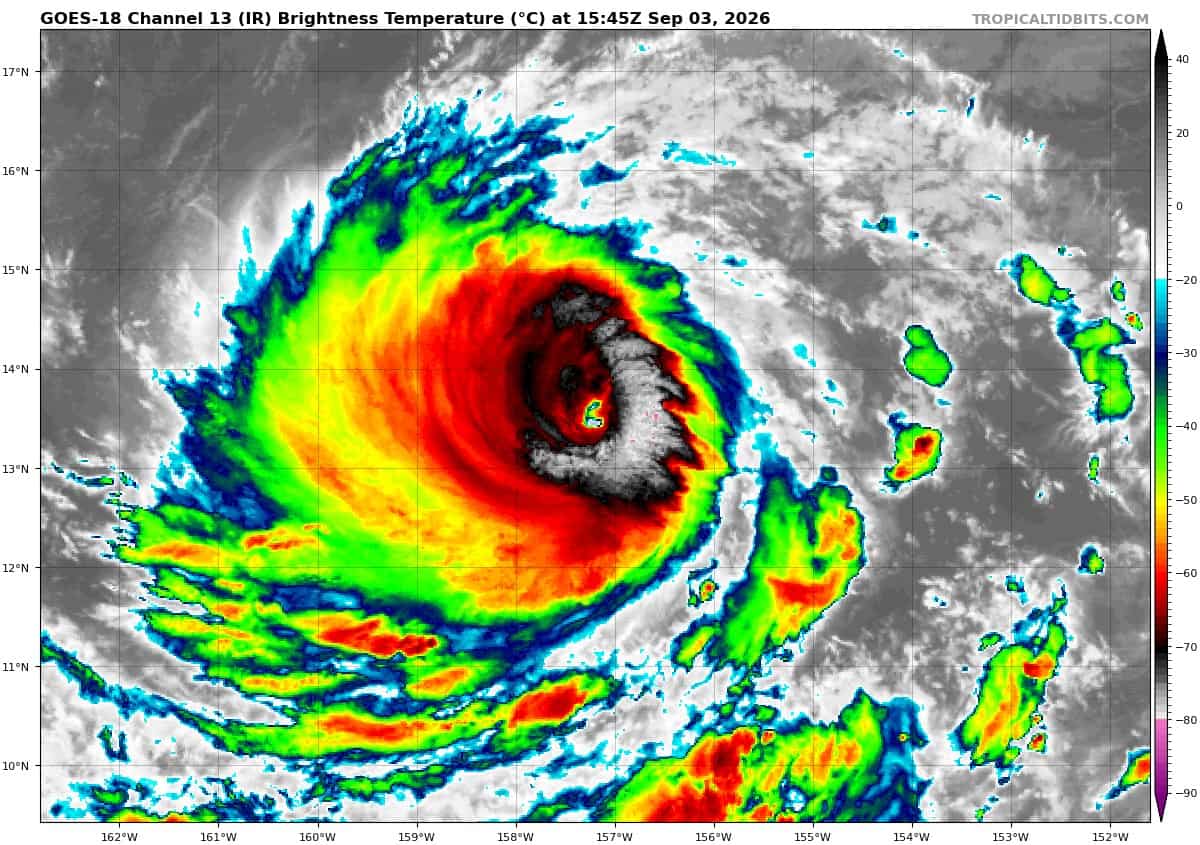
Tropical Cyclone 12E (Lowell) is located about 450 miles south-southwest of Hilo, Hawaii
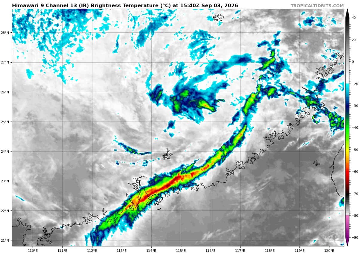
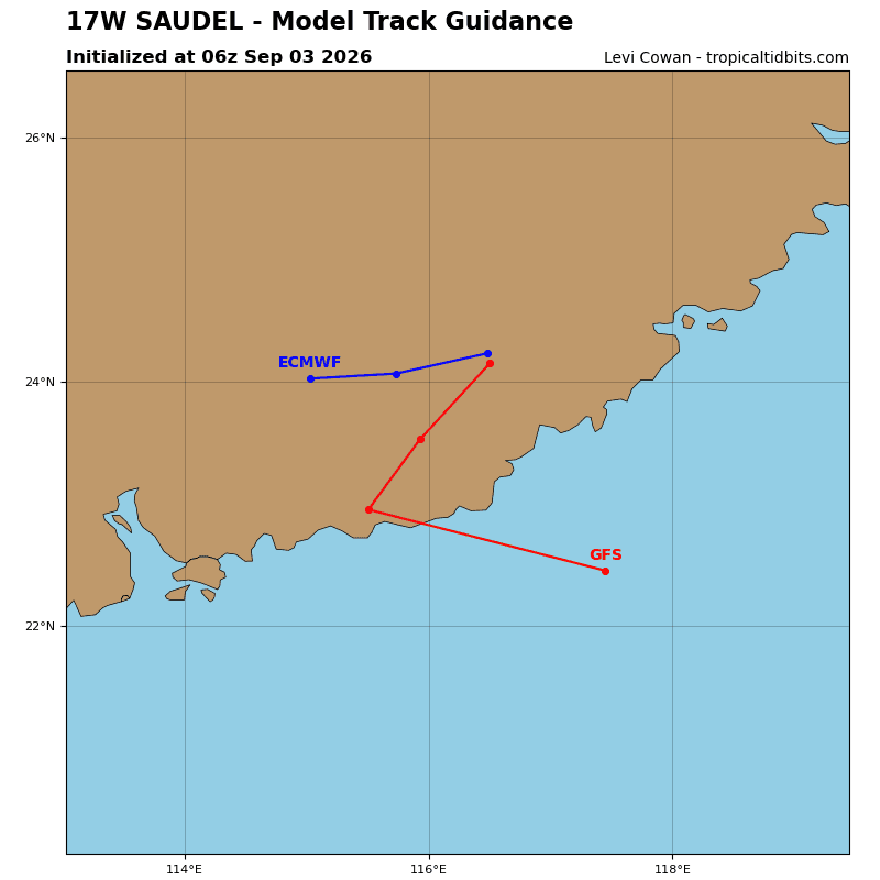
Tropical Cyclone 17W (Saudel) is located approximately 198 NM east-northeast of Hong Kong – Final Warning
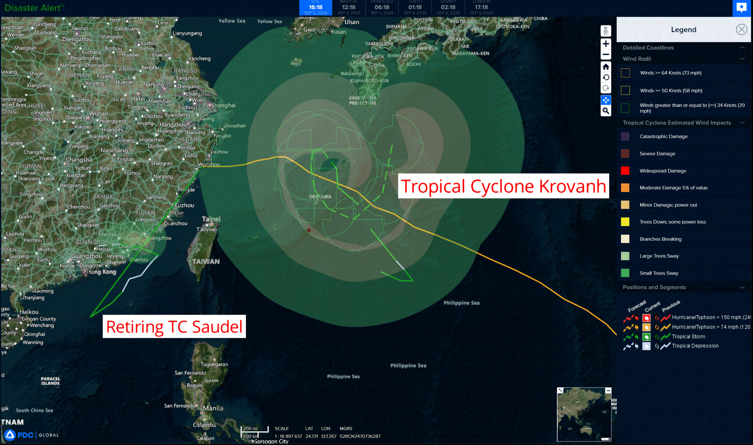
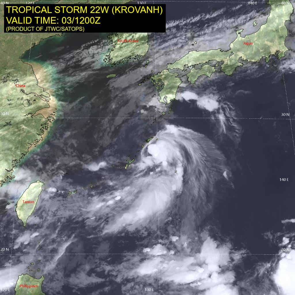
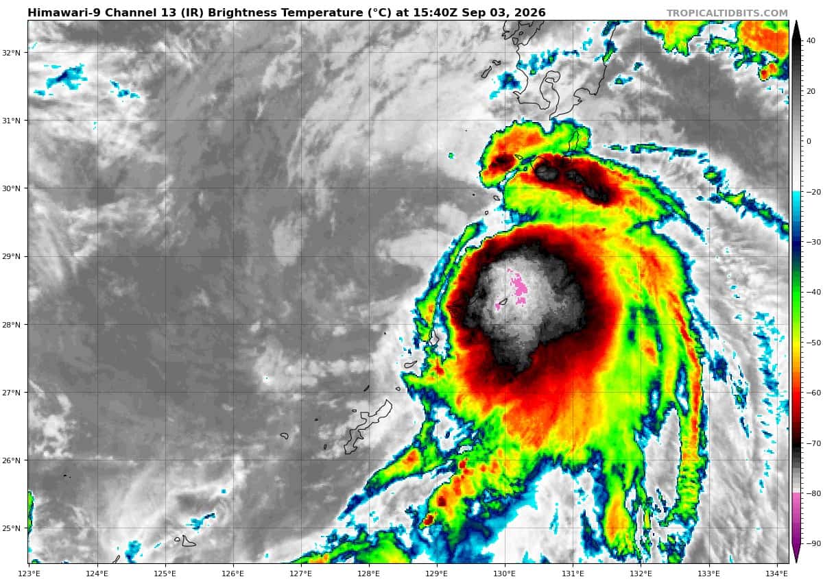
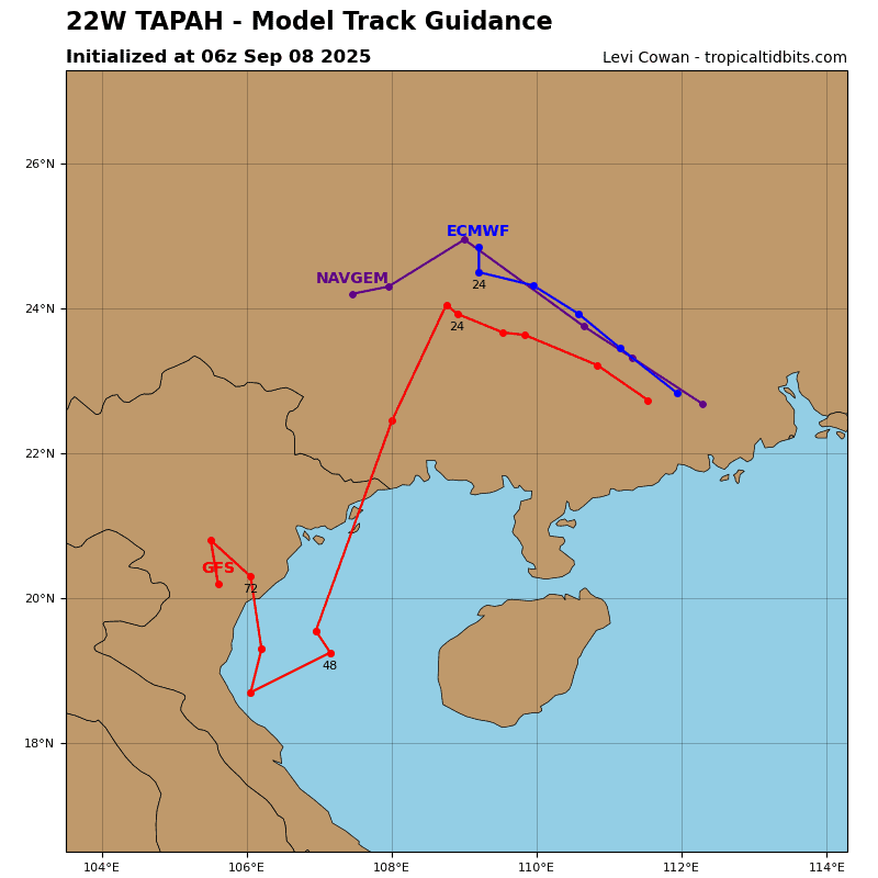
Tropical Cyclone 22W (Krovanh) is located approximately 107 miles north-northeast of Kadena AB
Northeast Pacific:
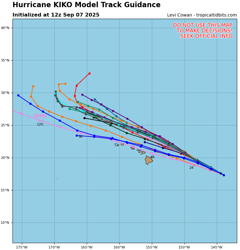
Tropical Cyclone 11E (Karina)
KARINA CONTINUES TO MOVE WESTWARD AS A MAJOR HURRICANE
According to the NHC advisory number 29…
Karina is moving toward the west near 10 mph (17 km/h), with a more west-northwestward motion expected over the next couple of days. Maximum sustained winds are near 115 mph (185 km/h) with higher gusts. Karina is a category 3 hurricane on the Saffir-Simpson Hurricane Wind Scale. Gradual weakening is forecast during the next several days. However, Karina is expected to remain a hurricane for the next couple of days. Hurricane-force winds extend outward up to 35 miles (55 km) from the center and tropical-storm-force winds extend outward up to 125 miles (205 km). The estimated minimum central pressure is 961 mb (28.38 inches).
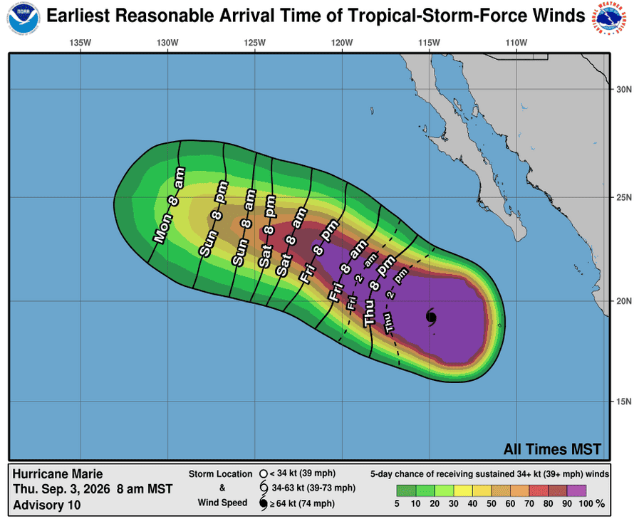
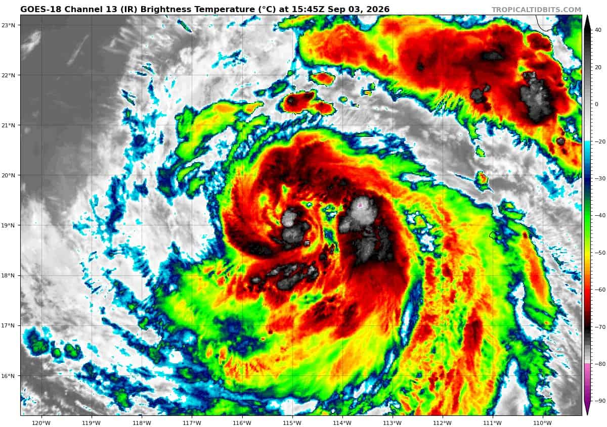
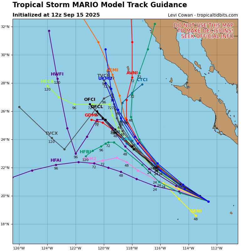
Tropical Cyclone 13E (Marie)
MARIE A LITTLE STRONGER
According to the NHC advisory number 10…
Marie is moving toward the west-northwest near 10 mph (17 km/h), and this motion is expected to continue through this weekend. Maximum sustained winds are near 90 mph (150 km/h) with higher gusts. Some strengthening is forecast over the next day or so, followed by gradual weakening this weekend. Hurricane-force winds extend outward up to 40 miles (65 km) from the center and tropical-storm-force winds extend outward up to 230 miles (370 km). The Mexican Navy Weather Station on Clarion Island recently reported a wind gust of 56 mph (90 km/h) in one of Marie’s outer rain bands. The estimated minimum central pressure is 976 mb (28.82 inches).
HAZARDS AFFECTING LAND
SURF: Swells generated by Marie will affect portions of the coast of southwest Mexico and the Baja California Peninsula for the next few days and will likely spread northward to Southern California over the weekend. These swells are likely to cause life-threatening surf and rip current conditions.
Central North Pacific:
Tropical Cyclone 12E (Lowell)
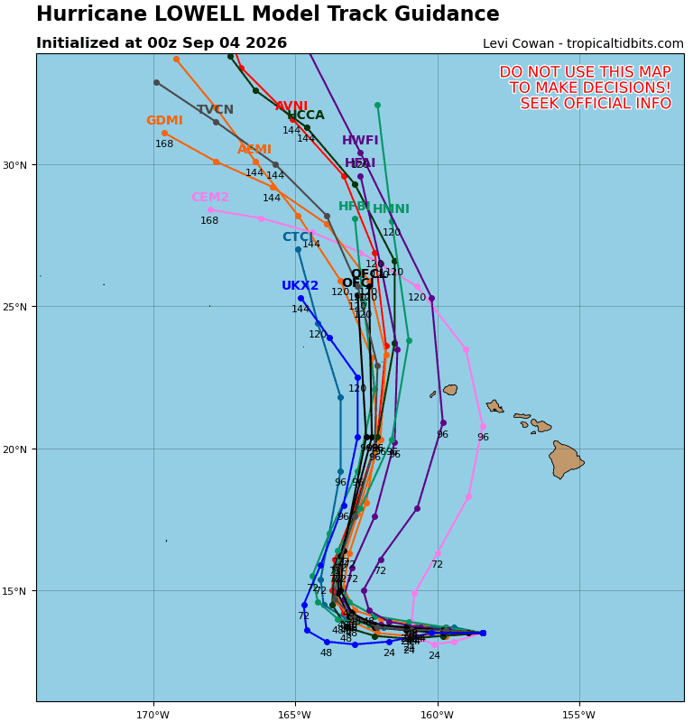
LOWELL EXPECTED TO REMAIN A MAJOR HURRICANE FOR THE NEXT SEVERAL DAYS…INTERESTS IN THE HAWAIIAN ISLANDS SHOULD MONITOR THE PROGRESS OF LOWELL
According to the NHC advisory number 29…
Lowell is moving toward the west near 10 mph (17 km/h). This general motion with a gradual decrease in forward speed is expected during the next couple of days, followed by a turn toward the northwest and north this weekend. Maximum sustained winds are near 140 mph (220 km/h) with higher gusts. Lowell is a category 4 hurricane on the Saffir-Simpson Hurricane Wind Scale. Some fluctuations in intensity are expected during the next few days. However, Lowell is expected to remain a major hurricane for the next several days. Hurricane-force winds extend outward up to 40 miles (65 km) from the center and tropical-storm-force winds extend outward up to 140 miles (220 km). The estimated minimum central pressure is 945 mb (27.91 inches).
HAZARDS AFFECTING LAND
SURF: Swells generated by Lowell are spreading northward and will affect portions of the Hawaiian Islands during the next several days. These swells are likely to cause life-threatening surf and rip current conditions.
Western Pacific, Indian Ocean, and adjacent Seas:
Western Pacific
Tropical Cyclone 17W (Saudel) – Final Warning
According to the JTWC warning number 47…sustained winds were 40 knots with gusts to 50 knots
Available satellite and radar data indicate that the center of circulation has made landfall near
Dongshan Harbor in southeastern Shina. The storm is expected to quickly dissipate while tracking inland towards the west.
Tropical Cyclone 22W (Krovanh)
According to the JTWC warning number 10…sustained winds were 40 knots with gusts to 50 knots
After jogging west-northwestward from 0000z to 0600z, tropical storm (ts) 22W turned sharply northward during the past six hours, resulting in an average north-northwestward motion of 10-12 kts over the past 12 hours. The 10-minute wind observations from
Tokunoshima Island and radar imagery were critical in assessing the initial position with high confidence. Animated enhanced infrared (eir) satellite imagery depicts persistent convection along the southeastern periphery of the circulation, with improving equatorward outflow aloft as an upper-level ridge amplifies immediately east of the vortex. A 030934z wsf-m mwi 37 ghz image revealed a partially intact inner core with an opening along the western side. Partial rcm-3 sar and ascat-b passes at 030931z and 031117z, respectively, confirmed gale-force winds along the eastern periphery.
Although the circulation is traversing waters with sea surface temperatures (sst) of 27-29 degrees celsius, the moderate northwesterly vertical wind shear (vws) remains unrelenting, while dry air persists over the northern semicircle, resulting in marginal environmental conditions.
The system will track north-northwestward through 12 hours under the steering influence of the str to the east. Meanwhile, an extensive ridge is building southeastward in the wake of a fast-moving trough crossing the Sea of Japan. This development will cause TS 22W to stall between 12 and 24 hours before reversing course and tracking equatorward. By 60 hours, the circulation will gradually come under the influence of deep-layer westerly to southwesterly flow, which will drive the system eastward. Toward the end of the forecast period, the str positioned east of Honshu will extend westward, inducing a poleward turn toward mainland Japan. As the system approaches the stall point, the building ridge will increase vws and bring a northeasterly surge of cool, dry air into the circulation.
Therefore, the forecast calls for slight weakening by 24 hours, though the system could weaken more than currently forecast. The equatorward and subsequent eastward trajectory after 36 hours will bring TS 22W into a more favorable environment of lower shear and higher moisture content. However, the broad, weakened circulation will require substantial time to consolidate before re-intensification can commence. Accordingly, the wind field will likely become increasingly symmetric after 72 hours, with gradual strengthening to 40 kts by 120 hours.
The broad wind field consists of a large core of light winds near the center. The gale-force winds are located 30-60 NM from the center. Therefore, the winds near the center will remain light, with the strongest winds displaced well away from the center.
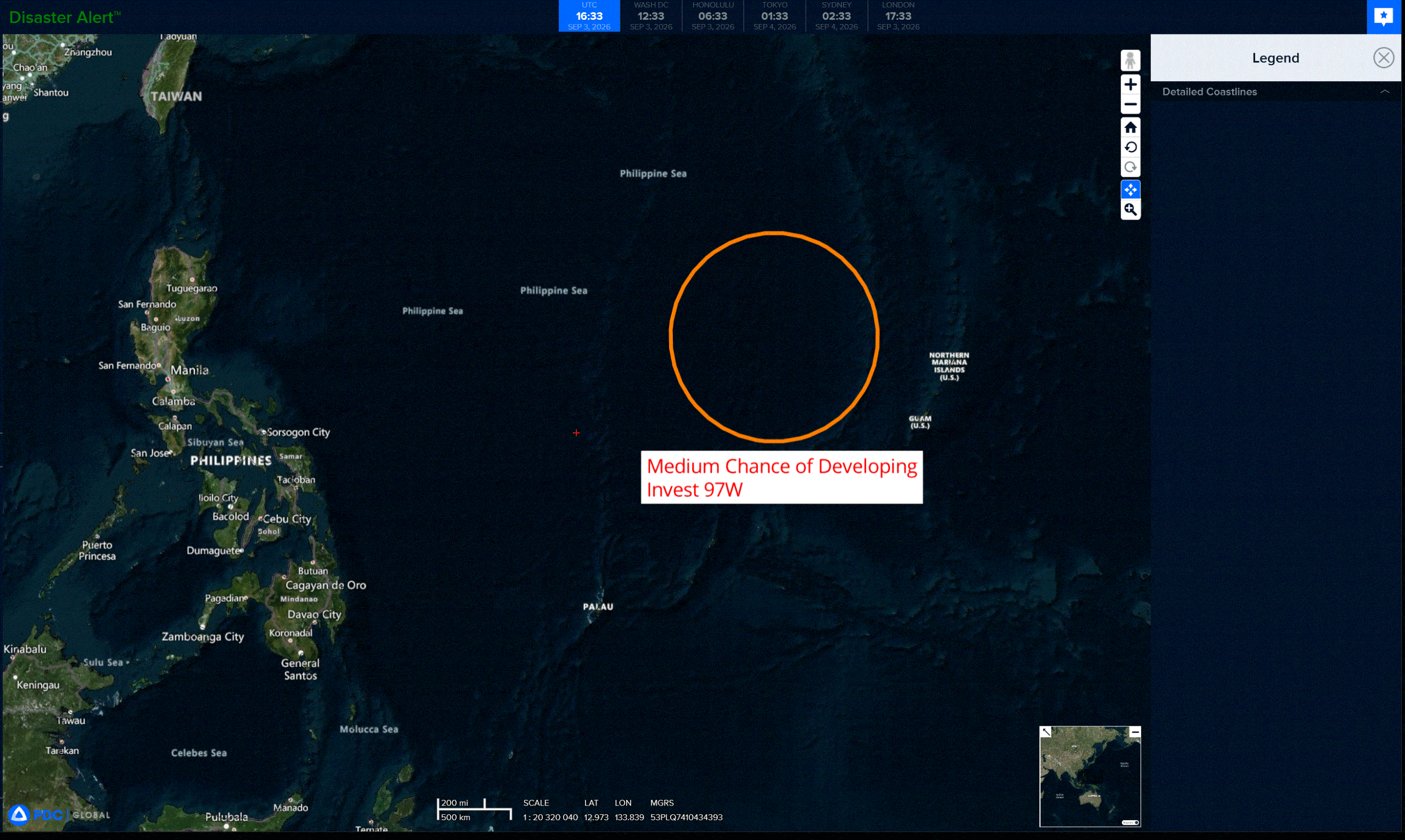
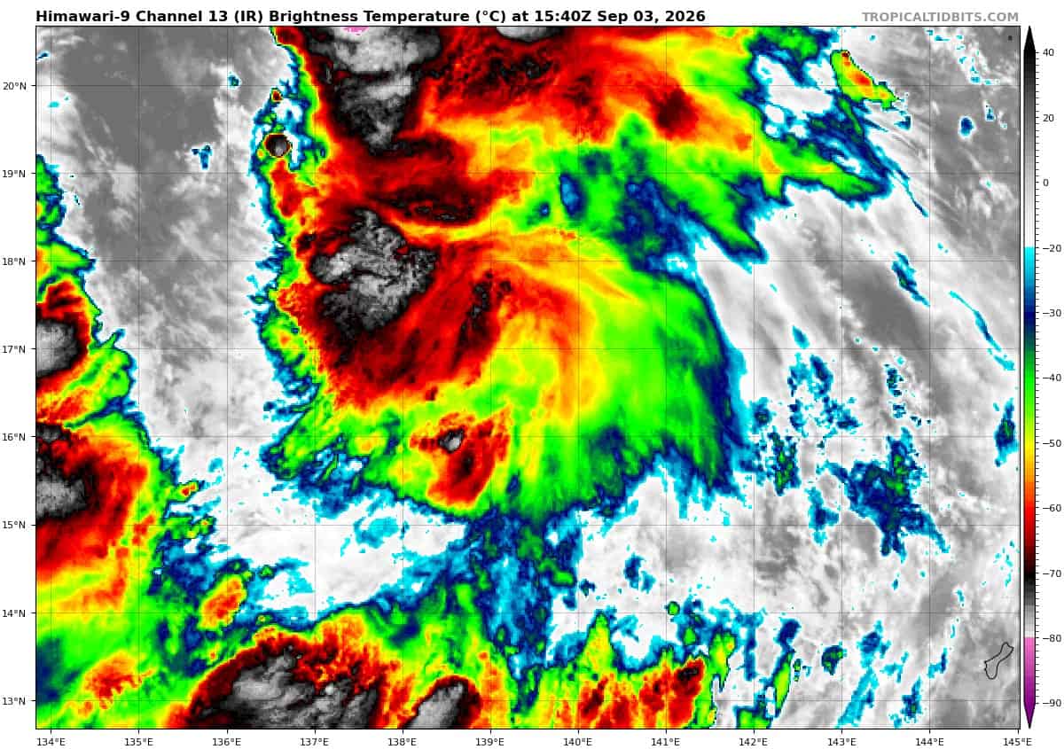
>>> There’s an area of disturbed weather being referred to as Invest 97W, which is located approximately 293 NM west-northwest of Guam.
Animated enhanced infrared satellite imagery (eir) reveals a poorly defined low-level circulation center (llcc) obscured by mid- and high-level clouds. Deep convection has persisted for several hours in the northwestern quadrant associated with 97W, reflecting an improved convective signature. A 030005z metop-b ascat pass shows a closed surface circulation with 20 kt winds along the western and southern periphery. More recent scatterometry data indicate that the llcc is elongated, and elevated winds now span two-
thirds of the way around the llcc.
Overall environmental conditions are assessed as marginally favorable with moderate (20-25 kts) vertical wind shear, very warm (29-30 c) sea surface temperatures, improving equatorward upper-level outflow, and a robust amount of moisture in the area.
Global models are relatively conservative with development on 97W, with deterministic models maintaining a broad circulation that slightly consolidates over the next 24 hours while
transiting northwestward.
Maximum sustained surface winds are estimated at 18 to 23 knots.
Minimum sea level pressure is estimated to be near 1005 mb.
The potential for the development of a significant tropical cyclone within the next 24 hours is upgraded to medium.