

Current Snapshot
For all the latest updates visit: DisasterAWARE
ed
goes19_ir_05L_202609031427_lat32.4-lon-96.3
030831WPCQPF_sm
030831WPCERO_sm

05L_tracks_latest
By PDC’s Senior Weather
Specialist Glenn James

The Pacific Disaster Center’s (PDC Global) Thursday, September 3, 2026, Tropical Cyclone Activity Report…for the Atlantic Ocean, the Caribbean Sea, and the Gulf of America
Current Tropical Cyclones:
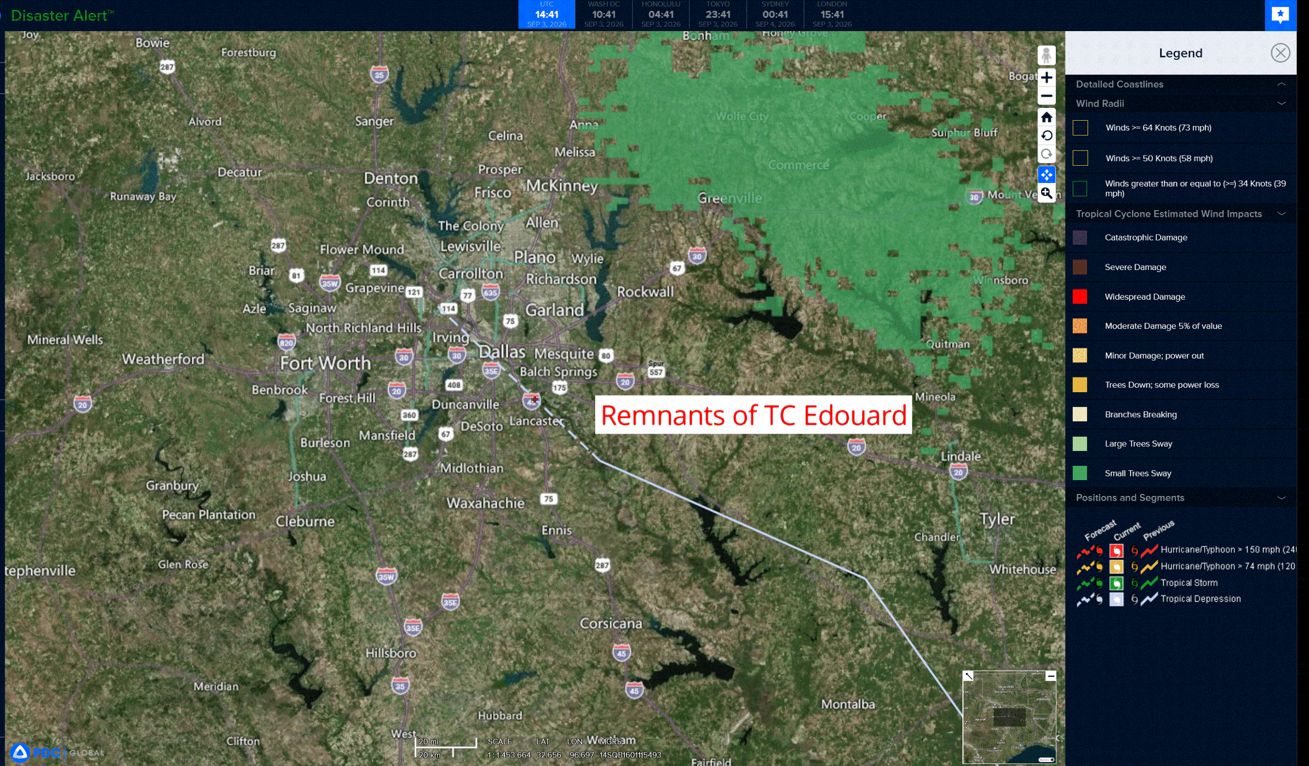
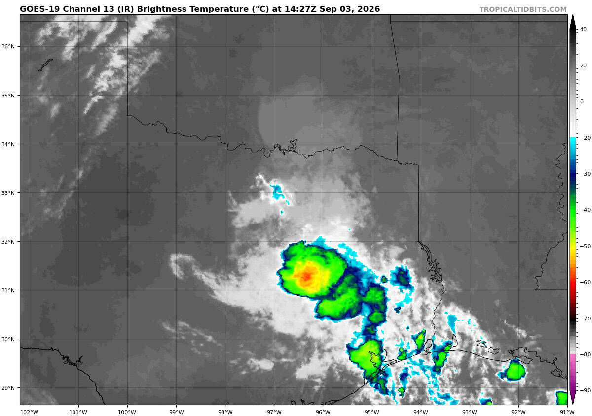
Remnants of Tropical Cyclone Edouard…is located about 40 miles southeast of Dallas, Texas
Atlantic Ocean: There are no active tropical cyclones
Caribbean Sea: There are no active tropical cyclones
Gulf of America:
Remnants of Tropical Cyclone 05L (Edouard) – Last Advisory
EDOUARD’S REMNANTS WILL CONTINUE TO PRODUCE HEAVY RAINFALL AND FLOODING THROUGH THURSDAY
According to the NHC advisory number 12
The remnants are moving toward the west-northwest near 5 mph (7 km/h) and this motion is expected to continue until dissipation. Maximum sustained winds are near 25 mph (35 km/h) with higher gusts. Slow weakening to dissipation is forecast during the next 24 hours. The estimated minimum central pressure is 1012 mb (29.89 inches).
HAZARDS AFFECTING LAND
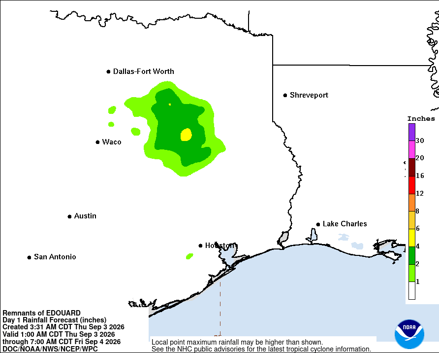
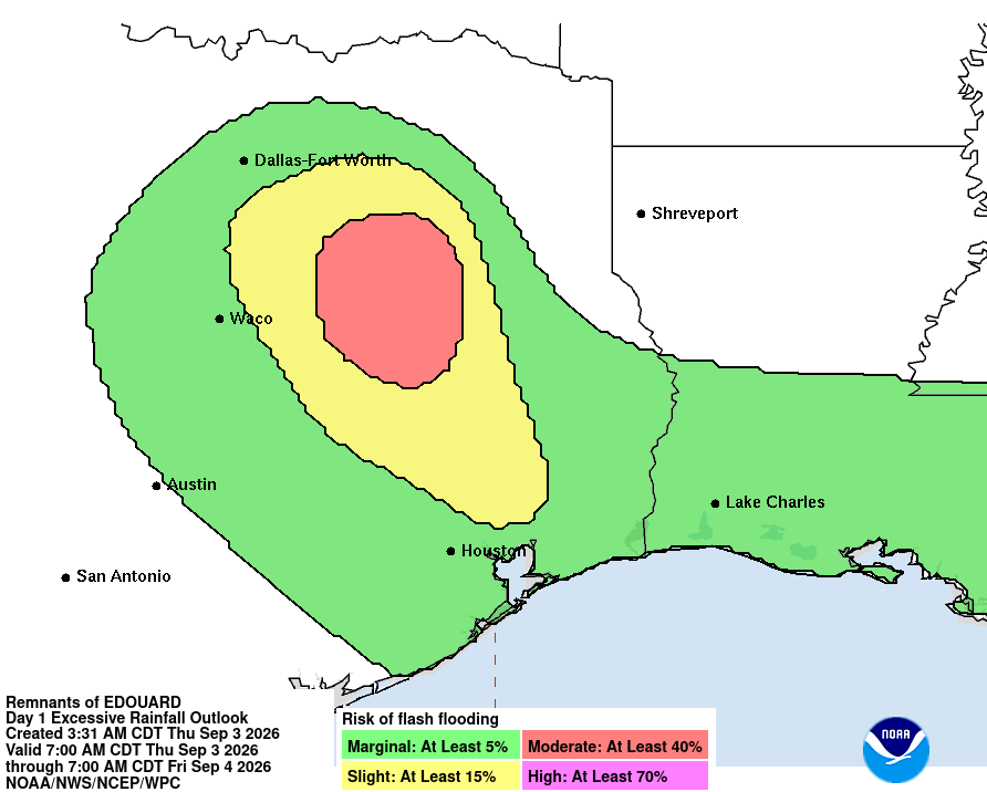
RAINFALL: Additional rainfall totals of 2 to 4 inches are possible across northeast Texas Thursday. This will bring total rainfall amounts along the path of Edouard to 5 to 10 inches, with maximum totals up to 22 inches. Additional flash flooding is possible through Thursday, especially in low-lying and urban areas. Isolated moderate to major river flooding is expected.