

Current Snapshot
For all the latest updates visit: DisasterAWARE
1800x1080ec
3
011431_earliest_reasonable_toa_34K
goes18_ir_11E_202609011435_lat18.0-lon-128.5

11E_tracks_latest
011445_earliest_reasonable_toa_34
goes18_ir_12E_202609011435_lat13.4-lon-149.0
12E_tracks_latest
011440_earliest_reasonable_toa_34
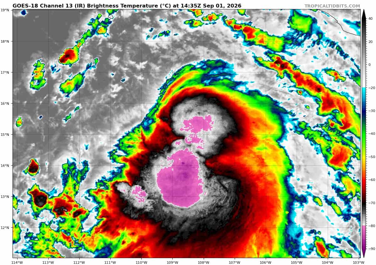
goes18_ir_13E_202609011435_lat14.7-lon-108.4
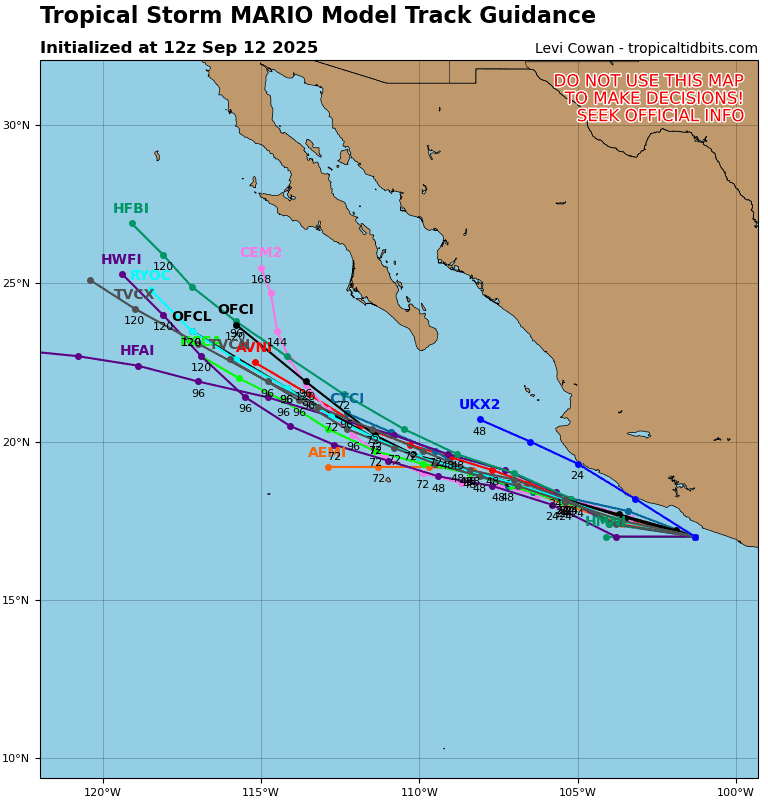
13E_tracks_latest
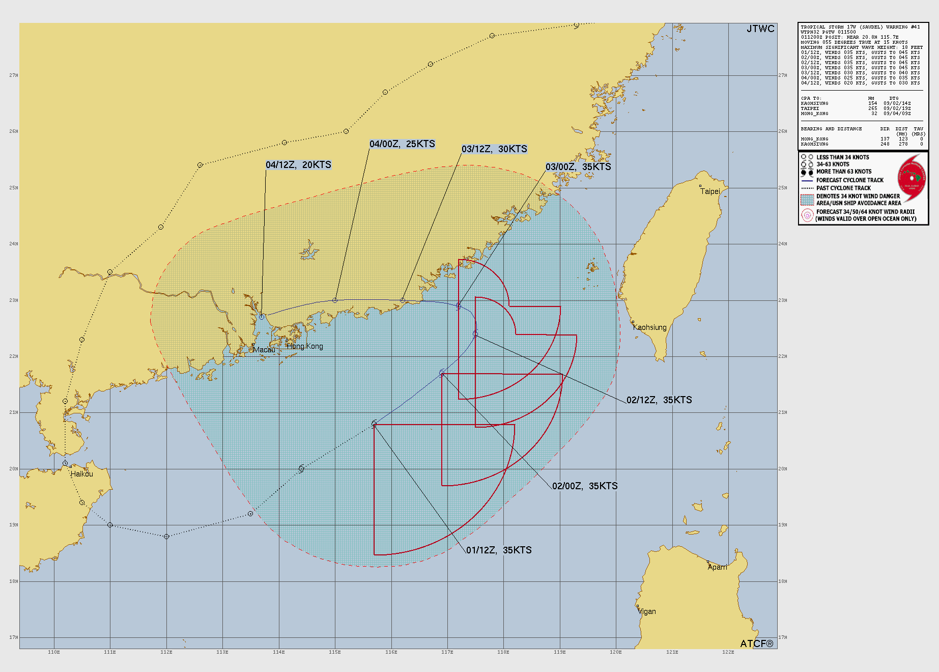
wp1726
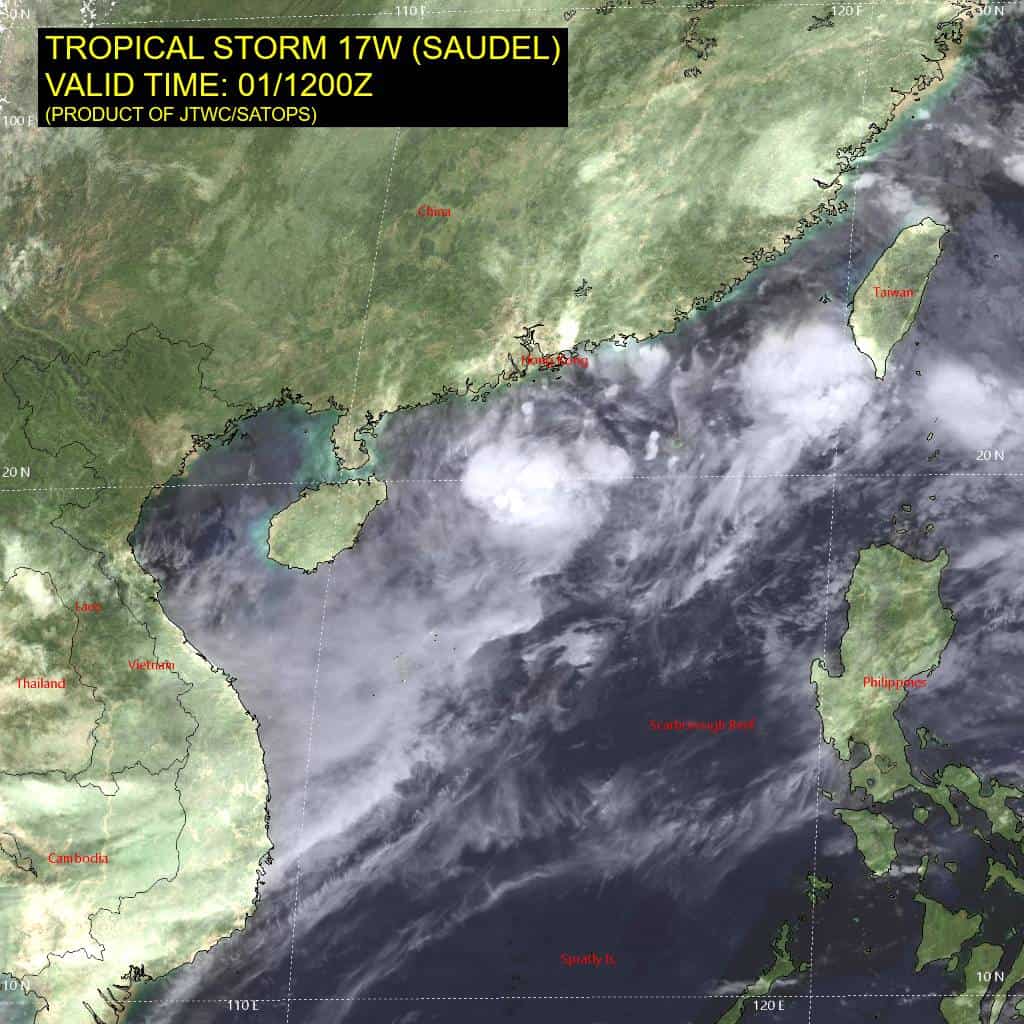
17W_011200sair
himawari9_ir_17W_202609011430_lat20.8-lon115.7
17W_tracks_latest
wp2226
22W_011200sair
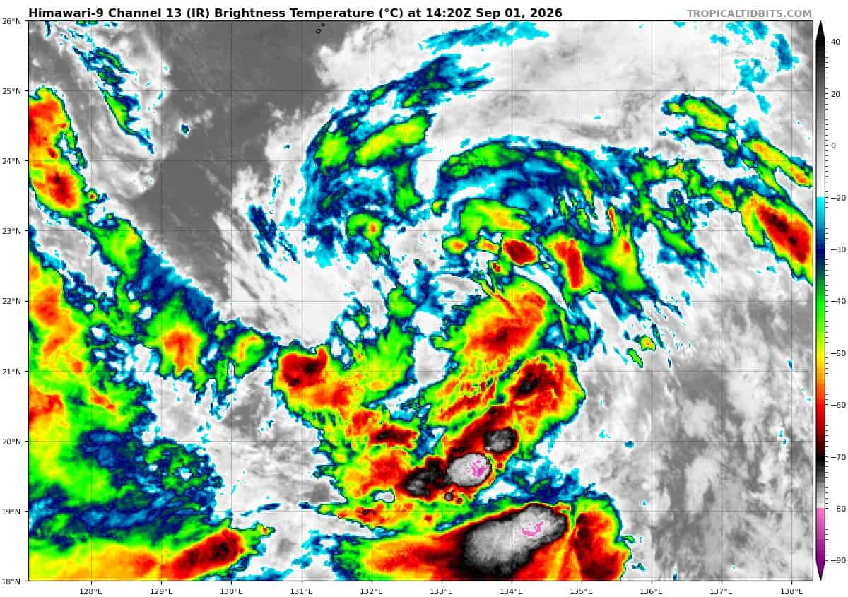
himawari9_ir_22W_202609011420_lat22.0-lon132.7
22W_tracks_latest
By PDC’s Senior Weather
Specialist Glenn James

The Pacific Disaster Center’s (PDC Global) Tuesday, September 1, 2026, Tropical Cyclone Activity Report…for the Pacific Ocean, the Indian Ocean, and adjacent Seas.
Tropical Cyclones
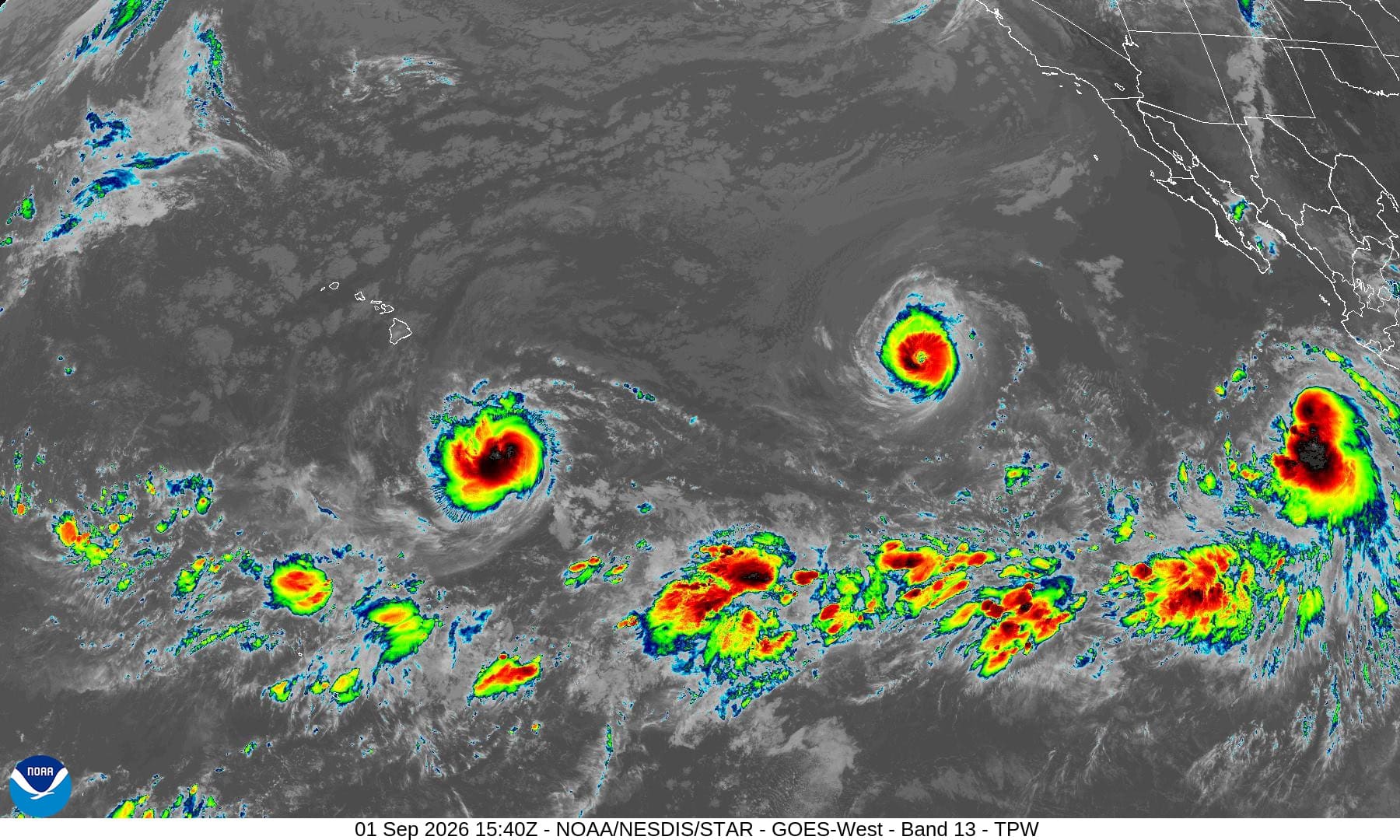
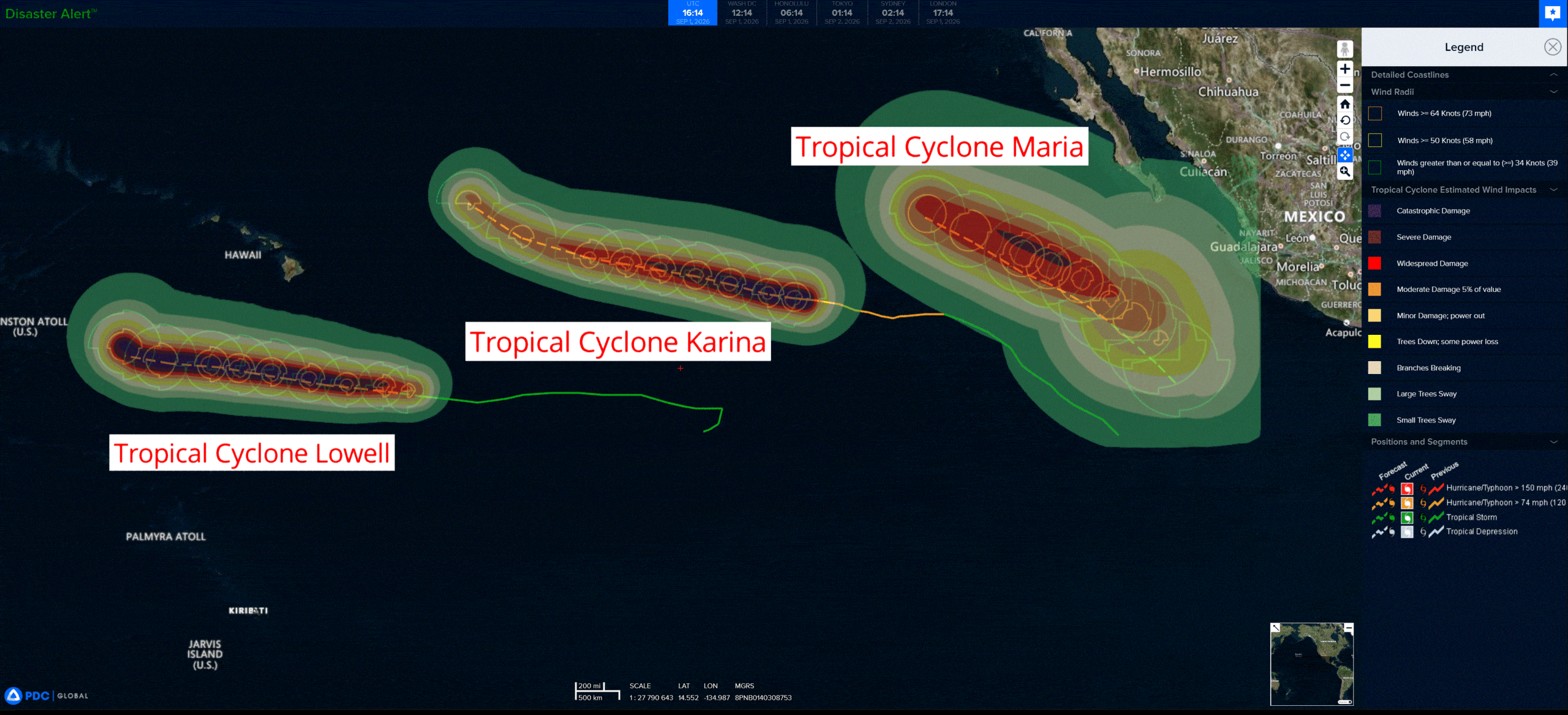
Tropical Cyclone 11E (Karina) is located about 1280 miles west-southwest of the southern tip of Baja CA
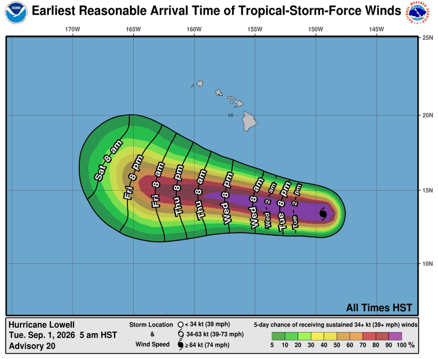
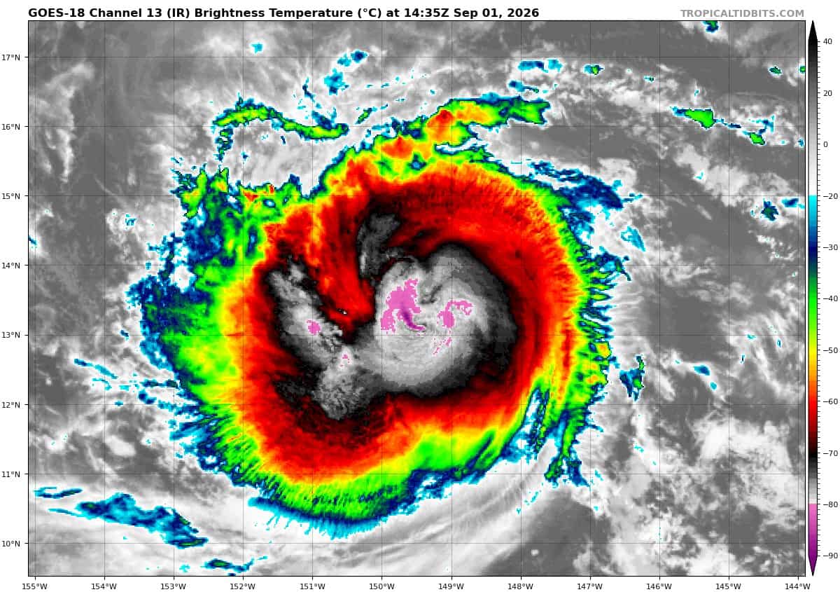
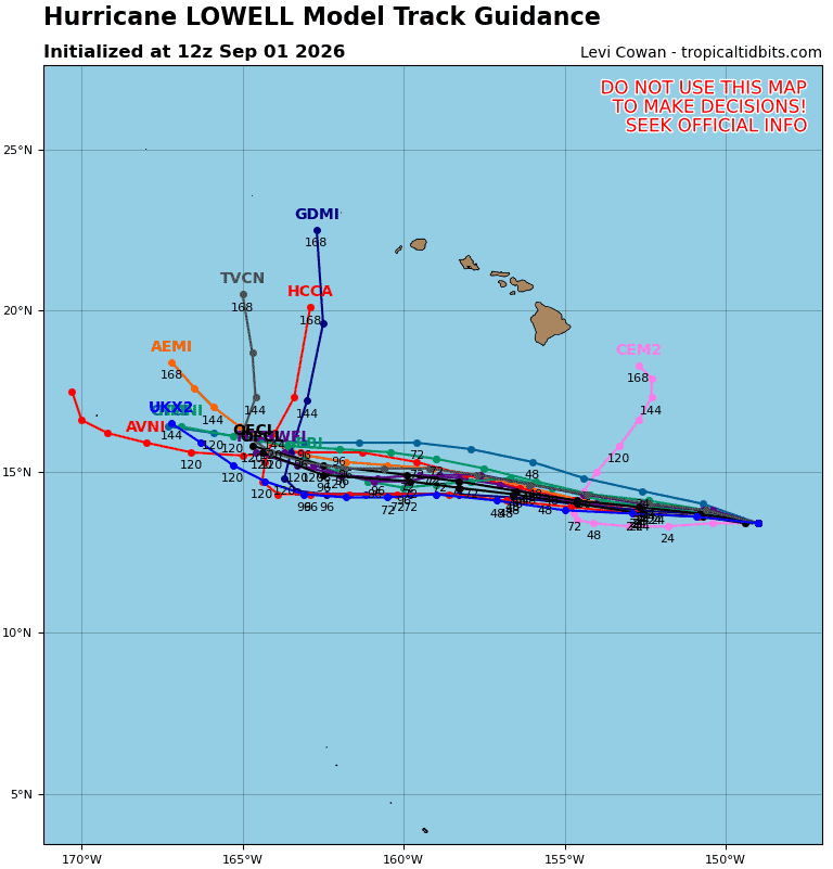
Tropical Cyclone 12E (Lowell) is located about 575 miles southeast of Hilo, Hawaii
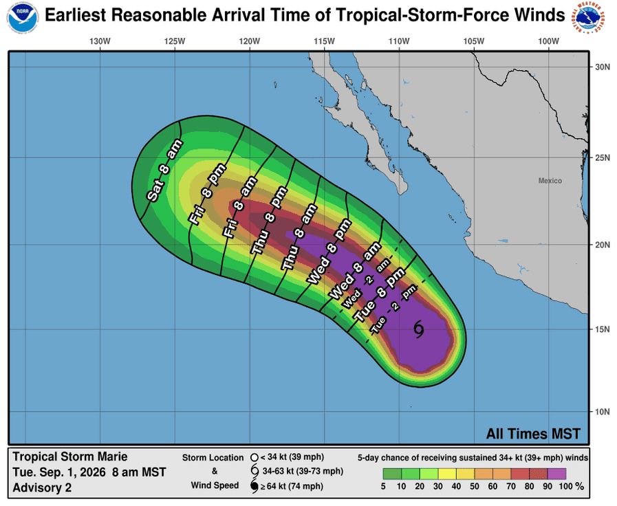
Tropical Cyclone 13E (Marie) is located about 400 miles southwest of Manzanillo, Mexico
Tropical Cyclone 17W (Saudel) is located approximately 123 NM southeast of Hong Kong
Tropical Cyclone 22W (Krovanh) is located approximately 380 miles southeast of Kadena AB
Northeast Pacific:
Tropical Cyclone 11E (Karina)
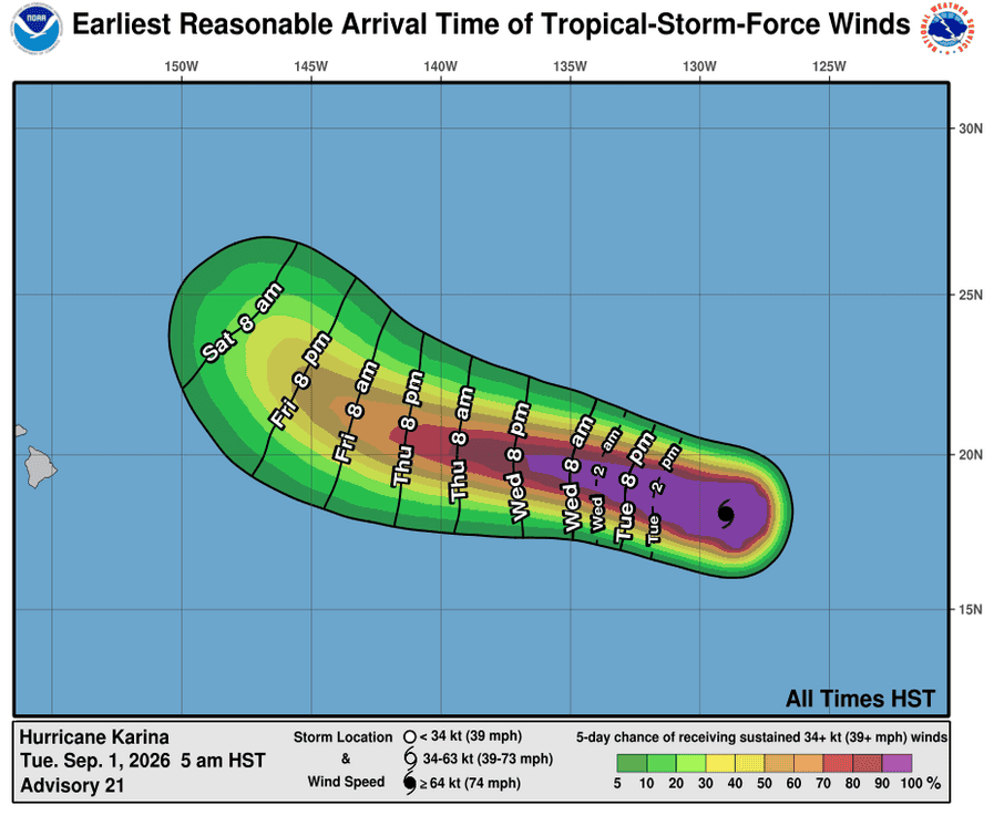
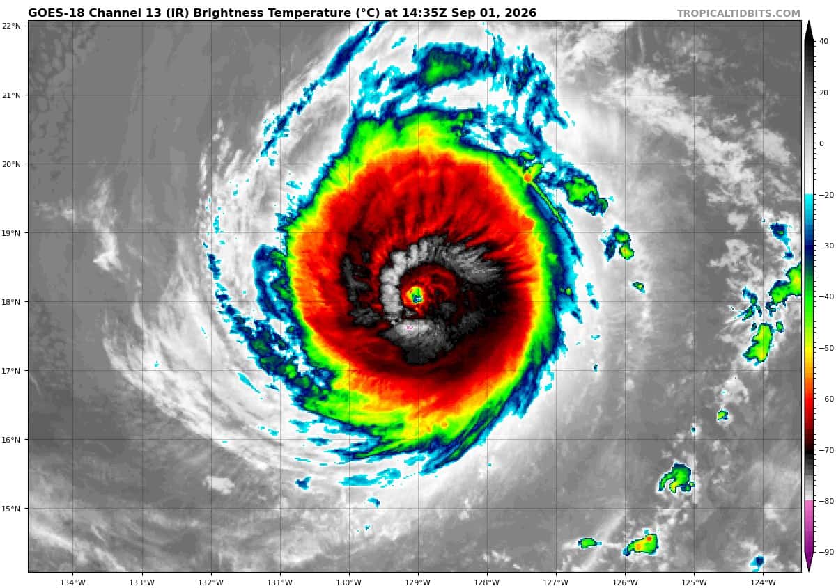
KARINA REMAINS A CATEGORY FOUR HURRICANE BUT EXPECTED TO WEAKEN
According to the NHC advisory number 21…
Karina is moving toward the west near 12 mph (19 km/h), and a westward to west-northwestward motion is expected during the next few days. Maximum sustained winds remain near 140 mph (220 km/h) with higher gusts. Karina is a category 4 hurricane on the Saffir-Simpson Hurricane Wind Scale. Gradual weakening is expected during the next several days. Hurricane-force winds extend outward up to 35 miles (55 km) from the center and tropical-storm-force winds extend outward up to 115 miles (185 km). The estimated minimum central pressure is 945 mb (27.91 inches).
Tropical Cyclone 13E (Marie)
MARIE GRADUALLY BECOMING BETTER ORGANIZED
According to the NHC advisory number 2…
Marie is moving toward the northwest near 9 mph (15 km/h), and a turn toward the west-northwest is expected on Thursday. Maximum sustained winds are near 45 mph (75 km/h) with higher gusts. Gradual strengthening is forecast, and Marie is expected to become a hurricane by Wednesday night. Tropical-storm-force winds extend outward up to 205 miles (335 km) from the center. The estimated minimum central pressure is 1002 mb (29.59 inches).
HAZARDS AFFECTING LAND
SURF: Swells generated by Marie will affect portions of the coast of southwest Mexico and the Baja California Peninsula for the next few days and will likely spread northward to southern California over the weekend. These swells are likely to cause life-threatening surf and rip current conditions.
Central North Pacific:
Tropical Cyclone 12E (Lowell)
LOWELL NOW A HURRICANE …FORECAST TO STRENGTHEN TO MAJOR HURRICANE BY WEDNESDAY NIGHT
According to the NHC advisory number 19…
Lowell is moving toward the west-northwest near 12 mph (19 km/h). A west to west-northwest motion is expected to continue during the next several days. Maximum sustained winds have increased to near 80 mph (130 km/h) with higher gusts. Rapid strengthening is forecast during the next day or two, and Lowell is expected to become a major hurricane by Wednesday night. Hurricane-force winds extend outward up to 15 miles (30 km) from the center and tropical-storm-force winds extend outward up to 90 miles (150 km). The estimated minimum central pressure is 985 mb (29.09 inches).
HAZARDS AFFECTING LAND
SURF: Swells generated by Lowell are likely to affect portions of the Hawaiian Islands beginning on Wednesday. These swells are likely to cause life-threatening surf and rip current conditions.
Western Pacific, Indian Ocean, and adjacent Seas:
Western Pacific
Tropical Cyclone 17W (Saudel)
According to the JTWC warning number 2…sustained winds were 35 knots with gusts to 45 knots
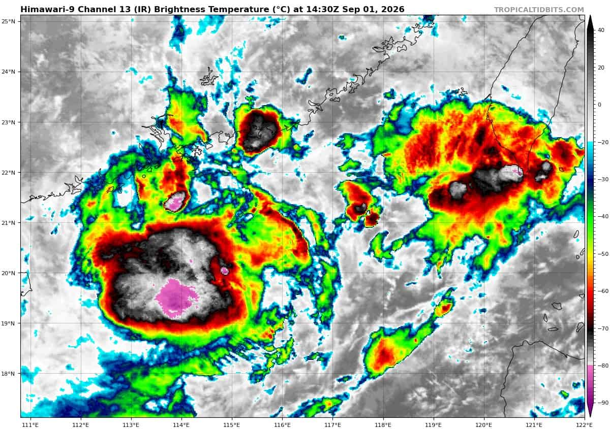
Animated enhanced infrared (eir) satellite imagery depicts tropical storm 17w (Saudel) with a mostly exposed low-level circulation center (llcc) and flaring convection displaced to the southwest. The system continues to have a highly asymmetric wind field due toits placement along the northern side of strong monsoonal
southwesterlies. The strongest winds are confined to the southeastern quadrant, which are enhanced by the monsoonal flow.
Environmental analysis indicates that 17w is located within a marginally favorable environment characterized by weak outflow aloft, low to moderate (15-20 kts) vertical wind shear, and warm (29-30 c) sea surface temperatures.
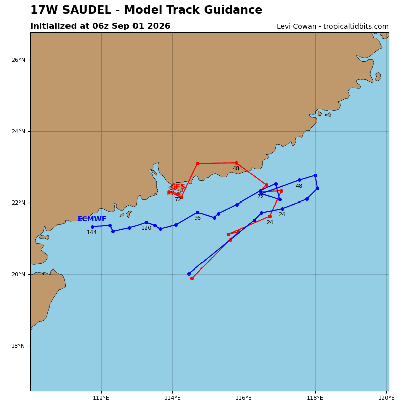
TS 17w is forecast to track northeastward, along the northern periphery of the ner to the south through 36 hours. Around 36 hours, the system will enter a weak steering environment as the ner moves off to the west, causing track speeds to slow. Near 48 hours, a building ridge over eastern China is expected to gain control as the primary steering mechanism, turning 17w rather sharply westward. 17w will then continue on a westward track through 72 hours, skirting the coast of China, near Hong Kong.
In terms of intensity, 17w is forecast to maintain its current intensity through 36 hours as the environment remains marginally favorable. Models show the system struggling to consolidate due to the asymmetry in the wind field and weak outflow. After 36 hours, increasing easterly shear and terrain interaction will steadily weaken the vortex.
Dissipation is forecast to occur around 72 hours, north of Hong Kong. However, if the system turns more sharply southwestward and stays over water rather than tracking inland, there is a potential for intensification.
Tropical Cyclone 22W (Krovanh)
According to the JTWC warning number 2…sustained winds were 35 knots with gusts to 45 knots
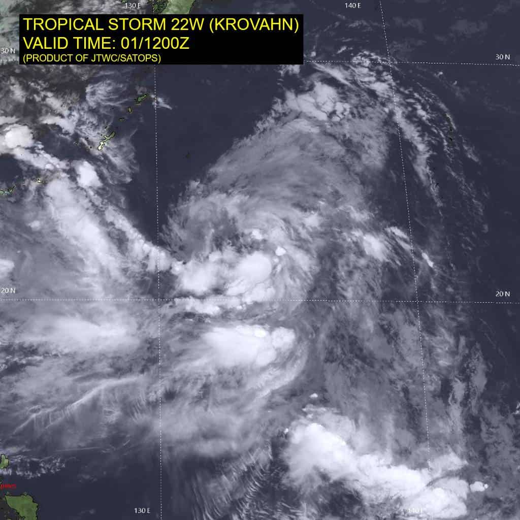
Animated enhanced infrared (eir) satellite imagery depicts tropical storm 22w (Krovanh) with a consolidating low-level circulation center (llcc) and fragmented convective banding along the southern semicircle. Over the past 6 hours, the system made a somewhat unexpected jump to the southeast, Hence the relocated warning. this was likely due to the circulation pinching off along the eastern portion of the previously much broader circulation.
Environmental analysis indicates that 22w is in a marginally favorable environment characterized by moderate
equatorward outflow aloft, low (10-15 kts) vertical wind shear, subsidence over the western periphery, and warm (28-29 c) sea surface temperatures.
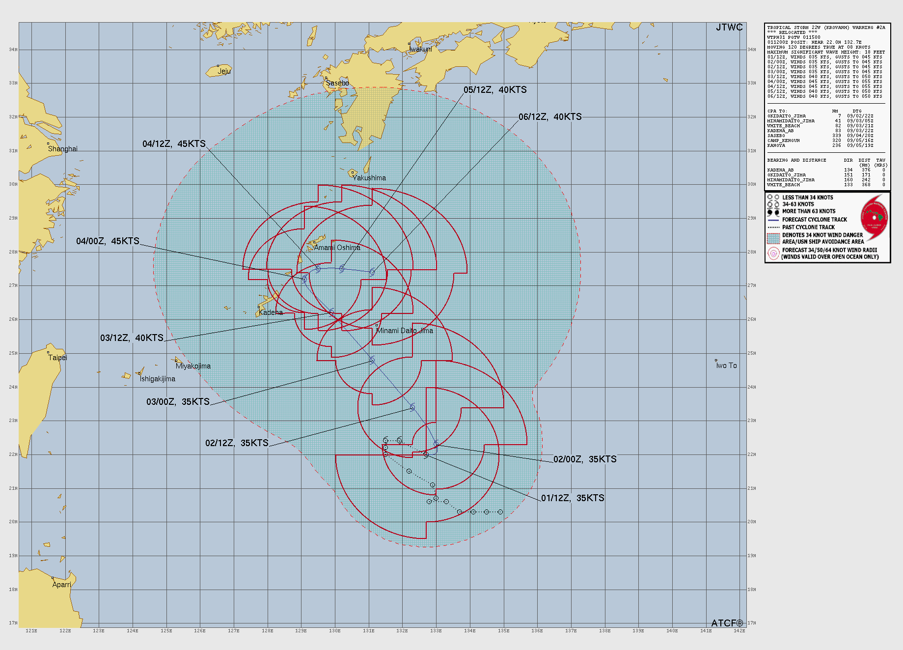
TS 22w is forecast to continue tracking slowly over the next 12 hours as the system remains placed within the
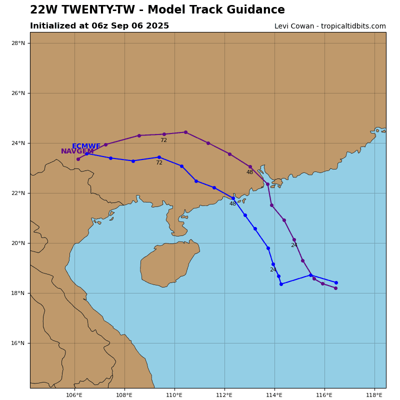
competing steering pattern. After 12 hours, the ner to the southwest will weaken and move off to the west, allowing for the str to become the primary steering mechanism. This will cause 22w to track northwestward through 60 hours, toward the Ryukyu Islands. After 60 hours, an upper-level trough will break down the steering ridge, causing the system to be placed within a weak steering environment.
Tthe actual track of the system is highly uncertain after 60 hours, but the JTWC track forecast calls for a slow eastward movement through 120 hours as a building ner far to the south loosely controls the steering.
In terms of intensity, 22W is forecast to marginally intensify to a peak of 45 kts around 60 hours as the broad vortex attempts to further consolidate and the upper-level trough to the west fills. After 60 hours, westerly shear and dry air is forecast to increase, causing the system to gradually weaken through 120 hours.